|
Damaging wind, hail and heavy rain |
|
 |
|
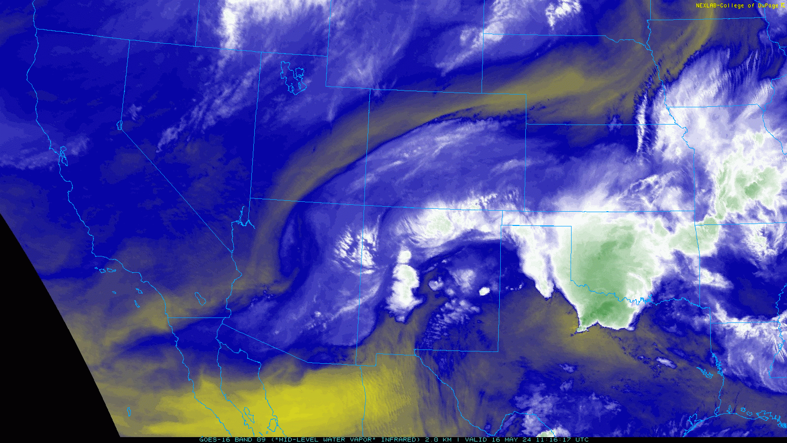
| Water vapor satellite loop valid from 6:16 am to 7:01 am on Thursday, 16 May 2024. | |
|
A storm system emerging from the Four Corners region, in combination with a southward sagging cold front, served as triggers for thunderstorm develop across the southern High Plains Wednesday afternoon (15 May). Although moisture levels were not particularly juicy, at least by May standards, it was sufficient to supply weak to modest instability that fueled several rounds of strong to severe thunderstorm through the evening and overnight hours. |
|
 |
|
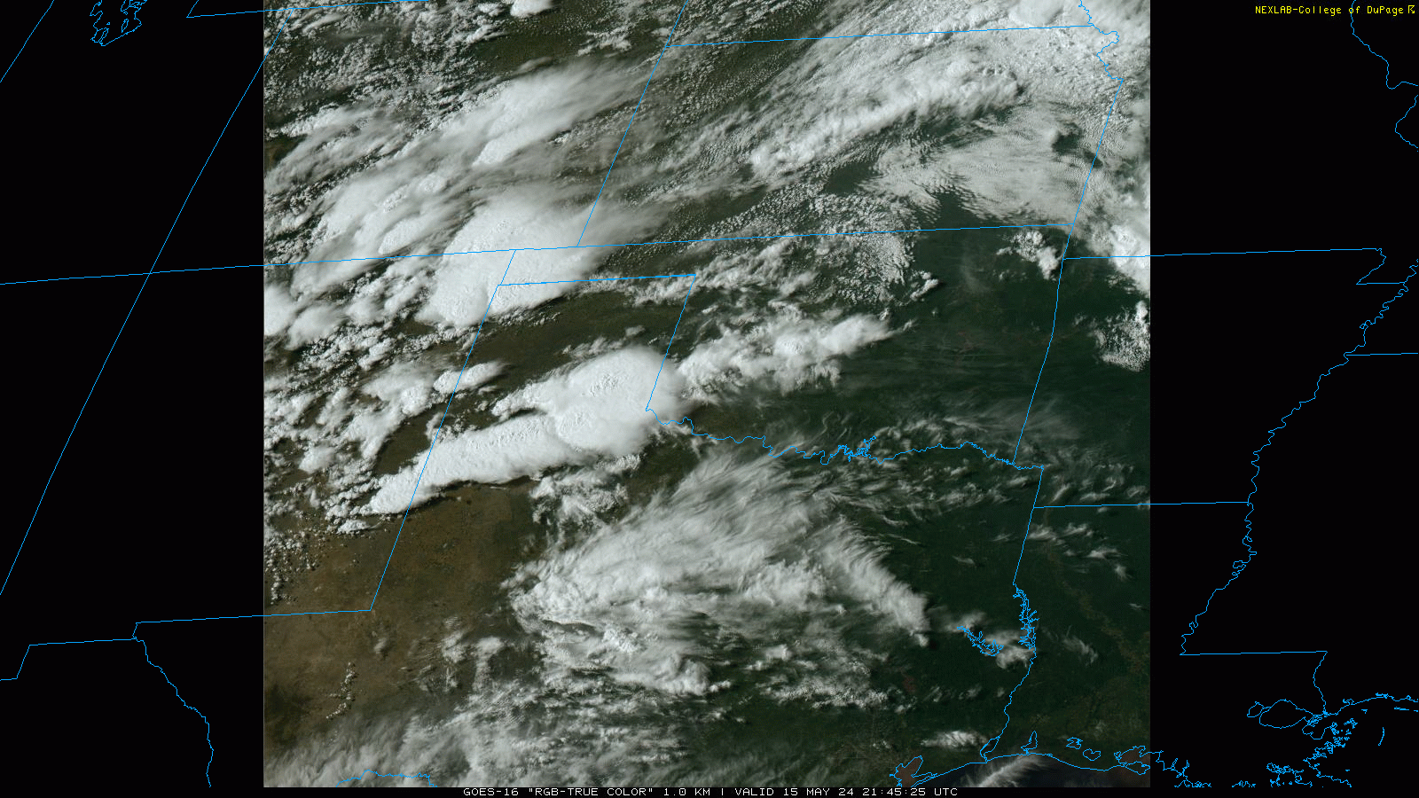
| RGB "True Color" satellite loop valid from 4:47 pm to 5:07 pm on Wednesday, 15 May 2024. | |
| The initial thunderstorm development occurred along a frontal boundary that extended from southwest Oklahoma into the northwestern South Plains and southeast New Mexico, as well as over the higher terrain of New Mexico and southeast Colorado. The most robust updraft cores generated pockets of hail, including hail as large as golf balls on the southwest side of Plainview. | |
 |
|
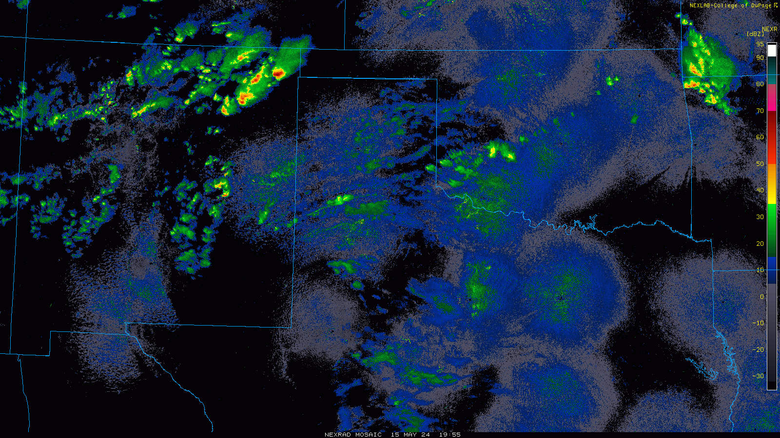
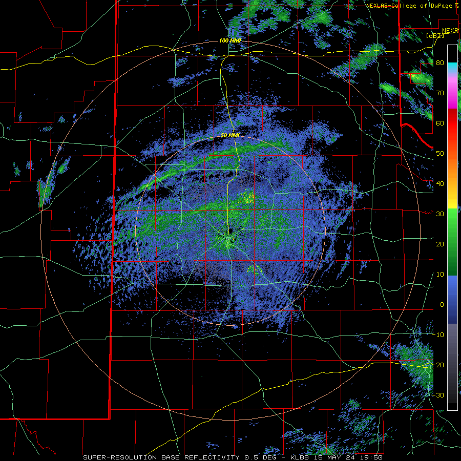
| Regional radar animation valid from 2:55 pm to 10:15 pm on Wednesday (15 May 2024). | |
| The warm/hot conditions, with highs in the upper 80s and lower 90s, and modest moisture levels led to high-based thunderstorms. These storms were proficient at generating strong to severe wind gusts, thanks, in part, to the deep and relatively dry sub-cloud layer ripe for evaporative cooling. Many locations recorded wind gust of 40 to 50+ mph as the storms approached and moved through, with several wind gusts near and above 60 mph measured. A peak wind gust of 78 mph was measured by the West Texas Mesonet site on the south side of Plainview at 4:32 pm. | |
 |
|
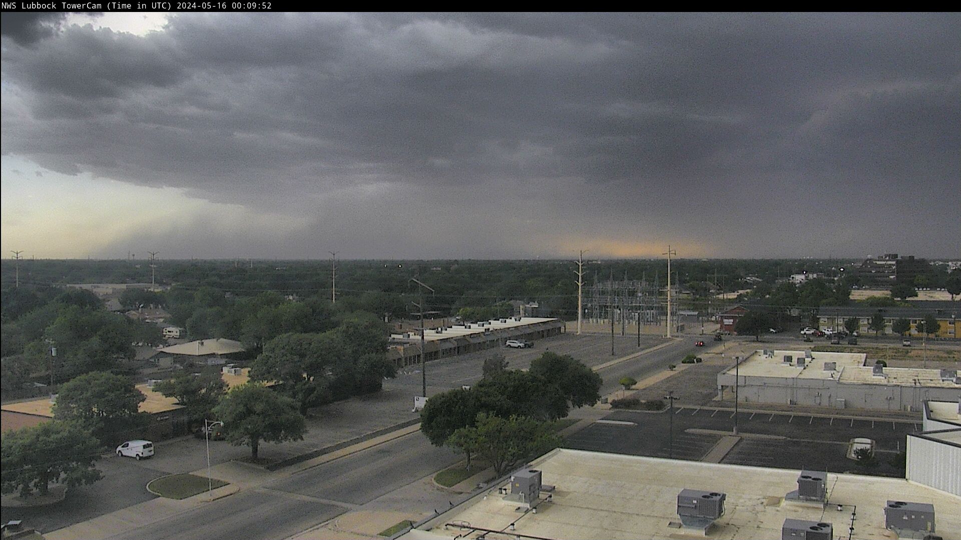
| High-based thunderstorm and dusty outflow (dust foot) approaching Lubbock from the west at 7:10 pm on Wednesday evening (15 May 2024). | |
| The wind kicked up dust on the leading edge of the advancing rain-cooled air, and also helped to spark additional thunderstorms as the activity propagated eastward. After a relative lull in storm coverage and intensity late evening, additional rounds of strong thunderstorms moved across the northern South and Rolling Plains through early Thursday morning. | |
 |
|
| Lubbock WSR-88D radar animation valid from 2:50 pm to 10:17 pm on Wednesday (15 May 2024). An additional radar animation, valid from 2:31 am to 6:18 am on Thursday (16 May 2024), can be VIEWED HERE. | |
| Despite the limited moisture, the rain gradually moistened the sub-cloud layer, and where storms repeatedly tracked, they dropped significant rainfall. The heaviest rainfall, near and above an inch, was focused in an east-to-west swath from north of Morton to Plainview and Ralls to near Paducah, with an additional pocket east of Silverton. | |
 |
|
| Infrared satellite loop valid from 1:31 pm to 2:56 pm on Thursday, 16 May 2024. | |
| The following day, Thursday (16 May) brought additional rounds of thunderstorms to the south-central United States. The heaviest and most widespread rain targeted regions well downstate, over a good chunk of the center and southeast part of Texas, where they were already battling flooding in spots. Closer to home, a complex of thunderstorms rolled out of southeast New Mexico during the late afternoon, and across a large portion of the South Plains through early evening. | |
 |
|
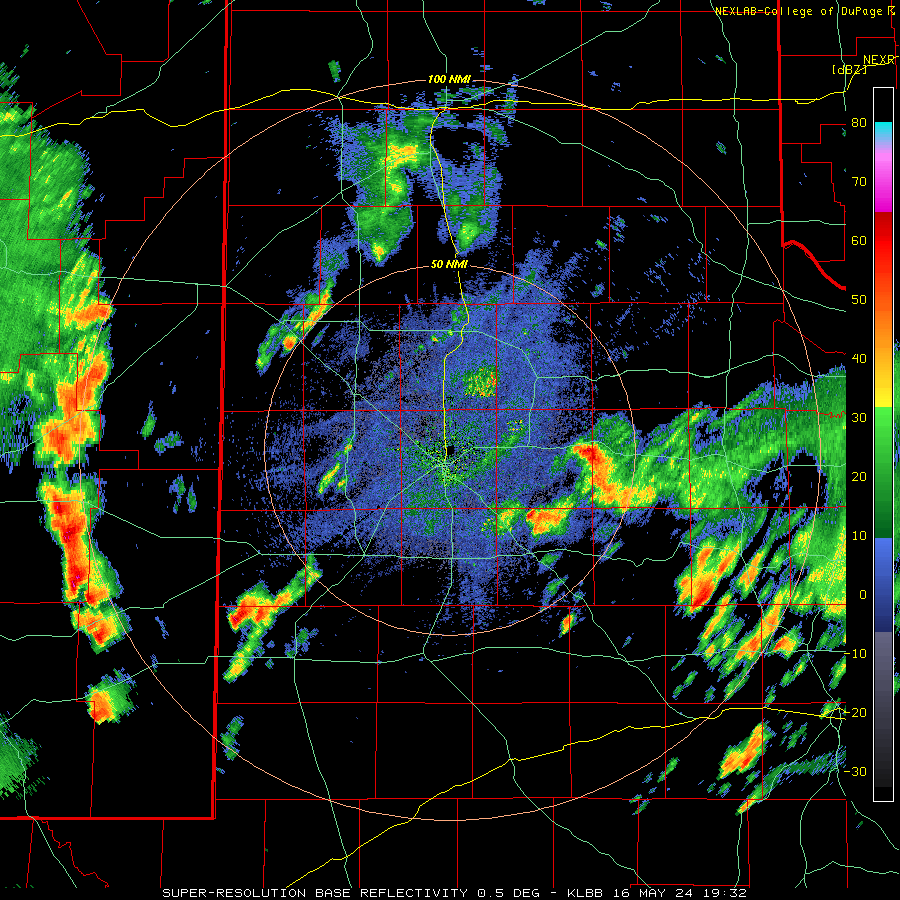
| Lubbock WSR-88D radar animation valid from 2:32 pm to 8:42 pm on Thursday (16 May 2024). | |
| The heaviest rain Thursday afternoon and evening targeted the southern and western South Plains, though most locations saw at least a little additional rainfall and gusty outflow winds. Several spots did experience wind gusts to severe levels, measured as high as 68 mph at the West Texas Mesonet station north of Plains, where they also had nearly 2/3 inch of rainfall. The Denver City COOP measured an impressive 1.52 inches, surpassing their entire rainfall for the year up to that point (1.25 inches of rain fell in Denver City from January 1st through May 15th)! | |
 |
|
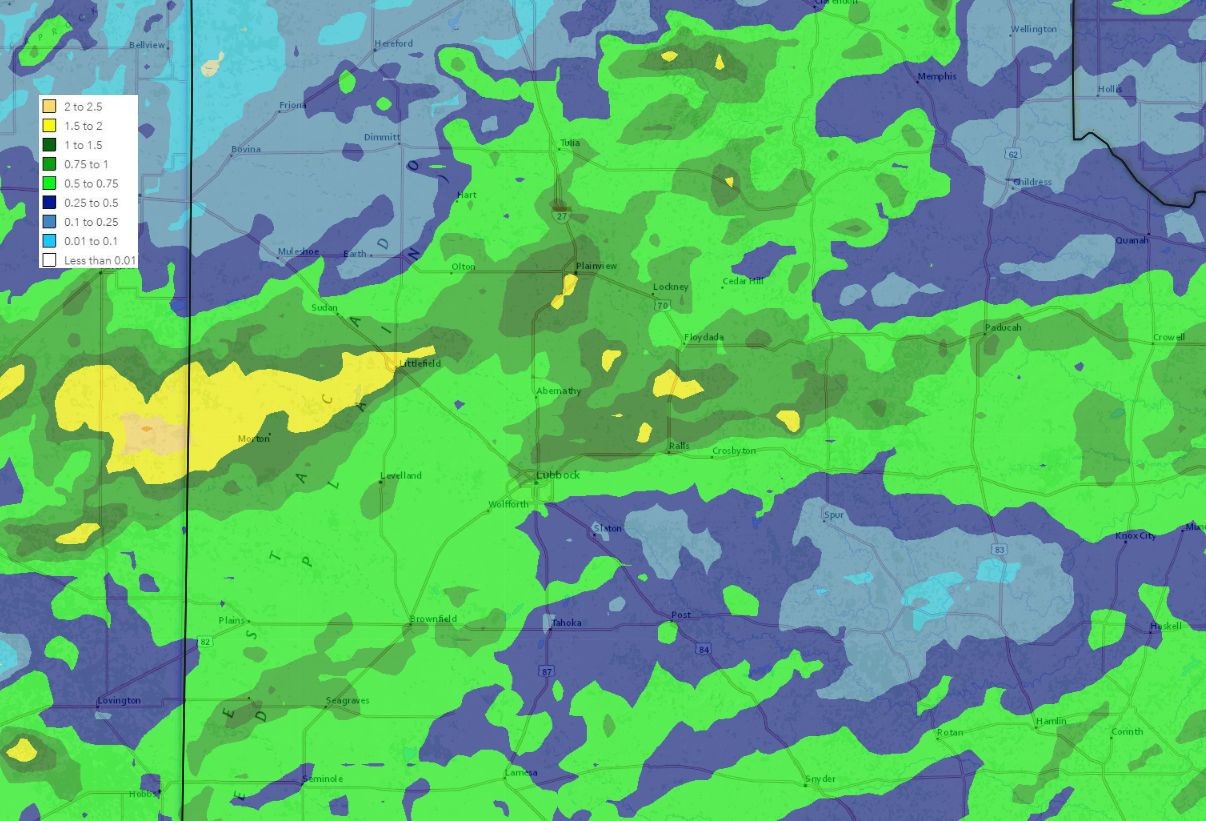
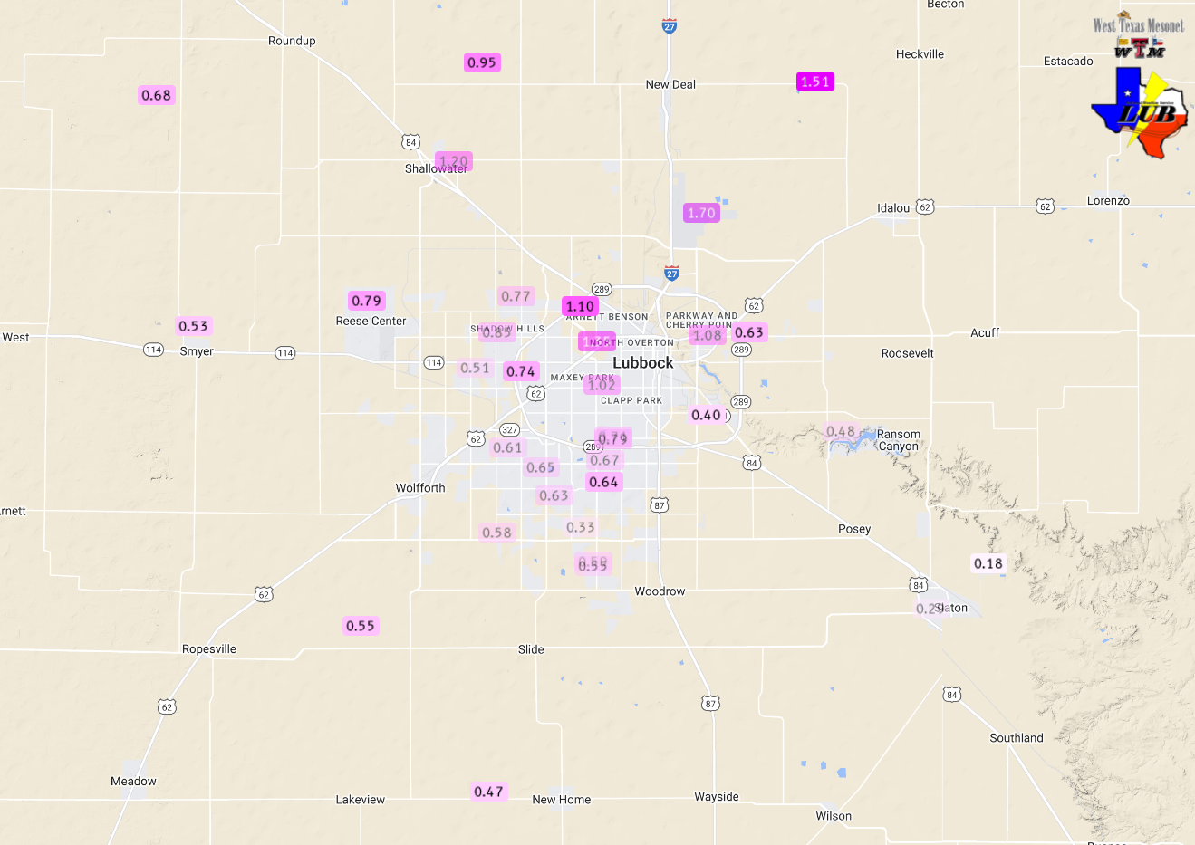
| 5-day radar-estimated and bias-corrected rainfall ending at 7 am on Monday, 20 May 2024. The rain measured by the West Texas Mesonet over this same period can be VIEWED HERE, with a closer look at the Lubbock area FOUND HERE. | |
|
The heavier rain clipped the north side of Lubbock on the 15th, including the official reporting site at the Lubbock Airport, which measured 1.51 inches. This rain boosted the year-to-date rainfall to 5.50 inches, which is a little over a half inch of normal. Unfortunately, the south side of Lubbock didn't see as much rain on the 15th, generally only recording a tenth or two, though they did record healthier totals, closer to a half inch, on the 16th. Storm reports collected from this active mid-May can found below: |
|
Preliminary Local Storm Report
National Weather Service Lubbock TX
309 AM CDT Thu May 16 2024

..TIME...   ...EVENT...      ...CITY LOCATION...     ...LAT.LON...
..DATE...   ....MAG....      ..COUNTY LOCATION..ST.. ...SOURCE....
            ..REMARKS..

0430 PM     Hail             3 SW Plainview          34.16N 101.76W
05/15/2024  M1.75 Inch       Hale               TX   Public

            Quarter to golf ball size. Time estimated.

0432 PM     Tstm Wnd Gst     1 SE Plainview          34.18N 101.71W
05/15/2024  M78 MPH          Hale               TX   Mesonet

            Measured by the West Texas Mesonet.
            Corrected from non-TSTM gust.

0714 PM     Tstm Wnd Gst     6 E Ropesville          33.42N 102.05W
05/15/2024  M74 MPH          Lubbock            TX   Mesonet

            Also gusted to 60 mph at 715 PM. Measured by
            the West Texas Mesonet.

0731 PM     Tstm Wnd Gst     New Home                33.33N 101.91W
05/15/2024  M69 MPH          Lynn               TX   Mesonet

            Measured by West Texas Mesonet.

0738 PM     Tstm Wnd Gst     New Home                33.33N 101.91W
05/15/2024  M65 MPH          Lynn               TX   Mesonet

            Also gusted to 61 mph at 737 PM. Measured by
            the West Texas Mesonet.

0833 PM     Tstm Wnd Gst     5 NW White River Lake   33.53N 101.17W
05/15/2024  M59 MPH          Crosby             TX   Mesonet

            Occurred from outflow 15 miles ahead of
            thunderstorms. Measured by the West Texas
            Mesonet.

0100 AM     Tstm Wnd Gst     6 SSW Anton             33.73N 102.19W
05/16/2024  M58 MPH          Hockley            TX   Mesonet

0126 AM     Tstm Wnd Gst     4 NNE Shallowater       33.75N 101.97W
05/16/2024  M58 MPH          Lubbock            TX   Mesonet

0300 AM     Tstm Wnd Gst     3 NNW Mcadoo            33.77N 101.04W
05/16/2024  M67 MPH          Dickens            TX   Mesonet

