|
Rounds of cool mid-March rain |
|
 |
|
|
Water vapor satellite animation valid from 6:06 am to 6:56 am on Friday (15 March 2024). |
|
|
Several disturbances ejecting well ahead of nearly stationary upper level storm system over the Desert Southwest provided cool and moist weather for West Texas in mid-March. The passing impulses helped lift mild and moist air up and over cooler air that moved in place behind a cold front Thursday evening (14 March). This caused elevated showers and thunderstorms to develop over southeast New Mexico early Friday morning (15 March). |
|
 |
|
| Lubbock WSR-88D radar animation valid from 6:53 am to 9:15 am on Friday (15 March 2024). | |
|
The rain and thunderstorms expanded in coverage as they moved northeastward across the entire South Plains region through the day Friday. However, instability and moisture decreased with northeast extent, so the overall intensity and lightning waned, but the rain persisted. |
|
 |
|
| Lots of small hail falling in Levelland Friday morning (15 March 2024). The image is courtesy of Whitney Owens. | |
|
Early on there was just enough instability aloft to support a couple of stronger thunderstorm cores across the western South Plains the first half of Friday morning, which produced small hail and a lot of lightning. One of these stronger cells with small hail tracked directly over Levelland before weakening. All of this weather occurred while temperatures down at ground level were stuck in the 40s. Rain totals of a tenth to quarter of an inch were fairly common with this initial round of activity, though some lucky spots saw around a half inch. |
|
 |
|
| Visible satellite animation valid from 7:56 am to 8:56 am on Saturday (16 March 2024). | |
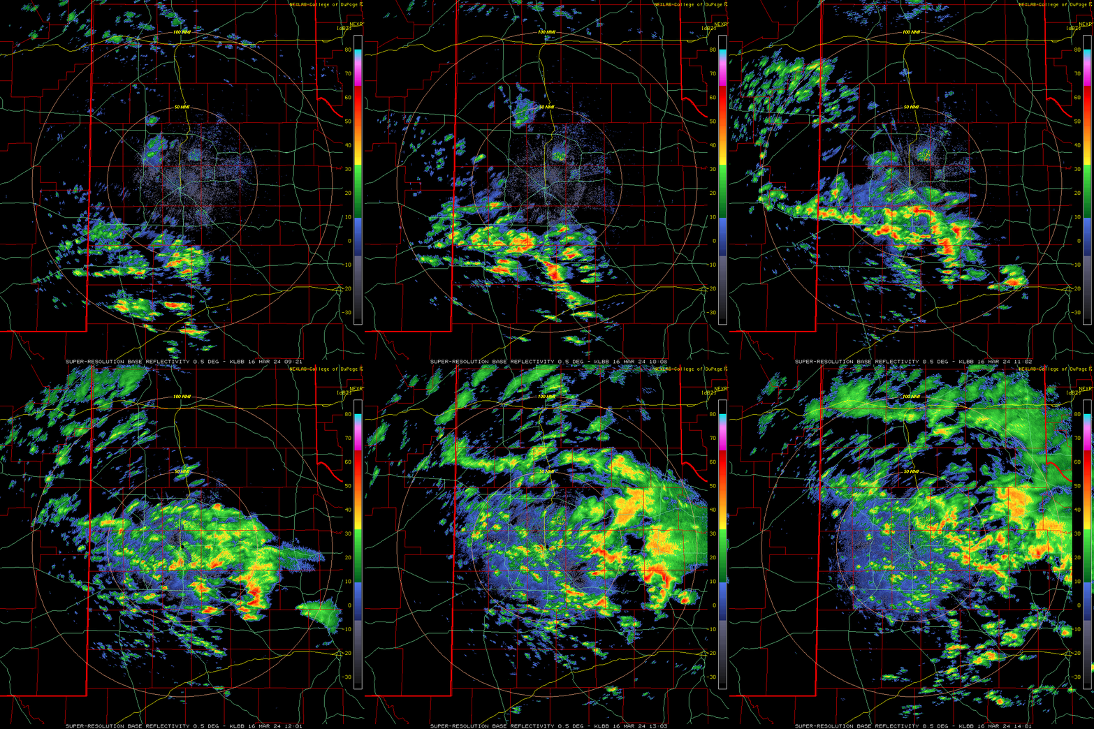
| The next morning brought a near repeat, with early-day showers and thunderstorms developing and expanding in coverage as they tracked northeastward across northwestern Texas. The more intense cores produced lightning and brief heavy rain, while nearly the entire region saw at least a little rain. | |
 |
|
| Lubbock WSR-88D radar animation valid from 4:21 am to 9:01 am on Saturday (16 March 2024). | |
| When the stronger lift faded, the showers and thunderstorms diminished, but areas of drizzle persisted through much of the rest of Saturday and right into early Sunday. Although gloomy and cool, the mid-March weekend brought welcome moisture to the region. | |
 |
|
| Radar-estimated and bias-corrected rainfall totals from the mid-March 2024 rain. Rain totals, as measured by the West Texas Mesonet and the NWS, can be at: South Plains View; and the Lubbock View. | |
| Rain tallies over this cool and moist stretch varied from a tenth to third of an inch over much of the western South Plains to near one inch over most of the Rolling Plains. A few spots even topped the inch mark off the Caprock, while locations in and around Lubbock generally recorded totals from a 1/2 to 2/3rds of an inch. Lubbock officially measured 0.51", while Childress had 0.45". | |