|
Overnight thunderstorms provide widespread rain |
|
 |
|
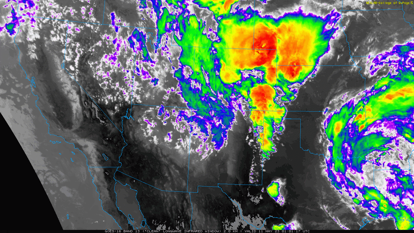
| Infrared satellite animation valid from 8:01 pm on Wednesday to 6:01 am on Thursday (10-11 May 2023). | |
|
The approach of an upper level storm system through the Four Corners, in combination with a gradual return of Gulf moisture, teamed with a tightening dryline and lifting warm front to trigger scattered thunderstorms Tuesday afternoon and evening (25 April 2023). |
|
 |
|
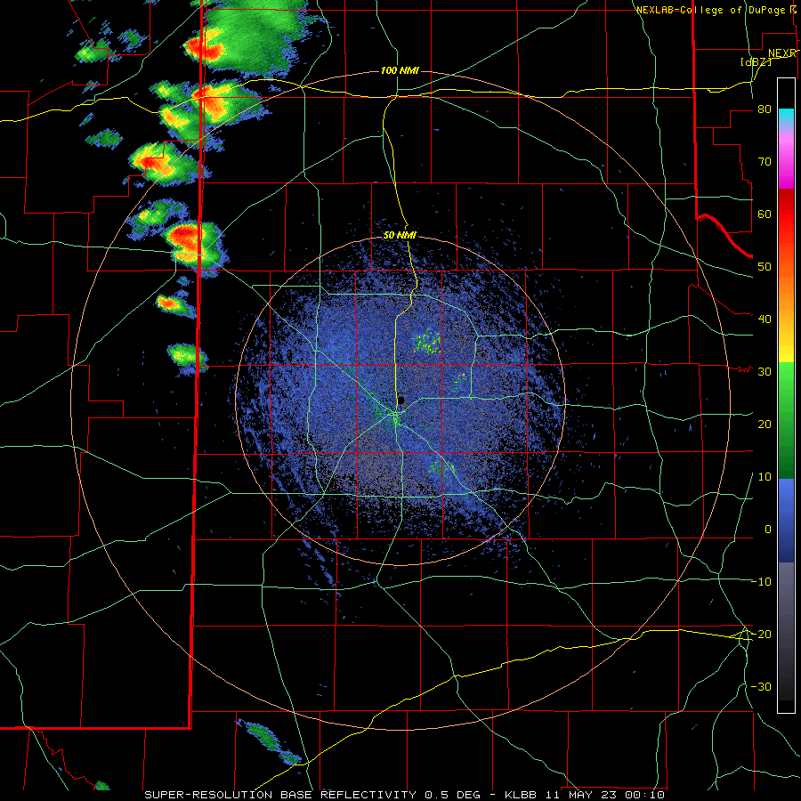
| Lubbock WSR-88D radar animation valid from 7:10 pm to 9:47 pm on Wednesday (10 May). | |
| Thunderstorms initially developed across parts of eastern New Mexico Thursday afternoon, then formed closer to the TX/NM line in the evening. These scattered thunderstorms were occasionally on the strong side, bringing gusty winds, small hail and brief heavy rain to parts of the northwestern South Plains and western Texas Panhandle through the late evening hours. A few of the storms briefly breached severe limits as they raced northeastward. One of the stronger storms dropped quarter size hail in Muleshoe around midnight, while another generated a wind gust to 67 mph near Morton about one hour later. | |
 |
|
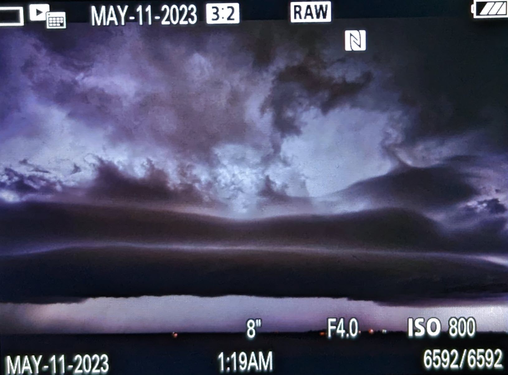
| Shelf cloud approaching Littlefield early Thursday morning. The picture was taken at 1:19 am and is courtesy of Alex Schueth. | |
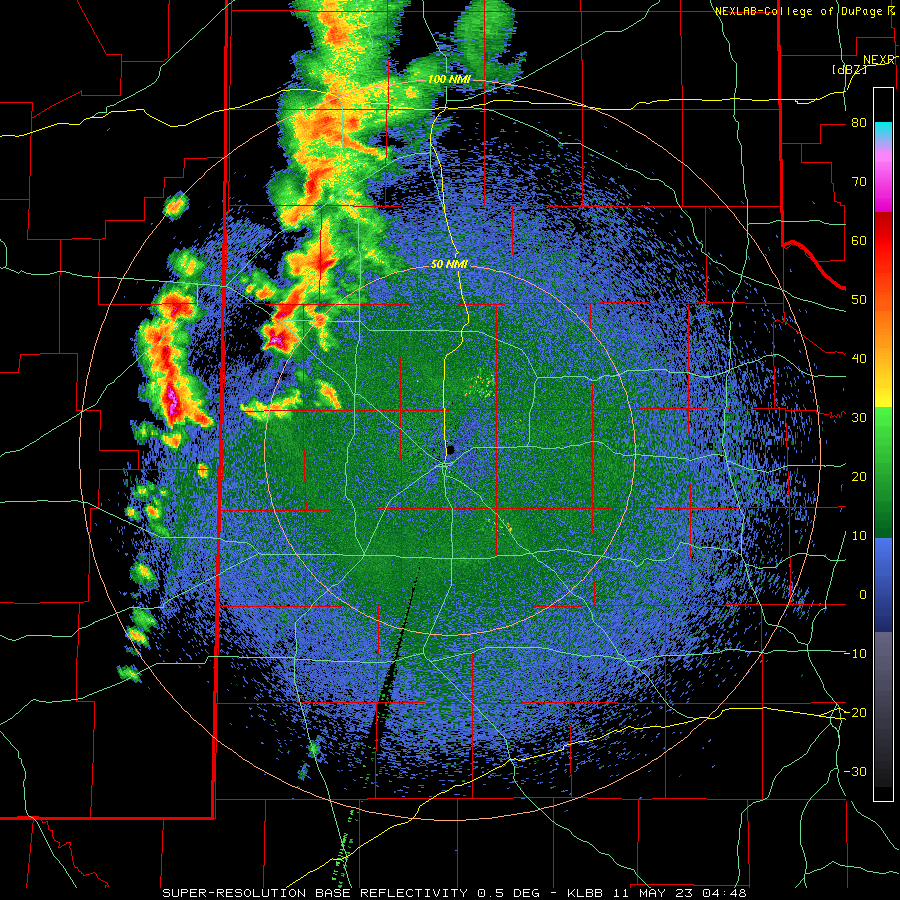
| The approach of a Pacific front, along with the stronger lift from the upper level storm system, then led to the rapid development of a line of storm near the TX/NM line around midnight. This line of storms swept eastward across much of the South Plains through the overnight hours before fading. However, additional thunderstorms erupted over the Rolling Plains between 4 and 5 am, then quickly raced east and northeastward. | |
 |
|
| Lubbock WSR-88D radar animation valid from 11:48 pm on Wednesday (10 May) to 6:23 am on Thursday (11 May). | |
| The evolution of the lines of thunderstorms left a gap in precipitation from parts of the eastern South Plains into the western Rolling Plains, while several stronger cells within the lines produced localized heavier totals. | |
 |
|
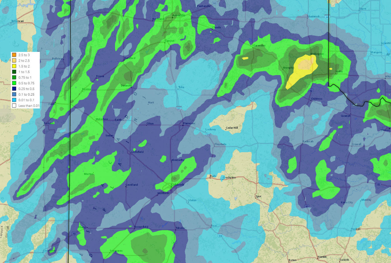
| 24-hour radar-estimated and bias-corrected rainfall ending at noon on Thursday (11 May). The rainfall measured by the West Texas Mesonet (WTM) over this period can be VIEWED HERE. | |
|
Overall, rain totals of a 1/4 to 1/2 inch were fairly common where it did rain, with several narrower swaths of 1/2 to 1+ inches. Officially, the Lubbock Airport recorded 0.80 inches of rain, which was on the higher side and was tied to a small but intense storm that tracked over the northwestern and western side of the city. Locations on the south and southeast side of the city largely missed out, measuring little to no rainfall. |
|
 |
|
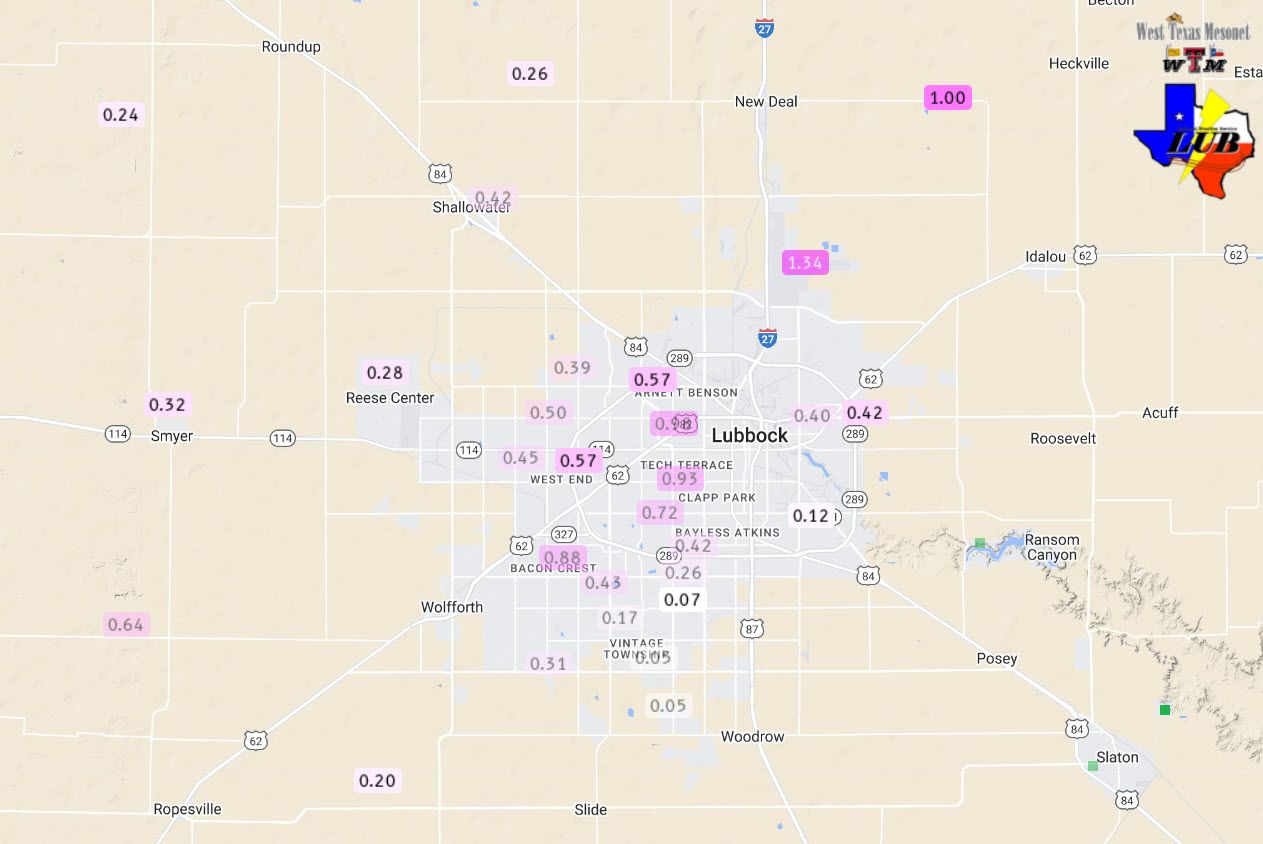
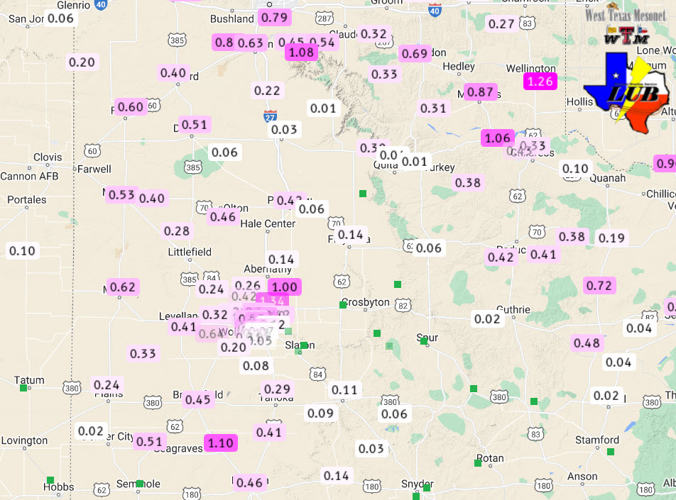
| 24-hour rainfall measured at various locations around the Lubbock area ending at 2 pm on Thursday (11 May). The data are courtesy of the WTM and general public. | |
|
Preliminary storm reports for this active overnight can be found below: |
|
PRELIMINARY LOCAL STORM REPORT
NATIONAL WEATHER SERVICE LUBBOCK TX
630 AM CDT THU MAY 11 2023

..TIME...   ...EVENT...      ...CITY LOCATION...     ...LAT.LON...
..DATE...   ....MAG....      ..COUNTY LOCATION..ST.. ...SOURCE....
            ..REMARKS..

1155 PM     HAIL             MULESHOE                34.23N 102.73W
05/10/2023  E1.00 INCH       BAILEY             TX   LAW ENFORCEMENT

0102 AM     TSTM WND GST     1 ENE MORTON            33.73N 102.74W
05/11/2023  M67 MPH          COCHRAN            TX   MESONET

0353 AM     FLASH FLOOD      LUBBOCK                 33.58N 101.88W
05/11/2023                   LUBBOCK            TX   LAW ENFORCEMENT

            TWO VEHICLES STRANDED IN STANDING WATER. SEVERALS AREAS
            ACROSS TOWN WITH ROAD AND STREET FLOODING.

