|
Supercell brings very large hail, damaging winds and a brief tornado |
|
 |
|
| Supercell thunderstorm east of Floydada Tuesday evening (25 April 2023). The picture is courtesy of Jordan Hall. | |
|
The approach of an upper level storm system through the Four Corners, in combination with a gradual return of Gulf moisture, teamed with a tightening dryline and lifting warm front to trigger scattered thunderstorms Tuesday afternoon and evening (25 April 2023). |
|
 |
|
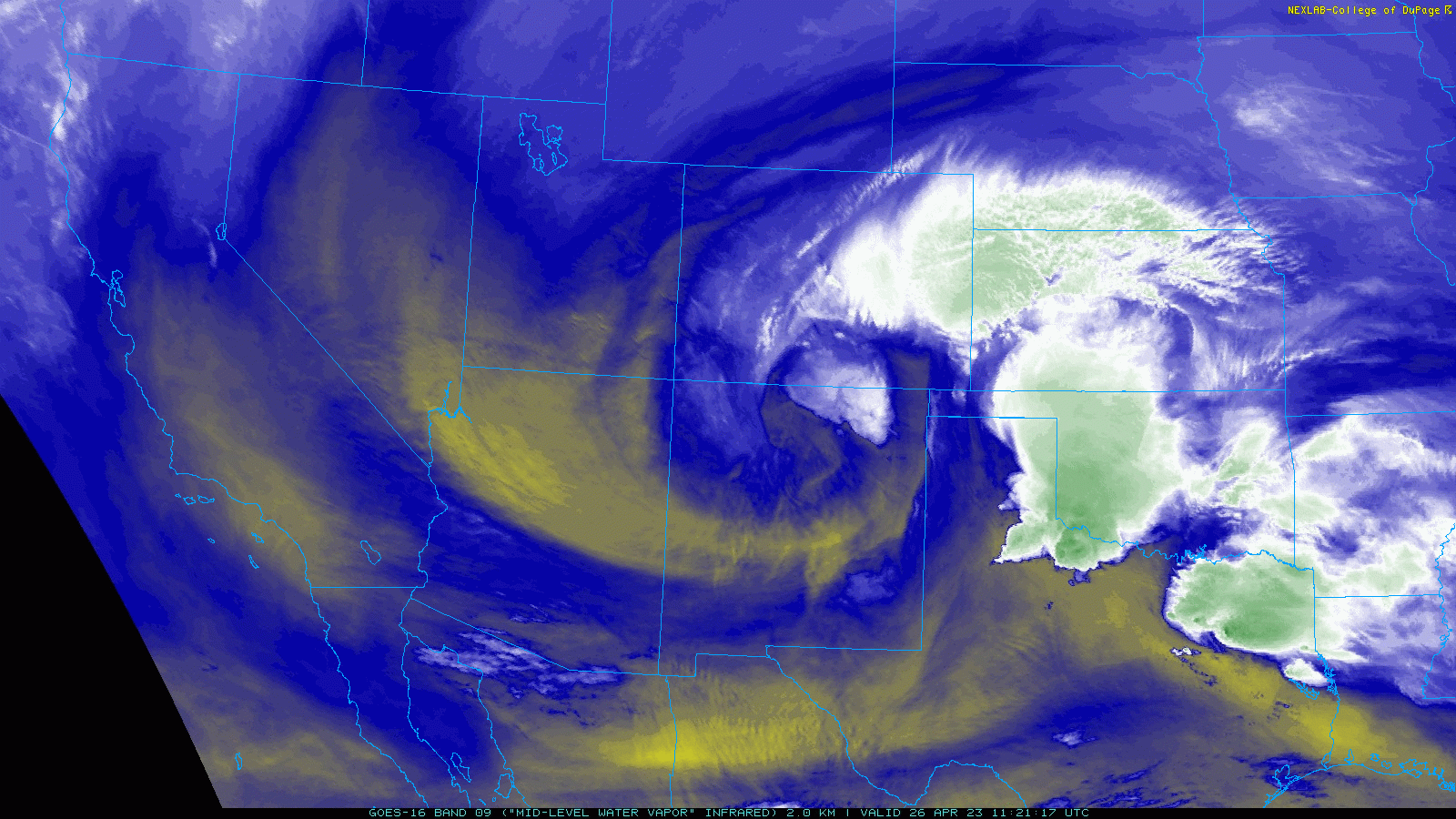
| Water vapor satellite animation valid from 6:21 am to 7:26 am on Wednesday (26 April 2023). | |
| The initial thunderstorm development was concentrated across the southwestern Texas Panhandle as well as the western South Plains, in close proximity to the warm front and dryline, respectively. Although moisture levels and instability were not particularly high by late April standards, they were sufficient, when coupled with improving vertical wind shear, to support organized thunderstorms, including rotating (supercell) storms. | |
 |
|
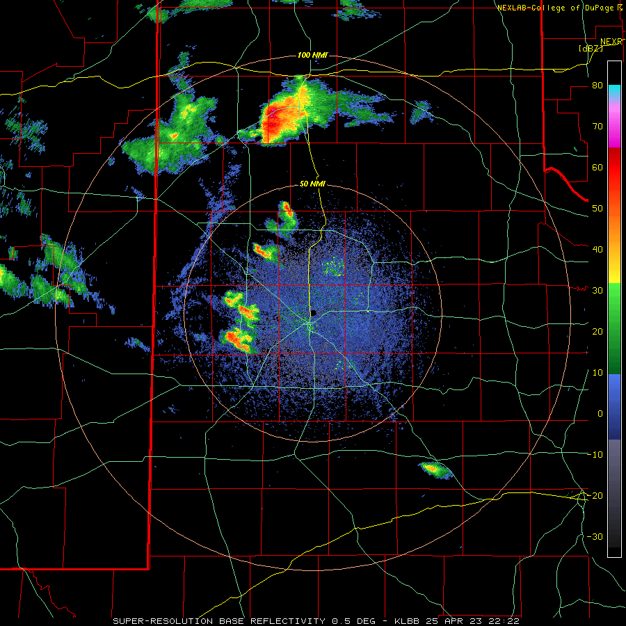
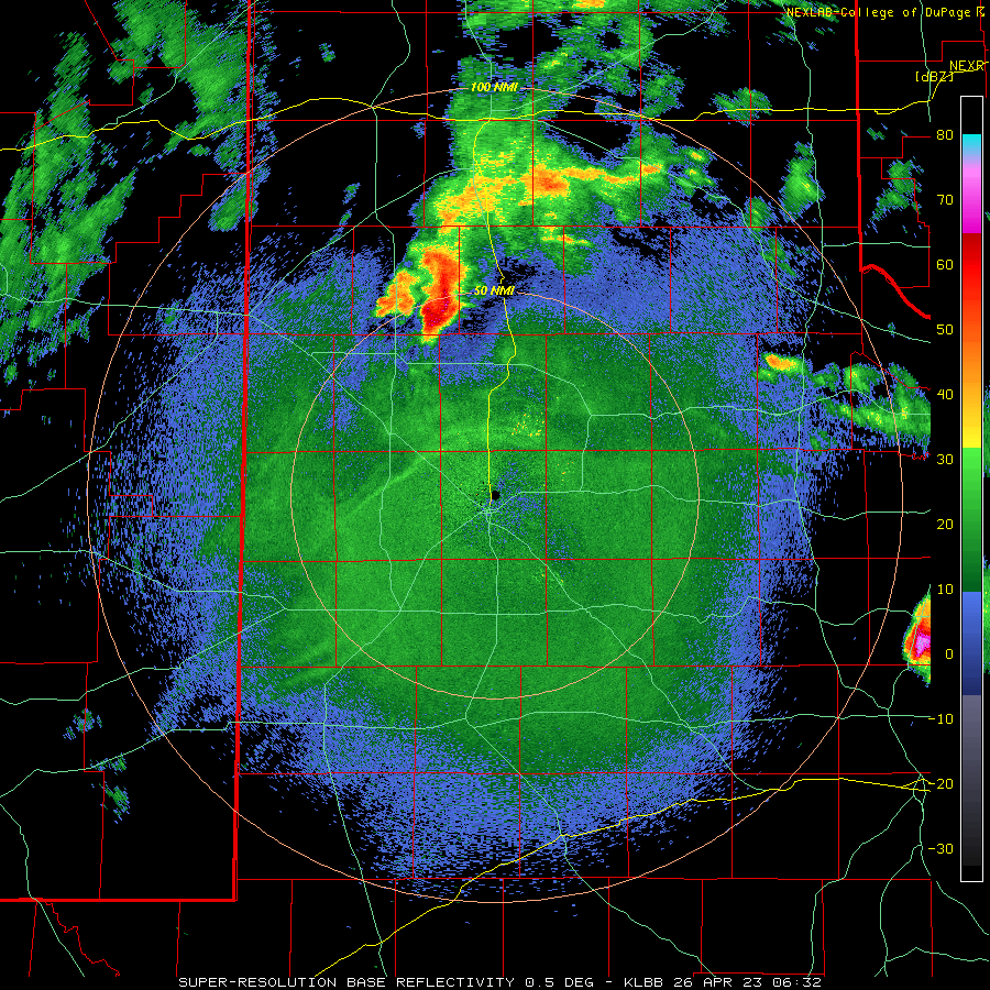
| Lubbock WSR-88D radar animation valid from 5:52 pm to 9:57 pm on Wednesday (25 April). A regional radar animation, valid from 3:35 pm on April 25th to 6:05 am on April 27th, can be VIEWED HERE. | |
| The most intense storm of the day evolved from a cluster of thunderstorms over the southwestern Texas Panhandle during the late afternoon hours. Once the storm became organized and started rotating, it "turned to the right," which means that it moved more southeastward (and opposed to eastward). | |
 |
 |
| Large hail that fell in Dickens (left) and Tulia (right) on Wednesday evening (25 April). The pictures were relayed by Jacob Riley and are courtesy of Alana Pollard and Dolores Nix, respectively. | |
|
The southeast track of the supercell brought the thunderstorm across Tulia, just northeast of Floydada, and eventually through McAdoo and Dickens before finally weakening over far southeast Dickens County late Tuesday evening. During its 6+ hour trek, the thunderstorm was a proficient hail producer, tossing hail as large as baseballs, softballs and even grapefruit. |
|
 |
|
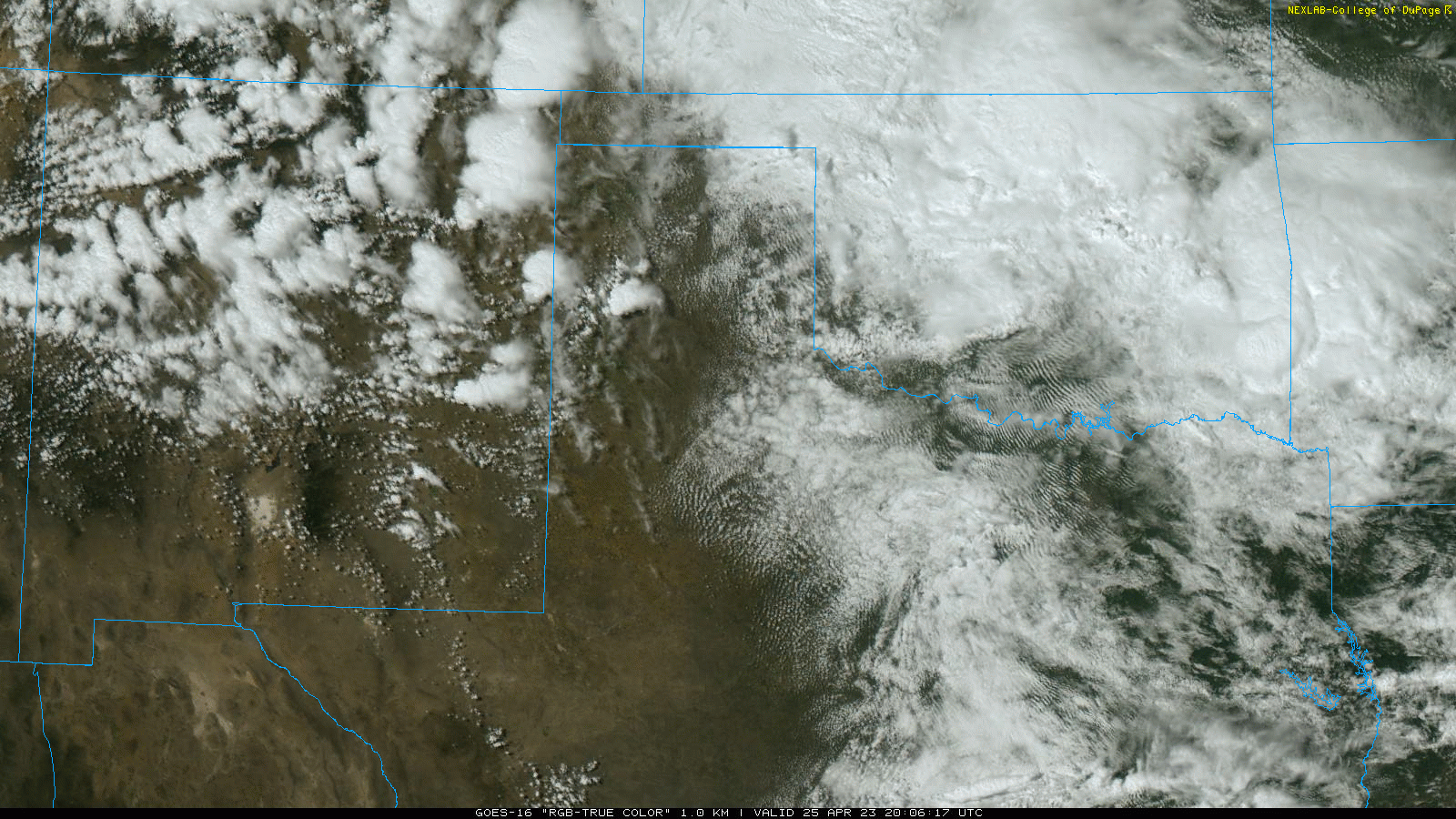
| "RGB-True Color" satellite animation valid from 3:06 pm to 7:26 pm on Wednesday (25 April 2023). | |
| The large to giant hail caused significant damage around the region, including Dickens, which took a direct hit. Windows were smashed out of homes and vehicles, while roofs and siding incurred large impact craters. | |
 |
|
| Hail damage sustained to vehicles in Dickens on Wednesday evening (25 April 2023). The picture was taken the following day by the NWS Lubbock Damage Survey Team. | |
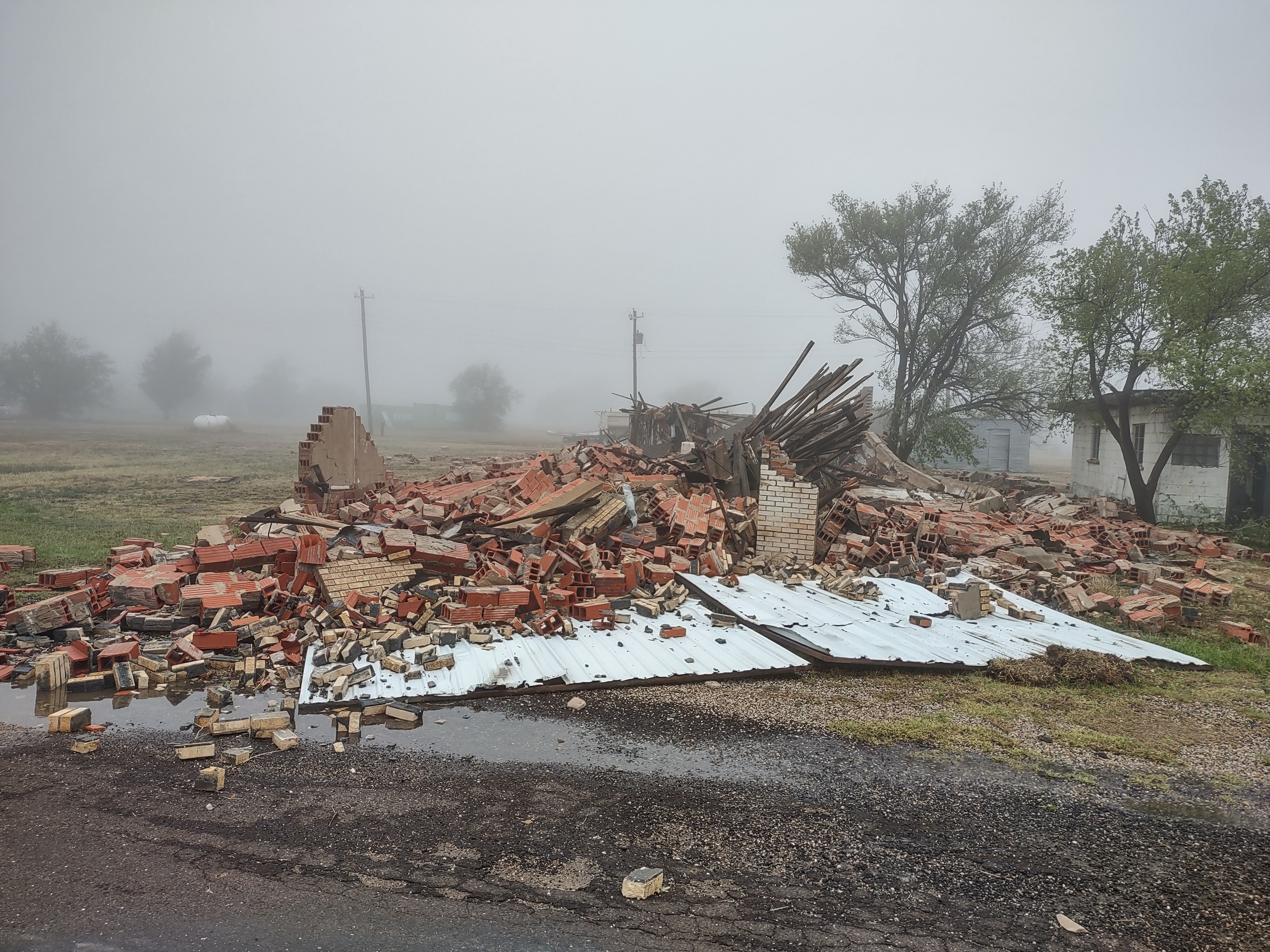
| The hail-producing thunderstorm occasionally generated intense straight-line winds too. The McAdoo West Texas Mesonet (WTM), located 3 miles north-northwest of the community, measured a peak gust of 90 mph at 9:39 pm. The severe winds swept through the town, destroying an old, abandoned grocery store (shown below), while causing considerable roof damage to several other structures. | |
 |
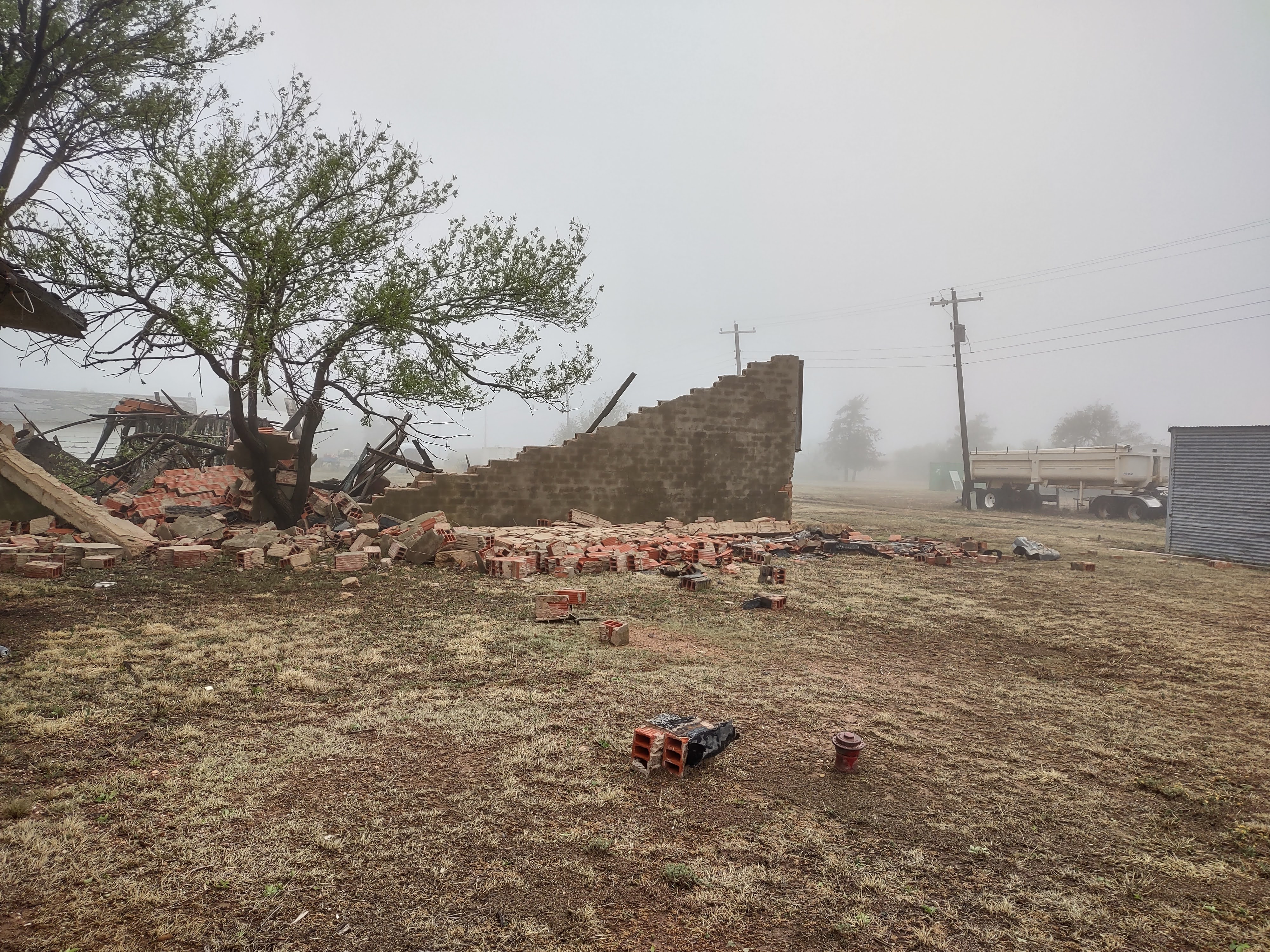 |
| A building in McAdoo that was destroyed by a severe thunderstorm Wednesday evening (25 April 2023). The pictures were taken the following day by the NWS Lubbock Damage Survey Team. | |
|
In addition to generating very large hail and damaging winds, the Tuesday evening supercell produced one brief tornado near Dougherty, in a rural area of southeastern Floyd County. A National Weather Service (NWS) Survey Team the following day could not find any signs of damage from the short-lived tornado. Thus, the tornado was assigned an EF-Unknown rating. |
|
 |
|
| Lubbock WSR-88D radar animation valid from 1:32 am to 6:02 am Thursday morning (26 April 2023). A regional radar animation, valid from 3:35 pm on April 25th to 6:05 am on April 27th, can be VIEWED HERE. | |
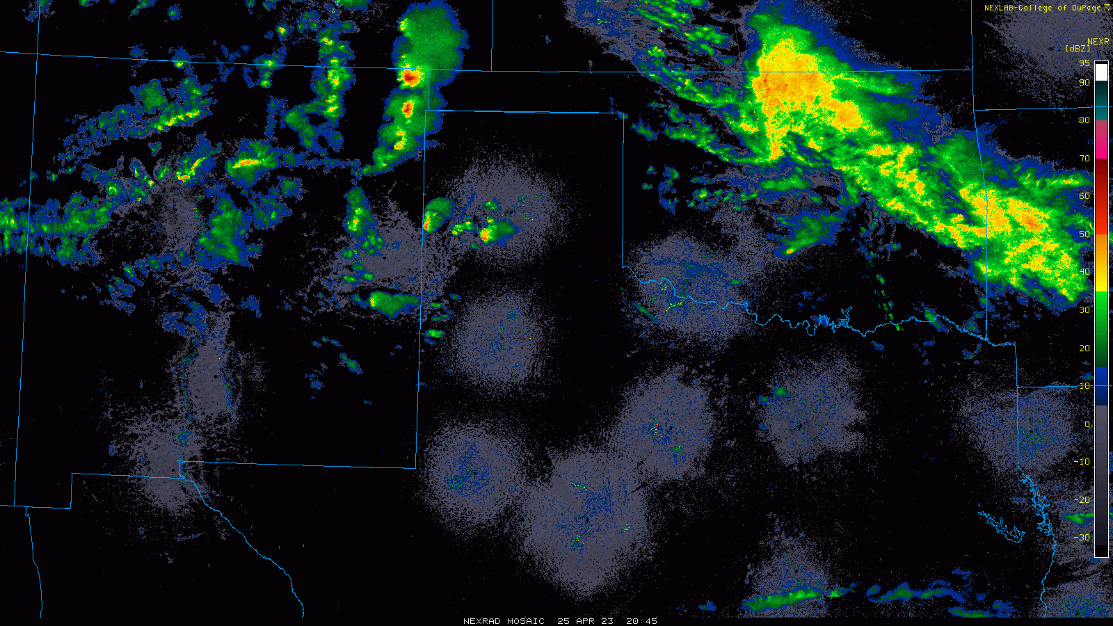
| More widespread showers and thunderstorms developed and moved across the southern Texas Panhandle, northern South Plains and much of the Rolling Plains late Tuesday night into Wednesday morning as the main lift from the upper level storm system moved over. A couple of these storms were on the strong side, but the main theme from this activity was widespread welcome rainfall. | |
 |
|
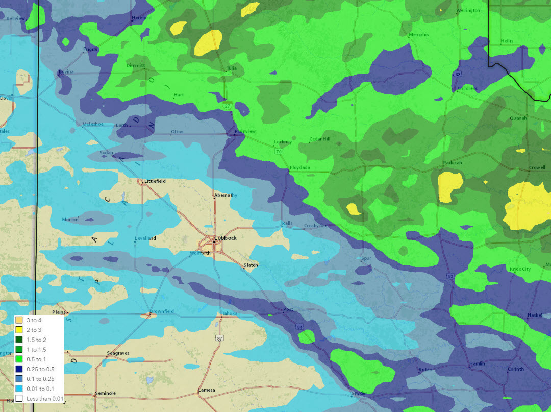
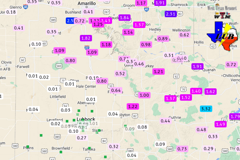
| 5-day radar-estimated and bias-corrected rainfall ending at 7 am on Friday (28 April). The rainfall measured by the West Texas Mesonet (WTM) over this period can be VIEWED HERE. | |
|
Rain totals of a half inch to an inch were common along and north of a Dimmitt to Floydada to Guthrie line, with localized totals in excess of 2 inches. The COOP observer near Grow, Texas, located about 15 miles south of Paducah, recorded an impressive 2.62 inches. Unfortunately, rainfall was spotty, and generally on the light side, over much of the central and southern South Plains, including in Lubbock, where only a trace was officially measured. The exception was in a narrow swath from south of Levelland to north of Tahoka and through Post, where a small but strong storm brought brief heavy rain, gusty winds and even a little hail at times. |
|
|
Preliminary storm reports and the Damage Survey results for this active late April day can be found below: |
|
PRELIMINARY LOCAL STORM REPORT...SUMMARY
NATIONAL WEATHER SERVICE LUBBOCK TX
320 AM CDT WED APR 26 2023

..TIME...   ...EVENT...      ...CITY LOCATION...     ...LAT.LON...
..DATE...   ....MAG....      ..COUNTY LOCATION..ST.. ...SOURCE....
            ..REMARKS..

0653 PM     HAIL             10 NW TULIA             34.64N 101.90W
04/25/2023  E1.25 INCH       SWISHER            TX   STORM CHASER


0715 PM     HAIL             TULIA                   34.54N 101.77W
04/25/2023  E1.50 INCH       SWISHER            TX   EMERGENCY MNGR

            SO REPORT RELAYED BY EM.

0730 PM     HAIL             2 S TULIA               34.51N 101.77W
04/25/2023  E2.75 INCH       SWISHER            TX   STORM CHASER

0801 PM     TSTM WND DMG     7 NNE PLAINVIEW         34.28N 101.67W
04/25/2023                   HALE               TX   STORM CHASER

            DELAYED REPORT OF A SNAPPED POWER POLE DUE
            TO RFD WINDS. TIME ESTIMATED FROM RADAR.

0840 PM     HAIL             10 N FLOYDADA           34.13N 101.34W
04/25/2023  E2.75 INCH       FLOYD              TX   FIRE DEPT/RESCUE

0855 PM     HAIL             3 E FLOYDADA            33.98N 101.28W
04/25/2023  E2.50 INCH       FLOYD              TX   STORM CHASER

            SOCIAL MEDIA VIDEO OF TENNIS BALL SIZE HAIL.
            TIME ESTIMATED FROM RADAR.

0939 PM     TSTM WND GST     3 NNW MCADOO            33.77N 101.03W
04/25/2023  M90 MPH          DICKENS            TX   MESONET

            WEST TEXAS MESONET. ADDITIONAL GUSTS RANGING
            FROM 60 MPH TO 87 MPH MEASURED FROM 937 PM
            TO 942 PM. SUSTAINED WIND OF 68 MPH MEASURED
            AT 940 PM.

0942 PM     TSTM WND DMG     MCADOO                  33.73N 101.01W
04/25/2023                   DICKENS            TX   EMERGENCY MNGR

            EM REPORTS LARGE BRICK BUILDING IN MCADOO IS
            COMPLETELY LEVELED AND DESTROYED. TIME
            ESTIMATED FROM RADAR.

0942 PM     TSTM WND DMG     MCADOO                  33.73N 101.01W
04/25/2023                   DICKENS            TX   EMERGENCY MNGR

            EM REPORTS ROOF BLOWN OFF OF GAS STATION IN
            MCADOO. TIME ESTIMATED FROM RADAR.

0944 PM     HAIL             MCADOO                  33.73N 101.01W
04/25/2023  E1.75 INCH       DICKENS            TX   FIRE DEPT/RESCUE

            GOLF BALL SIZE HAIL REPORTED BY MCADOO FIRE.

1006 PM     HAIL             DICKENS                 33.62N 100.84W
04/25/2023  E2.75 INCH       DICKENS            TX   PUBLIC


1008 PM     HAIL             DICKENS                 33.62N 100.84W
04/25/2023  E3.00 INCH       DICKENS            TX   BROADCAST MEDIA

            BROADCAST MEDIA RELAYED PHOTO OF ESTIMATED 3
            INCH HAIL IN DICKENS. TIME ESTIMATED FROM
            RADAR.

1009 PM     TSTM WND DMG     DICKENS                 33.62N 100.84W
04/25/2023                   DICKENS            TX   LAW ENFORCEMENT

            DICKENS COUNTY SHERIFF REPORTS MULTIPLE
            WINDOWS BLOWN OUT IN TOWN FROM WIND-DRIVEN
            HAIL. TIME ESTIMATED FROM RADAR.

