|
Intense winds, suffocating blowing dust and severe thunderstorms |
|
 |
|
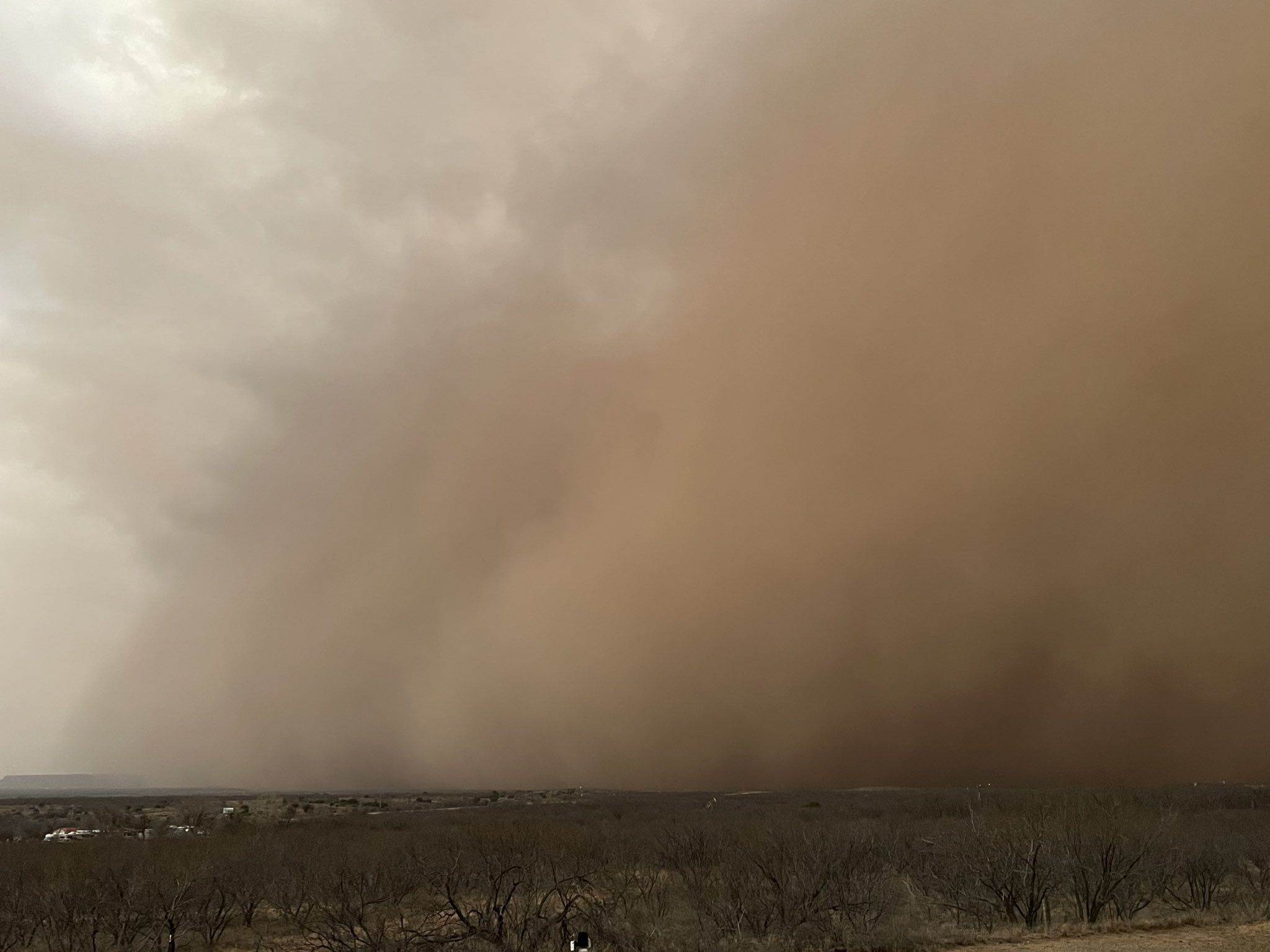
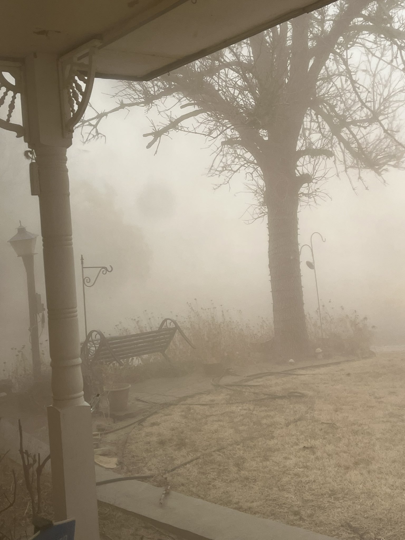
| Thick blowing dust blowing approaching Lake Alan Henry Sunday evening (26 February 2023). The image is courtesy Lake Alan Henry Weather via Twitter. | |
|
The second powerful winter storm to affect the region, and the country, in less than a week, brought another round of highly impactful weather to West Texas. Sunday (26 February) started off mild, cloudy (and foggy in spots) and moist as breezy southerly winds carried Gulf moisture into the southern High Plains. This rare moist start to a West Texas winter day even provided pockets of drizzle, a few light showers and a brief isolated thunderstorm through the morning hours. However, this was only a subtle taste of what was to unfold through the afternoon and evening hours. |
|
 |
|
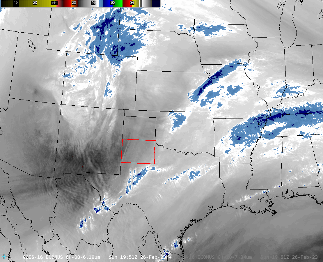
| Water vapor satellite loop valid from 1:51 pm to 11:46 pm on Sunday (26 February 2023). | |
| The powerful winter storm system, the same one that brought heavy snow and blizzard conditions to very low elevations in southern California, accelerated through the Four Corners and emerged across the central and southern High Plains Sunday afternoon and evening. As this occurred, rapidly deepening low pressure, in cahoots with a dryline and Pacific cold front, turned up the wind dramatically across the entire region. Initially gusty southerly winds not only transported moisture northward, but began to loft enough blowing dust to turn the sky an eerie red/brown by early to mid-afternoon. | |
 |
|
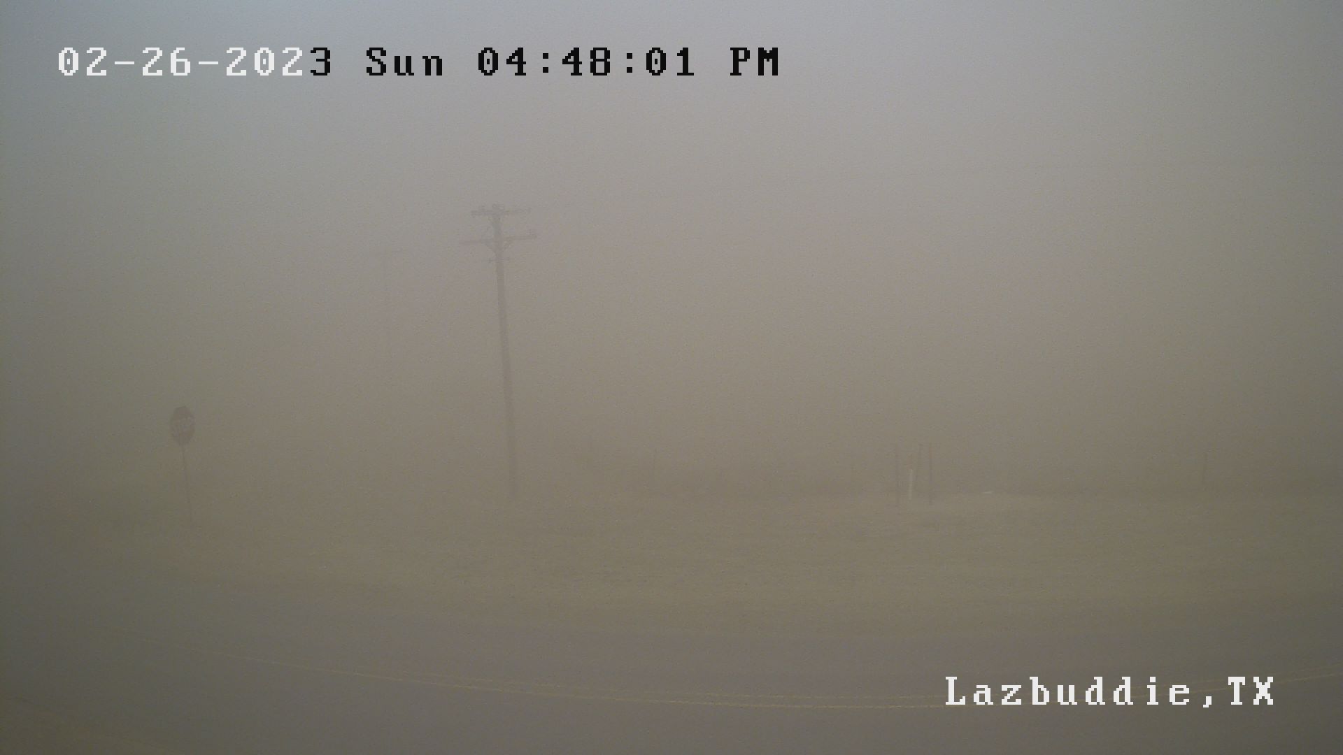
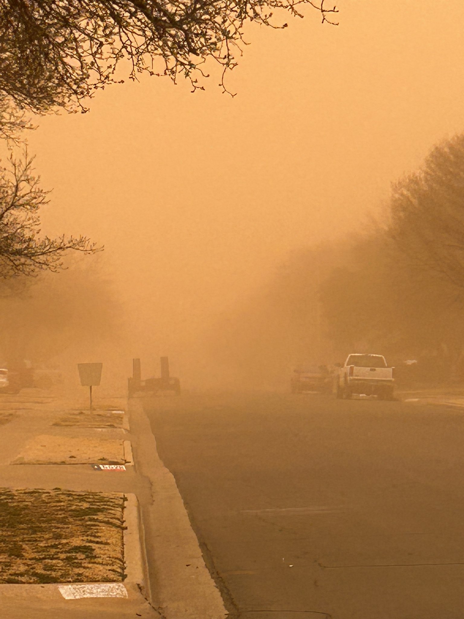
| View of thick blowing dust in Lazbuddie late Sunday afternoon (26 February). The image is courtesy of Five Area Telephone West Plains. | |
| Then, as the Pacific front raced out of eastern New Mexico, the wind and dust levels went from unpleasant to downright disgusting and dangerous. Widespread severe (58+ mph) wind gusts lofted copious amounts of dust, dropping the visibility to and below 1/4 mile in most locations on the Caprock through the late afternoon hours. | |
 |
|
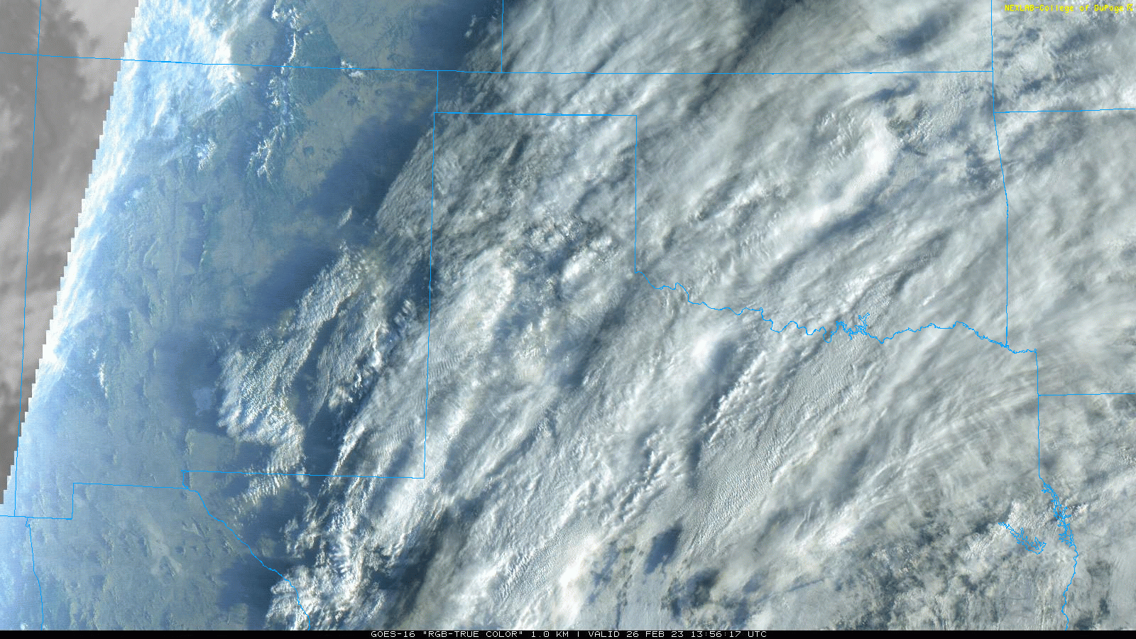
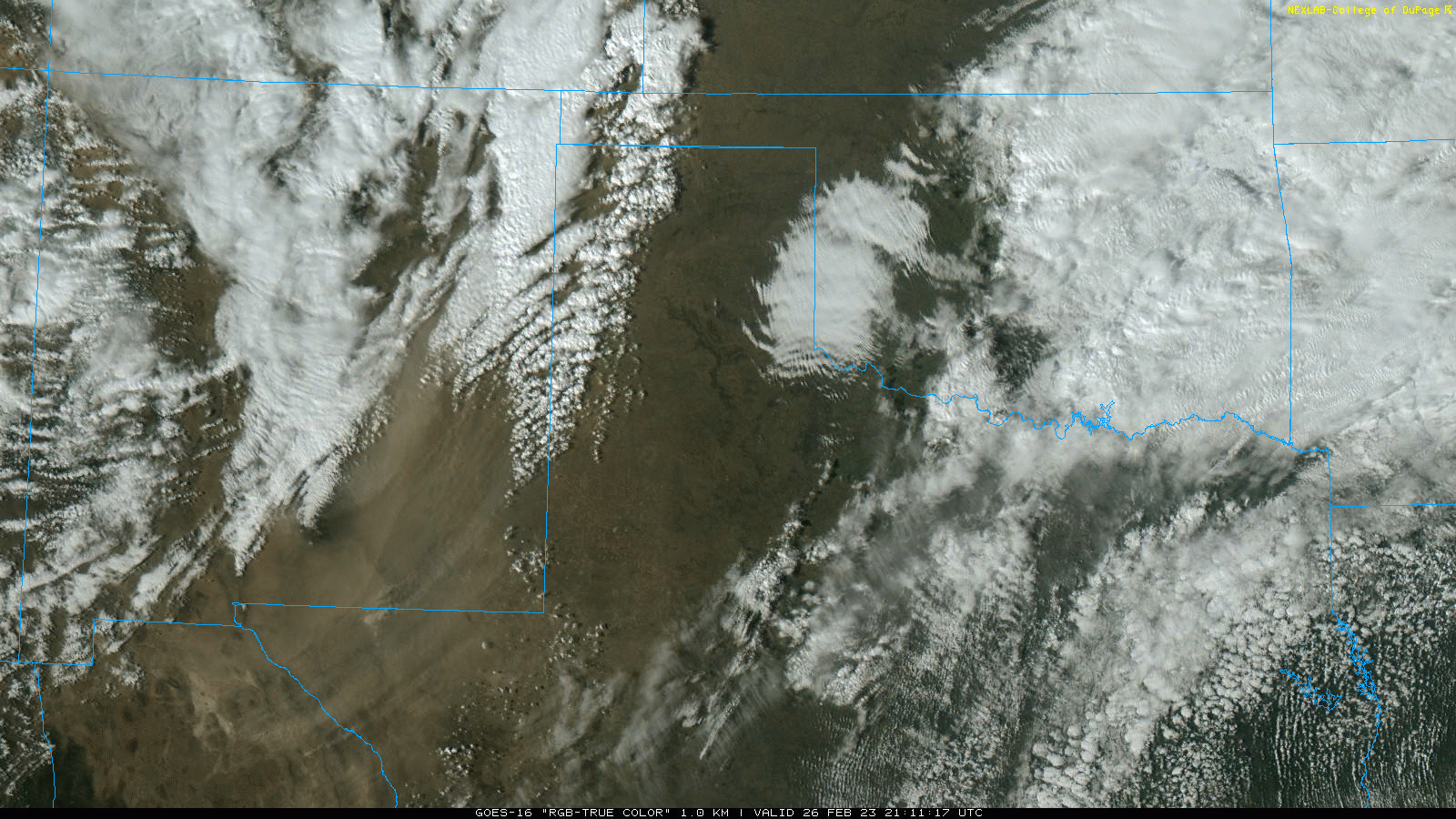
| "RGB-True Color" satellite animation valid from 7:56 am to 5:56 pm on Sunday (26 February). This animation contains 30-minute time steps. A similar animation from mid-afternoon through early evening, with 5-minute time steps, can be VIEWED HERE. | |
|
The dust didn't stop at the edge of the Caprock, but instead swept through the Rolling Plains during the evening, eventually moving on into Oklahoma and North and East Texas. The thick dust persisted for quite some time, and aside from the color and feel, had the appearance of fog given the persistent low visibility. Unfortunately, the thick dust make travel difficult to impossible and contributed to several accidents around the region. |
|
 |
 |
| Pictures of thick dust in Muleshoe (left) and Lubbock (right) late Sunday afternoon. The pictures are courtesy of Judd Baker and @ttuninteytwo via Twitter, respectively. | |
| When the cold front overtook the dryline, widespread showers and thunderstorms filled in over the southeast Texas Panhandle into the Rolling Plains. The storms did provide a little rain in spots as a quick-moving line raced eastward, but they also enhanced the wind and a few locations even experience hail, as large as golf balls in Memphis. | |
 |
|
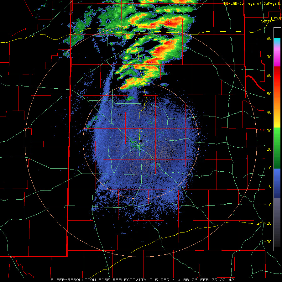
| Lubbock WSR-88D radar animation valid from 4:42 to 8:14 pm Sunday evening (26 February) | |
| Wind gusts of 60 to 80 mph were common with the strongest thunderstorm activity, but the West Texas Mesonet site one mile northeast of Memphis recorded an impressive 114 mph gust. Thankfully, this magnitude of wind appeared quite localized, though the town of Memphis did have some damage, both from the wind and wind-driven hail. Several windows were broken, roofs were damaged and carports were destroyed. | |
 |
|
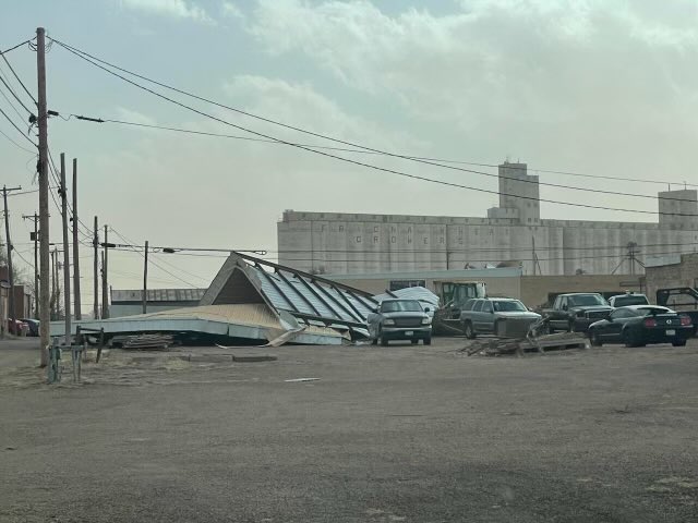
| Roof blown off the old American Legion building in Friona. The image is courtesy of @bwhite70 on Twitter. | |
| The damaging winds weren't confined to locations where the thunderstorms moved through. Instead, wind gusts of 60 to 80 mph were common across the Caprock from the late afternoon through the evening hours before gradually dropping to breezy levels by early Monday. | |
 |
|
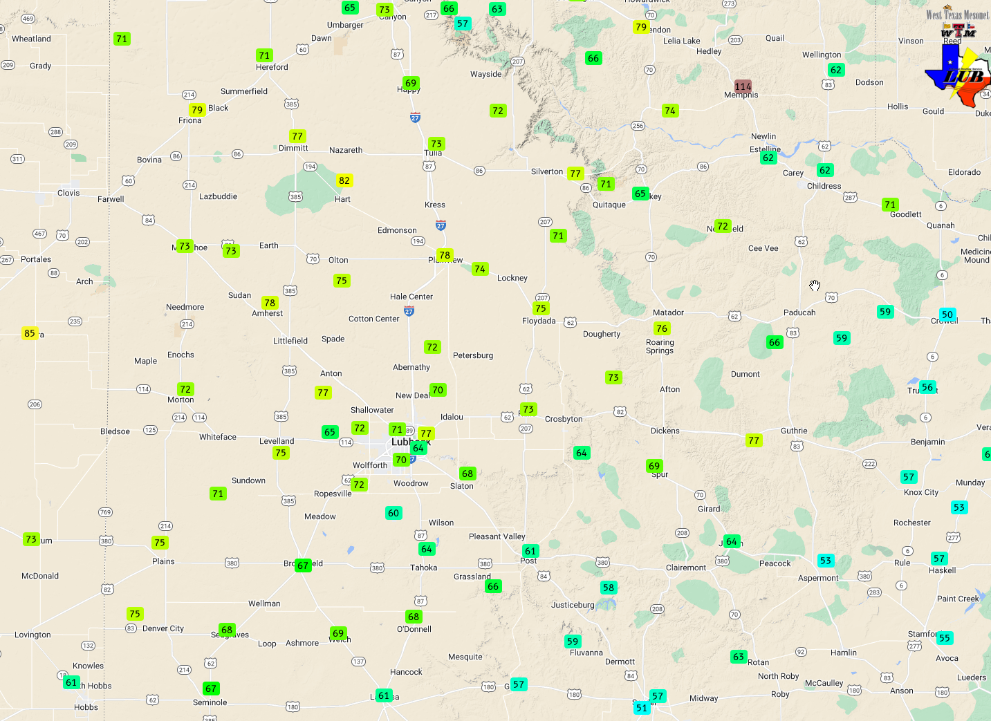
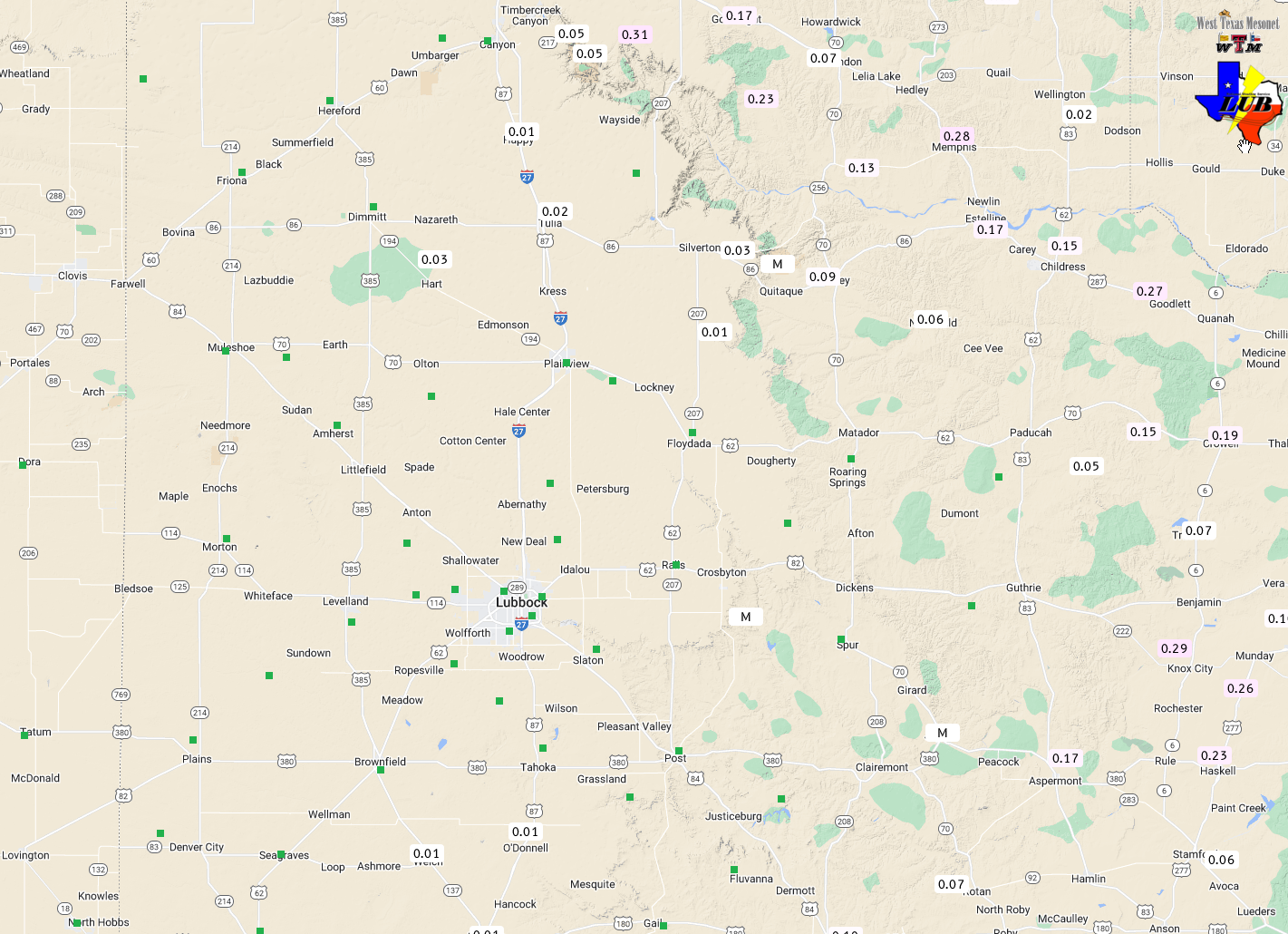
| Peak wind gusts measured on Sunday (26 February). The data are courtesy of the West Texas Mesonet (WTM). A color coded map of the peak wind gusts measured over most of the WTM domain can be VIEWED HERE. The highest sustained wind speeds measured by the WTM on the 26th can be FOUND HERE. | |
|
The Lubbock Airport officially measured a peak wind gust of 77 mph at 7:20 pm. The resulting thick blowing dust dropped Lubbock's visibility to at or below 1/4 mile from 5:53 pm to 7:14 pm, with zero visibility observed from 5:57 pm to 6:10 pm. The visibility finally recovered above 1 mile at 8:04 pm, but didn't improve above 6 miles until 4 am on Monday. |
|
 |
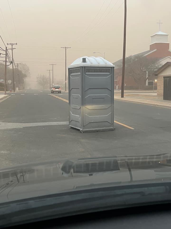 |
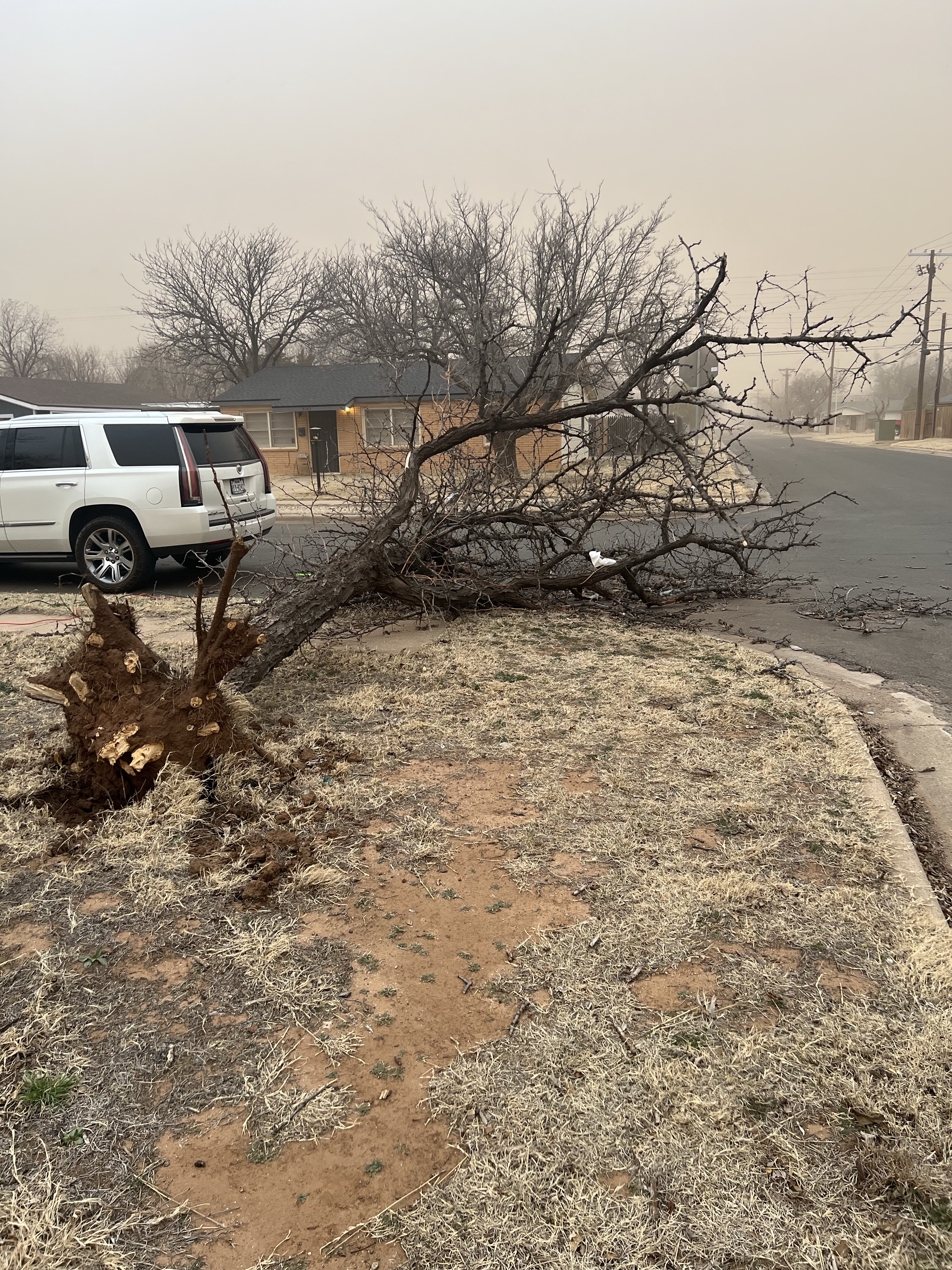
| Tree damage (left) and an escaped Porta Potty in Lubbock Sunday evening (26 February 2023). The images are courtesy of Tim Merritt and Todd Turnbow via Twitter. | |
| Behind the dryline, the intense winds and warm and much drier air created a period of critical fire weather. These conditions supported the ignition and spread of several wildfires on the South Plains, including one west of Levelland and a second in northwest Lamb County (west of Springlake). Smoke plumes from both of the fire listed can be seen clearly in the radar animation located several images above. | |
 |
|
 |
|
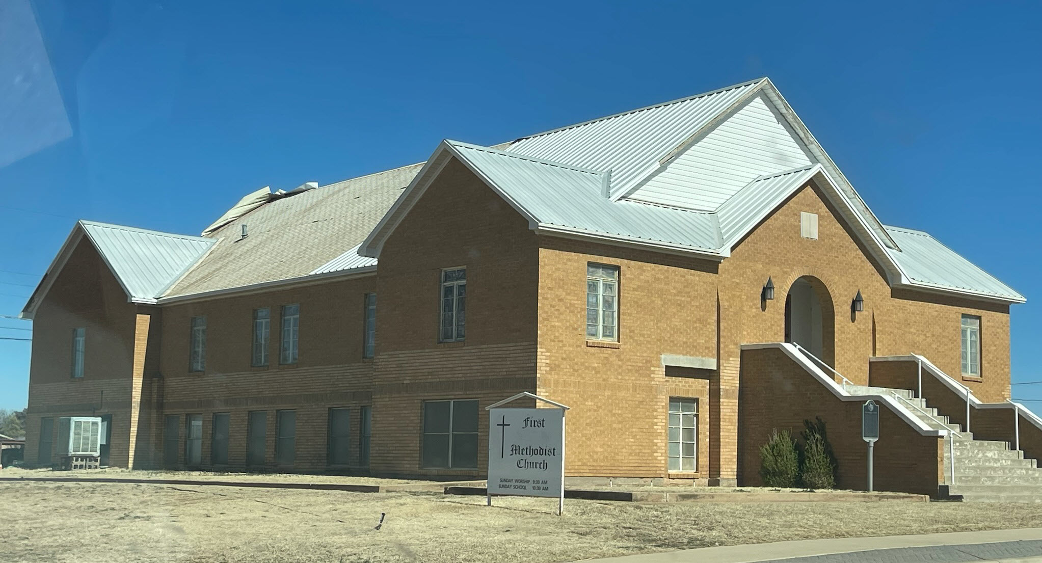
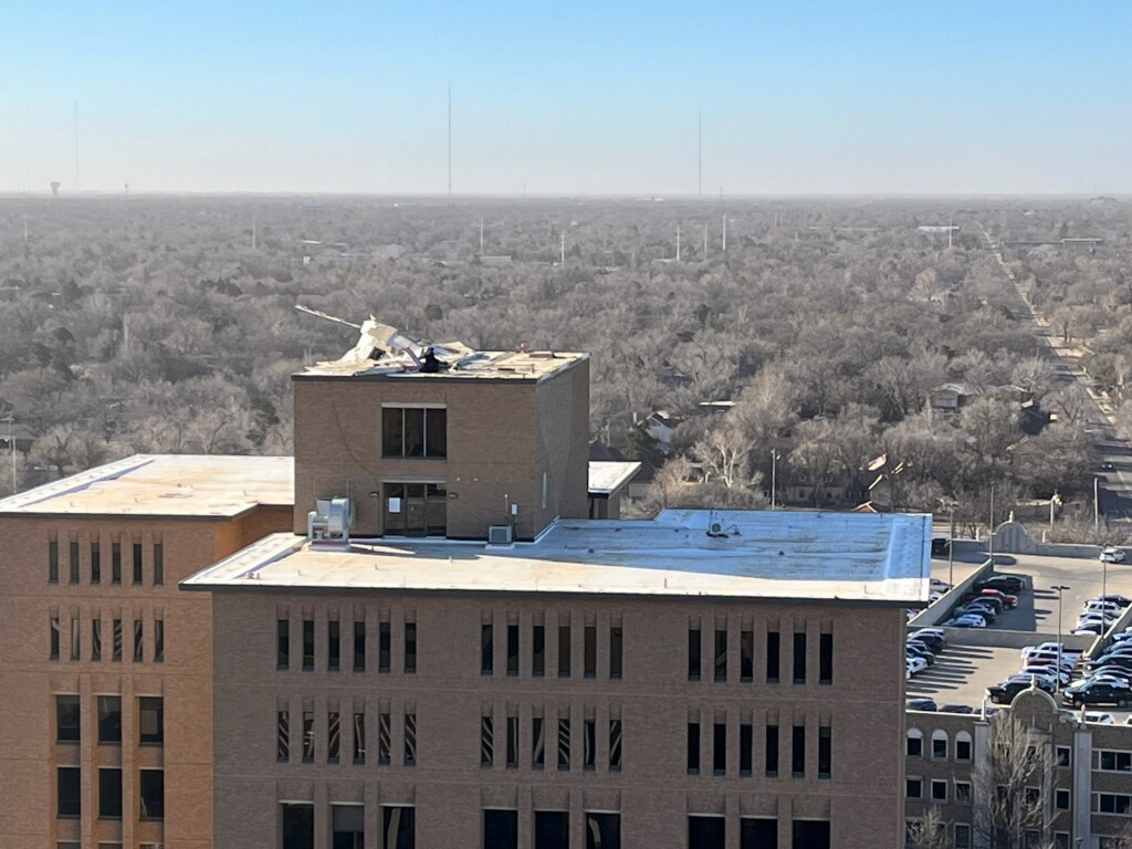
| Roof damage to the First Methodist Church in Turkey (above - top image) and the Huckabee College of Architecture building on the Texas Tech campus (above - bottom image), taken on 27 February. The damage pictures are courtesy of John Lipe and Chris Weiss, respectively. | |
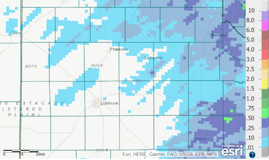
| On the positive side, the thunderstorms did bring a little rain to the region, primarily the southern Texas Panhandle and eastern Rolling Plains. Even where the storms raced through, rain totals generally ranged from a few hundredths to a quarter inch. Childress officially record 0.18 inches of rain, while Lubbock only had a trace. | |
 |
|
| 24-hour radar-estimated and bias-correct rainfall ending at 6 am on Thursday (27 February). Exact rainfall totals measured by the WTM can be VIEWED HERE. | |
|
Preliminary weather (wind, dust and hail) and damage reports collected on February 26th can be found below: |
|
Public Information Statement
National Weather Service Lubbock TX
622 AM CST Mon Feb 27 2023

...PEAK NON-CONVECTIVE WIND GUSTS FROM 26 FEBRUARY 2023...

Location                     Speed     Time/Date       Provider

...Texas...

...Bailey County...
1 SSW Muleshoe               73 MPH    0452 PM 02/26   Mesonet

...Briscoe County...
7 ESE Silverton              73 MPH    0800 PM 02/26   Mesonet
3 S Caprock Canyon SP        69 MPH    0700 PM 02/26   Mesonet

...Castro County...
2 N Hart                     82 MPH    0514 PM 02/26   Mesonet
2 NE Dimmitt                 77 MPH    0500 PM 02/26   Mesonet

...Childress County...
2 WNW Childress              78 MPH    1015 PM 02/26   ASOS
4 NE Childress               70 MPH    1021 PM 02/26   Mesonet

...Cochran County...
1 ENE Morton                 72 MPH    0500 PM 02/26   Mesonet
8 SW Sundown                 71 MPH    0523 PM 02/26   Mesonet

...Cottle County...
10 SW Paducah                84 MPH    1056 PM 02/26   Mesonet
2  SSE Hackberry             71 MPH    1123 PM 02/26   Mesonet

...Crosby County...
5 NW White River Lake        82 MPH    1033 PM 02/26   Mesonet
1 SSE Ralls                  73 MPH    0807 PM 02/26   Mesonet

...Dickens County...
3 NNW Mcadoo                 77 MPH    1009 PM 02/26   Mesonet
1 W Spur                     69 MPH    0658 PM 02/26   Mesonet

...Floyd County...
1 NNE Floydada               75 MPH    0742 PM 02/26   Mesonet
3 ENE South Plains           71 MPH    0807 PM 02/26   Mesonet

...Garza County...
6 SSW Graham                 75 MPH    1128 PM 02/26   Mesonet
1 NNW Lake Alan Henry        58 MPH    0719 PM 02/26   Mesonet

...Hale County...
1 SE Plainview               78 MPH    0721 PM 02/26   Mesonet
3 WSW Aiken                  74 MPH    0738 PM 02/26   Mesonet
6 ENE Abernathy              72 MPH    0723 PM 02/26   Mesonet
2 S Plainview                63 MPH    0603 PM 02/26   AWOS

...Hall County...
2 WSW Turkey                 67 MPH    0919 PM 02/26   Mesonet
6 SE Brice                   66 MPH    0815 PM 02/26   Mesonet
3 SSE Estelline              60 MPH    0944 PM 02/26   Mesonet

...Hockley County...
6 SSW Anton                  77 MPH    0616 PM 02/26   Mesonet
3 S Levelland                75 MPH    0529 PM 02/26   Mesonet
1 SSW Levelland              70 MPH    0515 PM 02/26   AWOS

...King County...
10 WSW Guthrie               69 MPH    1158 PM 02/26   Mesonet

...Lamb County...
1 ENE Amherst                78 MPH    0509 PM 02/26   Mesonet
6 S Olton                    75 MPH    0520 PM 02/26   Mesonet
9 NNW Sudan                  73 MPH    0459 PM 02/26   Mesonet

...Lubbock County...
1 NNW Lubbock Int. Airport   77 MPH    0720 PM 02/26   ASOS
4 E Lubbock                  77 MPH    0726 PM 02/26   Mesonet
2 NW Reese Center            72 MPH    0544 PM 02/26   Mesonet
6 E Ropesville               72 MPH    0547 PM 02/26   Mesonet
3 WNW Lubbock                71 MPH    0553 PM 02/26   Mesonet
5 E Wolfforth                70 MPH    0715 PM 02/26   Mesonet
5 NNW Idalou                 70 MPH    0723 PM 02/26   Mesonet
4 SSE Lubbock                64 MPH    0620 PM 02/26   Mesonet

...Lynn County...
1 WNW ODonnell               68 MPH    0608 PM 02/26   Mesonet

...Motley County...
3 N Roaring Springs          76 MPH    0719 PM 02/26   Mesonet
1 S Northfield               72 MPH    0803 PM 02/26   Mesonet

...Parmer County...
2 ENE Friona                 79 MPH    0440 PM 02/26   Mesonet

...Swisher County...
2 E Tulia                    73 MPH    0631 PM 02/26   Mesonet
8 NNW Mackenzie Reservoir    72 MPH    0711 PM 02/26   Mesonet
1 E Happy                    69 MPH    0635 PM 02/26   Mesonet

...Terry County...
2 S Brownfield               67 MPH    0530 PM 02/26   Mesonet

...Yoakum County...
6 WNW Denver City            75 MPH    0451 PM 02/26   Mesonet
3 NNW Plains                 75 MPH    0444 PM 02/26   Mesonet

Observations are collected from a variety of sources with varying
equipment and exposures. We thank all volunteer weather observers
for their dedication. Not all data listed are considered official.

