|
Bitter cold, ice, sleet and light snow |
|||||
 |
|||||
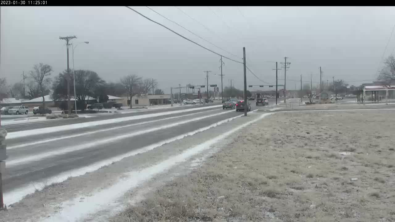
| Light wintry precipitation coating the ground in Lubbock at University and 74th Street Monday morning (30 January 2023). The image is courtesy of the City of Lubbock. | |||||
|
Following a mild start to the weekend, temperatures tumbled 30-40 degrees behind an overnight cold front. Arctic air and low clouds eased into West Texas behind the front, carried on northerly to northeasterly breezes. Although the winds behind the front were not particularly strong, the cooling was. |
|||||
![Chart showing the temperatures (red fill [2-m level], light pink line [1.5 m level] and purple line [9-m level) and dewpoint (green fill) measured by the West Texas Mesonet (WTM) site located near Texas Tech. Displayed are 7 days of data ending at noon on Monday (30 January 2023).Â](https://wxevents.caprockweather.com/images/lub/events/2023/events-2023-20230130-ice/7day_meteo_LBBW_ending_20230130_15Z_T_Td.png) |
|||||
|
|||||
|
Daytime highs plunged from the low to mid-60s on Saturday afternoon to the upper 20s to mid-30s on Sunday. In fact, given the predawn frontal passage, strength of the cold air and persistence of cloud cover, most locations recorded their daily high around or shortly after midnight early Sunday morning. Even where the sun broke out in the afternoon, temperatures only rose a few degrees. |
|||||
 |
 |
||||
|
|||||
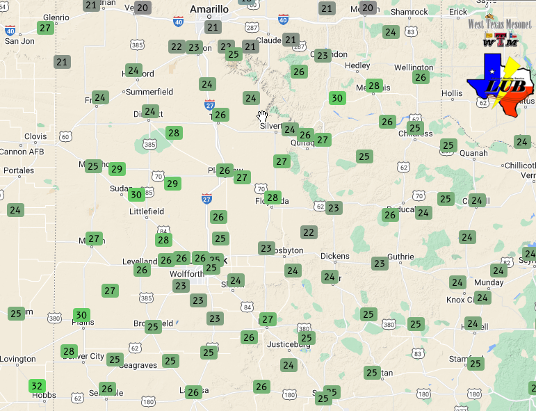
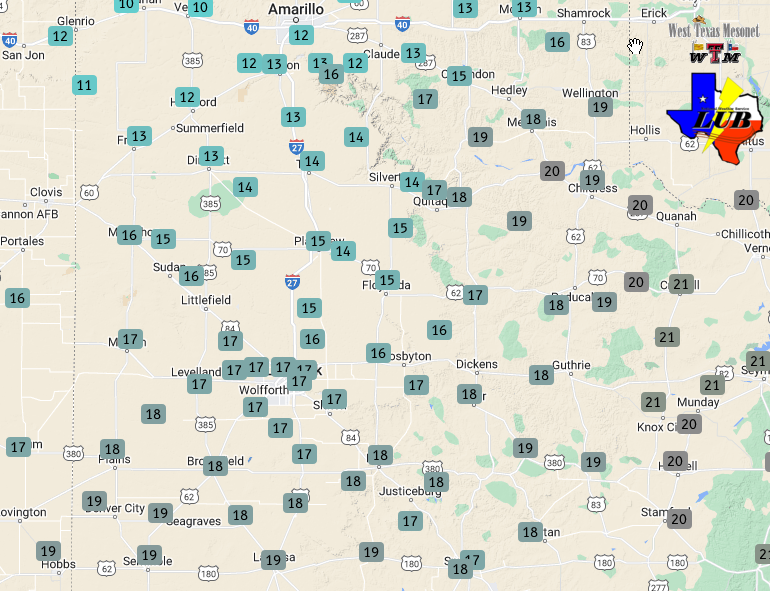
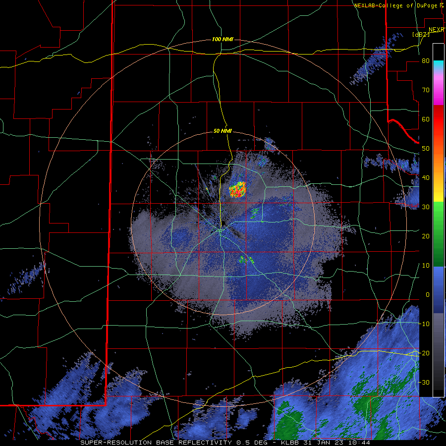
| Even colder air settled into the region Sunday night and Monday morning, as temperatures dipped into the teens over all of the South and Rolling Plains, and single digits in the Texas Panhandle. The bitter cold was accompanied by enough moistening to result in the development of areas of light freezing drizzle, light sleet and light snow. Unfortunately, though light, the wintry precipitation did create some travel difficulties as it quickly stuck to the sub-freezing roadways. | |||||
 |
|||||
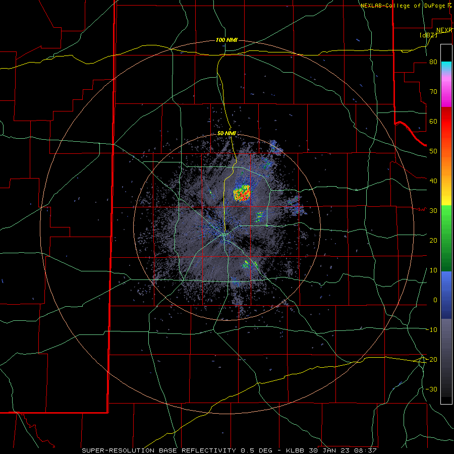
| Lubbock WSR-88D radar animation valid from 2:37 am to 10:13 am on Monday (30 January 2023). | |||||
| As the above radar animation depicts, the precipitation Monday morning was very light, barely detectable by radar other than a slight increase in the meager reflectivity values. The light drizzle, sleet and snow diminished toward midday, and road conditions improved by afternoon as the light icing eroded. | |||||
 |
|||||
| TXDOT road conditions captured at 9:30 am on January 30th. | |||||
| Despite the cessation of the precipitation, low clouds held firm which kept the temperatures from moving much through the afternoon hours. In fact, temperatures only managed to "warm" into the lower and middle 20s, remaining solidly below freezing. | |||||
 |
|||||
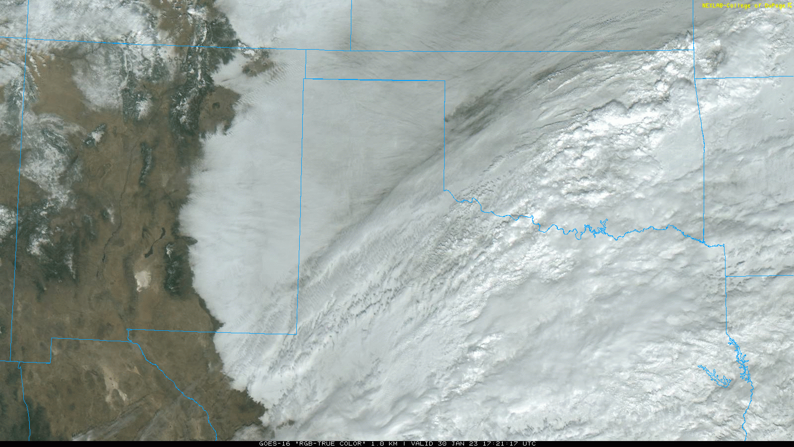
| "RGB True Color" regional satellite loop valid from 11:21 am to 12:11 pm on 30 January 2023. | |||||
| Below are a couple of additional photos of what the roads looked like Monday morning during the most intense, albeit still light, bouts of the freezing drizzle, sleet and snow. | |||||
 |
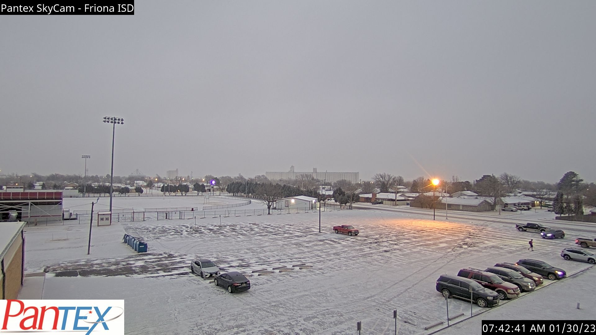 |
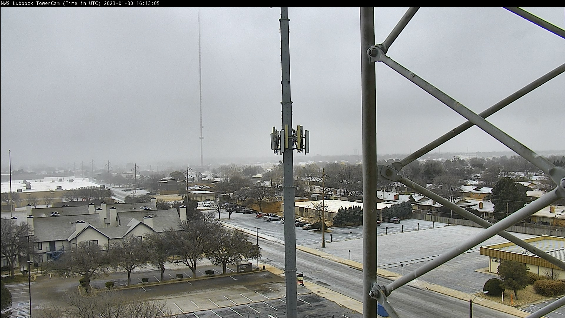
||||
| The wintry scene from NWS Lubbock (left) and in Friona (right) Monday morning (30 January 2023). The picture from Friona is courtesy of Pantex. | |||||
| Another cold night followed as temperatures eased downward into teens by early Tuesday morning. | |||||
 |
|||||
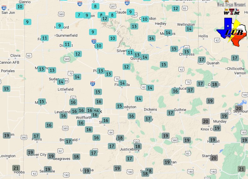
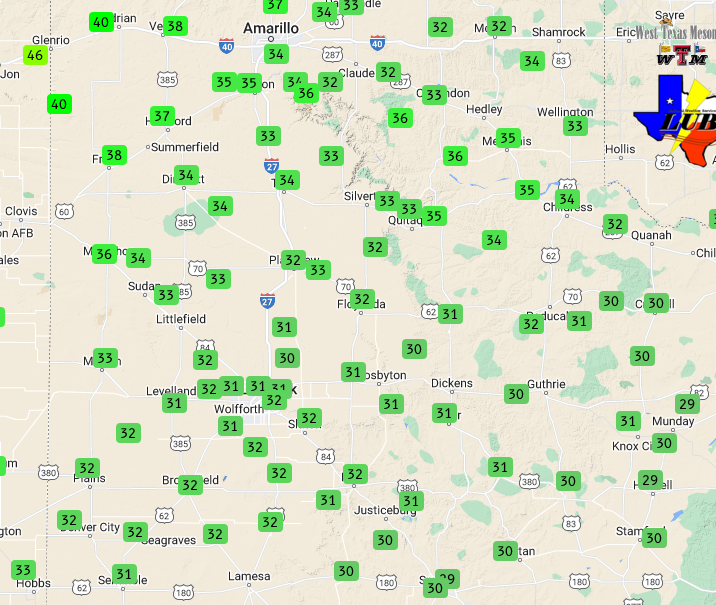
| Low temperatures recorded by the WTM Tuesday morning (31 January 2023). | |||||
| It felt like déjà vu Tuesday morning as pockets of light freezing drizzle (and snow flurries) redeveloped over parts of the region for the second morning in a row. The light frozen precipitation again created problems on area roadways, including in and around Lubbock. | |||||
 |
|||||
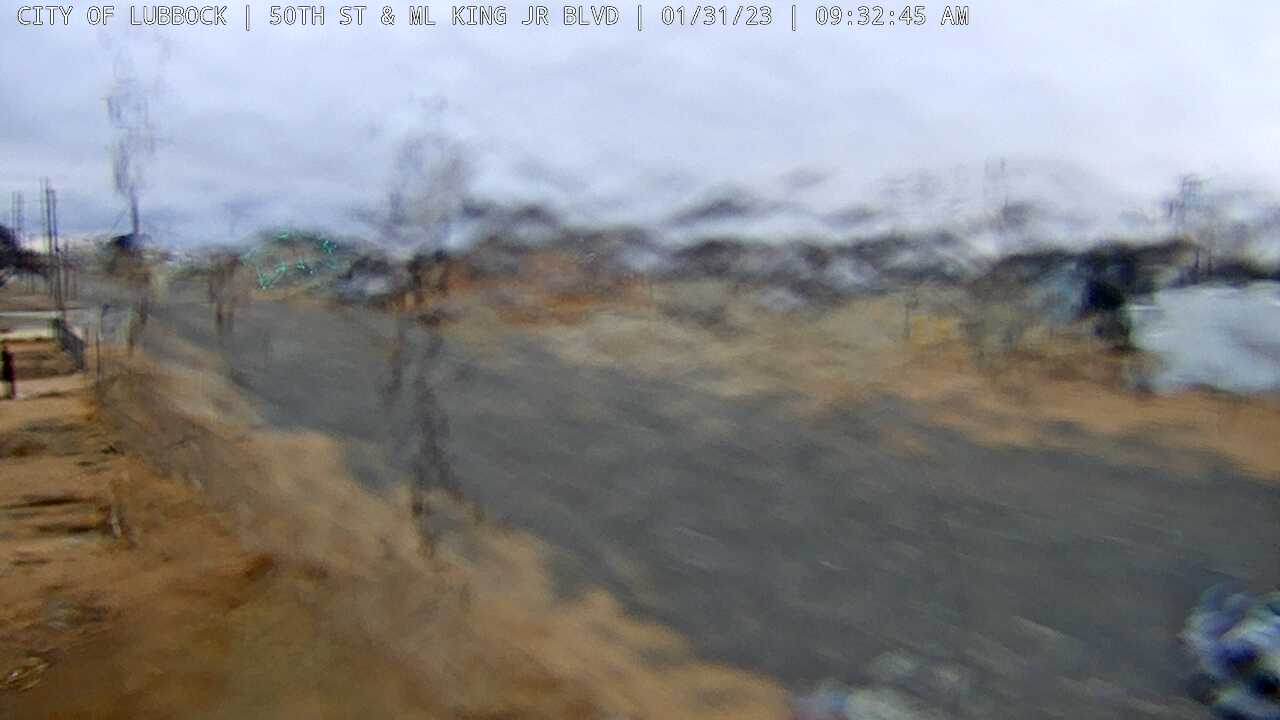
| Ice-covered camera lens at 50th and Martin Luther King Junior Boulevard Tuesday morning (31 January 2023). The image is courtesy of the City of Lubbock. | |||||
|
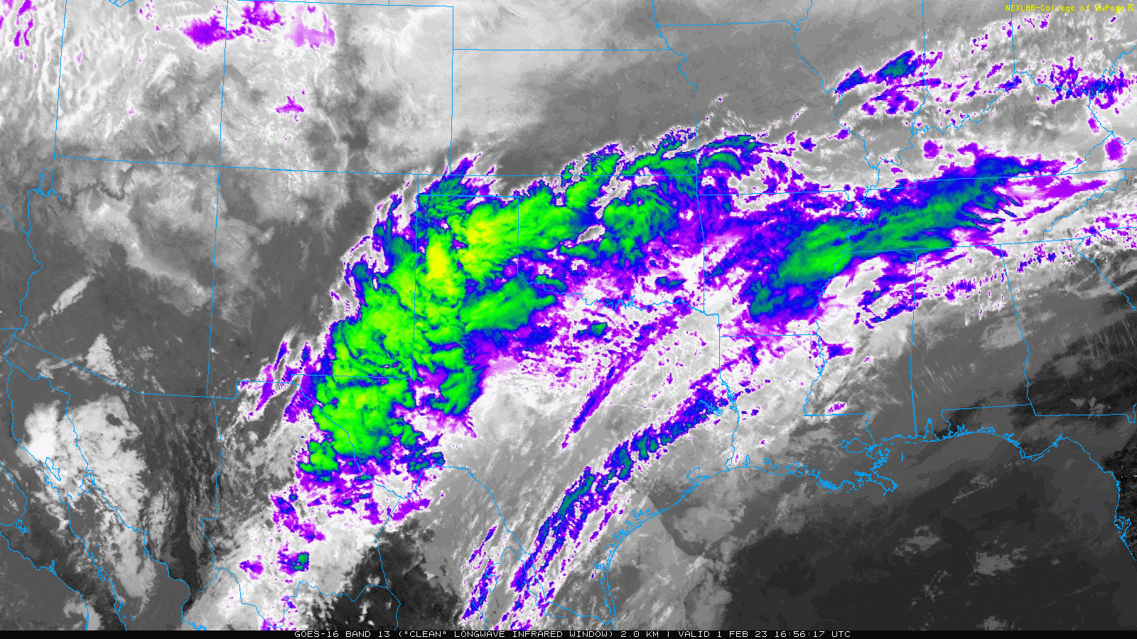
The wintry impacts were not confined to West Texas. In fact, the heaviest freezing rain and sleet targeted much of Central and North Texas Tuesday morning, where temperatures were stuck in the 20s. All of the ice and sleet resulted in widespread travel impacts downstate. |
|||||
 |
|||||
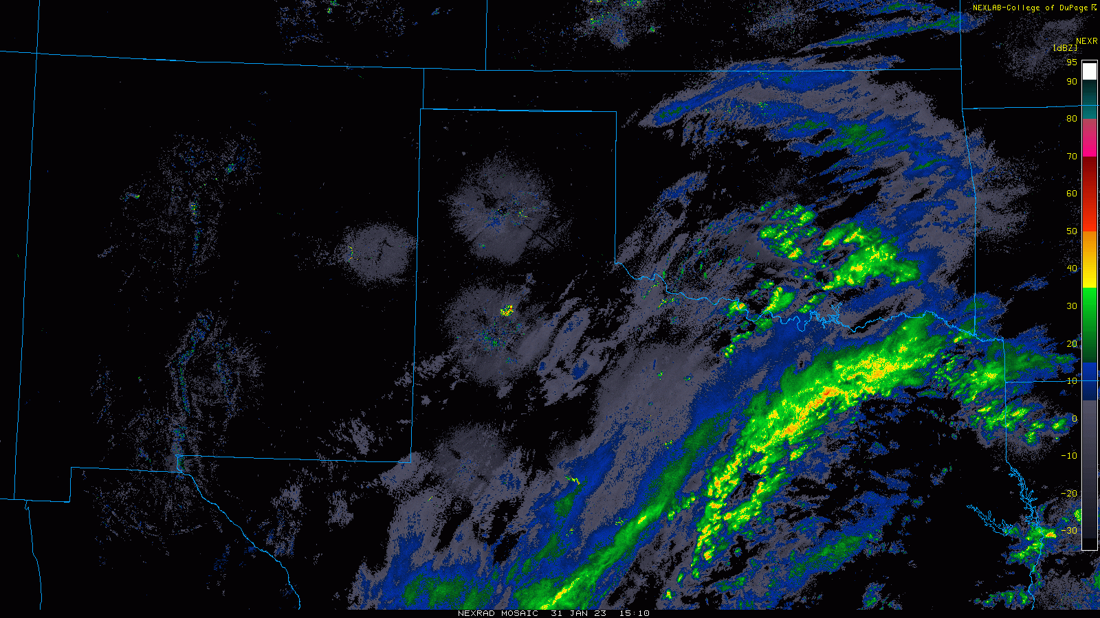
| Regional radar animation valid from 9:10 am to 11 am on Tuesday (31 January 2023). A view from the Lubbock WSR-88D radar, valid from 4:44 am to 11:04 am on the 31st can be FOUND HERE. | |||||
|
Closer to home, the South Plains region experienced another lull in the precipitation Tuesday afternoon and evening. Clouds even thinned enough, in spots, that sunglasses were needed during the afternoon. Even so, temperatures didn't move much and remained subfreezing. |
|||||
 |
 |
||||
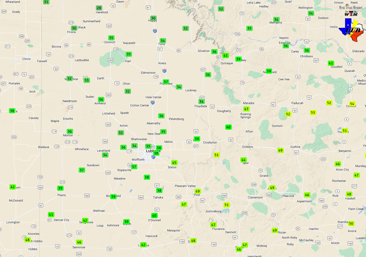
| High temperatures (left) Wednesday (1 February) and low temperatures (right) Thursday morning (2 February), as measured by the WTM. | |||||
|
Drier low-level air prevailed overnight into Wednesday morning across the South Plains, which help prevent a repeat of the previous two mornings. However, it was still chilly to begin the month of February. Lows the morning of the 1st ranged from the teens across the southwest Texas Panhandle to the lower and middle 20s in the Rolling Plains. |
|||||
 |
|||||
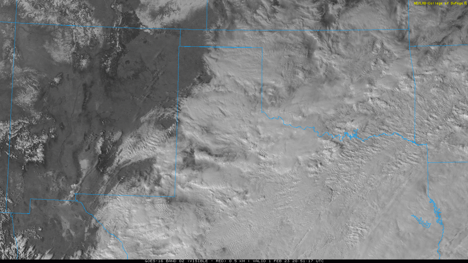
| Visible satellite animation valid from 2:51 pm to 3:46 pm on Wednesday (1 February). An infrared satellite image around this same time can be VIEWED HERE. | |||||
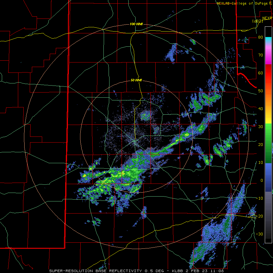
|
The moisture and wintry precipitation downstate, hitting Central and North Texas hard through the morning, gradually edged northward through the late morning and early afternoon hours on Wednesday. Several spots as far north and Brownfield and Lubbock did report spurts of light freezing rain and sleet by midday, with hazardous travel developing in spots by early afternoon, especially on elevated surfaces like bridges and overpasses. |
|||||
 |
|||||
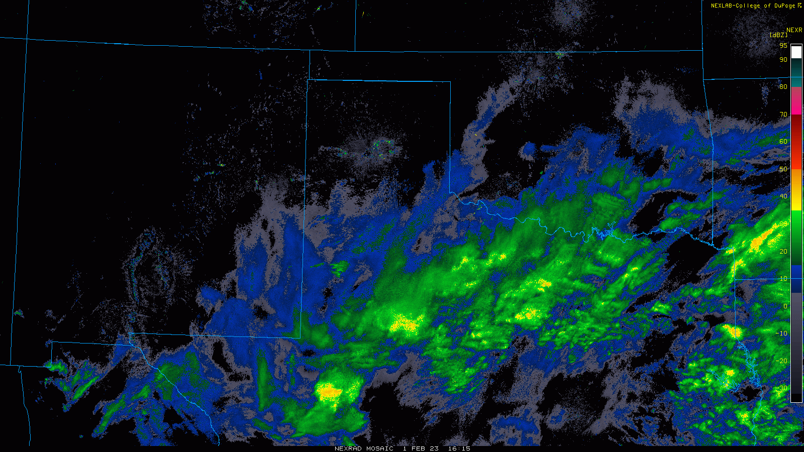
| Regional radar animation valid from 10:15 am to 2:55 pm on Wednesday (1 February 2023). A view from the Lubbock WSR-88D radar, valid from 5:03 am to 8:48 am on Thursday (2 February) can be FOUND HERE. | |||||
|
The periodic spurts of freezing rain and sleet continue through Wednesday evening and into early Thursday morning as temperatures lingered at to a few degrees below freezing. A final band of precipitation exited the region to the east by late morning as temperatures finally rebounded above freezing across the region. By the time all was said and done, many locations across the South Plains and Rolling Plains had experience sub-freezing temperatures continuously from early on Sunday until mid-morning on Thursday, and impressive 4+ day stretch. |
|||||
 |
|||||
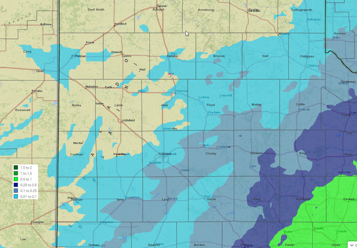
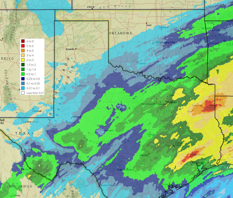
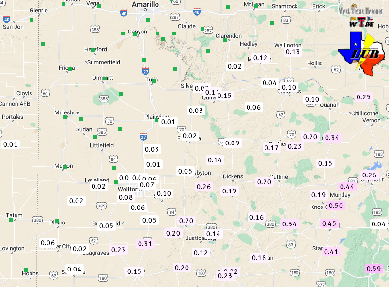
| 5-day radar-estimated and bias-corrected precipitation (liquid equivalent in inches) ending at 6 am on Thursday (2 February 2023). A Texas-wide view of this graphic can be VIEWED HERE. The melted precipitation collected by the WTM over this period can be FOUND HERE. | |||||
|
As the above map shows, although impactful in spots, the wintry precipitation didn't amount to very much moisture when melted down. Officially the Lubbock Airport only measured 0.04 inches of liquid over the entire event when the ice and sleet was melted. Similarly, Childress also measured 0.04 inches over the course of the late January and early February stretch. The icy totals were higher farther east, in the Rolling Plains, where a tenth to quarter inch was common. Farther downstate, impacts were much worse from Central into North Texas where a quarter to half inch of ice was common, as well as accumulating sleet. |
|||||

