|
The first widespread snow of the season! |
|||||
 |
|||||
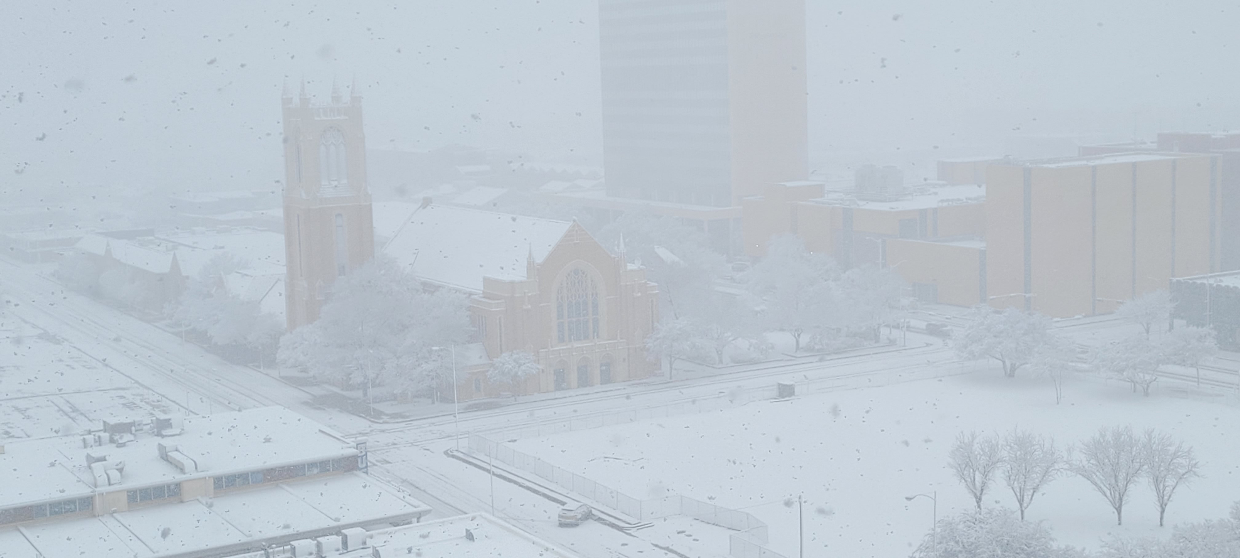
| Heavy snow falling in Downtown Lubbock on Tuesday (24 January 2023). The image is courtesy of Wood Franklin. | |||||
|
After a prolonged period of dry weather, which is not uncommon during the winter in West Texas, things took a dramatic turn. The instigating feature was a potent mid-upper level storm system that dropped into the Desert Southwest, then directed itself toward Texas. In advance of the system, cool air spread southward, setting the stage for a bout of wintry weather. |
|||||
 |
|||||
|
|||||
|
In advance of the system, gusty southeasterly winds carried Gulf moisture northwestward during the day Monday. This moisture was ingested by the western system, and when lift from the approaching storm spread over the region, precipitation rapidly blossomed Monday evening. The air at ground level was relatively dry, but quickly moistened as the snow fell into from aloft. |
|||||
 |
|||||
|
|||||
| Temperatures at ground level were also several degrees above freezing as the precipitation commenced Monday evening, though they rapidly dropped to around the freezing mark as the air saturated. Given the "mild" start to the wintery event, some locations experienced a brief period of rain and/or sleet before changing over to snow. | |||||
 |
|||||
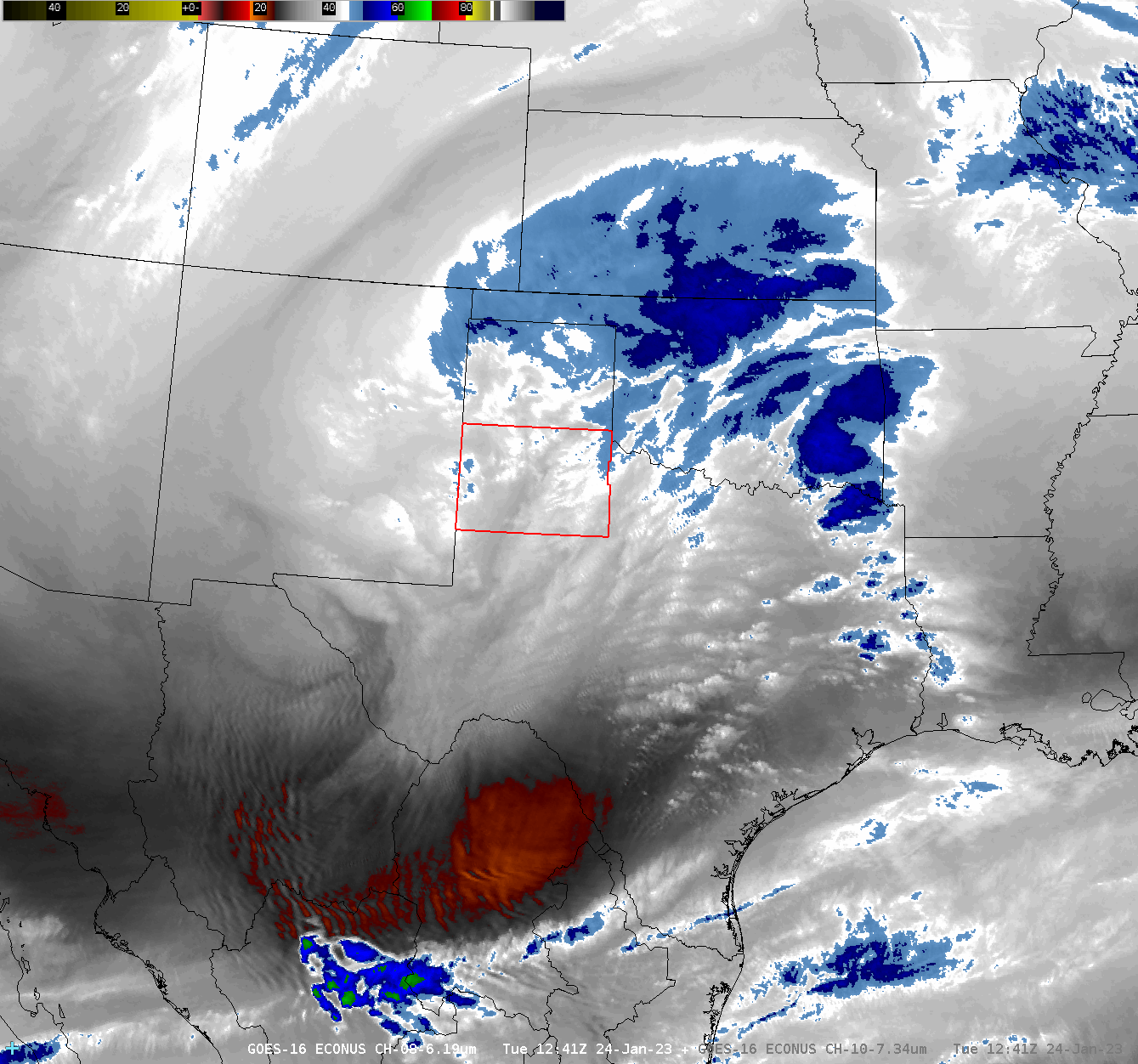
| Regional water vapor satellite loop valid from 6:41 am to 10:46 am on 24 January 2023. | |||||
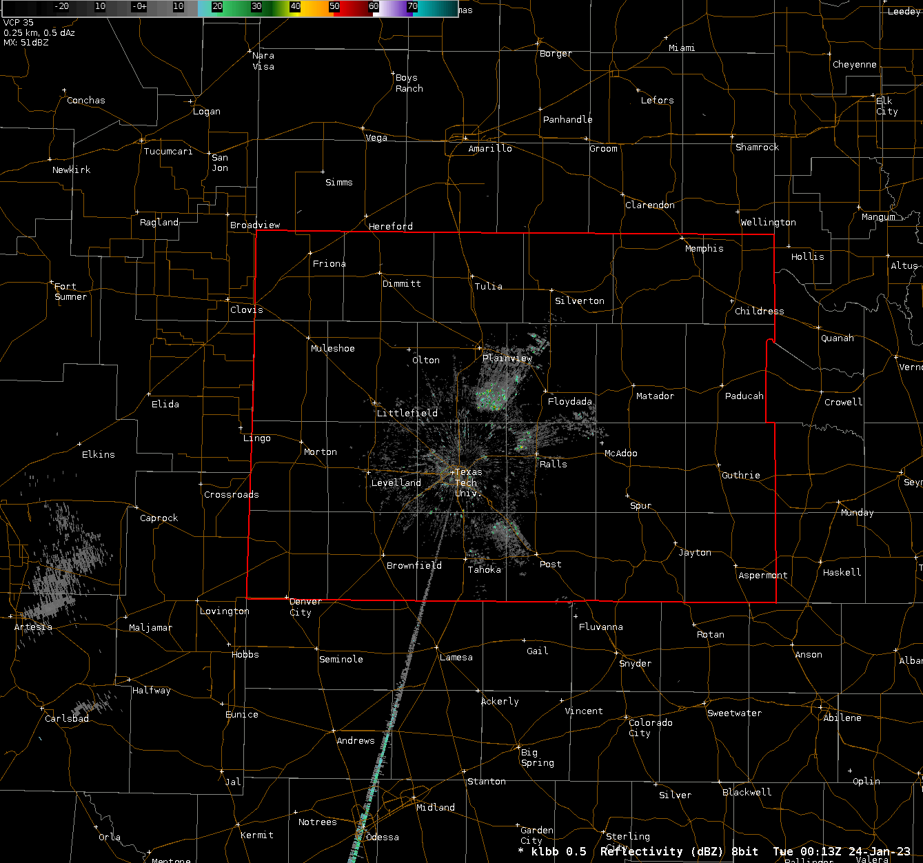
| Bands of moderate to heavy snow spread from west-to-east across the South Plains, southern Texas Panhandle and Rolling Plains late Monday night into early Tuesday morning. With temperatures hovering right around the freezing mark, the snow was very heavy (moisture infused). In addition, when the snow intensity waned, many of the primary roadways were "warm" enough that much/all of the snow quickly melted, which help mitigate travel issues. | |||||
 |
|||||
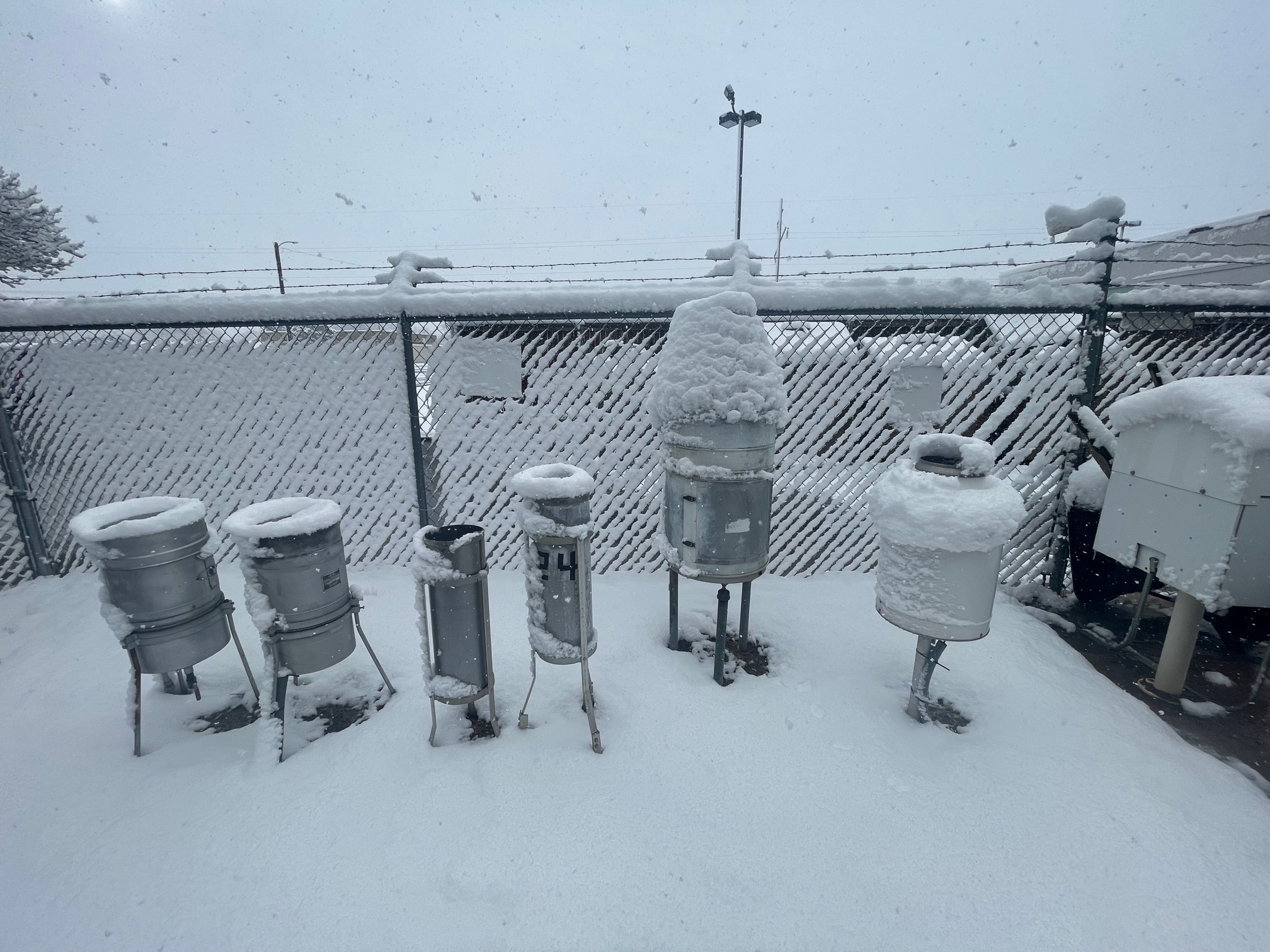
| Various precipitation gauges, along with other equipment, caked in snow at the NWS Lubbock office Tuesday morning (24 January 2023). | |||||
| However, where the wet snow didn't melt (on grass, vehicles, elevated surfaces like fences, etc.) it piled up fast and stuck to everything. Even all the rain gauges at NWS Lubbock weren't immune, as seen in the above photo. Sometimes this sticky snow made the melting and measurement of its liquid equivalent difficult, but it did make for great snowballs and snowman building. | |||||
 |
|||||
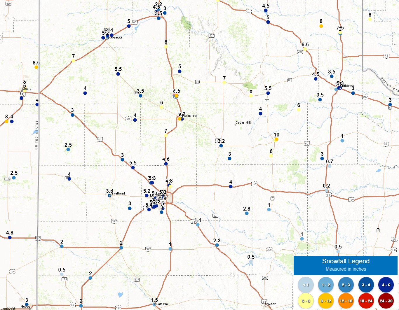
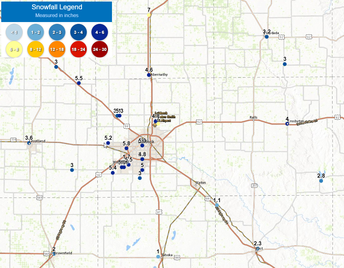
| Preliminary plot of snowfall recorded across the South Plains region on 24 January 2023. | |||||
| The snow continued to fall, occasionally moderate to heavy, through Monday morning and into the afternoon, before tapering off from west-to-east during the late afternoon hours. By the time the snowfall concluded, most of the South Plains region had recorded impressive totals. The heaviest snow, 6 to 8+ inches, targeted the north-central and northeast South Plains into the southern Texas Panhandle and northwestern Rolling Plains. Only the southeastern Rolling Plains, including Guthrie, Jayton and Aspermont, largely missed out on the significant snow because their temperatures where just a couple of degrees too warm. Instead, they saw more cold rain and generally only a dusting of snow. | |||||
 |
 |
||||
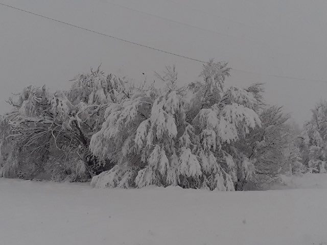
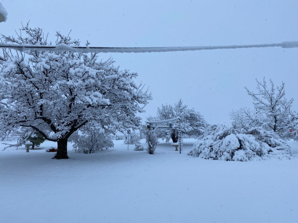
| Pictures of deep, heavy snow in Matador, TX, on 24 January 2023. The images are courtesy of Phillip Sharp. | |||||
| One of the big winners was around Matador (see the above pictures) where they measured a whopping 11 inches of snow. The heavy wet snow weighed down trees and power lines, but created a picturesque scene. | |||||
 |
|||||
| Plot of snowfall reports collected from around the region on Tuesday (24 January 2023). A closer view of the Lubbock area can be FOUND HERE. | |||||
| Many other locations, including around Roaring Springs, Parnell, Plainview and Friona measured a half foot or more of snow. | |||||
 |
|||||
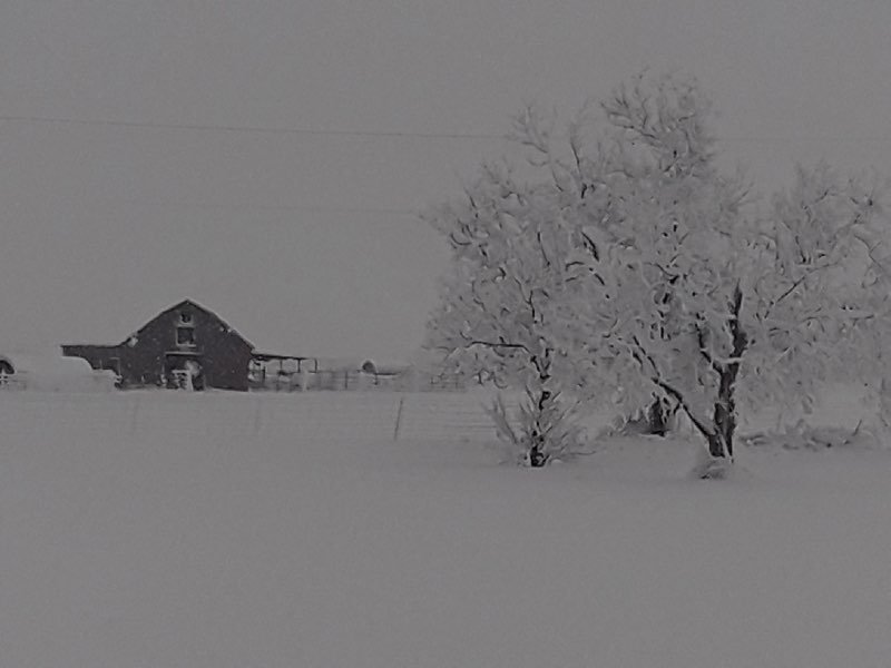
| Deep snow blanketing Roaring Springs, TX, on Tuesday (24 January 2023). The picture is courtesy of Jeff Thacker. | |||||
| Temperatures dropped well below freezing at most spots Tuesday night as skies cleared, which did lead to any wet roadways freezing and becoming slick. Many schools and businesses delayed their start as a result of the cold and slippery start to Wednesday. Conditions improved as the sun came out and temperatures climbed above freezing during the day. | |||||
 |
|||||
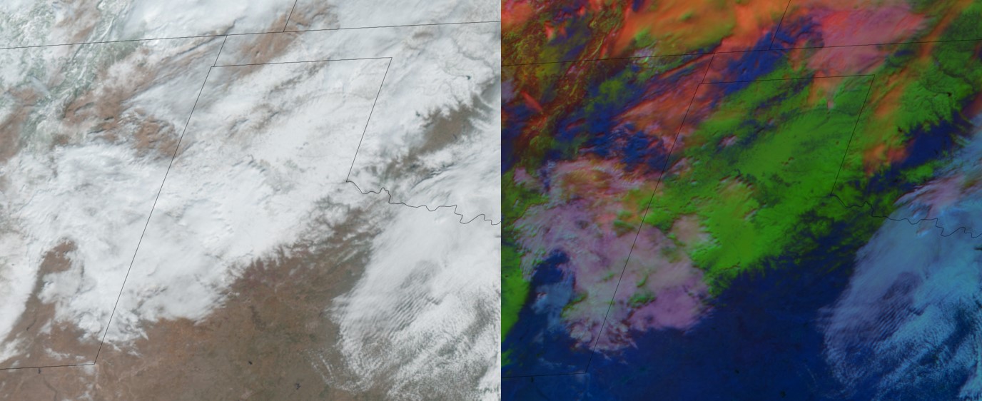
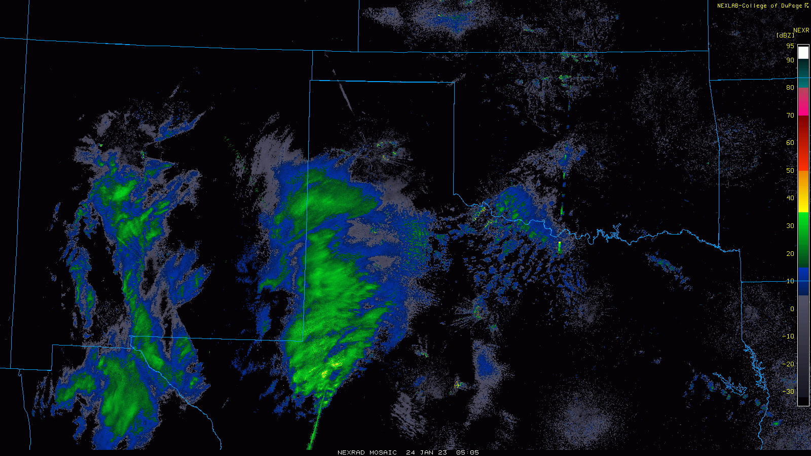
| GOES visible (left) and RGB enhanced (right) images snow and cloud cover Wednesday morning (25 January 2023). | |||||
| The above imagery shows what West Texas looked like from space Wednesday morning. The left visible image has plenty of white, which is a combination of snow pack and cloud cover. The right image better differentiates between the clouds (white) and snow (green). Regardless of the image, widespread snow is found stretching from southeast New Mexico into western Oklahoma and Kansas. | |||||
 |
|||||
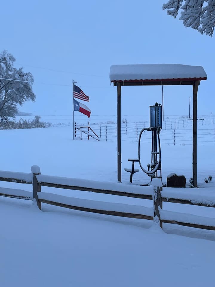
| Deep snow in Parnell, TX, on Tuesday (24 January 2023). The picture is courtesy of Cheryl Bruce. | |||||
| The widespread wet snow brought welcome moisture to the entire region, with many spots receiving 1/4" to 1/2"+ of liquid, when melted down. Much of the southeast Texas Panhandle into the northern Rolling Plains had close to 1" of liquid, which is quite impressive. | |||||
 |
|||||
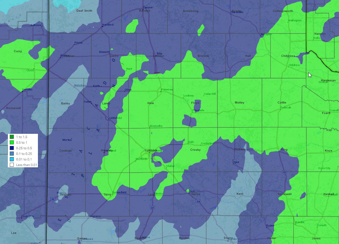
| Radar-estimated and bias-corrected precipitation (liquid equivalent in inches) for the late January 2023 snow event. A plot of the melted snowfall (inches) measured by the West Texas Mesonet from this evening can be FOUND HERE. | |||||
|
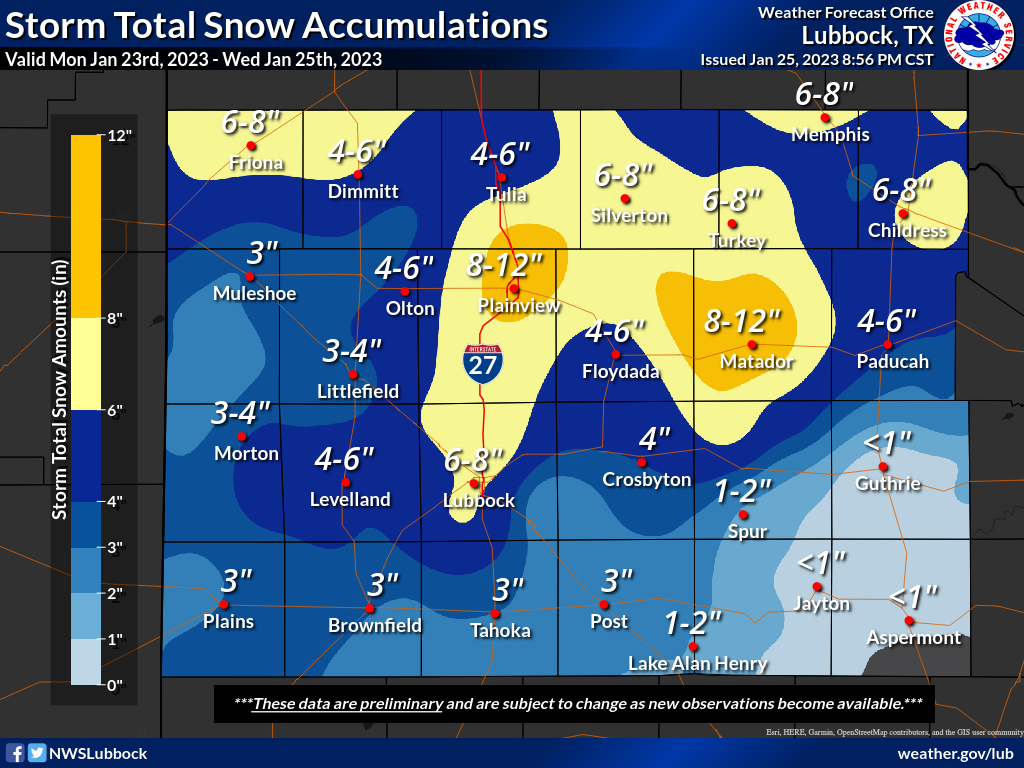
Officially, the Lubbock Airport measured 7.2 inches on January 24th, which melted down to 0.57 inches of liquid. Both the snowfall and liquid set daily records, outpacing 1961 which had 2.9 inches of snow and 0.39 inches of liquid. Similarly, Childress measured 7.3 inches of snow and 0.56 inches of rain for the event, both which were daily records. Preliminary snow reports collected during this snow January day can be found below: |
|||||
Public Information Statement
National Weather Service Lubbock TX
749 PM CST Wed Jan 25 2023

...PRELIMINARY STORM TOTAL SNOWFALL REPORTS...

Location                     Amount    Time/Date       Lat/Lon

...Texas...

...Bailey County...
Muleshoe                     3.0 in    0733 AM 01/25   34.22N/102.73W
1 WNW Muleshoe Wildlife Refu 2.5 in    0945 AM 01/25   33.95N/102.77W

...Briscoe County...
Silverton                    7.0 in    1028 AM 01/24   34.47N/101.30W
Quitaque                     6.0 in    0730 AM 01/24   34.37N/101.05W

...Castro County...
2.6 N Dimmitt                6.0 in    0756 AM 01/25   34.59N/102.31W
1.1 S Hart                   3.5 in    0700 AM 01/25   34.37N/102.12W

...Childress County...
Childress                    7.3 in    0700 AM 01/25   34.44N/100.22W
5 S Dodson                   6.0 in    0700 AM 01/25   34.69N/100.03W
2 E Childress                5.3 in    1045 AM 01/24   34.43N/100.21W
2.8 S Tell                   4.0 in    0700 AM 01/25   34.34N/100.40W
7.2 NW Childress             3.5 in    0700 AM 01/25   34.52N/100.29W

...Cochran County...
Morton                       4.0 in    0800 AM 01/25   33.72N/102.76W

...Cottle County...
7 E Paducah                  3.2 in    0732 AM 01/25   34.02N/100.19W
10 S Paducah                 3.0 in    0821 AM 01/24   33.88N/100.38W

...Crosby County...
Crosbyton                    4.0 in    0700 AM 01/25   33.65N/101.25W
2 SSE White River Lake       3.1 in    0935 AM 01/25   33.45N/101.09W

...Dickens County...
1.2 W Spur                   1.7 in    0700 AM 01/25   33.48N/100.88W

...Floyd County...
Floydada                     5.2 in    0700 AM 01/25   33.98N/101.33W
9 SE Floydada                5.0 in    0700 AM 01/25   33.88N/101.25W

...Garza County...
Post                         3.3 in    0549 AM 01/25   33.20N/101.37W
Southland                    2.6 in    0809 AM 01/25   33.36N/101.55W
Lake Alan Henry              2.0 in    0815 AM 01/25   33.07N/101.05W
2.4 ENE Justiceburg          1.7 in    0700 AM 01/25   33.05N/101.16W

...Hale County...
Plainview                    9.0 in    0900 AM 01/24   34.19N/101.72W
1 E Plainview                8.7 in    0700 AM 01/25   34.19N/101.70W
1.6 N Plainview              8.7 in    0730 AM 01/25   34.21N/101.72W
3.2 NNW Abernathy            7.0 in    0700 AM 01/25   33.88N/101.86W
Hale Center                  7.0 in    0910 AM 01/24   34.06N/101.85W
Edmonson                     6.0 in    0830 AM 01/24   34.28N/101.89W
Abernathy                    5.9 in    0712 AM 01/25   33.84N/101.85W

...Hall County...
Turkey                       7.0 in    0930 AM 01/25   34.39N/100.89W
Memphis                      6.5 in    0920 AM 01/24   34.73N/100.54W
Memphis                      5.0 in    0700 AM 01/25   34.73N/100.54W

...Hockley County...
Anton                        5.5 in    0916 AM 01/24   33.81N/102.16W
2 S Levelland                4.5 in    0700 AM 01/25   33.55N/102.38W
6 NNW Ropesville             4.0 in    0700 AM 01/25   33.49N/102.19W

...Kent County...
Jayton                       1.0 in    0930 AM 01/24   33.25N/100.57W

...King County...
15 S Paducah                 2.2 in    0600 AM 01/25   33.81N/100.30W
Guthrie                      0.2 in    0745 AM 01/25   33.63N/100.34W

...Lamb County...
Olton                        4.5 in    0756 AM 01/25   34.18N/102.14W
5 SE Littlefield             3.5 in    0800 AM 01/25   33.87N/102.26W

...Lubbock County...
Lubbock Int. Airport         7.2 in    0800 AM 01/25   33.66N/101.81W
4 NW Lubbock                 6.5 in    0700 AM 01/25   33.61N/101.93W
3 WNW Woodrow                6.2 in    0827 AM 01/25   33.46N/101.89W
4 W Lubbock                  5.8 in    1030 AM 01/24   33.57N/101.95W
8 SW Lubbock                 5.5 in    1102 AM 01/24   33.51N/101.94W
2 S Wolfforth                5.4 in    1249 PM 01/24   33.48N/102.01W
1 W Lubbock                  5.3 in    1030 AM 01/24   33.58N/101.88W
1 E Shallowater              5.3 in    1100 AM 01/24   33.69N/101.98W
2 E Wolfforth                5.3 in    0956 AM 01/24   33.50N/101.97W
Reese Center                 5.2 in    1100 AM 01/24   33.59N/102.03W
6.4 NW Lubbock               5.1 in    0700 AM 01/25   33.64N/101.96W
4 NW Woodrow                 5.0 in    1032 AM 01/24   33.49N/101.88W
4 S Lubbock                  5.0 in    0600 AM 01/25   33.52N/101.88W
3 S Lubbock                  4.8 in    1155 AM 01/24   33.53N/101.88W
7 WSW Lubbock                4.3 in    0700 AM 01/25   33.52N/101.95W
7 SW Lubbock                 4.2 in    0700 AM 01/25   33.50N/101.96W
Shallowater                  4.0 in    0700 AM 01/25   33.69N/101.99W
13.2 N Lubbock               3.7 in    0700 AM 01/25   33.77N/101.88W
Ransom Canyon                2.5 in    0900 AM 01/25   33.53N/101.68W

...Lynn County...
Tahoka                       3.0 in    0630 AM 01/25   33.17N/101.80W

...Motley County...
1 NE Matador                 11.0 in   0800 AM 01/25   34.02N/100.81W
2 E Flomot                   8.0 in    0814 AM 01/25   34.23N/100.96W
Roaring Springs              8.0 in    0730 AM 01/25   33.90N/100.86W

...Parmer County...
Friona                       7.0 in    1015 AM 01/24   34.64N/102.72W
Friona                       5.5 in    0600 AM 01/25   34.64N/102.72W
Lazbuddie                    4.0 in    0730 AM 01/24   34.39N/102.61W

...Stonewall County...
1 NW Aspermont               0.5 in    0700 AM 01/25   33.15N/100.23W

...Swisher County...
Kress                        8.5 in    0945 AM 01/24   34.37N/101.75W
Tulia                        5.0 in    0700 AM 01/25   34.55N/101.76W

...Terry County...
Brownfield                   3.0 in    0730 AM 01/25   33.19N/102.27W

...Yoakum County...
Denver City                  3.5 in    0700 AM 01/25   32.96N/102.82W
Plains                       3.0 in    0800 AM 01/25   33.19N/102.83W

Observations are collected from a variety of sources with varying
equipment and exposures. We thank all volunteer weather observers
for their dedication. Not all data listed are considered official.

