|
A cold November rain (and sleet and snow for some) |
|||||
 |
|||||
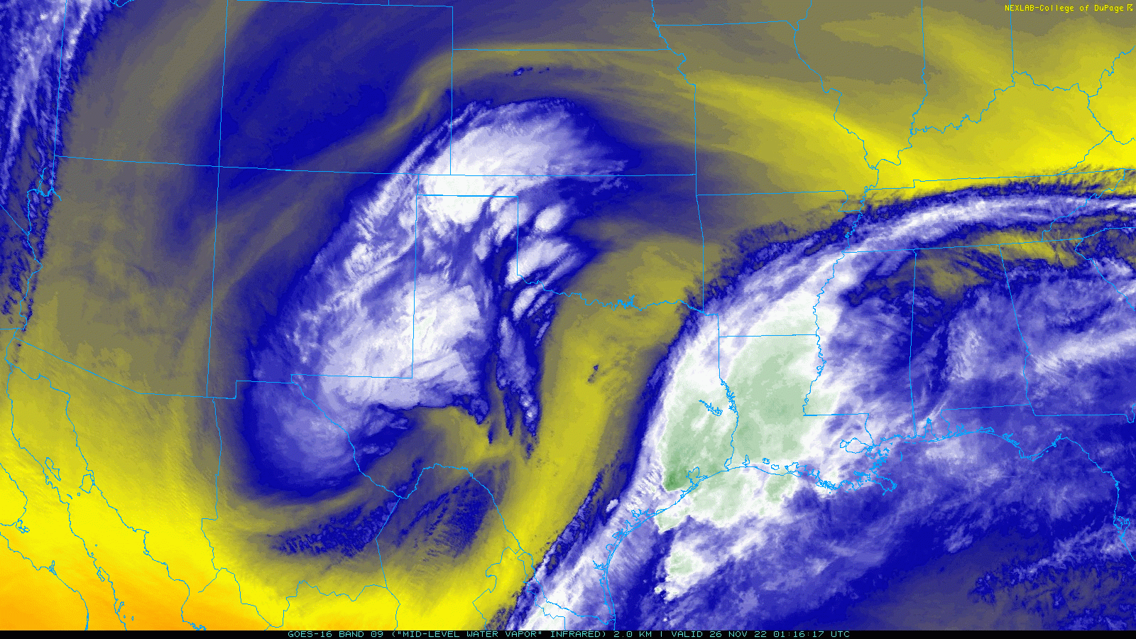
| Regional water vapor satellite loop valid from 7:16 pm to 8:11 pm on 25 November 2022. | |||||
|
A powerful storm system dropped out of the southern Rockies on Thanksgiving (November 24th), got its act together over northern Chihuahua Friday, then ejected northeastward across the Permian Basin and into North Texas on Saturday. The initial approach of the system, coupled with an early Thanksgiving Day cold front, provided much cooler air and gusty northerly winds for Turkey Day. In addition, areas of drizzle and light rain showers developed well behind the cold front, expanding from north-to-south across the southern Texas Panhandle into the Rolling Plains Thursday afternoon and evening. |
|||||
 |
|||||
|
|||||
|
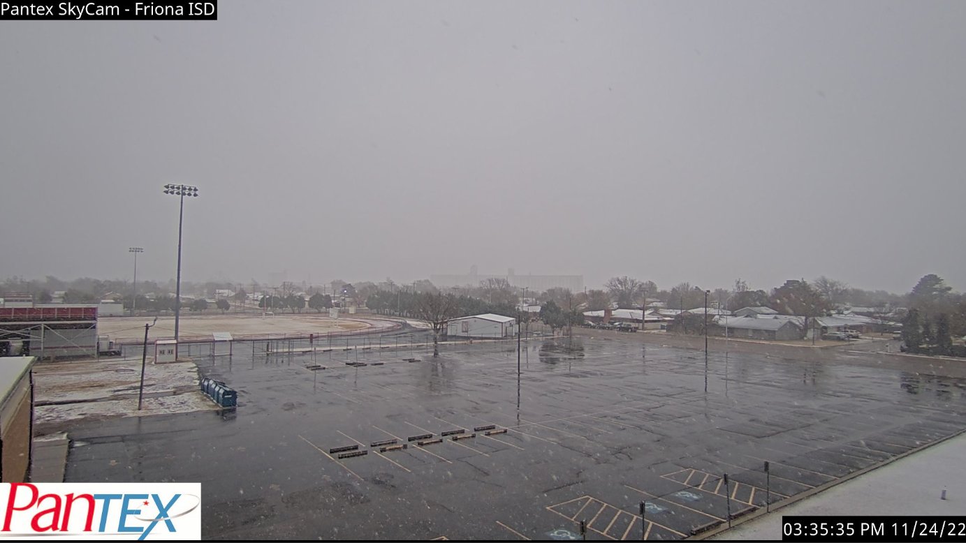
Where it cooled just enough, the initial round of precipitation even changed to snow across the southwest Texas Panhandle for a period Thursday evening. A dusting of snow quickly covered the ground, but it then melted off nearly as fast, leaving little to no snow on the ground by the next morning. |
|||||
 |
|||||
|
|||||
|
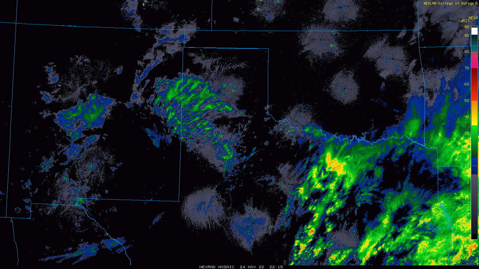
The steady precipitation shifted further south Friday morning as the center of the storm system dipped into northern Mexico. The bulk of the precipitation in the morning was focused across the Permian Basin and south and westward from there, though steady rain did edge northward into the southern South and Rolling. The rain even mixed with sleet and snow at times across parts of the Caprock as temperatures hovered in the middle 30s. The precipitation did fully change to snow at times across the western and southwestern South Plains, where light accumulations occurred. |
|||||
 |
|||||
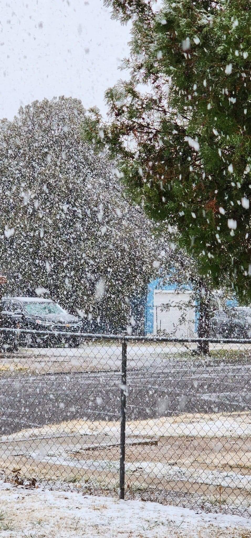
| Heavy, wet snow falling in Hobbs Friday afternoon (25 November). The picture is courtesy of Sandra Rascon, via Jacob Riley and KLBK. | |||||
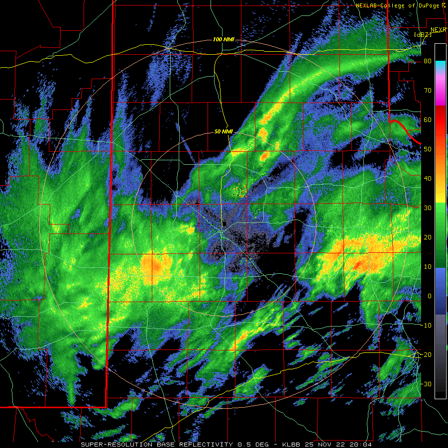
| Even in Lubbock, a brief period of sleet and/or snow was observed in many spots Friday evening as a heavier band of precipitation raced northward across the South Plains. However, the wintry precipitation didn't last long and little to no accumulation occurred in Lubbock. | |||||
 |
|||||
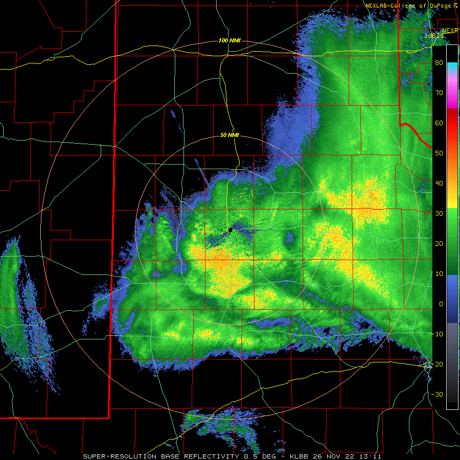
| Lubbock WSR-88D radar animation valid from 4:05 pm to 11:01 pm on 25 November 2022. An additional radar animation, valid from 7:11 am to 10:32 am on the 26th, can be VEIWED HERE. | |||||
| This was not the case further the southwest, closer to the storm system, where temperatures were just a few degrees cooler. This allowed the precipitation to transition to heavy wet snow across southeast New Mexico into the mountains of Far West Texas. Many locations in this region saw a quick 2-4+ inches of snow, with pockets of much heavier snow. | |||||
 |
|||||
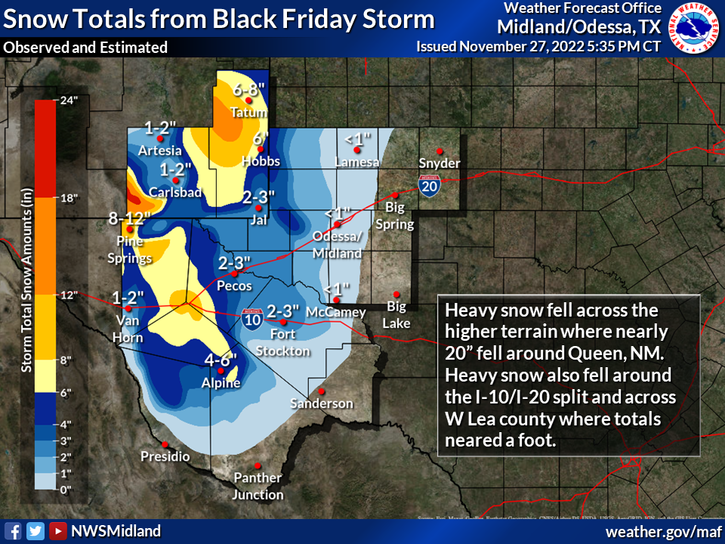
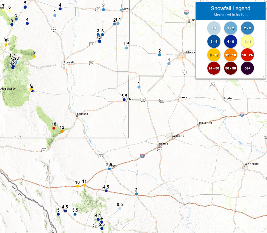
| Snow total map for southeast New Mexico and parts of West and Far West Texas. The image is courtesy of NWS Midland and is valid for late November 2022. Plotted observed snowfall reports for this event can be FOUND HERE. | |||||
| The heaviest snow was concentrated over far southeast New Mexico and from the Guadalupe Mountains into the Davis Mountains where 6 inches to more than a foot was measured. The heaviest snow total reported was an impressive 18 inches in Queen, NM. Snow (and sleet) totals were much lighter over the central and western South Plains where a cold rain tended to dominate, but generally ranged from trace amounts across the central South Plains (including Lubbock) to 1 to 2 inches in Levelland, Whiteface and Denver City. | |||||
 |
|||||
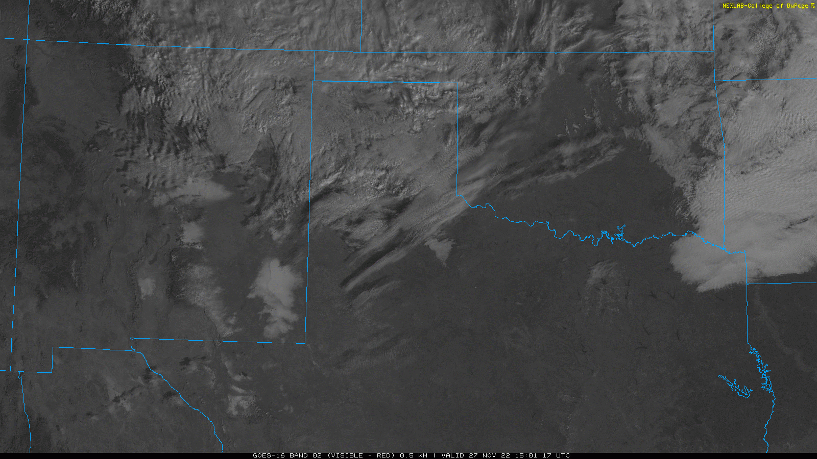
| Regional visible satellite loop captured Sunday morning (27 November 2022). Regions of snow (stationary white areas) are clearly visible in southeast New Mexico and parts of Far West Texas. Note: The stationary white circle in south-central New Mexico is not snow, but instead is the sand at White Sands National Park. | |||||
| When skies cleared and the sun returned, the areas deep snow cover clearly stood on visible satellite imagery (see the above satellite animation). The snow was clearly concentrated over the higher terrain of southeast New Mexico into the mountains of Far West Texas as well as in a large field over the plains of extreme southeast New Mexico. | |||||
 |
|||||
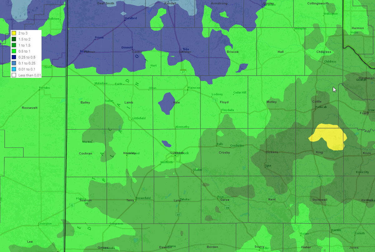
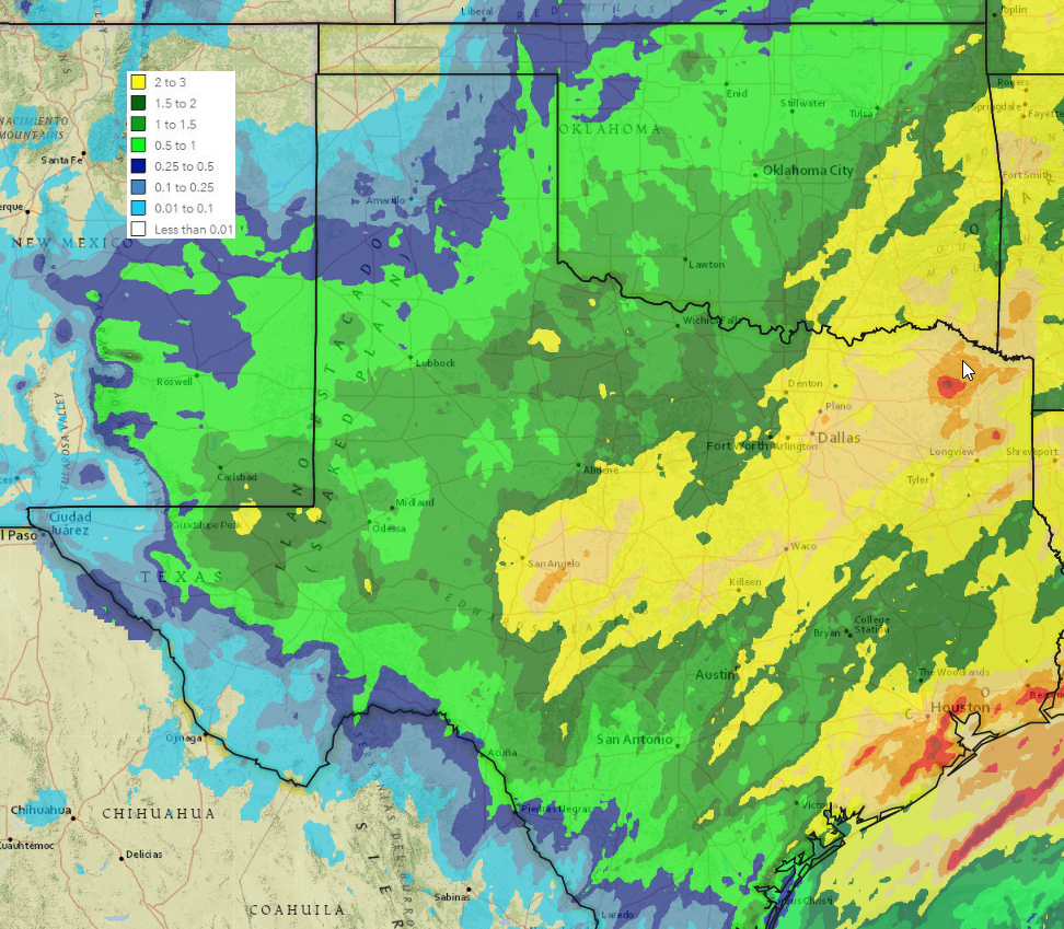
| 5-day radar-estimated and bias-corrected rainfall (inches) ending at 7 am on Sunday morning (27 November 2022). A larger statewide view can be FOUND HERE. | |||||
| Although much of the South Plains region avoided any wintry impacts thanks to temperatures holding a few degrees above freezing, everyone did experience a cold November rain. In fact, the rain was quite widespread and significant, especially given the time of year when moisture is often difficult to come by. Rain (and melted sleet and snow) totals generally varied from 1/4" to 1/2" over the southwestern Texas Panhandle to 1" to 1.5"+ in the Rolling Plains. | |||||
 |
|||||
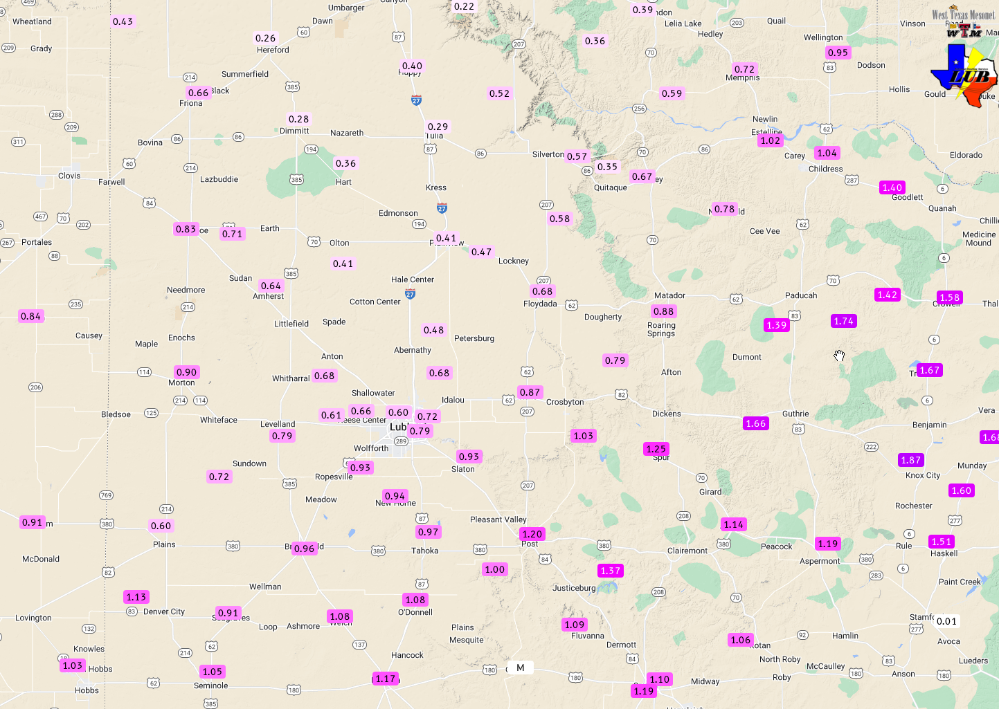
| 4-day rain (and melted snow) totals ending at 7:30 am on 28 November 2022. The data are courtesy of the West Texas Mesonet. | |||||
| Lubbock officially measured 0.56 inches over the late November event, though a bulk of the central, southern and eastern portion of the city saw closer to three-quarters of an inch. Childress fared even better, measuring 0.98 inches over the 3-day event. Not to be outdone, the Hackberry West Texas Mesonet site (southeast of Paducah) measured 1.74 inches. Altogether, welcome widespread moisture fell on the state, which continues to battle a long-term drought. | |||||
| Preliminary snowfall reports from around the South Plains region can be found below: | |||||
PRELIMINARY LOCAL STORM REPORT...SUMMARY
NATIONAL WEATHER SERVICE LUBBOCK TX
941 AM CST SAT NOV 26 2022

..TIME...   ...EVENT...      ...CITY LOCATION...     ...LAT.LON...
..DATE...   ....MAG....      ..COUNTY LOCATION..ST.. ...SOURCE....
            ..REMARKS..

0130 PM     SNOW             DENVER CITY             32.97N 102.83W
11/25/2022  E1.0 INCH        YOAKUM             TX   PUBLIC

            ACCUMULATION ON GRASS.

0834 PM     SNOW             ROPESVILLE              33.41N 102.15W
11/25/2022  E1.0 INCH        HOCKLEY            TX   PUBLIC

            SLUSH ON HIGHWAY 62 AT ROPESVILLE.

0930 PM     SNOW             LEVELLAND               33.58N 102.36W
11/25/2022  E1.0 INCH        HOCKLEY            TX   PUBLIC

            VIDEO SHARED VIA SOCIAL MEDIA. TIME ESTIMATED.

0943 PM     SNOW             WHITEFACE               33.60N 102.61W
11/25/2022  U0.0 INCH        COCHRAN            TX   PUBLIC

            GROUND AND ROADS COVERED IN SNOW AT WHITEFACE ISD.

0819 AM     SNOW             DENVER CITY             32.97N 102.83W
11/26/2022  M1.0 INCH        YOAKUM             TX   CO-OP OBSERVER

            MEASURED AN INCH OF SNOW, WHICH REMAINS ON THE GROUND
            THIS MORNING.

0828 AM     SNOW             LEVELLAND               33.58N 102.36W
11/26/2022  M2.0 INCH        HOCKLEY            TX   CO-OP OBSERVER

            MEASURED 2 INCHES OF SNOWFALL. ONE INCH OF SNOW REMAINS
            ON THE GROUND THIS MORNING.
|
|||||

