|
Several rounds of late October rain & storms |
|||||
 |
|||||
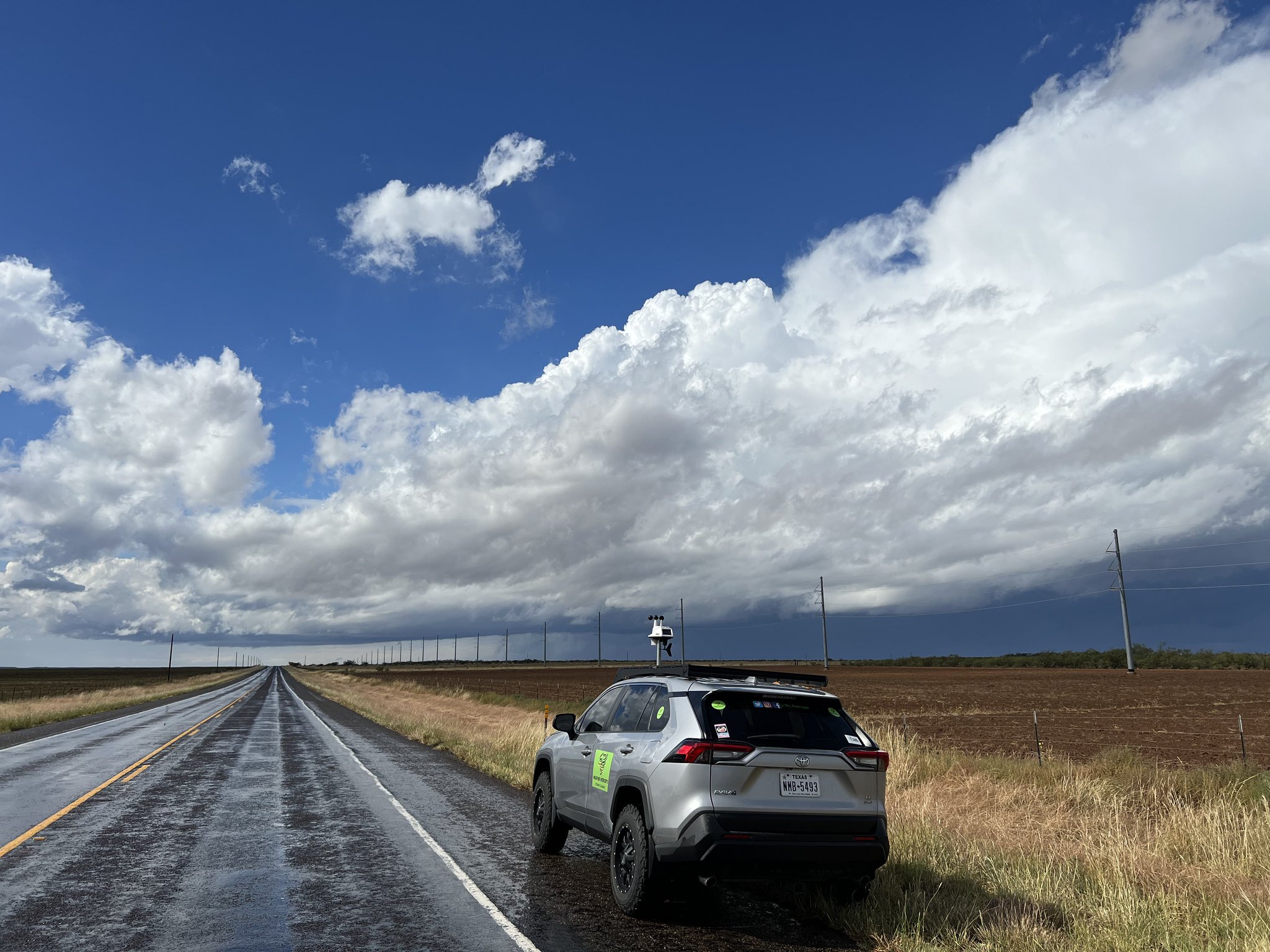
| Storm clouds developing near Matador Monday afternoon (24 October 2022). The image is courtesy of Weather Intercepts. | |||||
|
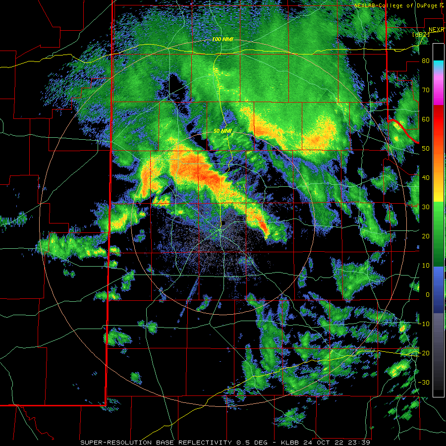
Late October brought successive storm systems, each which dug through the Four Corners and were able to tap Gulf moisture and bring rounds of showers and thunderstorms across West Texas. The first storm system of note approached western Texas on Monday morning (24 October), triggering widespread showers and a few thunderstorms. The activity evolved into a line of thunderstorms as it advanced into western North Texas producing heavy rain and gusty outflow winds. |
|||||
 |
|||||
|
|||||
|
As the counter-clockwise spinning storm system passed across the South Plains Monday afternoon it provided strong lift that triggered additional showers and thunderstorms. |
|||||
 |
|||||
|
|||||
| A batch of stronger storms redeveloped during the afternoon, bringing heavy rain and gusty winds as they moved across the southeast Texas Panhandle and adjacent Rolling Plains. | |||||
 |
|||||
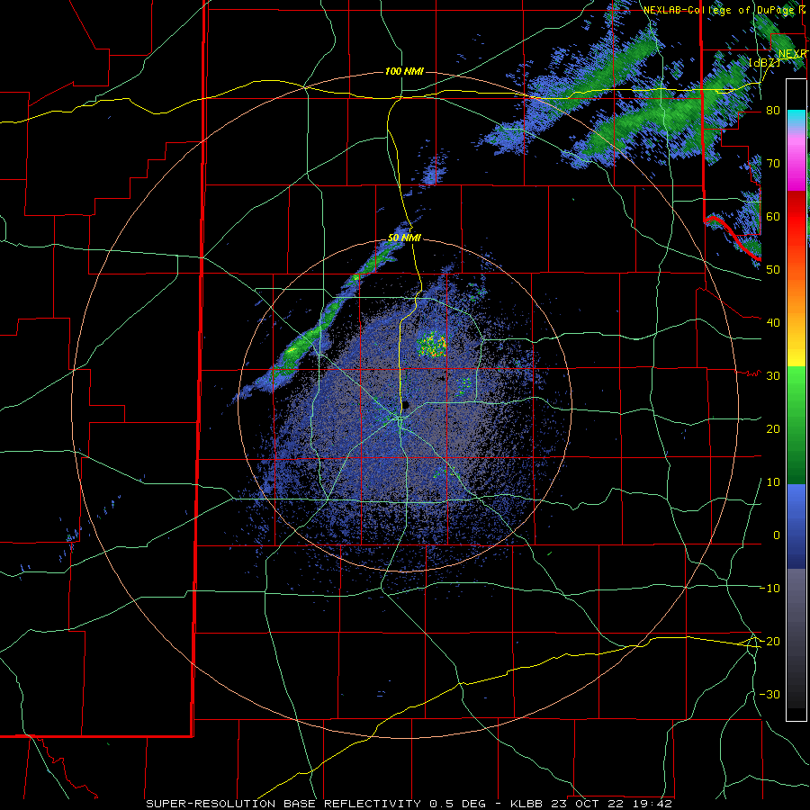
| Lubbock WSR-88D radar animation valid from 11:44 am to 3:02 pm on 24 October 2022. Additional radar animations can be found at: 4:52 pm to 7:08 pm on the 24th; and 6:44 pm to 8:39 pm on the 24th. | |||||
| As the storm system passed, a large area of light to moderate rain continued through Monday evening, with a bulk of the rain focused across the southern Texas Panhandle and northern Rolling Plains. The rain quickly shifted east of the region during the predawn hours of the 25th. | |||||
 |
|||||
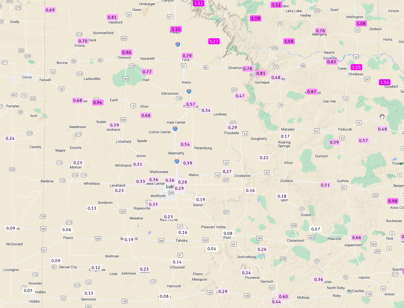
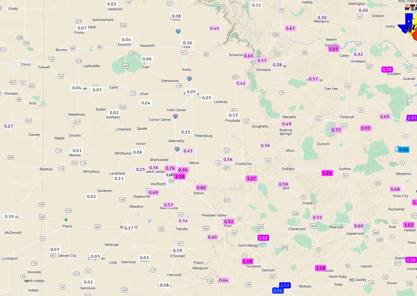
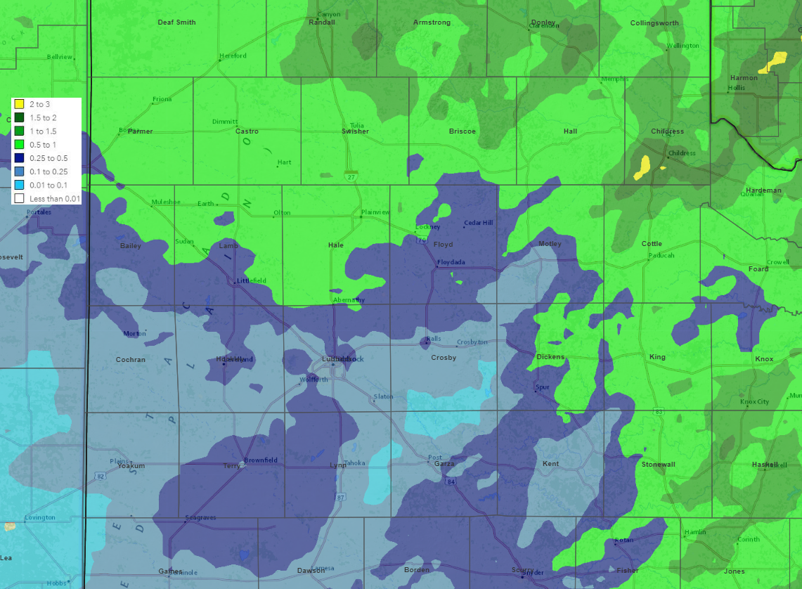
| 2-day rainfall measured by the West Texas Mesonet, ending at 7 am on 25 October 2022. The data are courtesy of the West Texas Mesonet. A radar-estimated bias-corrected rainfall plot for this same period can be VIEWED HERE. | |||||
| The quick-moving storm system provided at least a little rain for the entire region. Rain totals were lightest across the southwest South Plains, where a tenth to quarter inch were common. The heaviest rain was focused across the southern Texas Panhandle, where a half inch to over an inch were measured. In between, the Lubbock area generally saw around a third of an inch. | |||||
 |
|||||
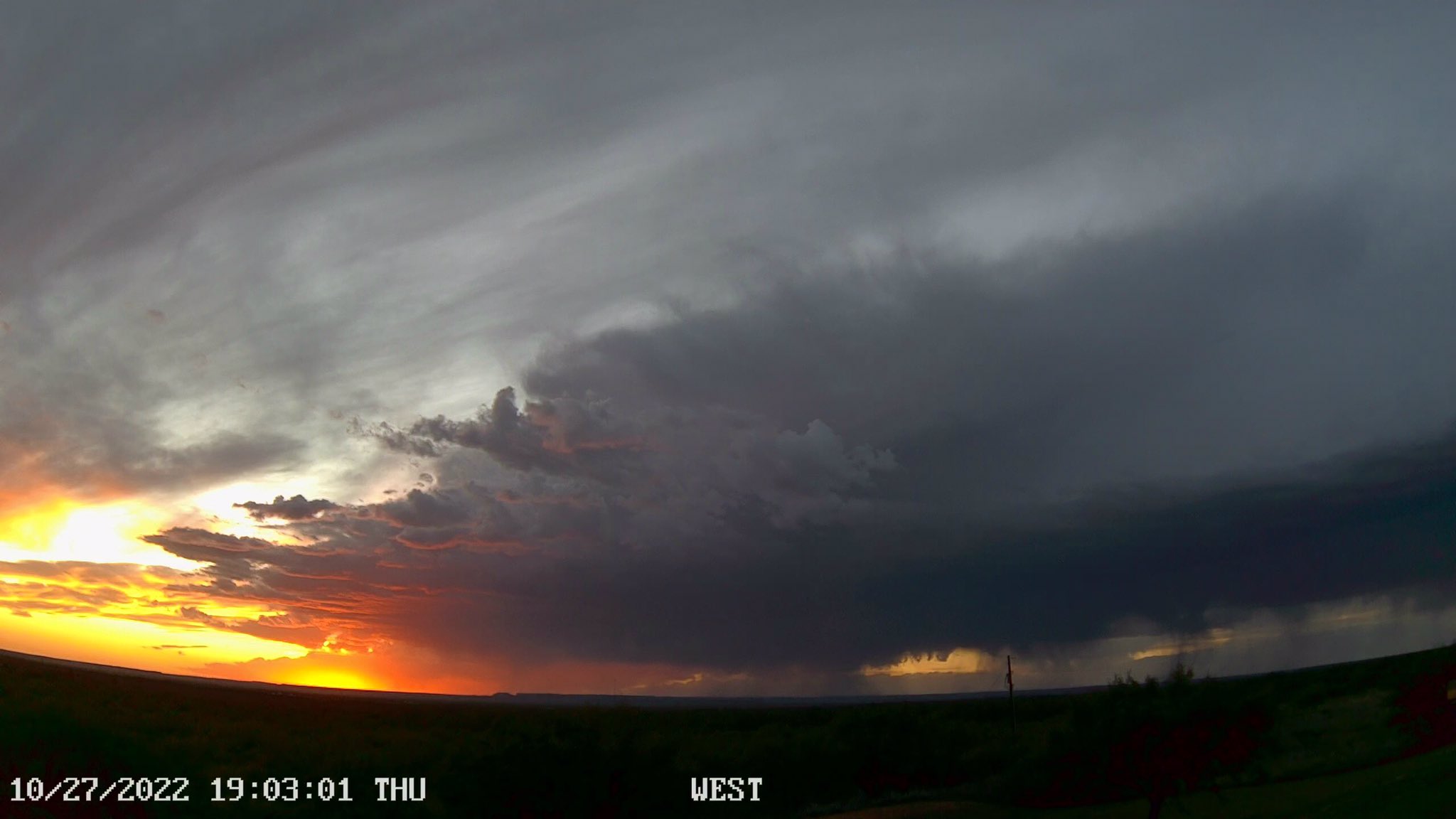
| Rotating thunderstorm near Cee Vee Thursday evening (27 October 2022). The image is courtesy of Andrew Shearer. | |||||
| After a couple day break, the next upper level storm system quickly approached from the northwest, taking a similar track to the early-week system. Moisture was initially slow to return, but eventually did improve east of a developing dryline Thursday afternoon (27 October). Scattered thunderstorms quickly developed along the dryline Thursday evening. | |||||
 |
|||||
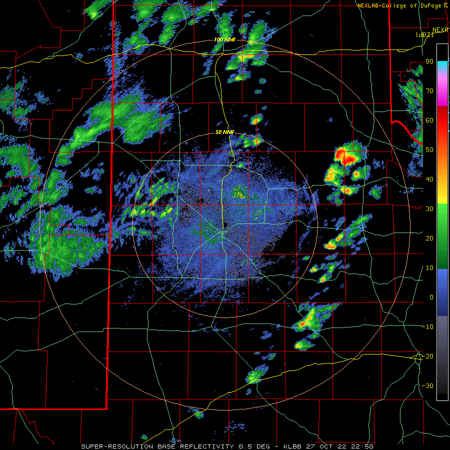
| Lubbock WSR-88D radar animation valid from 5:50 pm to 7:58 pm on 27 October 2022. | |||||
| The initial storms encountered modest instability and wind shear, which in combination, supported storm organization, including several rotating storms. The most intense storm of the evening moved across northern Cottle County, dropping ping pong ball sized hail as it moved across Cee Vee, northwest of Paducah. Additional strong to severe storms formed and tracked across parts of the Rolling Plains through late Thursday evening. | |||||
 |
|||||
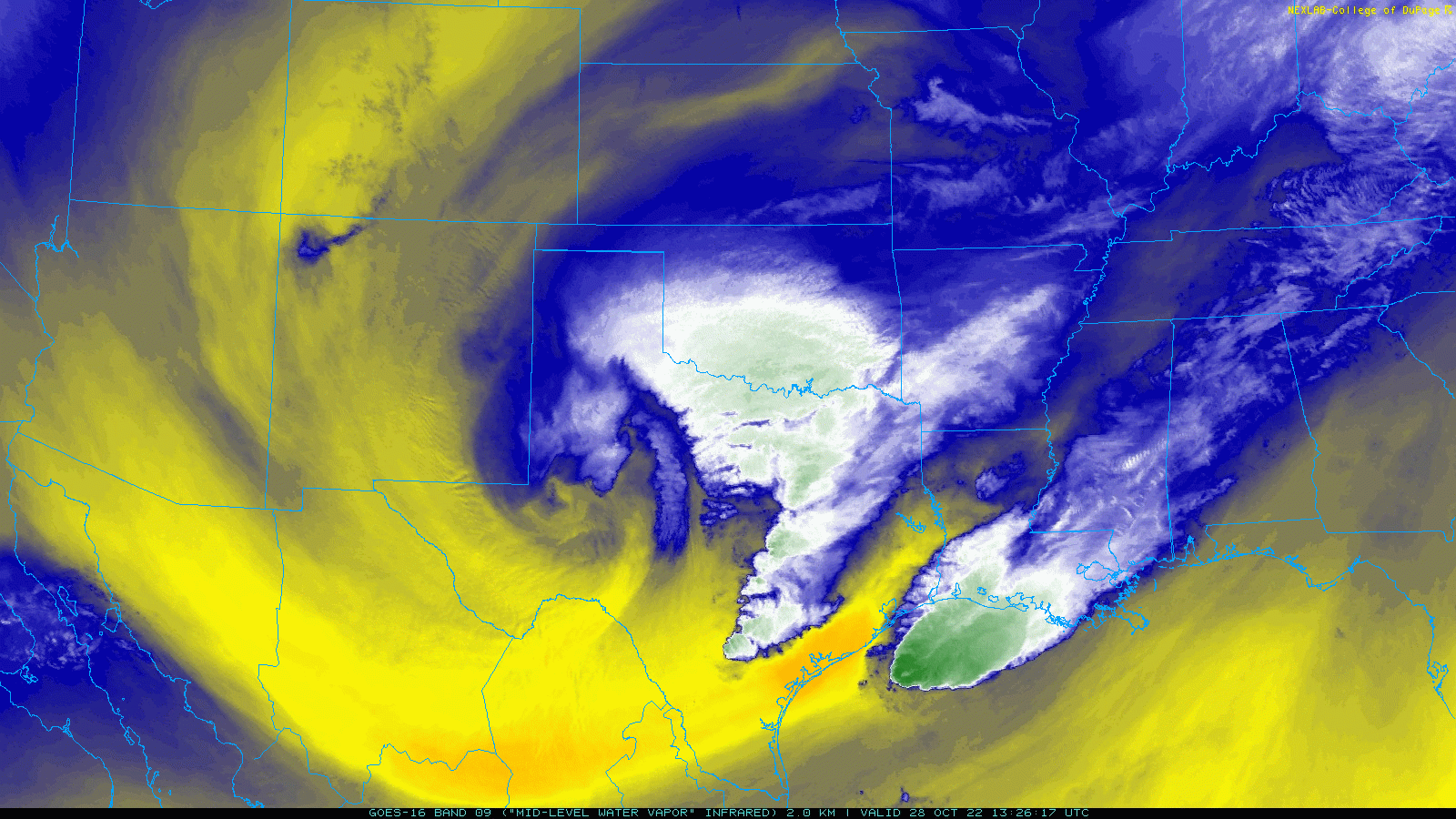
| Regional water vapor satellite loop valid from 8:21 am to 9:16 am on 28 October 2022. | |||||
| As the tightly wound low emerged over the South Plains and Permian Basin it wrapped moisture back westward north of the center of the low. This led to additional rounds of showers and embedded thunderstorms over northwest Texas lingering into Friday. | |||||
 |
|||||
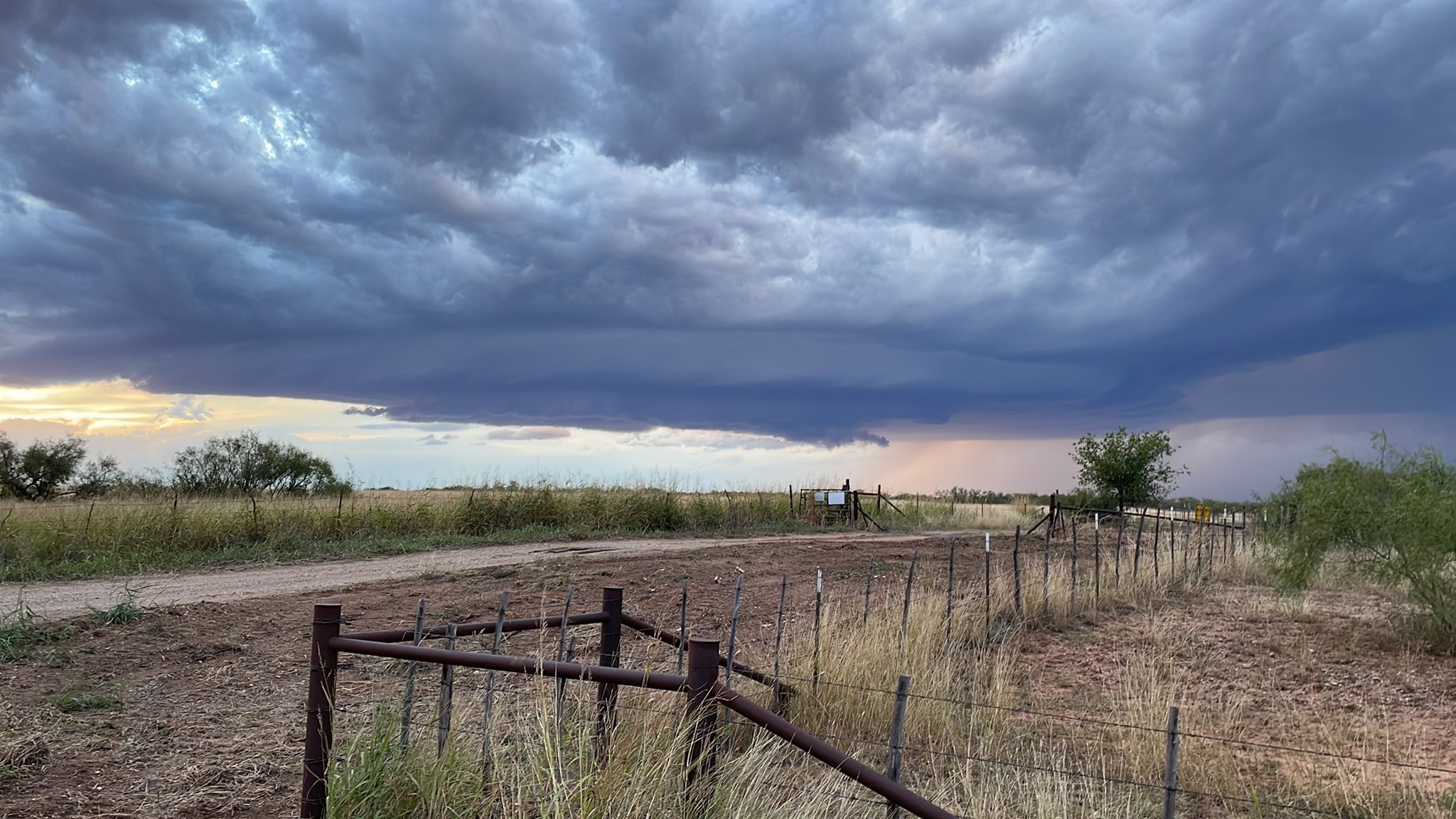
| Ominous clouds approaching Lake Alan Henry Thursday evening (27 October 2022). The image is courtesy of Lake Alan Henry Weather. | |||||
| A period of moderate to heavy rain, along with the occasional rumble of thunder, affected the Lubbock area in the predawn hours of Friday. This bout of rain brought around an inch or more of rain to roughly the southeast half of Lubbock, with lighter totals further west. | |||||
 |
|||||
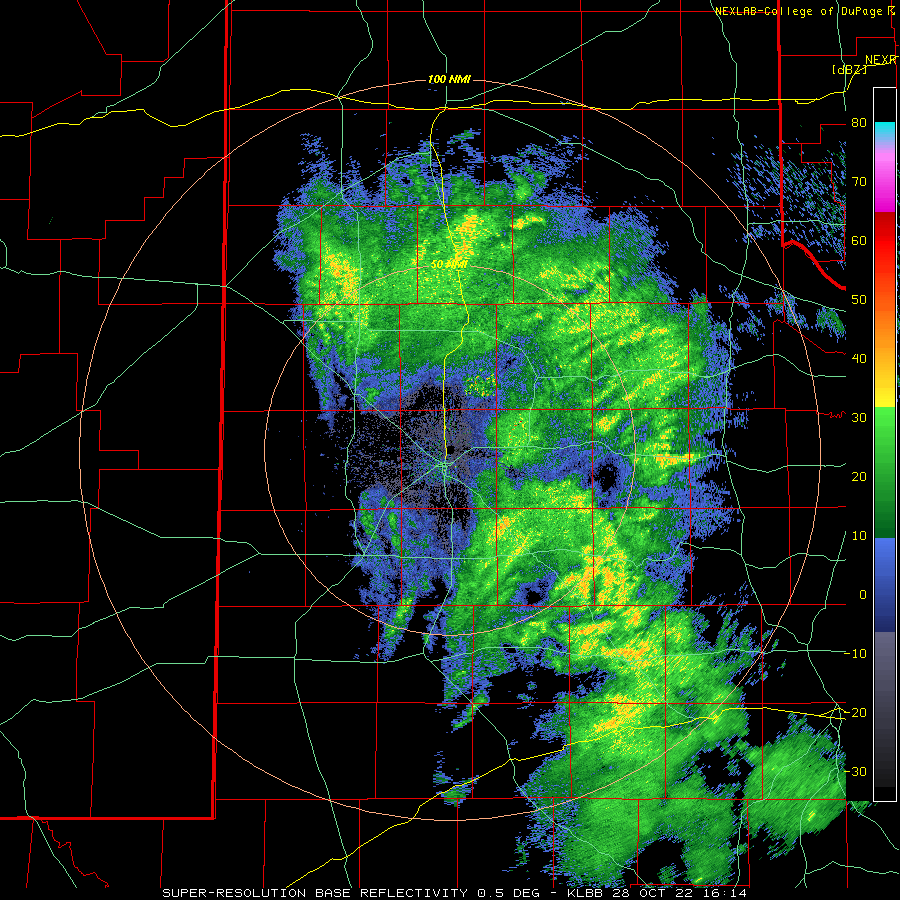
| Lubbock WSR-88D radar animation valid from 11:14 am to 2:42 pm on 28 October 2022. | |||||
| Thereafter, periods of light to moderate rain continued across the eastern South Plains, southeast Texas Panhandle and much of the Rolling Plains through Friday afternoon, before eventually diminishing from west-to-east by early evening. | |||||
 |
|||||
| 3-day rainfall measured by the West Texas Mesonet, ending at 4 pm on 29 October 2022. The data are courtesy of the West Texas Mesonet. A radar-estimated bias-corrected rainfall plot for this same period can be VIEWED HERE. | |||||
| This late-week system provided rain for most of the region again, similar to the early-week system. Unfortunately, the lightest totals were again found across the western South Plains. However, many locations from the southeast South Plains into the Rolling Plains did record an additional half inch to well over an inch. | |||||
 |
|||||
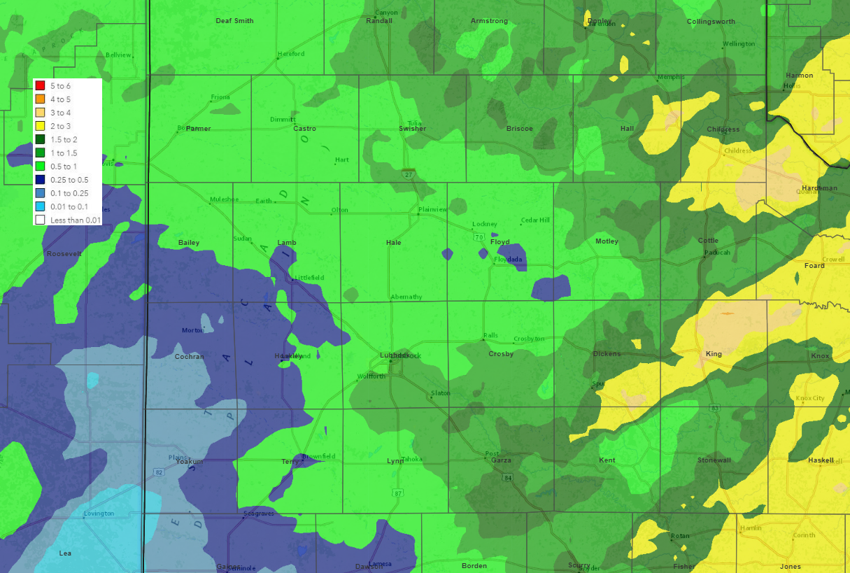
| 7-day radar-estimated and bias-corrected rainfall (inches) ending at 7 am on Saturday morning (29 October 2022). | |||||
| Altogether, the final full week of October 2022 was filled with rain for the entire region. Over the course of the two storm systems, many spots recorded 0.5" to 1.5"+ of rain. The heaviest rain targeted spots off the Caprock, including around Childress and from southeast Dickens into a good portion of King Counties. The Childress Airport officially measured 2.15", which boosted their year-to-date (YTD) total to 14.52" (still about 7" shy of the YTD average). Lubbock officially measured 0.75" over the 5-day stretch, raising their YTD total to 14.06" (just under 3" below the YTD average of 16.67"). Unfortunately, the southwestern South Plains missed out on much of the beneficial rain, generally recording a quarter inch or less. | |||||

