|
Mid-June brings the Heat, Heatbursts and Microburst! |
|||||
 |
|||||
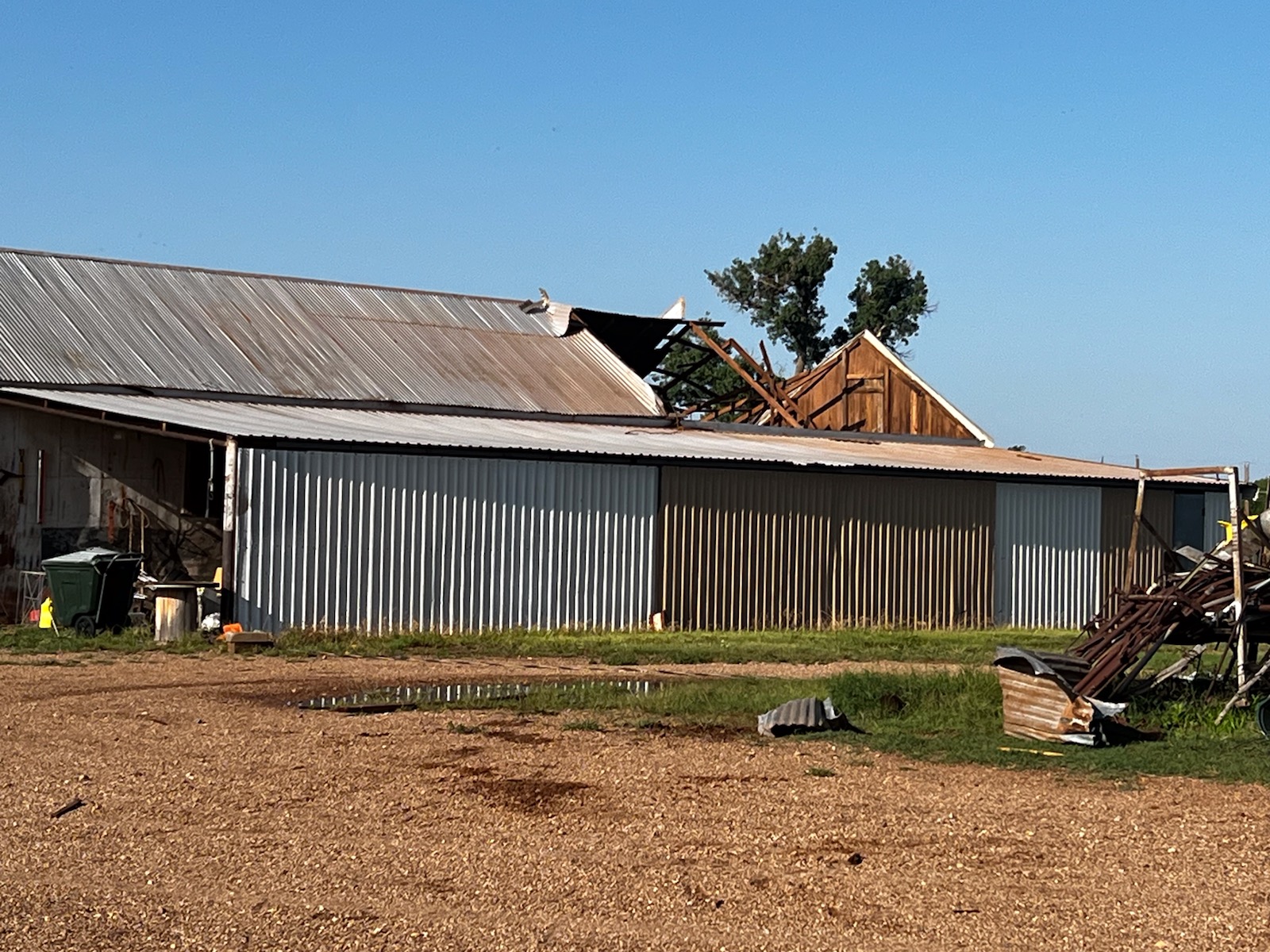
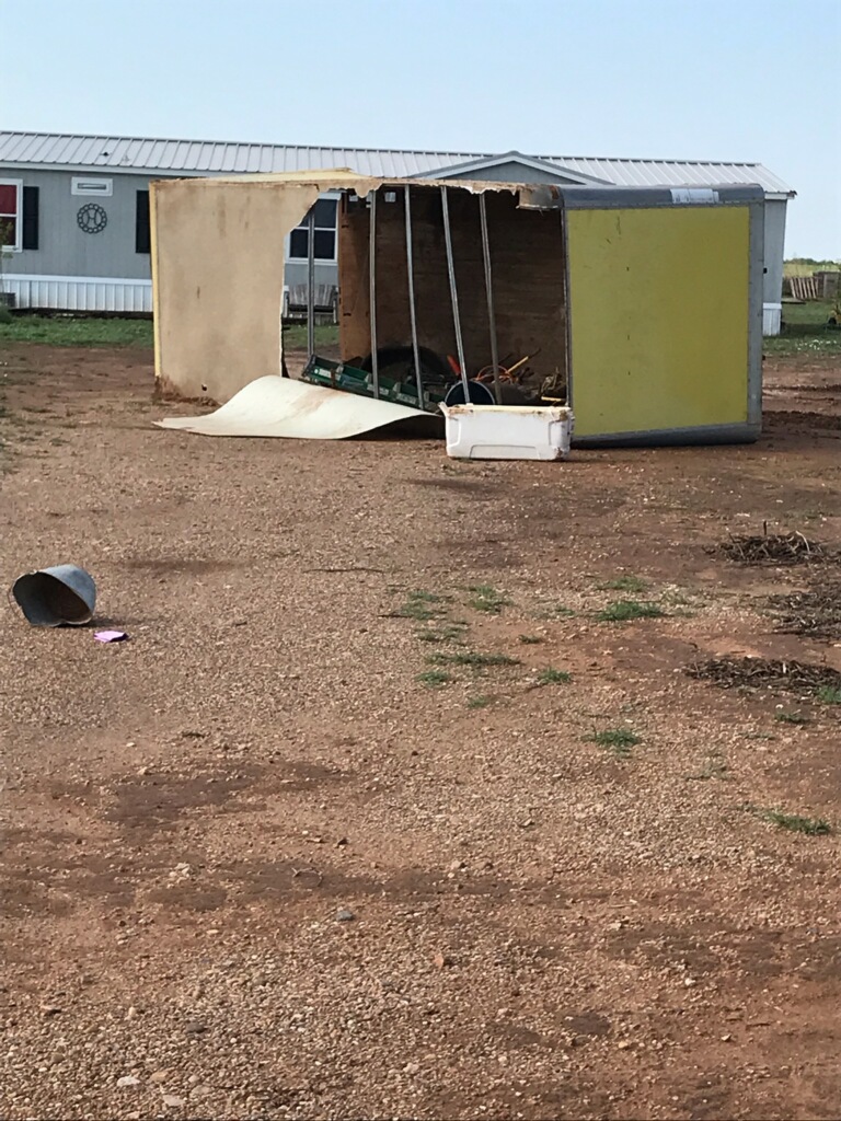
| Damage incurred on the southeast side of Childress around 2 am early Friday morning (10 June 2022). The image is courtesy of Bill Ricks. | |||||
|
After relatively reasonable temperatures and the periodic rain and thunderstorms from late May through early June, mid-June brought the heat for West Texas. The heat built quickly on the heels of the final complex of thunderstorms that rolled through the Texas Panhandle late Thursday evening into early Friday morning (9-10 June). |
|||||
 |
|||||
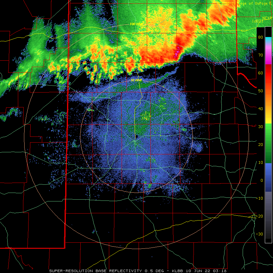
| Lubbock WSR-88D radar animation valid from 10:18 pm on 9 June to 6:28 am on 10 June 2022. | |||||
|
The cool outflow from a broken line of thunderstorms that surged through the southern Texas Panhandle provided strong to severe wind gusts late Thursday evening. The wind gusts associated with the thunderstorm outflow peaked in the 60 to 75 mph range near Lesley, Memphis and Childress between 10 pm and midnight. |
|||||
 |
|||||
|
|||||
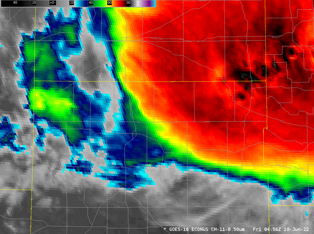
| Interestingly, another round of strong to severe wind gusts affected several locations across the southern Texas Panhandle 1 to 2 hours after the initial line of thunderstorms went through. These intense winds were produced on the back side of the departing t-storm complex, as decaying showers and rapidly warming cloud tops (shown below) moved across the region. Instead of dropping temperatures, as occurred with the passing outflow, these strong winds were characterized by much warmer/hotter and drier air, thus giving them the "heatburst" designation. | |||||
 |
|||||
| Infrared satellite loop valid from 11:56 pm on 9 June to 1:56 am on 10 June 2022. | |||||
| Heatbursts generally occur when showers and thunderstorms rapidly weaken within a relatively hot atmosphere during the overnight hours. Rapidly sinking air develops below the weakening shower activity. As the air sinks, it warms and dries, and if it is accelerating downward fast enough, it can push through the shallow "cooler" air that has developed near the ground after sunset. This produces a rapid rise in temperature and decrease in dewpoint as experienced at ground level. The winds with the more extreme heatbursts can also gust as high as 60 to 80+ mph, causing damage as they do so. | |||||
 |
|||||
| Additional damage incurred on the southeast side of Childress around 2 am early Friday morning (10 June 2022). The image is courtesy of Bill Ricks. | |||||
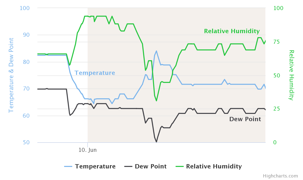
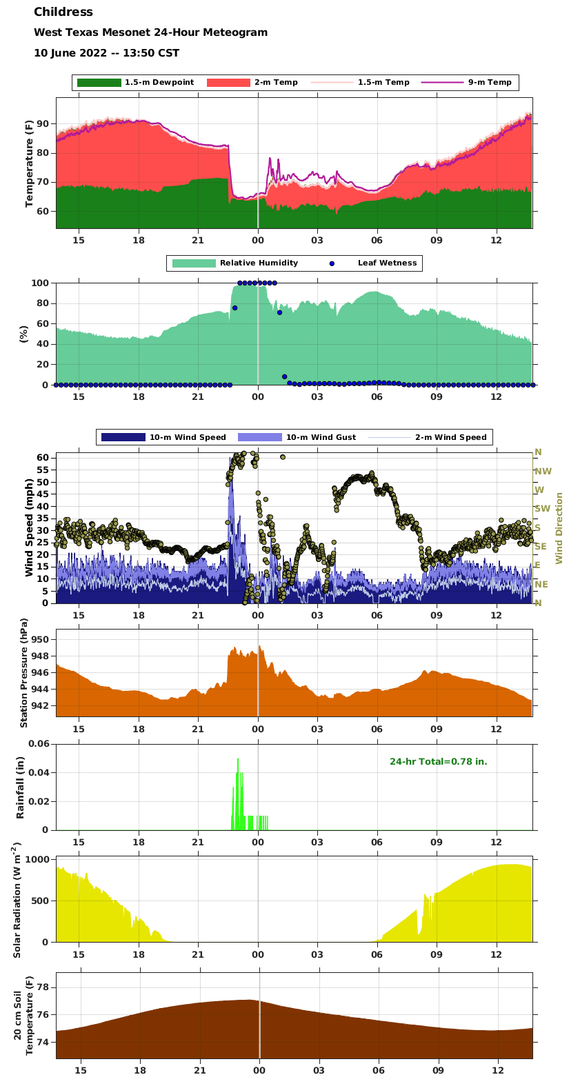
| Unfortunately, one of the heatbursts near Childress did cause considerable damage to several structures near the southeast side of town early Friday morning (10 June 2022). The nearby West Mesonet site near Childress recorded a 60 mph gust with the initial outflow at 11:35 pm on the 9th, as temperatures quickly dropped from the lower 80s to middle 60s. The official observation site at the Childress Airport, located a couple miles west of town, then measured a wind gust to 72 mph at 1:45 am on the 10th, complete with the temperature jumping from the middle 60s to middle 80s, while the dewpoint briefly fell from the lower 60s to around 50 degrees. Both the temperature and dewpoint gradually moderated thereafter, allowing the relative humidity to rise back to around 75% after briefly dipping below 40%. | |||||
 |
|||||
|
|||||
|
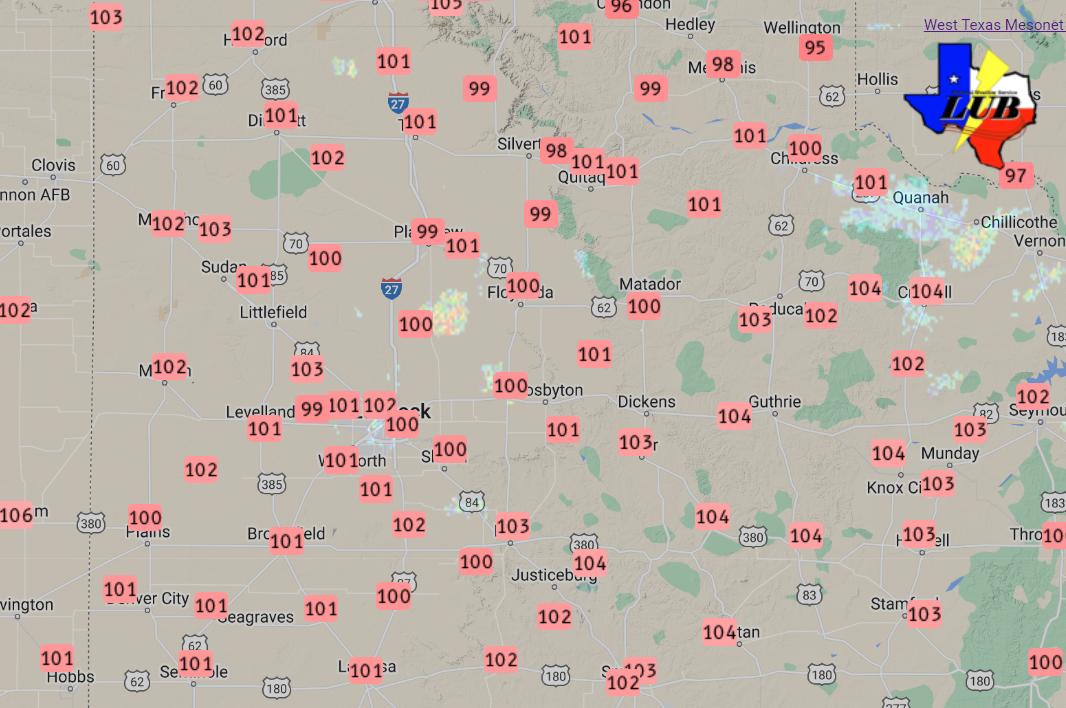
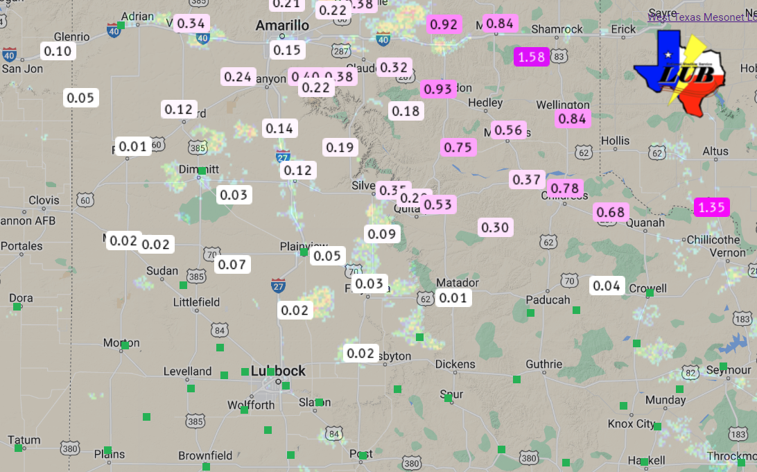
On the positive side, the line of thunderstorms brought additional rainfall to the southern Texas Panhandle. Rain totals near or above a half inch were common over a good chunk of Hall, Childress and northern Cottle Counties, while lighter amounts fell on much of the remainder of the southern Texas Panhandle and northern South Plains. |
|||||
 |
|
||||
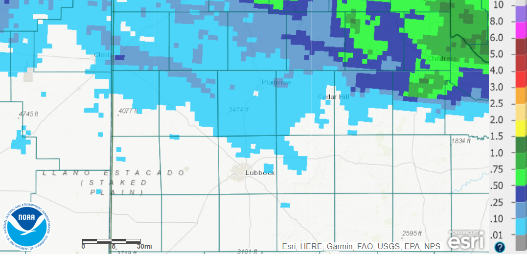
| High temperatures measured by the West Texas Mesonet on 11 June (left) and 12 June (right) 2022. The highs observed on 10 June can be SEEN HERE and 13 June can be FOUND HERE. | |||||
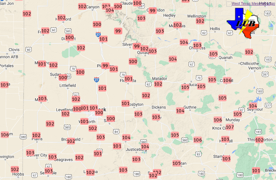
| The next few days brought the heat as upper ridging built firmly over the region. Most locations recorded temperatures near or just above 100 degrees Friday afternoon (10 June). Even hotter weather followed over the weekend as highs from 105 to 110 degrees were common. The intense heat broke several daily record highs and maximum lows. Lubbock hit 107ËšF on the 12th, eclipsing the previous record of 105ËšF (set in 2001). Childress recorded record highs of 108ËšF (previously 103ËšF in 1959) and 111ËšF (previously 105ËšF in 1955) on the 11th and 12th, respectively. Lubbock also tied an all-time record warm low for June when it only cooled to 78ËšF on June 11th. | |||||
 |
|||||
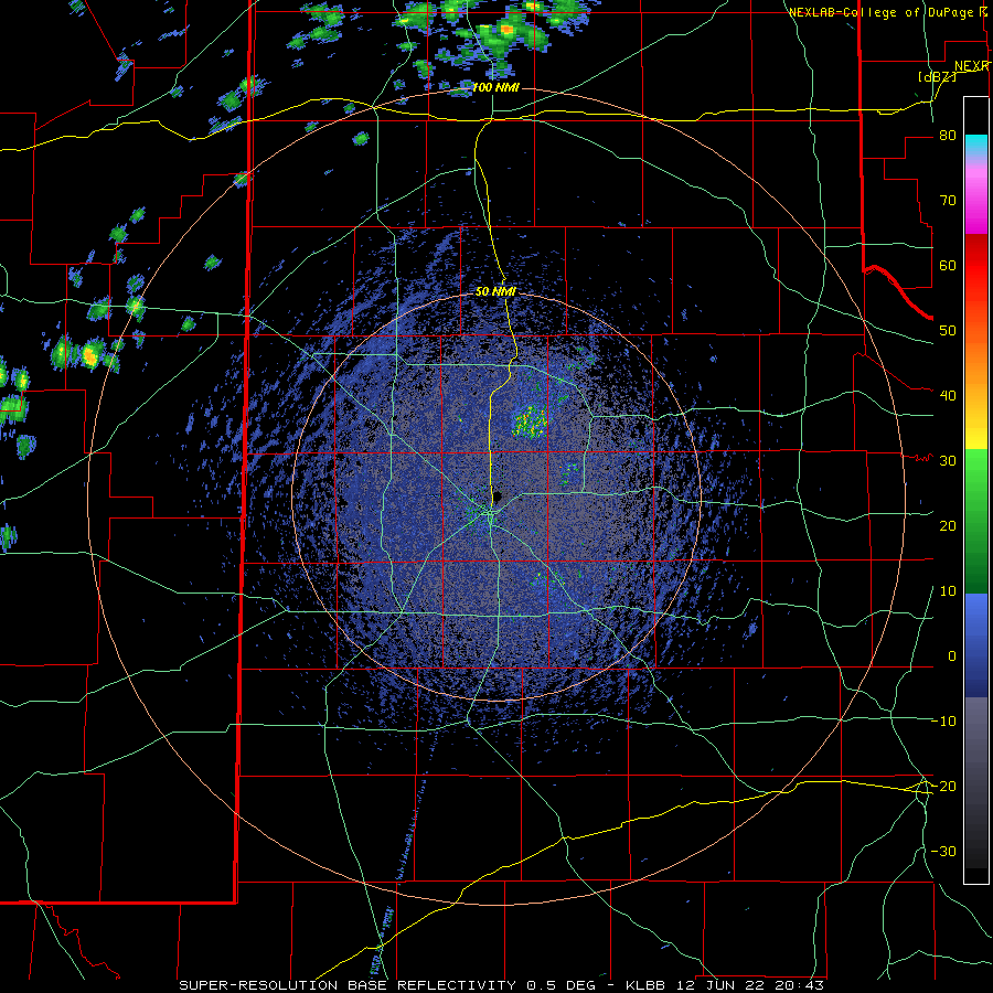
| Lubbock WSR-88D radar animation valid from 3:43 pm on 12 June to 6:28 am on 13 June 2022. | |||||
|
The extreme heat even fueled isolated high-based showers and thunderstorms Sunday evening (12 June). Unfortunately, this activity produced little in the way of rainfall or cooling, but did generate small but intense wind gusts. One such shower produced an 84 mph wind gust as it moved across the Dimmitt West Texas Mesonet site, just about 1 hour after measuring a 64 mph gust with a different virga shower. Preliminary storm reports collected on this unsettled mid-June stretch can be found below: |
|||||
PRELIMINARY LOCAL STORM REPORT...SUMMARY
NATIONAL WEATHER SERVICE LUBBOCK TX
436 AM CDT FRI JUN 10 2022

..TIME...   ...EVENT...      ...CITY LOCATION...     ...LAT.LON...
..DATE...   ....MAG....      ..COUNTY LOCATION..ST.. ...SOURCE....
            ..REMARKS..

1045 PM     TSTM WND GST     2 S LESLEY              34.65N 100.81W
06/09/2022  M64 MPH          HALL               TX   MESONET

            WEST TEXAS MESONET.

1055 PM     TSTM WND GST     2 WSW TURKEY            34.38N 100.93W
06/09/2022  M60 MPH          HALL               TX   MESONET

            WEST TEXAS MESONET 2WSW TURKEY.

1103 PM     TSTM WND GST     1 ENE MEMPHIS           34.73N 100.53W
06/09/2022  M75 MPH          HALL               TX   MESONET

            WEST TEXAS MESONET MEMPHIS 1NE.

1139 PM     TSTM WND GST     4 NE CHILDRESS          34.46N 100.20W
06/09/2022  M60 MPH          CHILDRESS          TX   MESONET

            WEST TEXAS MESONET 2NNE CHILDRESS.

1250 AM     TSTM WND GST     6 S OLTON               34.09N 102.12W
06/10/2022  M61 MPH          LAMB               TX   MESONET

            WEST TEXAS MESONET OLTON 6S.

1251 AM     TSTM WND GST     6 S OLTON               34.09N 102.12W
06/10/2022  M67 MPH          LAMB               TX   MESONET

            WEST TEXAS MESONET OLTON 6S.

0144 AM     NON-TSTM WND GST 6 S OLTON               34.09N 102.12W
06/10/2022  M61 MPH          LAMB               TX   MESONET

            HEAT BURST AT THE WEST TEXAS MESONET 6S
            OLTON.

0145 AM     TSTM WND GST     2 W CHILDRESS           34.43N 100.28W
06/10/2022  M72 MPH          CHILDRESS          TX   ASOS

