|
Large hail & torrential rain targets the southern |
|||||
 |
|||||
| Giant hail (3.5" diameter) that fell just southeast of Memphis, Texas, late Tuesday afternoon (31 May 2022). The picture is courtesy of Randy Jennings. | |||||
|
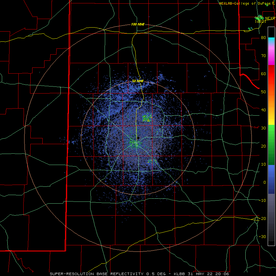
The final day of May brought a return of rich Gulf moisture to West Texas, more typical of humidity levels usually found well downstate. The abundant moisture, in combination with strong daytime heating, provided the fuel for robust thunderstorm development along and quasi-stationary front located across the southern Texas Panhandle late Tuesday afternoon (31 May 2022). |
|||||
 |
|||||
|
|||||
|
Strong instability and moderate wind shear allowed the storms which formed to quickly become severe and gain mid-level rotation. The rotating t-storms were efficient at generating hail, including very large hail at times. Several locations near Memphis and Tulia reported hail as large 3 to 3.5 inches in diameter. The giant hail, bigger than baseballs, busted windshields on numerous vehicles on Highway 287 just southeast of Memphis. |
|||||
 |
|||||
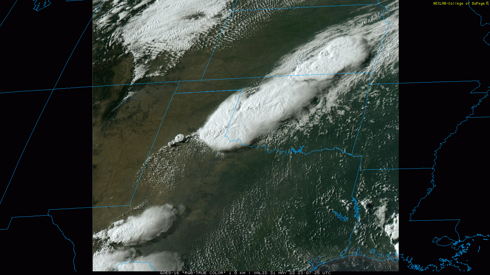
| "RGB-True Color" 1-minute satellite imagery valid from 6:07 to 6:28 pm on 31 May 2022. | |||||
|
The above satellite imagery shows thunderstorms erupting along the frontal zone from southeastern Kansas into western Oklahoma and the southern Texas Panhandle. Storm also fired across the higher terrain of Far West Texas, but clouds failed to grow to "storm status" along the dryline which extended from north-to-south over the central and western South Plains. |
|||||
 |
|||||
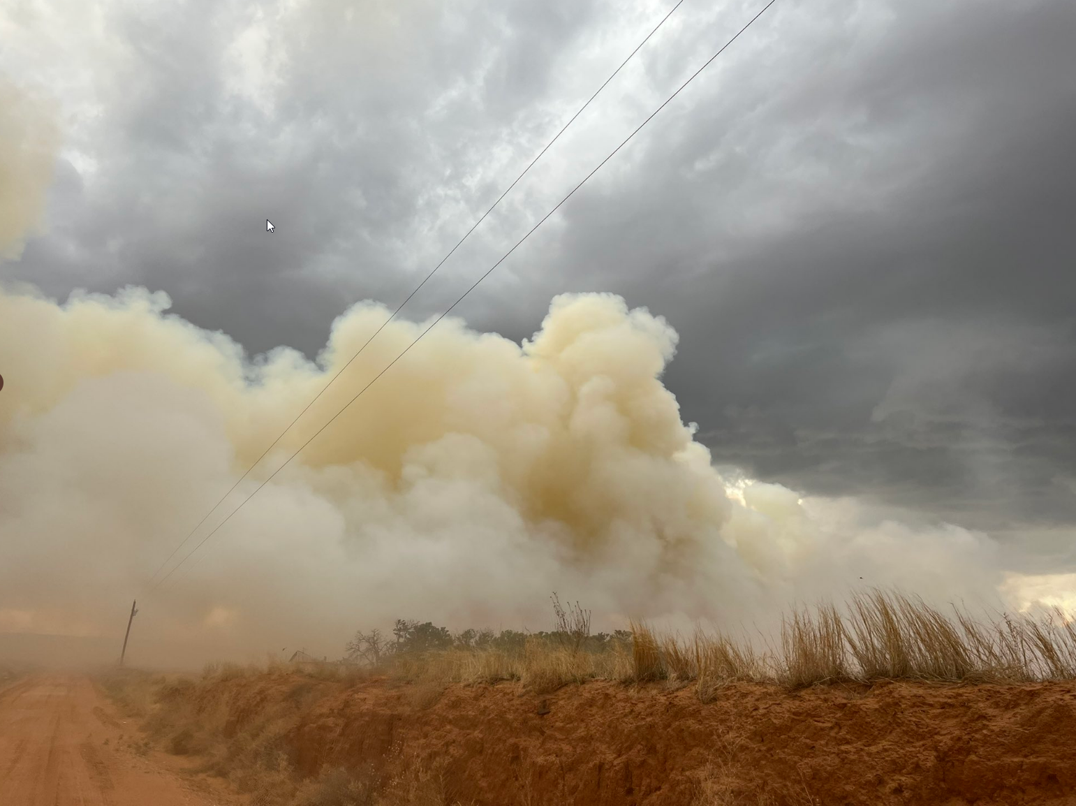
| Wildfire that started near Memphis Tuesday evening (31 May 2022). The picture is courtesy of Victor Gensini. | |||||
| Early on, lightning likely ignited a fire near Memphis. However, the rain and hail that followed helped suppress the fire shortly thereafter. Intense storms developed westward into the south-central Texas Panhandle through the early evening, then continued to train eastward over the southeast Texas Panhandle and eventually the northern Rolling Plains through the evening and early morning. | |||||
 |
|||||
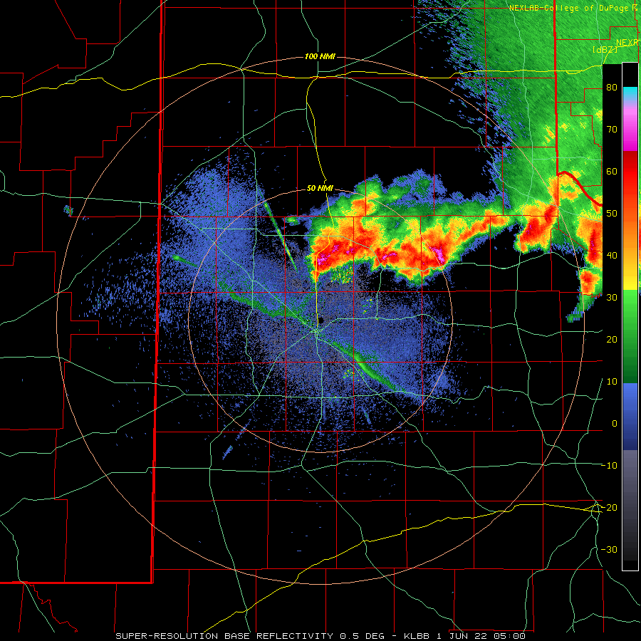
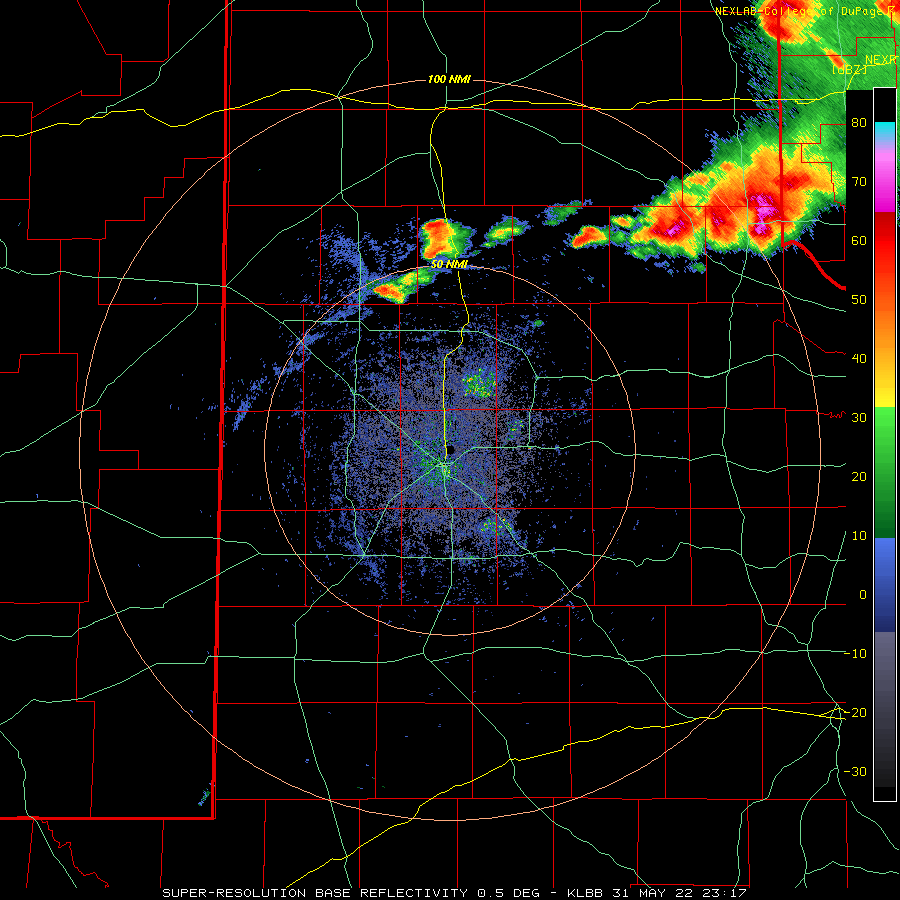
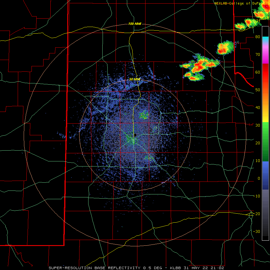
| Lubbock WSR-88D radar animation valid from midnight to 6:00 am on 1 June 2022. | |||||
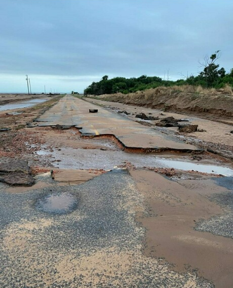
| The intense and excessive rainfall flooded out a number of roadways across the southeast Texas Panhandle, including in and around Memphis. Below is what remains of portions of FM 2472 southwest of Memphis. | |||||
 |
|||||
| Washed out road in Hall County southwest of Memphis (FM 2472) Wednesday morning (1 June 2022). The image is courtesy of Childress TXDOT. | |||||
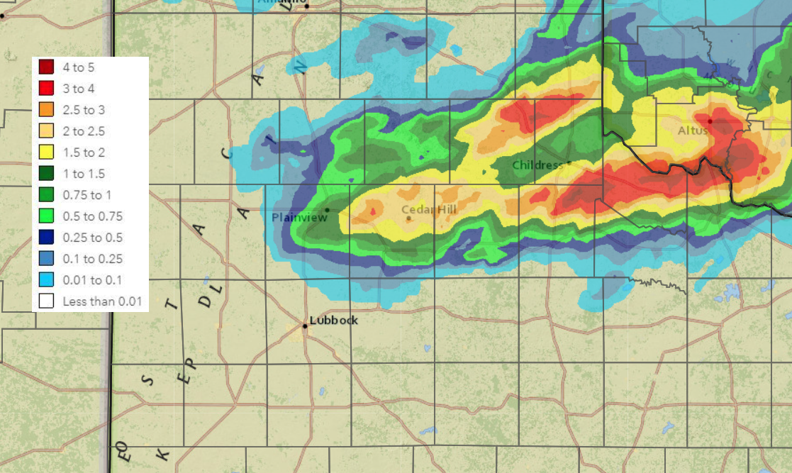
| On the positive side, the thunderstorms dropped widespread significant rain. Many locations from Plainview eastward to north of Paducah to Wellington received over an inch of rain, with several spots seeing 3+ inches. Officially Childress recorded 1.18 inches, while over 3 inches were measured at the Aiken, Memphis, Goodlett and Odell West Texas Mesonet sites. | |||||
 |
|||||
|
|||||
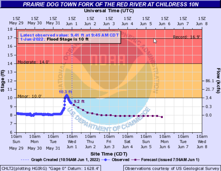
| Runoff from the heavy rain resulted in a significant spike in the Prairie Dog Town Fork of the Red River north of Childress. The river peaked at 10.3 feet, just above flood stage early Wednesday morning, but quickly dropped back under flood stage shortly afterwards. | |||||
 |
|||||
| Plot of the Prairie Dog Town Fork of the Red River 10 miles north of Childress during late May and the beginning of June 2022. | |||||
|
The preliminary storm reports collected over this active last day of May can be found below. In addition, more limited severe weather and rainfall occurred the following day, June 1st. The preliminary storm reports for June 1st can also be viewed below. |
|||||
PRELIMINARY LOCAL STORM REPORT...SUMMARY
NATIONAL WEATHER SERVICE LUBBOCK TX
339 AM CDT WED JUN 01 2022

..TIME...   ...EVENT...      ...CITY LOCATION...     ...LAT.LON...
..DATE...   ....MAG....      ..COUNTY LOCATION..ST.. ...SOURCE....
            ..REMARKS..

0449 PM     HAIL             3 SE MEMPHIS            34.69N 100.50W
05/31/2022  M3.50 INCH       HALL               TX   STORM CHASER

            PHOTO FROM SOCIAL MEDIA SHOWING A HAILSTONE MEASURED
            APPROXIMATELY 20 MINUTES AFTER THE CORE WENT THROUGH
            THIS AREA. NUMEROUS VEHICLES HAVE HAD WINDSHIELDS BUSTED
            OUT ON US 287 AS WELL.

0504 PM     HAIL             5 E MEMPHIS             34.73N 100.45W
05/31/2022  M2.50 INCH       HALL               TX   STORM CHASER

            AVERAGE HAILSTONES WERE 2" IN DIAMETER BUT A FEW UP TO
            2.5" IN DIAMETER.

0554 PM     HAIL             MEMPHIS                 34.73N 100.54W
05/31/2022  M2.00 INCH       HALL               TX   EMERGENCY MNGR

0642 PM     HAIL             TULIA                   34.54N 101.77W
05/31/2022  E1.75 INCH       SWISHER            TX   PUBLIC

            SOCIAL MEDIA PHOTO OF GOLF BALL SIZED HAIL.

0646 PM     HAIL             6 E NEWLIN              34.60N 100.33W
05/31/2022  E1.50 INCH       CHILDRESS          TX   CO-OP OBSERVER

            LARGEST HAIL WAS PING PONG SIZED

0731 PM     HAIL             7 ESE TULIA             34.50N 101.66W
05/31/2022  E2.00 INCH       SWISHER            TX   STORM CHASER

0807 PM     FLASH FLOOD      1 S PLASKA              34.59N 100.65W
05/31/2022                   HALL               TX   EMERGENCY MNGR

            A PORTION OF FM 2472 NEAR PLASKA HAS BEEN WASHED OUT
            FROM THE HEAVY RAINFALL.

0811 PM     HAIL             SILVERTON               34.47N 101.30W
05/31/2022  E2.75 INCH       BRISCOE            TX   FIRE DEPT/RESCUE

            SEVERAL WINDSHIELDS REPORTED BROKEN AS WELL.

0815 PM     FLASH FLOOD      5 SE MEMPHIS            34.67N 100.48W
05/31/2022                   HALL               TX   LAW ENFORCEMENT

            US 287 NEAR FM 1619 IS FLOODED.

0817 PM     FLASH FLOOD      2 SW MEMPHIS            34.71N 100.56W
05/31/2022                   HALL               TX   TX DOT

            A PORTION OF FM 1041 WAS REPORTED WASHED OUT NEAR
            HIGHWAY 256 DUE TO THE HEAVY RAINFALL.

1010 PM     HAIL             PLAINVIEW               34.19N 101.72W
05/31/2022  M1.50 INCH       HALE               TX   SOCIAL MEDIA

            PHOTO OF PING PONG BALL SIZED HAIL SHARED ON TWITTER.

1014 PM     HAIL             PLAINVIEW               34.19N 101.72W
05/31/2022  E2.00 INCH       HALE               TX   BROADCAST MEDIA

1022 PM     HAIL             LOCKNEY                 34.12N 101.44W
05/31/2022  E1.75 INCH       FLOYD              TX   BROADCAST MEDIA

1225 AM     HAIL             1 NE MATADOR            34.02N 100.81W
06/01/2022  E1.75 INCH       MOTLEY             TX   CO-OP OBSERVER

            MOST HAIL STONES WERE THE SIZE OF QUARTERS, BUT LARGEST
            WERE GOLFBALLS.

1257 AM     HAIL             FLOYDADA                33.98N 101.34W
06/01/2022  E1.00 INCH       FLOYD              TX   LAW ENFORCEMENT

            BROADCAST MEDIA ALSO RELAYED REPORT OF QUARTER SIZE
            HAIL IN FLOYDADA.

0109 AM     HAIL             9 SE FLOYDADA           33.89N 101.23W
06/01/2022  E1.75 INCH       FLOYD              TX   CO-OP OBSERVER

0134 AM     TSTM WND GST     2 W CHILDRESS           34.43N 100.28W
06/01/2022  M61 MPH          CHILDRESS          TX   ASOS

