|
Storms bring huge hail and tornadoes to the Rolling Plains |
|
 |
|
| Tornadic storm near Grow, Texas, Wednesday evening (4 May 2022). The picture is courtesy of Melony Metz. | |
|
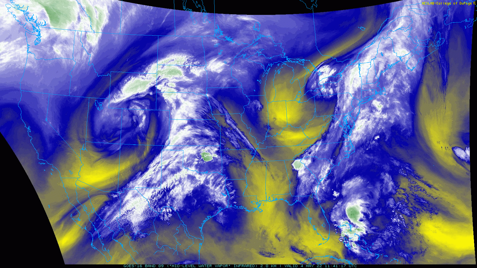
Wednesday afternoon and evening (4 May 2022) brought active weather, including a cyclic tornadic thunderstorm that affected portions of the Rolling Plains. The severe weather was triggered by a dryline, in combination with a strong storm system approaching from the Great Basin into the central Rockies. |
|
 |
|
| Water vapor satellite loop valid from 6:46 am to 7:16 am on Wednesday (4 May 2022). | |
|
Initially, isolated storm development occurred over the southwest and south-central Texas Panhandle Wednesday afternoon. These storms quickly became strong to severe, and dropped hail from quarter to ping pong ball sized. This included one short-lived storm that generated quarter size hail as tracked near Vigo Park. |
|
 |
|
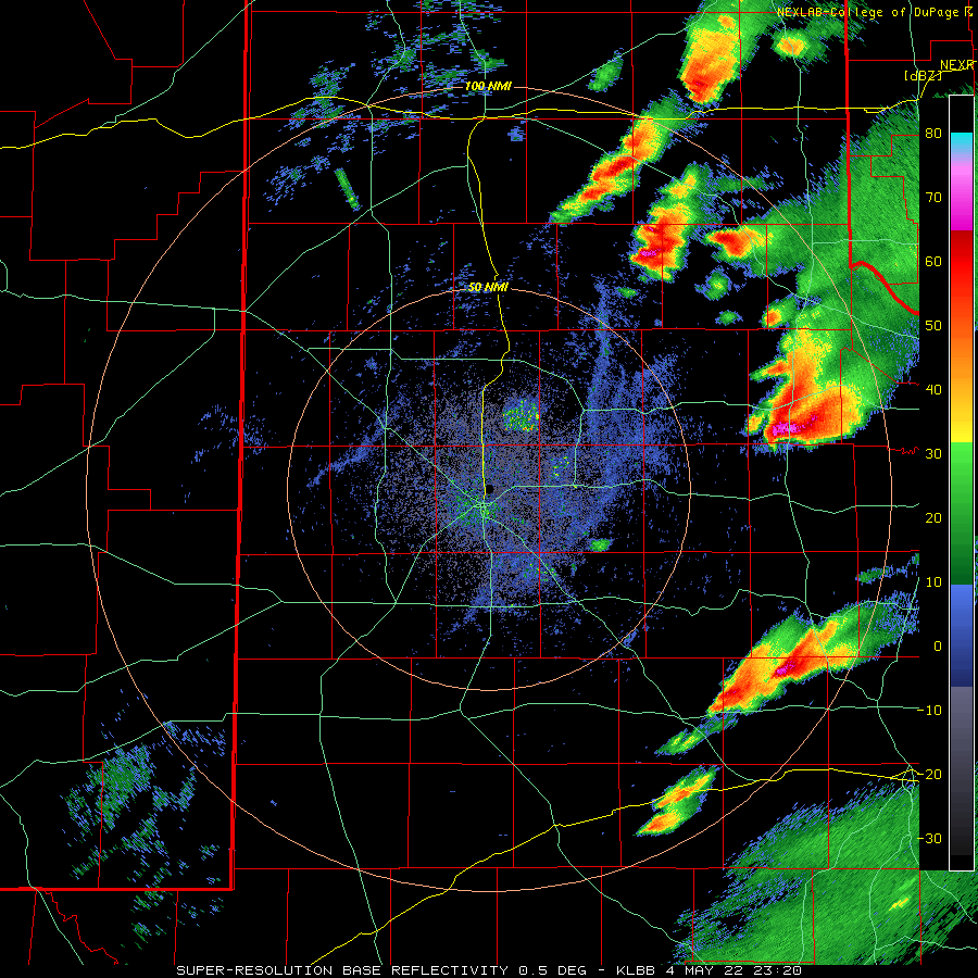
| Lubbock WSR-88D radar animation valid from 4:52 pm to 5:43 pm on 4 May 2022. An additional radar animation, valid from 1:32 pm to 3:00 pm, can be VIEWED HERE. | |
|
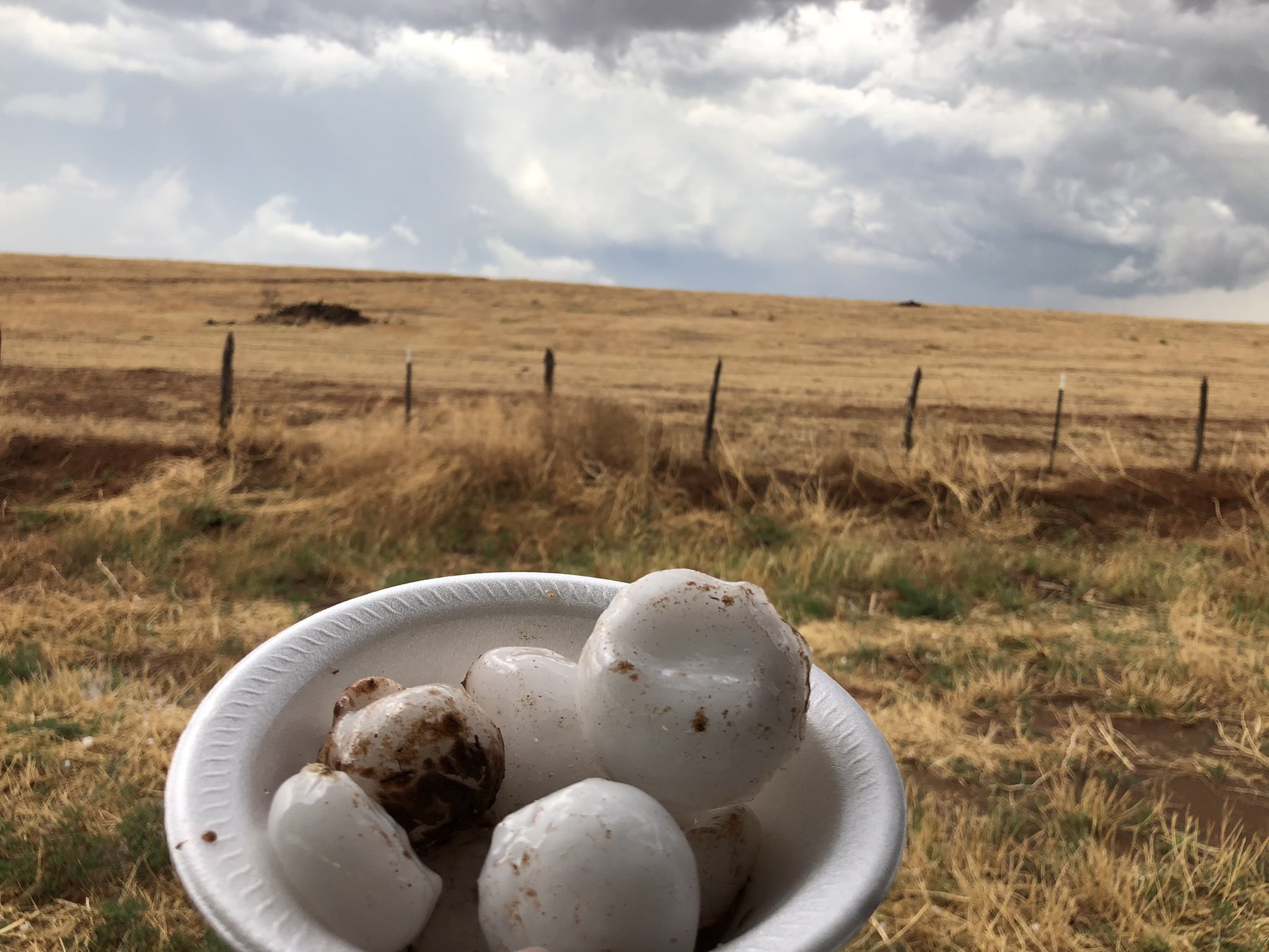
Greater intensity storms formed a bit later in the afternoon, erupting ahead of a dryline surge over the west-central Rolling Plains. Strong instability and wind shear caused the more intense storms to start rotating, with the cyclonically rotating storms moving slowly eastward and the anticyclonically rotating storms racing north-northeastward. Both flavors of rotating storms generated very large hail, in spots near and greater than baseball in size. |
|
 |
|
| Large hail that fell south of Paducah Wednesday evening (4 May 2022). The image is courtesy of Ian Giammanco. | |
|
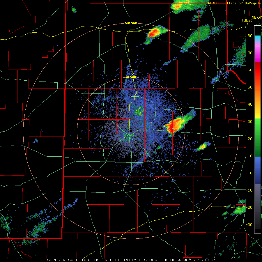
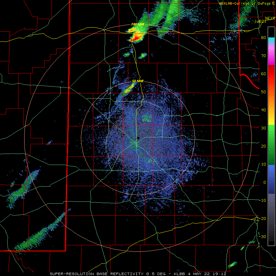
The most intense storm of the day formed east of Crosbyton, moved northeastward to near Afton, then more directly eastward near Dumont and Grow, and then across rural parts of northeast King County and southeast Cottle County. As it did so, the storm generated baseball to softball size hail and a few tornadoes. |
|
 |
|
| Lubbock WSR-88D radar animation valid from 6:20 pm to 7:05 pm on 4 May 2022. Additional radar animations can be viewed at: 2:12 pm to 7:07 pm on 4 May; and 4:52 pm to 9:03 pm on 4 May. | |
|
The first tornado report of the day came in from west of Dumont (shown below), where a dusty circulation took shape under a rotating wall cloud. This tornado was well documented by storm chasers, but inflicted no known damage as it remained over open country. |
|
 |
|
| Tornadic storm near Dumont, Texas, Wednesday evening (4 May 2022). The picture is courtesy of Daniel Shaw. | |
 |
|
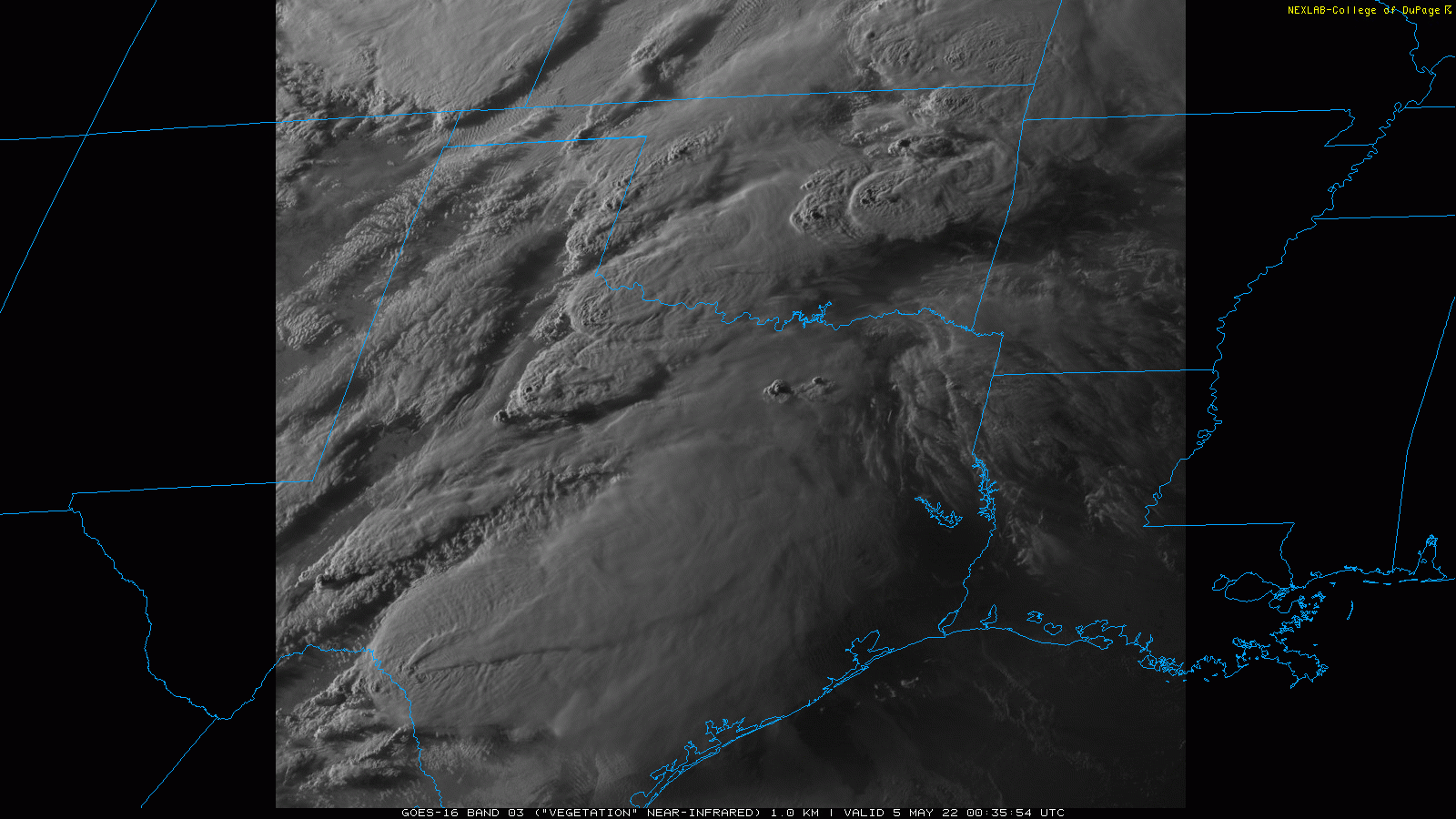
| Late evening visible satellite loop valid from 7:35 pm to 7:42 pm on Wednesday (4 May 2022). Note the shadows associated with the overshooting tops of the most intense thunderstorms. | |
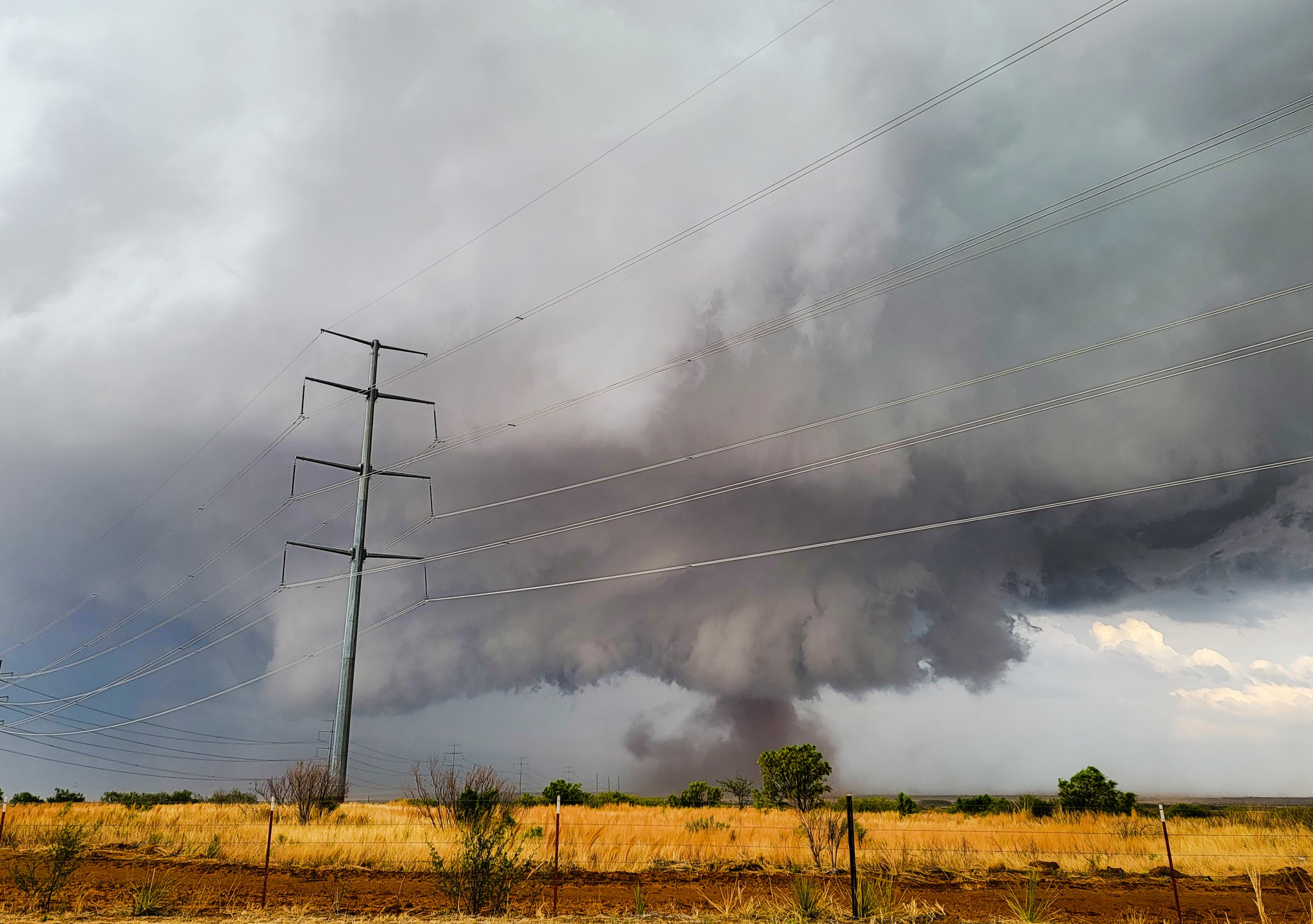
| The next tornado formed roughly a half hour later near Grow, Texas, or about 15 miles south of Paducah. This tornado persisted around 15 minutes, and moved roughly east-southeast remaining close to FM 1168 and FM 3416 for about 5 miles before turning east and crossing CR 204. | |
 |
|
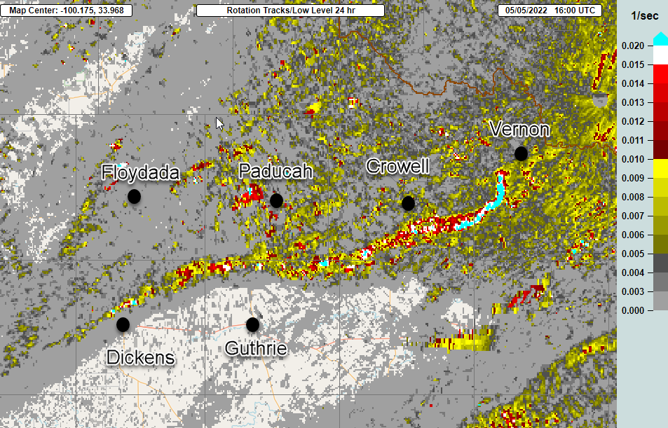
| MRMS low-level (2 km) rotation track calculated on 4 May 2022. | |
|
The final tornado documented in Lubbock's County Warning Area (CWA) developed at 7 pm southeast of Chalk, then tracked over remote portions of northeast King County before crossing into Knox County. This tornado appeared to be wider (and more intense?) on chaser videos, but caused no observed damage. Since no damage was observed with any of the three tornadoes documented in Lubbock's CWA, all three tornadoes received an EF-Unknown rating. |
|
 |
|
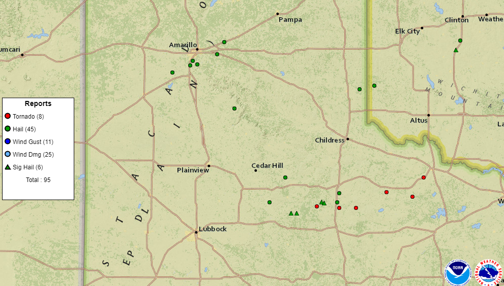
| Storm reports collected by the National Weather Service and displayed by the Storm Prediction Center for 4 May 2022. | |
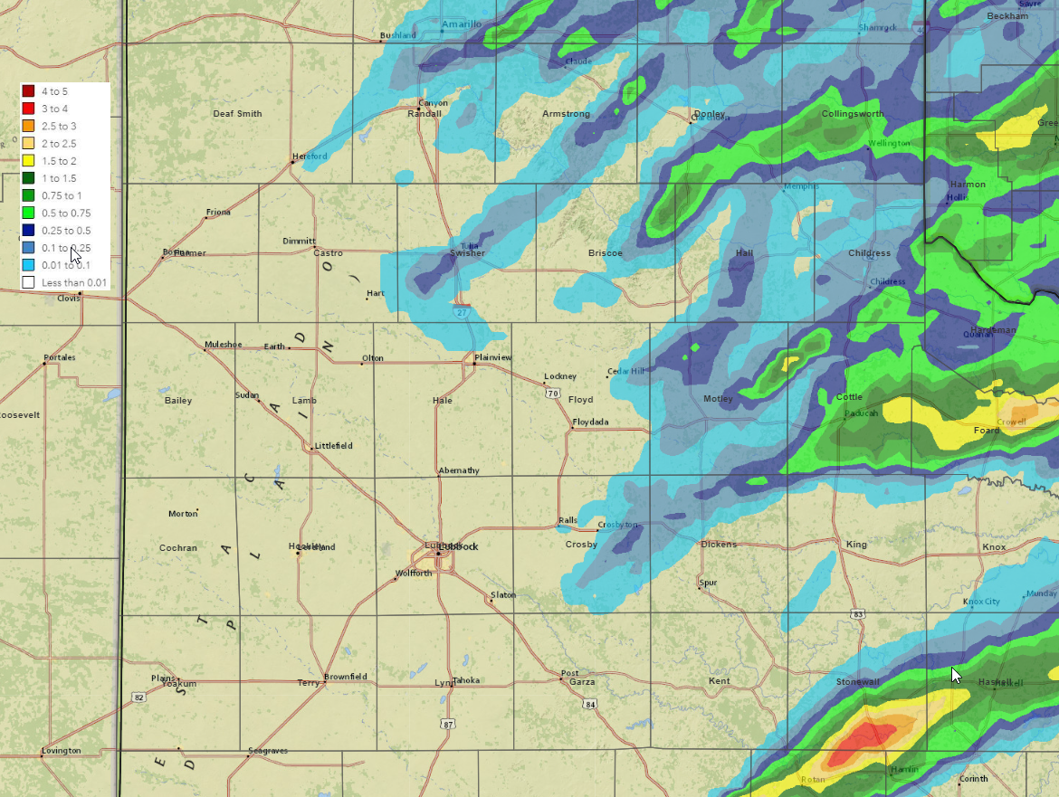
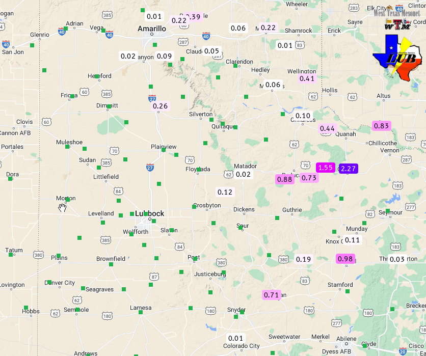
| Although the giant hail and tornadoes were generally unwelcome, the thunderstorm activity did provide much-needed rain over parts of the Rolling Plains and southeast Texas Panhandle. The heaviest rain fell over portions of southeast Stonewall County, where repeated thunderstorms likely brought 2-4 inches of rain. Unfortunately, the significant rainfall was fairly limited in coverage though. | |
 |
|
| 24-hour radar-estimated and bias-correct rainfall ending at 6 am on 6 May 2022.Rain totals measured by the West Texas Mesonet can be FOUND HERE. | |
| The preliminary damage survey report and storm reports collected on this active early May day can be found below. | |
Public Information Statement
National Weather Service Lubbock TX
1105 AM CDT Fri May 6 2022

...NWS Damage Survey for May 4 2022 Tornado Event...

.Overview...A cyclic supercell produced several tornadoes across the
Rolling Plains of West Texas during the late afternoon and evening hours
of 4 May 2022. Numerous chaser and spotter videos were received by the
office that indicated that three tornadoes were likely to have occurred
from northeast Dickens County through northern King County. Damage survey
teams from the NWS Lubbock office and the West Texas Mesonet on 5 May 2022
could not find any visible damage from any of the tornadoes, so EF damage
ratings are unknown as of this report.

.Dumont...

Rating:                 EF-Unknown
Estimated Peak Wind:    N/A
Path Length /statute/:  3.72 miles
Path Width /maximum/:   N/A
Fatalities:             0
Injuries:               0

Start Date:             05/04/2022
Start Time:             05:52 PM CDT
Start Location:         4 W Dumont / Dickens County / TX
Start Lat/Lon:          33.813 / -100.5941

End Date:               05/04/2022
End Time:               06:02 PM CDT
End Location:           2 NNW Dumont / Dickens County / TX
End Lat/Lon:            33.8263 / -100.5314

Survey Summary:
Multiple chaser reports including video of a small tornado W-NW
of Dumont, TX. Track length estimated. No damage was observed via
NWS survey on 5/5/2022.

.Grow...

Rating:                 EF-Unknown
Estimated Peak Wind:    N/A
Path Length /statute/:  8.5 miles
Path Width /maximum/:   N/A
Fatalities:             0
Injuries:               0

Start Date:             05/04/2022
Start Time:             06:30 PM CDT
Start Location:         2 WNW Grow / King County / TX
Start Lat/Lon:          33.8149 / -100.3299

End Date:               05/04/2022
End Time:               06:45 PM CDT
End Location:           5 SSE Chalk / King County / TX
End Lat/Lon:            33.805 / -100.1847

Survey Summary:
Video footage of tornado beginning just northeast of intersection
of US 83 and FM 1168. Tornado moved roughly E-SE remaining close
to FM 1168 and FM 3416 for about 5 miles before turning E and
crossing CR 204. NWS survey on 5/5/2022 found no observed damage.


.Northeast_King...

Rating:                 EF-Unknown
Estimated Peak Wind:    N/A
Path Length /statute/:  7.2 miles
Path Width /maximum/:   N/A
Fatalities:             0
Injuries:               0

Start Date:             05/05/2022
Start Time:             07:00 PM CDT
Start Location:         7 SE Chalk / King County / TX
Start Lat/Lon:          33.804 / -100.1325

End Date:               05/05/2022
End Time:               07:15 PM CDT
End Location:           9 SE Hackberry / King County / TX
End Lat/Lon:            33.8355 / -100.0159

Survey Summary:
This tornado appears to be wider on chaser video than the Dumont tornado.
No damage was observed by NWS survey team on 5/5/2022. Track estimated
from chaser reports and radar as it moved over the rangeland of northeast
King County before crossing into Knox County.

&&

EF Scale: The Enhanced Fujita Scale classifies tornadoes into the
following categories:

EF0...Weak......65 to 85 mph
EF1...Weak......86 to 110 mph
EF2...Strong....111 to 135 mph
EF3...Strong....136 to 165 mph
EF4...Violent...166 to 200 mph
EF5...Violent...>200 mph

NOTE:
The information in this statement is preliminary and subject to
change pending final review of the events and publication in NWS
Storm Data.

