|
Wind, dust and wildfires (again) |
|
 |
|
| Infrared satellite loop valid from 6:06 am to 6:21 am on Tuesday (12 April 2022). | |
|
A powerful storm system ejecting from northern Rockies into the northern High Plains brought impactful weather to much of the nation in mid-April. Feet of snow fell across parts of Montana and North Dakota, where blizzard conditions also occurred. Unfortunately, the northern track and strong westerly flow on the south side of the system meant that West Texas received another healthy (or unhealthy) dose of wind, dust and critical fire weather. |
|
 |
|
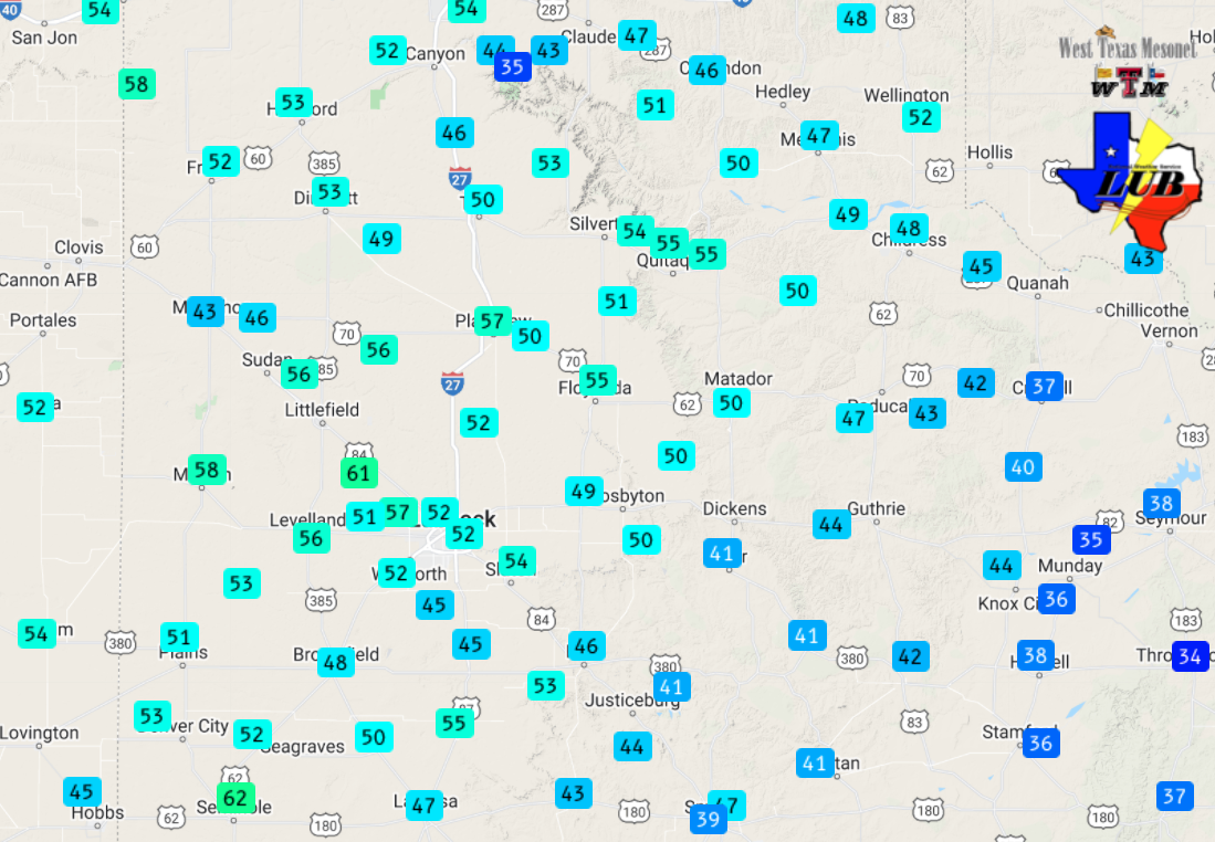
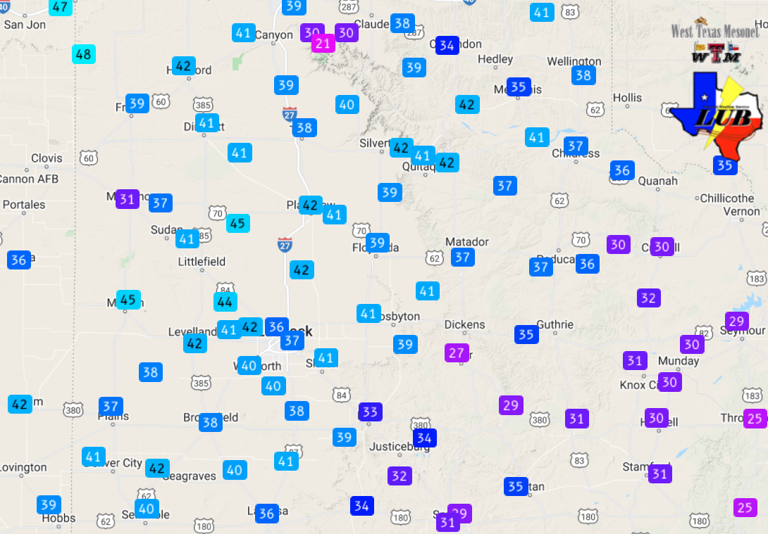
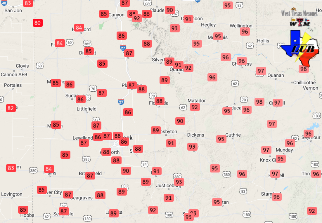
| Maximum wind gusts measured by the West Texas Mesonet on Tuesday, 12 April 2022. The peak sustained wind speeds for the day can be VIEWED HERE. High temperatures on the 12th can be SEEN HERE. | |
|
The strongest winds visited the South Plains region Tuesday afternoon and evening (12 April 2022). Wind gusts from 50 to 60 mph were common across much of the South Plains into the Texas Panhandle. The wind, in combinations with the worsening drought and warm and dry conditions, meant conditions were ripe for blowing dust and extremely critical fire weather. |
|
 |
|
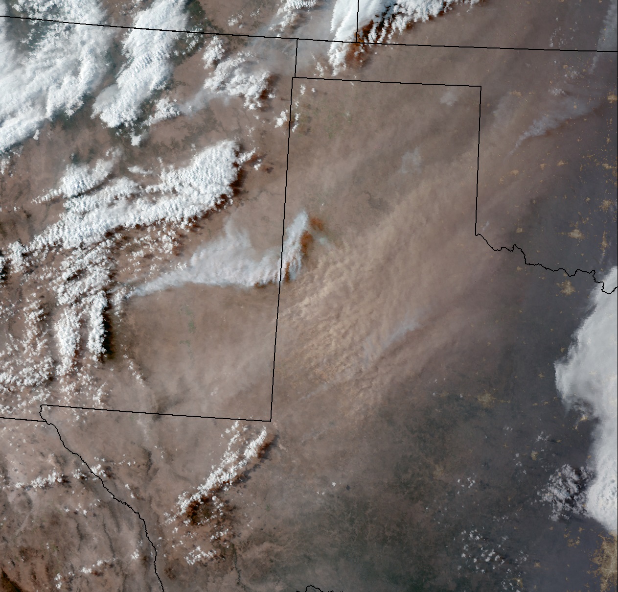
| GeoColor satellite image captured at 7:01 pm on 12 April 2022. A short animation of the "True Color" imagery around this same time can be VIEWED HERE. | |
|
Copious amounts of dust were lifted and carried across the region during the afternoon and evening hours, as it evident in the above satellite imagery. Lubbock, Childress and Plainview reported visibilities of 3 miles or less for an extended period of time as the large dust plume engulfed the region. |
|
 |
|
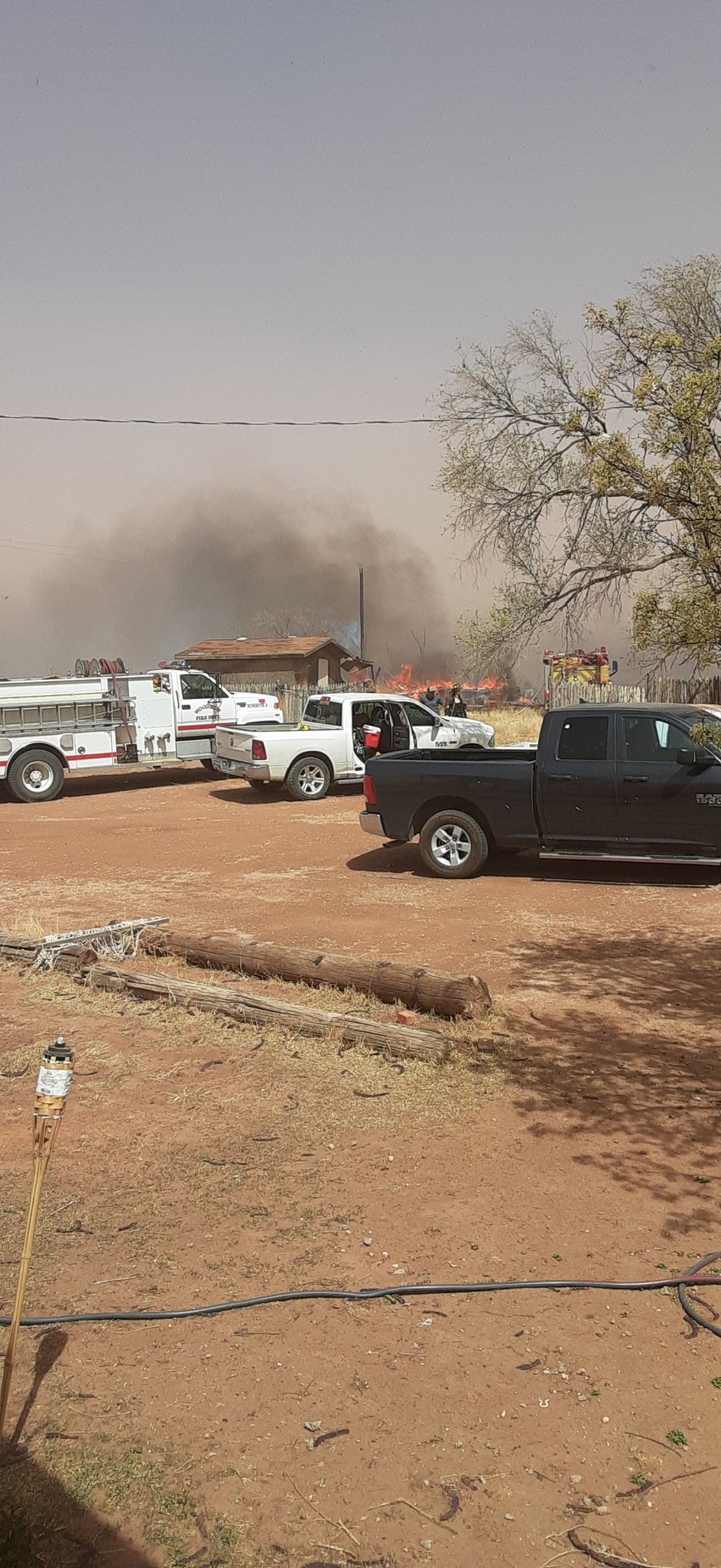
| Fire burning near Reese Center on Tuesday afternoon (12 April 2022). The image is courtesy of @KhrisRogers on Twitter. | |
|
If the dust wasn't enough of a slap in the face, the gusty, warm and dry winds also supported several wildfires locally and regionally. One fire engulfed a few structures north of Reese Center; another fire threatened several buildings on the south side of Levelland (of the north side of the airport); and a third fire burned into the south side of Plainview. A three fires where eventually contained through the evening hours. Unfortunately, a more significant fire also ignited and quickly spread around Ruidoso, in the mountains of New Mexico. Known as the McBride Fire, it killed at least 2 people and destroyed 150+ structures as of April 14th. |
|
 |
|
| "Shortwave window" infrared satellite loop valid from 7:01 pm to 7:07 pm on Tuesday (12 April 2022). The "dark spots" are hot spots where wildfires are ongoing. | |
|
Where all of the wind energy did encounter Gulf moisture, thunderstorms erupted over parts of north and central Texas. Several of these storms quickly became severe, including one that produce a number of tornadoes in central Texas. The most significant tornado caused extensive damage and injured 23 people near the community of Salado, located between Waco and Austin. Hail as large as 5.5 inches in diameter also fell out of the tornadic storm near Salado. The severe thunderstorms and tornadoes extended into parts of Louisiana, while another swath of hail, wind and tornadoes from this same large storm system impacted parts of Kansas, Nebraska, Iowa, Minnesota and Wisconsin. |
|
 |
|
| Regional radar animation valid from 6:30 pm to 7:10 pm on 12 April 2022. | |
| The preliminary storm reports collected over this windy and dusty day can be found below. | |
PRELIMINARY LOCAL STORM REPORT...SUMMARY
NATIONAL WEATHER SERVICE LUBBOCK TX
859 PM CDT TUE APR 12 2022

..TIME...   ...EVENT...      ...CITY LOCATION...     ...LAT.LON...
..DATE...   ....MAG....      ..COUNTY LOCATION..ST.. ...SOURCE....
            ..REMARKS..

1223 PM     NON-TSTM WND GST 6 SSW ANTON             33.73N 102.19W
04/12/2022  M61 MPH          HOCKLEY            TX   MESONET

            WEST TEXAS MESONET

0127 PM     NON-TSTM WND GST 6 NNE LUBBOCK           33.67N 101.82W
04/12/2022  M60 MPH          LUBBOCK            TX   ASOS

0524 PM     NON-TSTM WND GST 1 ENE MORTON            33.73N 102.74W
04/12/2022  M58 MPH          COCHRAN            TX   MESONET

            WEST TEXAS MESONET

