|
Days of Wind & Fire Weather and pockets of Rain, Storms & Snow |
|
 |
|
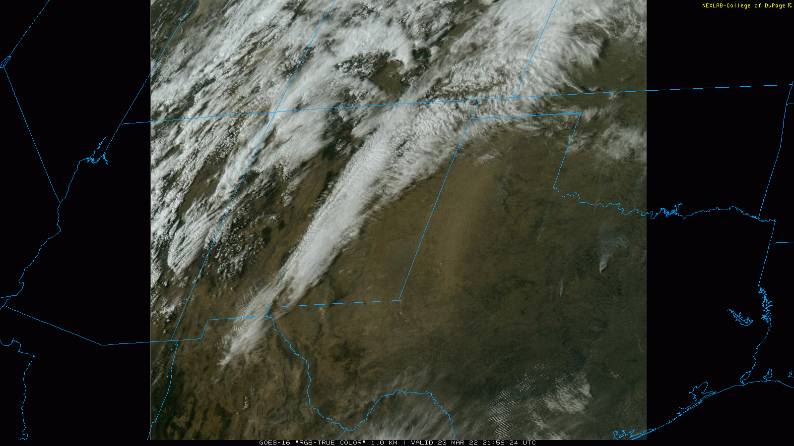
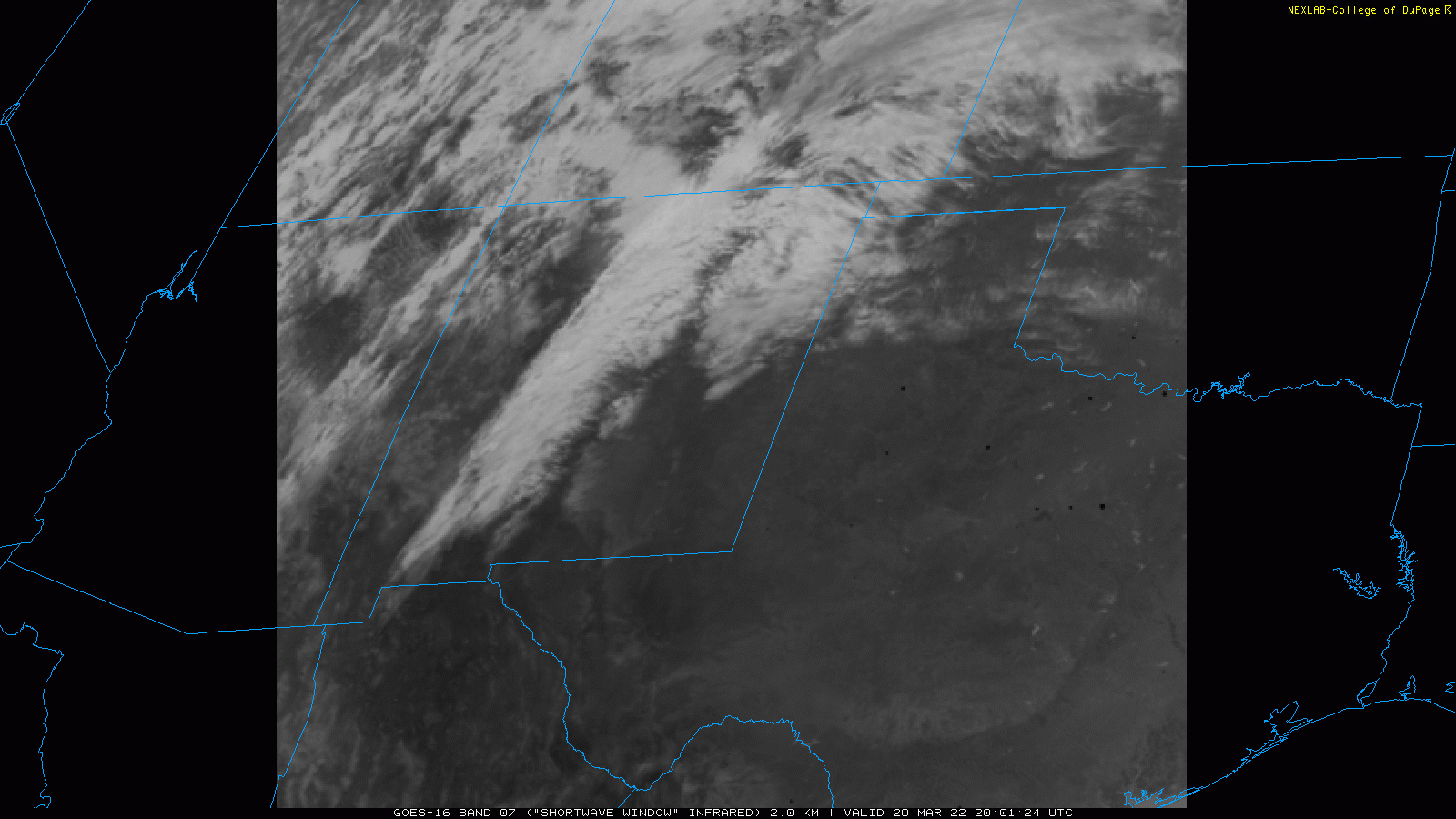
| "True Color" satellite image valid from 4:56 pm to 5:02 pm on Sunday (20 March 2022). Note the extensive dust plume moving from south-to-north across the western South Plains and Texas Panhandle. Smoke plumes from fires in the Central Texas are also obvious. A short infrared satellite loop captured around 3 pm can be VIEWED HERE. The "hot spots" (dark spots) indicate ongoing wildfires. | |
|
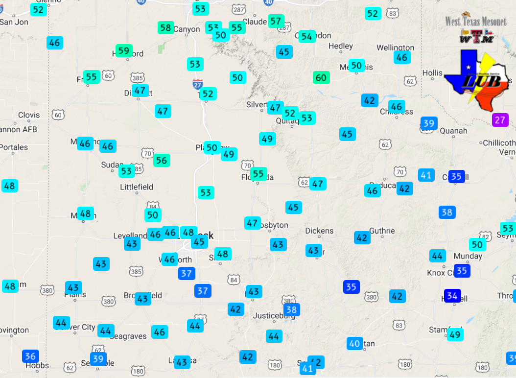
The approach and passage of a large and slow-moving upper level storm system provided a protracted period of impactful weather to West Texas in late March 2022. Initially, as the system approached through the western states, it induced strong and gusty southerly winds across the southern High Plains on Sunday (March 20th). The winds, generally sustained at 25 to 35 mph, with gusts to 45 mph, lofted plenty of blowing dust from the dry fields and lake beds and carried it northward across the central and western South Plains and Texas Panhandle. Although southerly, the winds were also very dry, which led to widespread critical fire weather that supported numerous wildfires across the region. |
|
 |
|
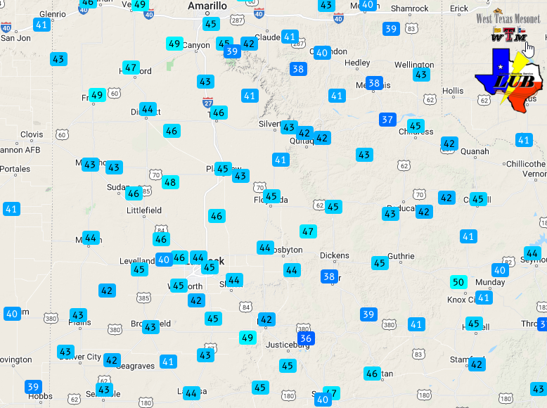
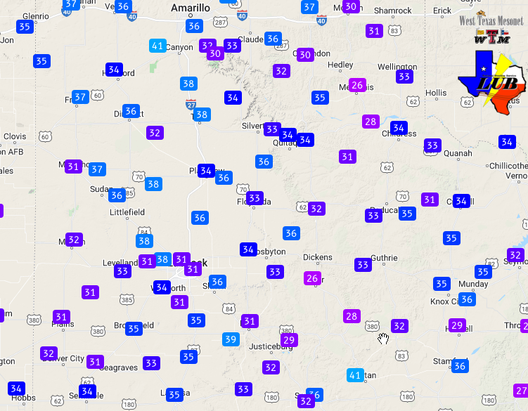
| Maximum wind gusts measured by the West Texas Mesonet on Sunday, 20 March 2022. The peak sustained wind speeds for the day can be VIEWED HERE. | |
|
The prolonged period of southerly winds eventually transported Gulf moisture northward, enveloping the South Plains by early Monday morning (March 21st), complete with a period of low clouds. These clouds gradually grew into showers and thunderstorms during the afternoon as lift from the approaching system spread over from the west. The most intense storms formed along and ahead of a dryline over parts of Central and North Texas. |
|
 |
|
| Regional radar animation valid from 2:52 pm to 3:18 pm on 21 March 2022. | |
|
Further west, a few stronger storms also developed near and immediately north of a strong cold front that plunged southward out of the Texas Panhandle and through the South and Rolling Plains Monday afternoon and evening. Small hail and brief heavy rain were reported over Caprock Canyons State Park with one of the storms, while another brought a quick inch of rain to the Aspermont area. |
|
 |
|
| Temperatures observed by the West Texas Mesonet at 6:30 pm on 21 March 2022. | |
|
More widespread precipitation filled in well behind the cold front, in an area of concentrated lift on the north and northwest side of the rotating storm system across the Texas Panhandle. The precipitation started as rain, but switched to snow as the colder air blew into the region Monday evening. The heaviest snow was concentrated in and around Amarillo where reports as high as 6+ inches were received. |
|
 |
|
| Infrared satellite loop captured valid from 8:51 pm to 9:26 pm on 31 March 2022. | |
|
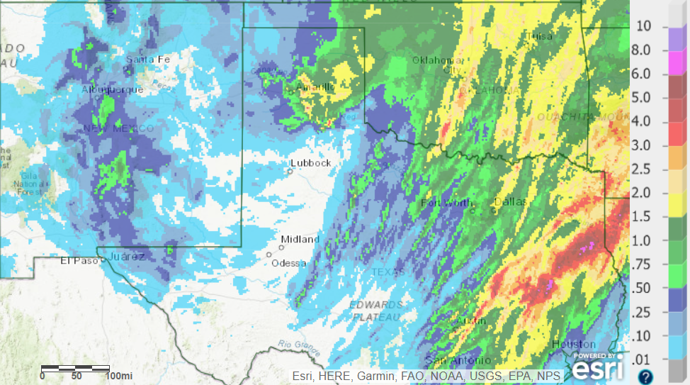
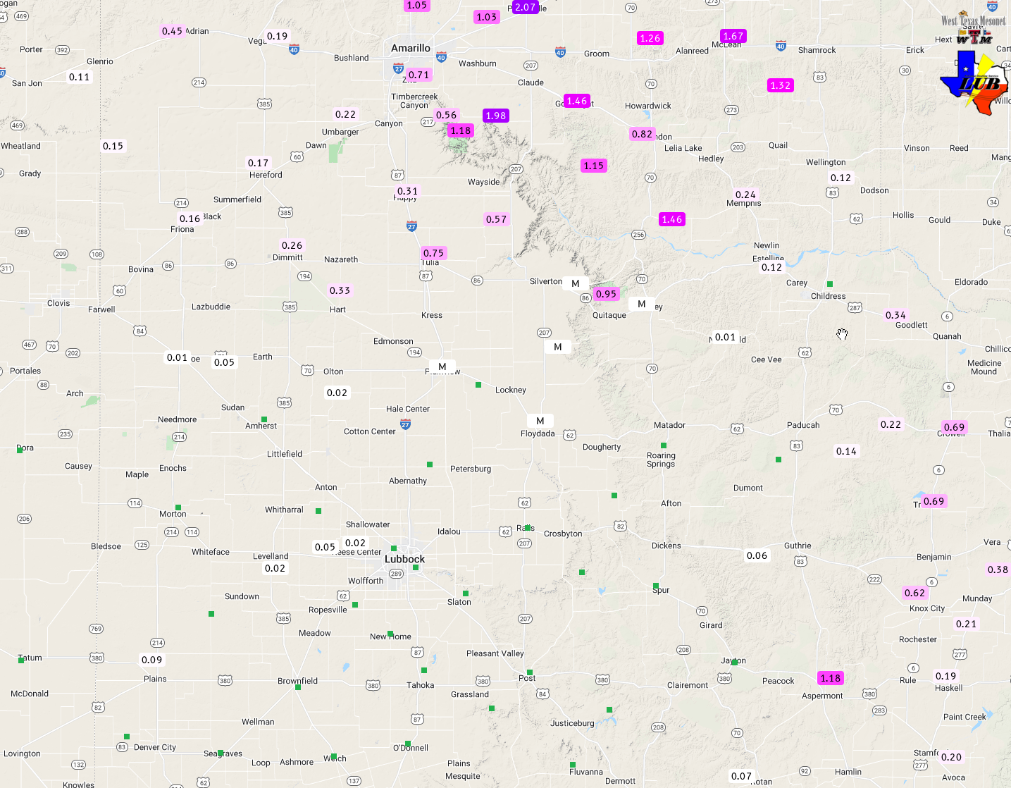
As the below map shows, the heaviest precipitation was focused over the eastern Rolling Plains and southern Texas Panhandle, with spotty light rainfall over the remainder of the South and Rolling Plains. |
|
 |
|
| 24-hour radar-estimated and bias-correct rainfall (inches) ending at 7 am on 22 March 2022. A regional view can be FOUND HERE. Measured totals from the West Texas Mesonet for this event can be VIEWED HERE. | |
|
In addition to sparking precipitation development, and quickly dropping temperatures from the 60s into the 30s and 40s, the cold front brought intense northerly winds. Winds gusted as 45 to 55 mph in many locations, while several spots measured gusts near 60 mph. All the wind did also kick up another round of dust. |
|
 |
|
| Maximum wind gusts measured by the West Texas Mesonet on Monday, 21 March 2022. The peak sustained wind speeds for the day can be VIEWED HERE. | |
|
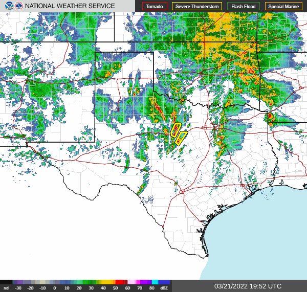
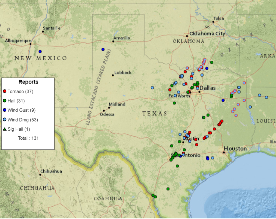
Much more widespread and heavier rainfall affected locations farther to the east, but the rainfall also came with a price. Several severe thunderstorms, including damaging tornadoes, impacted parts of Central and North Texas Monday afternoon and evening. |
|
 |
|
| Storm reports collected on Monday, 21 March 2022. | |
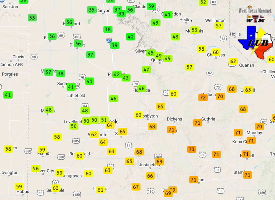
| Following the rain, snow and severe thunderstorms in Texas Monday, two additional days of strong northerly winds followed before the storm system finally moved on. Tuesday provided north winds gusting up to 50 to 60 mph at many spots. The highest gusts were concentrated around Quitaque and Turkey, where they gusted well over 60 mph during the early morning hours of the 22nd. | |
 |
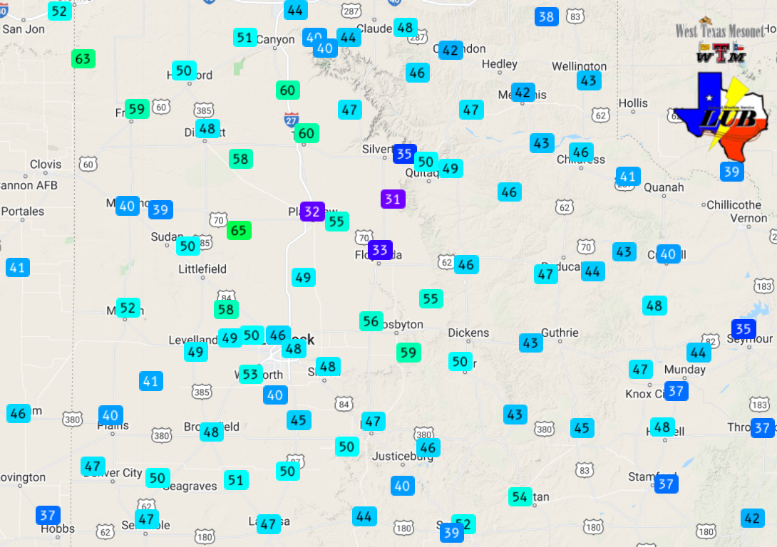 |
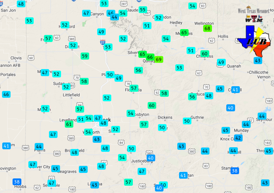
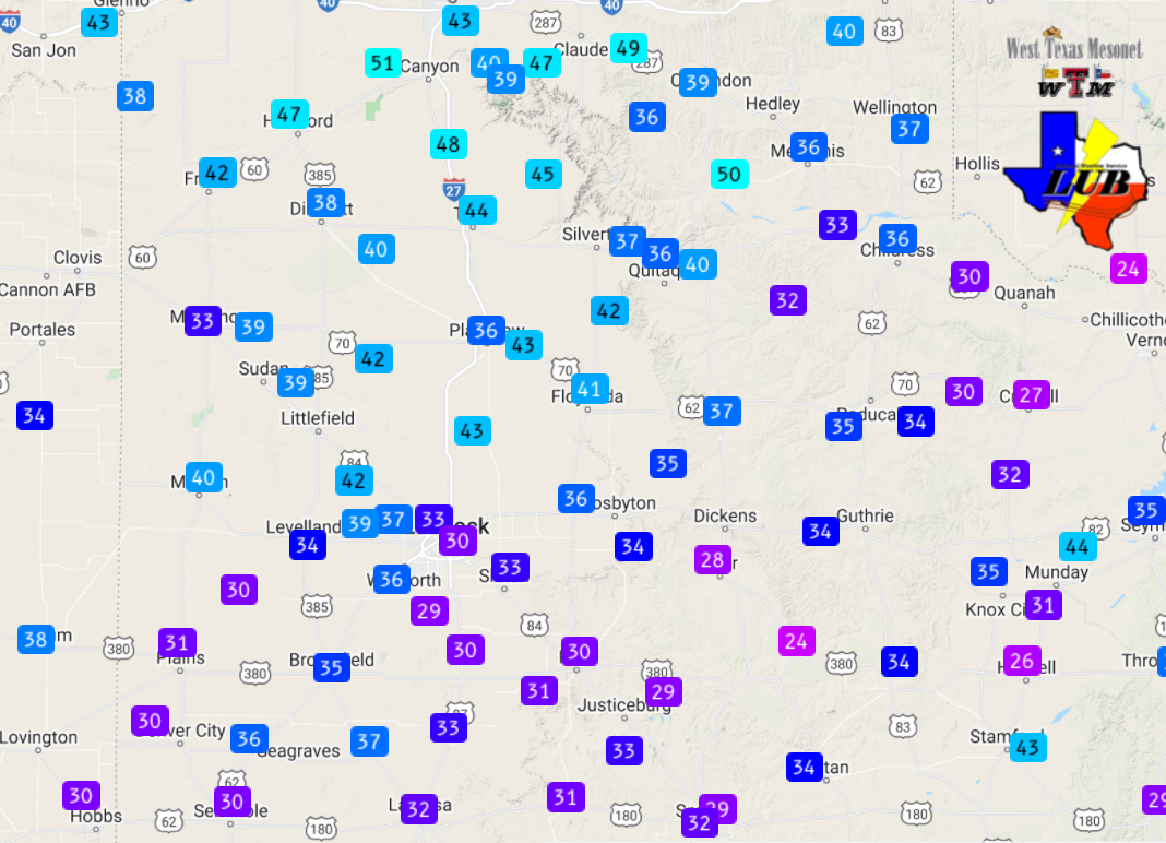
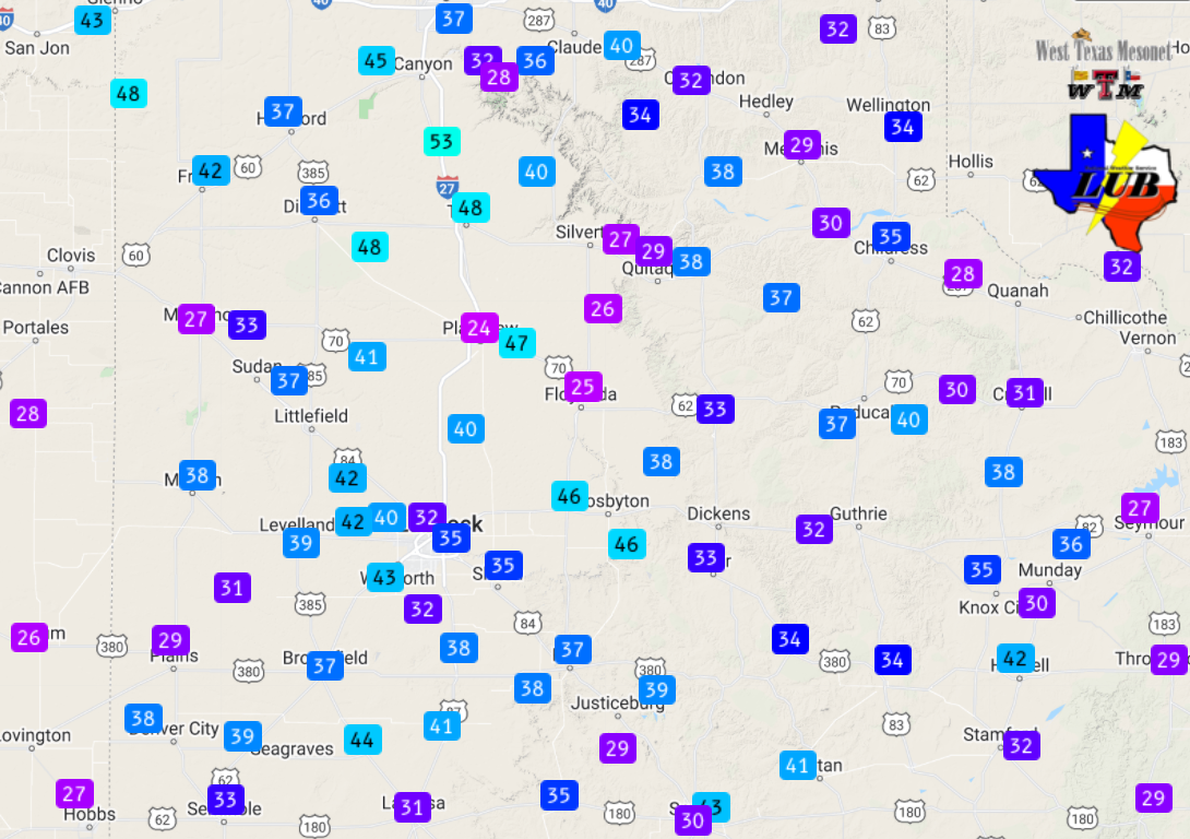
| Peak wind gusts measured by the West Texas Mesonet on Tuesday, 22 March 2022 (left) and Wednesday, 23 March 2022 (right). The maximum sustained wind speeds for the 22nd can be VIEWED HERE and for 23rd can be SEEN HERE. | |
|
The winds weren't quite as strong Wednesday morning, but received an unneeded boost during the afternoon when scattered high-based showers moved over as a final upper level impulse streamed by. These sprinkles/showers provided very little in the way of moisture at ground level, but did help enhance the wind, producing gusts near and over 60 mph at several sites on the Caprock.
The preliminary storm reports collected over this active period of weather can be found below. |
|
PRELIMINARY LOCAL STORM REPORT...SUMMARY
NATIONAL WEATHER SERVICE LUBBOCK TX
717 AM CDT WED MAR 23 2022

..TIME...   ...EVENT...      ...CITY LOCATION...     ...LAT.LON...
..DATE...   ....MAG....      ..COUNTY LOCATION..ST.. ...SOURCE....
            ..REMARKS..

0932 PM     NON-TSTM WND GST 2 S LESLEY              34.65N 100.81W
03/21/2022  M62 MPH          HALL               TX   MESONET

            WEST TEXAS MESONET

1022 PM     NON-TSTM WND GST 1 NE MEMPHIS            34.73N 100.53W
03/21/2022  M61 MPH          HALL               TX   MESONET

