|
Wind, dust and fire weather visit West Texas |
|
 |
|
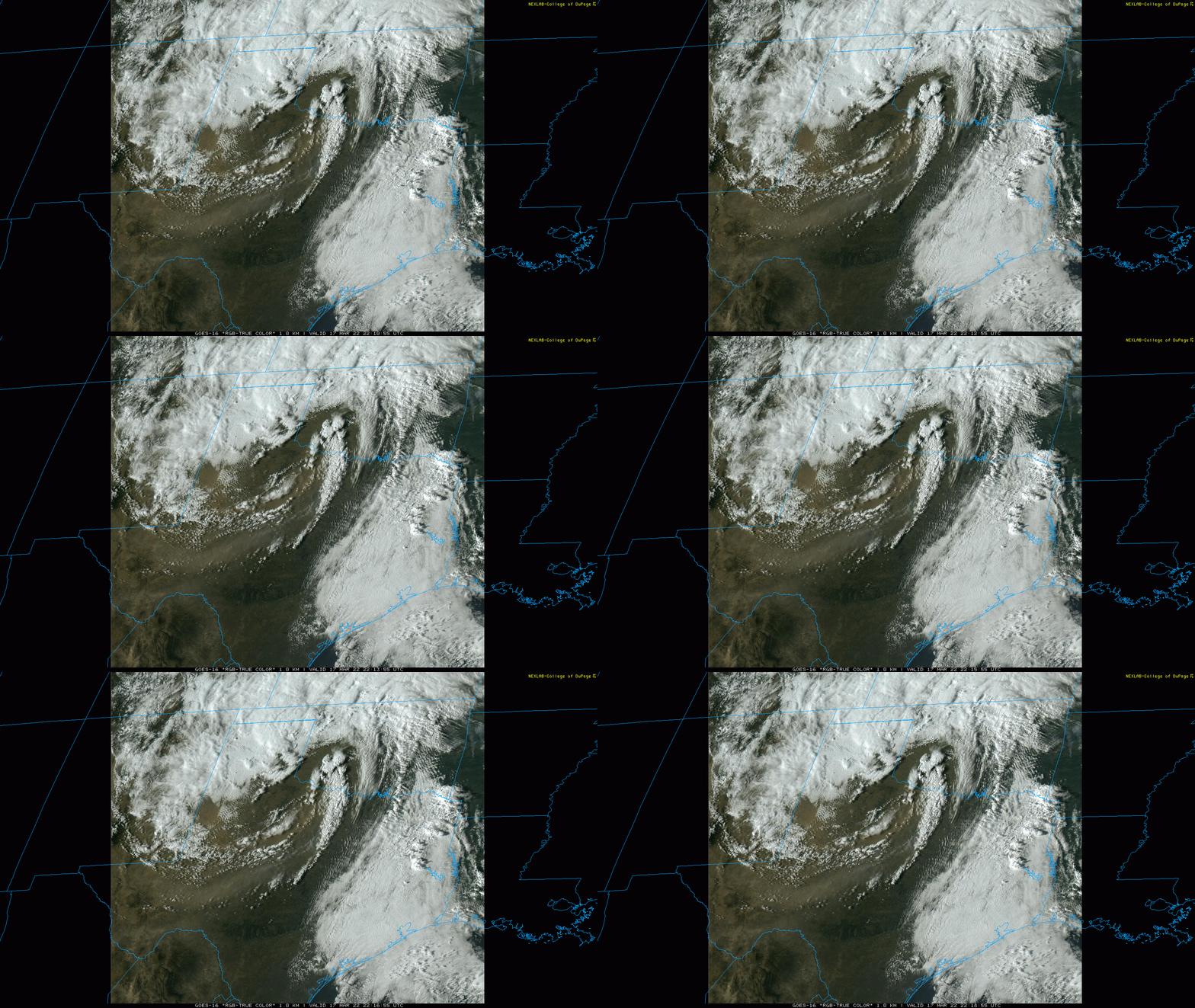
| "True Color" 1-minute satellite loop valid from 5:10 pm to 5:18 pm on Thursday (17 March 2022). | |
|
A powerful storm system emerging from the Four Corners over the southern High Plains provided strong winds and widespread blowing dust on Thursday, March 17th. Gusty and dusty westerly winds developed in the morning across the southern South Plains, ahead of a cold front. Even stronger northwesterly winds followed the cold front, which swept across the South Plains during the afternoon hours. |
|
 |
|
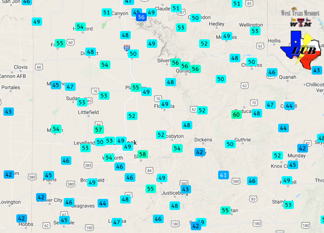
| Peak wind gusts recorded by the West Texas Mesonet (WTM) on Thursday, 17 March 2022. The peak wind speeds measured by the WTM on the 17th can be VIEWED HERE. | |
|
Wind gusts peaked in the 45 to 55 mph range at most spots Thursday afternoon and evening, though a few sites recorded gusts as high as 55 to 60 mph. The robust and persistent wind lofted copious amounts of dust, dropping the visibility below 3 miles at many locations for a couple of hours. The visibility at Lubbock officially dropped as low as 2.5 miles as the wind gusted to 58 mph. |
|
 |
|
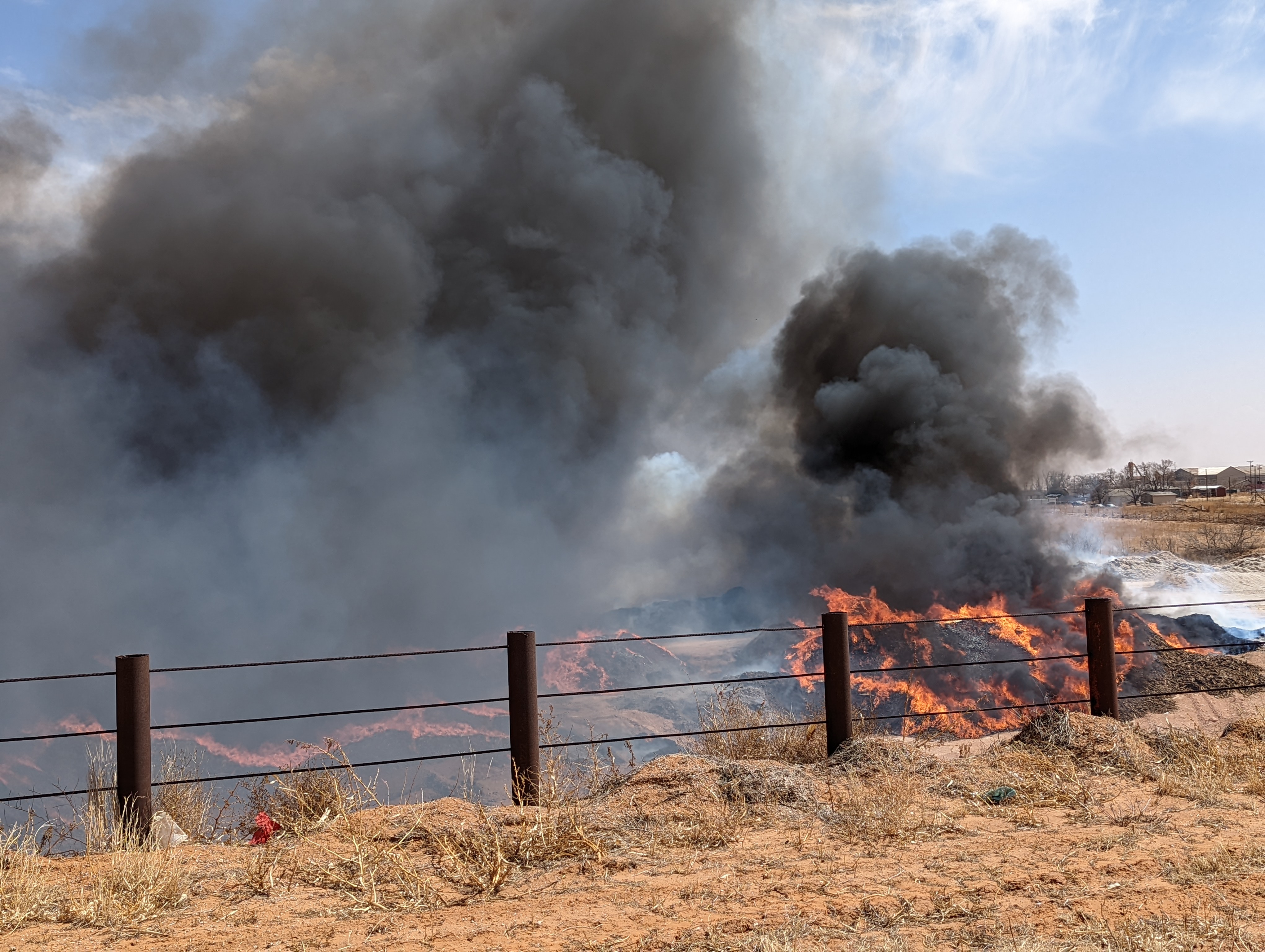
| Fire on the west side of Brownfield Thursday afternoon (17 March 2022). | |
|
Ahead of the cold front, the strong winds, in combination with warm and very dry air, also created critical to extremely critical fire weather. The dry winds fanned a fire on the west side Brownfield as well as a couple of other fires over the South and Rolling Plains. Thankfully, cooler and somewhat more moist air spilling in behind the cold front did mitigate the fire danger modestly. |
|
 |
|
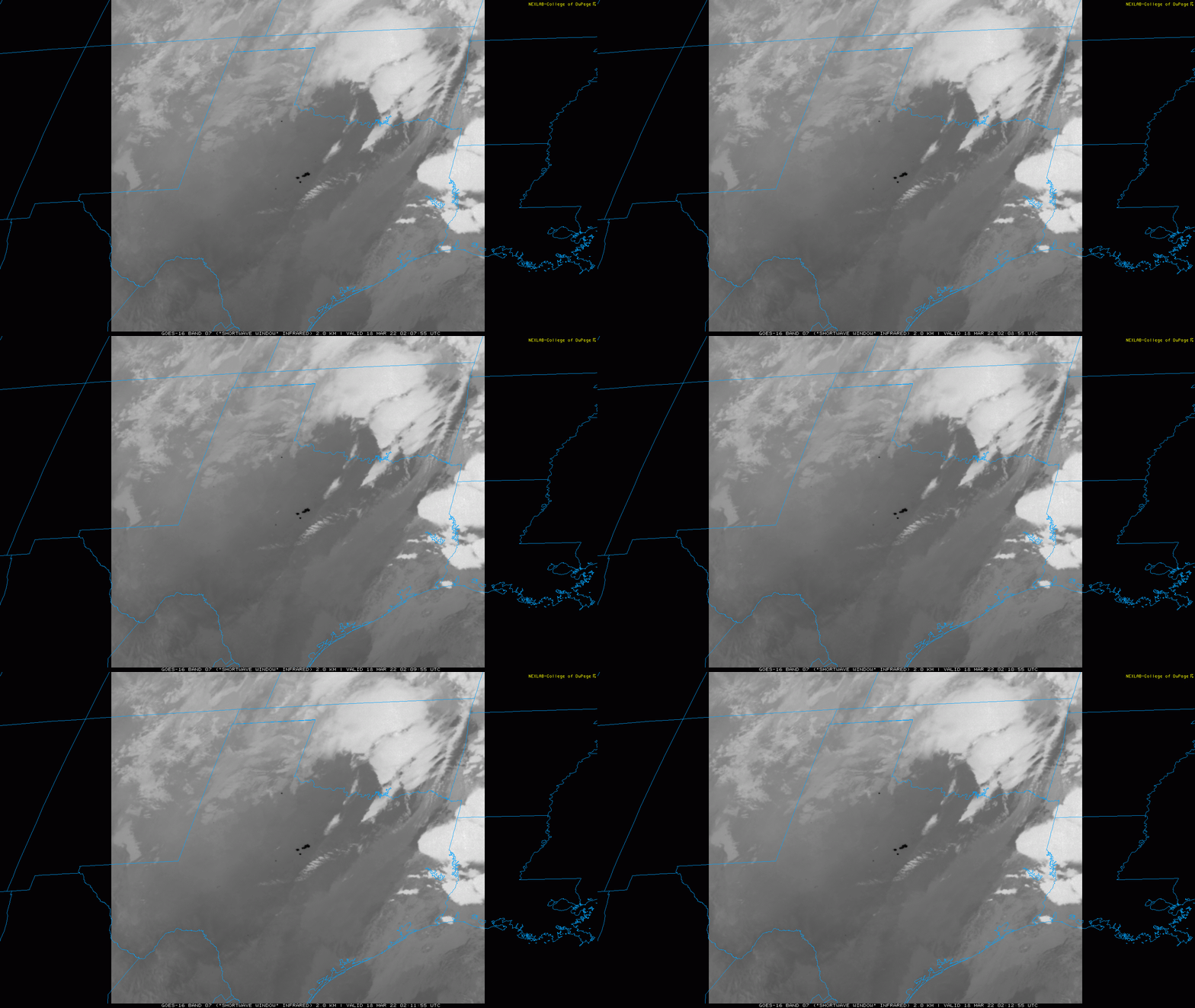
| "Shortwave Window" Infrared 1-minute satellite loop valid from 9:07 pm to 9:12 pm on Thursday (17 March 2022). | |
|
Where the warmest and driest conditions occurred, the winds fanned several intense wildfires over the central part of the state (dark spots seen on the above satellite animation). This included the Eastland Complex Fire, Kidd Fire, Wheat Field Fire and Oak Mott Fire that burned 100,000+ acres, including much of the community of Carbon, south of I-20 in Eastland County. Sadly, at least 142 structures were lost to the fires and a sheriff's deputy died while helping people evacuate the wildfires. The preliminary storm reports collected over this windy mid-March day can be found below. |
|
PRELIMINARY LOCAL STORM REPORT...SUMMARY
NATIONAL WEATHER SERVICE LUBBOCK TX
515 PM CDT FRI MAR 18 2022

..TIME...   ...EVENT...      ...CITY LOCATION...     ...LAT.LON...
..DATE...   ....MAG....      ..COUNTY LOCATION..ST.. ...SOURCE....
            ..REMARKS..

0728 PM     NON-TSTM WND GST 2 NE SLATON             33.46N 101.62W
03/17/2022  M58 MPH          LUBBOCK            TX   MESONET

            WEST TEXAS MESONET

0826 PM     NON-TSTM WND GST 10 SW PADUCAH           33.89N 100.40W
03/17/2022  M60 MPH          COTTLE             TX   MESONET

            WEST TEXAS MESONET