|
Wind & fire weather to showers & storms to bitter cold & frozen precipitation |
|
 |
|
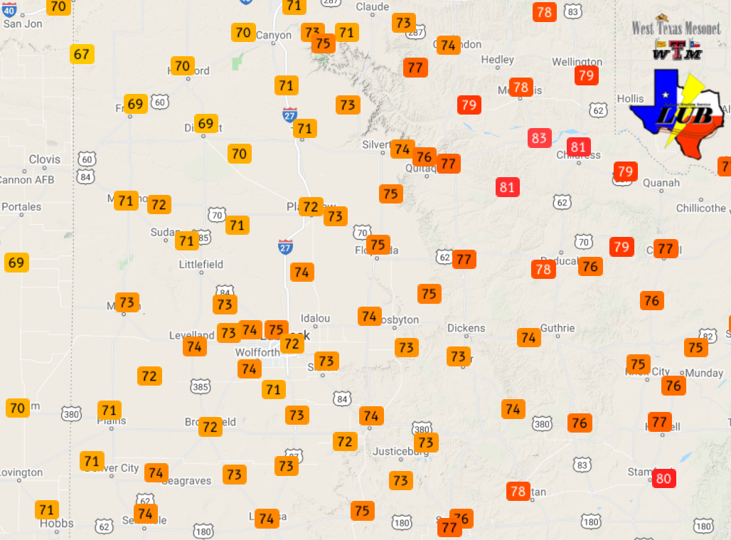
| High temperatures recorded on Monday (21 February 2022). The data are courtesy of the West Texas Mesonet. | |
|
Warm, dry and windy conditions on President's Day created widespread critical fire weather Monday afternoon (February 21st). These conditions supported the development and spread of a grassfire on the west side of Amarillo, designated the Cadillac Fire, which destroyed 4 homes and 11 outbuildings. Thankfully, nobody was injured or killed by the fire. |
|
 |
|
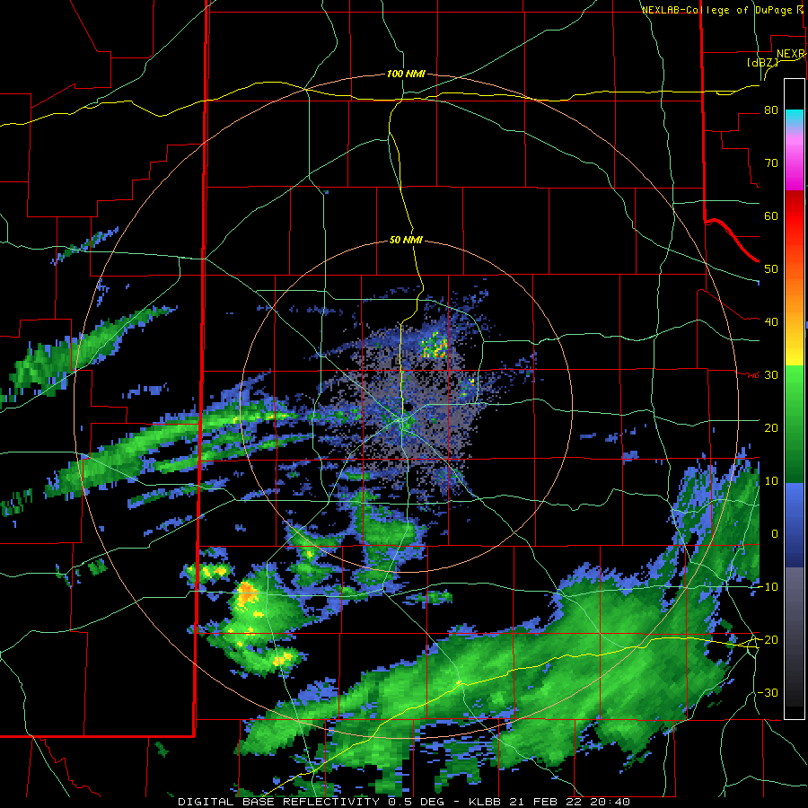
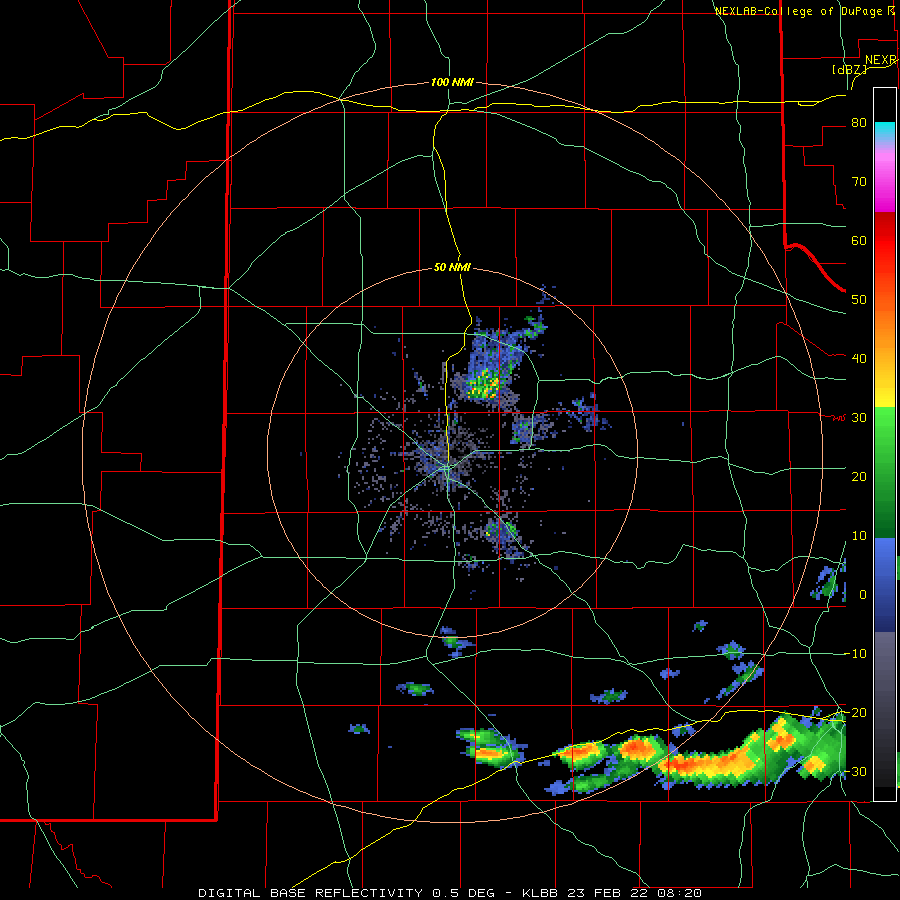
| Lubbock WSR-88D base reflectivity loop valid from 2:40 pm to 6:24 pm on 21 February 2022. | |
|
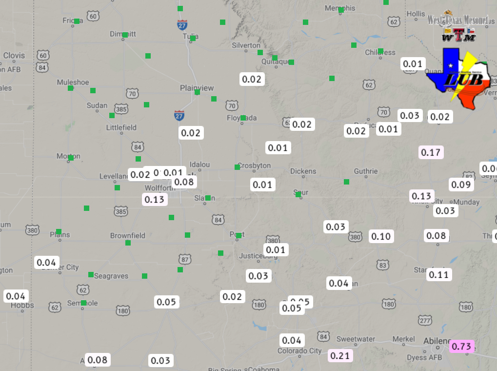
Despite the dry low-levels, a potent sub-tropical disturbance approaching the region from the west provided mid-upper level moisture and lift which was able to overcome the dry sub-cloud layer. In response, sprinkles, showers and even a few thunderstorms developed and raced northeastward across portions of the South Plains and Rolling Plains late Monday afternoon into Monday evening. In addition to locally enhancing the wind, the showers provided scattered light rainfall. Rain totals were mostly in the trace to several hundredths of an inch range, though a few locations did measure over a tenth of an inch. The rainfall recorded by the West Texas Mesonet the afternoon and evening of the 21st can be FOUND HERE. |
|
 |
|
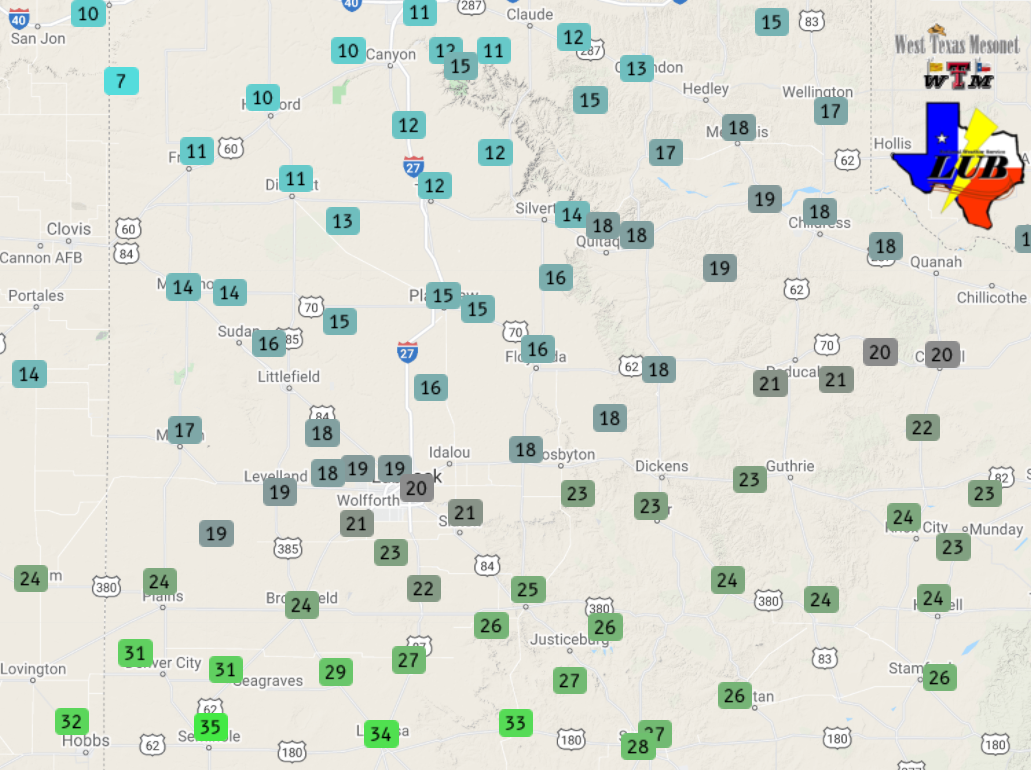
| Low temperatures observed Tuesday morning (22 February 2022) by the West Texas Mesonet. | |
|
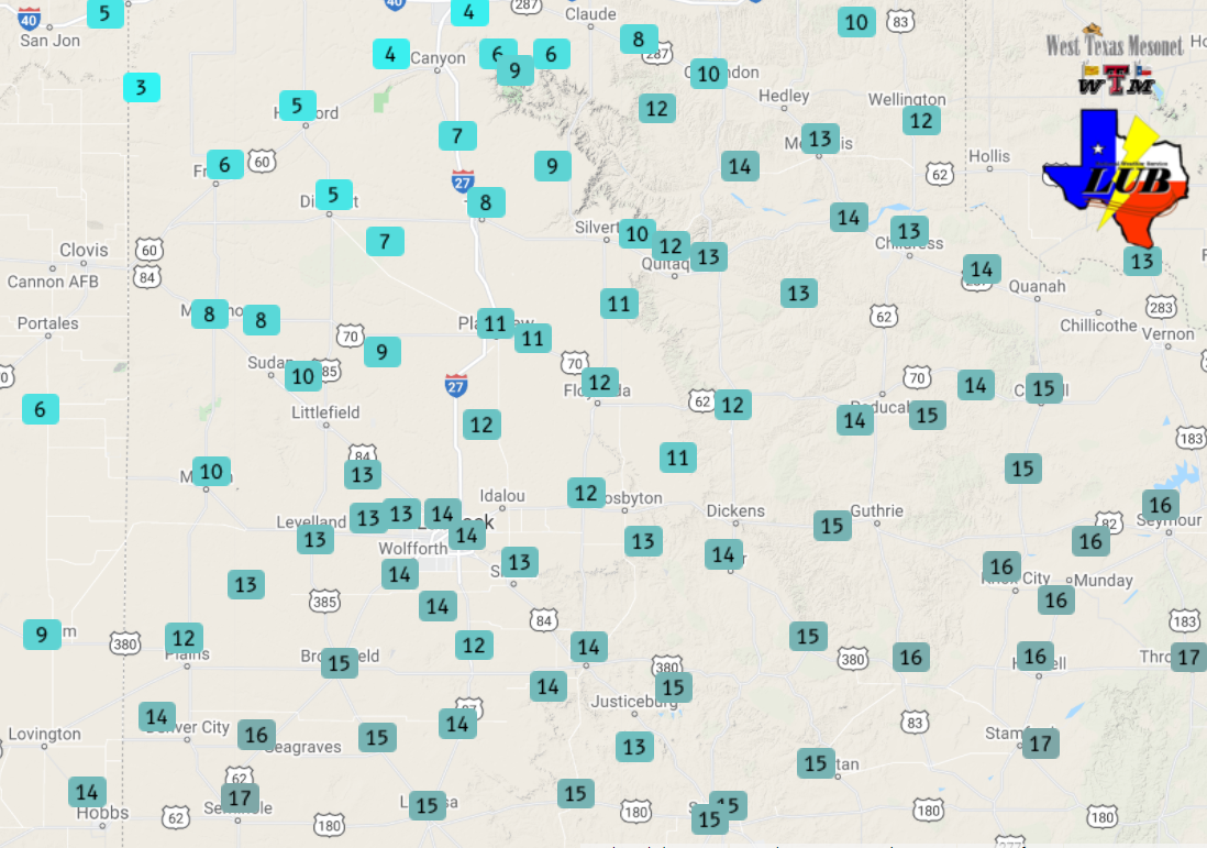
Skies cleared Monday night and the leading edge of colder air slipped into the region early Tuesday on gusty northerly winds, several hours ahead of schedule. Lows reached the teens and 20s Tuesday morning, and it felt like the single digits for many, but temperatures did recover into the upper 30s and 40s for most thanks to abundant sunshine Tuesday afternoon. Where the front was latest to move through, highs approached 60 degrees over the far southwest South Plains. |
|
 |
|
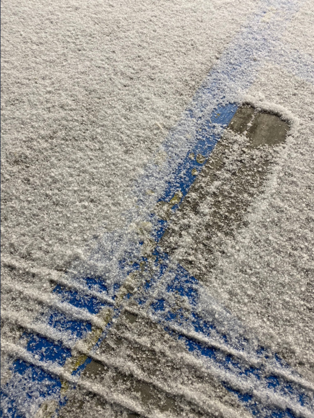
| Sleet covering the ground just to the southeast of Lubbock early Wednesday morning (23 February). The image is courtesy of Lubbock Fire and Rescue. | |
|
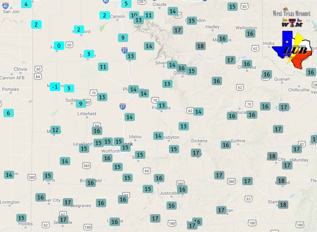
The cold air aggressively deepened Tuesday evening, and temperatures bottomed out in the singles digits across the southwest Texas Panhandle and northern South Plains, while teens were common over the remainder of the South and Rolling Plains. It felt 10 to 20 degrees colder thanks to the breezy winds. In addition, as increasingly moist air returned northward above the very cold air settling into place, elevated sleet showers and thunderstorms developed across the eastern Permian Basin late Tuesday night. This activity raced northeastward, affecting the southeast South Plains and much of the Rolling Plains early Wednesday morning. |
|
 |
|
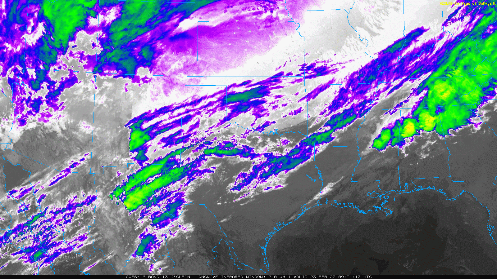
| Lubbock WSR-88D base reflectivity loop valid from 2:20 am to 10:33 am on 23 February 2022. An infrared satellite animation valid this same morning can be VIEWED HERE. | |
|
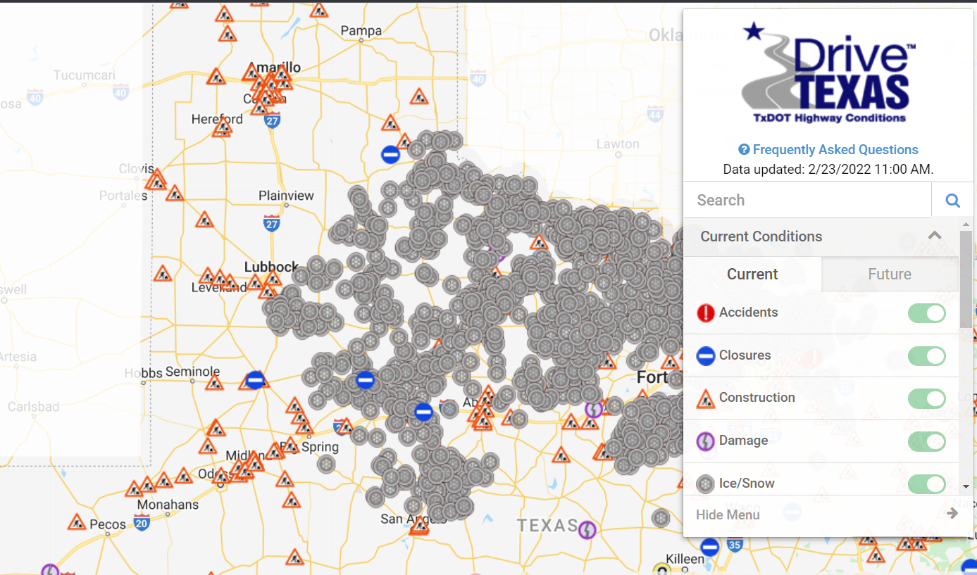
The sleet covered roadways became very slick the morning of the 23rd, generally from just southeast of Lubbock (including Slaton) eastward into the Rolling Plains and southeast Texas Panhandle, as the below map shows. |
|
 |
|
| TXDOT road conditions captured around 11 am the morning of 23 February 2022. | |
|
The wintry precipitation quickly shifted east, but clouds hung around much of the day on Wednesday and temperatures only "warmed" into the 20s at most locations. Where sunshine was a bit more prevalent, a few spots made it into the lower 30s across the western South Plains and southeast New Mexico. |
|
 |
|
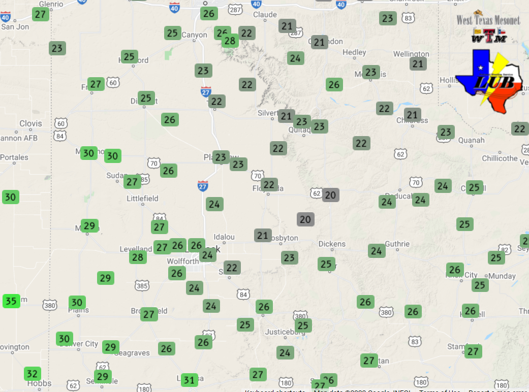
| High temperatures recorded by the West Texas Mesonet on 23 February 2022. Lows observed on either side of this cold afternoon can be found at: Lows the morning of February 23rd; and Lows the morning of February 24th. | |
|
Another cold night followed, down in the teens for most locations. Where skies remained mostly clear, across the southwest Texas Panhandle and northwest South Plains, temperatures tumbled down to around zero. Further east, clouds helped it stay "warmer" but they also brought pockets of freezing drizzle, freezing fog and light snow. The light wintry precipitation did create additional slick spots the morning of the 24th, primarily off the Caprock. |
|
 |
|
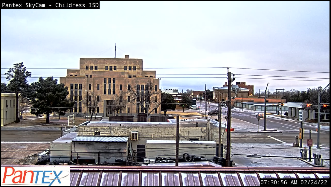
| Light frozen precipitation on the ground in Childress the morning of February 24th. The image is courtesy of Pantex. | |
| The preliminary storm reports collected over this windy, then cold and wintry stretch can be found below. |
PRELIMINARY LOCAL STORM REPORT...SUMMARY
NATIONAL WEATHER SERVICE LUBBOCK TX
911 PM CST MON FEB 21 2022

..TIME...   ...EVENT...      ...CITY LOCATION...     ...LAT.LON...
..DATE...   ....MAG....      ..COUNTY LOCATION..ST.. ...SOURCE....
            ..REMARKS..

1223 PM     NON-TSTM WND GST 3 N ROARING SPRINGS     33.94N 100.85W
02/21/2022  M60 MPH          MOTLEY             TX   MESONET

            WEST TEXAS MESONET

0226 PM     NON-TSTM WND GST 2 WSW TURKEY            34.38N 100.93W
02/21/2022  M58 MPH          HALL               TX   MESONET

            WEST TEXAS MESONET

0332 PM     NON-TSTM WND GST 2 NNE FLOYDADA          34.00N 101.33W
02/21/2022  M68 MPH          FLOYD              TX   MESONET

            WEST TEXAS MESONET

0343 PM     NON-TSTM WND GST 6 S OLTON               34.09N 102.12W
02/21/2022  M61 MPH          LAMB               TX   MESONET

            WEST TEXAS MESONET. GUST UNDER HIGH-BASED SHOWERS.

0403 PM     NON-TSTM WND GST 6 S OLTON               34.09N 102.12W
02/21/2022  M64 MPH          LAMB               TX   MESONET

            WEST TEXAS MESONET

0413 PM     NON-TSTM WND GST 1 NE AMHERST            34.02N 102.40W
02/21/2022  M58 MPH          LAMB               TX   MESONET

            WEST TEXAS MESONET

0449 PM     NON-TSTM WND GST 3 NE ASPERMONT          33.17N 100.20W
02/21/2022  M60 MPH          STONEWALL          TX   MESONET

            WEST TEXAS MESONET. GUST UNDER DECAYING HIGH-BASED
            SHOWER.

0514 PM     NON-TSTM WND GST 2 W CHILDRESS           34.43N 100.28W
02/21/2022  M60 MPH          CHILDRESS          TX   ASOS

0559 PM     NON-TSTM WND GST VIGO PARK               34.65N 101.50W
02/21/2022  M59 MPH          SWISHER            TX   MESONET

            WEST TEXAS MESONET

