|
Strong winds and blowing dust visit |
|
 |
|
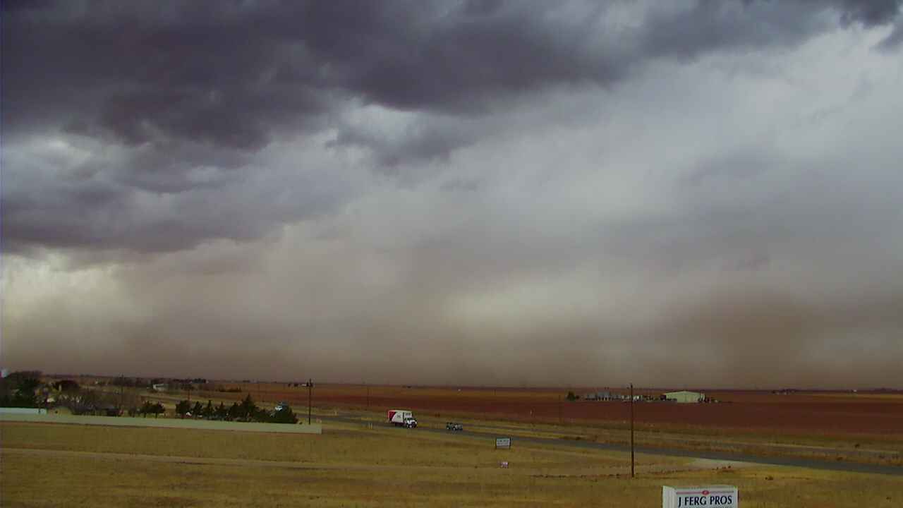
| A dusty and cloudy sky near Wolfforth Tuesday afternoon (24 November 2020). | |
|
After a couple of days of cool, cloudy and damp conditions, the weather took a dramatic twist on Tuesday (November 24th). The changeable weather was driven by a robust upper level low that rapidly approached from the Four Corners. Initially, the storm system sparked widely scattered showers and thunderstorms early Tuesday morning, well before daybreak. Spotty tenth to quarter inch rain totals were measured with the most intense storms. The big winner was the Dimmitt West Texas Mesonet site which recorded a quick 0.29 inches with the passage of an overnight thunderstorms. |
|
 |
|
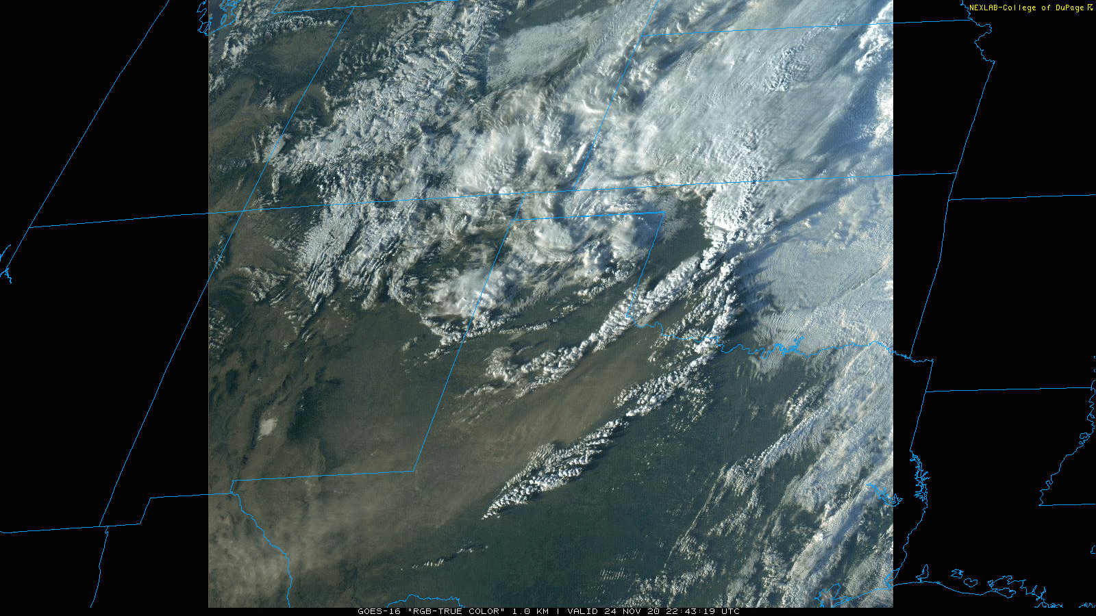
| RGB "True Color" satellite loop captured Tuesday afternoon (24 November 2020). | |
| These moist conditions quickly became a thing of the past as strong and dry westerly winds overspread the South Plains, south of the track of the upper level low, during the day on Tuesday. Westerly winds of 25 to 35 mph, with gusts to 45 mph, became common Tuesday afternoon. These strong winds kicked up dust, resulting in a red/brown hue to the skyline. | |
 |
|
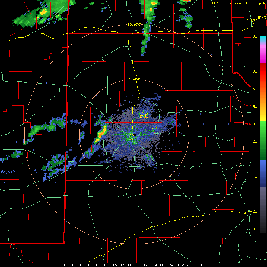
| Lubbock WSR-88D animation valid from 1:29 pm to 5:29 pm on November 24th. | |
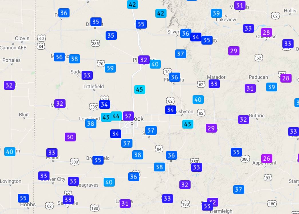
| In addition, even with the drier air moving in near ground level, strong lift and sufficient elevated moisture near the center of the storm system was enough to generate a few high-based showers. These showers tracked from west to east across the southern Texas Panhandle and northern and central South Plains Tuesday afternoon. Although very little of the moisture reached the ground, the virga showers did locally enhance the wind and dust. The Dimmitt West Texas Mesonet (WTM) site and the Abernathy WTM site recorded peak gusts of 59 and 62 mph, respectively, as the virga showers moved by. | |
 |
|
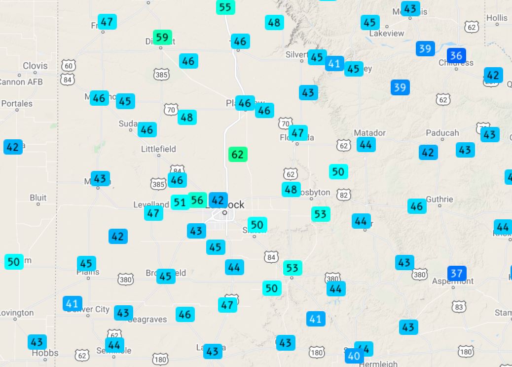
| Peak wind gusts recorded by the West Texas Mesonet on Tuesday, November 24th. The sustained wind speeds for the day can be VIEWED HERE. | |
| The winds gradually decreased toward sunset as the storm system began to shift east. However, a cold front plunging southward out of the Texas Panhandle and through the South Plains renewed the strong winds for a period, though this time they were out of the north and northwest. Eventually, the winds finally relented well behind the cold front late Tuesday night. | |
 |
|
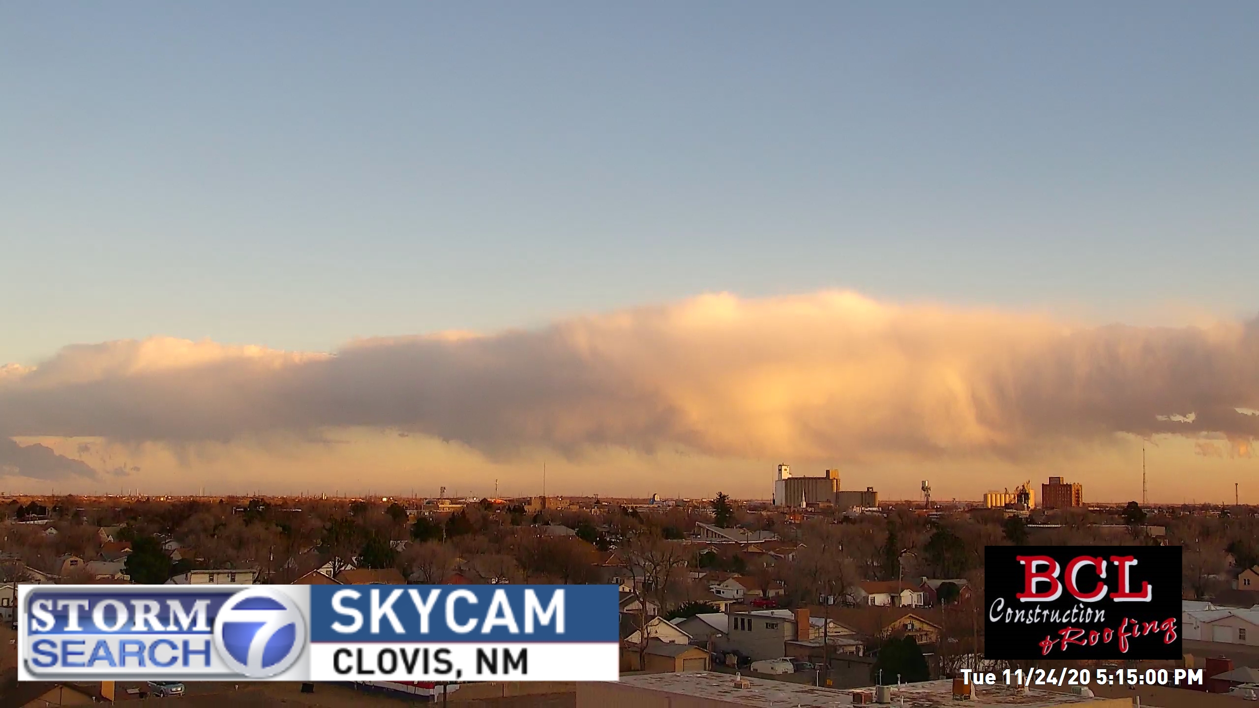
| Virga shower, as viewed from Clovis, NM, Tuesday evening. The image is courtesy of Storm Search 7. | |

