|
Strong September front ushers in record cold and areas of rain |
|
 |
|
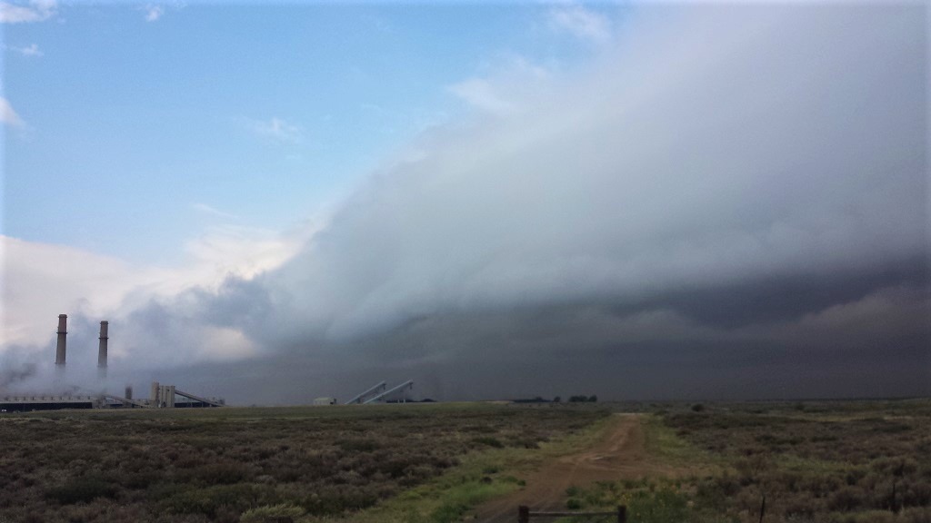
| Low clouds pouring in behind a strong cold front near Muleshoe Tuesday morning (8 September 2020). The picture is courtesy of the West Texas Mesonet. | |
|
An unseasonably strong cold front plunged through the South Plains on Tuesday, September 8th. Gusty northerly winds sustained at 25 to 35 mph carried in much colder air, with temperatures falling through the 60s, 50s and into the 40s behind the front. |
|
 |
|
| The cold air spilling into West Texas, coupled with a strong temperature inversion, generated and supported a plethora of gravity waves Tuesday morning, as can be seen above. The satellite animation is valid 10:46 am to 10:51 am on 8 September 2020. | |
| At one point during the afternoon temperatures ranged from the upper 40s across the southwest Texas Panhandle to lower 90s in the southern Rolling Plains. Clouds quickly filled in behind the front, but showers and thunderstorms didn't develop until the front reached the southern South Plains and Rolling Plains Tuesday afternoon | |
 |
|
| Lubbock radar animation valid from 2:11 pm to 3:54 pm on 8 September 2020. | |
| The storm system that provided the shot of unseasonable cold air settled into the Four Corners, where it lingered for several days. At the higher elevations, the system had enough cold air to drop significant snow in the Rockies. | |
 |
|
| Water vapor animation valid from 1:21 pm to 2:16 pm on 8 September 2020. | |
| Here over the southern High Plains, temperatures were mild enough to keep all the precipitation liquid. In fact, rounds of heavy rain affected much of Central and North Texas, including clipping the eastern part of the Rolling Plains. | |
 |
|
| Regional radar animation valid from 1:08 am to 2:18 am on 9 September 2020. An additional radar animation, valid from 4:08 am to 5:18 am on the 2nd can be VIEWED HERE. | |
| The remainder of the Rolling Plains and South Plains saw periods of light rain and drizzle Tuesday night through Thursday, though amounts were on the light side. Rain totals of several hundredths to a couple of tenths of an inch rain were common on the South Plains. Where the steadier and heavier rain fell, several inches accumulated along and east of a Vernon to Aspermont to Colorado City. The Aspermont West Texas Mesonet site recorded an impressive 5.79 inches, while Lubbock officially recorded 0.23 inches (which was more than most of the city). | |
|
|
|
 |
|
| 7-day radar-estimated and bias corrected rainfall ending at 7 am on Thursday (10 September 2020). A close up view of the South Plains region can be ACCESSED HERE. The West Texas Mesonet measured 3-day rainfall totals, ending at 3 am on Friday (11 September) can be FOUND HERE. | |
|
More impressive than the rain (for most of the South Plains region) was the record setting cold. Lubbock set three consecutive record lows September 8th, 9th and 10th, when the temperatures dipped to 45 degrees, 41 degrees and 43 degrees, respectively. |
|
 |
|
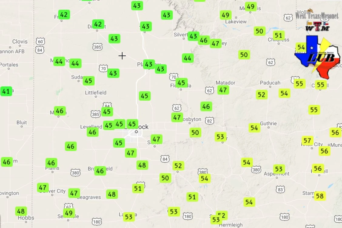
| High temperatures recorded by the West Texas Mesonet on Wednesday (9 September 2020). To view the highs on the adjacent days click on the following links: Tuesday (8 September) and Thursday (10 September). | |
| Even more shocking, highs on the 9th only rose into the 40s and lower 50s. Lubbock officially recorded a high of 46 degrees, which would have broken the previous record low for the day. This shattered the previous record for the low maximum for the date (65 degrees, set in 1995), | |
 |
|
| Low temperatures recorded by the West Texas Mesonet on Wednesday (9 September 2020). Lows the following day, Thursday, can be FOUND HERE. | |
| Several locations across the southwest Texas Panhandle and northwestern South Plains dipped in the 30s over this cold stretch, though thankfully everyone escaped a frost or freeze. | |
 |
|
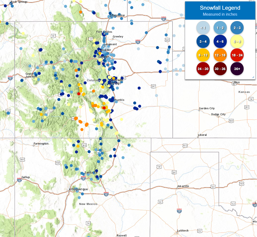
| Snow totals across the central and southern Rockies from early September (8-10 September 2020). | |
| Where it was colder, snow totals of a foot or more were common over the central and southern Colorado Rockies. | |

