|
Widespread rain and isolated severe storms |
|||||||||||
 |
|||||||||||
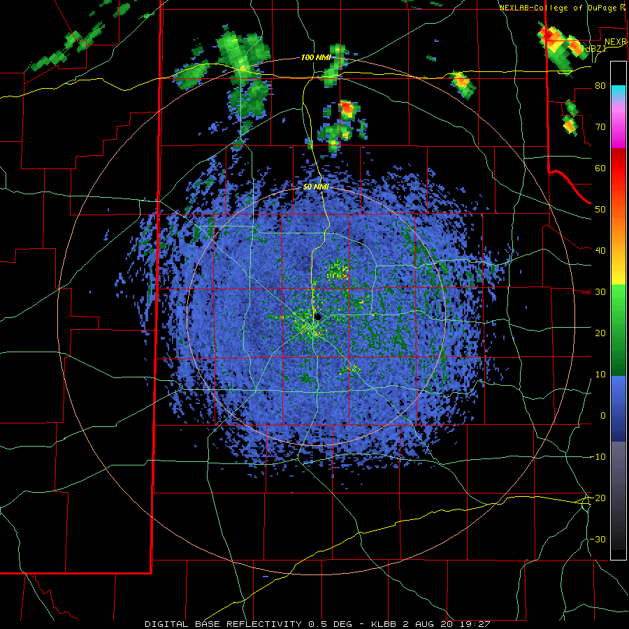
| Lubbock WSR-88D radar animation valid from to 2:27 pm to 8:22 pm on 2 August 2020. | |||||||||||
|
Hot temperatures, sufficient moisture and a weak passing upper level disturbance provided a couple of rounds of thunderstorms for the South Plains region from Sunday afternoon and evening into early Monday morning (2-3 August). As temperatures peaked near 100 degrees, scattered thunderstorms formed across the southeastern Texas Panhandle. This activity moved south-southeastward through the evening hours, dropping locally heavy rain and generating isolated severe wind gusts across the Rolling Plains. |
|||||||||||
 |
|||||||||||
| Meteorgram from the White River Lake 6NW West Texas Mesonet site on Sunday, 2 August 2020. | |||||||||||
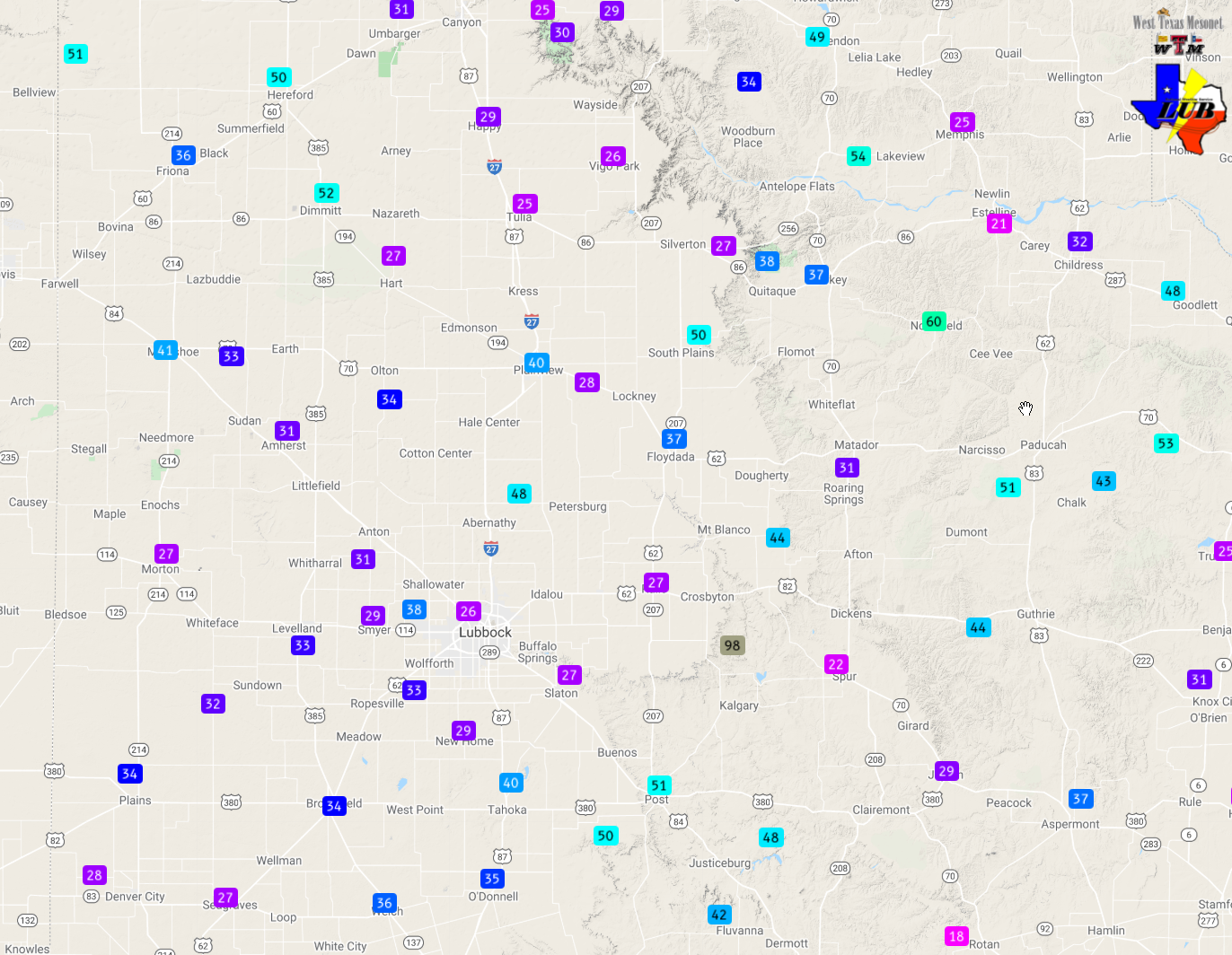
| One storm produced a 60 mph wind gust as it moved across the Northfield West Texas Mesonet, while another storm generated a 98 mph gust as it moved over the White River Lake Mesonet located 6 miles northwest of the community of White River Lake. This extreme gust was accompanied by very intense rain, dropping 1.11 inches of rain, much of which fell in 15 minutes. Thankfully the extreme wind was localized and did no known damage. | |||||||||||
 |
|||||||||||
| Regional radar animation valid from 8:28 pm to 9:38 pm on 3 August 2020. | |||||||||||
|
|||||||||||
| In total, most of the region received at least a little rain between Sunday afternoon and Monday morning. The heaviest rain, in excess of an inch, fell in narrow swaths over parts of Cottle, Crosby and Garza Counties. Most spots on the Caprock measured a tenth to half inch of rain, with locally higher amounts. | |||||||||||
 |
|||||||||||
| 24-hour radar-estimated and bias-corrected rain totals ending at noon on 3 August 2020. The 24 hour rain totals measured by the West Texas Mesonet can be VIEWED HERE. | |||||||||||
|
The preliminary storm reports for this early August event can be viewed below. |
PRELIMINARY LOCAL STORM REPORT
NATIONAL WEATHER SERVICE LUBBOCK TX
623 PM CDT SUN AUG 02 2020

..TIME...   ...EVENT...      ...CITY LOCATION...     ...LAT.LON...
..DATE...   ....MAG....      ..COUNTY LOCATION..ST.. ...SOURCE....
            ..REMARKS..

0550 PM     TSTM WND GST     1 S NORTHFIELD          34.27N 100.60W
08/02/2020  M60 MPH          MOTLEY             TX   MESONET

            MEASURED BY THE WEST TEXAS MESONET

0555 PM     TSTM WND GST     6 NW WHITE RIVER LAKE   33.53N 101.17W
08/02/2020  M70 MPH          CROSBY             TX   MESONET

            MEASURED BY THE WEST TEXAS MESONET

0605 PM     TSTM WND GST     6 NW WHITE RIVER LAKE   33.53N 101.17W
08/02/2020  M98 MPH          CROSBY             TX   MESONET

            MEASURED BY THE WEST TEXAS MESONET. ADDITIONALLY, A
            WIND GUST OF 82 MPH WAS OBSERVED AT 6 PM AND 70 MPH AT
            555 PM.

