| July 2020 starts on an unsettled note 2-6 July 2020 |
|
 |
|
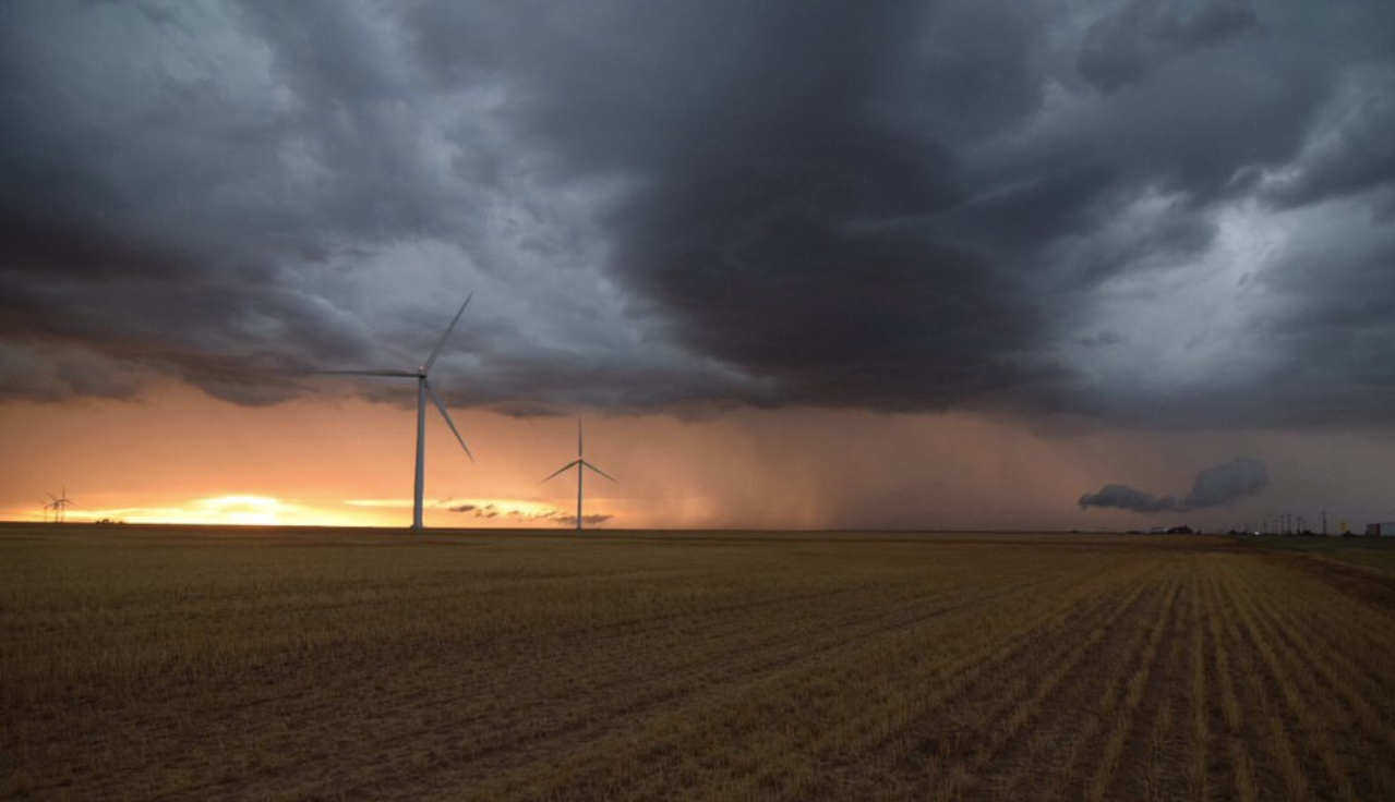
| Storms approaching Friona from the west Sunday evening. The image is courtesy of Chad Casey. | |
|
Early July 2020 provide a several unsettled days of weather. The first few days of the month shower and thunderstorm coverage was limited, but a few select spots did receive beneficial rains. Vigo Park found itself under a small but intense storm on Thursday, July 2nd, and picked up a quick 3 inches of rain in about 90 minutes while also recording a 56 mph wind gust. |
|
 |
|
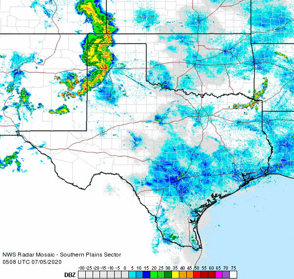
| Regional radar animation valid from 12:08 am to 1:18 am on 5 July 2020. Additional regional radar animations can be viewed at: 10:58 pm on 4 July to 12:08 am on 5 July; 2:18 am to 3:28 am on 5 July; and 3:48 am to 4:58 am on 5 July 2020. | |
| The thunderstorm activity became more widespread late on July 4th, after most people finished celebrating Independence day. A line of showers and thunderstorms advanced out of eastern New Mexico during the late evening hours, weakening but continuing over much of the South Plains and Rolling Plains through the early morning hours of the 5th. This line of storms brought gusty winds and widespread light to moderate rainfall. | |
 |
|
| Developing storm over southeast Lubbock Sunday evening (5 July). The image is courtesy of Weather Intercepts. | |
|
Scattered thunderstorms redeveloped over the South Plains again on the evening of the 5th (Sunday). This activity moved slowly south and eastward through the early morning hours of the 6th. This activity was generally sub-severe, but the slow movement, combined with rich moisture, resulted in localized tropical downpours. |
|
 |
|
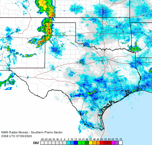
| Regional radar animation valid from 11:08 pm on 5 July to 12:18 am on 6 July 2020. Additional regional radar animations can be viewed at: 7:58 pm to 9:08 pm on 5 July; and 2:18 am to 3:28 am on 6 July 2020. | |
| Over the course of the first week of July, most of the region saw a little rain, while several spots recorded 1 to 3+ inches. Officially the Lubbock Airport measured 1.05 inches in early July, most of which fell during a quick and localized downpour on the evening of the 5th. Unfortunately the heart of the city of Lubbock missed out on this heavier downpour, generally recording one to two tenths of an inch of rain during this stretch. The Childress Airport recorded 1.29 inches the first week of July. | |
 |
|
| 7-day radar-estimated and bias-corrected rainfall ending at 3 am on 7 July 2020. Observed rain total over this same stretch, as measured by the West Texas Mesonet, can be VIEWED HERE. | |

