| Mid-April bring storms, wind, a freeze and snow 10-14 April 2020 |
|||||||||||
 |
|||||||||||
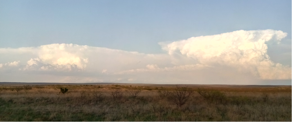
| Looking east from near the Pitchfork Ranch (west of Guthrie) on Saturday evening (11 April 2020). | |||||||||||
|
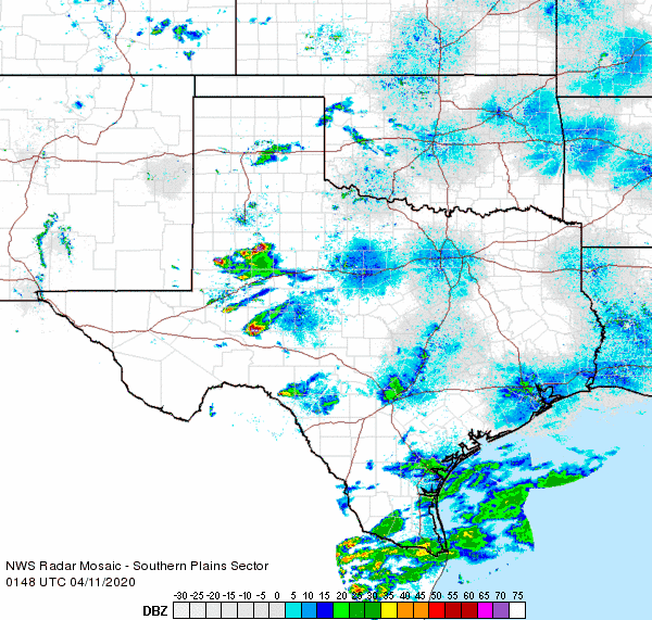
Mid-April 2020 brought active and changeable weather to the West Texas region. Initially, Friday evening (April 10th), several severe thunderstorms developed across the Permian Basin as Gulf moisture gradually moved into the region. A few of these storms raced northeastward into the southeast South Plains and western Rolling Plains before falling apart. One of the storms did drop nickel size hail 7 miles southeast of Post before rapidly weakening. Additional non-severe showers and thunderstorms provided a little bit of rain for a couple of spots across the northwest South Plains and southwest Texas Panhandle late Friday afternoon into the early evening hours. |
|||||||||||
 |
|||||||||||
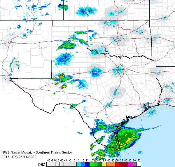
| Regional radar animation valid from 7:18 pm to 8:28 pm on 10 April 2020. An additional regional radar animation, valid from 8:48 pm to 9:58 pm, can be VIEWED HERE. | |||||||||||
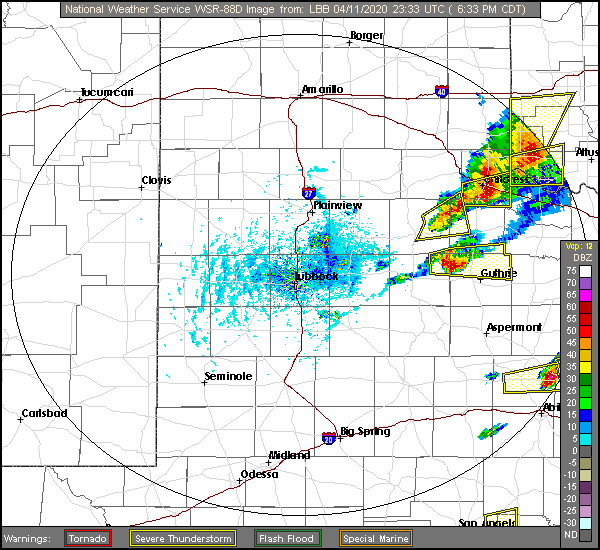
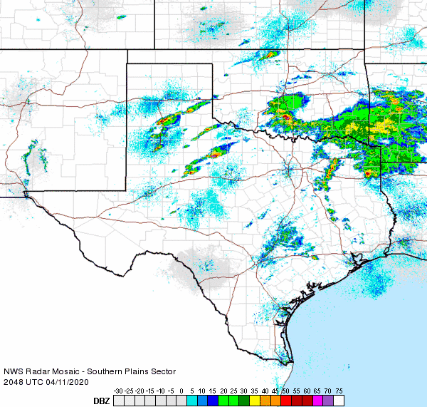
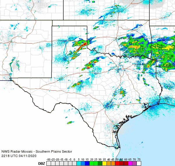
| The next morning started on the cloudy and mild side, but did give way to partly cloudy skies. The return of sunshine helped temperatures climb into the 70s and 80s, and coupled with a diffuse dryline and passing upper level disturbance, scattered strong to severe thunderstorms formed during the late afternoon hours. The activity formed across the south-central Texas Panhandle into the central South Plains, then tracked east-northeastward through the evening. Additional severe storms also affected the southern Rolling Plains into the Big Country during the afternoon hours. | |||||||||||
 |
|||||||||||
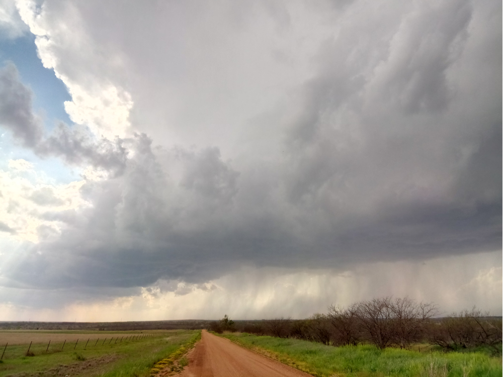
| Thunderstorm developing just west of Dickens on Saturday afternoon (11 April 2020). | |||||||||||
|
|||||||||||
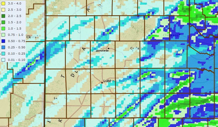
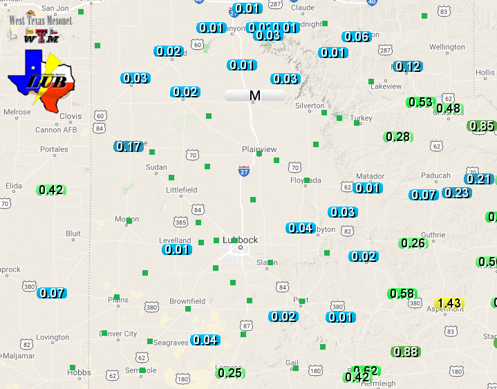
| Rainfall from the thunderstorms was spotty and most concentrated off the Caprock. Aspermont was the big winner, recording 1.43 inches at the West Texas Mesonet site just northeast of town. The heaviest rain, over an inch, was confined to a few narrow swaths in the Rolling Plains. Officially, Lubbock only recorded a trace of precipitation, while Childress measured 0.64 inches. | |||||||||||
 |
|||||||||||
| 2-day rain totals ending at 2 pm on 12 April 2020. The precipitation totals measured by the West Texas Mesonet over this same period can be VIEWED HERE. | |||||||||||
|
Easter Sunday started on the mild side for most locations, but a strong cold front moved southward through the region during the day. The front brought sharply colder air into the South Plains on gusty northerly winds. Sustained northerly winds peak near or above the 30 mph mark during the day, with gusts as high as 40-50 mph. |
|||||||||||
 |
|||||||||||
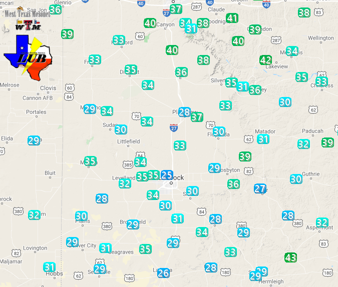
| Maximum sustained wind speeds recorded by the West Texas Mesonet sites on Sunday (12 April 2020). The peak wind gusts for the 12th can be FOUND HERE. | |||||||||||
| Temperatures tumbled behind the front and bottomed out in the 20s and lower 30s by early Easter Monday (13 April). Although not record cold, many locations did experience a freeze slightly after their average last freeze date, thereby shorting the growing season on the front end. | |||||||||||
 |
|||||||||||
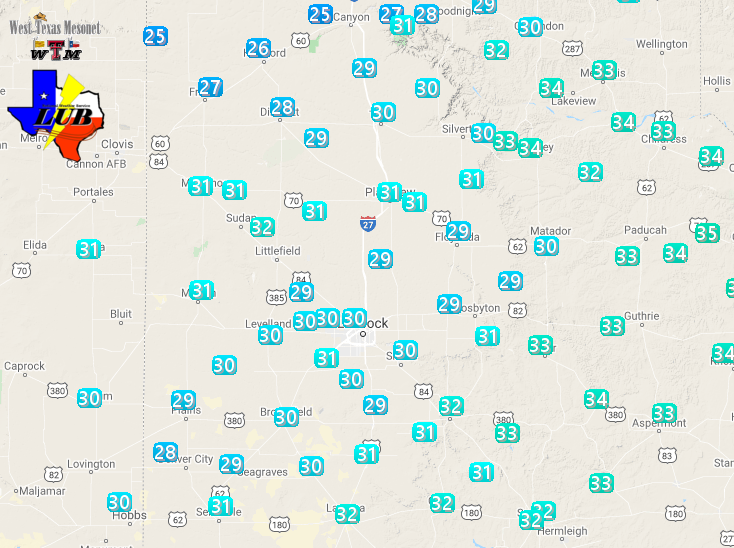
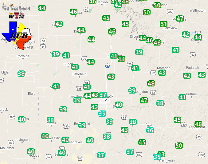
| Low temperatures measured by the West Texas Mesonet Monday morning (13 April 2020). | |||||||||||
| The cold air lingered in the region through Tuesday and early Wednesday, with many locations experiencing freezes the next couple of mornings too. To add insult to injury, a passing mid-level storm system proved potent enough to squeeze out a swath of snow that affected much of the southern Texas Panhandle and northern South and Rolling Plains. | |||||||||||
 |
|||||||||||
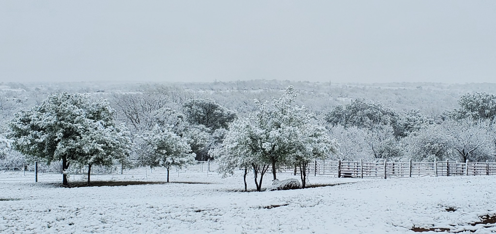
| Captured just south of Estelline on Tuesday morning (14 April 2020). The picture is courtesy of Farrah Holcomb. | |||||||||||
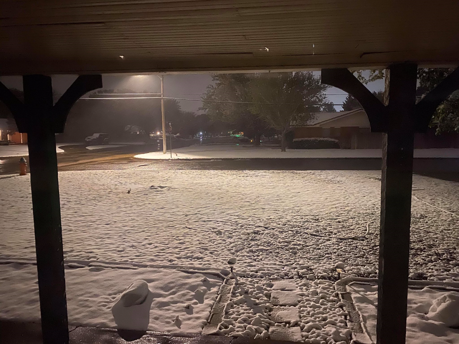
| The snow did create pretty landscapes more reminiscent of winter. However, the snow didn't stick around, melting off during the afternoon as temperatures recovered into the 40s. | |||||||||||
 |
|||||||||||
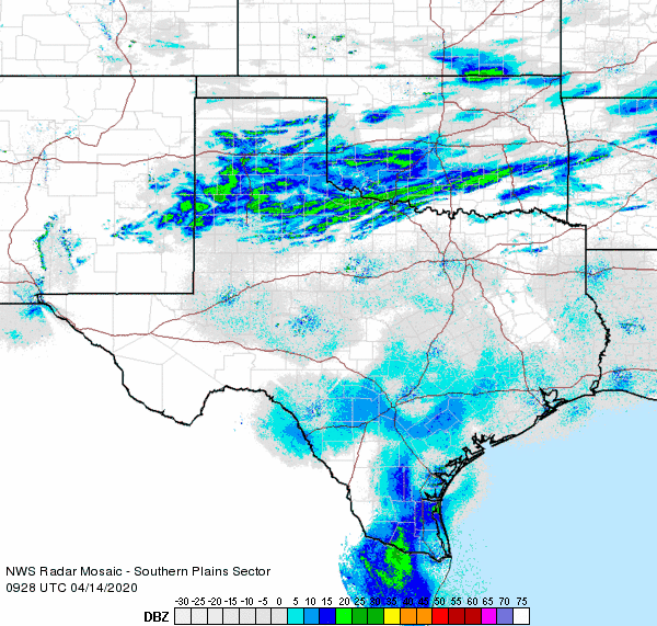
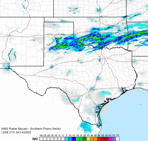
| Regional radar animation valid from 4:28 am to 5:38 am on 14 April 2020. An additional regional radar animation, valid from 7:08 am to 8:18 am, can be VIEWED HERE. | |||||||||||
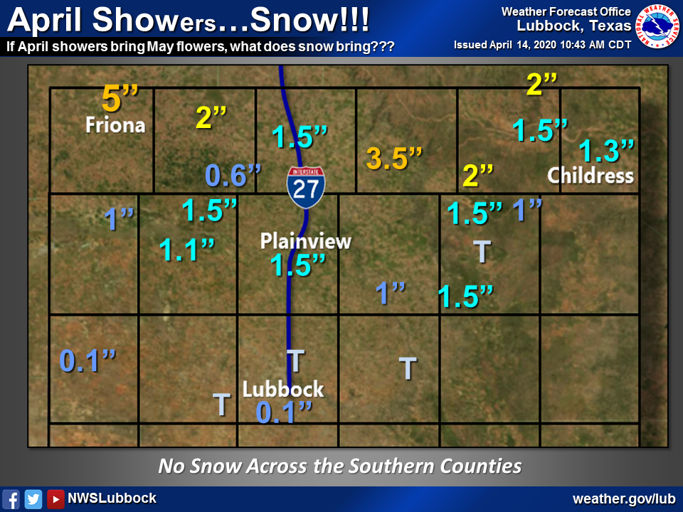
| Officially, Lubbock only recorded a trace of snow, but further north 1 to 3 inches of snow was fairly common. On the high end, Friona measured an impressive 5 inches, while Silverton had 3.5 inches. Melted the snow was equivalent to a few hundredths to over a quarter of an inch of liquid. | |||||||||||
 |
|||||||||||
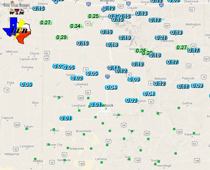
| Snow totals recorded from around the South Plains region on April 14th. The reports are from the NWS COOP observers. The melted snow ranged from a couple of hundredths of an inch to over a quarter inch of liquid. These liquid totals, from the West Texas Mesonet, can be VIEWED HERE. | |||||||||||
| A couple more pictures of the rare, short-lived, mid-April wintry scene are shown below. | |||||||||||
 |
 |
||||||||||
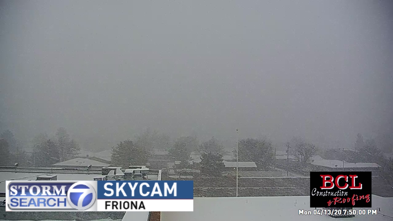
| Additional pictures of the snow from Friona (left) and Plainview (right). The pictures are courtesy of Storm Search 7 and Shannon Allen, respectively. | |||||||||||
| Hail reports collected from April 10th and 11th as well as snow reports from April 14th can be viewed below. | |||||||||||
PRELIMINARY LOCAL STORM REPORT
NATIONAL WEATHER SERVICE LUBBOCK TX
703 PM CDT SAT APR 11 2020

..TIME...   ...EVENT...      ...CITY LOCATION...     ...LAT.LON...
..DATE...   ....MAG....      ..COUNTY LOCATION..ST.. ...SOURCE....
            ..REMARKS..

0926 PM     HAIL             7 SE POST               33.12N 101.30W
04/10/2020  E0.88 INCH       GARZA              TX   LAW ENFORCEMENT

            LOCATION AND TIME ESTIMATED BASED ON RADAR.

0301 PM     HAIL             5 S PEACOCK             33.11N 100.40W
04/11/2020  M1.25 INCH       STONEWALL          TX   PUBLIC

0319 PM     HAIL             ASPERMONT               33.14N 100.22W
04/11/2020  E1.75 INCH       STONEWALL          TX   CO-OP OBSERVER

0449 PM     HAIL             2 NW LOCO               34.74N 100.19W
04/11/2020  M1.25 INCH       CHILDRESS          TX   PUBLIC

            REPORT FROM MPING

0511 PM     HAIL             2 SE MEMPHIS            34.71N 100.52W
04/11/2020  E1.00 INCH       HALL               TX   LAW ENFORCEMENT

            LOCATION WAS 2 MILES SOUTH OF MEMPHIS ON 287. TIME
            ESTIMATED FROM RADAR.

0636 PM     HAIL             3 ENE CHILDRESS         34.43N 100.20W
04/11/2020  E0.75 INCH       CHILDRESS          TX   PUBLIC

            REPORT FROM MPING. TIME ESTIMATED FROM RADAR.

0651 PM     HAIL             KIRKLAND                34.39N 100.07W
04/11/2020  M0.75 INCH       CHILDRESS          TX   LAW ENFORCEMENT

            TIME ESTIMATED FROM RADAR.

