| Another round of widespread rain for West Texas 8 March 2020 |
|
 |
|
| Regional radar animation valid from 7:38 am to 8:48 am on 8 March 2020. | |
|
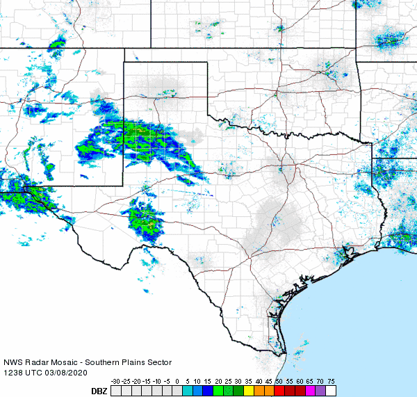
A rich tap of moisture streaming over from the eastern Pacific brought a few rounds of rain to the South Plains region on Sunday, March 8th. The first embedded disturbance within the moist plume provided light rain Sunday morning. Low levels were initially fairly dry, which acted to limit the rain totals to generally under a tenth of an inch. |
|
 |
|
| Infrared satellite loop valid from 8:01 pm to 8:36 pm on 8 March 2020. | |
|
After a lull through much of the afternoon, a more robust surge of moisture moved out of eastern New Mexico through the evening hours. This round of light to moderate rain was directed toward the northwestern South Plains and southern Texas Panhandle. |
|
 |
|
| Regional radar animation valid from 6:58 pm to 8:08 pm on 8 March 2020. | |
|
Following immediately on the heels of this second round of rain, a final line of rain raced from west-to-east across most of the South Plains region late Sunday night into the early morning hours of Monday. All the precipitation quickly ended, exiting to the east by around 5 am Monday. |
|
 |
|
| 48-hour radar-estimated and bias-correct rain (inches) ending at 10 am on 9 March 2020. A regional view for this same period can be ACCESSED HERE. A plot of West Texas Mesonet rain totals ending at 2:40 pm on 4 March 2020 can be FOUND HERE. | |
|
Over the course of Sunday and early Monday the entire region picked up some rain, with the heaviest totals, from a third of an inch to nearly an inch, favoring the northwest half of the South Plains and southern Texas Panhandle. The West Texas Mesonet site located near Muleshoe was the big winner, recording 0.92 inches of rainfall. Officially, Lubbock measured 0.51 inches or rain and Childress recorded 0.28 inches. The rain at Lubbock boosted the yearly running total to 1.90 inches, which is 0.21 inches above normal. |
|

