|
Windy and colder, with snow for some |
|||
 |
|||
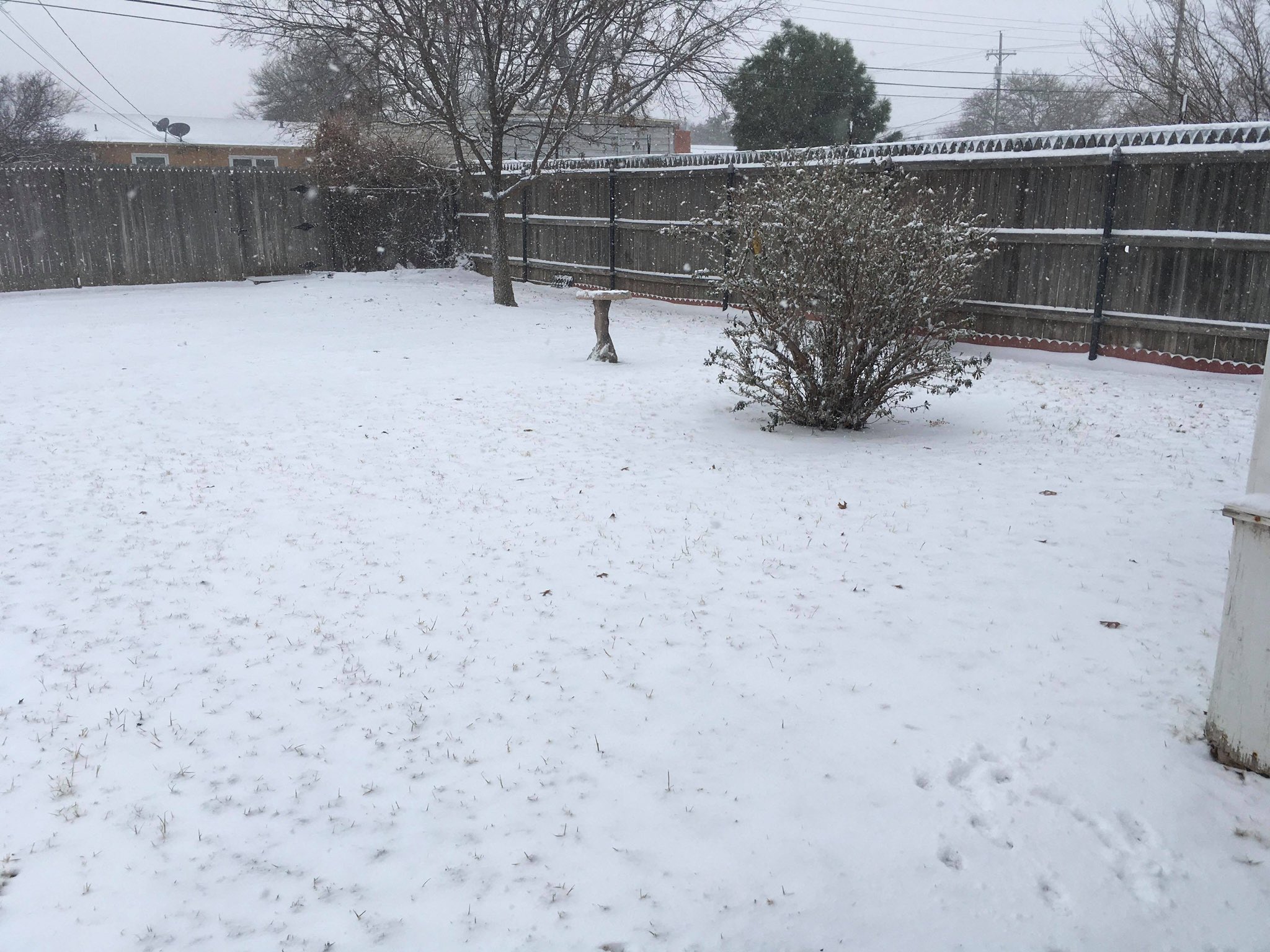
| Snow falling in Plainview Sunday morning (13 December 2020). The picture is courtesy of Jacob Riley. | |||
|
A potent, but moisture starved, upper level storm system traversed the South Plains region on Sunday (13 December). As the system passed it carried in colder air on gusty northerly winds. In addition, it was able to squeeze out a quick shot of moisture, primarily across the southern Texas Panhandle and northern South and Rolling Plains. Temperatures cooled enough that most of this precipitation fell in the form of snow, as the above image from Plainview illustrates. |
|||
 |
|||
| Mid-level water vapor loop captured from GOES-16 on Sunday morning (13 December 2020). The animation is valid from 7:26 am to 8:06 am CST. | |||
| The system tracked steadily east-southeastward through the day. In response, the accumulating snowfall followed suit, spreading from the southern Texas Panhandle into the northeast South Plains and northern Rolling Plains through the morning hours. The wintry precipitation quickly diminished and shifted east with the system during the afternoon hours. | |||
 |
|||
| Lubbock radar animation valid from 6:15 am to 8:08 am on Sunday (13 December 2020). | |||
| Even those locations that missed out on the snow didn't escape the gusty northerly winds and colder air. In fact, the strongest winds affected more western locations, including the southwest Texas Panhandle and western South Plains, where peak wind gusts between 40 and 50 mph were measured. | |||
 |
|||
| Peak wind gusts recorded by the West Texas Mesonet sites on December 13, 2020. The peak sustained wind speeds for the 13th can be VIEWED HERE. | |||
| As the system shifted to the east, skies quickly cleared from west-to-east Sunday afternoon and evening. Where clouds cleared before sunset, a nice view of the fresh snowpack was captured by the visible satellite loop below. | |||
|
|
|||
 |
|||
| Visible satellite animation valid from 2:01 pm to 4:01 pm on Sunday (13 December 2020). As low clouds shift into Oklahoma an expansive snow shield can be seen extending from much of the Texas Panhandle into southwest Kansas, northeast New Mexico and eastern Colorado. | |||
| The quick-hitting system did drop accumulating snow across much of the Texas Panhandle, including in Tulia (see below) where around 2 inches of snow fell. The brief burst of snow did cover roadways and create a few slick spots, though conditions quickly improved once the snowfall ceased. | |||
|
|||
| Snow blanketing Tulia early Sunday morning (13 December 2020). The picture is courtesy of Jacob Riley. | |||
|
When all was said and done, an inch or two of snow was fairly common across the southern Texas Panhandle. Further north snow totals were higher, generally from 2 to 4 inches along the I-40 Corridor. |
|||
 |
|||
| Snowfall totals reported to the National Weather Service on December 13th. | |||
| The radar-estimated precipitation image below shows that the precipitation ended abruptly over the central South Plains and southern Rolling Plains. The Lubbock Airport officially recorded a trace of snow, while in and around Childress around an inch of snow was common. When melted down, between a tenth and quarter of an inch of liquid equivalent was common where the heavier snow fell, with localized spots closer to a half inch. | |||
 |
|||
| Radar-estimated and bias-corrected 3-day liquid equivalent ending at 6 pm on 16 December 2020. | |||
| The preliminary storm reports for this mid-December winter storm can be viewed below. | |||
PRELIMINARY LOCAL STORM REPORT...SUMMARY
NATIONAL WEATHER SERVICE LUBBOCK TX
330 PM CST SUN DEC 13 2020

..TIME...   ...EVENT...      ...CITY LOCATION...     ...LAT.LON...
..DATE...   ....MAG....      ..COUNTY LOCATION..ST.. ...SOURCE....
            ..REMARKS..

0845 AM     SNOW             2 SE HART               34.37N 102.09W
12/13/2020  E1.0 INCH        CASTRO             TX   CO-OP OBSERVER

0845 AM     SNOW             TULIA                   34.54N 101.77W
12/13/2020  M1.6 INCH        SWISHER            TX   CO-OP OBSERVER

0845 AM     SNOW             VIGO PARK               34.65N 101.50W
12/13/2020  E1.0 INCH        SWISHER            TX   CO-OP OBSERVER

1030 AM     SNOW             SILVERTON               34.47N 101.30W
12/13/2020  E1.5 INCH        BRISCOE            TX   PUBLIC

1030 AM     SNOW             SILVERTON               34.47N 101.30W
12/13/2020  E1.5 INCH        BRISCOE            TX   PUBLIC

1055 AM     SNOW             1 NW CHILDRESS          34.42N 100.25W
12/13/2020  M1.0 INCH        CHILDRESS          TX   CO-OP OBSERVER

1104 AM     SNOW             MEMPHIS                 34.73N 100.54W
12/13/2020  E1.5 INCH        HALL               TX   LAW ENFORCEMENT

1230 PM     SNOW             TULIA                   34.54N 101.77W
12/13/2020  M2.1 INCH        SWISHER            TX   CO-OP OBSERVER

            SNOW TOTAL

1230 PM     SNOW             MEMPHIS                 34.73N 100.54W
12/13/2020  E2.0 INCH        HALL               TX   CO-OP OBSERVER

1245 PM     SNOW             FLOYDADA                33.98N 101.34W
12/13/2020  M1.0 INCH        FLOYD              TX   LAW ENFORCEMENT


