| Rounds of showers and thunderstorms and a strong cold front (6-7 November 2019) |
 |
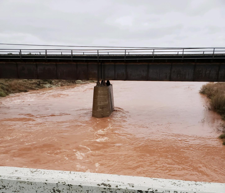
| Water flowing down the Double Mountain Fork of the Brazos near Justiceburg on 7 November 2019. The picture is courtesy Lake Alan Henry Weather. |
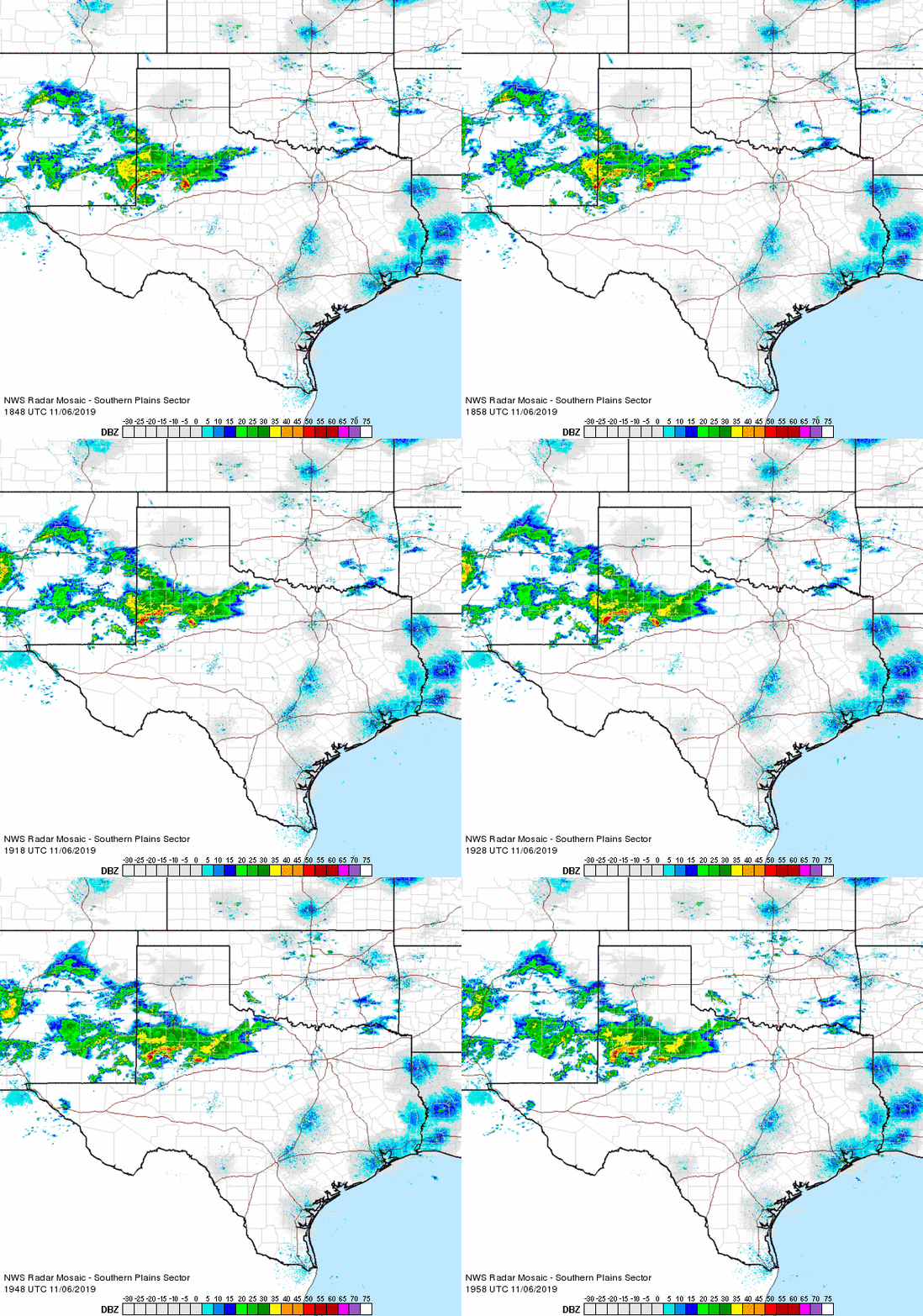
| Early November 2019 brought rounds of widespread showers and thunderstorms. The heaviest rain fell on Wednesday afternoon and evening (6 November) as thunderstorms tracked repeatedly across the central and southern South Plains and much of the Rolling Plains. The strongest of the thunderstorms produced bursts of heavy rain along with frequent lightning. |
 |
| Regional radar animation valid from 12:48 pm to 1:58 pm on 6 November 2019. Additional regional radar animations can be viewed at: 3:18 pm to 4:28 pm and 5:08 pm to 6:18 pm. |
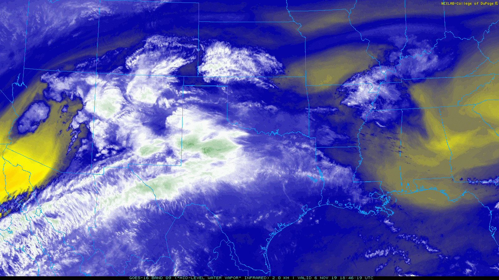
| The rainfall was fueled by abundant Gulf moisture and a tap of middle and upper level moisture from the eastern Pacific. The rich moisture was then acted on by an approaching subtropical disturbance, sparking the rounds of rainfall from Wednesday into Thursday. |
 |
| Water vapor image captured at 12:46 pm on 6 November 2019. |
| The widespread moderate to heavy rainfall shifted to the east early Thursday morning, but additional light showers (and drizzle) persisted behind an early-day cold front. Temperatures plummeted from the 50s and lower 60s ahead of the front into the 30s, as gusty north winds carried in the much colder air early Thursday. By daybreak Thursday, all of the South and Rolling Plains were in the 30s. |
 |
| Regional radar animation valid from 11:28 pm on 6 November to 12:38 am on 7 November 2019. Additional regional radar animations can be viewed at: 11:48 am to 12:58 pm on 7 November. |
| The cold and damp conditions even produced a few pockets of freezing drizzle and very light freezing rain through Thursday afternoon, but the marginal temperatures and warm ground kept impacts minimal. |
 |
| 7-day radar-estimated and bias-corrected rain totals ending at 6 am on 8 November 2019. A regional view of the same information can be FOUND HERE. Measured rain totals from the West Texas Mesonet can be VIEWED HERE. |
| Everyone across the South Plains region recorded at least a little rainfall over this early November event, though amounts were on the light side across the southern Texas Panhandle into the northern South Plains. The heaviest rain favored spots along and south of a Plains to Lubbock to Paducah line. Rain totals of 2 to 3+ inches were common from south of Brownfield through Post, Jayton and Aspermont. Officially, Lubbock recorded 0.59 inches of rain over the 2-day event, pushing the yearly tally to 23.26 inches, or 5.50 inches above the year-to-day average. |
 |
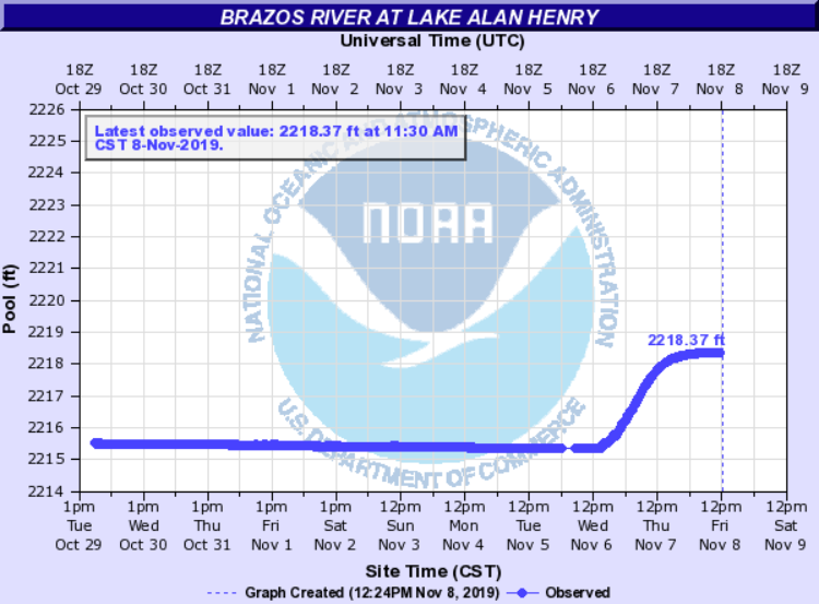
| Level of Lake Alan Henry, ending at 12 pm on 8 November 2019. |
| The heaviest rain fell almost squarely over the Double Mountain Fork of the Brazos River, upstream of Lake Alan Henry. Runoff from the rain flowing down the river into the lake cause the lake to rise nearly 3 feet, boosting it to 95% of conservation level (from 87%). Unfortunately, White River Lake and Mackenzie Lake largely missed out on the rainfall. |