| Mid-September 2019 drops rain on the High Plains 19-21 September 2019 |
 |
| Regional radar animation valid from 5:28 pm to 6:38 pm on Thursday, 19 September 2019. Additional radar animations can be found at: 7:18 pm to 8:28 pm on 19 September 2019; and 8:18 pm to 9:28 pm on 19 September 2019. |
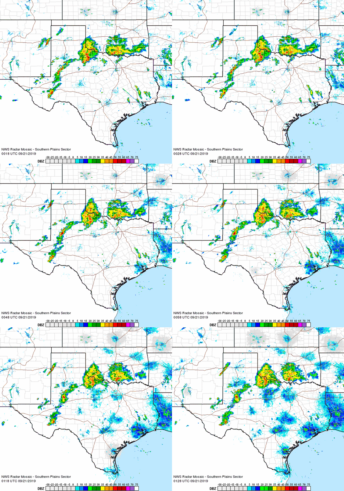
| An influx of moisture, combined with several passing upper level disturbances, sparked a number of rounds of showers and thunderstorms across West Texas in mid-September (19th-21st). The first widespread activity favored the Texas Panhandle into the northern South and Rolling Plains Thursday afternoon and evening. A few of these storms were strong to marginally severe, producing small hail and wind gusts in excess of 50 mph. In addition, the thunderstorms produced very heavy rain, with a number of locations recording 1 to 3+ inches. |
 |
| Meteogram displaying 24 hours of temperature, dewpoint , relative humidity, wind, pressure, rainfall, solar radiation and soil temperature data for the Claude West Texas Mesonet ending at 7:15 pm CDT on 19 September 2019. |
| The Claude West Texas Mesonet site (located 12 miles southwest of town near the rim of Palo Duro Canyon) was particularly hard hit. A very intense storm became stationary over the site, producing torrential rainfall and a 58 mph wind gust. The site recorded an incredible 6.27 inches of rain in one hour, and a total of 9.54 inches over the duration of the thunderstorms. Runoff from this tremendous amount of rain did briefly push the Prairie Dog Town Fork of the Red River at Wayside above flood stage. |
 |
| Regional radar animation valid from 7:18 pm to 8:28 pm on Friday, 20 September 2019. |
| The following day, Friday the 20th, brought additional rounds of thunderstorms to the region. This time the heavy rain-producing thunderstorms developed across the central and eastern South Plains and spread eastward into the Rolling Plains. A few of these storms were on the strong side, but torrential rainfall and intense lightning were the common themes. More pockets of heavy rain followed late Friday night into early Saturday. |
 |
| 5-minute GOES 16 water vapor loop (Band 9) valid from 1:56 pm to 2:21 pm on 21 September 2019. |
| The feed of moisture off the eastern Pacific became even richer on Saturday, the 20th, as it tapped Tropical Storm Lorena, which was moving up the Gulf of California. This tropical moisture fueled additional widespread showers and thunderstorms over much of West Texas. |
 |
| Regional radar animation valid from 5:28 pm to 6:38 pm on Saturday, 21 September 2019. Additional radar animations can be found at: 2:58 pm to 4:08 pm on 21 September 2019; and 7:58 pm to 9:08 pm on 21 September 2019. |
| The rain coverage and intensity peaked Saturday evening as it tracked from west to east across the South Plains region. The torrential downpours can in waves at many places, dumping another 1 to 3 inches of rain from the central South Plains into the northern Rolling Plains and southeast Texas Panhandle. The heavy rain quickly diminished and shifted to the east after midnight. |
 |
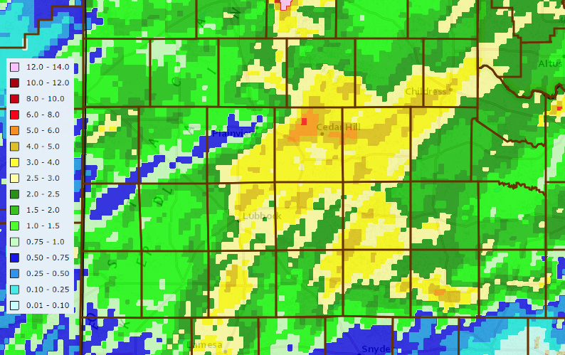
| 3-day radar-estimated and bias-corrected rainfall ending at noon on Sunday, 22 September 2019. The 3-day rain totals measured by the West Texas Mesonet over this same period can be VIEWED HERE. |
| The three days filled with rounds of heavy precipitation yielded widespread rain totals of 1 to 2+ inches, including a corridor of 2 to 4+ inches from near Lubbock through Floydada, Matador and Childress. Childress officially recorded 3.95 inches over this wet stretch, including 3.46 inches on the 21st, which shattered the daily record (previously 1.22 inches, set in 1936). |
 |
| 2019 accumulated precipitation for Lubbock through Saturday, 21 September. |
| Lubbock officially measured 4.09 inches over this event. Although Lubbock failed to set any new daily rainfall records, the rainfall did boost the year-to-date total to 20.19 inches. This ensures that Lubbock will finish 2019 with above average rainfall. |