| Thunderstorms generate landspouts, hail and damaging winds July 10, 2019 |
|
 |
|
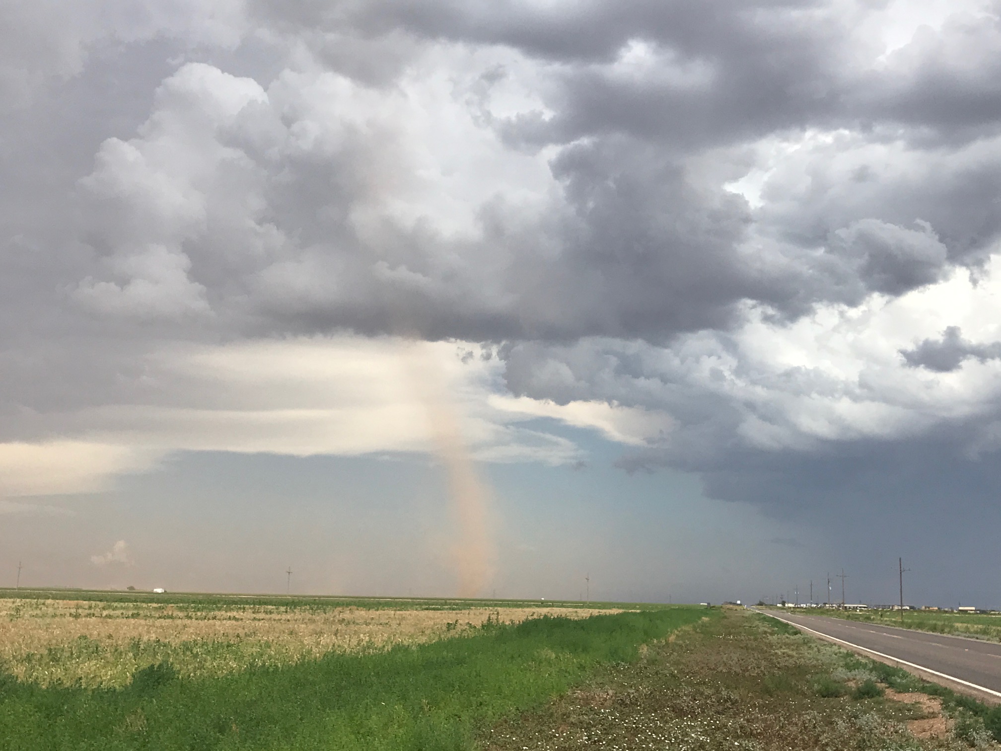
| View of a landspout tornado that occurred just north of the Lubbock Airport on the afternoon of 10 July 2019. The picture was taken by Bruce Haynie. | |
| Wednesday, July 10th, provided a hot day. Temperatures soared into the upper 90s and lower triple digits, as high as 106 degrees at Post. The extreme heat, coupled with a southwestward moving boundary containing rich moisture in its wake, was enough to generate scattered thunderstorms Wednesday afternoon. Although wind shear was weak under a building upper level ridge, strong instability was sufficient to fuel storms that occasionally flexed to severe levels. | |
 |
|
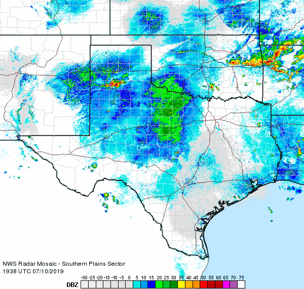
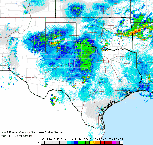
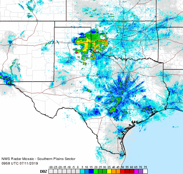
| Regional radar animation valid from 2:38 pm to 3:48 pm on 10 July 2019. Additional animations can be found at: 3:18 pm to 4:28 pm on 10 July 2019; and 4:58 am to 6:08 am on 11 July 2019. | |
| The initial thunderstorms developed across the south-central Texas Panhandle and quickly became severe. Additional storms then formed as the activity and associated outflow boundaries moved southwestward. Several other storms became strong to severe as they developed into the southwest Texas Panhandle and northern South Plains. | |
 |
|
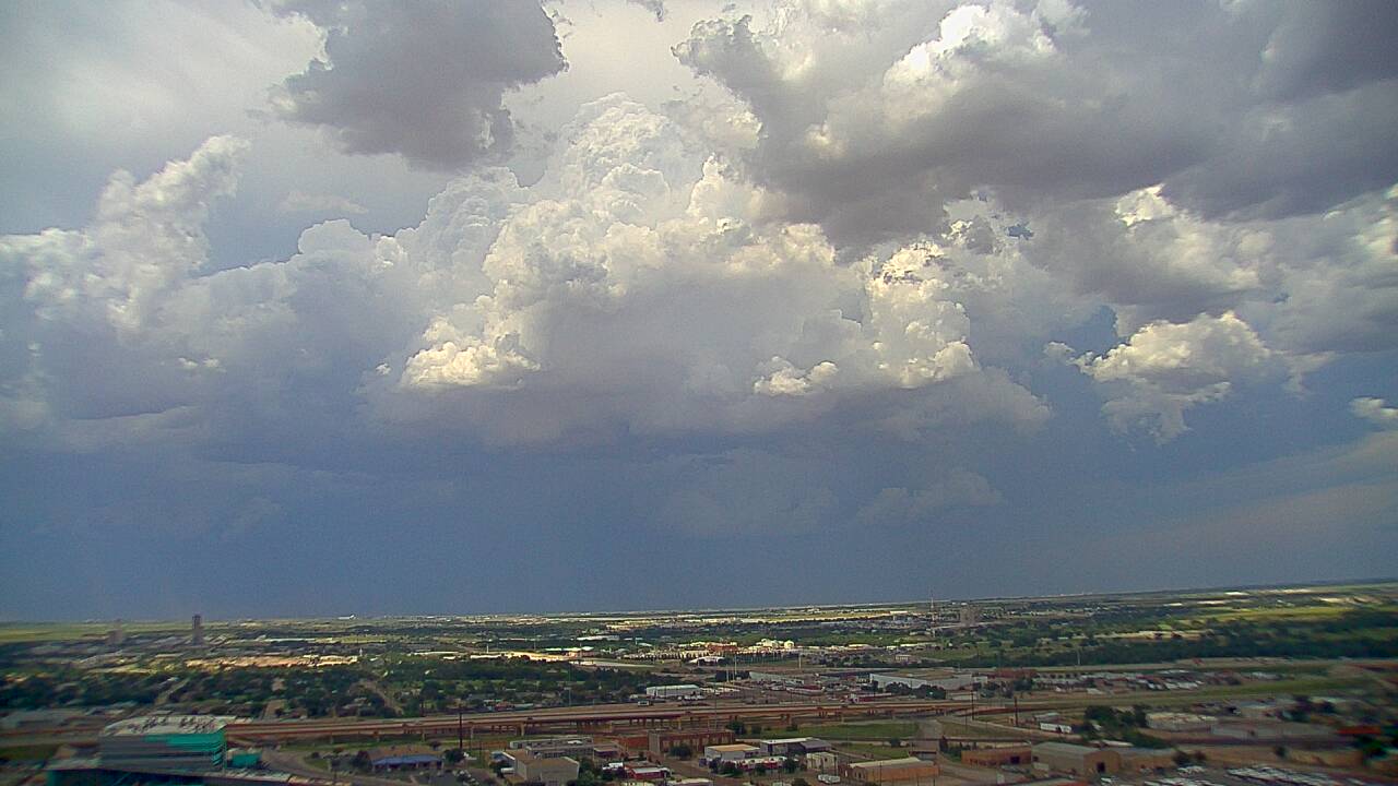
| Storm building over the northern part of Lubbock County, as seen from the NTS building, on Wednesday afternoon (10 July 2019). The picture is courtesy of KAMC. | |
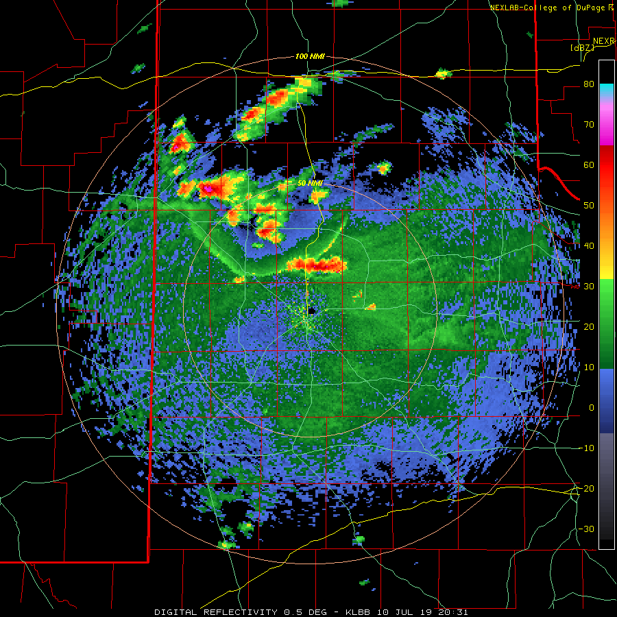
| One particularly intense storm formed on intersecting boundaries directly over the Lubbock Airport. Early on in its development two brief landspout-type tornadoes (one can be seen at the top of this page) formed as the rising air stretched out the already rotating air along the boundaries. These landspouts did no known damage. However, the storm went on to produce hail slightly larger than quarters along with a peak measured wind gust of 78 mph at the Lubbock Airport. | |
 |
|
| Lubbock radar animation valid from 4:31 pm to 5:40 pm on 10 July 2019. | |
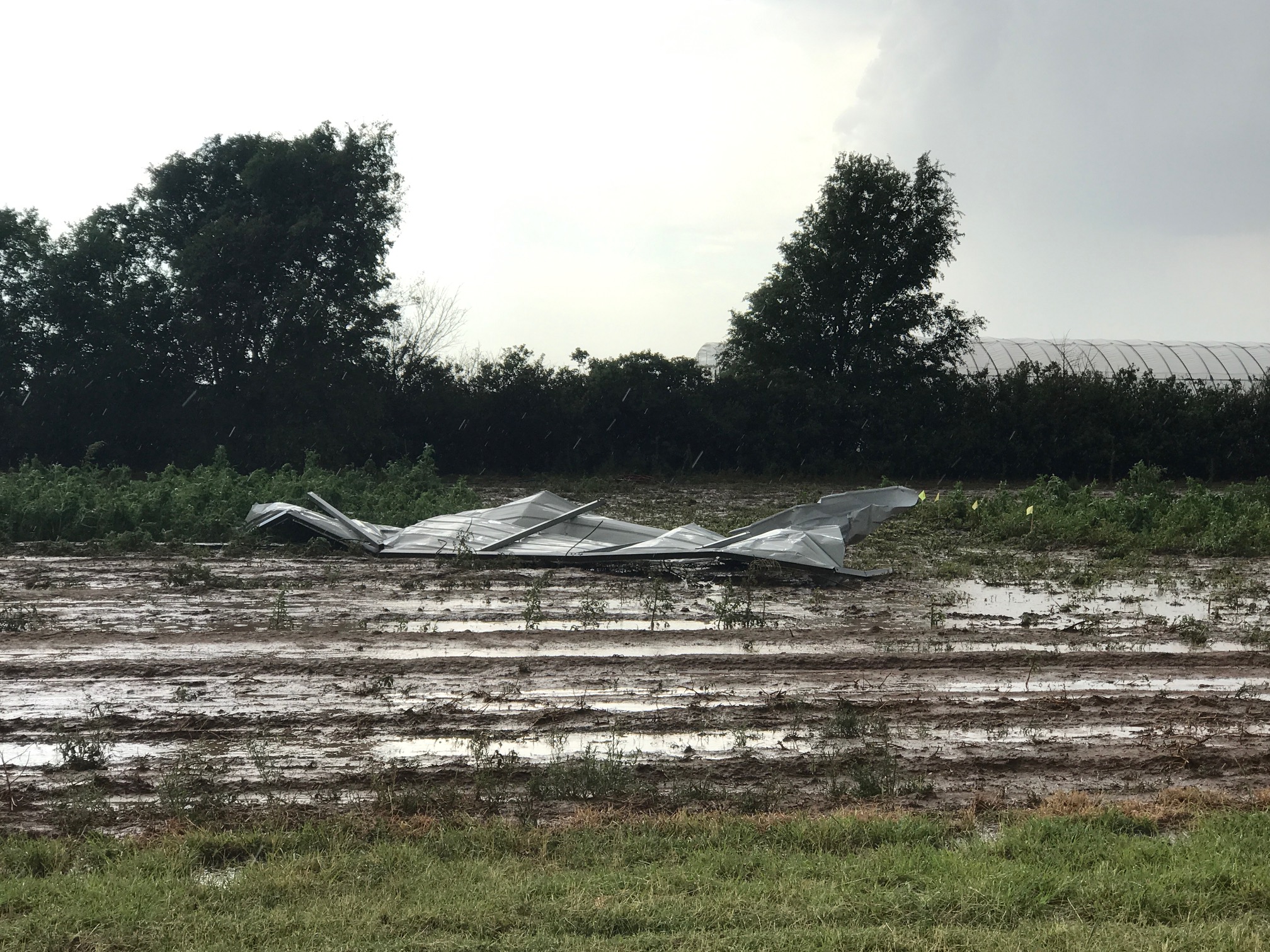
| The severe wind gust did cause damage to a couple of buildings between the Lubbock Airport and the USDA in northern Lubbock County, as seen below. | |
 |
|
| Sheet metal damage south of the USDA, just north of the Lubbock Airport, Wednesday afternoon (10 July 2019). The picture is courtesy of Bruce Haynie. | |
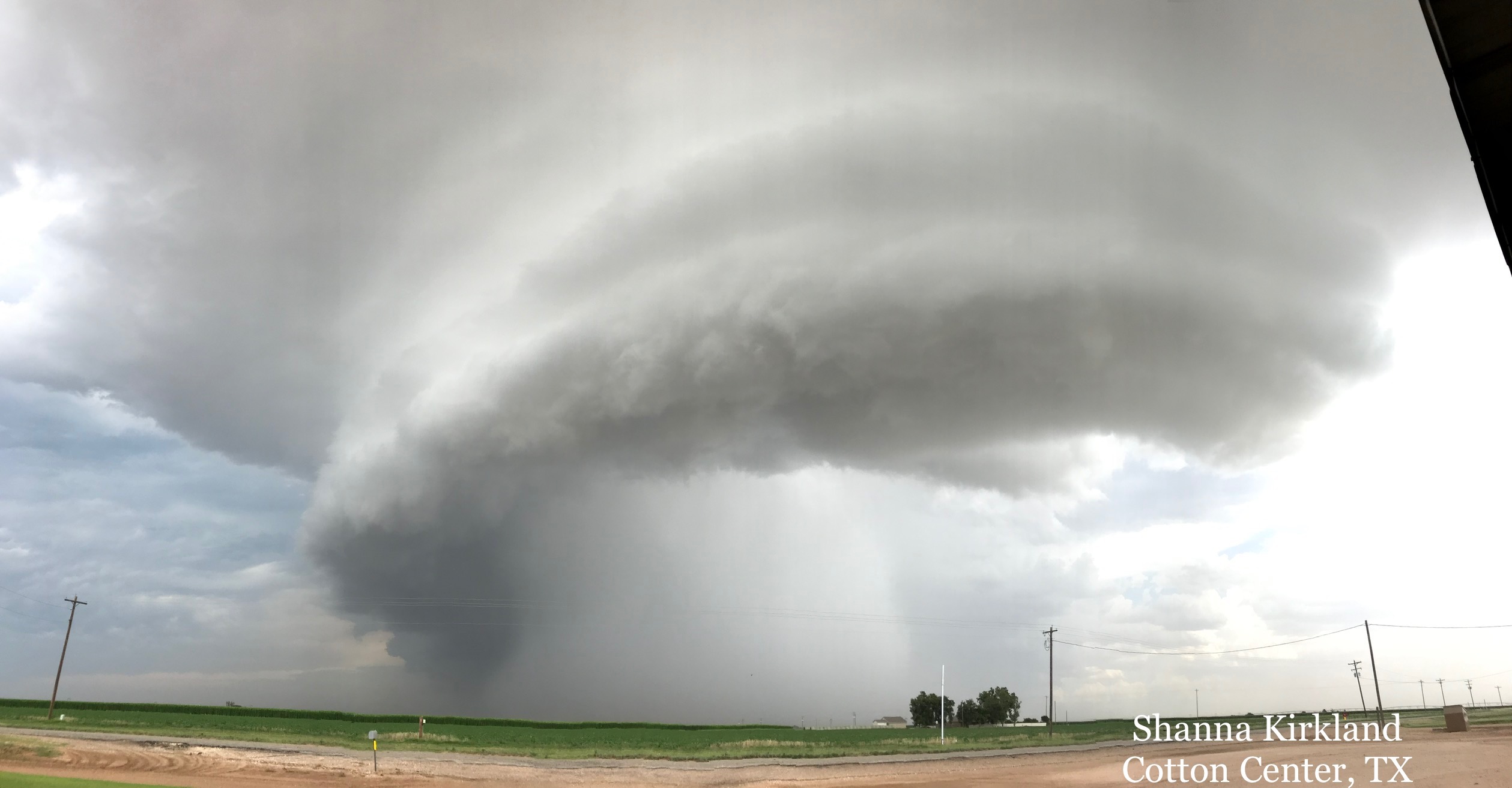
| Another severe storm just to the north, across southern Hale County (pictured below), also generated damaging winds. The intense winds from this storm overturned a center pivot and removed the roof of a school house. | |
 |
|
| Severe thunderstorm near Cotton Center on 10 July 2019. The picture is courtesy of Shanna Kirkland. | |
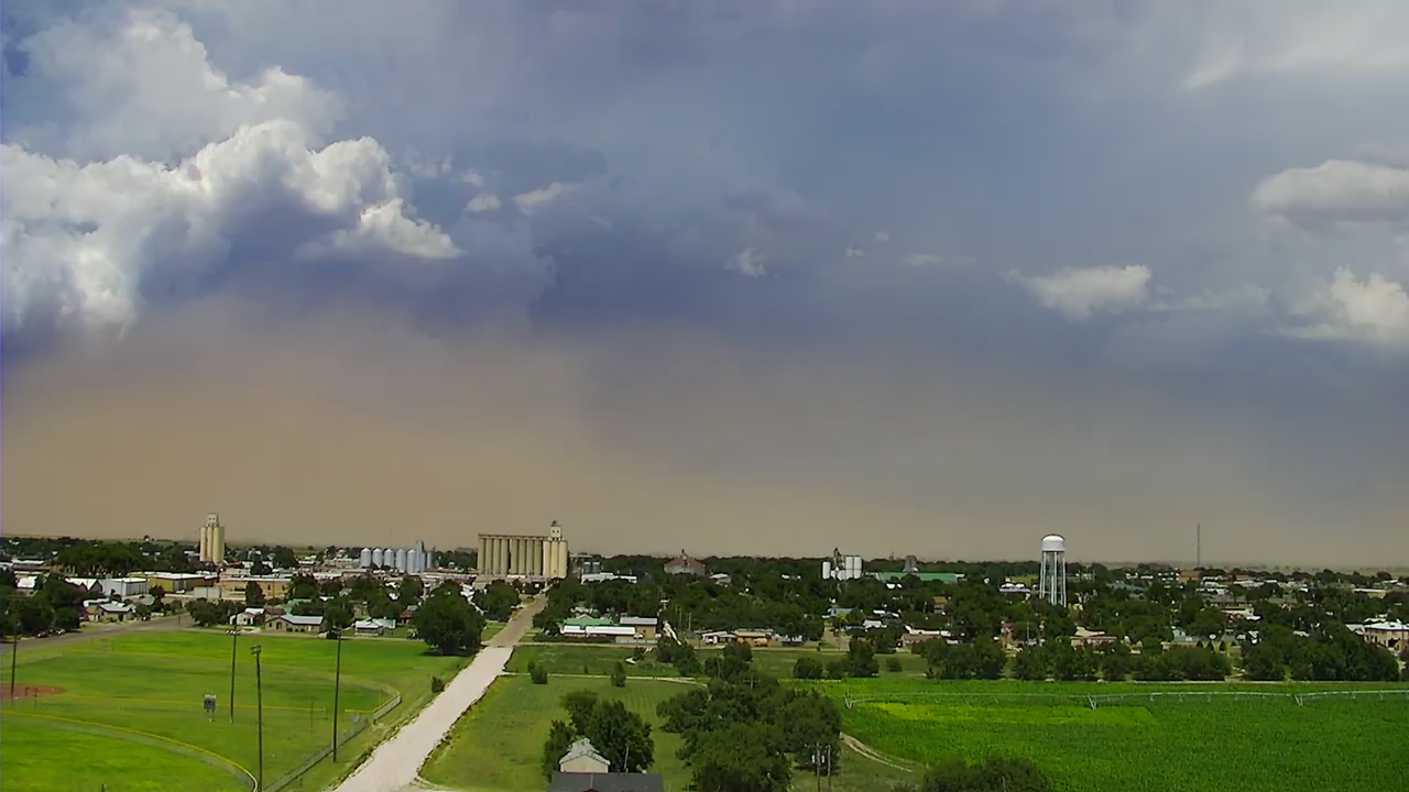
| The individual storms, though briefly quite intense, didn't last very long as their outflows quickly spread out from them. This acted to cut of the storms from the moist/unstable air, but it did also kick up dust and force additional new storm development, allowing the cycle to repeat itself. | |
 |
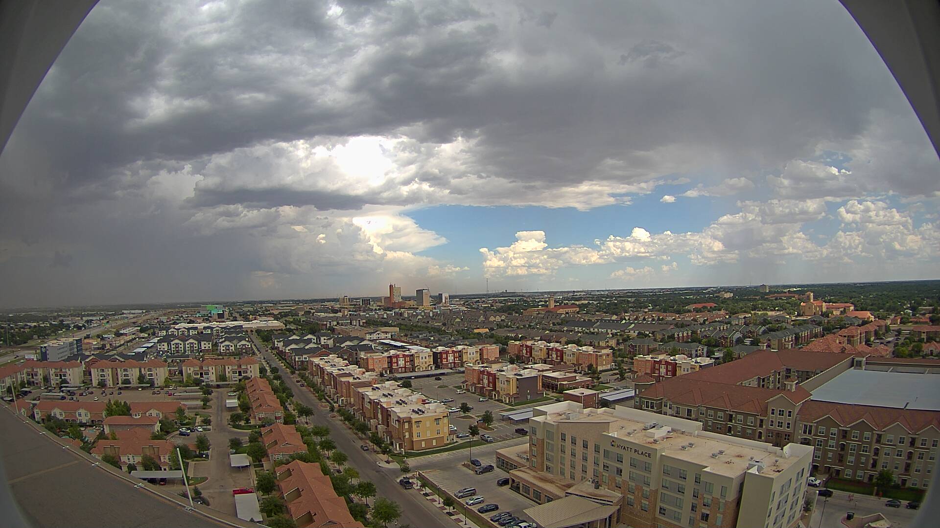 |
| Additional views of the storms and dusty outflows from July 10th. The left picture was taken over Muleshoe and the right one was looking east from Lubbock. The images are courtesy of KAMC. | |
| The activity quickly diminished by early evening, but not before dropping small pockets of moderate to heavy rainfall. The Lubbock Airport officially record 0.51 inches of rain from the severe storm. After a quiet mid-late evening, another round of strong to severe thunderstorms dropped southward out of the eastern Texas Panhandle in the predawn hours of Thursday, July 11th. One storm dropped an even 2 inches of rain in Memphis before diminishing. | |
 |
|
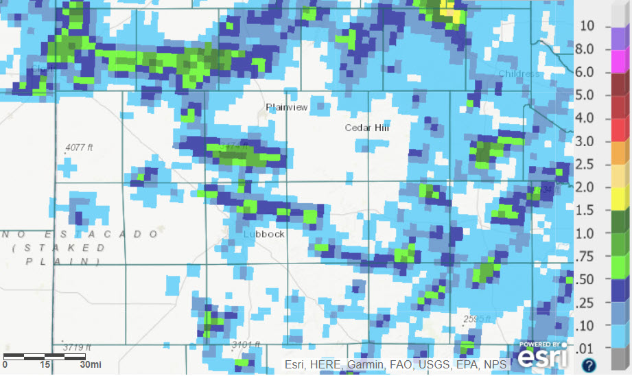
| Radar-estimated and bias-corrected 24-hour rainfall ending at 7 am on 11 July 2019. | |
| The preliminary storm reports for this unsettled afternoon can be found below. | |
PRELIMINARY LOCAL STORM REPORT...SUMMARY
NATIONAL WEATHER SERVICE LUBBOCK TX
1103 PM CDT WED JUL 10 2019

..TIME...   ...EVENT...      ...CITY LOCATION...     ...LAT.LON...
..DATE...   ....MAG....      ..COUNTY LOCATION..ST.. ...SOURCE....
            ..REMARKS..

0359 PM     HAIL             RHEA                    34.67N 102.95W
07/10/2019  E1.00 INCH       PARMER             TX   CO-OP OBSERVER

            MOSTLY NICKLE SIZE HAIL WITH OCCASIONAL QUARTER-SIZE
            HAIL MIXED IN.

0444 PM     TSTM WND GST     6 NNE LUBBOCK           33.67N 101.82W
07/10/2019  M78 MPH          LUBBOCK            TX   ASOS

            LUBBOCK ASOS REPORTS SUSTAINED WIND 56 MPH AT THE SAME
            TIME.

0445 PM     TSTM WND DMG     2 N LUBBOCK INT. AIRPOR 33.69N 101.82W
07/10/2019                   LUBBOCK            TX   NWS EMPLOYEE

            PIECES OF NEW SHEET METAL ROOFING FOUND IN A FIELD WEST
            OF COUNTY ROAD 2500

0447 PM     HAIL             2 N LUBBOCK INT. AIRPOR 33.68N 101.81W
07/10/2019  E0.75 INCH       LUBBOCK            TX   BROADCAST MEDIA

            VIEWER REPORTED MARBLE SIZE HAIL 2 MILES NORTH OF THE
            AIRPORT

0449 PM     HAIL             LUBBOCK INT. AIRPORT    33.65N 101.81W
07/10/2019  E1.25 INCH       LUBBOCK            TX   NWS EMPLOYEE

            NWS EMPLOYEE REPORTED MOSTLY DIME TO NICKLE SIZE WITH
            OCCASIONAL HALF DOLLAR HAIL MIXED IN.

