| Thunderstorms drop areas of heavy rainfall 6-8 July 2019 |
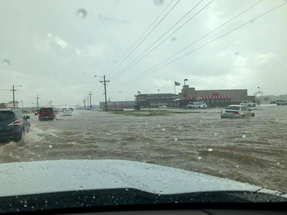 |
| Flooding near 82nd Street and Milwaukee Avenue in southwest Lubbock on Sunday, 7 July 2019. The picture is courtesy of Michelle Regalado and KCBD. |
| After a hot and mostly dry start to July, the weather turned active over the Holiday Weekend. Scattered thunderstorms initially developed on Saturday, July 6th, thanks to a weak disturbance embedded within an upper level ridge. Weak wind shear within the upper ridge helped to limit overall storm intensity, but it also meant any storms that formed moved very slowly. The slow storm motion, coupled with abundant summertime moisture, resulted in locally heavy downpours. |
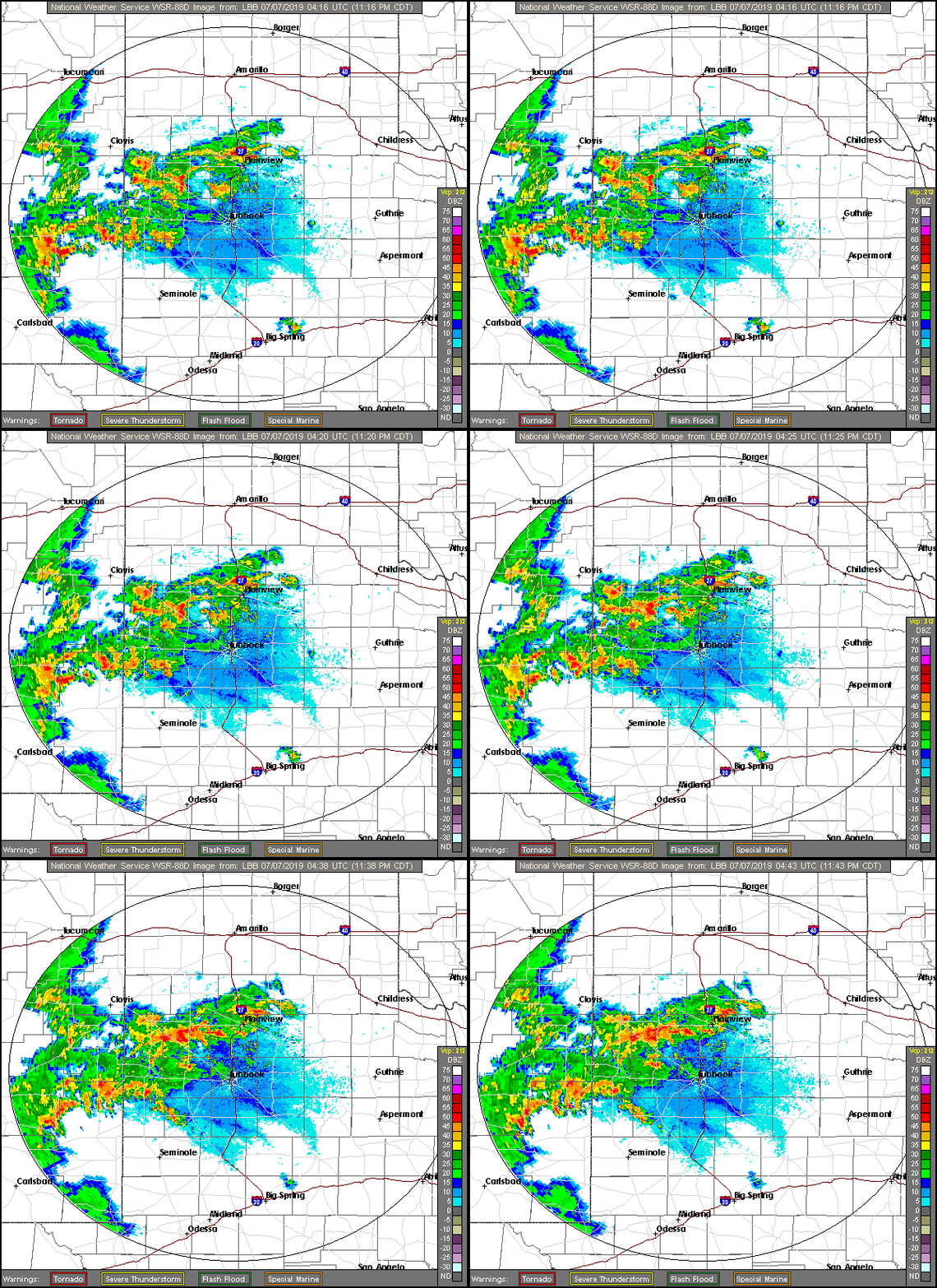 |
| Lubbock radar animation valid from 11:16 pm to 11:43 pm on 6 July 2019. |
| One of these torrential downpours parked directly over the Lubbock Airport where it dropped nearly 4 inches of rain (3.98" to be exact) Saturday evening. In addition to causing flooding, the rain boosted the annual total to 12.92 inches, or 3.22 inches above normal. The heaviest rains gradually developed northwestward through the evening hours. |
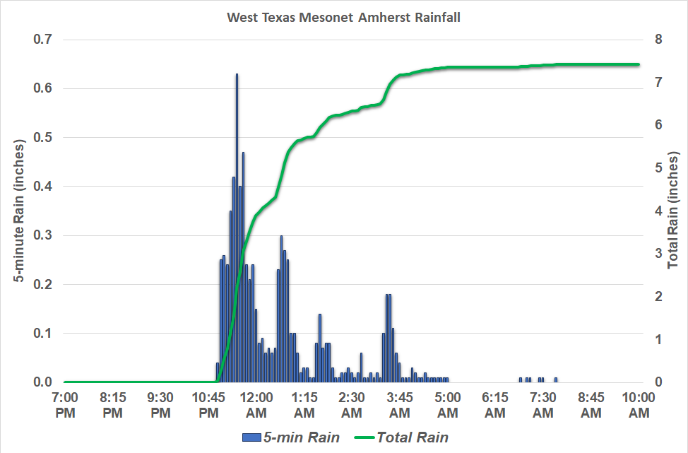 |
| Plot of rainfall rate and total rainfall at the West Texas Mesonet located just northeast of Amherst late Saturday into early Sunday (6-7 July 2019). |
| Locations in and around Amherst were at the epicenter of the heavy rain. The nearby West Texas Mesonet recorded 7.43 inches, half of which fell in one hour. The bulk of the rain fell between 11 pm on the 6th and 4 am on the 7th. |
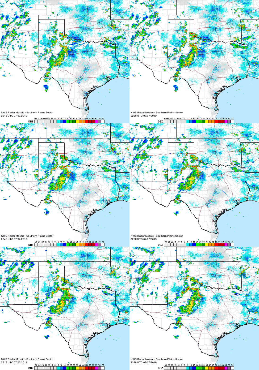 |
| Regional radar animation valid from 5:18 pm to 6:28 pm on 7 July 2019. Additional radar animations can be found at: 9:38 pm to 10:48 pm on 6 July 2019; and 3:38 pm to 4:48 pm on 8 July 2019. |
| The mid-level disturbance worked in concert with residual boundaries from previous storms to supply additional rounds of heavy thunderstorms on Sunday and Monday (7-8 July). Much of this activity was a bit further east than Saturday's storms. However, one storm formed over the southwest part of Lubbock Sunday afternoon, dropping another quick 1-3 inches of rain and causing extensive street flooding (see the picture at the top of this page). |
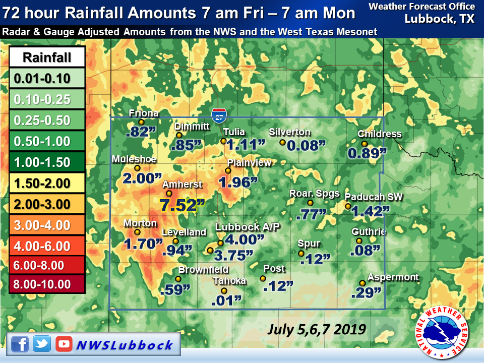 |
| 72-hour rain totals ending at 7 am on Monday, 8 July 2019. |
| By the time this 3-day stretch of wet weather ended, most spots on the South Plains region saw at least some rain. The exception was over parts of the southeast South Plains into the southern Rolling Plains where they missed out altogether. Otherwise, many locations recorded an inch or more of rain, with 1-3+ inches being common over a good chunk of the western and northern South Plains. Even off the Caprock, 0.50-1.50 inches of rain was seen in many spots. |