
Late April and early May 2019 brought rounds of severe thunderstorms to West Texas, complete with pockets of heavy rain. Persistent southwesterly flow aloft, passing upper level disturbances and plenty of moisture and instability east of the dryline provided the ingredients for the rounds of severe weather. The weather first became active in late April and the first day of May. A write up of the severe weather that impacted the region April 27th, 30th and May 1st can be FOUND HERE.
 |
 |
|
View of strong thunderstorm the evening of 3 May 2019. The left picture is near Jayton and courtesy of Jeremy Carter. The right image is looking east from Lubbock.
|
|
After a quiet day on May 2nd, strong and severe thunderstorms developed on the afternoon of May 3rd near the TX/NM state line. One storm dropped hail as large as golf balls in Lazbuddie Friday afternoon. This activity moved east and southeastward through the late afternoon, while additional strong and severe thunderstorms formed in the Rolling Plains during the evening. One of the evening storms generated golf ball size hail as it tracked by just to the west of Jayton.
The next day, Saturday, May 4th, brought another round of severe thunderstorms across the western South Plains. The most intense storm dropped tennis ball size hail in Needmore. The storms rotated strongly and did also generate two very brief tornadoes over open land in Bailey County.
 |
 |
|
Two views of a supercell thunderstorm, south of Muleshoe (left) and east of Enochs (right) on the evening of 4 May 2019. The pictures are courtesy of Brandon Sullivan.
|
|
The severe thunderstorm tracked southeastward just south of Highway 84 before quickly dying during the late evening. An additional cluster of severe thunderstorms brought quarter size hail north of Dimmitt and a 63 mph wind gust near Tulia late in the evening.

The next day, Sunday, May 5th, was particularly active. The most intense storm of the day started in Lubbock County, but then sank south-southeastward through Lynn County where it produced a couple of tornadoes. The first tornado caused EF-2 damage as it tracked by to the northeast of Tahoka. A detailed summary of this active Sunday can be READ HERE.
 |
 |
|
Storms across the northwest South Plains and southwest Texas Panhandle on 6 May 2019. The right picture was taken from Levelland and is courtesy of KAMC.
|
|
Monday, May 6th, was not nearly as active as the previous day, though it did still provide a few strong thunderstorms across the southwest Texas Panhandle and northwest South Plains during the afternoon and evening hours. The storms, seen above, did make for some interesting and picturesque skies.
 |
 |
|
Supercell thunderstorm that produced several tornadoes near Tulia on the evening of 7 May 2019. The pictures were taken from just south of Tulia.
|
|
Tuesday, May 7th, brought a noticeable uptick in severe weather as a potent upper level storm system approached from the Four Corners. The most severe storm of the day started northwest of Lubbock and tracked steadily northeastward from there. The storm produced a brief tornado north of Halfway, and more substantial tornadoes southwest and northeast of Tulia. Thankfully, the tornadoes occurred over open land and didn't cause any known significant damage.
 |
|
|
Water vapor imagery valid from 1:36 pm to 2:21 pm on 7 May 2019.
|
Additional strong and severe storms did form across the central South Plains into the evening. This activity dropped large hail and generated several wall clouds, but no known tornadoes.

The below pictures show a couple of wall clouds. The left image shows the storm that was occasional tornadic as it tracked past Tulia. The right image was from a storm later in the evening that produced a well-developed wall cloud near Shallowater before the storm weakened as it moved northeast from there.
 |
 |
|
Wall clouds near Tulia (left) and Shallowater (right) on Tuesday evening, 7 May 2019. The pictures are courtesy of KAMC and Storm Search 7.
|
|
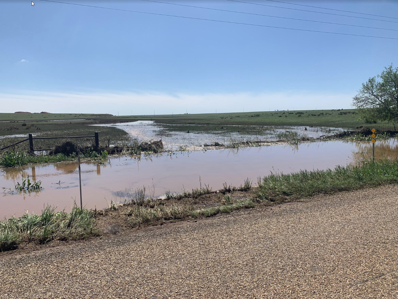
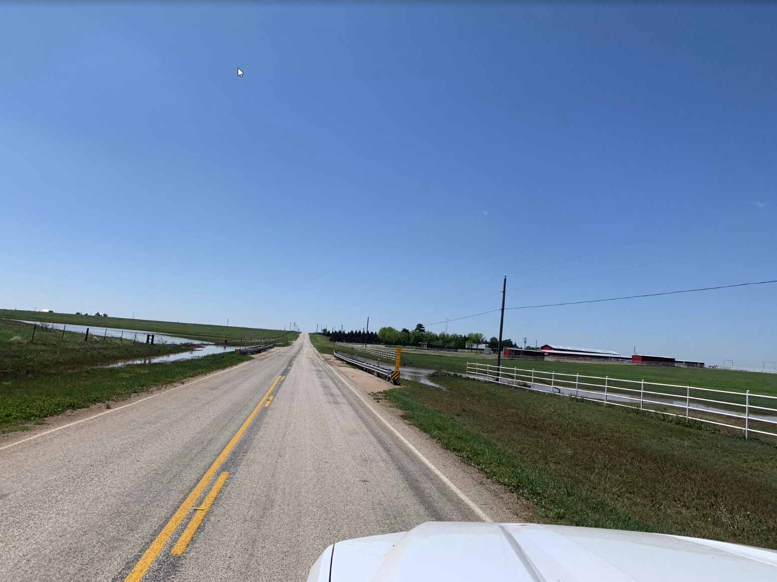
The severe storms on Tuesday also dumped torrential rain, especially across parts of Swisher County, where they lingered longer. The heavy rain flooded several roadways west of Tulia where several inches of rain likely fell. The below pictures show the aftermath from the flooding the previous day. Middle Tule Creek rose several feet for a period during and immediately after the heavy rain Tuesday afternoon and evening.
 |
 |
|
Post-flooding along the Middle Tule Creek west of Tulia. The pictures were taken the day after the severe thunderstorms and flooding on 8 May 2019.
|
|
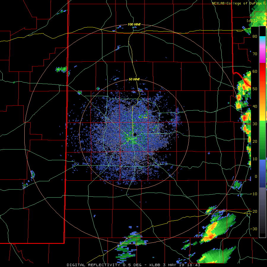
The below plot shows the approximate location of the tornadoes that formed early Tuesday evening. Although the tornadoes were rated EF-U since they didn't hit any damage indicators and thus were not able to be assigned an intensity, straight-line winds that were estimated as high as 80 mph west of Vigo Park did snapped several power poles.


The below imagery shows the approximate swaths of hail, as estimated by radar. Hail as large as golf balls was reported southwest of Lubbock, near Wolfforth, just after midnight, while many other locations reported quarter to ping pong ball size hail between 10 pm on the 8th and 1 am on the 9th.


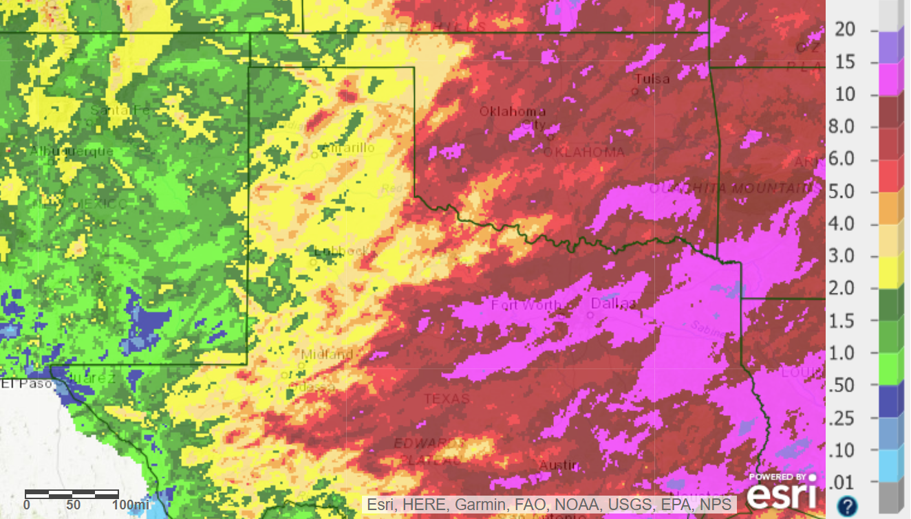
Over the course of this active stretch of weather from late April through mid-May, widespread rain fell over the South Plains region. Rain totals of 2 to 4+ inches were common. This rain did result in some generally minor flooding at times, but it also led to a rapid green up.

A listing of the Preliminary Local Storm Reports (LSRs) for this active stretch of weather can be found below.
PRELIMINARY LOCAL STORM REPORT...SUMMARY
NATIONAL WEATHER SERVICE LUBBOCK TX
1018 PM CDT FRI MAY 03 2019

..TIME...   ...EVENT...      ...CITY LOCATION...     ...LAT.LON...
..DATE...   ....MAG....      ..COUNTY LOCATION..ST.. ...SOURCE....
            ..REMARKS..

0320 PM     HAIL             LAZBUDDIE               34.39N 102.61W
05/03/2019  E1.75 INCH       PARMER             TX   PUBLIC

            TWITTER PICTURE SENT TO AMARILLO TV STATION OF GOLF
            BALL SIZED HAIL

0446 PM     FLOOD            7 S MULESHOE            34.13N 102.73W
05/03/2019                   BAILEY             TX   LAW ENFORCEMENT

            FLOODING OCCURRING ON TX-214

0611 PM     HAIL             FRIONA                  34.64N 102.72W
05/03/2019  E1.00 INCH       PARMER             TX   CO-OP OBSERVER

0717 PM     HAIL             SUMMERFIELD             34.74N 102.51W
05/03/2019  E1.00 INCH       CASTRO             TX   EMERGENCY MNGR

            HAIL FOUND ON US-60 IN SUMMERFIELD BY EMERGENCY MANAGER

0737 PM     HAIL             6 SSW JAYTON            33.17N 100.61W
05/03/2019  E1.75 INCH       KENT               TX   LAW ENFORCEMENT

            US HWY 380 AND FM 1083

