| Late March thunderstorms bring small hail and welcome rains 27-28 March 2018 |
|
 |
|
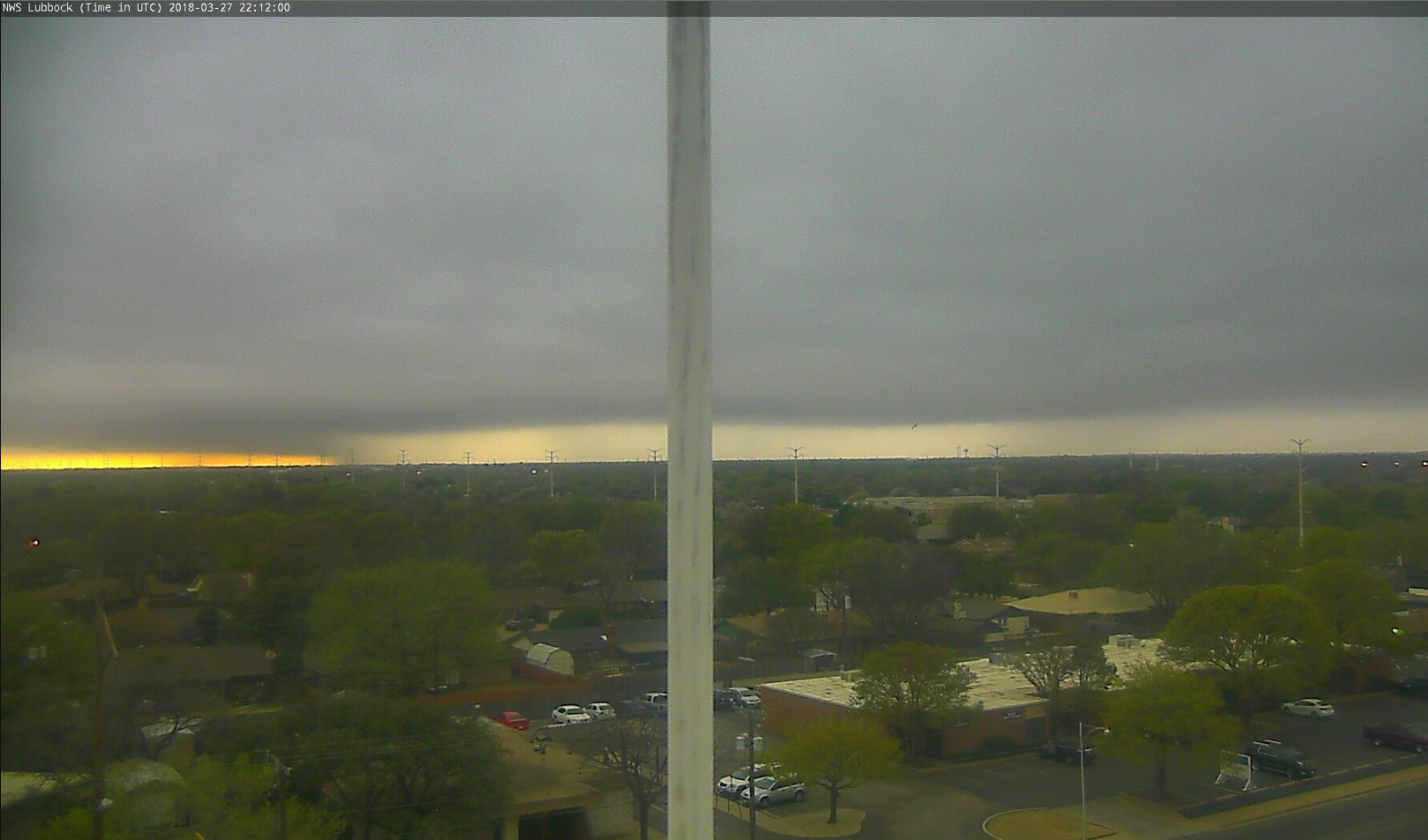
| A strong thunderstorm approaches Lubbock from the southwest early Tuesday evening (27 March 2018). The white hue descending from the clouds to the ground indicates hail is present in the storm. | |
| Late March brought welcome rain to much of the South Plains region. Sprinkles and light rain showers visited many locations on Monday (26 March), but dry lower levels limited amounts to generally under a tenth of an inch. This changed Tuesday afternoon as a cold front moving southward through the region joined forces with improved low-level moisture and an approaching upper level low from the west. The combination of factors, along with daytime heating ahead of the cold front, caused showers and thunderstorms to blossom. The initial activity developed across the southwest South Plains into the Permian Basin, but quickly expanded northeastward through the late afternoon and evening hours. | |
 |
|
| Lubbock radar animation valid from 5:24 pm to 7:04 pm on 27 March 2018. An additional animation valid from 8:37 pm to 10:13 pm on the 27th can be VIEWED HERE. | |
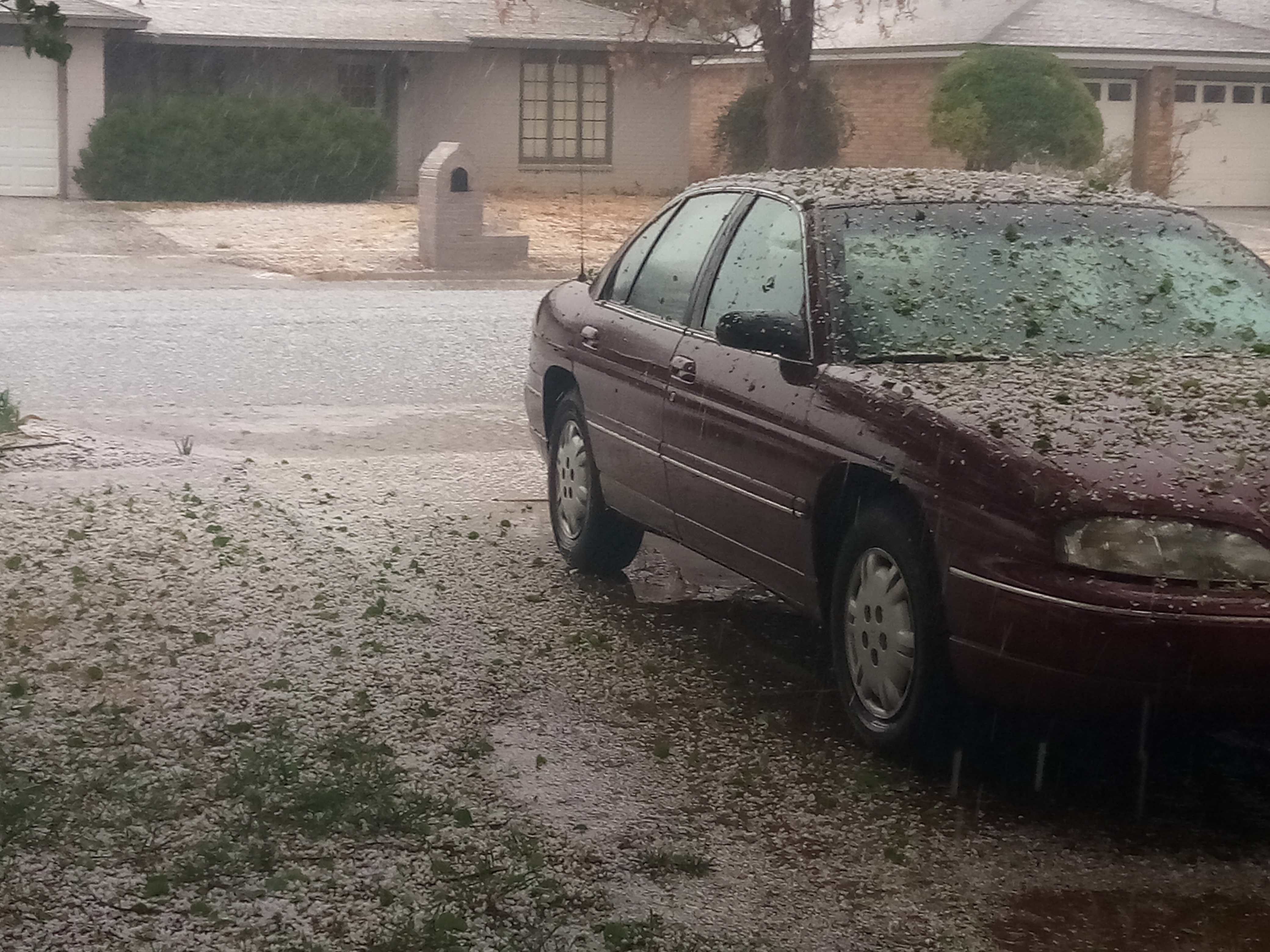
| Instability levels were not particularly high, but when coupled with strong vertical wind shear they were sufficient to produce several strong thunderstorms across the southern South Plains into the Permian Basin. One such storm briefly strengthened as it moved over the south side of Lubbock (seen at the beginning of the above radar loop). This storm dropped copious amounts of pea to dime size hail, blanketing the ground in a layer of white in spots. | |
  |
 |
| A couple of pictures of small but abundant hail that fell across southern Lubbock Tuesday evening (27 March 2018). The left picture is courtesy of Gary Skwira and the right one is from Jason Jordan. To view a short video of hail falling in south Lubbock CLICK HERE. | |
| In the developmental stages of the thunderstorms, a couple of brief landspout-type tornadoes were also observed. Unlike typical tornadoes which form under well-established rotating thunderstorms, landspouts often form when a growing cloud occurs above air that already possesses low-level rotation. In this particular case, the front provided a focus for near-ground rotation which was then stretched upward under the developing clouds to form the landspout tornado. Thankfully, landspout tornadoes are usually short-lived and relatively weak, often producing winds under 60 mph, akin to a strong dust devil. In addition to the landspout displayed below, another brief landspout tornado was observed near Meadow late Tuesday afternoon. Neither tornado caused any known damage before quickly dissipating. | |
 |
|
| Landspout tornado that formed near Loop, Texas, Tuesday evening (27 March 2018). The picture is courtesy of Cameron Nixon. Another brief landspout tornado was observed north of Brownfield this same evening. A link to a video of this second landspout tornado close to Meadow, captured by Mike Womack, can be VIEWED HERE.. | |
| The below satellite loop shows the moisture and implied circulation of the middle and upper atmosphere Tuesday afternoon. A well-defined upper level low (counterclockwise spin in the imagery) is seen over western New Mexico. This low provided lift over West Texas and drew a plume of sub-tropical moisture over the region. The lift and moisture, coupled with the front at lower levels, supplied ample forcing to generate the widespread showers and thunderstorms Tuesday evening and overnight. | |
  |
|
| Water vapor animation captured between 3:02 pm and 3:47 pm on 27 March 2018. | |
| The showers and thunderstorms quickly developed into a southwest-to-northeast oriented band that then tracked slowly eastward across the Rolling Plains through early Wednesday morning. The overall intensity and coverage of the activity did gradually decrease with time, particularly after 3 am Wednesday. | |
 |
|
| Regional radar animation valid from 8:28 pm to 9:38 pm on 27 March 2018. Additional regional radar animations can be found at: 5:28 pm to 6:38 pm on the 27th; and 1:58 pm to 3:08 pm on the 27th. | |
| The below visible satellite loop shows shower and thunderstorm development taking place over southeast New Mexico and the western South Plains Tuesday afternoon. The development occurred in a region of greater instability, where the clouds thinned and allowed for decent warming during the early afternoon. | |
 |
|
| 1-minute visible satellite animation captured between 3:39 pm and 3:48 pm on 27 March 2018. | |
| After all was said and done, most of the South Plains and Rolling Plains received beneficial rains. Rain totals near and above a half an inch were common east of a Plains to Plainview to Wellington line, with amounts near and above an inch cutting from southwest to northeast over the South Plains. Unfortunately, the northwest South Plains and southwest Texas Panhandle largely missed out, particularly from Morton through Sudan and Tulia where little to no rain fell. | |
 |
|
| 24-hour radar-estimated and bias-correct rain totals ending at 7 am on Wednesday, 28 March 2018. A plot of the 24-hour rain totals from the West Texas Mesonet over this period can be FOUND HERE. A map displaying the plotted COOP and WTM rainfall for this event can be VIEWED HERE. | |
| Officially the Lubbock Airport recorded 0.78" of rain during the event, boosting the total for the year to 1.07 inches. This rain cut the year-to-date rainfall deficit to 1.28 inches. Southern portions of Lubbock fared even better with measured totals near and above one inch common. | |

