| Mid-March brings rounds of strong winds, blowing dust and wildfires 15 - 19 March 2018 |
|
 |
|
| Wildfire burning in eastern Childress County on Friday evening, 16 March 2018. The picture is courtesy of the Texas A&M Forest Service. | |
| Two upper level storm system tracking out of the southern Rockies and into the central High Plains brought rounds of wind and blowing dust to West Texas in mid-March. The warm, dry and windy conditions also supported the ignition and spread of several wildfires in the region. | |
 |
|
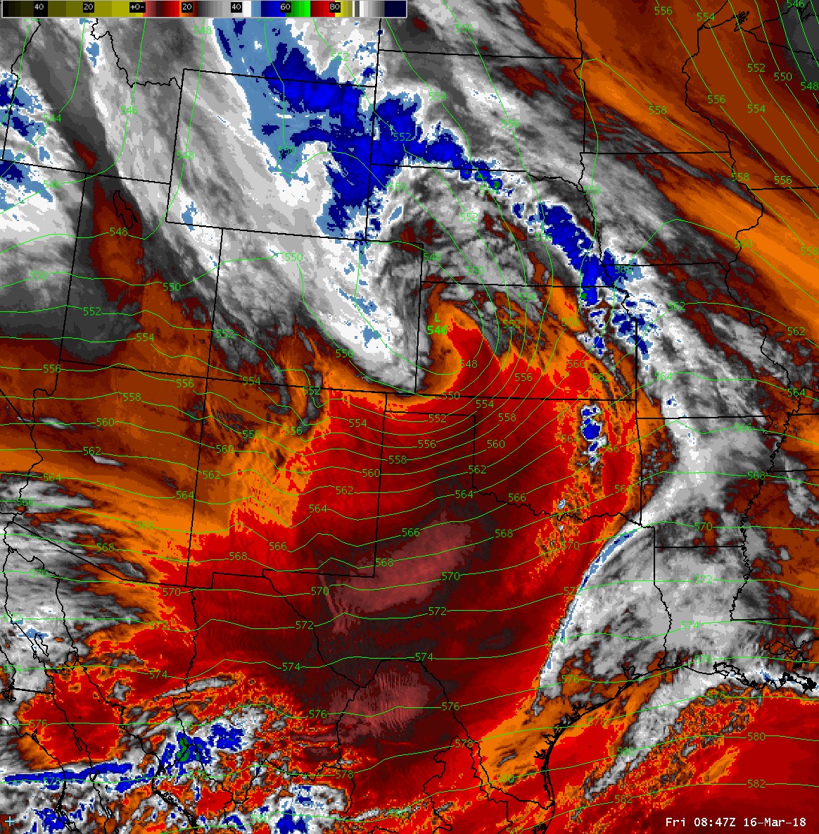
| Water vapor satellite loop valid from 3:47 to 6:07 am on 16 March 2018. | |
|
The first of the two storm systems tracked across western Kansas during the early morning hours of the 16th. Winds increased in advance of this system, gusting as high as 45 to 52 mph across the Caprock Thursday afternoon (15 March). The winds decreased slightly overnight, but renewed in vigor on Friday as the system gradually pulled away from the region. A few wildfires developed both Thursday and again Friday, including one northeast of Childress that is pictured at the top of this page. Thankfully, the fires were able to be contained as winds diminished in the evening hours, or earlier in a couple cases. |
|
 |
 |
| Maximum wind speeds (mph) recorded by the West Texas Mesonet on March 15th (left) and March 16th (right). | |
| Saturday, March 17th provide one welcome light wind day between the two potent systems. The light wind conditions persisted into the first half of the 18th. In addition, an upper level disturbance in advance of the primary storm system brought enough Pacific moisture to squeeze out light rain over a good chunk of the South Plains, Rolling Plains and southeast Texas Panhandle Sunday morning. | |
 |
|
| Regional radar animation valid from 5:28 am to 6:38 am on 18 March 2018. | |
| Rain totals of a couple hundredths to a tenth of an inch were common with the early Sunday rain. Unfortunately, the light rain and weak winds were quickly replaced with much drier air as strong southwesterly winds spread out of New Mexico ahead of the next quickly approaching upper low. | |
 |
|
| 24 hour radar-estimated rainfall ending at 7 pm on 18 March 2018. A plot of the measured rain totals for the West Texas Mesonet can be VIEWED HERE. | |
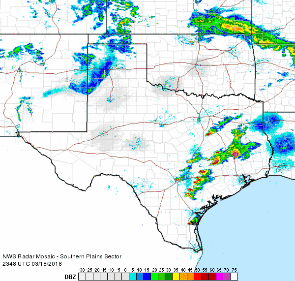
| After observing rain in the morning, radar turned to sampling smoke and blowing dust in the afternoon and evening as wind gusts exceeded 50 mph across the southwest Texas Panhandle and western South Plains. The below radar animation shows a plume of smoke streaming northeastward from a fire located southeast of Morton. The larger plume stretching out of eastern New Mexico into the western Texas Panhandle is dust, which was concentrated along a Pacific cold front. | |
 |
|
| Lubbock radar animation valid from 3:27 pm to 5:15 pm on 18 March 2018. | |
| The below satellite imagery clearly shows areas of dust spreading out of eastern New Mexico and across the South Plains during the evening of the 18th. The Pacific front can be seen concentrating the dust over the northwest South Plains, while it was also helping to spark thunderstorm development from the northeastern Texas Panhandle into western Kansas. | |
 |
|
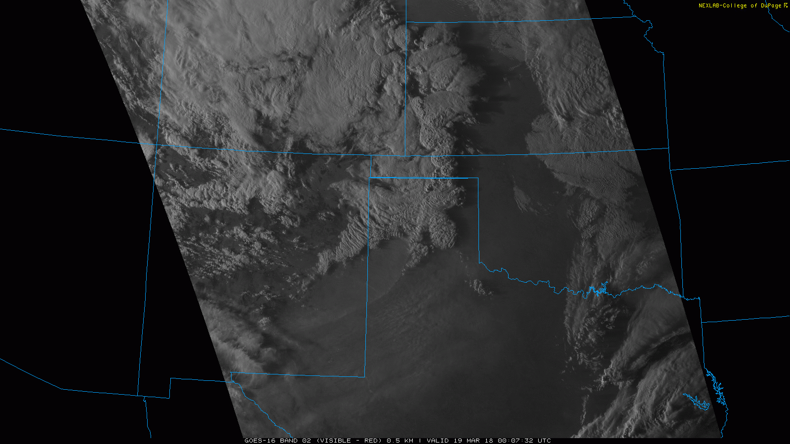
| 1-minute visible GOES 16 animation from 7:07 pm to 17:17 pm on 18 March 2018. | |
| The below view is what the approaching cold front and concentrated area of dust looked like in eastern Hockley County Sunday evening. The visibility did drop well below a couple of miles for a short period as the front moved through, with some dust lingering in the air through much of Sunday night. | |
 |
|
| Picture of the dust along a cold front approaching the Ropesville during the evening of 18 March 2018. The image is courtesy of Wes Burgett. | |
| Across the northeast Texas Panhandle, where the front encountered better moisture and instability, isolated strong to severe thunderstorms development Sunday evening. Quarter size hail and a couple of tornadoes were reported with the severe thunderstorms, including one brief landspout tornado south of Spearman and another tornado that downed power lines and an out building northwest of Glazier. West of the severe thunderstorms, a few large wildfires affected the Texas Panhandle, including a couple of fires near Amarillo and one northeast of Channing. | |
 |
|
| Regional radar animation valid from 6:48 pm to 7:58 pm on 18 March 2018. | |
| The South Plains and Rolling Plains missed out on the thunderstorms, but very strong westerly winds did continue through much of Sunday night and early Monday morning. In fact, numerous locations gusted from 55 to 60 mph during the overnight hours. The winds did finally decrease toward dawn Monday, though gusty northwesterly winds redeveloped and persisted through much of Monday before finally dropping off more significantly Monday evening. | |
 |
|
| Peak wind gusts (mph) recorded by the West Texas Mesonet and National Weather Service on the evening of the 18th (Sunday) and early morning hours of the 19th (Monday). The circled gusts occurred between 11 pm and 3 am. | |

