| Spring-like system brings thunderstorms to West Texas 26 December 2018 |
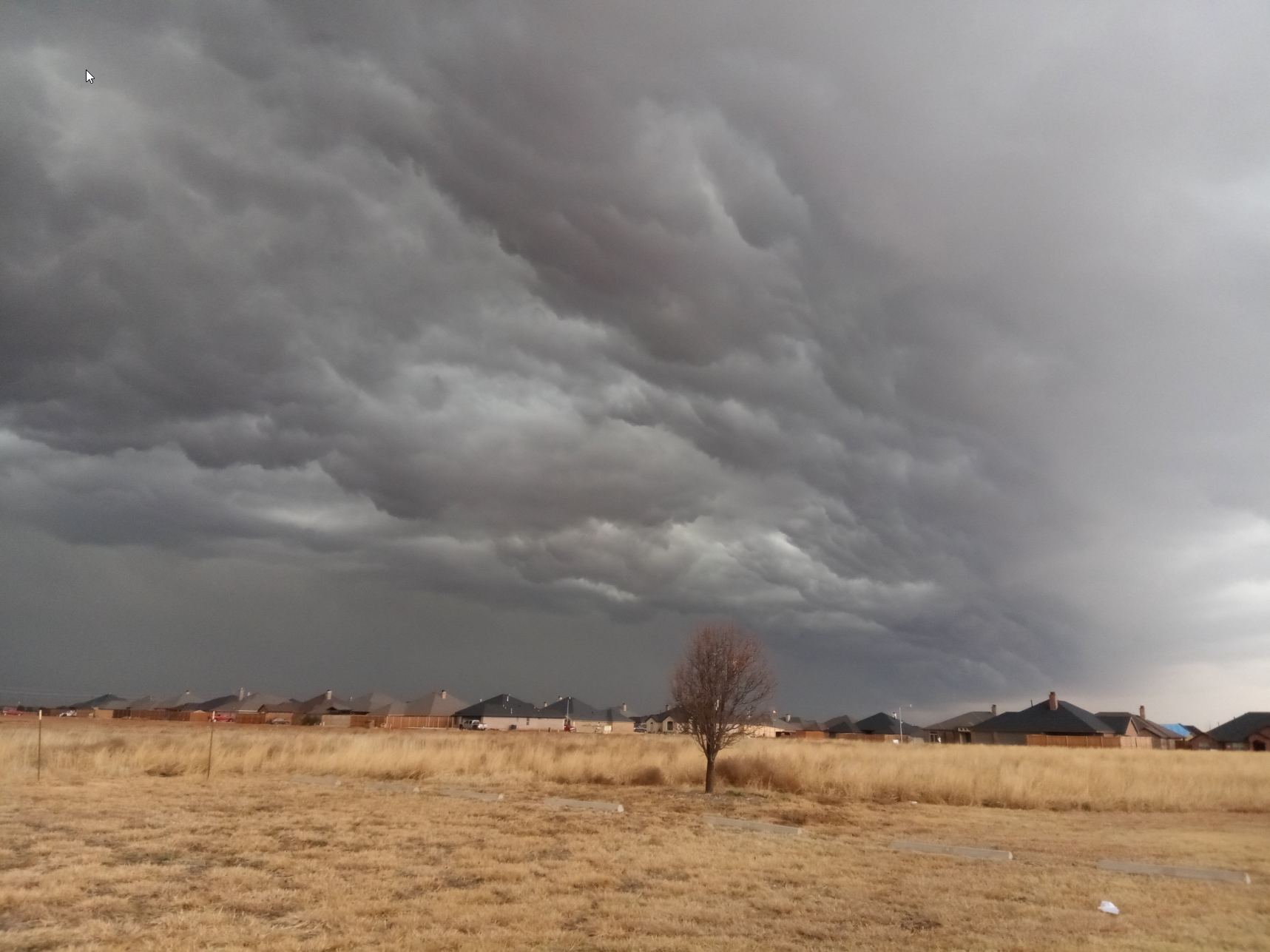 |
| Leading edge of a line of thunderstorms moving into Lubbock around 2 pm on Wednesday, 26 December 2018. |
| Following a mild and tranquil Christmas Eve and Christmas Day, moisture rapidly increased ahead of a strong storm system dropping through the Desert Southwest. This initially led to the development of widespread low clouds, fog and drizzle late in the evening on Christmas. The moisture then fueled scattered showers and thunderstorms by early Wednesday morning (26 December) as lift and moisture deepened. The strongest storms produced plenty of lightning in addition to brief downpours. |
 |
| Regional radar animation valid from 11:18 am to 12:28 pm on 28 December 2018. |
| A short lull in precipitation followed late morning into early afternoon before even stronger lift from the approaching system and Pacific-type cold front sparked additional thunderstorms. |
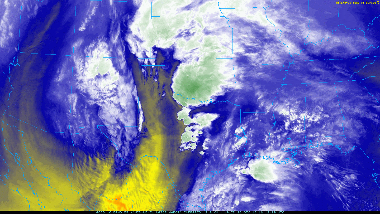 |
| Water vapor satellite loop captured from 12:12 pm to 12:57 pm on 26 December 2018. |
| These thunderstorms quickly formed into a line across the western South Plains and then marched eastward through the afternoon and early evening hours. Enough instability and wind shear was present to support a few strong to severe thunderstorms. Many spots experience small hail as the line moved through, while hail as large as quarters fell in Littlefield and Matador. |
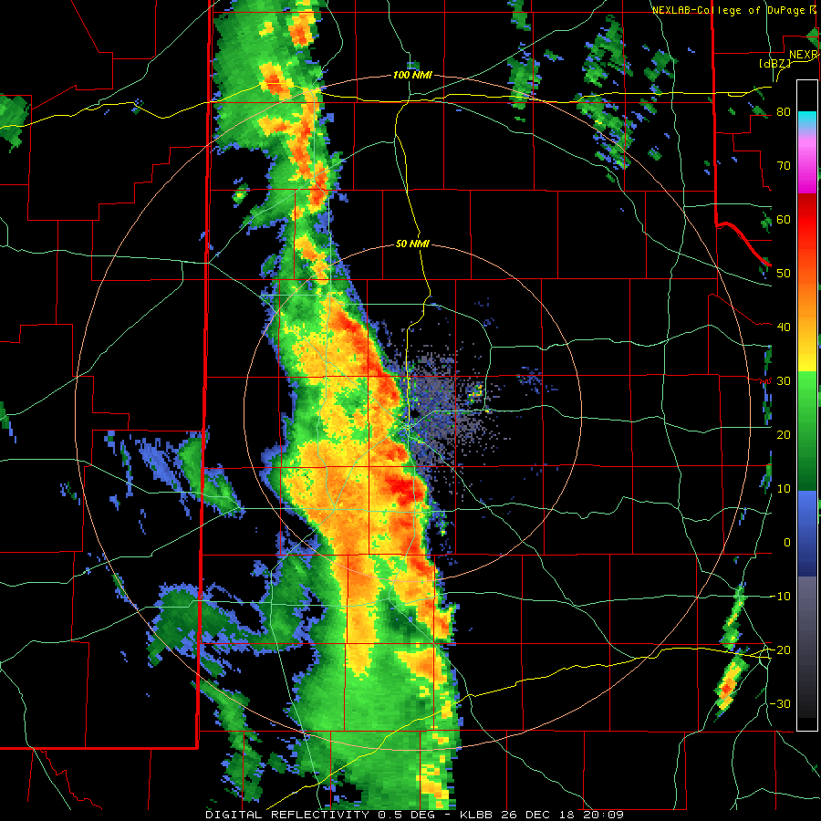 |
| Lubbock radar animation valid from 2:09 pm to 2:44 pm on 26 December 2018. Additional regional radar animation can be found at: 12:48 pm to 1:58 pm on 28 December 2018; and 5:08 pm to 6:18 pm on 28 December 2018. |
| Strong winds in excess of 50 mph also accompanied the squall line, causing minor damage in spots. Moreover, several brief spin ups developed along the leading edge of the line of storms. At least one of these areas of rotation spawned a brief tornado east of Afton where it damaged three silos and caused minor property damage. |
 |
| Rainfall measured by the West Texas Mesonet from 26 December 2018. A bias-corrected radar-estimated rainfall plot can be FOUND HERE. |
| The rounds of thunderstorms did bring more welcome winter moisture to West Texas. Many spots picked up a tenth to half inch of rain, with a couple swaths of heavier rain in the Rolling Plains. The Lubbock Airport officially recorded 0.32 inches. The Childress Airport measured 0.41 inches. |

