| A cool, moist and wet weekend 6-8 October 2018 |
 |
| Tornado captured north of Dimmitt on the Sunday afternoon, 7 October 2018. The picture is courtesy of Blake Brown. |
| The first weekend of October brought a continuation of the wet and unsettled stretch of fall weather. The primary instigator this weekend was a slow-moving upper level storm system that parked across the Desert Southwest. This system provided rounds of lift that interacted with abundant moisture and a frontal zone that pushed into the center part of the state. |
 |
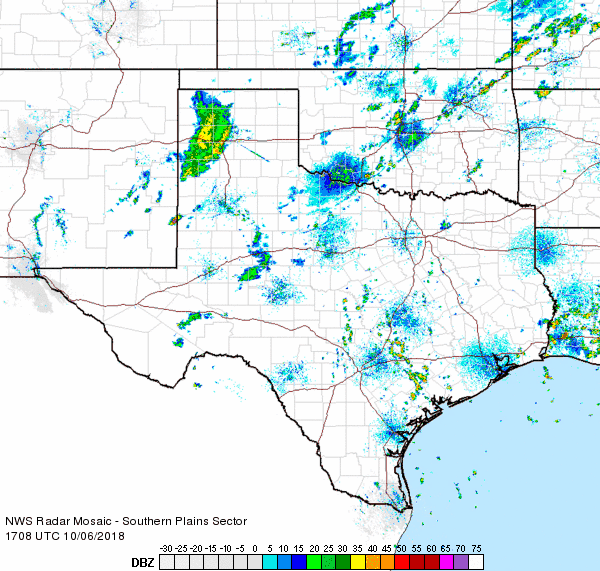
| Regional radar animation valid from 4:18 pm to 5:28 pm on 6 October 2018. Additional radar animations can be found at: 12:08 pm to 1:18 pm on 6 October; and 7:28 pm to 8:38 pm on 6 October. |
| The focus for the more widespread showers and thunderstorms were closer to the front, across the southern South and Rolling Plains on Saturday, October 6th. The frontal zone lifted northward as a warm front the following day. After a bout of showers and thunderstorms across the Rolling Plains and southeast Texas Panhandle Sunday morning and early afternoon, thunderstorms formed along the front across the southwest Texas Panhandle. |
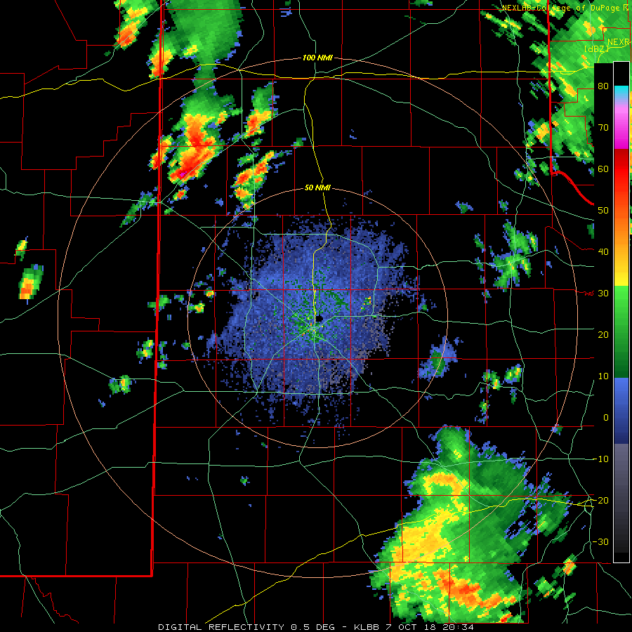 |
| Lubbock radar animation valid from 3:34 pm to 4:09 pm on 7 October 2018. |
| The thunderstorms over the southwest Texas Panhandle quickly became intense, generating hail and even a couple of brief tornadoes. The warm front provided enough extra spin for the thunderstorms to rotate rapidly, with one storm dropped two brief tornadoes north of Dimmitt. Thankfully, the tornadoes occurred over open land and caused no known damage. The storms also dropped very heavy rain which caused flooding north of Friona. |
 |
| Wall cloud and possible funnel observed near Bovina Sunday afternoon, 7 October 2018. The pictures is courtesy of Brandon Sullivan. |
| More widespread showers and thunderstorms then moved slowly across West Texas the following day, Monday, 9 October. This occurred as the southwestern storm system finally began moving eastward. Instability was rather limited, but a very moist atmosphere still supported heavy rain with the more intense showers. A small supercell thunderstorm even dropped quarter size hail as it tracked north of Brownfield Monday evening before weakening. |
 |
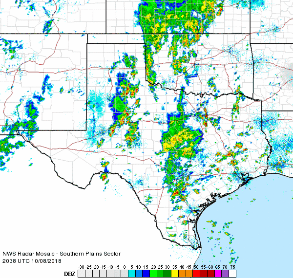
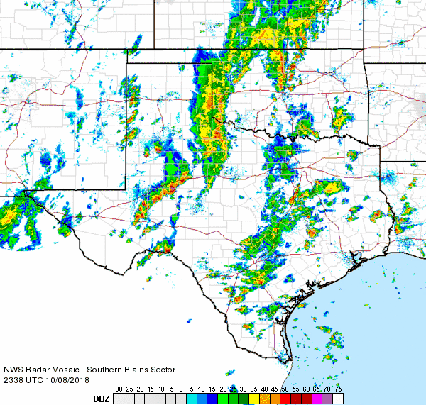
| Regional radar animation valid from 8:58 am to 10:08 am on 8 October 2018. Additional radar animations can be found at: 6:38 am to 7:48 am on 8 October; 3:38 pm to 4:48 pm on 8 October; and 6:38 pm to 7:48 pm on 8 October. |
| Eventually it dried out as the upper level storm system moved by to the north of the region, but not before everyone across the South Plains region saw some rain. Many locations recorded two or more inches of rain over the course of the three days, with the heaviest totals generally found in the Rolling Plains and southeast Texas Panhandle. |
 |
| Five-day radar-estimated and bias-corrected rain totals ending at 4 am on 10 October 2018. A regional view of this same information can be VIEWED HERE. |
| The heavy rain did cause minor flooding in many locations, but it also helped to ease the long term drought that was still impacting the region. Officially the Lubbock Airport recorded 1.67 inches of rain over this event. |
 |
| West Texas Mesonet three-day rain totals ending at 8 pm on 9 October 2018. |
| The below satellite imagery shows the large and complex storm system that provided the unsettled stretch of weather in early October 2018. The dynamic and moisture rich system was more reminiscent of a spring-type system in many ways. |
 |
| Water vapor imagery captured at 6:27 pm on 7 October 2018. |

