| Storms bring high winds and large hail 7 June 2018 |
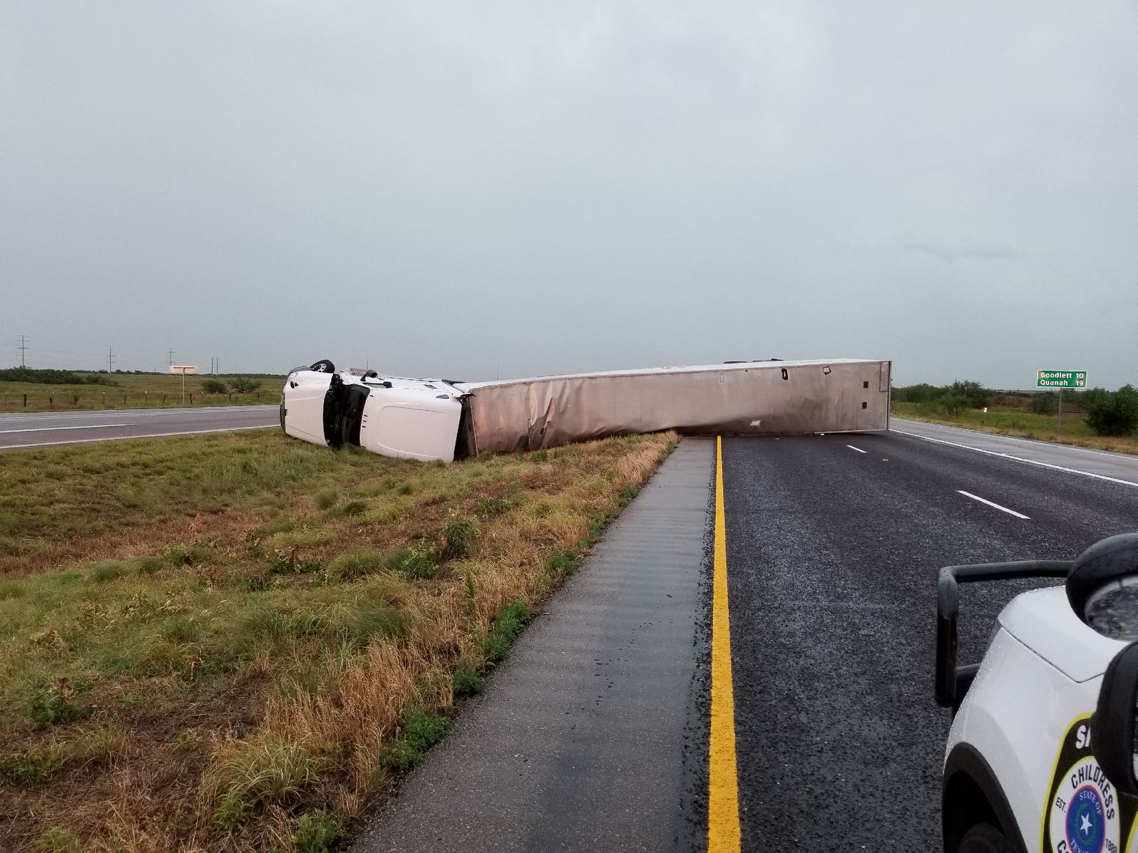 |
| Tractor trailer blown over near Kirkland, on Highway 287, on the evening of 7 June 2018. |
| Hot temperatures, decent moisture levels and a passing upper level disturbance were enough to support the development of severe thunderstorms on Thursday afternoon (7 June 2018). Storms exploded across the southeast Texas Panhandle and northern Rolling Plains between 2 and 3 pm, quickly becoming severe. The most intense storms quickly began rotating while also slowing to a crawl. One storm stalled over the Tell area, dropping torrential rain and golf ball size hail. The COOP observer in Tell recorded 4.48 inches of rain, much of which fell in a couple of hours and nearly flooded his residence. |
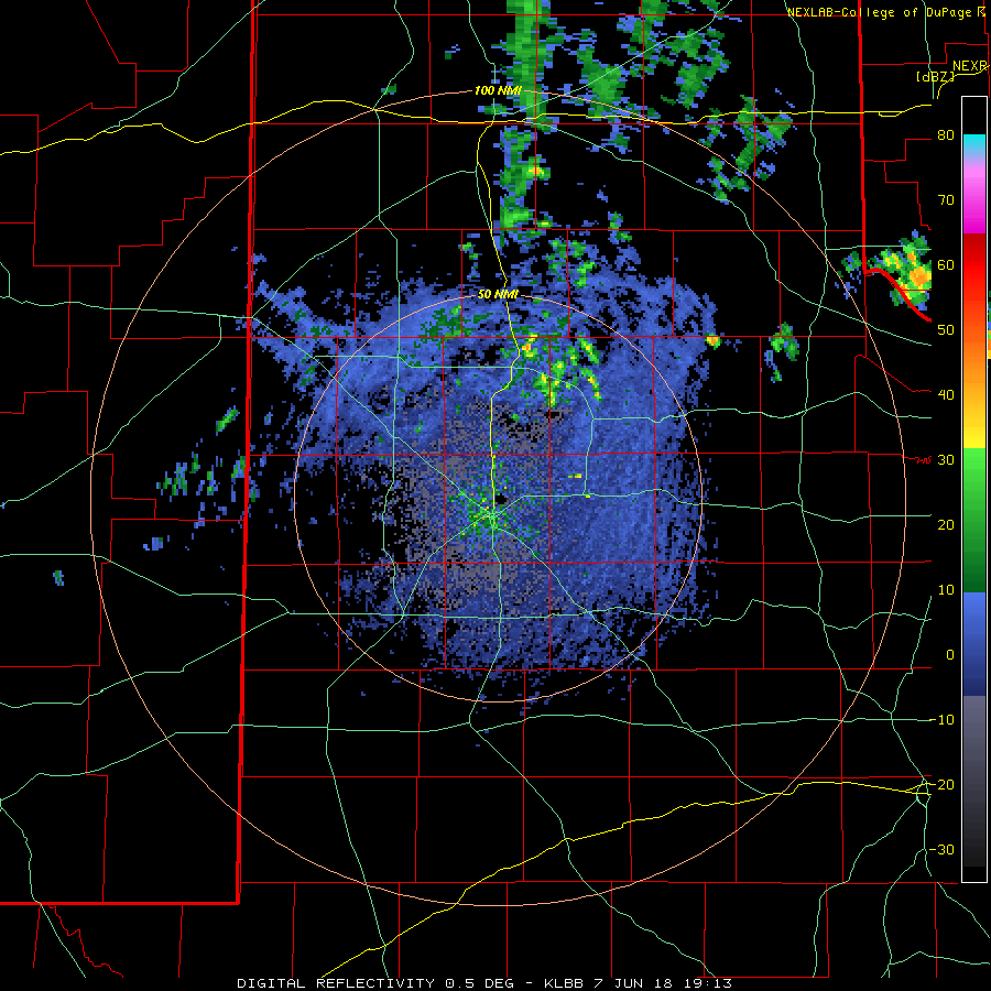 |
| Lubbock WSR-88D animation valid from 2:13 pm to 2:57 pm on 7 June 2018. |
| In addition to producing swaths of large hail, a couple of the storms generated damaging wind gusts. One storm produced a measured gusts of 84 mph at the West Texas Mesonet site 2 miles south of Lesley. The severe winds also knocked over a tractor trailer near Kirkland (picture at the top of this page). |
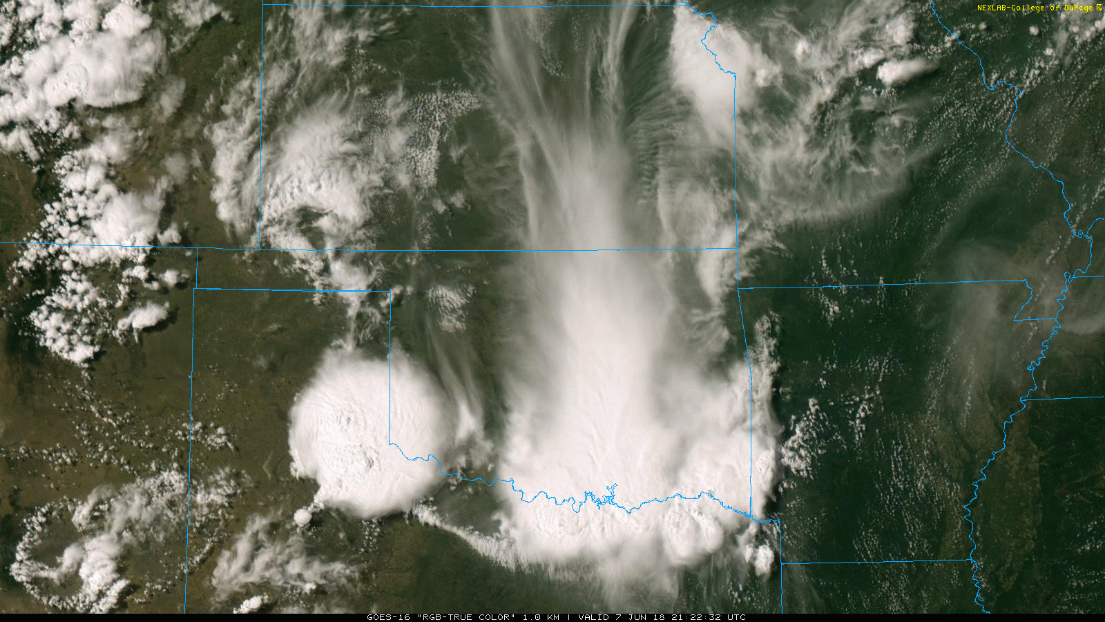 |
| GOES 16 "RGB-True Color" image captured at 4:22 pm on 7 June 2018. |
| The thunderstorms congealed into a small complex as they gradually advanced southeastward across the Rolling Plains through the evening and overnight hours. |
 |
| Regional radar animation valid from 5:18 pm to 6:28 pm on 7 June 2018. Additional animations can be viewed at: 3:28 pm to 4:38 pm on 7 June 2018 and 4:18 pm to 5:28 pm on 7 June 2018. |
| The complex of thunderstorms did send a strong outflow boundary westward onto the Caprock. This outflow kicked up a lot of dust and a haboob was observed in some locations, like near Slaton in the below picture. |
 |
| Haboob near Slaton on the evening of June 7th. The picture is courtesy of Mark Ethridge. |
| The thunderstorms did provide widespread rain for much of the southeast Texas Panhandle and Rolling Plains. Rain totals of 1/2 to 1+ inches were common, with localized pockets in excess of 1.5 inches. The Childress Airport officially recorded 1.14 inches, while back up on the Caprock Lubbock only saw a trace. |
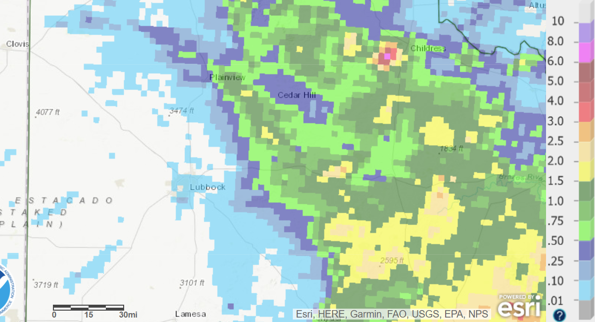 |
| 24-hour radar-estimated and bias-corrected rainfall ending at 7 am on 8 June 2018. |
| The preliminary storm reports for this event can be FOUND HERE. |

