| Damaging Winds and Large Hail Hammer Ralls 1 June 2018 |
|
 |
|
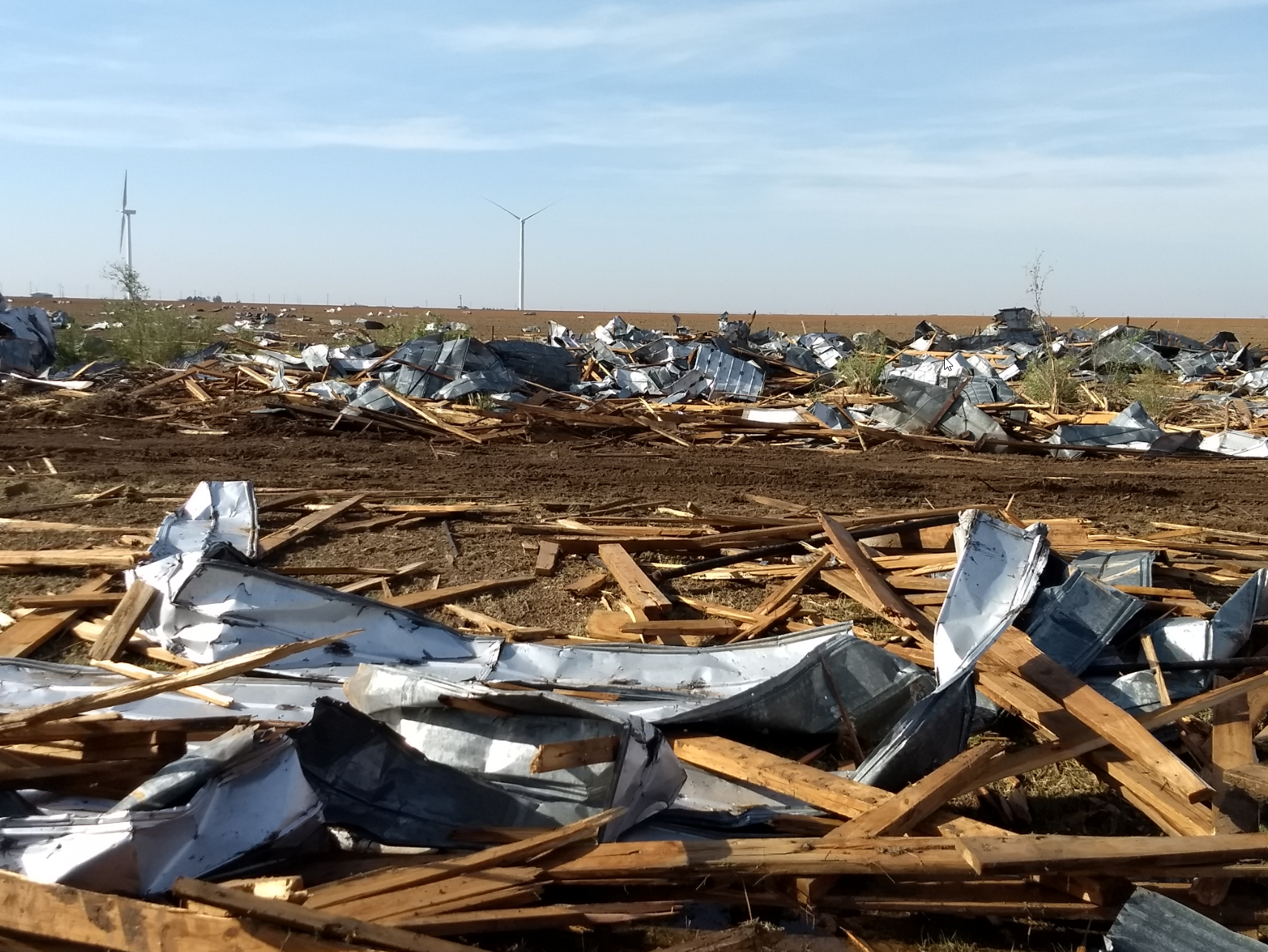
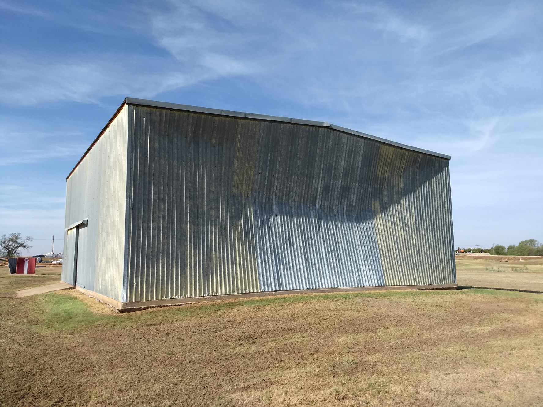
| Damage sustained at the Ralls Compress in Ralls, TX, on the evening of 1 June 2018. | |
| Record heat and sufficient moisture along and ahead of a dryline was enough to generate widely scattered showers and thunderstorms during the afternoon of 1 June 2018. One particular storm began to rotate and strengthen as it moved southeastward from the eastern South Plains into the southern Rolling Plains. This storm went on to produced damaging winds and large hail as it tracked across Ralls, Crosbyton, Spur, north of Clairemont and east of Jayton during the late afternoon and early evening hours. | |
 |
|
| The back side of a severe thunderstorm on the evening of the June 1st. The image is looking east from south Lubbock. | |
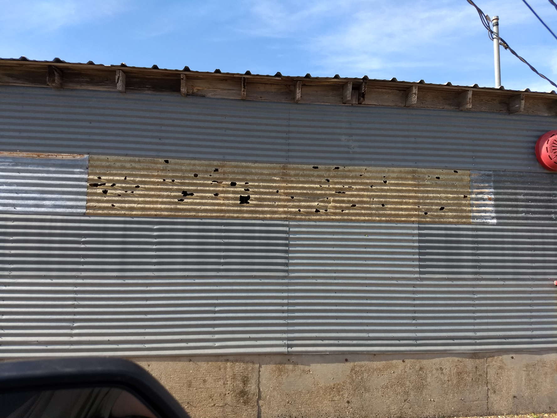
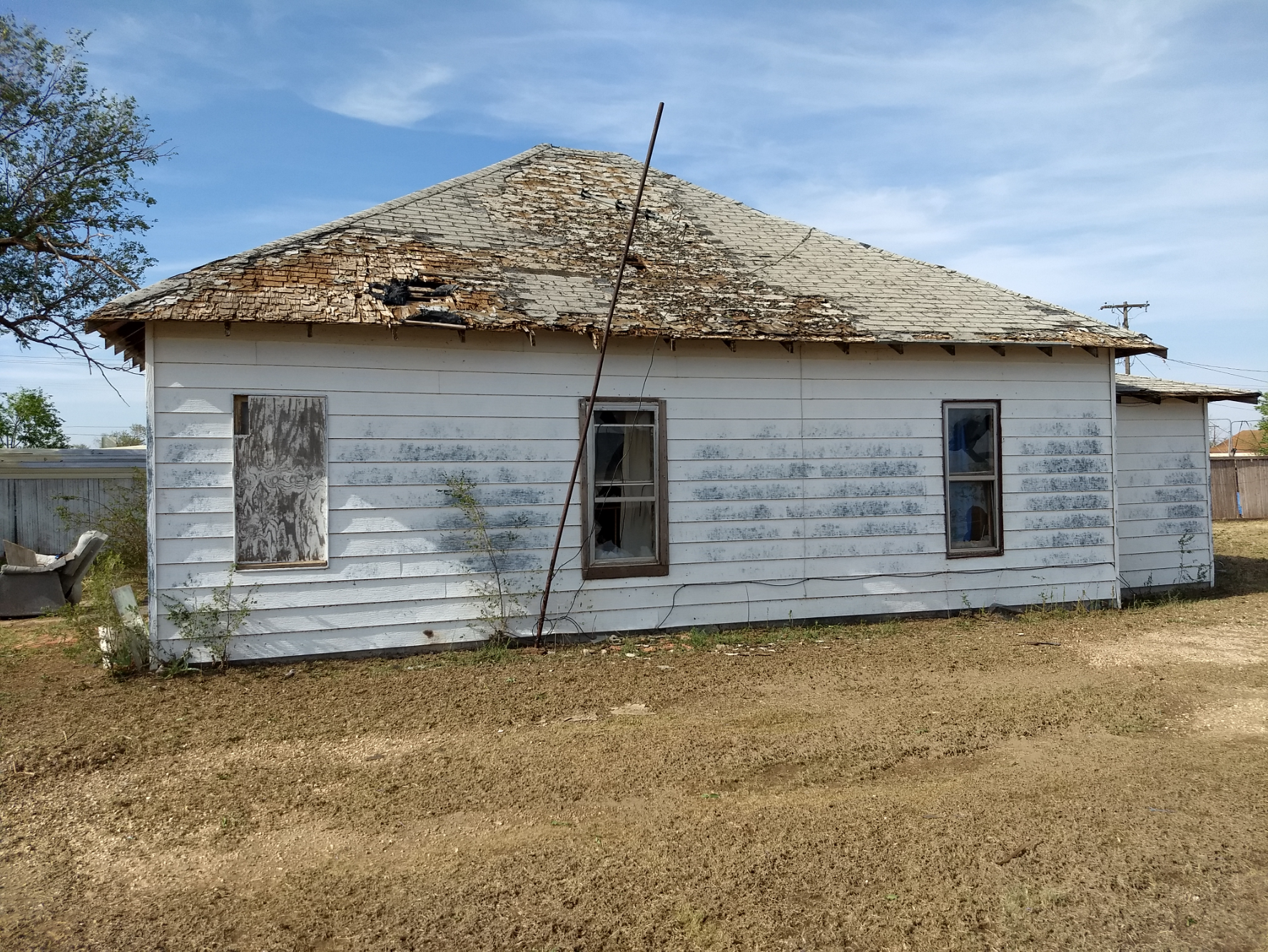
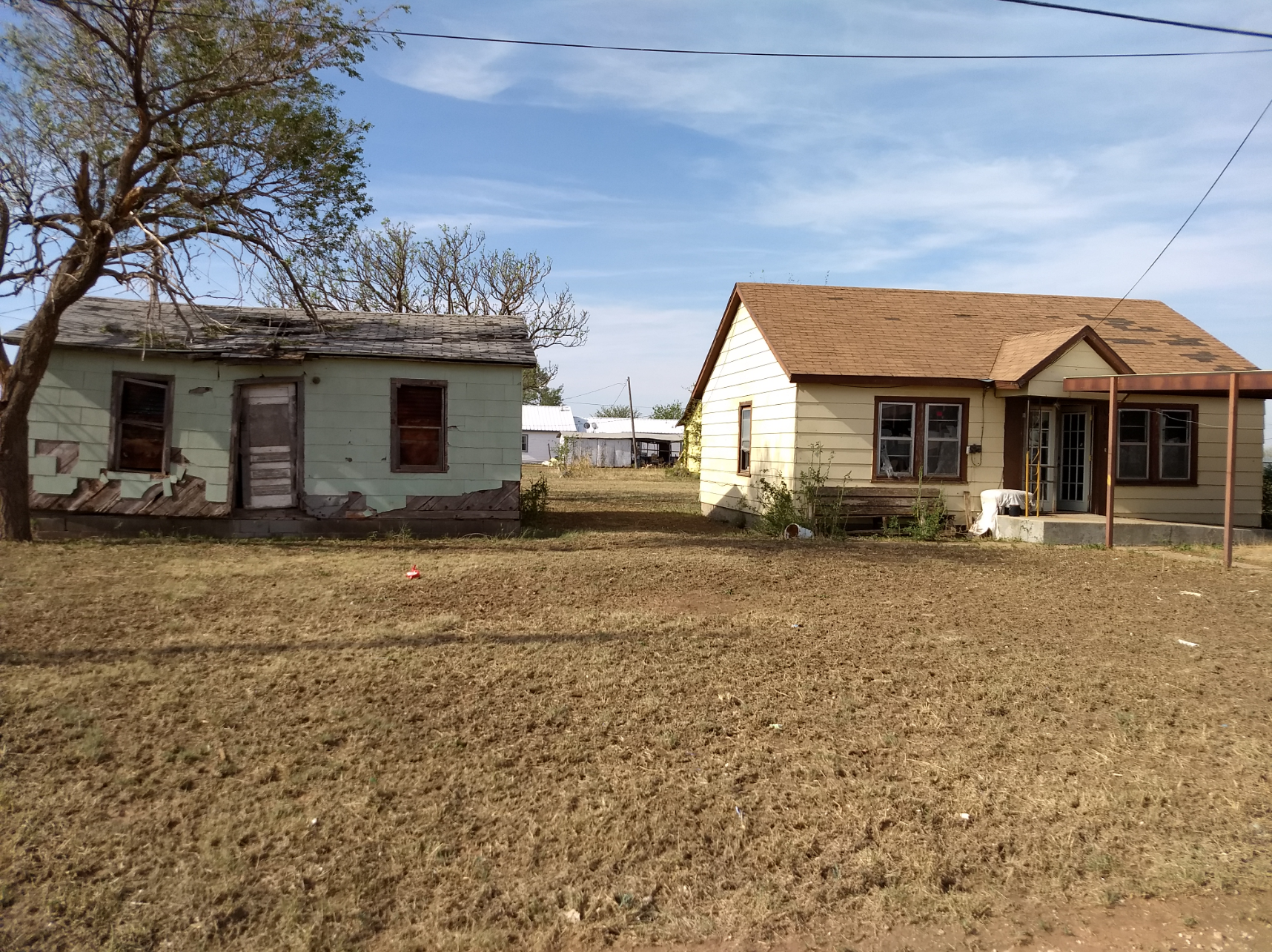
| Ralls was particularly hard hit, where winds estimated as high as 80 to 90 mph damaged and destroyed several buildings on the southwest side of town. Wind-driven hail as large as baseball as caused extensive window, roof and tree damage around town. | |
 |
|
| The dominate storm formed in an environment characterized by very hot temperatures, peaking near 105â°F. These conditions were quite favorable for the generation of strong downburst winds, as was experienced in several locations along the storms track. The West Texas Mesonet side located on the southeast side of Ralls did measure a wind gust of 69 mph before being destroyed by the large hail. | |
 |
|
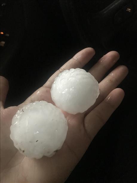
| Large hail that fell in Ralls on June 1st. The picture is courtesy of KCBD and Jodie. | |
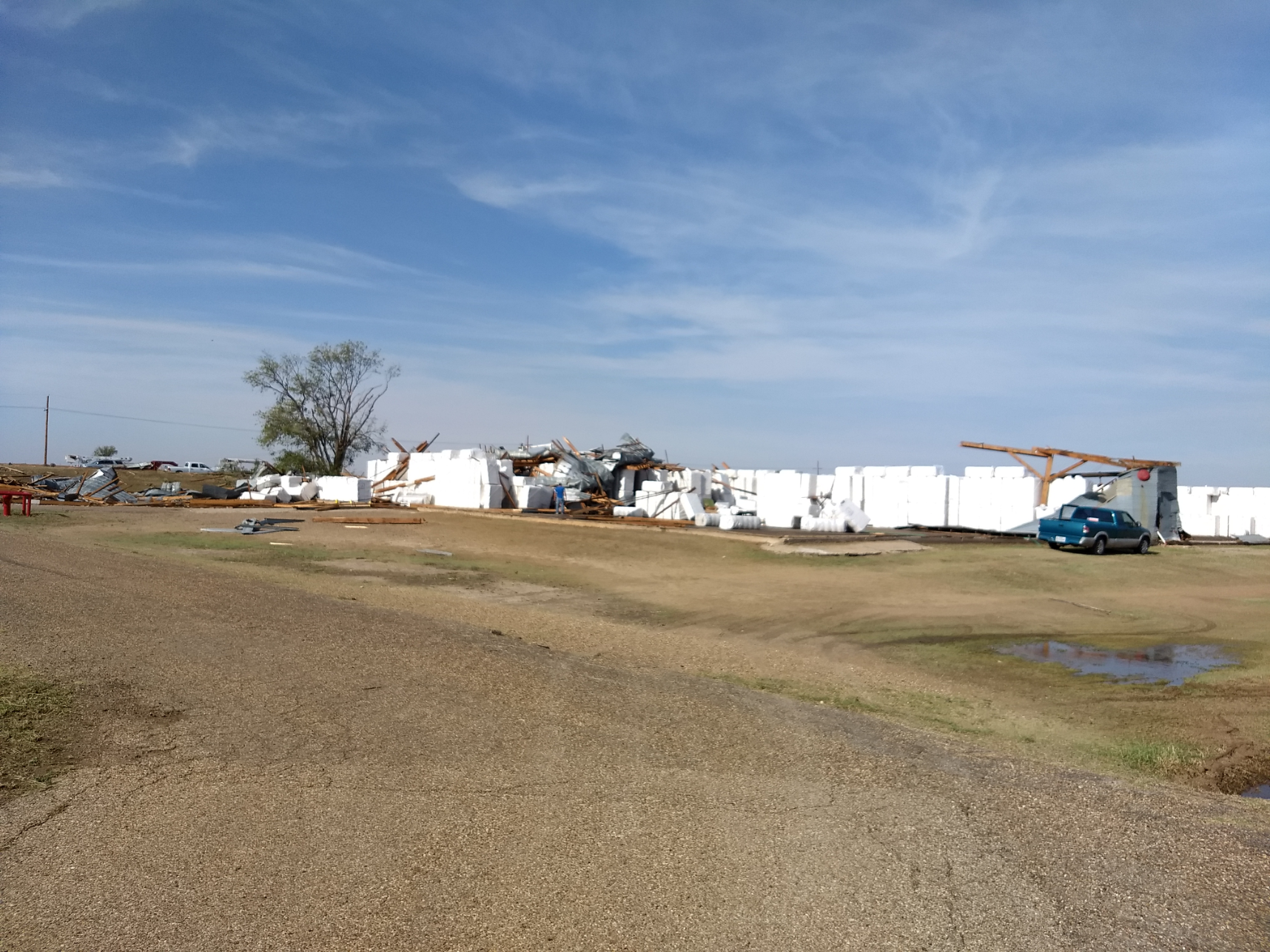
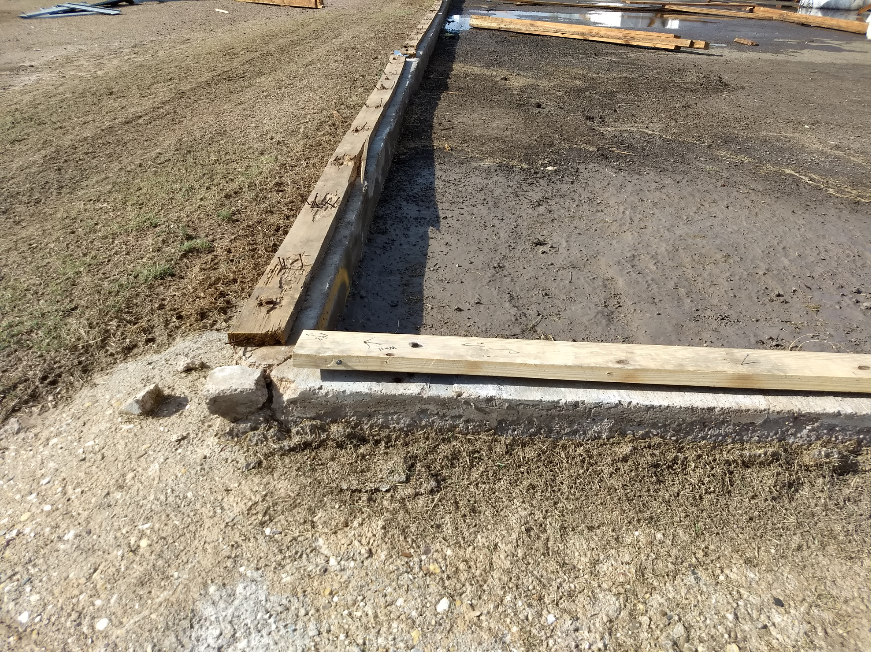
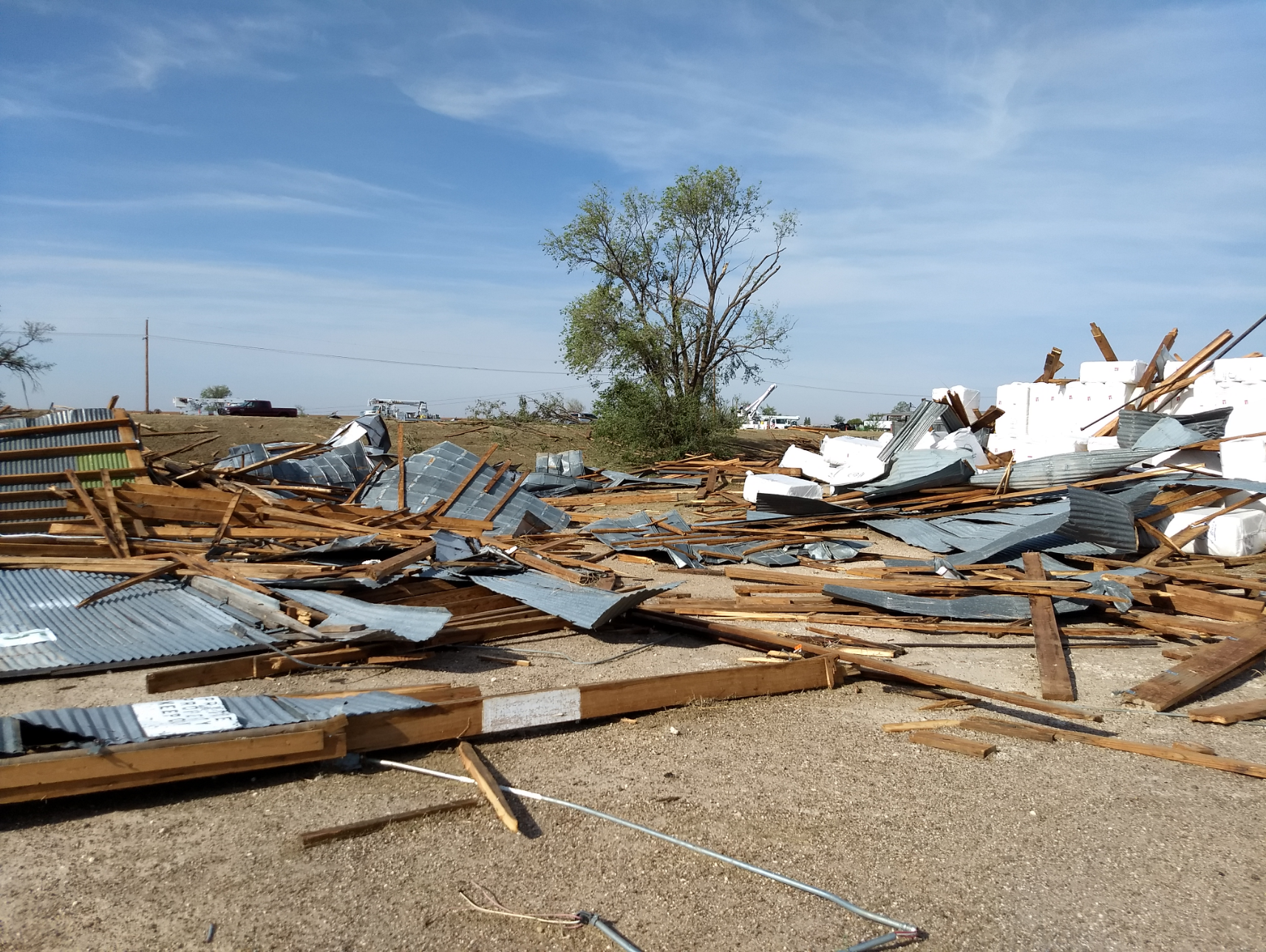
| As the below pictures show, the intense winds and large hail did a lot of damage in and around Ralls. The Ralls Compress was hard hit, with three warehouses north of U.S. Highway 62/82 being completely destroyed with debris blown southward across the highway. Several dozen utility poles were damaged or destroyed on the west side of town and a number of center pivots were overturned. | |
 |
 |
 |
 |
 |
 |
| Damage sustained at the Ralls Compress in Ralls, TX, on the evening of 1 June 2018. | |
| The wind driven hail also knocked out many north facing windows and damaged roofs. | |
 |
 |
| Damage sustained to buildings in Ralls, TX, on the evening of 1 June 2018. | |
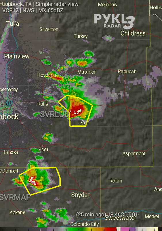
| The below radar image was captured around the time of the 69 mph wind gust recorded by the West Texas Mesonet site located on the southeast side of Ralls. The high reflectivity (reds/purples) indicated heavy rain and hail. The velocity data captured at this same time are relatively unremarkable, likely at least partly due to the fact that the winds were largely perpendicular to the radar beam from the Lubbock radar. | |
 |
|
| Lubbock radar image captured at 5:45 pm on 1 June 2018. A view of the velocity data at this same time can be VIEWED HERE. | |
| The below meteogram shows how the temperature crashed from the triple digits into the 60s as the storm moved through. In addition to the wind and hail, the Ralls Mesonet also record 0.54 inches of rainfall. | |
 |
|
| Meteogram from the Ralls West Texas Mesonet site located on the southeast side of town for 1 June 2018. | |
| The radar animation shows the storm as it approached Spur, after inflicting the damage at Ralls. This storm dropped baseball size hail in Spur as it passed over around 7 pm after generating a 68 mph wind gust at the White River Lake West Texas Mesonet a half hour earlier. | |
 |
|
| Lubbock radar animation of the supercell that produced damaging winds as it moved by Ralls and Spur on 1 June 2018. The animation is valid from 6:46 pm to 7:07 pm. | |
| The intense thunderstorm continued to track southeastward, producing severe wind gusts and large hail. Wind gusts near 70 mph were estimated north of Clairemont and east of Jayton, while golf ball size hail was observed 9 miles northwest of Clairemont. | |
 |
|
| Large hail that fell in Spur on 1 June 2018. The picture is courtesy of KCBD. | |
| The below plots show the maximum temperatures and wind gusts record by the West Texas Mesonet on June 1st. Triple digit highs were common, with most spots seeing highs peak within a couple of degrees of 105. Even outside of the severe winds associated with the thunderstorms, breezy winds gusting to 30 to 40 mph were common. | |
 |
 |
| High temperatures (left) and maximum wind gusts (mph) observed by the West Texas Mesonet on 1 June 2018. | |
| On the positive side of things, the thunderstorms did drop locally heavy rain during this relatively dry spring season. However, most locations recorded little to no rainfall. | |
 |
|
| Radar-estimated and bias-correct 24 hour precipitation ending at 7 am on 2 June 2018. A plot of the rain measured by the West Texas Mesonet can also be VIEWED HERE. | |
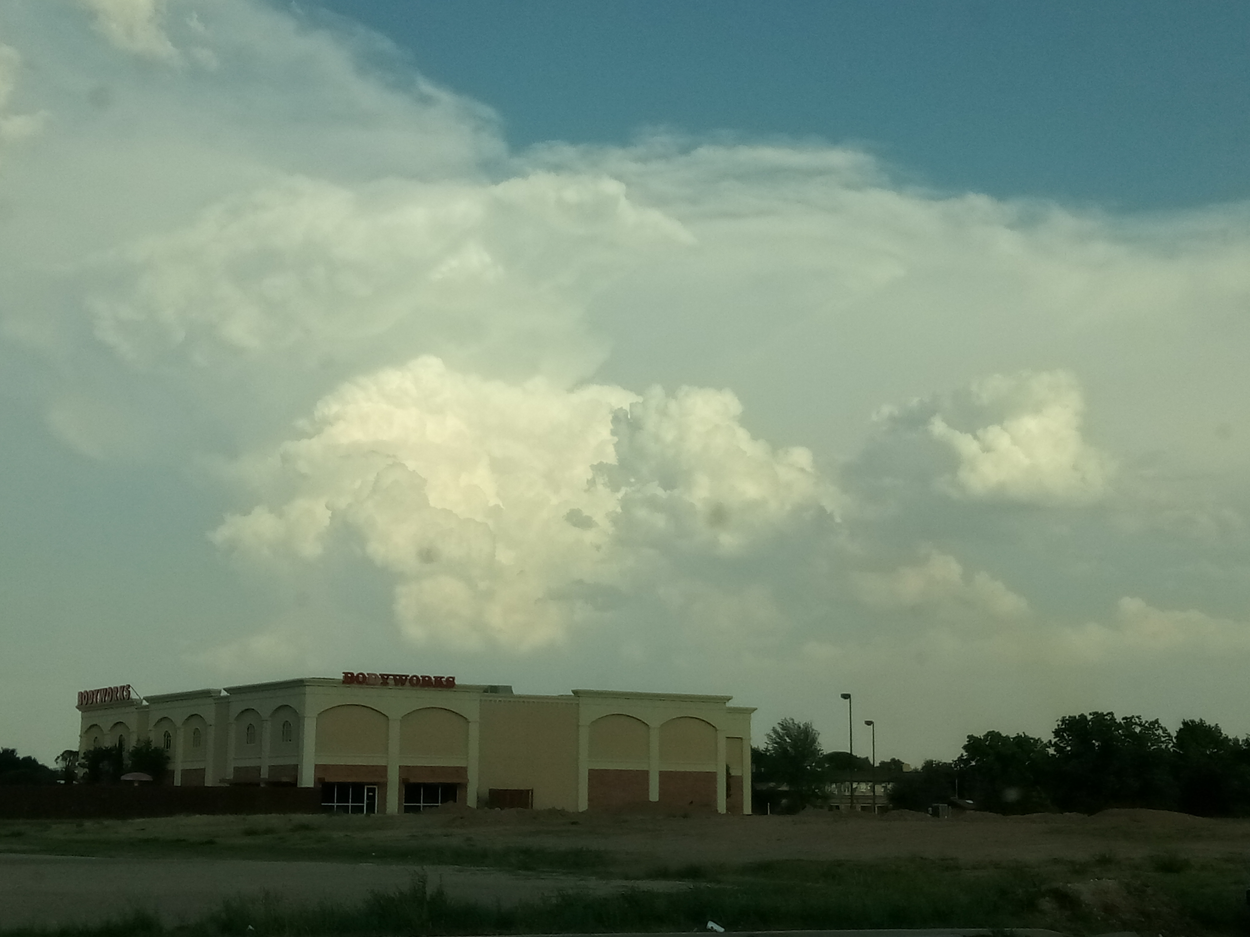
| The storm clouds did also create a picturesque view as can be seen below. | |
 |
|
| The severe thunderstorms did paint a beautiful sky, as viewed from Lubbock the evening of June 1st. | |
| The preliminary storm reports for the event can be FOUND HERE. In addition, a damage survey was conducted by the National Weather Service in Lubbock. The results of the damage survey can be VIEWED HERE. | |

