Late Tuesday afternoon, a broken line of showers and thunderstorms developed across the far southern and eastern portions of the Texas Panhandle, then moved generally to the southeast across the northern Rolling Plains in the evening hours. This activity developed in an atmospheric environment that is well known to support strong wind gusts. The presence of some mid-level moisture and instability helps generate the showers & t-storms, and the deep, dry boundary layer (the layer of air between the cloud base and the ground) helps accelerate the downdrafts as they descend with evaporating precipitation (virga). Tuesday evening, one such downdraft (often called a dry microburst or downburst depending on the extent of the winds) hit the town of Memphis, Texas in the far northeast portion of Hall County, producing wind gusts measured up to 75 mph and wind damage in town.

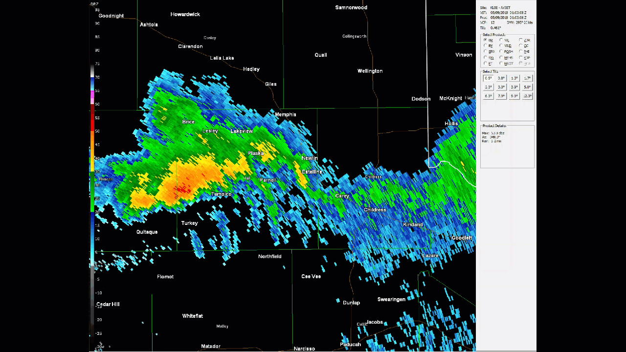
As the above radar image shows, at the time of the downburst, the echos in the vicinity of Memphis were very weak. In fact, no rain was reported at the West Texas Mesonet site near the town. The radar loop below shows how the main line of storm activity was well to the south of Memphis.
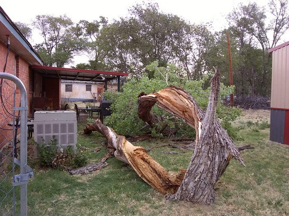
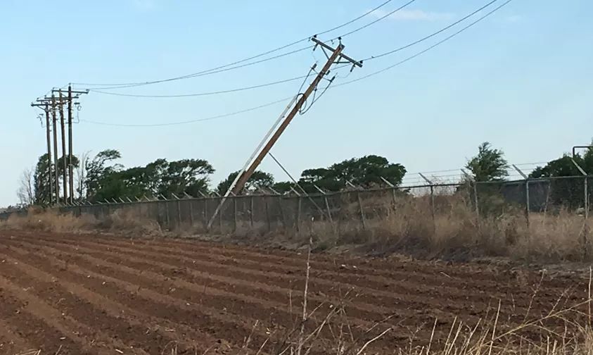
Here are a few samples of the damage that the severe wind gusts caused in the town of Memphis:

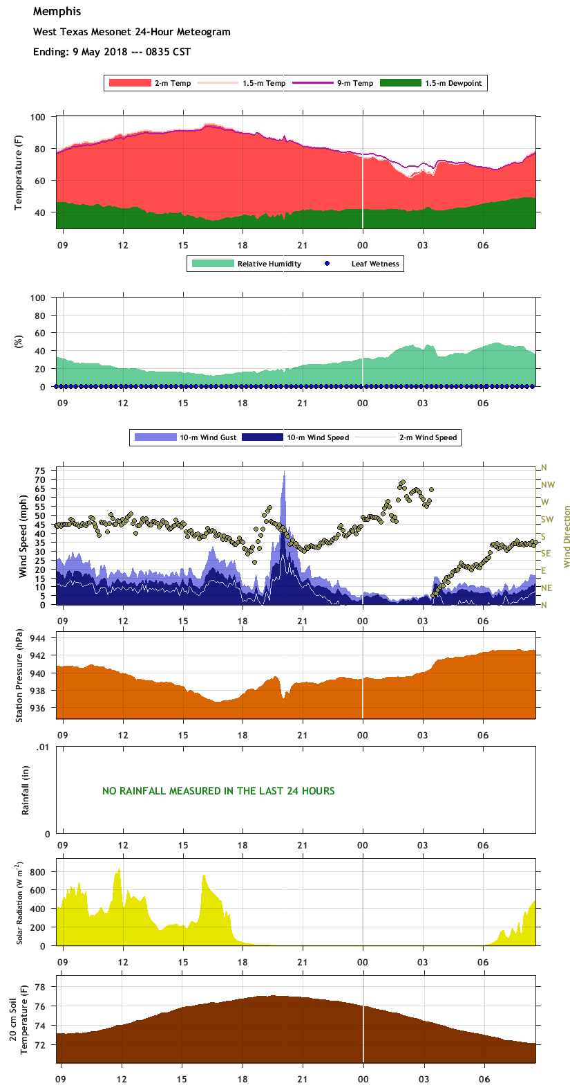
The West Texas Mesonet site just to the northeast of Memphis recorded approximately 15 minutes of severe winds (58 mph or greater). The image below shows a time series, or meteogram of the observations from the mesonet site.
PRELIMINARY LOCAL STORM REPORT...SUMMARY
NATIONAL WEATHER SERVICE LUBBOCK TX
1255 PM CDT WED MAY 09 2018

..TIME...   ...EVENT...      ...CITY LOCATION...     ...LAT.LON...
..DATE...   ....MAG....      ..COUNTY LOCATION..ST.. ...SOURCE....
            ..REMARKS..

0905 PM     TSTM WND GST     1 NE MEMPHIS            34.73N 100.53W
05/08/2018  M75 MPH          HALL               TX   MESONET

            WEST TEXAS MESONET

0905 PM     TSTM WND DMG     MEMPHIS                 34.73N 100.54W
05/08/2018                   HALL               TX   SOCIAL MEDIA

            A NUMBER OF REPORTS AND PICTURES OF FENCE, ROOF, WINDOW
            AND TREE DAMAGE IN MEMPHIS. POWERS WAS KNOCKED OUT IN
            PARTS OF TOWN. SEVERE WIND GUSTS WERE ASSOCIATED WITH
            THE BACK SIDE OF A BROKEN LINE OF DECAYING
            THUNDERSTORMS.

