| Widespread Rain and a Couple of Severe Storms 12-13 April 2017 |
|
 |
|
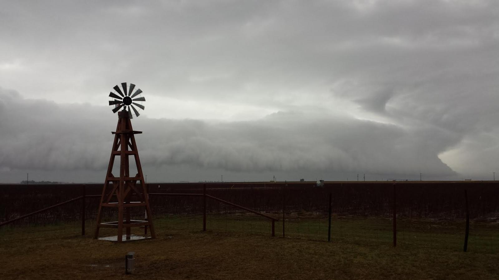
| Arcus cloud approaching Whitharrel on Wednesday evening (12 April 2017). Picture is courtesy of Wes Burgett. | |
| A slow moving upper level storm system joined forces with moisture returning from the Gulf to produce widespread rain and thunderstorms across West Texas from Tuesday afternoon into Wednesday (12-13 April 2017). The initial activity developed over southeast New Mexico Tuesday morning before spreading into the South Plains Tuesday afternoon. | |
 |
|
| Regional radar animation valid from 1:38 pm to 2:48 pm on 12 April 2017. | |
| There was just enough moisture and instability to allow a few of the storms to become severe, particularly across southeast New Mexico and Far West Texas. However, one more intense storm did move across the southwestern South Plains. The storm produced large hail as it moved across Denver City and Wellman before weakening by late afternoon. A list of the preliminary storm reports for this mid-April event can be FOUND HERE. | |
 |
|
| Heavy rain and large hail falling in Denver City at 2:21 pm on Wednesday. The picture is courtesy of KAMC. | |
| The severe storm moving across Yoakum County looked fairly impressive for a time, producing a well-developed wall cloud as it moved steadily eastward. | |
 |
 |
| View of a severe thunderstorm between Denver City and Seagraves Wednesday afternoon. The images are courtesy of Bobby Jo Kelley and KCBD. | |
| After the short and relatively limited bout of severe weather Tuesday afternoon the thunderstorms developed into a large complex of moderate to heavy rain that marched eastward across the region during the evening and overnight hours. The rain diminished across the South Plains by Wednesday morning, but additional rounds of showers and thunderstorms continued to affect the Rolling Plains into Wednesday afternoon and evening. | |
 |
|
| Regional radar animation valid from 8:18 pm to 9:28 pm on 12 April 2017. Additional radar animations the following day can be viewed here: 5:38 am to 6:48 am on 13 April 2017 and 10:58 am to 12:08 pm on 13 April 2017. | |
| The below imagery shows a couple of snapshots of the large area of showers and thunderstorms across much of the southern High Plains Tuesday evening. The clouds and rain also kept temperatures on the cool side, with readings mostly in the 50s by evening. | |
 |
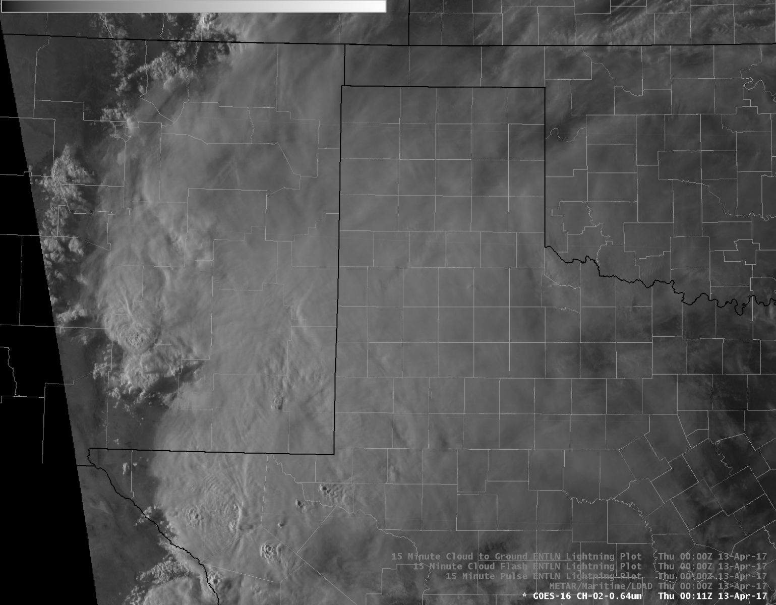 |
| Visible satellite images captured at: (left) 6:23 pm and (right) 7:11 pm on 12 April 2017. | |
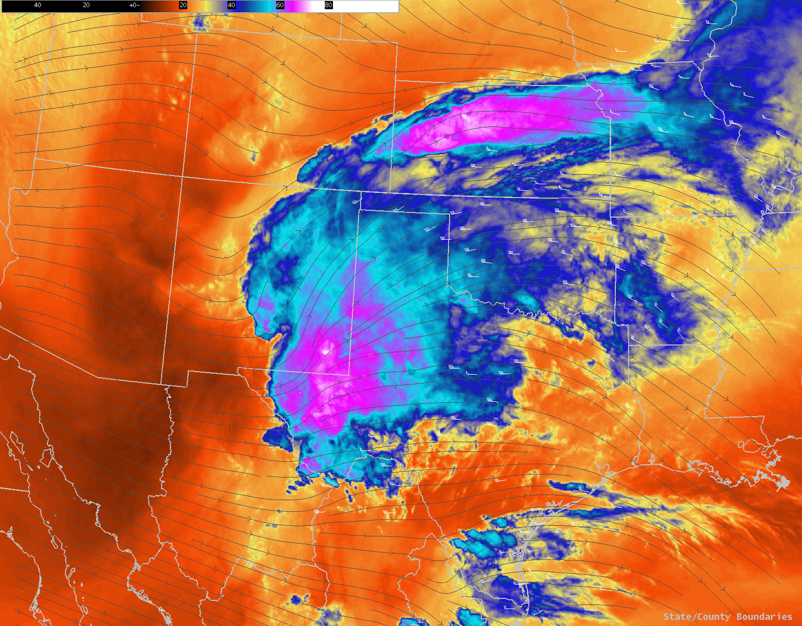
| The below imagery shows the general flow of winds in the middle and upper levels of the atmosphere along with all the moisture from eastern New Mexico through western Texas and into Kansas. The broad diffluent flow (spreading apart) east of the upper level disturbance over New Mexico helped force all of the rain further downstream Tuesday and Wednesday. Eventually the disturbance shifted east by late Wednesday, taking the rain with it. | |
 |
|
| Water vapor satellite image captured at 7:36 pm on 12 April 2017. | |
| Widespread beneficial rains blanketed a good portion of southeast New Mexico into the South Plains, Rolling Plains and western Oklahoma over the two-day event. Rainfall totals of 1 to 2 inches were fairly common south of the Highway 84 corridor of the South Plains as well as from north of Post through Guthrie and Paducah. | |
 |
|
| Two-day radar-estimated and bias-corrected rainfall ending at noon on 13 April 2017. To view a close up of the South Plains region click on the map. Additionally, a 48-hour rain total map from the West Texas Mesonet can be FOUND HERE. | |

