|
Active Stretch of Weather for West Texas
8-10 May 2013
|
 |
| Storm located to the east of Lubbock on the evening of Thursday, May 9, 2013. Click on the image for a larger view. |
| |
| A meandering upper level storm system across the southwestern United States combined with increasing moisture and instability to bring several rounds of active weather to West Texas during early May. The unsettled weather actually began as early as Monday, May 6th, when light rain visited spots up on the Caprock during the day, and a late evening thunderstorm brought rain, wind and small hail in a swath from Friona to Whiteface to Brownfield. On Tuesday (May 7th) a cluster of showers and thunderstorms visited Post, White River Lake, Jayton and points south. However, moisture and instability was rather low through the first part of the week and that generally limited the overall coverage and intensity of the precipitation. |
| |
 |
| Supercell thunderstorm located between Guthrie and Aspermont during the evening of Wednesday, May 8, 2013. The picture is courtesy of Greg Varoff. Click on the image for a larger view. |
| |
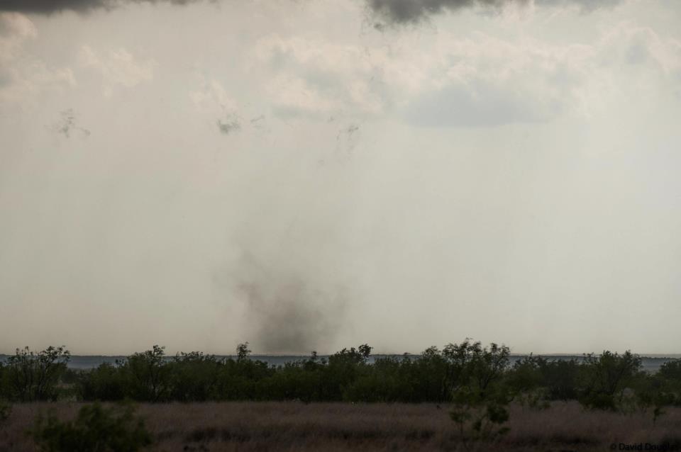
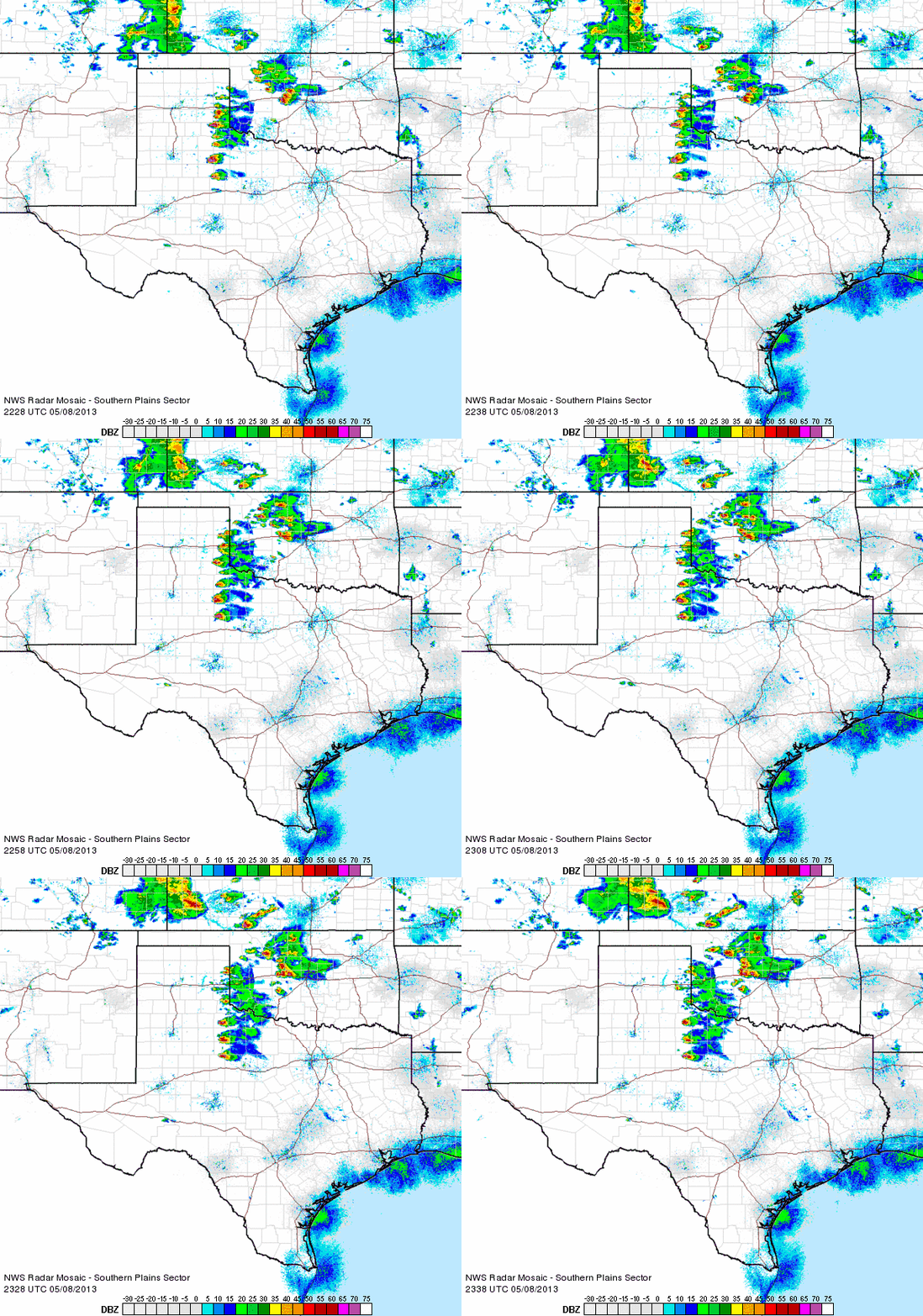
| A better supply of moisture then returned northward early Wednesday (May 8, 2013) and this set the stage for more robust thunderstorms by mid-week. A dryline sharpened near the edge of the Caprock Wednesday afternoon and this was the focus for the development of scattered severe supercell thunderstorm that tracked across the southeast Texas Panhandle and Rolling Plains. The storms produced very large hail, including a report of baseball size hail near Lakeview in Hall County. In addition, the National Weather Service received several reports of wall clouds, a funnel cloud and a brief tornado before the storms diminished and moved east by mid-evening. |
| |
|

|

|
| Pictures of a wall cloud (left) and possible brief tornado (right) captured on a storm that moved southwest of Guthrie during the evening of May 8, 2013. The left picture is courtesy of David Purkiss and the right picture is courtesy of Randy Denzer and David Douglas. Click on the images for a larger view. |
|
| |
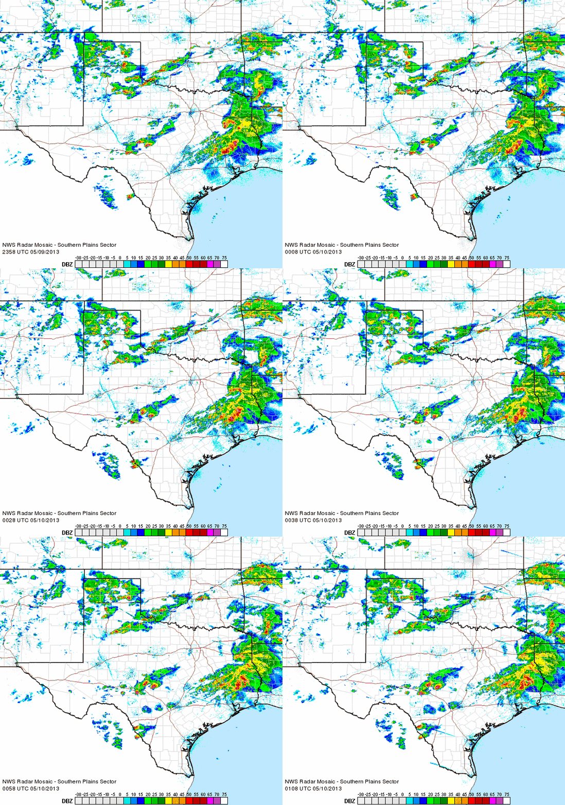
| A weak cold front moved through the South Plains early Thursday (May 9, 2013) before stalling out and retreating slowly northward through the day. This front, combined with a dryline, were the impetus for additional shower and thunderstorm development Thursday afternoon and evening. The greatest concentration of activity was across the southeast Texas Panhandle into the Rolling Plains and a few storms did become severe and drop large hail and locally heavy rains. The largest hail report gathered on this day was golf ball size, which occurred at McAdoo. |
| |
 |
| Regional radar loop valid 5:28 to 6:38 pm on Wednesday, May 8, 2013. |
| |
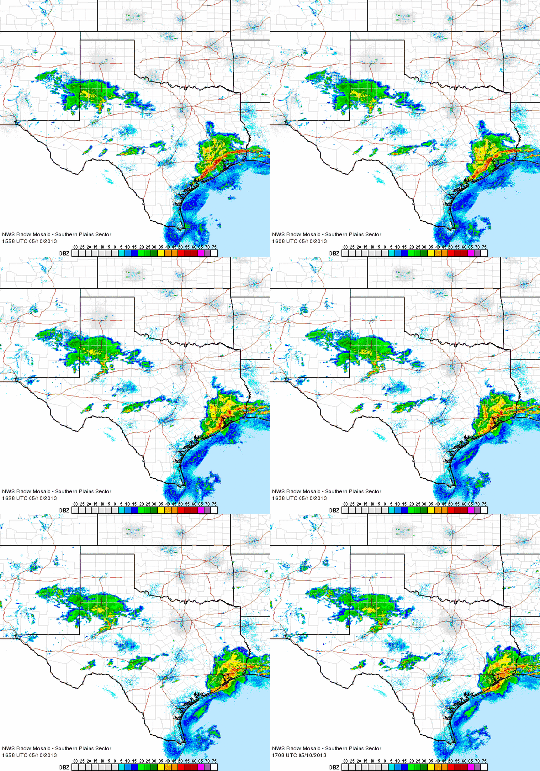
| The severe weather threat diminished for the South Plains region on Friday (May 10th), well behind the cold front which surged southward. However, a large batch of rain and embedded thunderstorms did develop across southeast New Mexico and shift slowly eastward across much of the South Plains into the southern Rolling Plains. Many spots recorded a tenth to half inch of rain before the precipitation diminished. |
| |
 |
| Regional radar loop valid 5:58 to 7:08 pm on Thursday, May 9, 2013. |
| |
| Although the active early May stretch was certainly not a drought buster, it did bring welcome rains to much of the region. Most locations did record at least a little rain, with a number of sites observing 1/2 to 1 inch of more of rain. |
| |
 |
| Regional radar loop valid 10:58 am to 12:08 pm on Friday, May 10, 2013. |
| |
|
Preliminary storm reports for the active weather can be found below:
May 8, 2013
May 9, 2013
|
| |
| |