 |
| View to the west-northwest from the Covenant Hospital webcam on Thursday afternoon. Image is courtesy Covenant Health Systems |
Thursday into Friday, a slow moving storm system moved out of the desert southwest across West Texas. As the storm approached, deep moisture flowed northwest from the Gulf into West Texas. Widespread rain showers spread northward out of the Permian Basin and over the South Plains following the track of the upper-level circulation. Various smaller scale cirulations also enhanced the rainfall locally. The result was record-setting rainfall for much of the region, especially from the southern South Plains into the south-central Texas Panhandle. Daily rainfall records were broken Thursday and Friday at the official observation site at the Lubbock International Airport. As of 5 pm on Friday, 4.02 inches of rain had fallen in 48 hours at the Lubbock Airport. This is also the most rainfall from a single event in April and the second-most rain recorded for the entire month at Lubbock. The 10-plus inches recorded so far has been the wettest start to the year in recorded history. In Lubbock, the excessive rainfall caused several road closures and even a roof collapse near Texas Tech University. Widepread flooding problems were also reported across the area-although most of the problems were minor. The map below shows some selected rainfall totals from across the area as of 3 pm on Friday. To view a Public Information Statement from Friday at 5 pm which includes more rainfall totals, click HERE.
 |
| Total event rainfall as of 3 pm Friday as reported by NWS and West Texas Mesonet weather stations. Click on the image to view a larger version. |
The two images below show satellite representations of the storm system. The first is a image from the visible spectrum Thursday afternoon. It shows the widespread shield of dense cloud cover across the South Plains area. As this time the center of circulation of the storm system was located in southwest Texas near Pecos. The second image around midday Friday shows the center of circulation located over the Rolling Plains.
 |
| NASA MODIS satellite image on the afternoon of April 15th, 2010. Click on the image to view a larger version. |
 |
| GOES12 Infrared Satellite imagery from midday Friday. Click on the image to view a larger version. |
The images below are loops of regional radar data which show portions of the event. Each loop covers a little bit more than an hour of time.
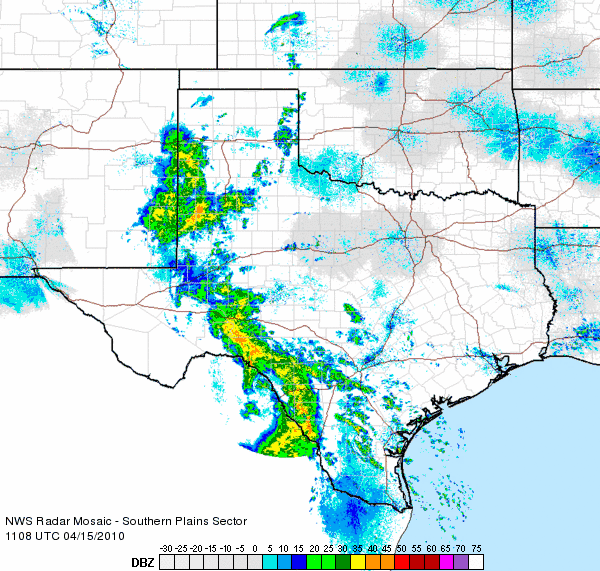 |
| 7-8 am on the 15th |
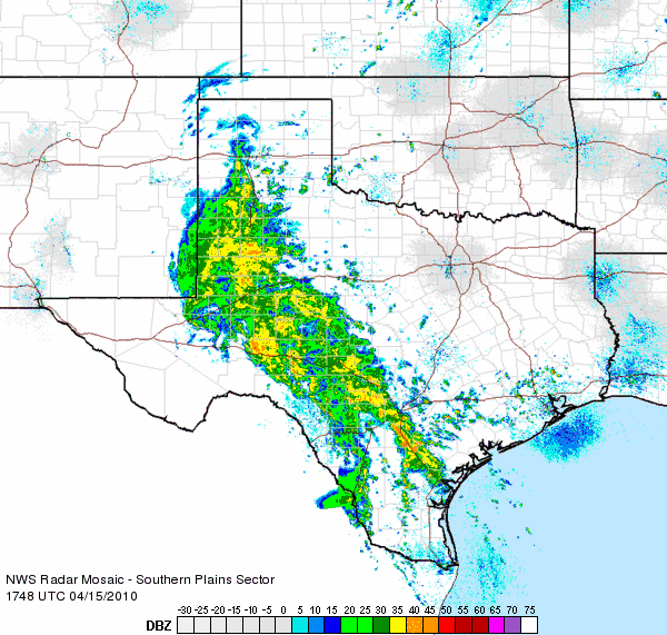 |
| 2-3 pm on the 15th |
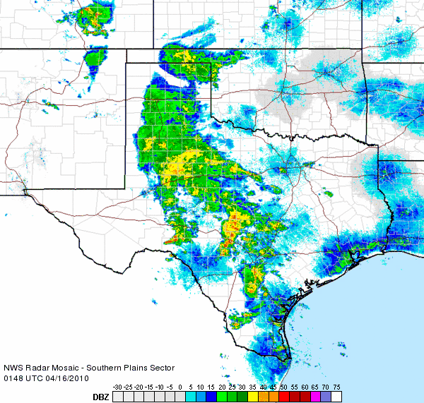 |
| 8-9 pm on the 15th |
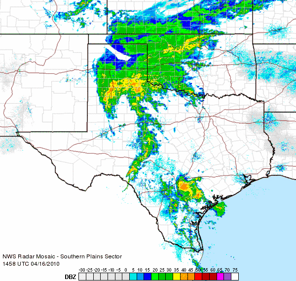 |
| 10-111 am on the 16th |
|
Images of base reflectivity from the National Weather Service WSR-88D radars across the region.
|
|
The pictures below show some of the rainy scenes around the Lubbock area. Click on any of the images to view a larger version.
|
|||
|
To view the report of this storm from the West Texas Mesonet Group at Texas Tech University please click HERE.


