|
Powerful Winter Storm Affects West Texas
|
|
 |
|
| Map displaying the maximum wind gusts (in mph) observed on the afternoon of Tuesday, December 8, 2009. The wind reports are compiled from data from the National Weather Service and the West Texas Mesonet. Click on the map for a larger view. | |
|
An intense upper level storm system moved across the central and southern plains on Tuesday, December 8, 2009. This storm system brought a prolonged period of freezing fog and freezing drizzle, followed by a brief period of snow and/or sleet and/or rain, and was capped off by a period of strong winds and blowing dust. Initially, in advance of this storm system, cold arctic air moved into the South Plains late Sunday night. Then, as the strong storm system approached, increasingly warm and moist air attempted to move in from the south. The relatively warmer and more moist air was lifted over the cold air in place at ground level and resulted in widespread fog and drizzle, and patchy light rain showers. Unfortunately, when coupled with temperatures only in the 20s, it resulted in a widespread light glaze of ice which created travel hazards and led to numerous car accidents. |
|
 |
 |
| A couple of pictures taken from the Science Spectrum in Lubbock as the band of clouds and precipitation approached during the early afternoon hours of December 8, 2009. Click on the images for a larger view. | |
| Eventually, as the storm system drew closer, the shallow cold air was dislodged by late Tuesday morning and early Tuesday afternoon. However, strong lift and sufficient instability allowed a band of snow and/or sleet and/or rain to form and quickly race across the South Plains, Rolling Plains and southern Texas Panhandle during the early afternoon hours. Total precipitation amounts remained rather light though, generally at a tenth of an inch or less, due to the rapid motion of the precipitation shield. Still, it made for a dramatic and changeable sky. | |
 |
 |
| Radar (left) and visible satellite (right) images taken shortly before 2 pm on December 8, 2009. The images show the clouds and precipitation that quickly raced across the region in advance of the strongest winds (and blowing dust) later that afternoon. Click on the images for a larger view. | |
| After the skies cleared again in the wake of the precipitation, very strong winds associated with this winter storm spread quickly across the region during the mid-afternoon hours. Wind gusts between 50 and 70 mph were common across much of the South Plains and southern Texas Panhandle, with slightly weaker winds recorded across much of the Rolling Plains (reference the map at the top of the page). The strongest wind gust recorded in the Lubbock County Warning Area was 69 mph, by the West Texas Mesonet site located 7 miles WNW of Denver City. A more complete list of maximum wind gusts for this day can be found by referencing the Public Information Statement issued on this event. | |
 |
|
| Enhanced MOSDIS aqua satellite imagery from the afternoon of December 8, 2009. The white represents areas of clouds and snow, with the brown swath from Mexico and Far West Texas into the Permian Basin and South Plains being blowing dust. Click on the image for a larger view. | |
| The strong winds also picked up plenty of dust and dimmed the South Plains' sky with a brownish hue. The above image shows what the wind and dust event looked like from space, while the below right image shows what it looked like from ground level. | |
 |
 |
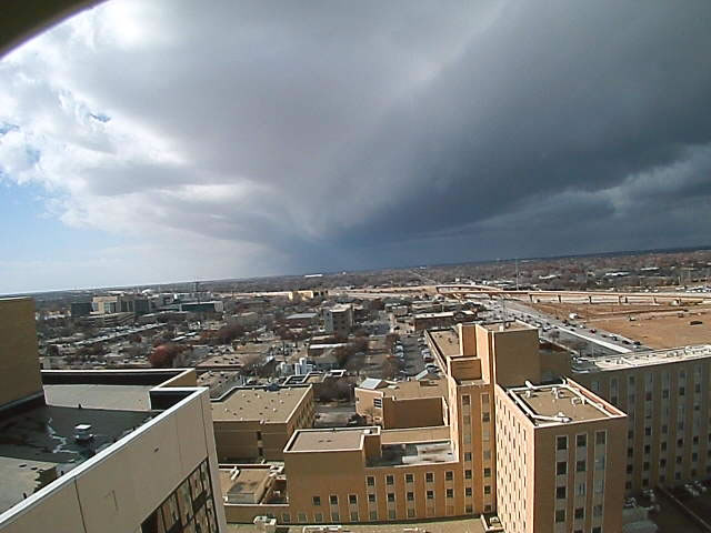
| Images taken from Covenant Hospital in Lubbock (looking west) at 12:55 pm (left) and again at 3:20 pm (right) on December 8, 2009. The left picture shows approaching clouds (with the associated band of precipitation), while the right image shows blowing dust near the height of the strong winds. Images are courtesy of KAMC. Click on the images for a larger view. | |
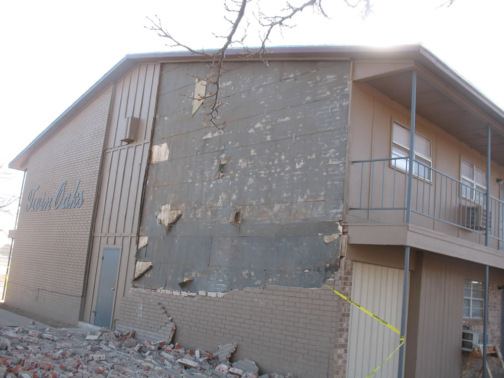
| The strong winds also created some problems. Below is damage sustained to the Twin Oaks Apartments located on the northwest side of Lubbock. The wind also knocked down a number of utility poles and fences around the area, and caused significant roof damage to an apartment in Levelland. A more complete list of storm reports can be found by CLICKING HERE. | |
 |
|
| Photograph of wind damage that occurred at Twin Oaks Apartments Tuesday afternoon. Click on the photo for a larger view. | |

