Image of hail taken on Highway 60 between Friona and Bovina around 4:30 pm on 23 April 2008. Picture courtesy of KVII and Coty Ivey. Click on the image for a larger view.
Wednesday brought a round of severe weather to much of the center part of the nation, from western South Dakota through western and central Texas. The intense weather was thanks in part to a number of factors that came together, including improved moisture levels and instability over the High Plains coupled with sufficiently strong middle and upper level winds. The storm development was further spurred by a couple of upper air disturbance emerging over the High Plains, one across the southern tier of the United States, and another moving out of the central and northern Rockies

Another view of the hail on Highway 60 between Friona and Bovina around 4:30 pm on 23 April 2008. Picture courtesy of KVII and Coty Ivey. Click on the image for a larger view.
Thunderstorm development on the South Plains began early in the day, with the first severe thunderstorm warning issued at 10:45 am, and a report of penny size hail reported at Littlefield at 11:00 am. Also, the West Texas Mesonet Station located 6 miles south-southwest of Anton recorded a 67 mph gust at 11:45 am. After a short respite, Parmer County saw a couple of rounds of severe thunderstorms, one in the early afternoon and another toward mid-afternoon. The first round of storms produced golf ball sized hail in Farwell at 1:30 pm, with the second round producing hail to penny size near Friona, and 1” diameter 7 miles south of Black between 4 and 5 pm. The activity over the Lubbock Forecast Office domain quickly wound down early Wednesday evening thanks in part to the early activity and resultant cool temperatures that help to stabilize the atmosphere, along with the fact that the upper level disturbance was departing to the east.

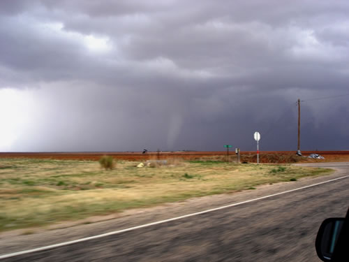
Image of a tornado in southern Dawson County near Sparenberg (northwest of Ackerly) around 3:52 pm on 23 April 2008. The view is looking northeast from the Martin/Dawson County lines southeast of Patricia. Image courtesy of the West Texas Mesonet and Dave Kook. Click on the image for a larger view.
Although the activity was rather strong, even more intense thunderstorms roamed just slightly farther to the south, roughly along a west-east line from near Seminole to Lamesa to Snyder to Anson, and eastward from there. The focus for this particular activity was a front that became stationary, with greatly improved instability to work with just to its south, and enhance spin on/near the stationary front. A number of supercell (rotating) thunderstorms formed along the stationary front, tracking roughly eastward over the same general area over and over. This training of thunderstorms brought localized very heavy precipitation, in addition to some very large hail, strong winds and a few sighted tornadoes. Several highlights of this activity include: A tornado in Snyder at 2:56 pm; A tornado about 14 miles south of Lamesa at 3:53 pm; and a tornado approximately 14 miles southeast of Lamesa at 3:57 pm. Additionally, numerous reports of golf ball sized hail and larger were received, including baseball to softball size hail in Lamesa around 7 pm.
For more information on this event, check out the following web sites: