Lubbock, TX
Weather Forecast Office
Rain Falls on Much of the Area (June 21-22, 2006)
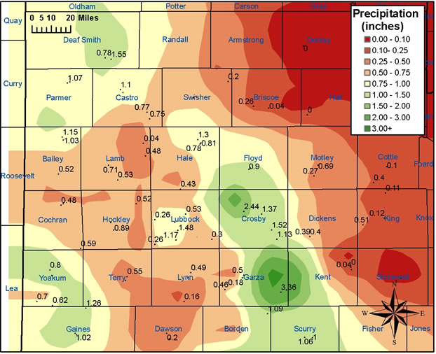
Above is a map of the rainfall (in inches) that fell across the region from June 21 through June 22, 2006. The image was created from data gathered by West Texas Mesonet Stations and NWS Cooperative observation stations.
The highest rainfall total in the area was recorded by the West Texas Mesonet site located 1 mile northwest of Lake Alan Henry, where 4.14 inches fell. Interestingly, this heavy rainfall also pushed Lake Alan Henry back over capacity (to 2220.6, just above capacity level of 2220 ft). Thus, water is again flowing over the spillway.
US Dept of Commerce
National Oceanic and Atmospheric Administration
National Weather Service
Lubbock, TX
2579 S. Loop 289
Suite 100
Lubbock, TX 79423-1400
806-745-4260
Comments? Questions? Please Contact Us.

