Overview
During the early afternoon of Thursday, May 19, 2022, a complex of thunderstorms expanded and intensified over sections of south-central Missouri. Thunderstorms quickly became strong to severe as the complex tracked east-northeast, impacting east-central Missouri, southeast Missouri, west-central Illinois and southwest Illinois. Numerous thunderstorms embedded within the broad complex exhibited signs of rotation, resulting in nine confirmed tornadoes. Of the nine tornadoes, six tornadoes occurred in Missouri and three occurred in Illinois. In Missouri, five of the six tornadoes were rated EF-0 and one tornado was rated EF-1. In Illinois, two tornadoes were rated EF-0, while the third was rated EF-1. In addition to the nine tornadoes, several locations were impacted by straight-line wind damage. The greatest impact from straight-line winds extended west to east through sections of southeast Missouri into southwest Illinois. The most extensive straight-line wind damage was in a swath from Desloge, MO through Chester, IL. Between the tornadoes and straight-line winds, much of the damage was similar in nature, taking out several trees, damaging outbuildings, machine sheds, and a few grain silos. Some residential homes also suffered damage, largely due to fallen trees, large limbs and/or flying debris. No fatalities nor injuries were reported.
Tornadoes:
|
Tornado - St. Clair, MO
Track Map  
|
||||||||||||||||||||
|
Tornado - Leslie, MO
Track Map  
|
||||||||||||||||||||||
|
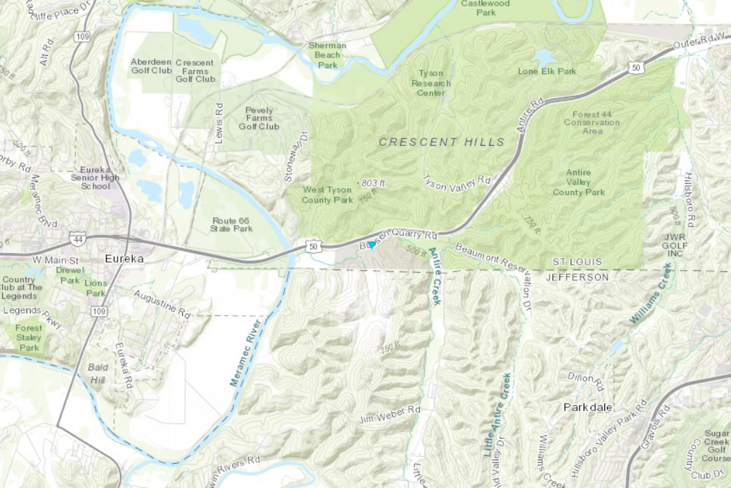
Tornado - Eureka, MO
Track Map  
|
||||||||||||||||||
|
Tornado - Kirkwood, MO
Track Map  
|
||||||||||||||||||||||
|
Tornado - Frontenac, MO
Track Map  
|
||||||||||||||||||||||
|
Tornado - Creve Coeur, MO
Track Map  
|
||||||||||||||||||||||
|
Tornado - Summerfield, IL
Track Map  
|
||||||||||||||||||||||
|
Tornado - Okawville, IL
Track Map
 
|
||||||||||||||||||||||
|
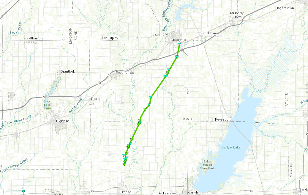
Tornado - Breese, IL - Greenville, IL
Track Map  
|
||||||||||||||||||||||||
The Enhanced Fujita (EF) Scale classifies tornadoes into the following categories:
| EF0 Weak 65-85 mph |
EF1 Moderate 86-110 mph |
EF2 Significant 111-135 mph |
EF3 Severe 136-165 mph |
EF4 Extreme 166-200 mph |
EF5 Catastrophic 200+ mph |
 |
|||||
Straight-Line Winds:
There were numerous reports of straight-line wind damage across the region, with some of the most concentrated damage spanning from near Farmington, MO into Chester, IL. Much of this damage was similar to that from the tornadoes, illustrating the fact that straight-line winds can be just as dangerous as low-end tornadoes.
 |
 |
 |
 |
|
Awning and attached support structure was lofted by straight-line wind, thrown into a utility pole and carried across the street. Chester, IL |
Large tree snapped and fell across powerlines. Chester, IL |
Several large limbs were snapped off multiple trees. A few of the largest branches landed on a garage on residential property. Chester, IL |
Small trees split in half under stress of straight-line winds. Chester, IL |
Radar Data:
The tornadoes and straight-line winds that were observed were triggered by a Mesoscale Convective Vortex (MCV), which is a feature usually resulting from earlier organized thunderstorm complexes. The MCV interacted with plentiful instability and spawned a quasi-linear convective system (QLCS), on which the tornadoes and straight-line winds developed. Below is a radar loop of the MCV spawning the QLCS (bowing line of thunderstorms) along with an annotated image of the two features.
|
A regional radar loop from KLSX in St. Louis, showing the MCV spawn a QLCS from 3:03 PM until 7:00 PM on May 19th, 2022. The QLCS eventually caused the tornadoes and straight-line wind observed across east-central Missouri and west-central Illinois. |
|
|
A regional radar loop from KLSX in St. Louis starting at 3:03 PM. During this loop, six tornadoes occurred in east-central Missouri. |
The tornadoes across Missouri occurred as the northern end of the QLCS moved through east-central Missouri and St. Louis County from 4:15 PM until 5:30 PM. During this time, six tornadoes occurred: two in Franklin County, MO and four in St. Louis County, MO. Below are screenshots of the radar data for each tornado during this time, with an annotation of the signature indicative of a potential or radar-confirmed tornado. Image orientation from top left (clockwise): Reflectivity, Velocity, Correlation Coefficient, Storm-Relative Velocity. |
|
Radar data from the St. Clair, MO tornado. |
Radar data from the Leslie, MO tornado. |
Radar data from the Eureka, MO tornado. |
|
Radar data from the Kirkwood, MO tornado. |
Radar data from the Frontenac, MO tornado. |
Radar data from the Creve Coeur, MO tornado. |
|
A regional radar loop from KLSX in St. Louis starting at 5:21 PM. During this loop, three tornadoes occurred in west-central Illinois and notable straight-line wind damage occurred in southeast Missouri and southwest Illinois. |
The tornadoes in west-central Illinois and straight-line wind damage across southeast Missouri and southwest Illinois occurred as the southern part of the QLCS crossed those areas from 5:30 PM until 7:00 PM. During this time, three tornadoes occurred: one in St. Clair County, IL, one in Clinton County, IL, and one that started in Clinton County, IL and ended in Bond County, IL. Notable straight-line wind damage was also observed in the Chester, IL area. Below are screenshots of the radar data for each tornado and the straight-line wind during this time, with an annotation of the signature indicative of a potential or radar-confirmed tornado. Image orientation from top left (clockwise): Reflectivity, Velocity, Correlation Coefficient, Storm-Relative Velocity. |
|
Radar data from the Summerfield, IL tornado. |
Radar data from the Okawville, IL tornado. |
Radar data from the Breese, IL - Greenville, IL tornado. |
|
Multi-Radar Multi-Sensor (MRMS) Base Reflectivity and GOES-East Infrared satellite imagery of the thunderstorm complex from its formation on the afternoon of May 18th, 2022 to its dissipation during the evening of May 20th, 2022. Credit: Tomer Burg (@burgwx) |
The impacts felt in our region were only part of a long journey the storm complex took. It began as several thunderstorms east of the Rocky Mountains congealing into a Mesoscale Convective System (MCS) across southern Great Plains late on May 18th. The MCS weakened during the early hours of May 19th, but as it approached our region the remnant energy was reinvigorated and interacted with moisture ahead of it to cause our region's impacts. It then moved east across the Ohio River Valley, weakened during the early morning on May 20th, and redeveloped across the Mid-Atlantic region. |
 |
Media use of NWS Web News Stories is encouraged! Please acknowledge the NWS as the source of any news information accessed from this site. |
 |