Overview
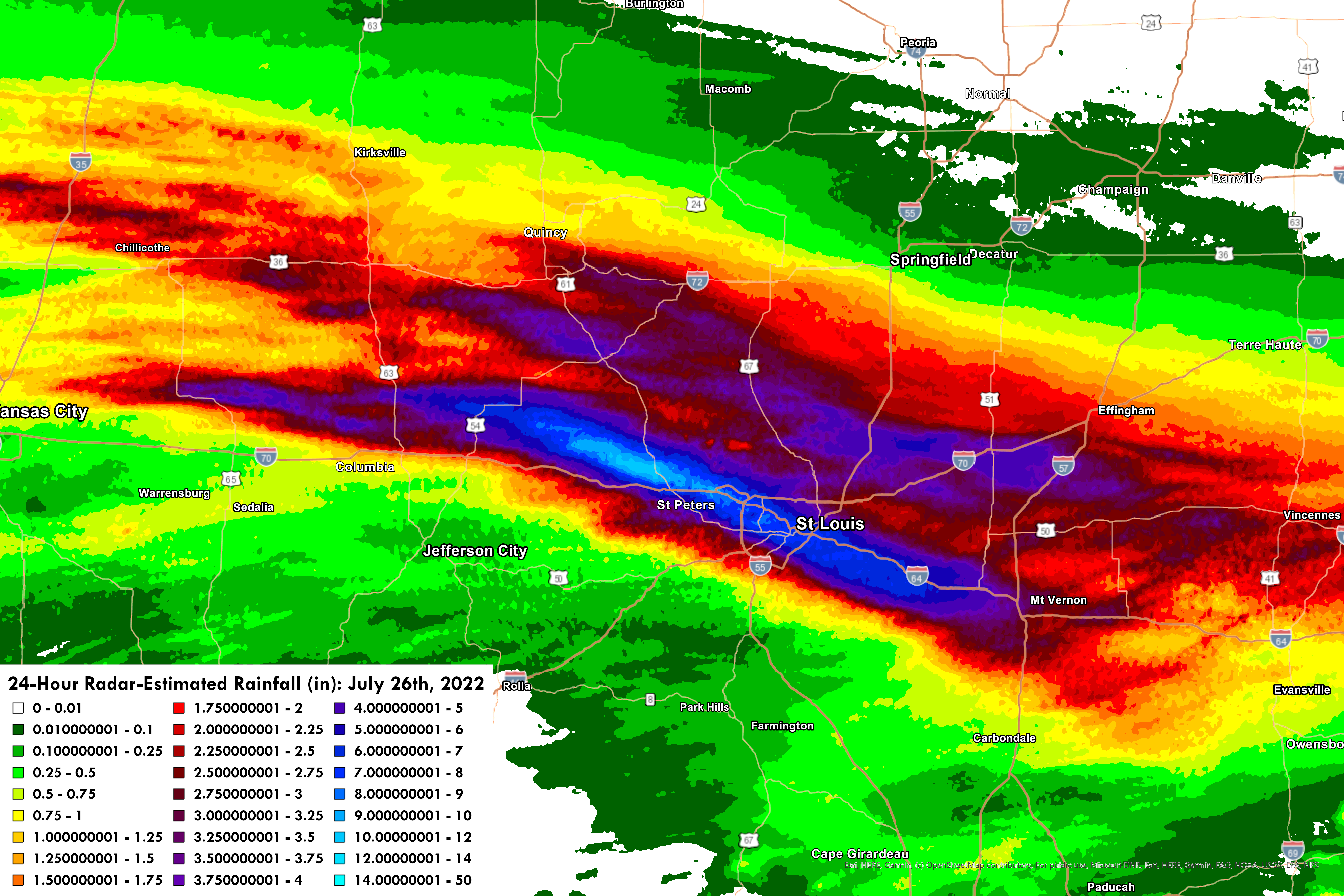
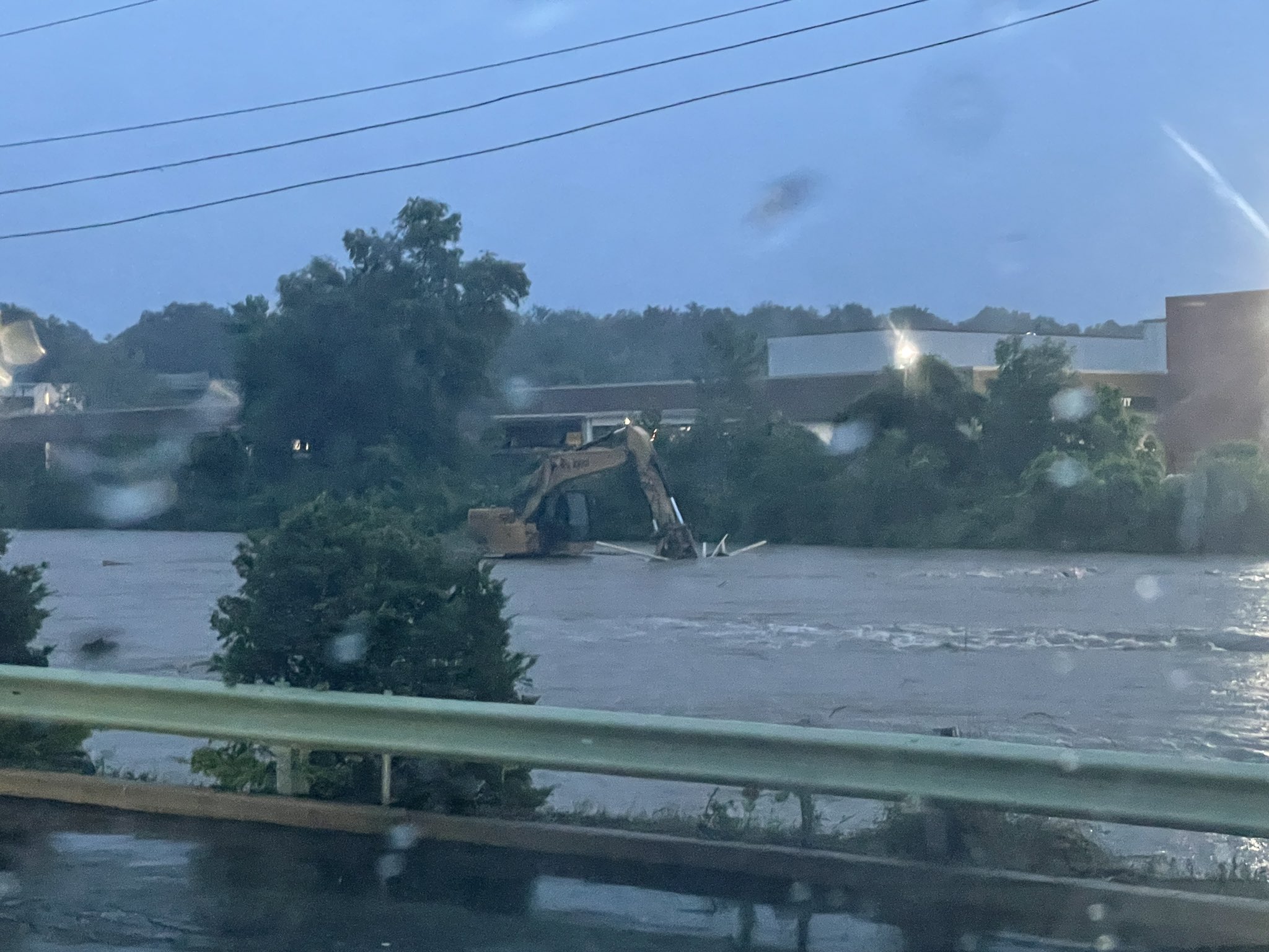
During the early morning of Tuesday, July 26th, 2022, a complex of training thunderstorms set up roughly along the I-70 corridor in Missouri and I-64 corridor in Illinois. Several rounds of thunderstorms with rainfall rates exceeding 2in/hr affected this area, including the St. Louis metropolitan area, through the early hours of July 26th and into the morning commute. Upwards of 11" of rain fell over the course of roughly 8 hours in an axis from Hawk Point, MO to St. Peters, MO according to radar-estimated rainfall products and several CoCoRaHS/spotter reports. A longer axis of over 8" of rain fell from northern Montgomery County in Missouri to St. Clair County in Illinois, causing multiple swift water rescues and scores of flooded interstates and homes across the St. Louis metropolitan area. St. Louis-Lambert International Airport also observed a new all-time record for daily precipitation: 8.64" of rain fell since midnight Central Standard Time (Daylight Savings Time is not used for climatological record-keeping). This value broke the previous record of 6.85", which occurred on August 20th, 1915 due to the remnants of the Galveston 1915 Hurricane. The storm-total rainfall was 9.07", but spans two days. Two fatalities were reported: one in St. Louis City, where a man drowned in his car near Skinker Blvd, and another in Hazelwood where a man drowned attempting to flee his flooded truck.
Click here to step through our GIS-based event review.
|
Multi-Radar Multi-Sensor (MRMS) 24hr Radar-Estimated Rainfall as of 12pm on July 26th. |
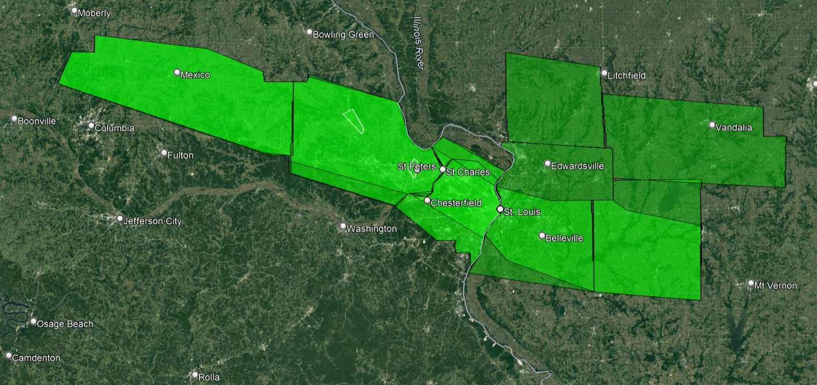
Flash Flood Warnings issued by NWS St. Louis on July 26th, 2022. One of these warnings, for parts of St. Louis City and St. Louis County, was a "Flash Flood Emergency." This type of Flash Flood Warning is reserved for high-end flash flooding events, like the one experience on July 26th. |
Weather and Climate Information
|
A regional radar loop from KLSX in St. Louis starting at 9:00pm on July 25th showing the development of training thunderstorms across the St. Louis metropolitan area. |
A persistent series of thunderstorms developed around 9:00pm on July 25th across east-central Missouri. The training thunderstorms expanded in area, and by around 10pm were impacting the St. Louis metropolitan area. Rain continuously fell at St. Louis-Lambert International Airport from 11pm until 2pm on the 26th. During that time, rainfall rates exceeding 2"/hr were observed and 9.06" of rain fell in that 15 hour period. In one six-hour period, 7.68" of rain fell, which statistically has a 1 in 1000 chance of occurring in a given year. Despite dry conditions prior to the event, rainfall amounts and rates of these magnitudes caused widespread impacts and at least one fatality. |
|
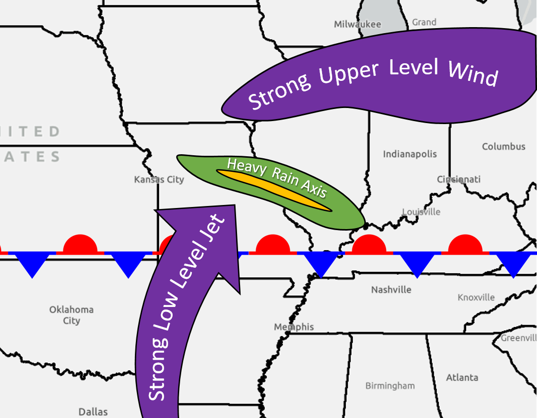
A conceptual model for the meteorological setup of the flash flooding event that occurred on July 26th, 2022 in the St. Louis metropolitan area. This setup is described in further technical detail in this paper written by Moore et al. (2003) in the AMS Weather and Forecasting journal.
|
The heavy rain fell north of a stationary front that was anchored across southern Missouri and Illinois. Strong low levels winds (around 5,000 feet) brought in copious amounts of low-level moisture which interacted with the front and the upper-level jet stream to produce repeated thunderstorms over the same area for more than 6 hours. These thunderstorms caused a narrow, but intense swath of heavy rainfall: most of the area saw at least a few inches of rainfall with a narrow band of 6 to 12 inches stretching from east central Missouri to southwest Illinois. |
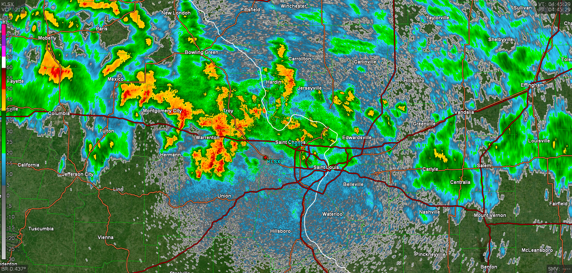
Below are a few still images of the radar loop. Notice the "train" of continuous thunderstorms impacting the northern St. Louis metropolitan area.
|
Radar reflectivity from KLSX in St. Louis valid at 11:45pm July 25th. |
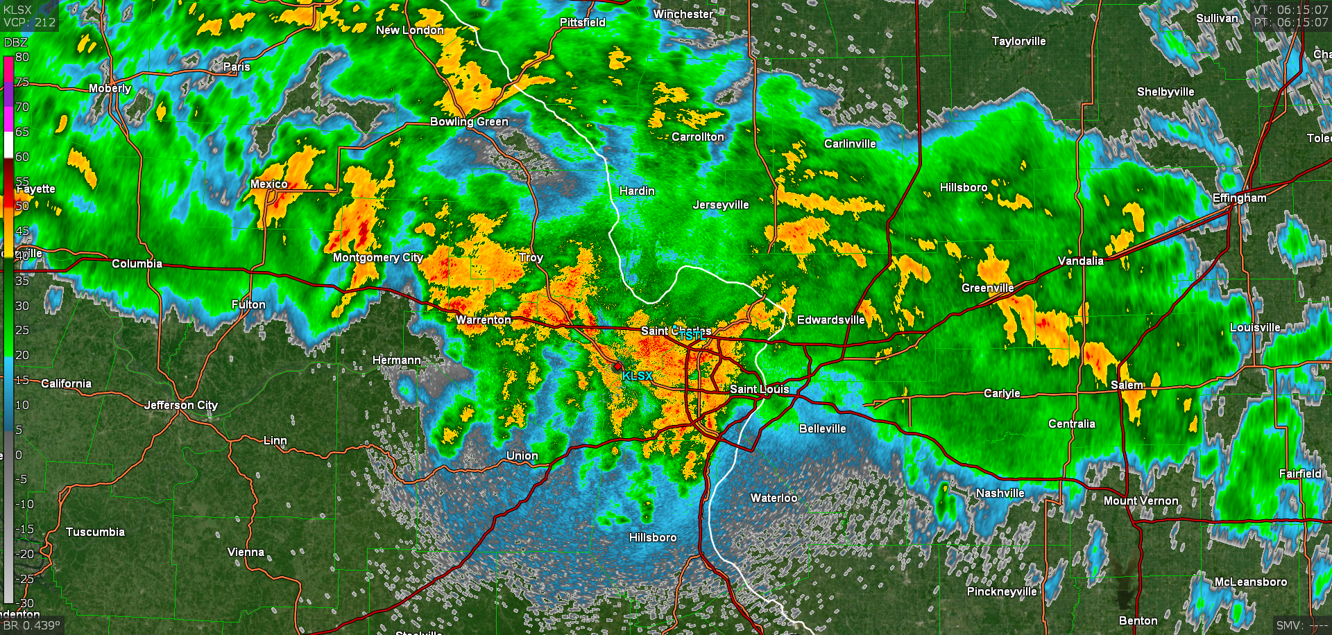
Radar reflectivity from KLSX in St. Louis valid at 1:45am July 26th. |
|
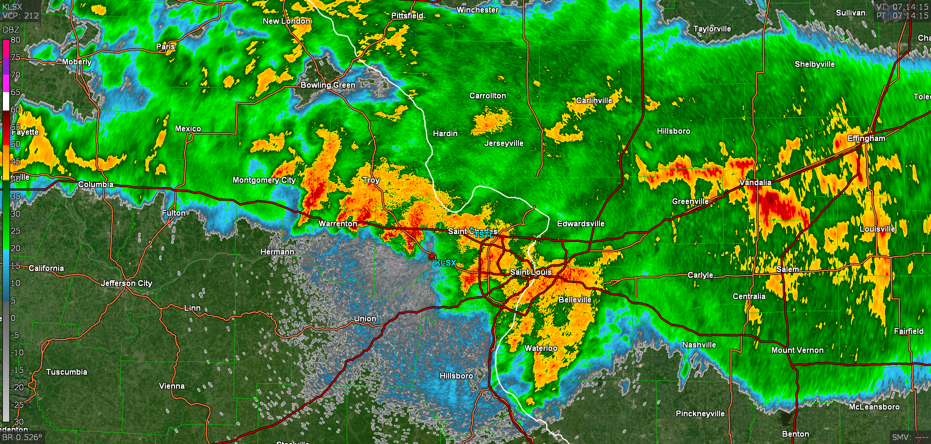
Radar reflectivity from KLSX in St. Louis valid at 2:14am July 26th. |
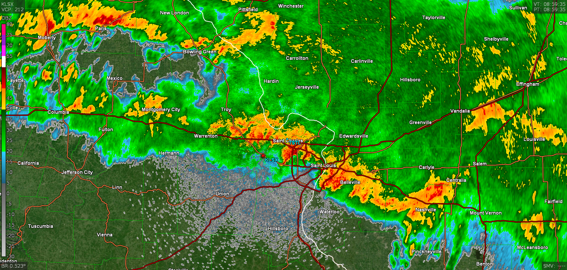
Radar reflectivity from KLSX in St. Louis valid at 3:59am July 26th. |
Climatological Context for This Historic Rainfall Event
|
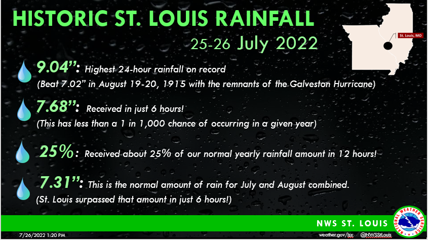
Social media graphic shared by NWS St. Louis to underscore the impressive statistics for this rainfall event. Note that the data was valid as of 1pm on July 26th at St. Louis-Lambert International Airport, where it was still raining lightly. |
This rainfall event was the most prolific one the St. Louis metropolitan area has seen since records began in 1874. Roughly 25% of our normal yearly rainfall fell in about 12 hours, and the highest 6-hour total (7.68") surpassed the normal amount of rain for the months of July and August combined. What is most impressive is how quickly the all-time record for 24-hour rainfall (7.02" in 1915) was surpassed. It took only 6 hours since midnight CST (all climate records are kept in standard time) to surpass the old record. |
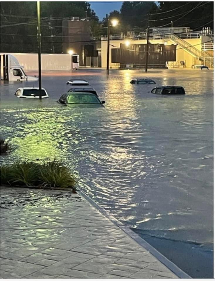
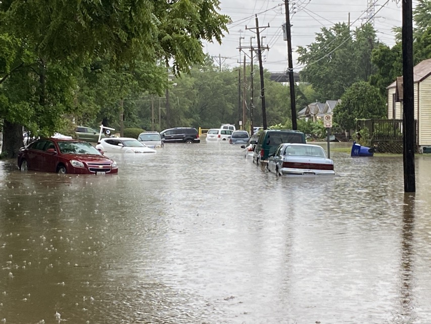
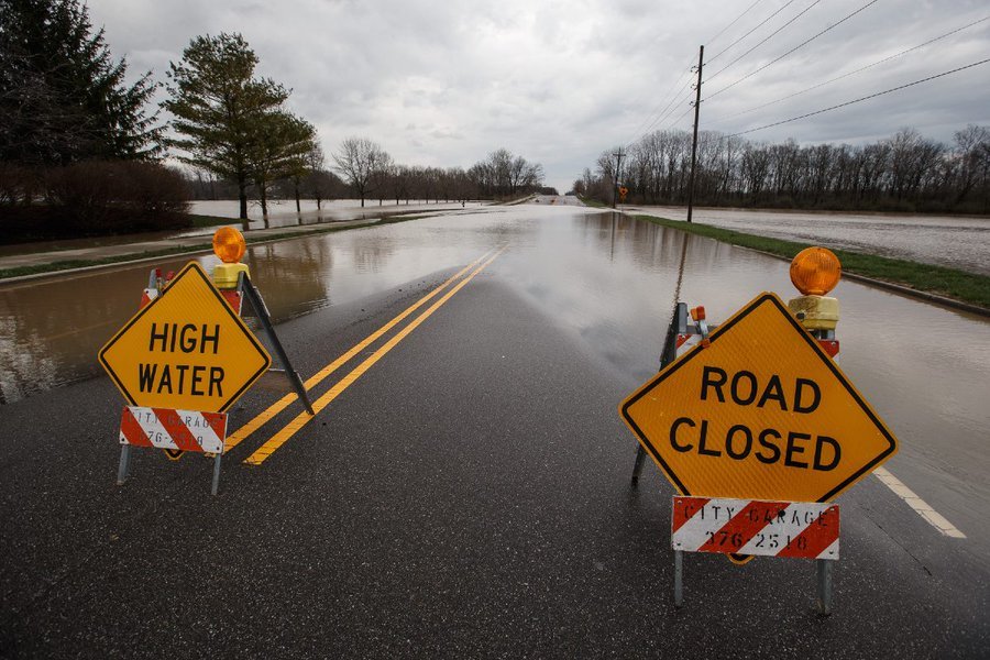
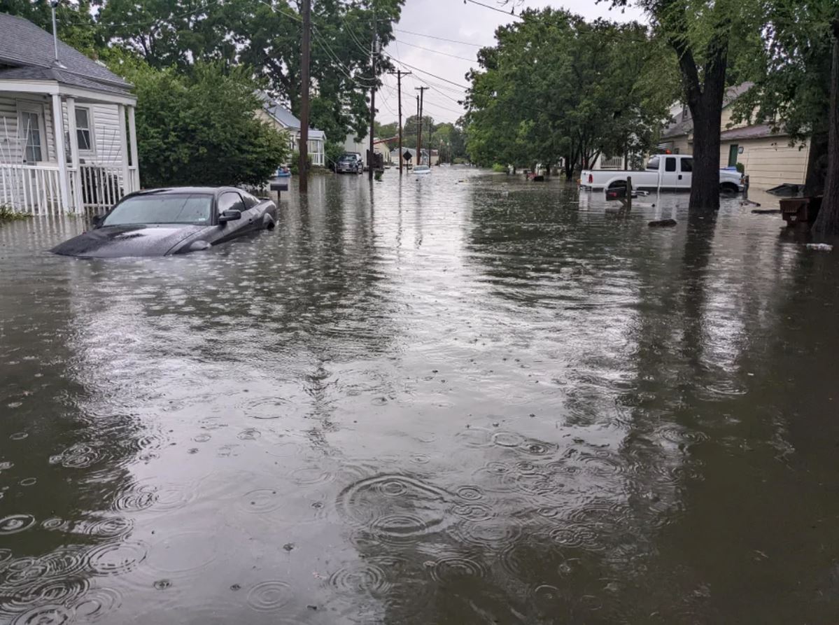
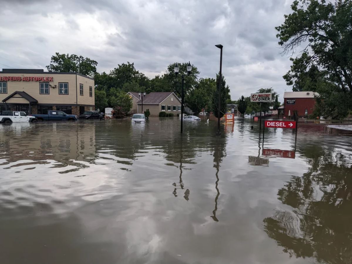
Flash Flooding Pictures
|
Flooding on Manchester Rd. between McKnight Rd. and S. Brentwood Blvd. in Brentwood, MO (Brent Pearson, Twitter) |
Flooding on McKnight Rd. and Litzsinger Rd. in Brentwood, MO (Brent Pearson, Twitter) |
Flooding on S. Brentwood Blvd and Marshall Ave. in Webster Groves, MO (Brent Pearson, Twitter) |
|
Flooding on S. Brentwood Blvd and Marshall Ave. in Webster Groves, MO (Brent Pearson, Twitter) |
Flooding on S. Brentwood Blvd and Marshall Ave. in Webster Groves, MO (Brent Pearson, Twitter) |
Flooding on S. Brentwood Blvd and Marshall Ave. in Webster Groves, MO (Brent Pearson, Twitter) |
|
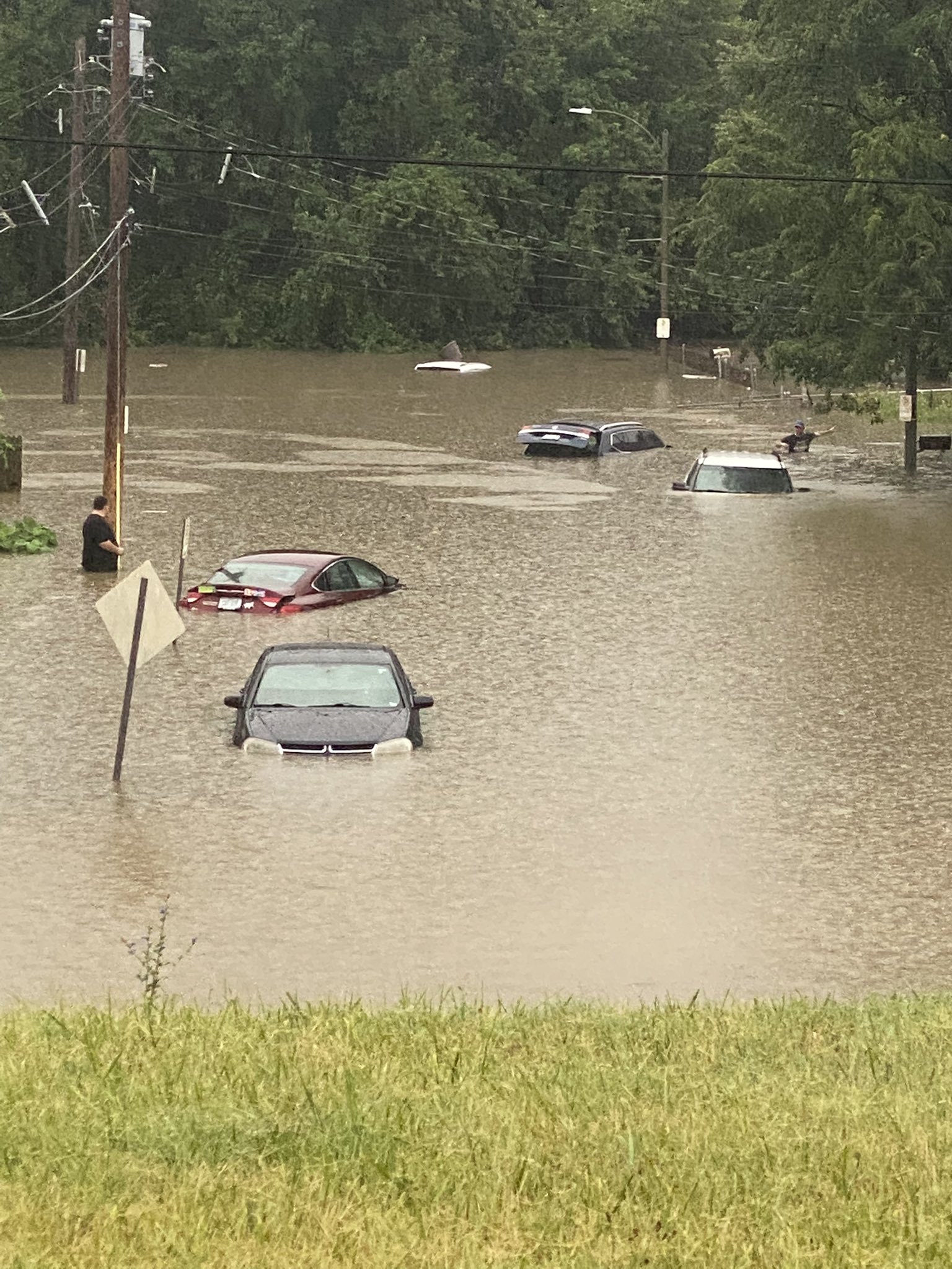
Flooding at Schuetz Rd. and Adie Rd. in Maryland Heights, MO (Chris Higgins, Twitter) |
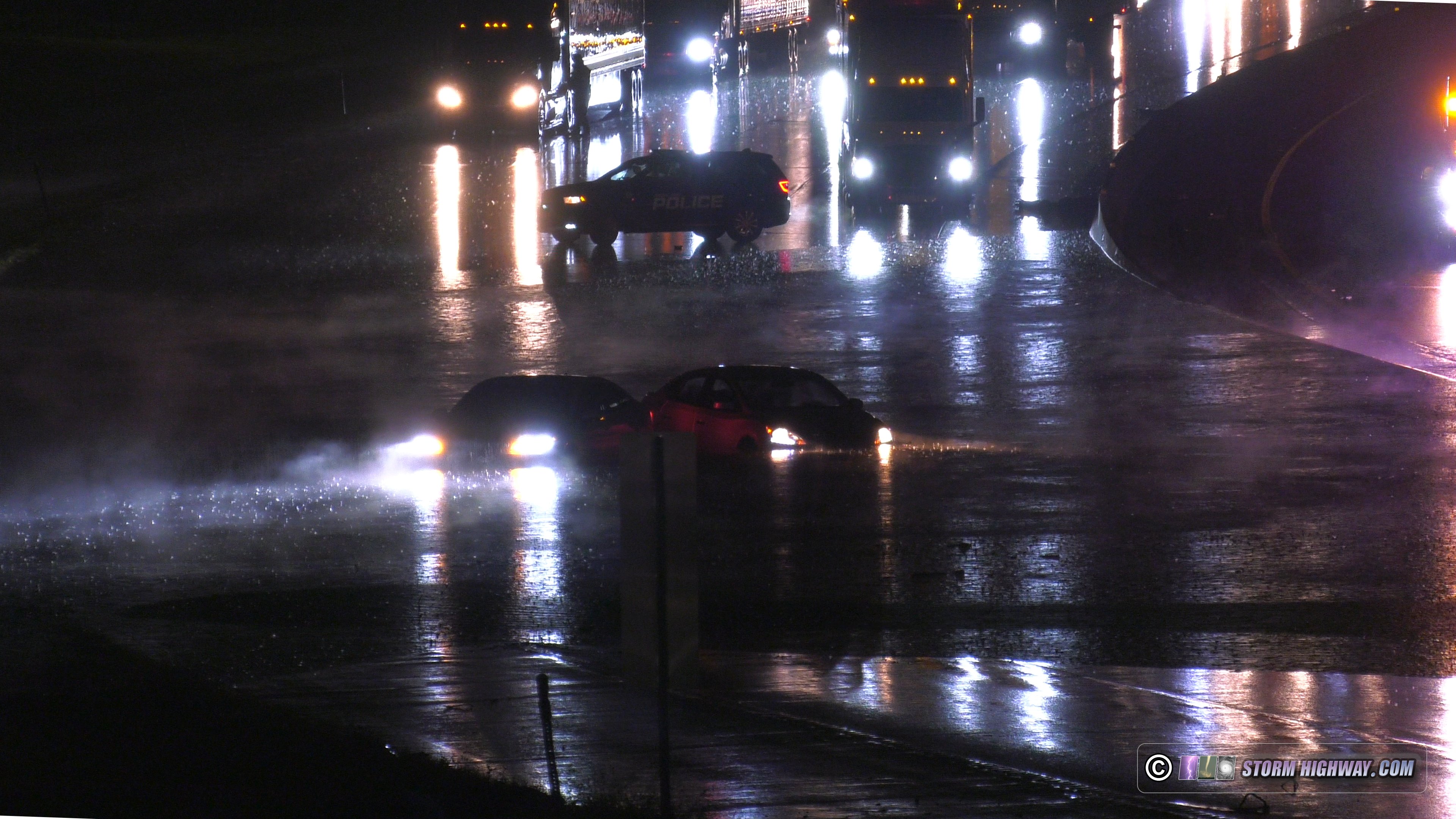
Flooding on I-170 in Overland, MO (Dan Robinson, Twitter) |
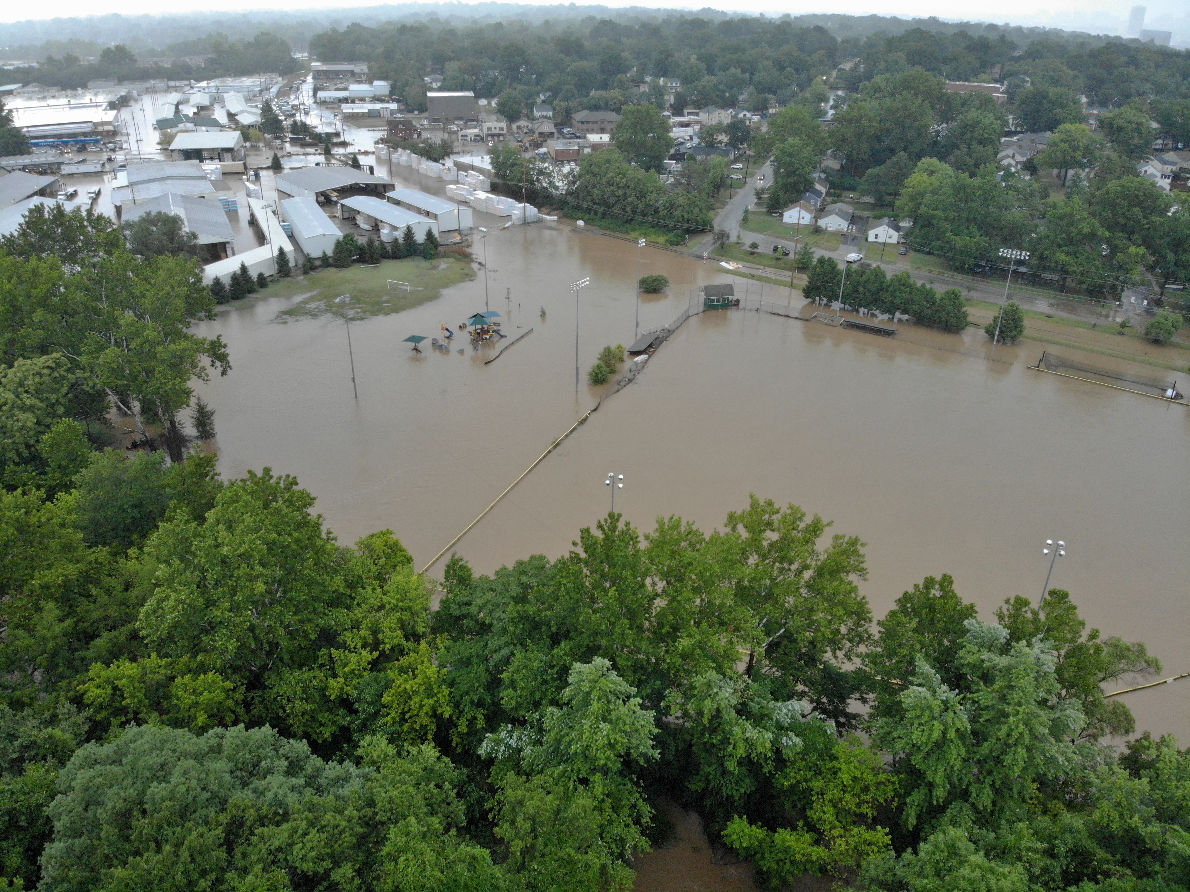
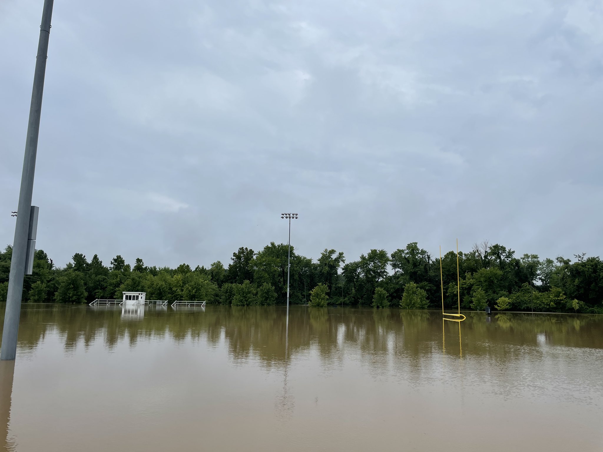
Flooding at the Brentwood Sports Complex off of Russell Ave. in Brentwood, MO (Robert Ward, Twitter) |
|
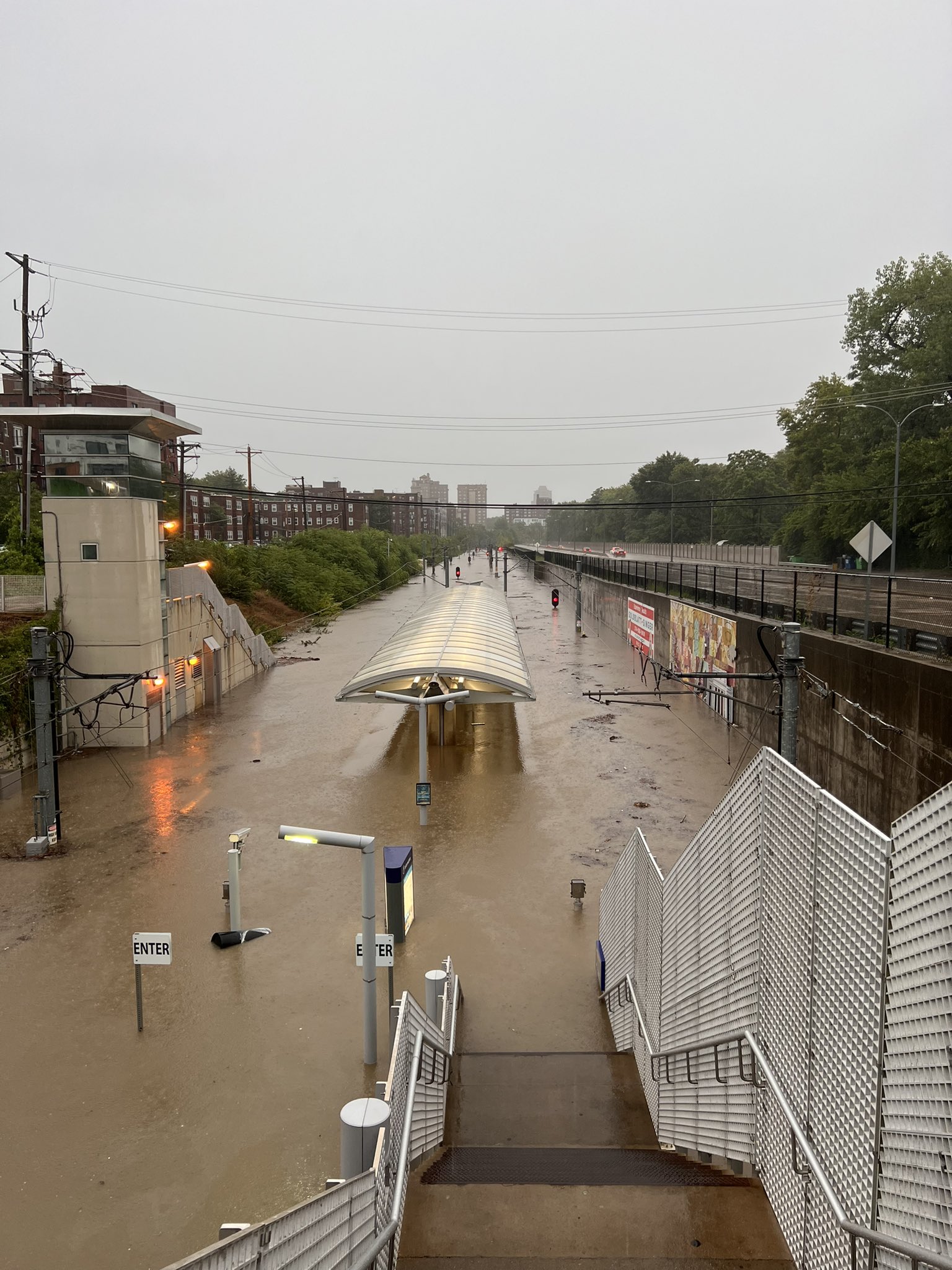
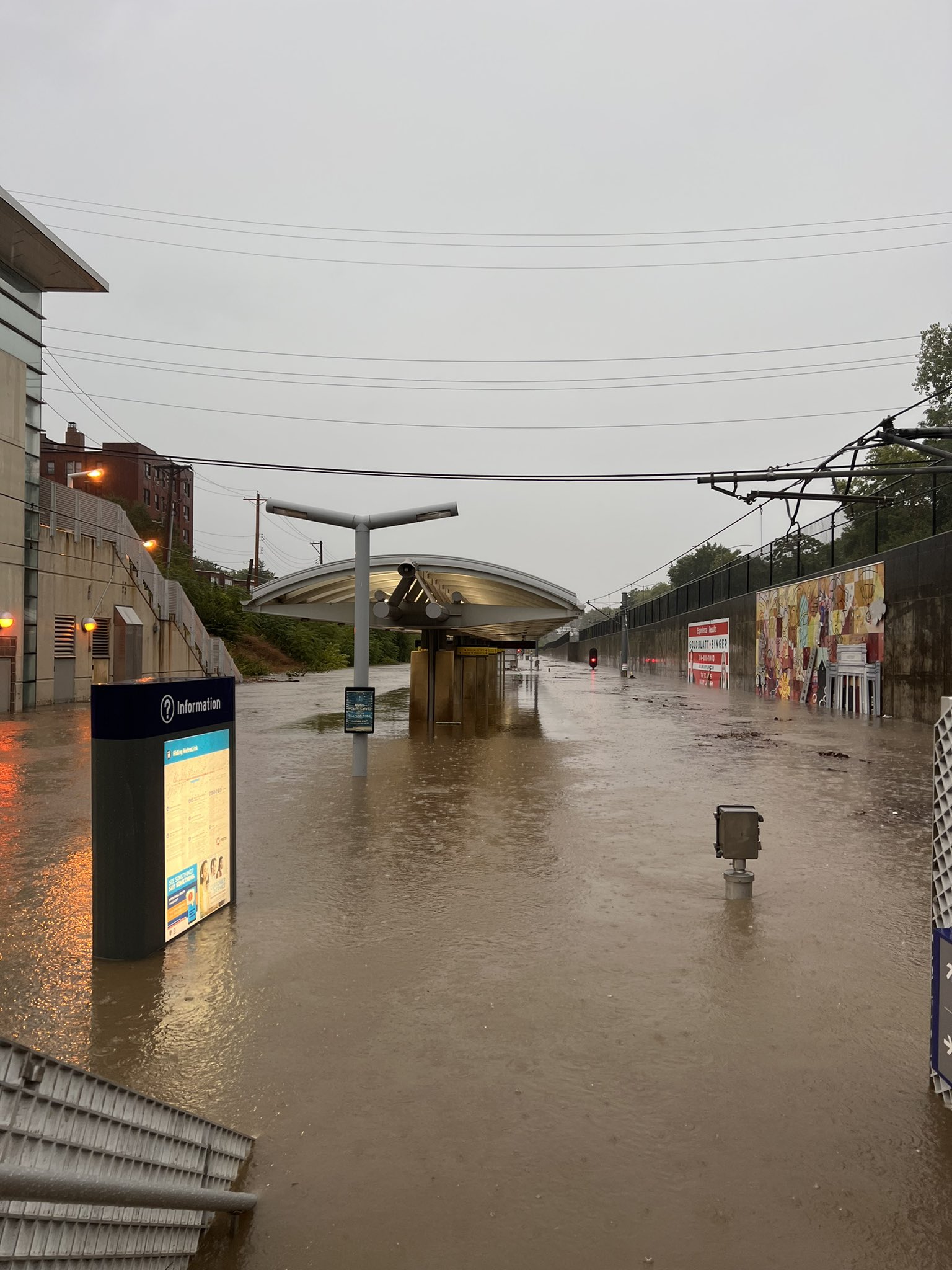
Flooding at the Forest Park DeBaliviere MetroLink station in St. Louis, MO (@TonyInStLouis, Twitter) |
Flooding at the Forest Park-DeBaliviere MetroLink station in St. Louis, MO (@TonyInStLouis, Twitter) |
Flooding on Hanley Rd. north of Manchester Rd. in Brentwood, MO (Megan Floyd, Twitter) |
|
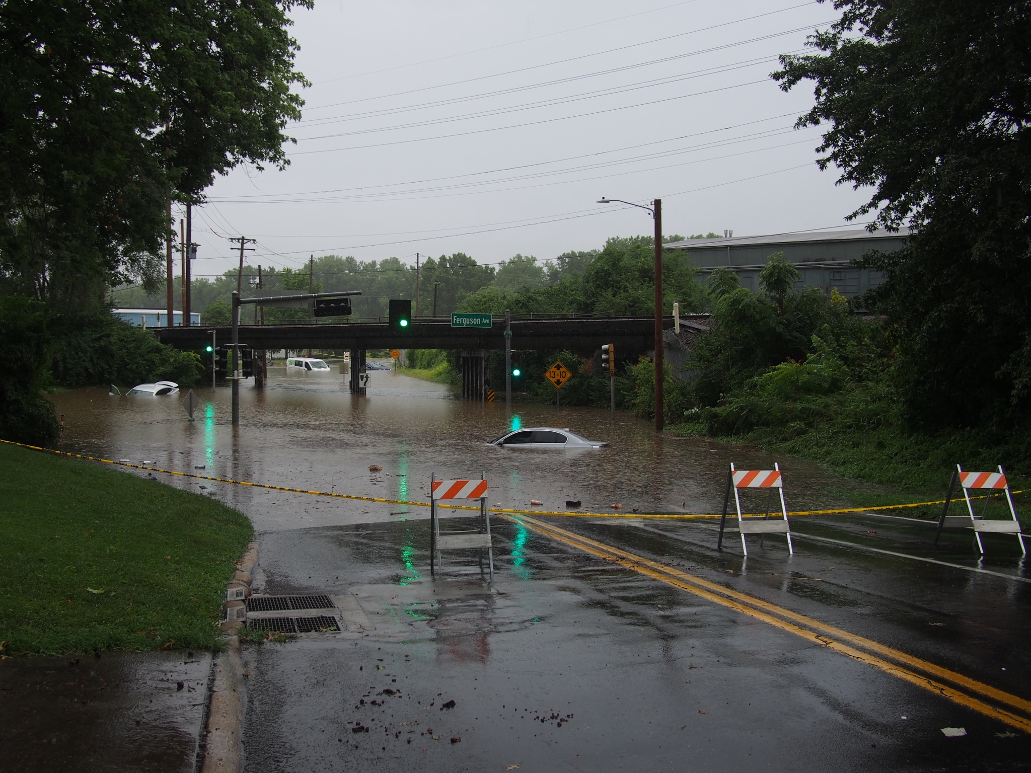
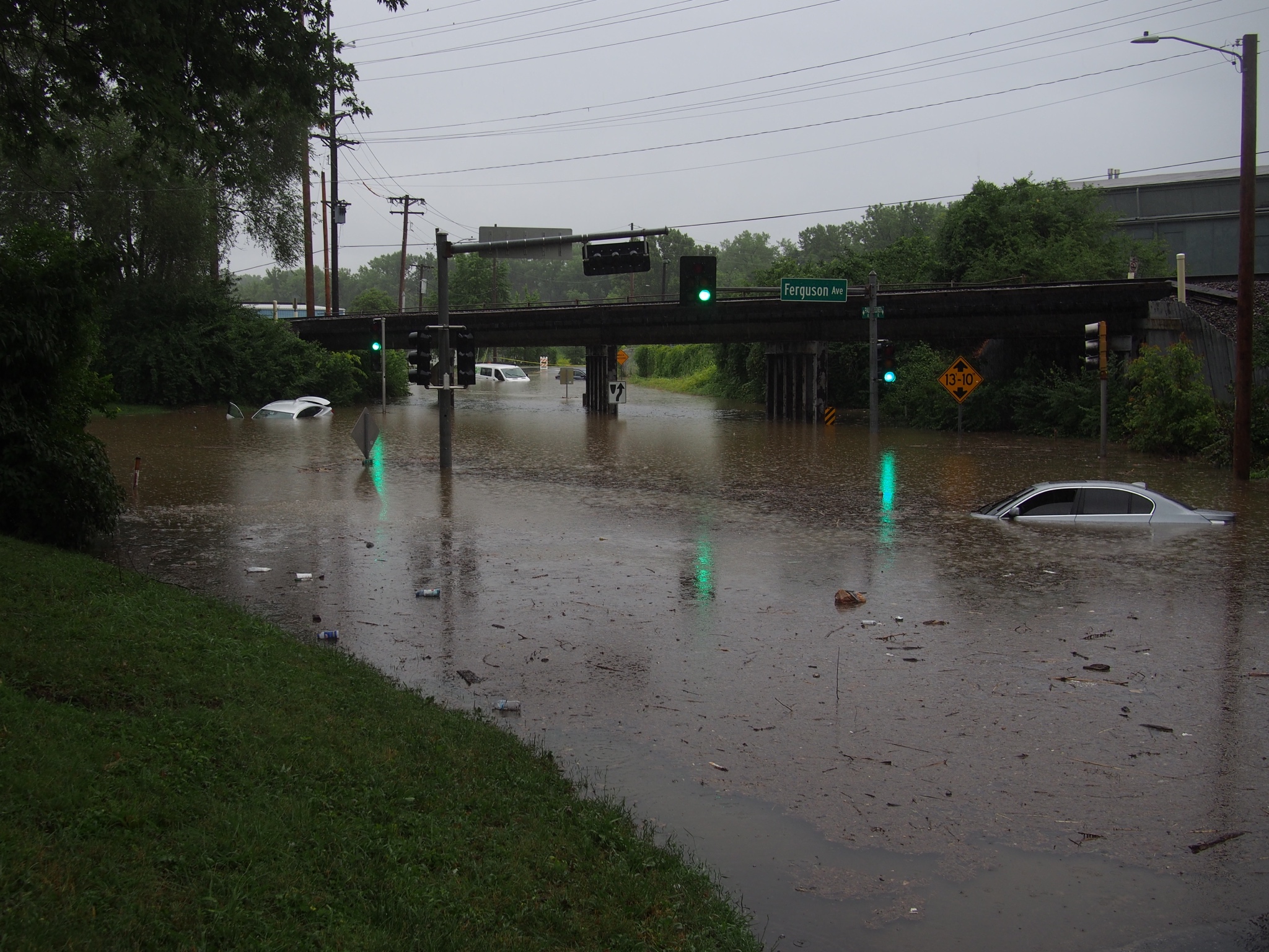
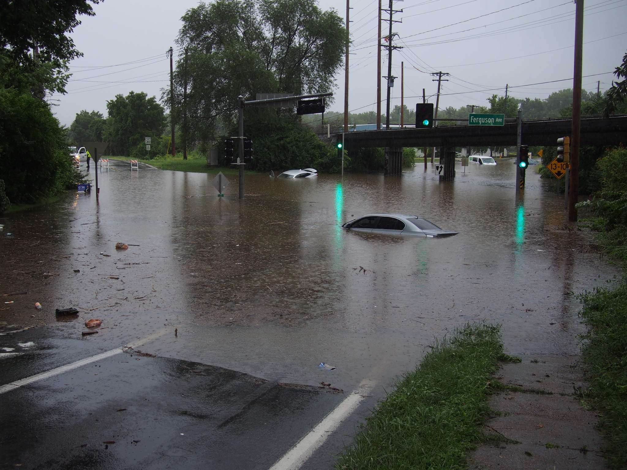
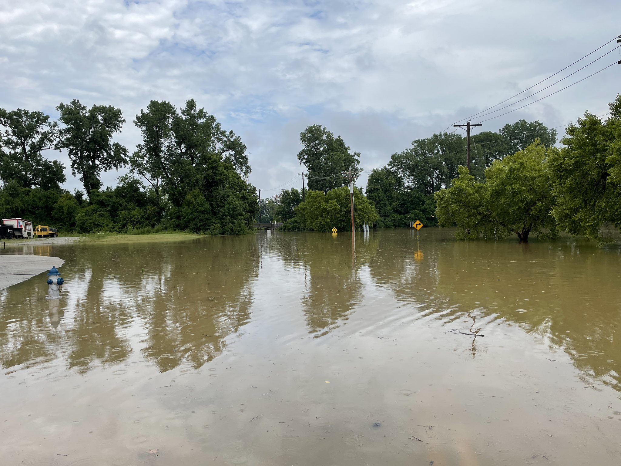
Flooding at S. Elizabeth Ave. and Ferguson Ave. in Ferguson, MO (Josh Renaud, Twitter)
|
Flooding at S. Elizabeth Ave. and Ferguson Ave. in Ferguson, MO (Josh Renaud, Twitter) |
Flooding at S. Elizabeth Ave. and Ferguson Ave. in Ferguson, MO (Josh Renaud, Twitter) |
|
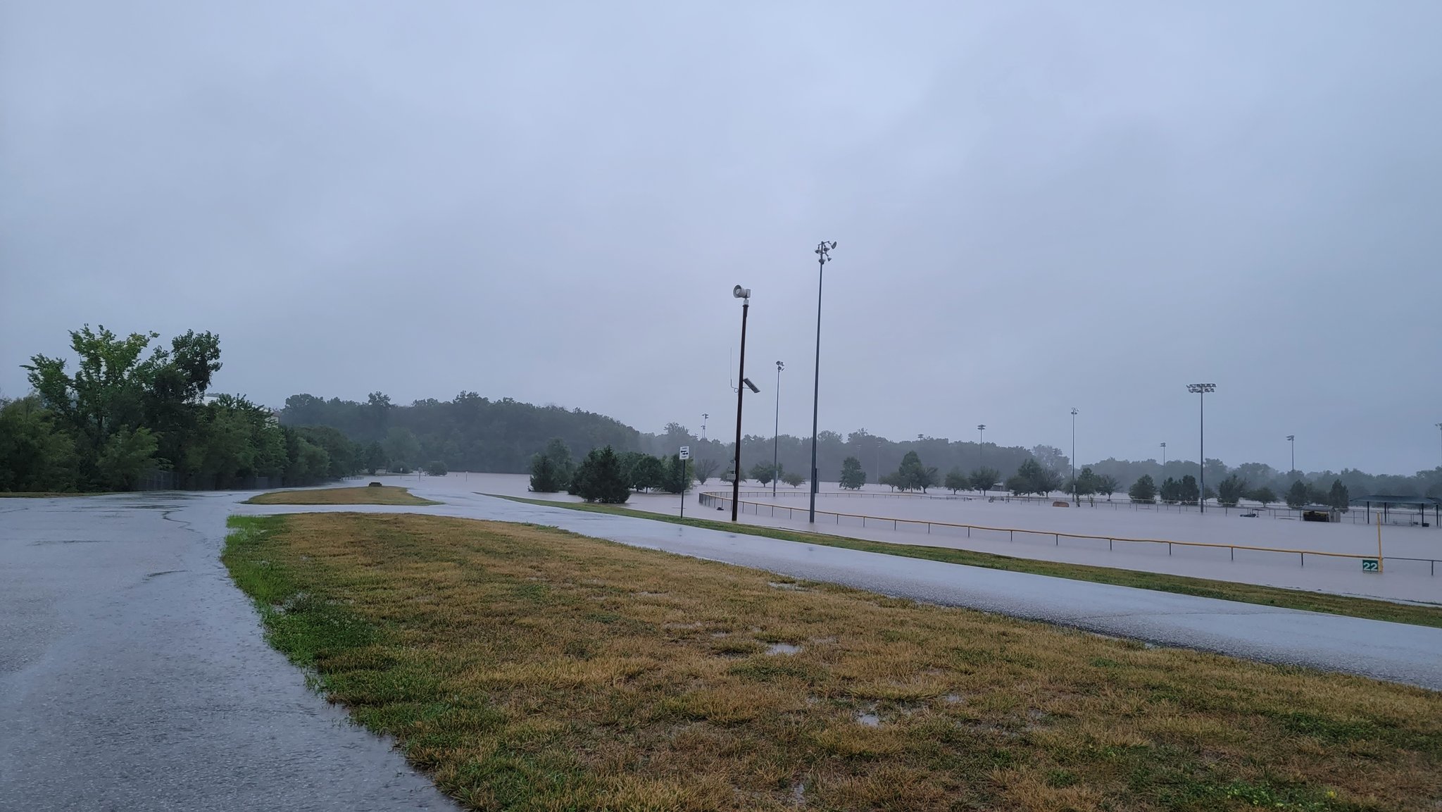
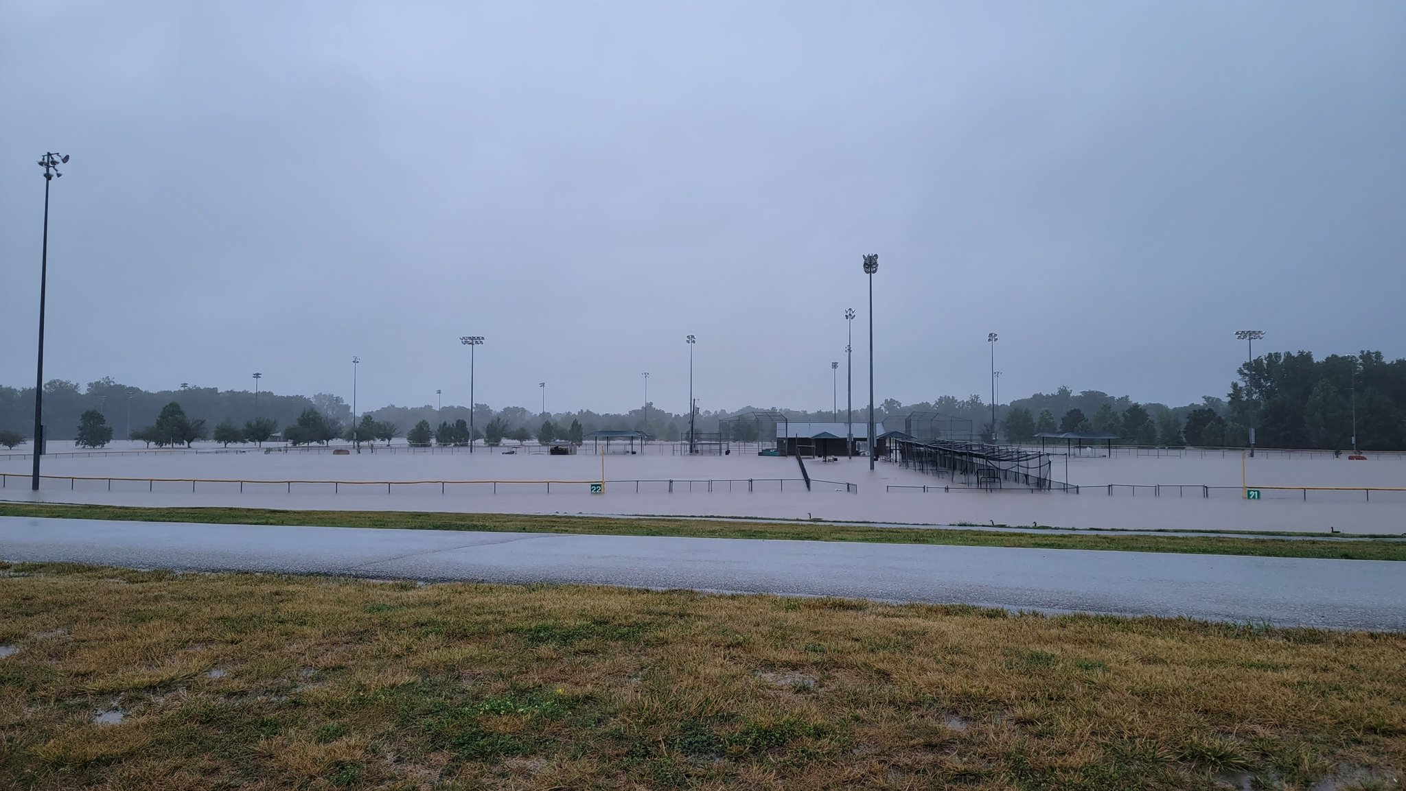
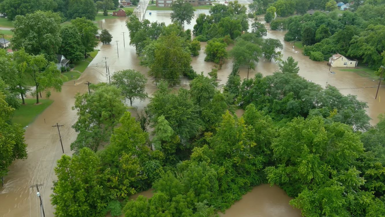
Flooding at the Woodlands Sports Complex in St. Peters, MO (Steven Walchli, Twitter) |
Flooding at the Woodlands Sports Complex in St. Peters, MO (Steven Walchli, Twitter) |
Flooding at the Woodlands Sports Complex in St. Peters, MO (Steven Walchli, Twitter) |
|
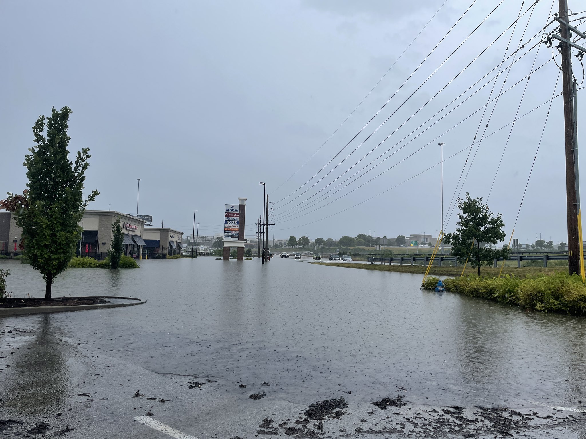
Flooding in St. Peters, MO on Mid Rivers Mall Dr. (Lincoln Hauser, Twitter) |
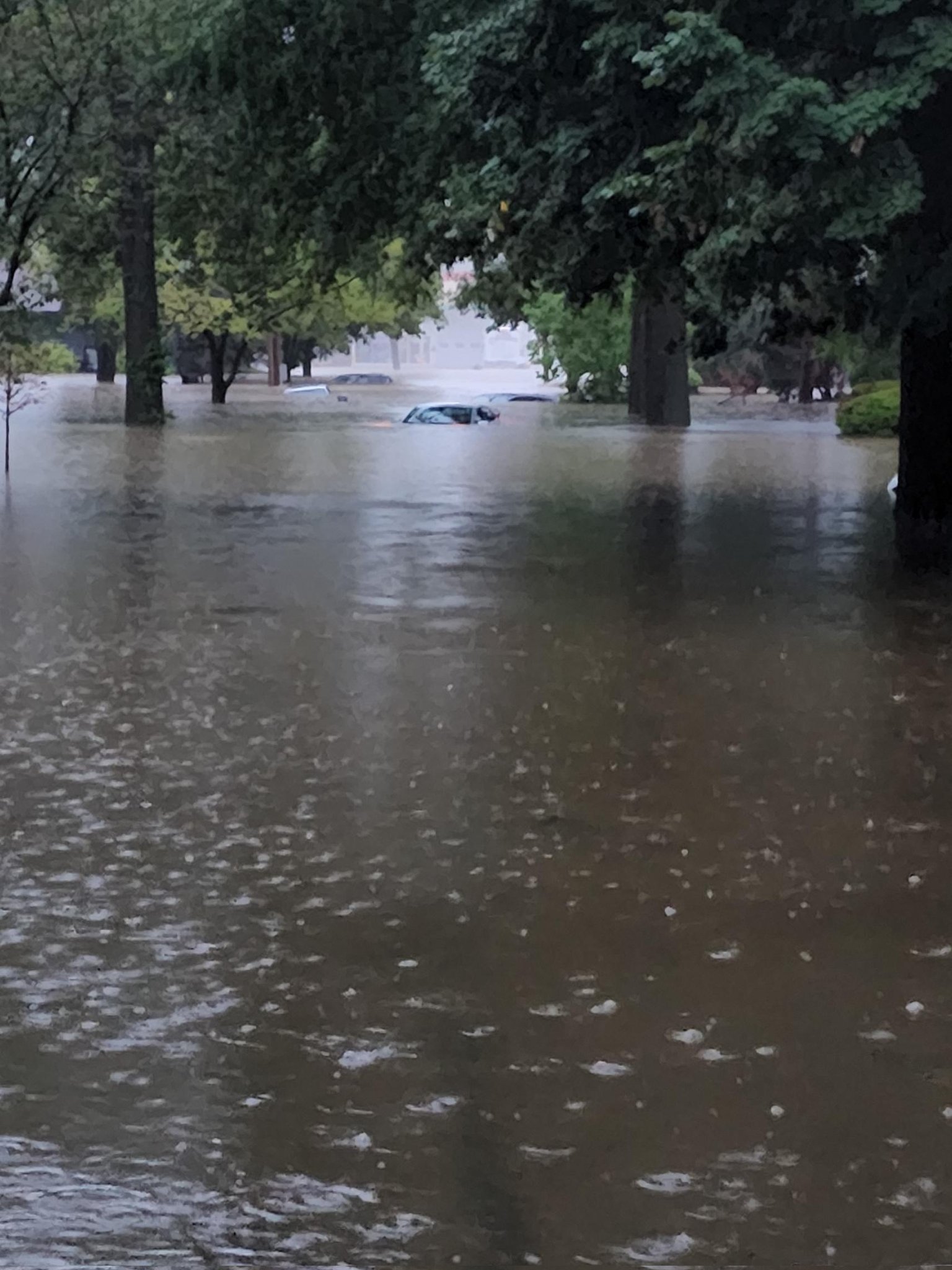
Flooding in University City, MO near Olive Blvd. (Sarah Kendzior, Twitter)
|
Flooding in south St. Louis, MO on Hermitage Ave. (Stacy Lynn, Twitter) |
|
Flooding in Marissa, IL causing road closures (Marissa Fire Department, Facebook) |
Flooding on Main St. in St. Peters, MO (Tornateor, Reddit) |
Flooding on Main St. in St. Peters, MO (Tornateor, Reddit) |
|
Flooding on Ellendale Avenue in St. Louis, MO (Julia Avery, Twitter) |
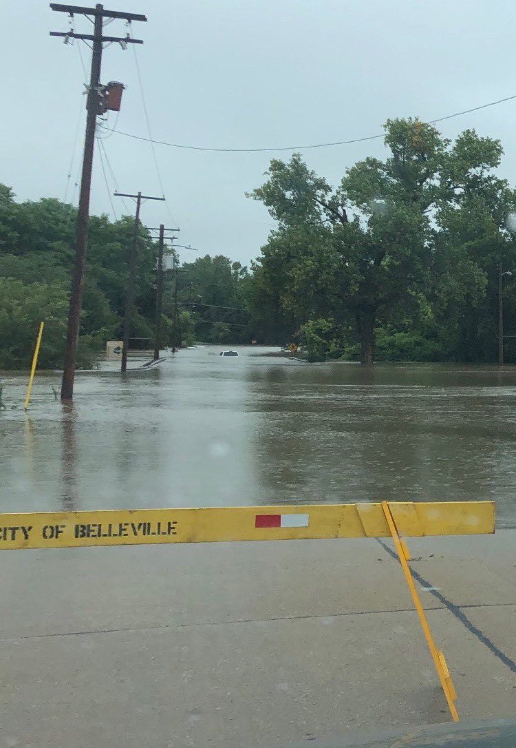
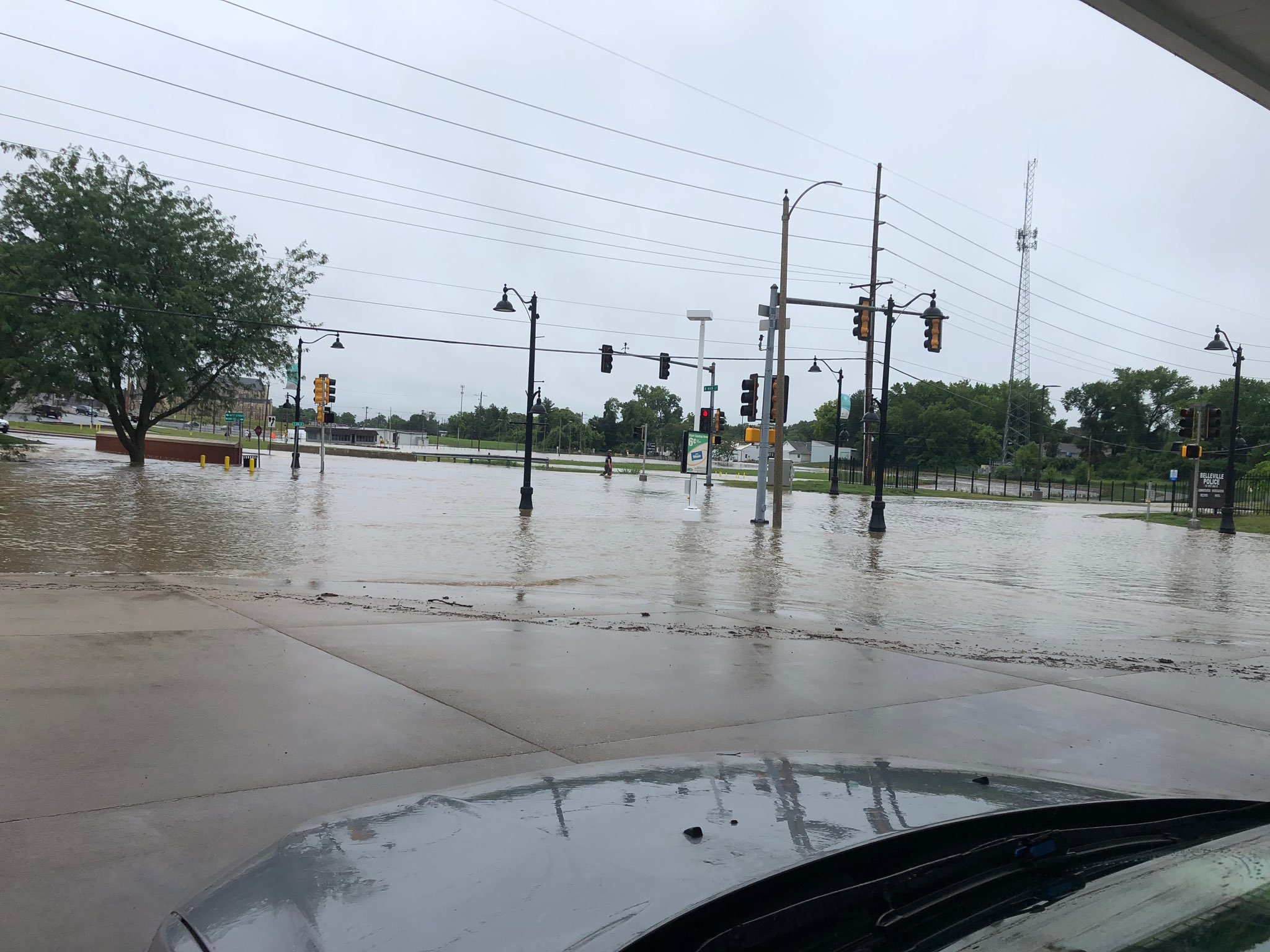
Flooding on Richland Creek at W. Main St. in Belleville, IL (Kelly Cassady, Twitter) |
Flooding at the intersection of West F St. and 3rd St. in Belleville, IL (St. Clair County Sheriff, Facebook) |
|
Flooding at Forest Park Parkway and Union Blvd. in St. Louis, MO (Stitch Benson, Twitter) |
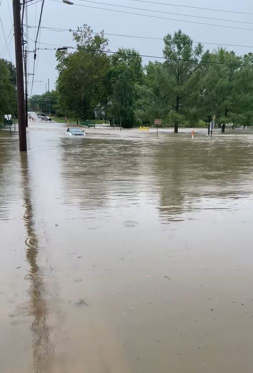
Flooding at the intersection of West F Street and 3rd St. in Belleville, IL (St. Clair County Sheriff, Facebook) |
Flooding on Richland Creek at W. Main St. in Belleville, IL (Kelly Cassady, Twitter) |
|
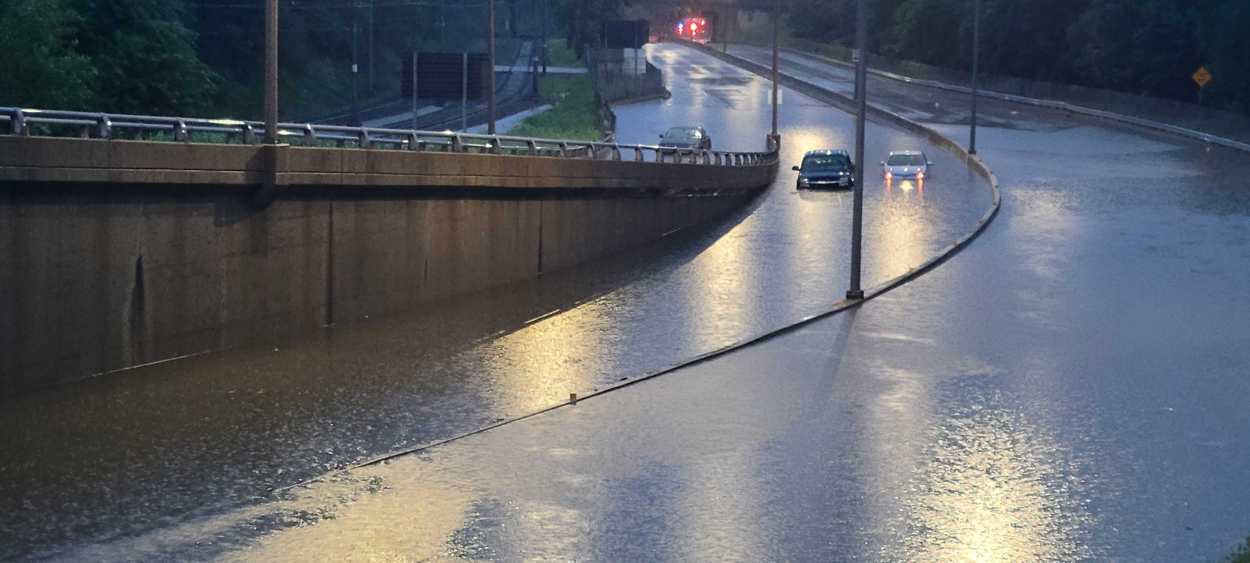
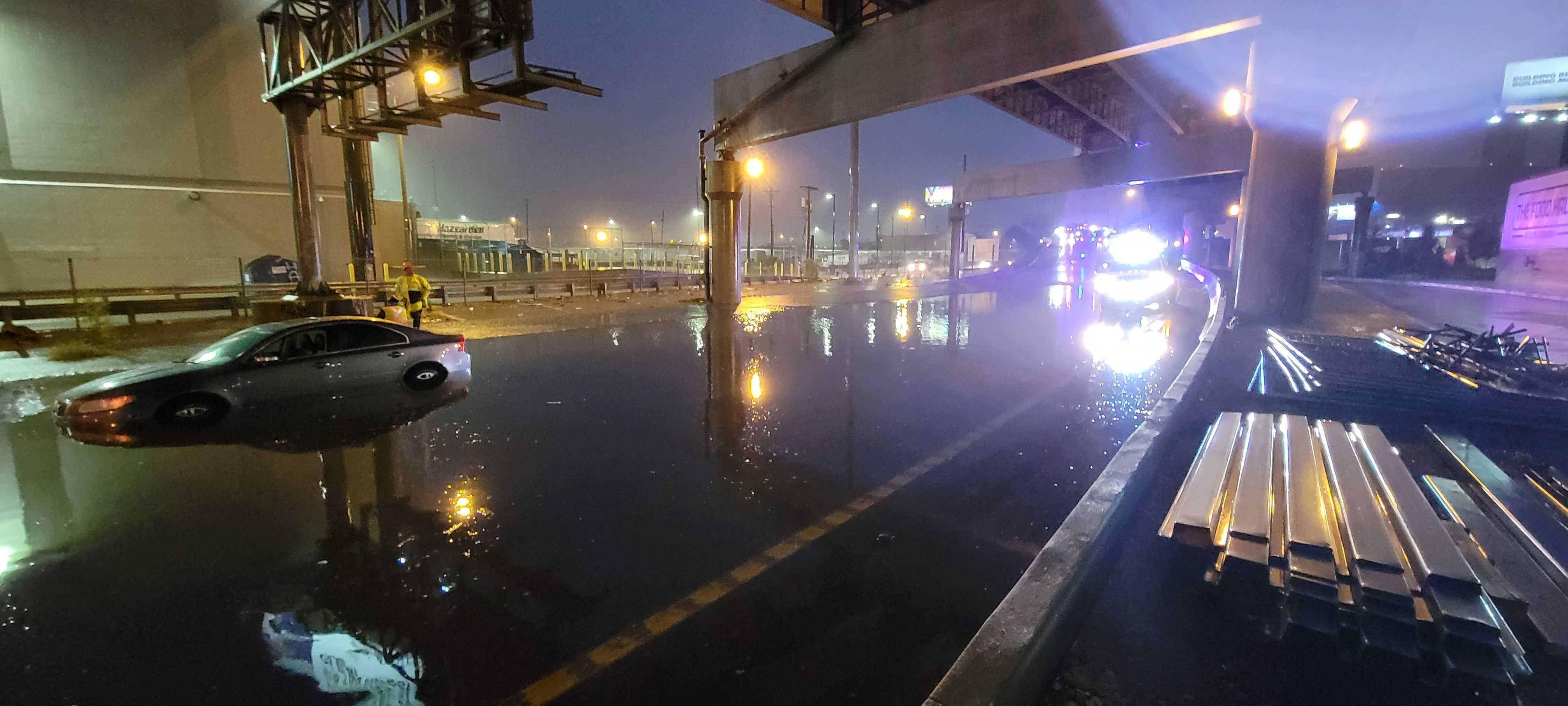
Flooding on I-64 Eastbound at Grand Ave. in St. Louis, MO (Stitch Benson, Twitter) |
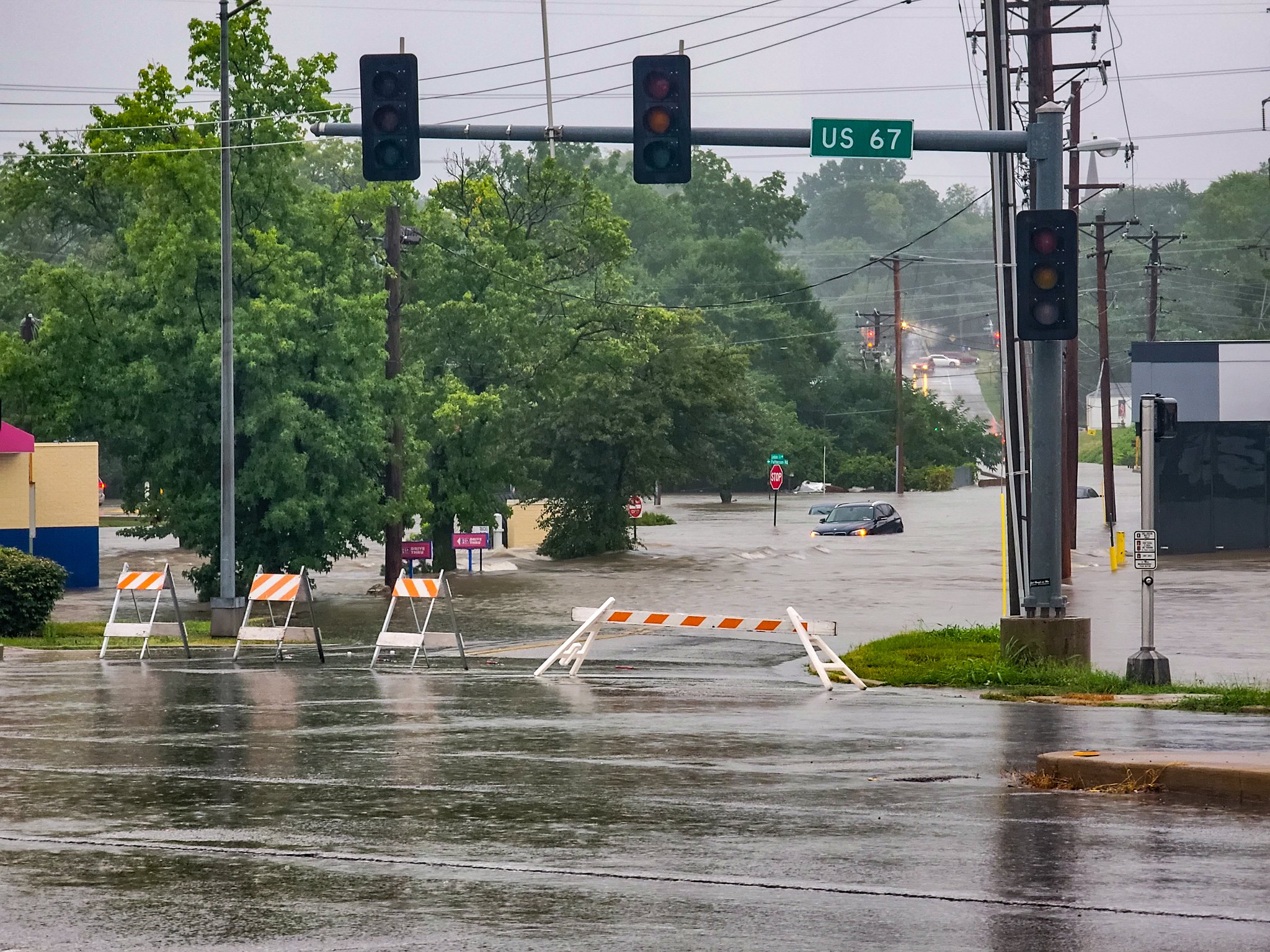
Flooding at Lindbergh Blvd. and St. Denis St. in Florissant, MO (STLFromAbove, Twitter) |
Flooding at the intersection of West F Street and 3rd Street in Belleville, IL (St. Clair County Sheriff, Facebook) |
|
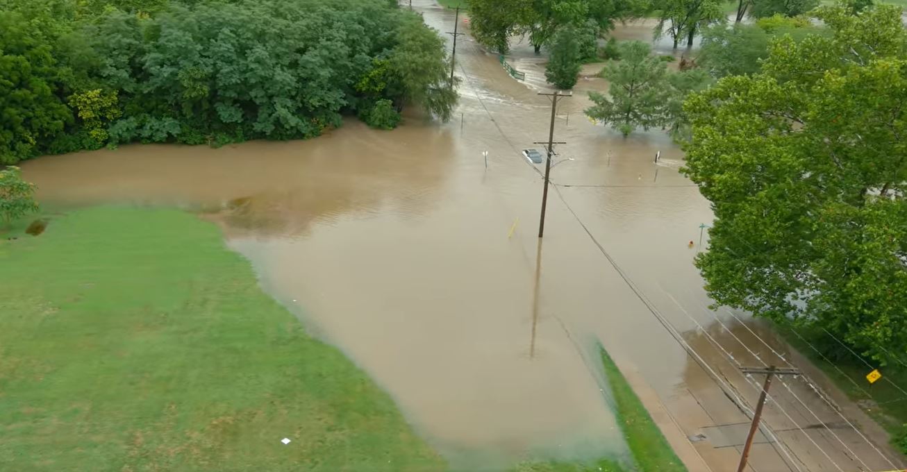
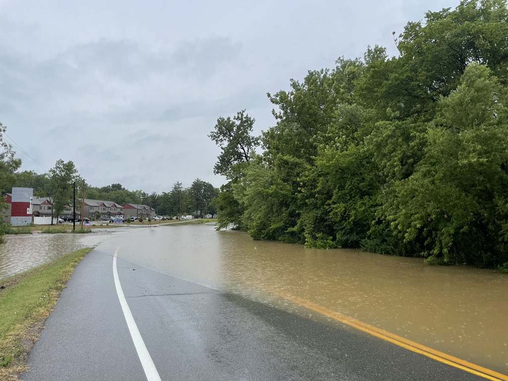
Flooding at Dames Park in O'Fallon, MO (Lincoln Hauser, Twitter) |
Flooding on Highway P in O'Fallon, MO (Lincoln Hauser, Twitter) |
Flooding on Brown Rd. in St. Peters, MO (Lincoln Hauser, Twitter) |
Summary of Storm Reports
000 NWUS53 KLSX 261832 LSRLSX PRELIMINARY LOCAL STORM REPORT...SUMMARY NATIONAL WEATHER SERVICE ST LOUIS MO 132 PM CDT TUE JUL 26 2022 ..TIME... ...EVENT... ...CITY LOCATION... ...LAT.LON... ..DATE... ....MAG.... ..COUNTY LOCATION..ST.. ...SOURCE.... ..REMARKS.. 1254 PM HEAVY RAIN 1 WNW SAINT PETERS 38.78N 90.63W 07/26/2022 E12.86 INCH ST. CHARLES MO PUBLIC POST FROM SOCIAL MEDIA. 0800 AM HEAVY RAIN 2 NE SAINT PETERS 38.80N 90.58W 07/26/2022 M12.34 INCH ST. CHARLES MO COCORAHS COCORAHS STATION MO-SS-37 ST. PETERS 2.2 NE. 1230 PM HEAVY RAIN 1 WNW CREVE COEUR 38.67N 90.46W 07/26/2022 E11.44 INCH ST. LOUIS MO PUBLIC POST FROM SOCIAL MEDIA. 1100 AM HEAVY RAIN 1 SE SAINT PETERS 38.77N 90.59W 07/26/2022 M11.36 INCH ST. CHARLES MO CO-OP OBSERVER AM OBSERVATION. 0700 AM HEAVY RAIN 1 SSW FLINT HILL 38.84N 90.87W 07/26/2022 M11.03 INCH ST. CHARLES MO COCORAHS AM OBSERVATION, RAIN CONTINUED. 0700 AM HEAVY RAIN 1 NNW O`FALLON 38.79N 90.71W 07/26/2022 M11.00 INCH ST. CHARLES MO COCORAHS AM OBSERVATION, RAIN CONTINUED. 1215 PM HEAVY RAIN SAINT ANN 38.73N 90.39W 07/26/2022 E10.95 INCH ST. LOUIS MO PUBLIC POST FROM SOCIAL MEDIA. 0445 AM HEAVY RAIN 1 NW SAINT PETERS 38.79N 90.62W 07/26/2022 E10.90 INCH ST. CHARLES MO PUBLIC POST FROM SOCIAL MEDIA. 0749 AM HEAVY RAIN 1 S ST. PETERS 38.77N 90.58W 07/26/2022 M10.88 INCH ST. CHARLES MO NWS EMPLOYEE 1014 AM HEAVY RAIN 1 SSE SAINT ANN 38.72N 90.38W 07/26/2022 M10.85 INCH ST. LOUIS MO PUBLIC RAIN ONGOING. 0807 AM HEAVY RAIN 1 ESE FLINT HILL 38.85N 90.85W 07/26/2022 E10.70 INCH ST. CHARLES MO PUBLIC 0700 AM HEAVY RAIN 2 SSE SAINT PAUL 38.82N 90.72W 07/26/2022 M10.58 INCH ST. CHARLES MO COCORAHS AM OBSERVATION, RAIN CONTINUED. 1221 PM HEAVY RAIN 3 ESE MOSCOW MILLS 38.93N 90.87W 07/26/2022 E10.44 INCH LINCOLN MO PUBLIC POST FROM SOCIAL MEDIA. 0700 AM HEAVY RAIN 1 SE MARYLAND HEIGHTS 38.71N 90.46W 07/26/2022 M10.35 INCH ST. LOUIS MO COCORAHS AM OBSERVATION, RAIN CONTINUED. 0537 AM HEAVY RAIN 1 NE O`FALLON 38.79N 90.70W 07/26/2022 M10.05 INCH ST. CHARLES MO TRAINED SPOTTER 0617 AM HEAVY RAIN 1 SSE SAINT PAUL 38.84N 90.74W 07/26/2022 M10.00 INCH ST. CHARLES MO TRAINED SPOTTER 0814 AM HEAVY RAIN 2 N CREVE COEUR 38.69N 90.43W 07/26/2022 E10.00 INCH ST. LOUIS MO PUBLIC POST FROM SOCIAL MEDIA. 0431 AM HEAVY RAIN 1 N SAINT PETERS 38.79N 90.61W 07/26/2022 M9.50 INCH ST. CHARLES MO AMATEUR RADIO LONG BRANCH AND SPENCER CROSSING. 0700 AM HEAVY RAIN 1 SW SAINT PETERS 38.77N 90.61W 07/26/2022 M9.50 INCH ST. CHARLES MO COCORAHS AM OBSERVATION, RAIN CONTINUED. 0418 AM HEAVY RAIN 1 NE O`FALLON 38.79N 90.70W 07/26/2022 M9.39 INCH ST. CHARLES MO PUBLIC 0410 AM HEAVY RAIN 1 SSE SAINT PAUL 38.84N 90.74W 07/26/2022 M9.00 INCH ST. CHARLES MO TRAINED SPOTTER 0842 AM HEAVY RAIN 1 ESE DARDENNE PRAIRIE 38.74N 90.71W 07/26/2022 M8.99 INCH ST. CHARLES MO PUBLIC FORMER NWS EMPLOYEE. 0730 AM HEAVY RAIN CASEYVILLE 38.64N 90.03W 07/26/2022 E8.50 INCH ST. CLAIR IL PUBLIC POST FROM SOCIAL MEDIA. 0900 AM HEAVY RAIN 2 NW CREVE COEUR 38.68N 90.46W 07/26/2022 E8.07 INCH ST. LOUIS MO PUBLIC POST FROM SOCIAL MEDIA. 0401 AM HEAVY RAIN 1 S SAINT PAUL 38.84N 90.74W 07/26/2022 M8.00 INCH ST. CHARLES MO PUBLIC 1031 AM HEAVY RAIN 1 NNW SAINT PETERS 38.79N 90.61W 07/26/2022 M8.00 INCH ST. CHARLES MO PUBLIC RAIN ONGOING. 0720 AM HEAVY RAIN 2 ENE SAINT CHARLES 38.81N 90.48W 07/26/2022 M7.85 INCH ST. CHARLES MO COCORAHS 0830 AM HEAVY RAIN 2 E RICHMOND HEIGHTS 38.63N 90.30W 07/26/2022 M7.80 INCH ST. LOUIS CITY MO TRAINED SPOTTER 1043 AM HEAVY RAIN 2 W SAINT LOUIS 38.63N 90.28W 07/26/2022 M7.79 INCH ST. LOUIS CITY MO MESONET STORM TOTAL. 1044 AM HEAVY RAIN MOSCOW MILLS 38.95N 90.92W 07/26/2022 M7.74 INCH LINCOLN MO MESONET STORM TOTAL. 0345 AM HEAVY RAIN 1 SE SAINT PETERS 38.77N 90.59W 07/26/2022 M7.68 INCH ST. CHARLES MO NWS EMPLOYEE 0422 AM HEAVY RAIN 1 SSE SAINT ANN 38.72N 90.38W 07/26/2022 M7.64 INCH ST. LOUIS MO PUBLIC RAIN MEASURED WITH PERSONAL WEATHER STATION AND STILL FALLING. 0830 AM HEAVY RAIN 2 WNW SAINT ANN 38.73N 90.43W 07/26/2022 E7.42 INCH ST. LOUIS MO PUBLIC POST FROM SOCIAL MEDIA. 0700 AM HEAVY RAIN 2 SSE O`FALLON 38.76N 90.70W 07/26/2022 M7.22 INCH ST. CHARLES MO PUBLIC AM OBSERVATION, RAIN CONTINUED. 0721 AM HEAVY RAIN 2 W COTTLEVILLE 38.76N 90.69W 07/26/2022 M7.22 INCH ST. CHARLES MO COCORAHS 0303 AM HEAVY RAIN 1 NE O`FALLON 38.79N 90.70W 07/26/2022 M7.15 INCH ST. CHARLES MO PUBLIC STORM TOTAL THUS FAR. 0835 AM HEAVY RAIN 3 SW MARYLAND HEIGHTS 38.69N 90.52W 07/26/2022 M7.15 INCH ST. LOUIS MO CO-OP OBSERVER AM OBSERVATION, RAIN CONTINUED. 0715 AM HEAVY RAIN 2 N HAZELWOOD 38.80N 90.36W 07/26/2022 M7.12 INCH ST. LOUIS MO COCORAHS AM OBSERVATION, RAIN CONTINUED. 0702 AM HEAVY RAIN 1 WSW FERGUSON 38.74N 90.30W 07/26/2022 M7.10 INCH ST. LOUIS MO PUBLIC 0700 AM HEAVY RAIN 3 SSW MEXICO 39.13N 91.90W 07/26/2022 M7.05 INCH AUDRAIN MO COCORAHS AM OBSERVATION, RAIN CONTINUED. 1249 PM HEAVY RAIN LEBANON 38.60N 89.82W 07/26/2022 E7.00 INCH ST. CLAIR IL PUBLIC POST FROM SOCIAL MEDIA. 0401 AM HEAVY RAIN SAINT PETERS 38.78N 90.60W 07/26/2022 M6.90 INCH ST. CHARLES MO AMATEUR RADIO 1225 PM HEAVY RAIN 1 NNE DARDENNE PRAIRIE 38.76N 90.73W 07/26/2022 M6.63 INCH ST. CHARLES MO PUBLIC 0300 AM HEAVY RAIN 1 SSE SAINT PAUL 38.84N 90.73W 07/26/2022 M6.50 INCH ST. CHARLES MO TRAINED SPOTTER RAINFALL THUS FAR. 0723 AM HEAVY RAIN 3 SE BELLEVILLE 38.51N 89.97W 07/26/2022 E6.33 INCH ST. CLAIR IL COCORAHS 0931 AM HEAVY RAIN 3 NNE LEMAY 38.57N 90.27W 07/26/2022 M6.30 INCH ST. LOUIS CITY MO PUBLIC 0943 AM HEAVY RAIN 3 NNE LEMAY 38.57N 90.27W 07/26/2022 E6.30 INCH ST. LOUIS CITY MO PUBLIC POST FROM SOCIAL MEDIA. 0700 AM HEAVY RAIN 2 NNE MARTINSBURG 39.12N 91.63W 07/26/2022 M6.29 INCH AUDRAIN MO COCORAHS AM OBSERVATION, RAIN CONTINUED. 0724 AM HEAVY RAIN 1 ENE FAIRMONT CITY 38.66N 90.09W 07/26/2022 M6.25 INCH ST. CLAIR IL COCORAHS 0700 AM HEAVY RAIN 2 SSE BELLEVILLE 38.51N 89.99W 07/26/2022 M6.23 INCH ST. CLAIR IL COCORAHS AM OBSERVATION, RAIN CONTINUED. 0723 AM HEAVY RAIN 2 ENE FAIRVIEW HEIGHTS 38.61N 89.97W 07/26/2022 M6.16 INCH ST. CLAIR IL COCORAHS 0700 AM HEAVY RAIN 3 SW MIDDLETOWN 39.10N 91.45W 07/26/2022 M6.15 INCH MONTGOMERY MO COCORAHS AM OBSERVATION, RAIN CONTINUED. 0725 AM HEAVY RAIN 3 SW MIDDLETOWN 39.09N 91.46W 07/26/2022 M6.15 INCH MONTGOMERY MO COCORAHS 0803 AM HEAVY RAIN 2 N BUELL 39.07N 91.44W 07/26/2022 M6.15 INCH MONTGOMERY MO PUBLIC 0513 AM HEAVY RAIN FERGUSON 38.75N 90.30W 07/26/2022 M6.14 INCH ST. LOUIS MO TRAINED SPOTTER 0700 AM HEAVY RAIN 1 NNE TROY 38.99N 90.97W 07/26/2022 M6.10 INCH LINCOLN MO COCORAHS AM OBSERVATION, RAIN CONTINUED. 0730 AM HEAVY RAIN 2 SSW HANNIBAL 39.68N 91.40W 07/26/2022 M6.10 INCH RALLS MO CO-OP OBSERVER AM OBSERVATION, RAIN CONTINUED. 0755 AM HEAVY RAIN MEXICO 39.17N 91.87W 07/26/2022 M6.10 INCH AUDRAIN MO CO-OP OBSERVER AM OBSERVATION. 0811 AM HEAVY RAIN MEXICO 39.17N 91.87W 07/26/2022 M6.10 INCH AUDRAIN MO CO-OP OBSERVER 1008 AM HEAVY RAIN AUXVASSE 39.02N 91.89W 07/26/2022 M6.00 INCH CALLAWAY MO BROADCAST MEDIA STORM TOTAL IN AUXVASSE, MO. 0439 AM HEAVY RAIN 1 NE MOSCOW MILLS 38.95N 90.91W 07/26/2022 M5.90 INCH LINCOLN MO MESONET 0815 AM HEAVY RAIN GLENDALE 38.59N 90.38W 07/26/2022 E5.86 INCH ST. LOUIS MO PUBLIC POST FROM SOCIAL MEDIA. 0600 AM HEAVY RAIN 1 SSE MASCOUTAH 38.49N 89.79W 07/26/2022 M5.78 INCH ST. CLAIR IL COCORAHS AM OBSERVATION, RAIN CONTINUED. 0630 AM HEAVY RAIN 2 N LEMAY 38.57N 90.28W 07/26/2022 M5.44 INCH ST. LOUIS CITY MO COCORAHS AM OBSERVATION, RAIN CONTINUED. 0728 AM HEAVY RAIN 1 WSW LAKESHIRE 38.54N 90.36W 07/26/2022 M5.44 INCH ST. LOUIS MO COCORAHS 1239 PM HEAVY RAIN 2 NE GRANITE CITY 38.73N 90.10W 07/26/2022 M5.39 INCH MADISON IL TRAINED SPOTTER 0440 AM HEAVY RAIN 1 WSW SAINT LOUIS 38.63N 90.27W 07/26/2022 E5.32 INCH ST. LOUIS CITY MO MESONET SCIENCE CENTER. 0815 AM HEAVY RAIN 1 SSE BELLEVILLE 38.51N 89.99W 07/26/2022 M5.30 INCH ST. CLAIR IL TRAINED SPOTTER 0247 AM HEAVY RAIN SAINT PETERS 38.78N 90.60W 07/26/2022 M5.13 INCH ST. CHARLES MO AMATEUR RADIO RAINFALL THUS FAR. 0724 AM HEAVY RAIN 1 NNW O`FALLON 38.60N 89.92W 07/26/2022 E5.08 INCH ST. CLAIR IL COCORAHS 0418 AM HEAVY RAIN 1 E MARYLAND HEIGHTS 38.72N 90.44W 07/26/2022 E5.00 INCH ST. LOUIS MO PUBLIC 0430 AM HEAVY RAIN 1 SSE VANDALIA 38.97N 89.09W 07/26/2022 M5.00 INCH FAYETTE IL PUBLIC 0700 AM HEAVY RAIN BELLEVILLE 38.53N 90.00W 07/26/2022 E4.90 INCH ST. CLAIR IL PUBLIC AM OBSERVATION. 0215 AM HEAVY RAIN 1 SSE SAINT PAUL 38.84N 90.73W 07/26/2022 M4.88 INCH ST. CHARLES MO TRAINED SPOTTER RAINFALL THUS FAR. 1218 PM HEAVY RAIN 2 WSW WELDON SPRING 38.71N 90.68W 07/26/2022 M4.56 INCH ST. CHARLES MO OFFICIAL NWS OBS SINCE MIDNIGHT. 1104 AM HEAVY RAIN 2 SE TRENTON 38.59N 89.66W 07/26/2022 M4.52 INCH CLINTON IL PUBLIC 0722 AM HEAVY RAIN 2 WSW LAKE SAINT LOUIS 38.78N 90.82W 07/26/2022 M4.50 INCH ST. CHARLES MO COCORAHS 1253 PM HEAVY RAIN WRIGHT CITY 38.83N 91.02W 07/26/2022 E4.50 INCH WARREN MO PUBLIC POST FROM SOCIAL MEDIA. 0700 AM HEAVY RAIN CENTRALIA 39.21N 92.13W 07/26/2022 M4.30 INCH BOONE MO COCORAHS AM OBSERVATION, RAIN CONTINUED. 0726 AM HEAVY RAIN 2 NW THOMPSON 39.21N 92.01W 07/26/2022 M4.30 INCH AUDRAIN MO COCORAHS 0700 AM HEAVY RAIN 1 NNE GLENDALE 38.60N 90.37W 07/26/2022 M4.28 INCH ST. LOUIS MO COCORAHS AM OBSERVATION, RAIN CONTINUED. 0820 AM HEAVY RAIN WEBSTER GROVES 38.59N 90.35W 07/26/2022 E4.23 INCH ST. LOUIS MO PUBLIC POST FROM SOCIAL MEDIA. 0209 AM HEAVY RAIN 1 NW CREVE COEUR 38.67N 90.45W 07/26/2022 M4.07 INCH ST. LOUIS MO PUBLIC RAINFALL THUS FAR VIA SOCIAL MEDIA. 0726 AM HEAVY RAIN 2 N CENTRALIA 39.23N 92.13W 07/26/2022 M4.01 INCH BOONE MO COCORAHS 0904 AM HEAVY RAIN 2 SE TRENTON 38.59N 89.66W 07/26/2022 M3.90 INCH CLINTON IL PUBLIC 0215 AM HEAVY RAIN 1 SSW FLINT HILL 38.83N 90.87W 07/26/2022 M3.73 INCH ST. CHARLES MO PUBLIC RAINFALL THUS FAR VIA SOCIAL MEDIA. 0237 AM HEAVY RAIN 2 WSW WELDON SPRING 38.71N 90.68W 07/26/2022 M3.58 INCH ST. CHARLES MO BROADCAST MEDIA RAINFALL THUS FAR. 0116 PM HEAVY RAIN 1 W AVISTON 38.61N 89.62W 07/26/2022 M3.52 INCH CLINTON IL PUBLIC 0335 AM HEAVY RAIN 1 SW FERGUSON 38.74N 90.30W 07/26/2022 M3.39 INCH ST. LOUIS MO PUBLIC 0700 AM HEAVY RAIN 1 E FIDELITY 39.16N 90.14W 07/26/2022 M3.37 INCH MACOUPIN IL CO-OP OBSERVER AM OBSERVATION, RAIN CONTINUED. 0615 AM HEAVY RAIN OKAWVILLE 38.43N 89.55W 07/26/2022 M3.34 INCH WASHINGTON IL COCORAHS AM OBSERVATION, RAIN CONTINUED. 1045 AM HEAVY RAIN MONROE CITY 39.65N 91.73W 07/26/2022 M3.30 INCH MONROE MO MESONET STORM TOTAL, RAIN ONGOING. 0700 AM HEAVY RAIN SAINT LIBORY 38.36N 89.71W 07/26/2022 M3.25 INCH ST. CLAIR IL CO-OP OBSERVER AM OBSERVATION, RAIN CONTINUED. 1218 PM HEAVY RAIN FLORIDA 39.49N 91.79W 07/26/2022 M3.25 INCH MONROE MO PUBLIC 0700 AM HEAVY RAIN 2 SSE THE LANDING 39.53N 91.65W 07/26/2022 M3.24 INCH RALLS MO CO-OP OBSERVER AM OBSERVATION, RAIN CONTINUED. 1030 AM HEAVY RAIN SAINT JACOB 38.72N 89.77W 07/26/2022 E3.10 INCH MADISON IL AMATEUR RADIO RAIN TOTAL SINCE MIDNIGHT, RAIN ONGOING. 0730 AM HEAVY RAIN 1 NE HANNIBAL 39.71N 91.37W 07/26/2022 M3.09 INCH MARION MO COCORAHS AM OBSERVATION. 0800 AM HEAVY RAIN EDWARDSVILLE 38.80N 89.97W 07/26/2022 M3.03 INCH MADISON IL COCORAHS AM OBSERVATION, RAIN CONTINUED. 1028 AM HEAVY RAIN SAINT JACOB 38.72N 89.77W 07/26/2022 M3.00 INCH MADISON IL PUBLIC 0850 AM HEAVY RAIN 2 W EDWARDSVILLE 38.79N 90.00W 07/26/2022 E2.98 INCH MADISON IL CO-OP OBSERVER AM OBSERVATION, RAIN CONTINUED. 0856 AM HEAVY RAIN 2 WNW SWANSEA 38.55N 90.02W 07/26/2022 M2.96 INCH ST. CLAIR IL PUBLIC STORM TOTAL SO FAR. 0700 AM HEAVY RAIN 1 ENE HALLSVILLE 39.12N 92.20W 07/26/2022 M2.91 INCH BOONE MO COCORAHS AM OBSERVATION, RAIN CONTINUED. 0726 AM HEAVY RAIN 1 ENE HALLSVILLE 39.12N 92.21W 07/26/2022 M2.91 INCH BOONE MO COCORAHS 0700 AM HEAVY RAIN 1 NNW BALLWIN 38.61N 90.56W 07/26/2022 M2.86 INCH ST. LOUIS MO COCORAHS AM OBSERVATION, RAIN CONTINUED. 1100 AM HEAVY RAIN 3 E HIGHLAND 38.74N 89.62W 07/26/2022 E2.75 INCH MADISON IL PUBLIC POST FROM SOCIAL MEDIA. 1245 PM HEAVY RAIN 1 NNE SUNSET HILLS 38.55N 90.41W 07/26/2022 M2.75 INCH ST. LOUIS MO PUBLIC 0600 AM HEAVY RAIN 2 E MOUNT OLIVE 39.07N 89.70W 07/26/2022 M2.73 INCH MONTGOMERY IL CO-OP OBSERVER AM OBSERVATION. 0700 AM HEAVY RAIN 3 S HARDIN 39.11N 90.62W 07/26/2022 M2.67 INCH CALHOUN IL COCORAHS AM OBSERVATION, RAIN CONTINUED. 0700 AM HEAVY RAIN PITTSFIELD 39.61N 90.80W 07/26/2022 M2.65 INCH PIKE IL CO-OP OBSERVER AM OBSERVATION, RAIN CONTINUED. 0700 AM HEAVY RAIN 1 SSW NEW LONDON 39.57N 91.41W 07/26/2022 M2.60 INCH RALLS MO COCORAHS AM OBSERVATION, RAIN CONTINUED. 0600 AM HEAVY RAIN SHELBINA 39.69N 92.04W 07/26/2022 M2.57 INCH SHELBY MO CO-OP OBSERVER AM OBSERVATION, RAIN CONTINUED. 0700 AM HEAVY RAIN 2 W SMITHTON 38.41N 90.04W 07/26/2022 M2.48 INCH ST. CLAIR IL COCORAHS AM OBSERVATION, RAIN CONTINUED. 0705 AM HEAVY RAIN 1 SW JERSEYVILLE 39.10N 90.34W 07/26/2022 M2.45 INCH JERSEY IL CO-OP OBSERVER AM OBSERVATION, RAIN CONTINUED. 0625 AM HEAVY RAIN CLARKSVILLE 39.37N 90.91W 07/26/2022 M2.30 INCH PIKE MO CO-OP OBSERVER AM OBSERVATION. 0700 AM HEAVY RAIN WHITE HALL 39.44N 90.40W 07/26/2022 M2.30 INCH GREENE IL CO-OP OBSERVER AM OBSERVATION. 0730 AM HEAVY RAIN BOWLING GREEN 39.34N 91.19W 07/26/2022 M2.21 INCH PIKE MO COCORAHS AM OBSERVATION, RAIN CONTINUED. 0700 AM HEAVY RAIN 3 E SILEX 39.13N 91.00W 07/26/2022 M2.18 INCH LINCOLN MO CO-OP OBSERVER AM OBSERVATION, RAIN CONTINUED. 0730 AM HEAVY RAIN 5 NNW PALMYRA 39.86N 91.55W 07/26/2022 M2.18 INCH MARION MO COCORAHS AM OBSERVATION, RAIN CONTINUED. 0727 AM HEAVY RAIN 3 NNW KINGDOM CITY 38.99N 91.96W 07/26/2022 M2.16 INCH CALLAWAY MO COCORAHS 0600 AM HEAVY RAIN 2 S TROY 38.71N 89.90W 07/26/2022 M2.15 INCH MADISON IL COCORAHS AM OBSERVATION, RAIN CONTINUED. 1205 PM HEAVY RAIN 1 NW MURPHY 38.51N 90.50W 07/26/2022 M2.02 INCH ST. LOUIS MO PUBLIC 0700 AM HEAVY RAIN SHELBYVILLE 39.80N 92.04W 07/26/2022 M2.01 INCH SHELBY MO COCORAHS 7AM OBSERVATION, RAIN CONTINUED. 0147 AM HEAVY RAIN 2 WSW WELDON SPRING 38.70N 90.68W 07/26/2022 M1.92 INCH ST. CHARLES MO OFFICIAL NWS OBS RAINFALL THUS FAR AT THE NWS ST. LOUIS OFFICE. 0628 AM HEAVY RAIN 1 NNW SHELBYVILLE 39.81N 92.04W 07/26/2022 M1.89 INCH SHELBY MO COCORAHS AM OBSERVATION, RAIN CONTINUED. 0700 AM HEAVY RAIN 4 W KELL 38.49N 88.97W 07/26/2022 M1.85 INCH MARION IL CO-OP OBSERVER AM OBSERVATION, RAIN CONTINUED. 0700 AM HEAVY RAIN 1 NNW BREESE 38.62N 89.53W 07/26/2022 M1.79 INCH CLINTON IL COCORAHS AM OBSERVATION, RAIN CONTINUED. 0700 AM HEAVY RAIN 1 NW CENTRALIA 38.53N 89.13W 07/26/2022 M1.76 INCH MARION IL CO-OP OBSERVER AM OBSERVATION. 0655 AM HEAVY RAIN 1 ENE BOWLING GREEN 39.34N 91.17W 07/26/2022 M1.66 INCH PIKE MO CO-OP OBSERVER AM OBSERVATION, RAIN CONTINUED. 0710 AM HEAVY RAIN 3 SW LAKESHIRE 38.51N 90.37W 07/26/2022 M1.48 INCH ST. LOUIS MO COCORAHS AM OBSERVATION, RAIN CONTINUED. 0700 AM HEAVY RAIN 2 SW HIGHLAND 38.72N 89.70W 07/26/2022 M1.42 INCH MADISON IL COCORAHS AM OBSERVATION, RAIN CONTINUED. 0650 AM HEAVY RAIN SALEM 38.63N 88.95W 07/26/2022 M1.41 INCH MARION IL CO-OP OBSERVER AM OBSERVATION. 0700 AM HEAVY RAIN RAMSEY 39.15N 89.10W 07/26/2022 M1.30 INCH FAYETTE IL CO-OP OBSERVER AM OBSERVATION. 0652 AM HEAVY RAIN GIRARD 39.45N 89.78W 07/26/2022 M1.28 INCH MACOUPIN IL COCORAHS AM OBSERVATION, RAIN CONTINUED. 1045 AM HEAVY RAIN WILLIAMSBURG 38.92N 91.70W 07/26/2022 M1.16 INCH CALLAWAY MO MESONET STORM TOTAL, RAIN ONGOING. 1045 AM HEAVY RAIN VANDALIA 39.31N 91.49W 07/26/2022 M1.10 INCH AUDRAIN MO MESONET STORM TOTAL, RAIN ONGOING. 0715 AM HEAVY RAIN STEFFENVILLE 39.97N 91.89W 07/26/2022 M1.05 INCH LEWIS MO CO-OP OBSERVER AM OBSERVATION, RAIN CONTINUED. 0700 AM HEAVY RAIN 3 SSE QUINCY 39.90N 91.36W 07/26/2022 M0.92 INCH ADAMS IL COCORAHS AM OBSERVATION, RAIN CONTINUED. 1045 AM HEAVY RAIN NOVELTY 40.01N 92.21W 07/26/2022 M0.84 INCH KNOX MO MESONET STORM TOTAL, RAIN ONGOING. 1048 AM HEAVY RAIN 1 SSE COLUMBIA 38.94N 92.32W 07/26/2022 M0.64 INCH BOONE MO MESONET STORM TOTAL, RAIN ONGOING. 1048 AM HEAVY RAIN 4 SE COLUMBIA 38.91N 92.27W 07/26/2022 M0.49 INCH BOONE MO MESONET STORM TOTAL, RAIN ONGOING. 1047 AM HEAVY RAIN 2 S COLUMBIA 38.93N 92.32W 07/26/2022 M0.47 INCH BOONE MO MESONET STORM TOTAL, RAIN ONGOING. 1100 AM HEAVY RAIN 7 SE COLUMBIA 38.90N 92.22W 07/26/2022 M0.40 INCH BOONE MO MESONET STORM TOTAL. 0153 AM FLASH FLOOD 1 NE COTTLEVILLE 38.76N 90.64W 07/26/2022 ST. CHARLES MO LAW ENFORCEMENT OHMES ROAD CLOSED NEAR MID RIVERS MALL DRIVE. DEPTH OF WATER UNKNOWN. 0251 AM FLASH FLOOD 1 NE FRONTENAC 38.64N 90.41W 07/26/2022 ST. LOUIS MO LAW ENFORCEMENT SOUTHBOUND LINDBERG AVE JUST NORTH OF I-64 HAS WATER COVERING THE ROAD AND SEVERAL CARS STUCK. 0253 AM FLASH FLOOD 3 ESE MARYLAND HEIGHTS 38.71N 90.43W 07/26/2022 ST. LOUIS MO LAW ENFORCEMENT SCHUETZ ROAD FLOODED SOUTH OF ADIE ROAD - CAR STRANDED. 0300 AM FLASH FLOOD 1 SSW FRONTENAC 38.62N 90.42W 07/26/2022 ST. LOUIS MO LAW ENFORCEMENT ROAD NOT PASSABLE DUE TO WATER COVERING THE ROAD - FLOODING FROM A NEARBY CREEK. 0307 AM FLASH FLOOD 1 W LADUE 38.64N 90.40W 07/26/2022 ST. LOUIS MO LAW ENFORCEMENT DEER CREEK FLOODING AND THREATENING HOUSES NEAR WARSON ROAD AND FOXBORO ROAD. 0311 AM FLASH FLOOD 2 W CREVE COEUR 38.66N 90.48W 07/26/2022 ST. LOUIS MO LAW ENFORCEMENT WATER OVER N MASON ROAD AND MUIRFIELD LN DUE TO FLOODING FROM A NEARBY CREEK. DEPTH OF WATER AROUND A FOOT. 0335 AM FLASH FLOOD UNIVERSITY CITY 38.67N 90.33W 07/26/2022 ST. LOUIS MO LAW ENFORCEMENT WATER RESCUE WITH VEHICLE STRANDED IN FLOODED ROAD AT WILSON AVE AND BURCH LN NEAR THE RIVER DES PERES. 0403 AM FLASH FLOOD 2 WSW SAINT ANN 38.72N 90.43W 07/26/2022 ST. LOUIS MO AMATEUR RADIO FEE FEE ROAD AND ADIE ROAD, ALONG WITH WELSCH INDUSTRIAL CT AND LACKLAND - WATER OVER THE ROADWAYS WITH VEHICLES IN THE WATER. 0419 AM FLASH FLOOD LADUE 38.64N 90.37W 07/26/2022 ST. LOUIS MO EMERGENCY MNGR WENNEKER DR AND TANGLEWOOD DR - WATER RESCUE INVOLVING RESIDENCE ALONG THE BLACK CREEK. 0432 AM FLASH FLOOD 1 WNW LADUE 38.64N 90.39W 07/26/2022 ST. LOUIS MO AMATEUR RADIO WATER APPROACHING HOUSES NEAR RIO VISTA DRIVE AND DEL REY PASS. 0435 AM FLASH FLOOD 3 ESE MARYLAND HEIGHTS 38.71N 90.43W 07/26/2022 ST. LOUIS MO BROADCAST MEDIA CHRIS HIGGINS TWITTER PHOTOGRAPH OF FLASH FLOODING NEAR SCHUETZ ROAD AND ADIE ROAD IN MARYLAND HEIGHTS. VAN SUBMERGED TO WINDOWS. 0441 AM FLASH FLOOD 1 WNW FLINT HILL 38.86N 90.87W 07/26/2022 ST. CHARLES MO DEPT OF HIGHWAYS MODOT REPORTS HIGHWAY 61 NEAR FLINT HILL IS CLOSED DUE TO WATER OVER THE HIGHWAY. 0446 AM FLASH FLOOD MARYLAND HEIGHTS 38.73N 90.45W 07/26/2022 ST. LOUIS MO MESONET FEE FEE CREEK HAS EXCEEDED MAJOR FLOOD STAGE IN MARYLAND HEIGHTS. 0447 AM FLASH FLOOD LADUE 38.64N 90.40W 07/26/2022 ST. LOUIS MO MESONET DEER CREEK HAS EXCEEDED MAJOR FLOOD STAGE AT LITZINGER ROAD AND ROCK HILL ROAD. 0456 AM FLASH FLOOD 1 N SAINT PETERS 38.80N 90.61W 07/26/2022 ST. CHARLES MO DEPT OF HIGHWAYS INTERSTATE 70 IS CLOSED IN BOTH DIRECTIONS NEAR MID RIVERS MALL DRIVE. POSSIBLY DUE TO SPENCER CREEK. 0618 AM FLASH FLOOD 1 WNW SAINT LOUIS 38.64N 90.27W 07/26/2022 ST. LOUIS CITY MO FIRE DEPT/RESCUE MULTIPLE VEHICLES STRANDED IN FLOOD WATERS AT FOREST PARK PKWY AND KINGSHIGHWAY. 0619 AM FLASH FLOOD 1 S BRENTWOOD 38.61N 90.35W 07/26/2022 ST. LOUIS MO PUBLIC SOCIAL MEDIA SHOWS FLASH FLOODING ALONG DEER CREEK NEAR BRENTWOOD AND MARSHALL ROAD. 0625 AM FLASH FLOOD SAINT LOUIS 38.64N 90.19W 07/26/2022 ST. LOUIS CITY MO FIRE DEPT/RESCUE VEHICLE STRANDED IN HIGH WATER AT N. BROADWAY AND CARRIE. 0628 AM FLASH FLOOD 2 ENE CLAYTON 38.65N 90.30W 07/26/2022 ST. LOUIS CITY MO FIRE DEPT/RESCUE THREE VEHICLES COMPLETELY SUBMERGED 900 BLOCK OF NORTH SKINKER. 0633 AM FLASH FLOOD 2 NNE COTTLEVILLE 38.78N 90.64W 07/26/2022 ST. CHARLES MO PUBLIC WOODLANDS SPORTS COMPLEX UNDER WATER DUE TO FLASH FLOODING OF DARDENNE CREEK. 0635 AM FLASH FLOOD 2 SSW HILLSDALE 38.66N 90.30W 07/26/2022 ST. LOUIS MO PUBLIC MULTIPLE CARS SUBMERGED IN UNIVERSITY CITY NEAR OLIVE BLVD. 0647 AM FLASH FLOOD 3 SSW TROY 38.94N 91.00W 07/26/2022 LINCOLN MO DEPT OF HIGHWAYS MODOT REPORTS ROUTE J IS CLOSED SOUTH OF TROY, MO. 0659 AM FLASH FLOOD 2 ESE SAINT LOUIS 38.62N 90.20W 07/26/2022 ST. LOUIS CITY MO FIRE DEPT/RESCUE 2700 BLOCK OF HERIMTAGE - COMPANIES RESPONDING TO APPROXIMATELY 18 HOMES WITH SUBSTANTIAL FLOODING/TRAPPED OCCUPANTS. WATER RESCUES OCCURRED. 0739 AM FLASH FLOOD 1 SSE SAINT PAUL 38.83N 90.73W 07/26/2022 ST. CHARLES MO DEPT OF HIGHWAYS HIGHWAY P IS CLOSED DUE TO FLOODING. 0751 AM FLASH FLOOD 4 NE O`FALLON 38.82N 90.66W 07/26/2022 ST. CHARLES MO DEPT OF HIGHWAYS MO-79 IS CLOSED DUE TO FLOODING. MODOT TRAVELER MAP. 0753 AM FLASH FLOOD 1 W OLD MONROE 38.93N 90.77W 07/26/2022 LINCOLN MO DEPT OF HIGHWAYS MODOT REPORTS ROUTE C WEST OF OLD MONROE IS CLOSED DUE TO FLOODING. 0755 AM FLASH FLOOD 2 WSW BRIDGETON 38.76N 90.46W 07/26/2022 ST. LOUIS MO DEPT OF HIGHWAYS MODOT REPORTS FLOODING OF ALL ON RAMPS AND OFF RAMPS AT I-70 AND MARYLAND HEIGHTS EXPRESSWAY. 0820 AM FLASH FLOOD 2 N SAUGET 38.62N 90.17W 07/26/2022 ST. CLAIR IL DEPT OF HIGHWAYS NORTHBOUND I-55 AT I-64 CLOSED DUE TO FLOODING. 0830 AM FLASH FLOOD 3 SE FREEBURG 38.40N 89.87W 07/26/2022 ST. CLAIR IL EMERGENCY MNGR WATER RESCUE STATE ROUTE 15 AND KARSH ROAD EAST OF FREEBURG. 0836 AM FLASH FLOOD 1 WSW BRENTWOOD 38.61N 90.36W 07/26/2022 ST. LOUIS MO BROADCAST MEDIA RESIDENTS BEING EVACUATED FROM FLASH FLOODING OF DEER CREEK. 0840 AM FLASH FLOOD 1 SE WASHINGTON PARK 38.62N 90.07W 07/26/2022 ST. CLAIR IL DEPT OF HIGHWAYS RAMPS FROM EASTBOUND I-64 TO I-255 CLOSED DUE TO FLOODING. 0905 AM FLASH FLOOD 1 NW SAINT PETERS 38.79N 90.63W 07/26/2022 ST. CHARLES MO BROADCAST MEDIA FLOODING AT STRAY PAWS RESCUE DROWNED AT LEAST 10 PUPPIES. 0949 AM FLASH FLOOD 2 ESE SAINT CHARLES 38.78N 90.48W 07/26/2022 ST. CHARLES MO PUBLIC HILLSIDE EROSION CAUSED A PEDESTRIAN BRIDGE TO COLLAPSE IN FRONTIER PARK. 0955 AM FLASH FLOOD 1 ENE HAZELWOOD 38.78N 90.34W 07/26/2022 ST. LOUIS MO PUBLIC WINDING CREEK APARTMENTS HAS WATER IN PARKING LOT AND IN THE BUILDING. 1000 AM FLASH FLOOD 2 ENE CLAYTON 38.66N 90.30W 07/26/2022 ST. LOUIS CITY MO BROADCAST MEDIA *** 1 FATAL *** A PERSON WAS KILLED NEAR SKINKER AND ENRIGHT WHEN THEIR CAR BECAME SUBMERGED IN 8 FEET OF WATER.
 |
Media use of NWS Web News Stories is encouraged! Please acknowledge the NWS as the source of any news information accessed from this site. |
|


 Weather Story
 Weather Map
 Local Radar