Overview
During the early afternoon on Sunday, April 20, 2025 (Easter Sunday) a severe thunderstorm developed in Miller County, Missouri and moved northward through Cole County and into Callaway County. The thunderstorm produced one EF-2 tornado near New Bloomfield, MO. This occurred ahead of a line of severe thunderstorms that formed in southwest Missouri and extended northward as it moved east. The line moved into mid-Missouri during the late afternoon hours and marched into eastern Missouri and southern Illinois. It produced numerous tornadoes and damaging wind reports across the region.
Below is a summary of the severe weather that occurred that day, along with details on the nine tornadoes surveyed by NWS St. Louis.
Tornadoes:
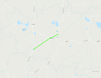
Tornado - New Bloomfield, MO
Callaway County, MO
| Date |
April 20, 2025 |
| Time (Local) |
1:31 PM - 1:36 PM CDT |
| EF Rating |
EF-2 |
| Est. Peak Winds |
120 mph |
| Path Length |
2.61 miles |
| Max Width |
100 yards |
| Injuries/Deaths |
1/0 |
|
Summary:
The tornado touched down south of County Road 362 at 1:31 PM and quickly strengthened, blowing in the garage and removing a significant section of roof from a home along County Road 362. This was the worst observed damage and was rated as 120 mph (EF-2). The tornado then moved north-northeast, crossing State Road Y and removing siding from a church along Blessing Lane. The tornado dissipated along County Road 347 at 1:36 PM. Additional damage along the path mainly consisted of tree damage.
|
Track Map
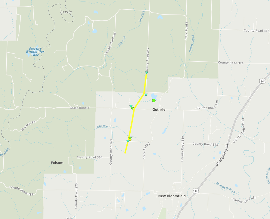 
Downloadable KMZ File
 |
 |
 |
 |
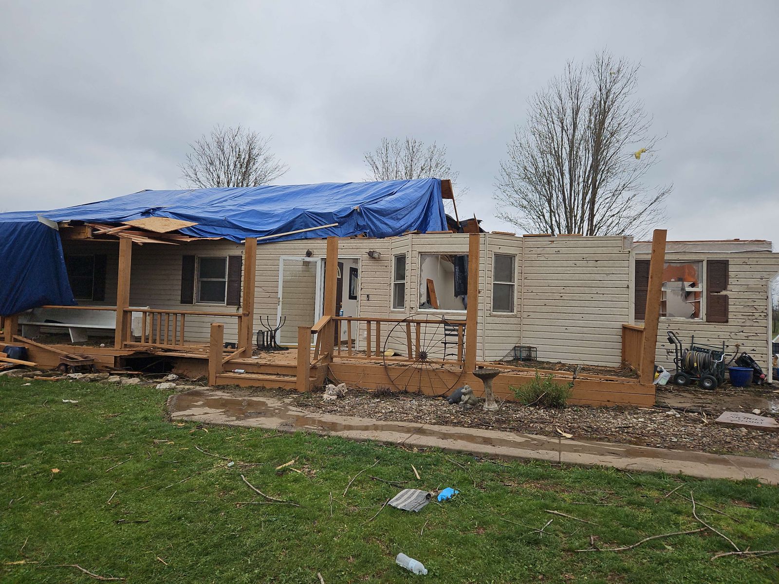
Home with significant roof damage from tornado.
Photo courtesy of NWS Storm Survey team |
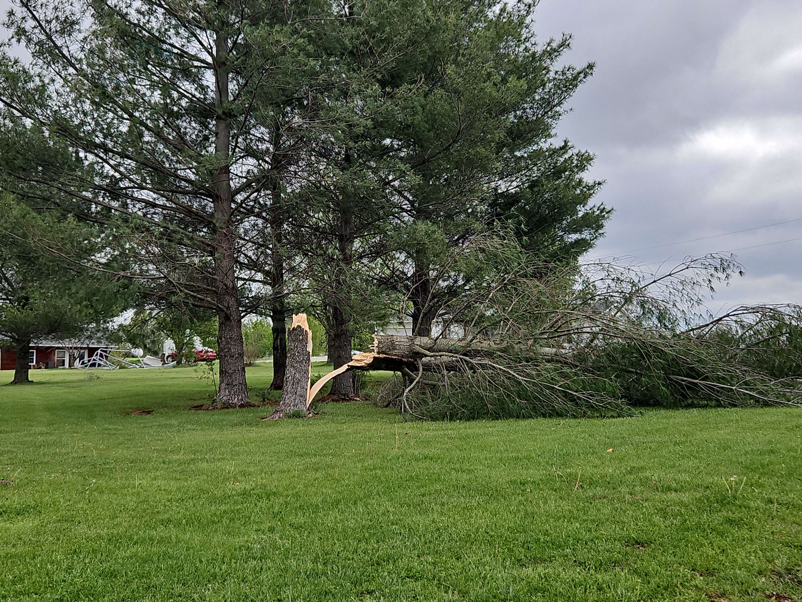
Tree trunk snapped by tornado.
Photo courtesy of NWS Storm Survey team |
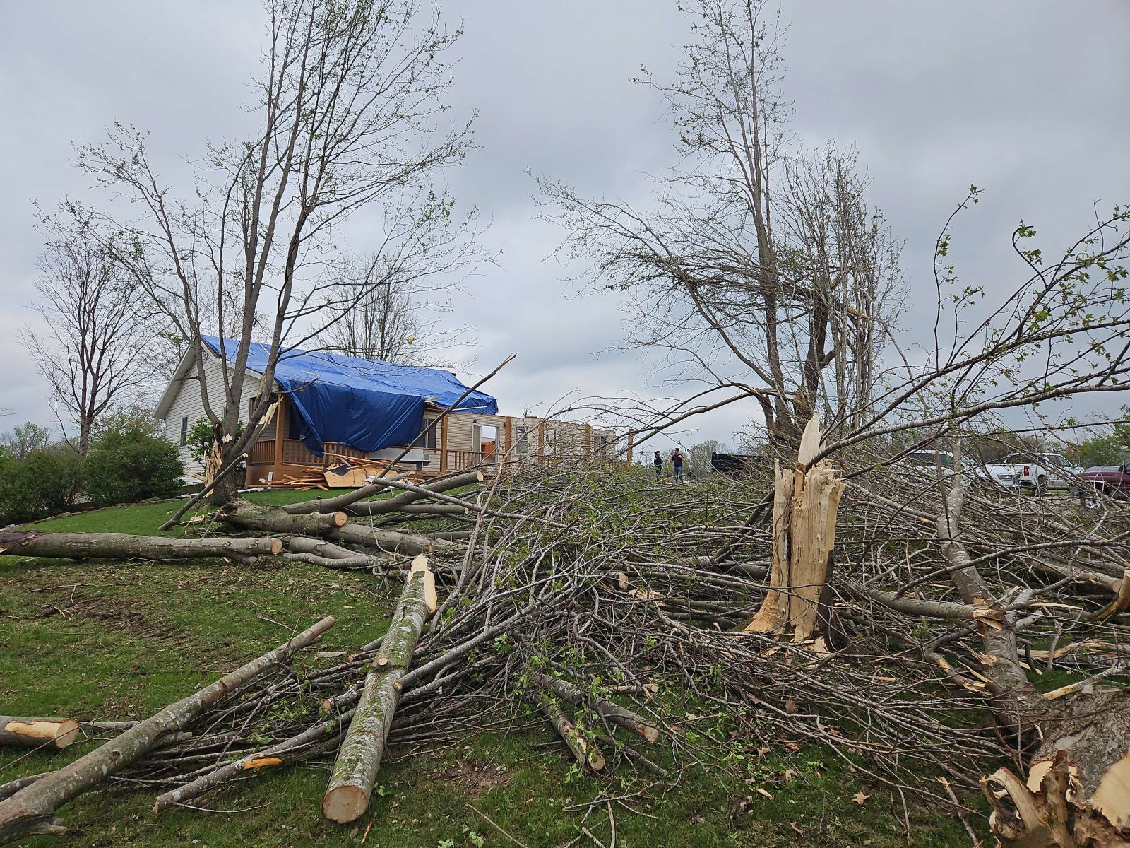
Extensive tree damage in the foreground and home with significant roof damage in the background.
Photo courtesy of NWS Storm Survey team |
Numerous trees filled with debris and damaged by tornadic winds.
Photo courtesy of NWS Storm Survey team |
|
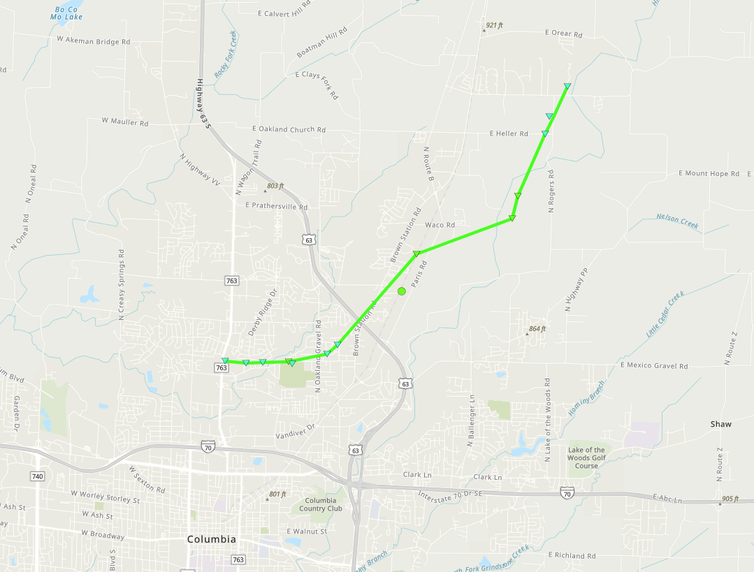
Tornado - Columbia, MO
Boone County, MO
| Date |
April 20, 2025 |
| Time (Local) |
5:18 PM - 5:25 PM CDT |
| EF Rating |
EF-1 |
| Est. Peak Winds |
110 mph |
| Path Length |
6.37 miles |
| Max Width |
100 yards |
| Injuries/Deaths |
0/0 |
|
Summary:
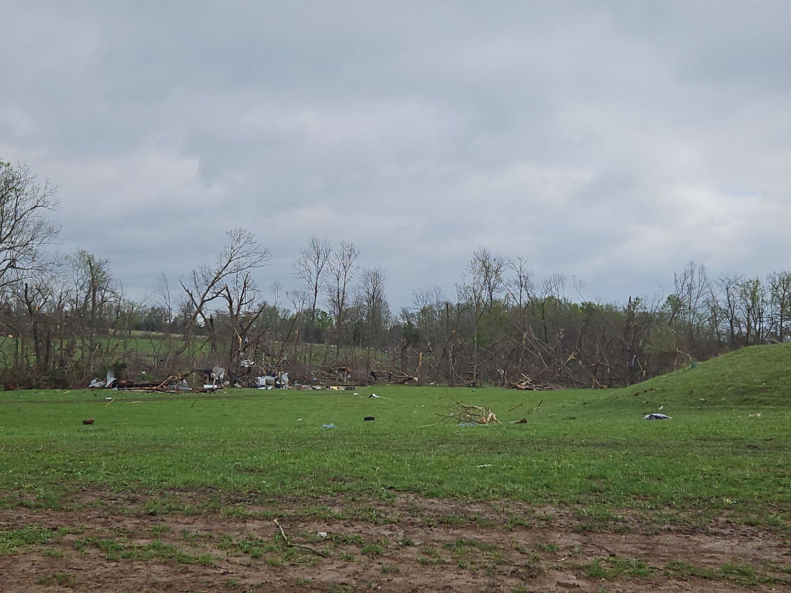
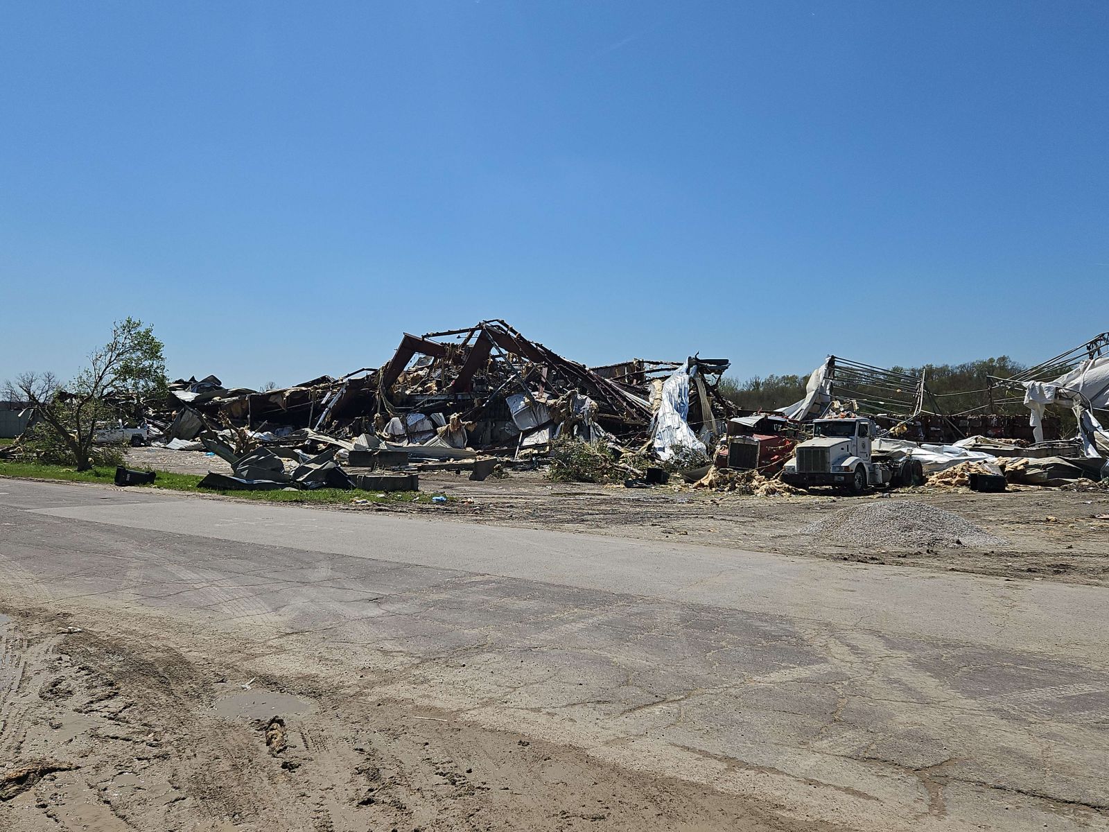
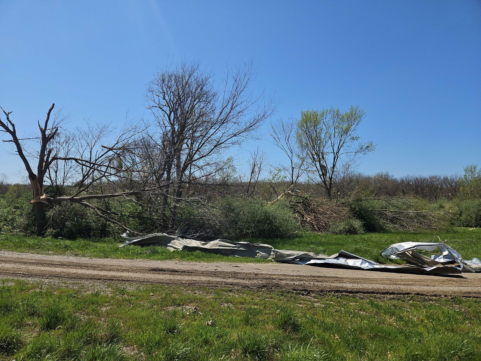
The tornado touched down at 5:18 PM about one mile north of Columbia along Rangeline Road. The tornado moved east, producing tree damage before passing just north of Albert-Oakland Park. Beyond Albert-Oakland Park the tornado took a northeast turn and crossed Highway 63. The tornado continued producing tree damage as it moved northeast toward Paris Road. As the tornado crossed over Hinkson Creek it caused significant damage to the Columbia Recycling Facility where the building is completely destroyed and the machinery inside significantly damaged. The tornado continued moving northeast, causing more tree damage before dissipating just north of E Highway HH along N Deer Valley Lane at 5:25 PM.
|
Track Map
Downloadable KMZ File
 |
 |
 |
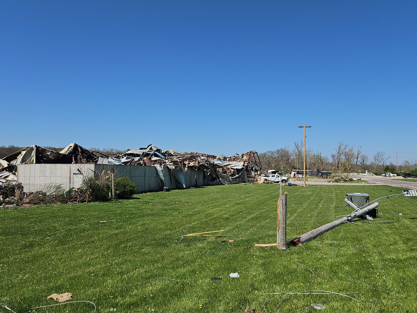 |
Metal building collapsed at the Columbia Recycling Facility due to tornadic winds.
Photo courtesy of NWS Storm Survey team |
Twisted metal debris in road near the Columbia Recycling Facility with snapped trees behind it.
Photo courtesy of NWS Storm Survey team |
Numerous power poles bent and snapped from tornadic winds.
Photo courtesy of NWS Storm Survey team |
Power pole snapped near base and collapsed metal building behind it.
Photo courtesy of NWS Storm Survey team |
|
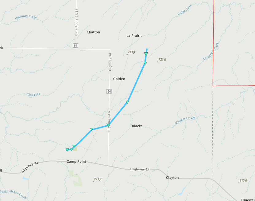
Tornado - Camp Point, IL
Adams County, IL
| Date |
April 20, 2025 |
| Time (Local) |
7:04 PM - 7:10 PM CDT |
| EF Rating |
EF-0 |
| Est. Peak Winds |
85 mph |
| Path Length |
8.17 miles |
| Max Width |
100 |
| Injuries/Deaths |
0/0 |
|
Summary:
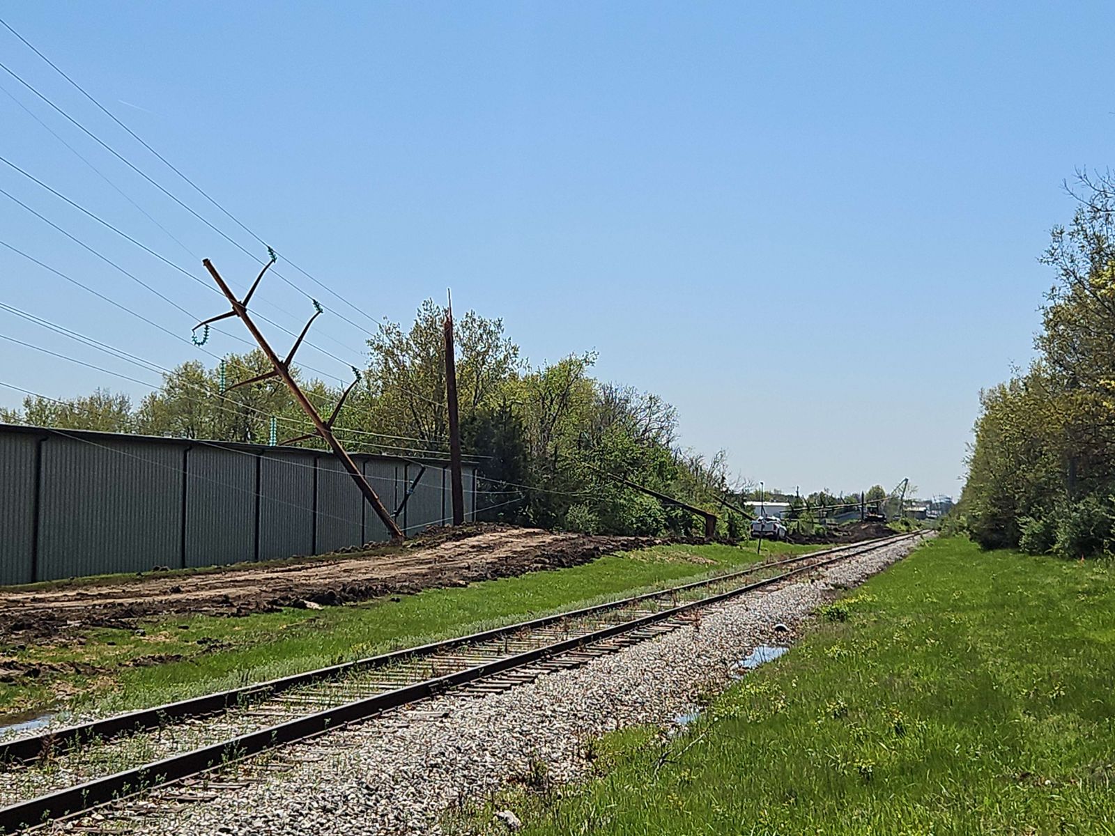
A weak tornado touched down along Hickman Road at 7:04 PM and destroyed an outbuilding with winds estimated as strong as 85 mph. It then moved northeast through Bailey Park and produced roof damage to another outbuilding along E 2400th Street near N 2150th Ave. The tornado continued to move northeast past Golden, IL and produced roof damage to multiple outbuildings along E 2700th Street between N 2500th Ave and N 2600th Ave before dissipating just north of N 2600th Ave at 7:10 PM.
|
Track Map
Downloadable KMZ File
 |
 |
 |
 |
Damage to the framing of a farm outbuilding
Photo courtesy of |
Collapsed farm structure
Photo courtesy of |
Felled tree with damage to home's roof and garage in the background
Photo courtesy of |
Damage to multiple farm structures
Photo courtesy of |
|
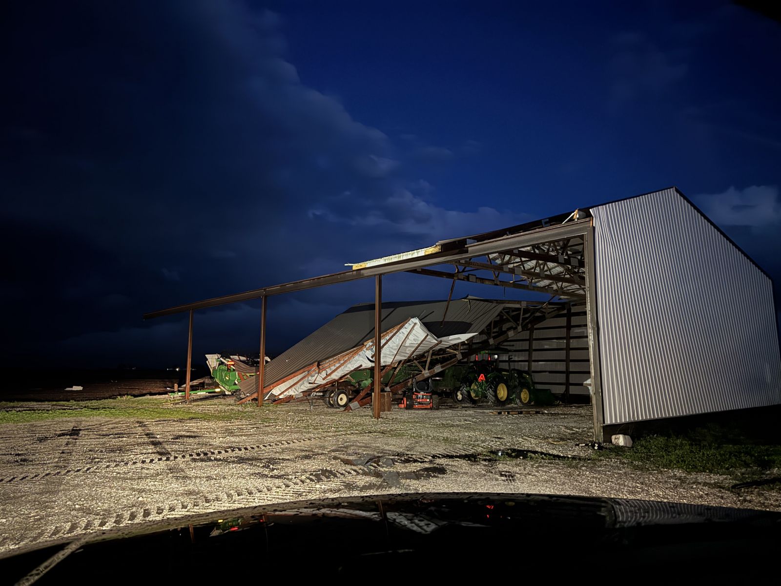
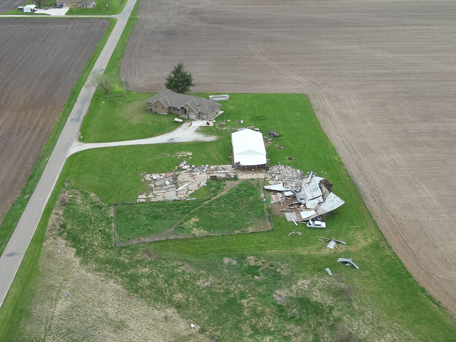
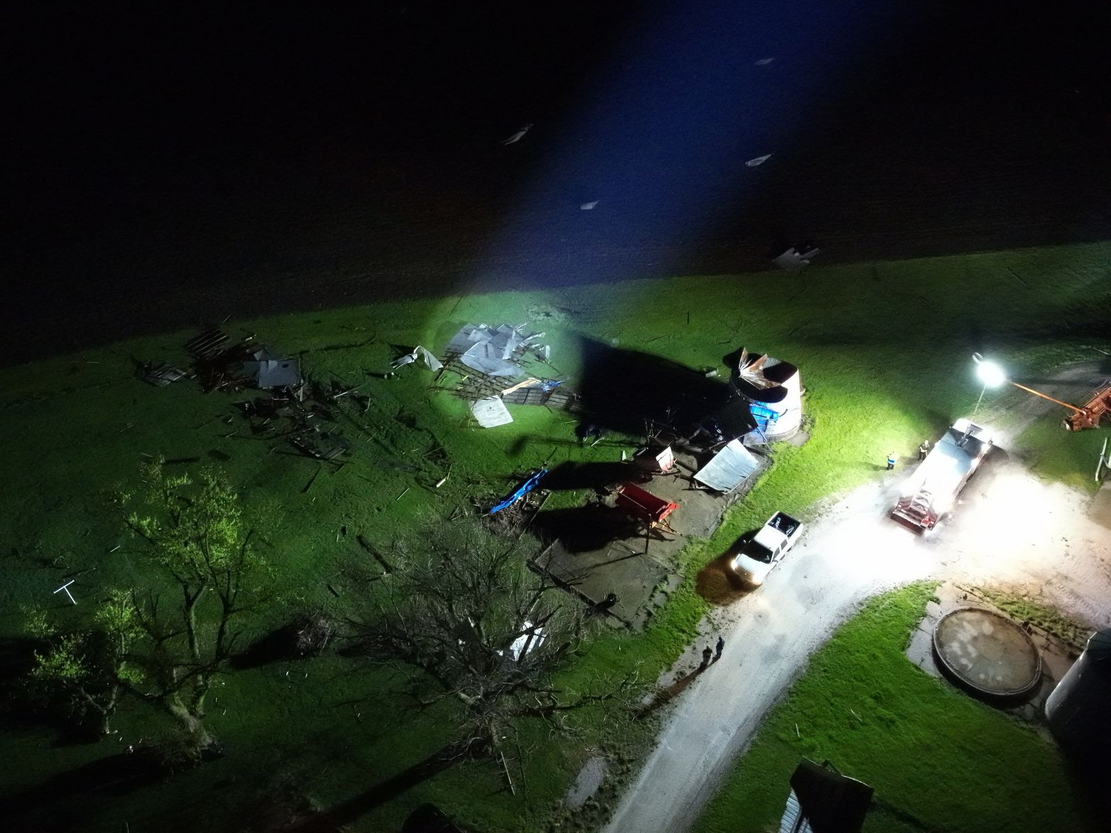
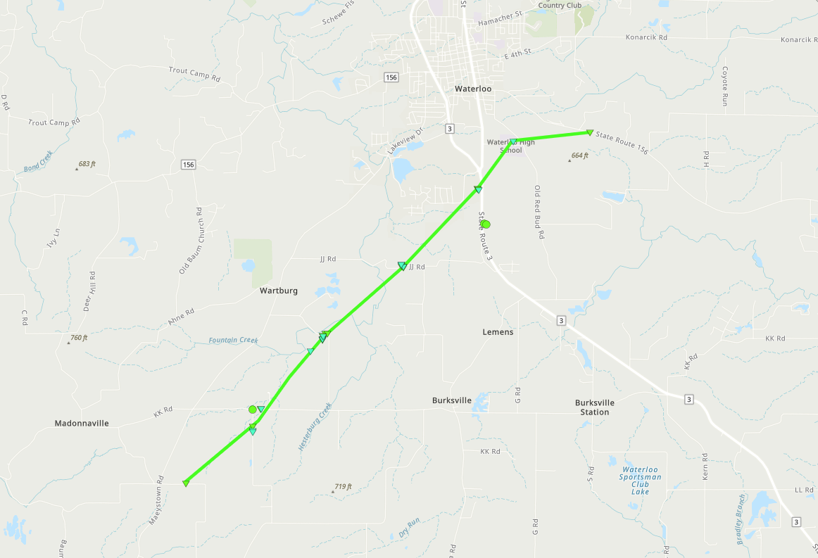
Tornado - Waterloo, IL
Monroe County, IL
| Date |
April 20, 2025 |
| Time (Local) |
8:00 PM - 8:07 PM CDT |
| EF Rating |
EF-1 |
| Est. Peak Winds |
100 mph |
| Path Length |
7.33 miles |
| Max Width |
100 yards |
| Injuries/Deaths |
0/0 |
|
Summary:
The tornado touched down at 8:00 PM along Koch Road, southeast of Madonnaville, and moved northeast, producing minor damage to a home and an outbuilding along Rock Road. Further to the northeast along LRC Road the tornado overturned an outbuilding and caused tree damage. More tree damage and minor outbuilding roof damage occurred along JJ road as the tornado tracked northeast between Wartburg and Burksville. The tornado moved into southern Waterloo and produced minor roof damage to one of the greenhouses at Waterloo High School before turning to the east and damaging power poles along Highway 156. The power pole damage was the worst damage and winds were estimated as high as 100 mph (EF-1). The tornado dissipated shortly thereafter at 8:07 PM.
|
Track Map
Downloadable KMZ File
 |
![Photo]() |
![Photo]() |
![Photo]() |
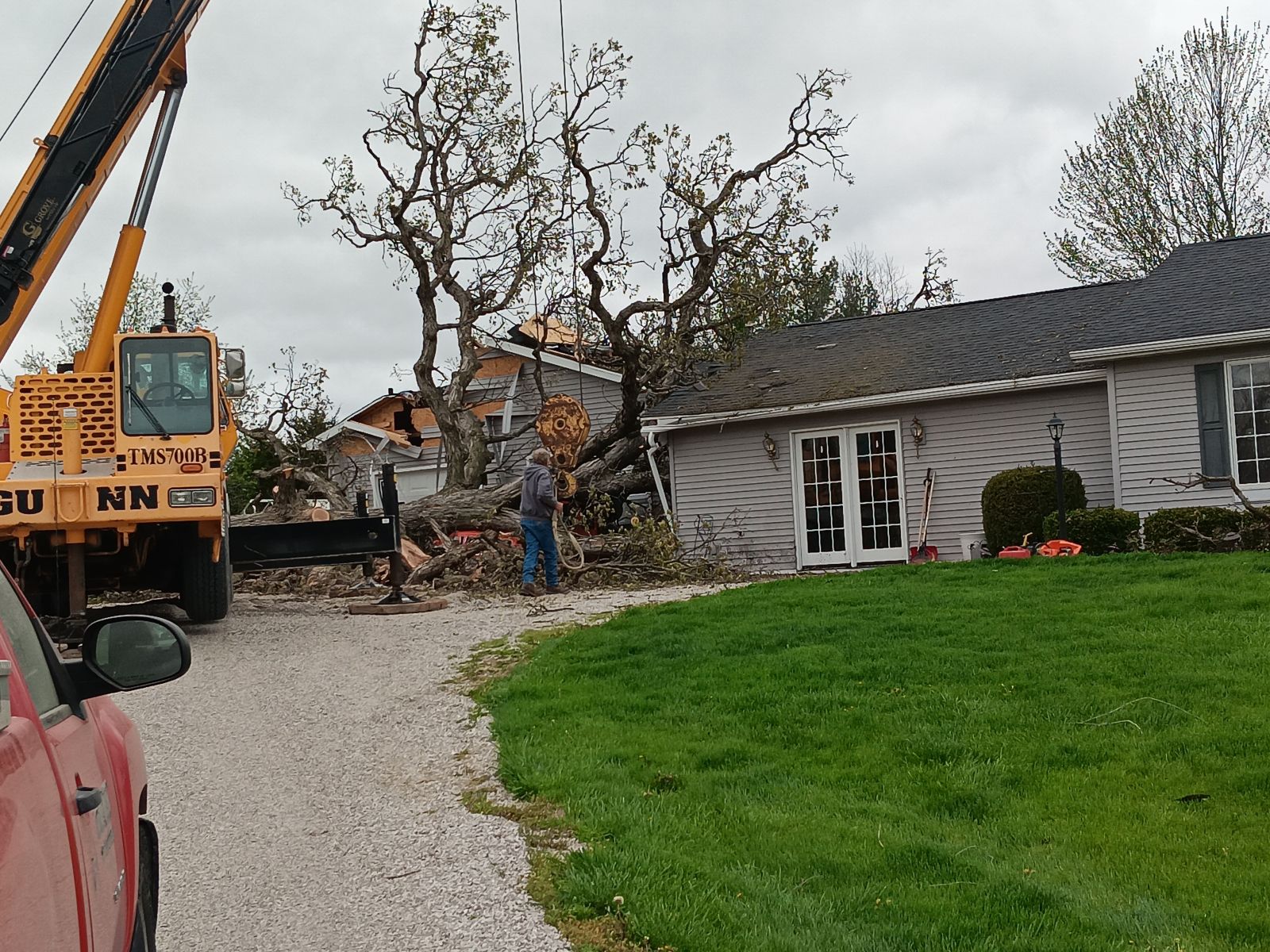
Large tree uprooted by tornado
Photo courtesy of NWS Storm Survey team |
Caption
(source) |
Caption
(source) |
Caption
(source) |
|
Tornado - Columbia, IL
Monroe County, IL
| Date |
April 20, 2025 |
| Time (Local) |
8:13 PM CDT |
| EF Rating |
EF-1 |
| Est. Peak Winds |
99 mph |
| Path Length |
0.35 miles |
| Max Width |
100 yards |
| Injuries/Deaths |
0/0 |
|
Summary:
A brief and weak tornado touched down along EE Road just south of Gilmore Lake and quickly moved northeast before dissipating at the intersection of EE Road and Gilmore Lake Road at 8:13 PM. When the tornado touched down it overturned an outbuilding, and was rated at 99 mph (EF-1) at this point. Tree damage was also recorded.
|
Track Map
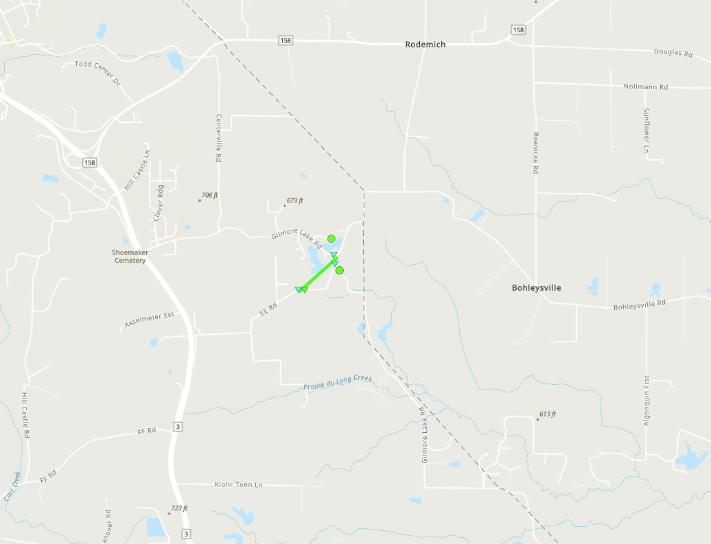
Downloadable KMZ File
 |
 |
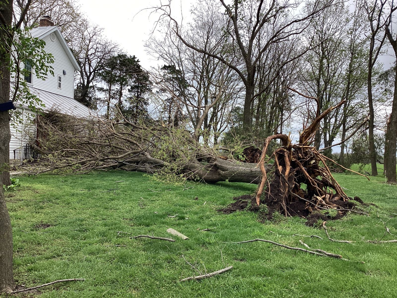
Extensive tree damage caused by tornadic winds
Photo courtesy of NWS Storm Survey team |
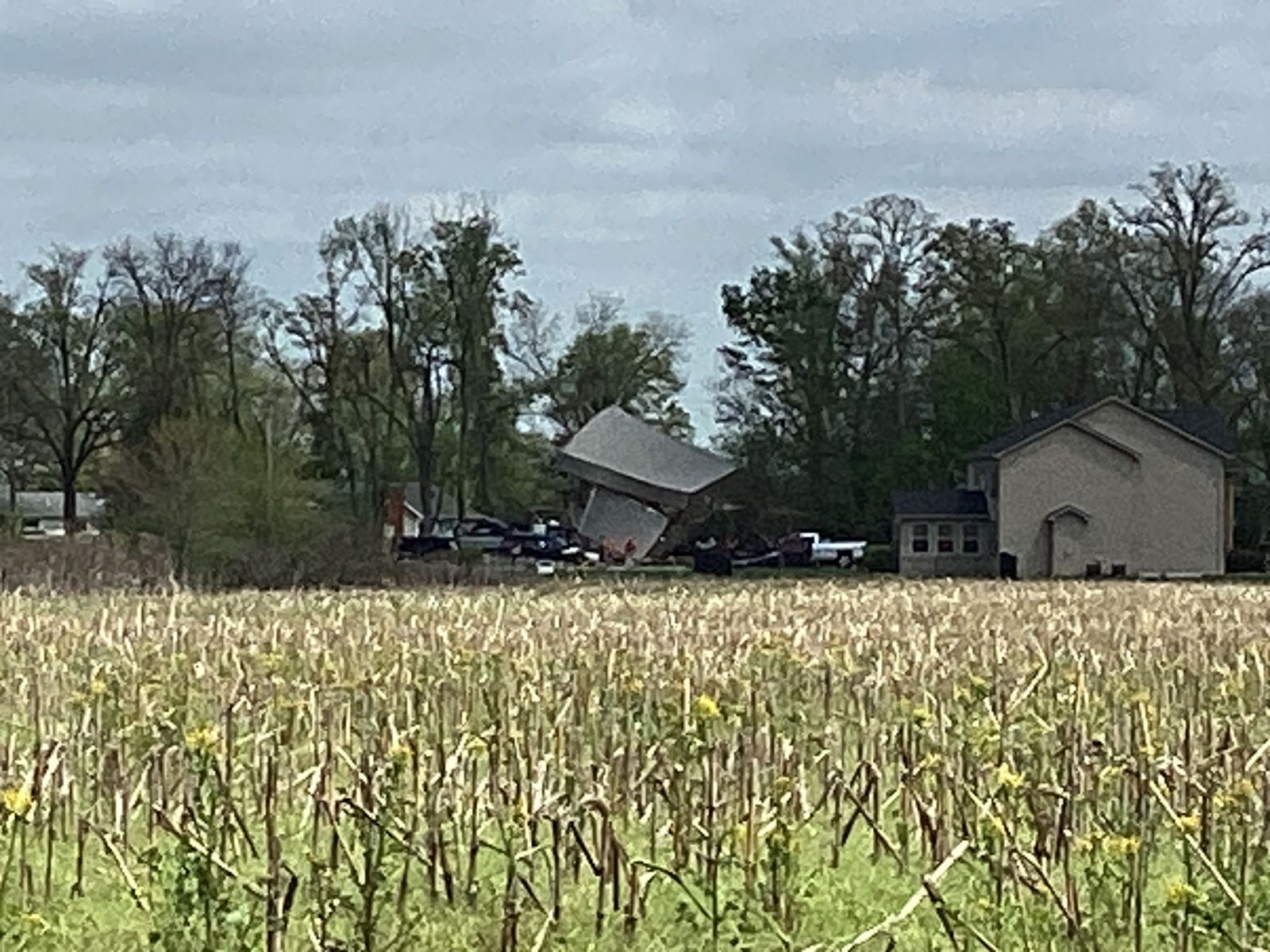
Overturned shed in background
Photo courtesy of NWS Storm Survey team |
|
Tornado - Millstadt, IL
St. Clair County, IL
| Date |
April 20, 2025 |
| Time (Local) |
8:14 PM CDT |
| EF Rating |
EF-0 |
| Est. Peak Winds |
85 mph |
| Path Length |
0.75 miles |
| Max Width |
100 |
| Injuries/Deaths |
0/0 |
|
Summary:
A brief and weak tornado touched down on Schwab Road, southwest of Millstadt at 8:14 PM. It destroyed an outbuilding and produced tree damage along Schwab Road with winds estimated as high as 85 mph.
|
Track Map
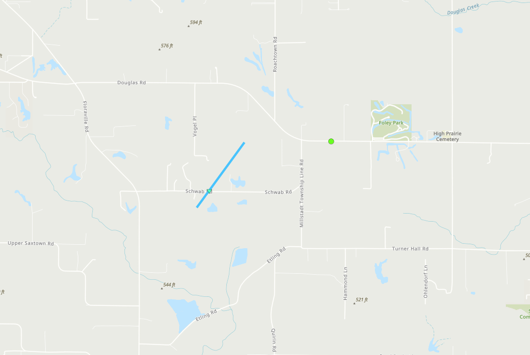
Downloadable KMZ File
![Photo]() |
![Photo]() |
![Photo]() |
![Photo]() |
Caption
(source) |
Caption
(source) |
Caption
(source) |
Caption
(source) |
|
Tornado - Baldwin, IL
Randolph County, IL
| Date |
April 20, 2025 |
| Time (Local) |
8:25 PM - 8:26 PM CDT |
| EF Rating |
EF-1 |
| Est. Peak Winds |
93 mph |
| Path Length |
1.32 miles |
| Max Width |
75 yards |
| Injuries/Deaths |
0/0 |
|
Summary:
The tornado touched down on Baldwin Road at 8:25 PM, producing tree damage with winds estimated around 70 mph. The tornado then moved northeast and uprooted and snapped trees along Ridge Road. The snapped trees were the worst damage, with winds estimated as high as 93 mph. Moving northeastward, the tornado removed the roof of a grain silo along Pearidge Road before lifting at 8:26 PM just east of Pearidge Road.
|
Track Map
Downloadable KMZ File
![Photo]() |
![Photo]() |
![Photo]() |
![Photo]() |
Caption
(source) |
Caption
(source) |
Caption
(source) |
Caption
(source) |
|
Tornado - Payson, IL
Adams County, IL
| Date |
April 20, 2025 |
| Time (Local) |
6:48 PM - 6:52 PM CDT |
| EF Rating |
EF-0 |
| Est. Peak Winds |
85 mph |
| Path Length |
4.2 miles |
| Max Width |
25 yards |
| Injuries/Deaths |
0/0 |
|
Summary: A weak tornado began near the intersection of Highways 172 and 57, and traveled roughly 4.2 miles to the northeast before dissipating. Damage to trees was most common, with some damage to bleachers as well.
|
Track Map
.png/payson_track(1)__399x273.png)
Downloadable KMZ File
| |
|
|
|
Caption
(source) |
Caption
(source) |
Caption
(source) |
Caption
(source) |
|
| |
Tornado - Spencerburg, MO
Pike County, MO
| Date |
April 20, 2025 |
| Time (Local) |
6:19 PM CDT |
| EF Rating |
EF-0 |
| Est. Peak Winds |
85 mph |
| Path Length |
600 yards |
| Max Width |
25 yards |
| Injuries/Deaths |
0/0 |
|
Summary: A very brief tornado was confirmed near Highway E, 2 miles northeast of the small community of Spencerburg, MO. One outbuilding sustained significant damage, along with some trees.
|
Track Map

Downloadable KMZ File
| |
|
|
|
Caption
(source) |
Caption
(source) |
Caption
(source) |
Caption
(source) |
|
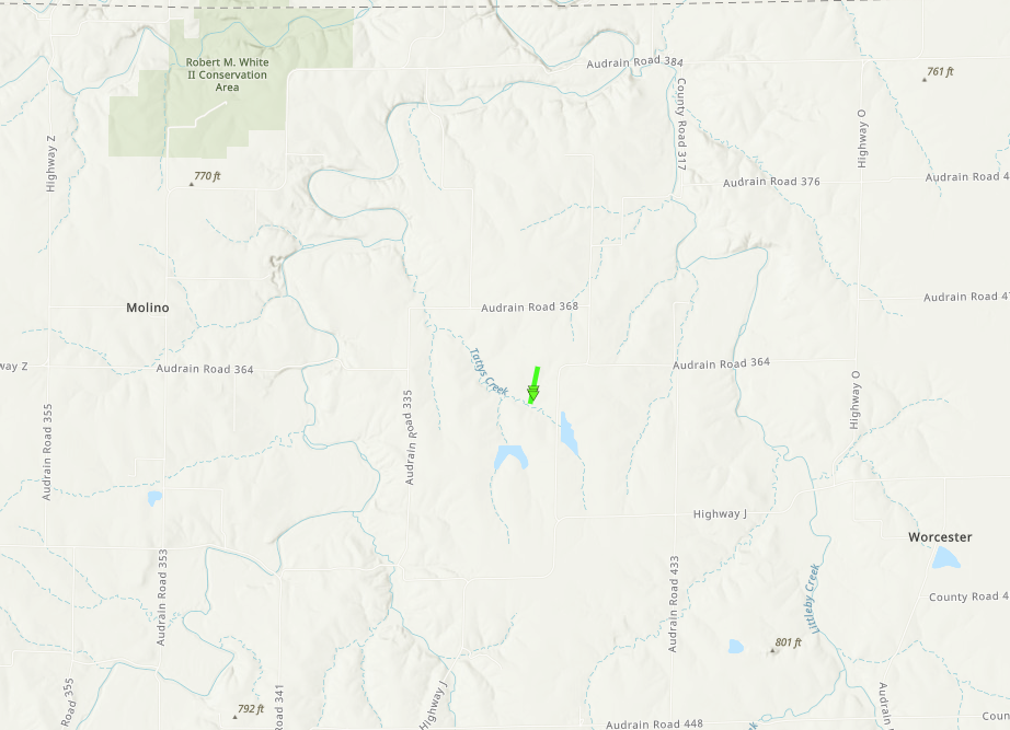
Tornado - Mexico, MO
Audrain County, MO
| Date |
April 20, 2025 |
| Time (Local) |
5:56 PM CDT |
| EF Rating |
EF-1 |
| Est. Peak Winds |
94 mph |
| Path Length |
0.32 miles |
| Max Width |
50 yards |
| Injuries/Deaths |
0/0 |
|
Summary: A brief EF-1 tornado tracked south to north just west of Highway MM in north-central Audrain County, destroying a couple of outbuildings and rolling two smaller grain bins. Debris was generally thrown northward and strewn widely, likely due to a downburst immediately following the tornado.
|
Track Map
Downloadable KMZ File
| |
|
|
|
Caption
(source) |
Caption
(source) |
Caption
(source) |
Caption
(source) |
|
The Enhanced Fujita (EF) Scale classifies tornadoes into the following categories:
EF0
Weak
65-85 mph |
EF1
Moderate
86-110 mph |
EF2
Significant
111-135 mph |
EF3
Severe
136-165 mph |
EF4
Extreme
166-200 mph |
EF5
Catastrophic
200+ mph |
 |
Storm Reports
Insert storm reports here. Copy in PNS or paste map.


 Weather Story
 Weather Map
 Local Radar