Overview
|
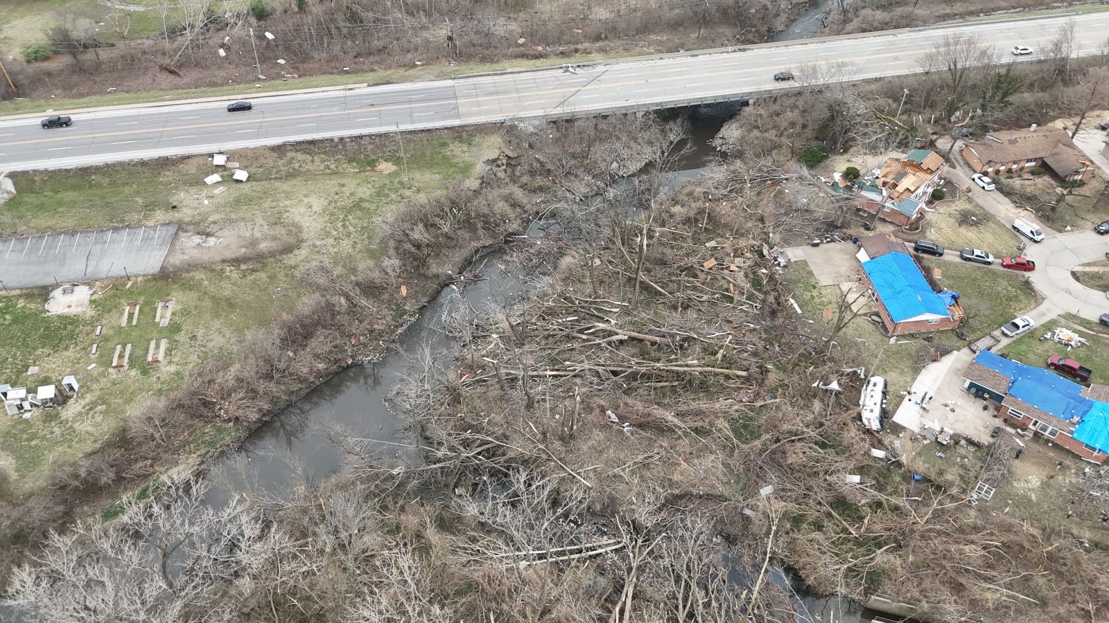
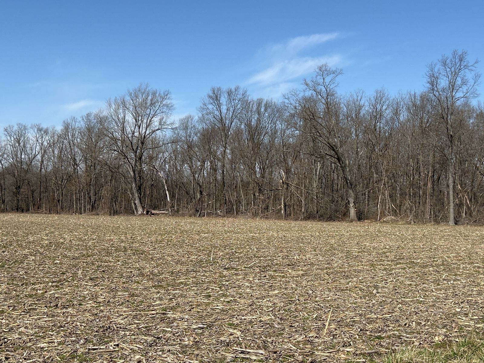
During the late afternoon of March 14, 2025, numerous severe thunderstorms developed across central Missouri and tracked east. After sunset, these thunderstorms began producing tornadoes, some strong, causing several injuries in the St. Louis county warning area (CWA). These tornadic supercells continued east into Illinois before exiting the region around midnight on March 15th. In total, 12 tornadoes touched down in the CWA, making it one of the most active outbreaks on record for the St. Louis CWA. The very strong low pressure system that caused the outbreak also resulted in strong non-thunderstorm winds and warm, dry air in the region during the day. This resulted in sporadic wind damage before the thunderstorms as well as numerous wildfires in Missouri and Illinois. Below is a summary of the severe weather that occurred that day, along with details on each tornado surveyed by NWS St. Louis.
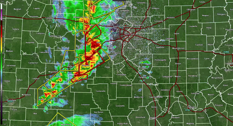
KLSX Base reflectivity and warnings from the afternoon and evening of March 14, 2025. |
.png) 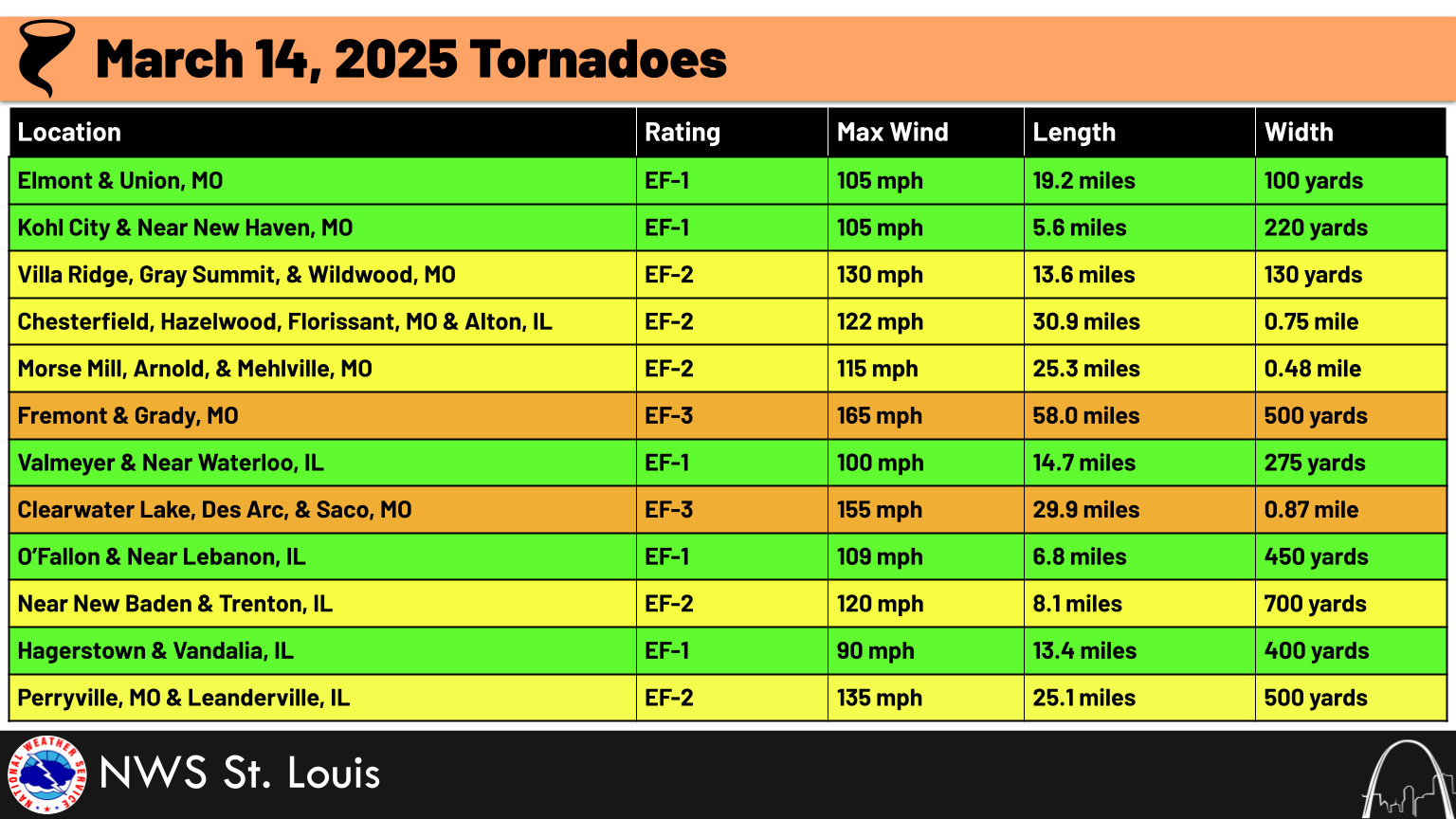 |
 |
 |
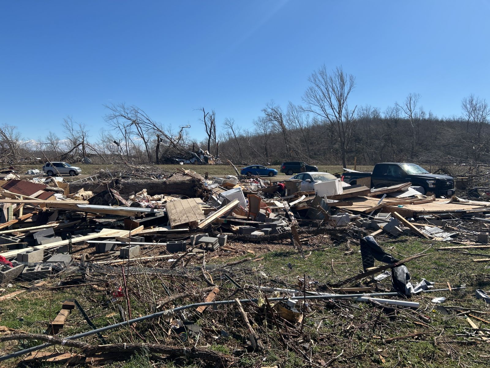 |
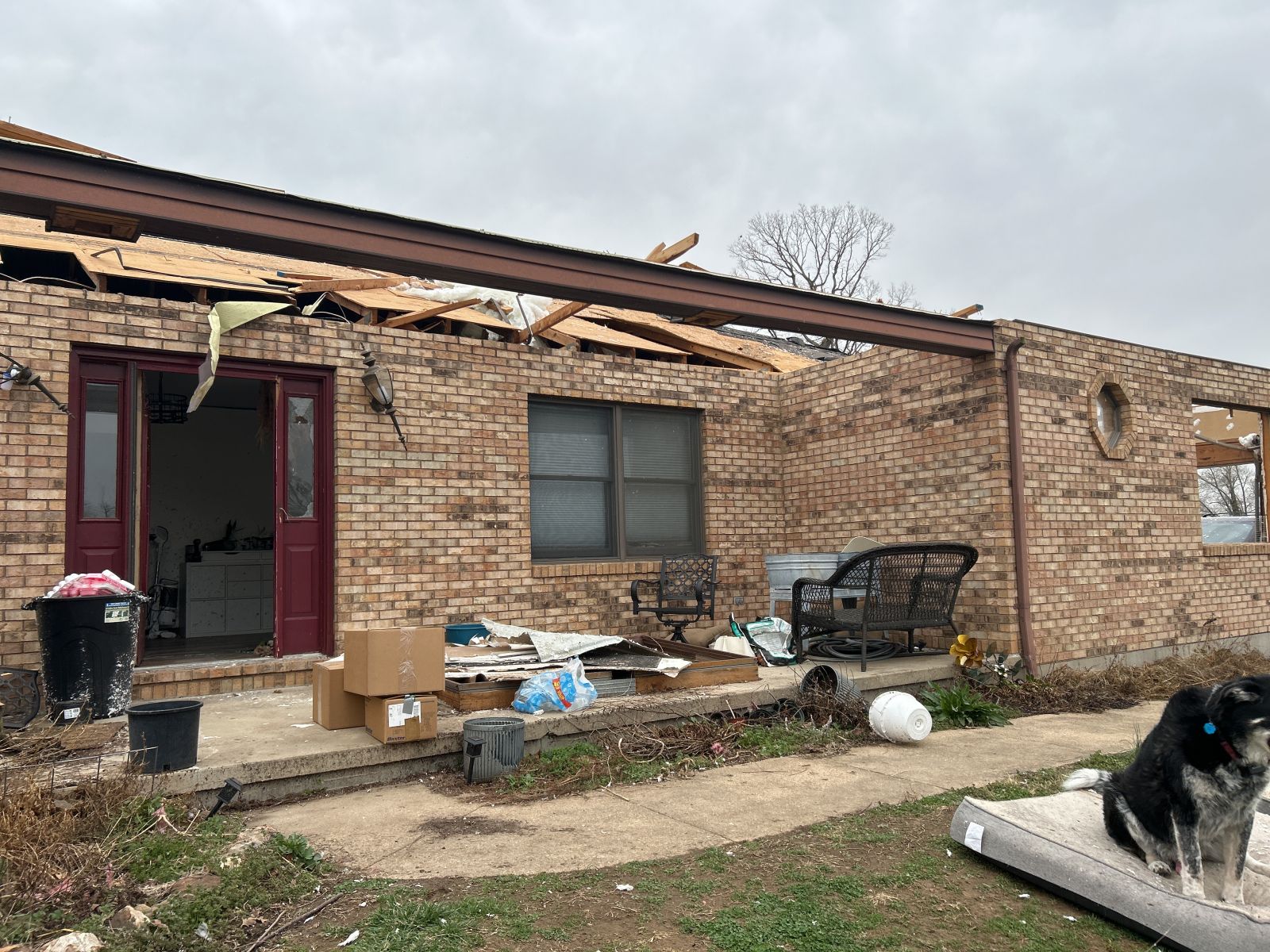
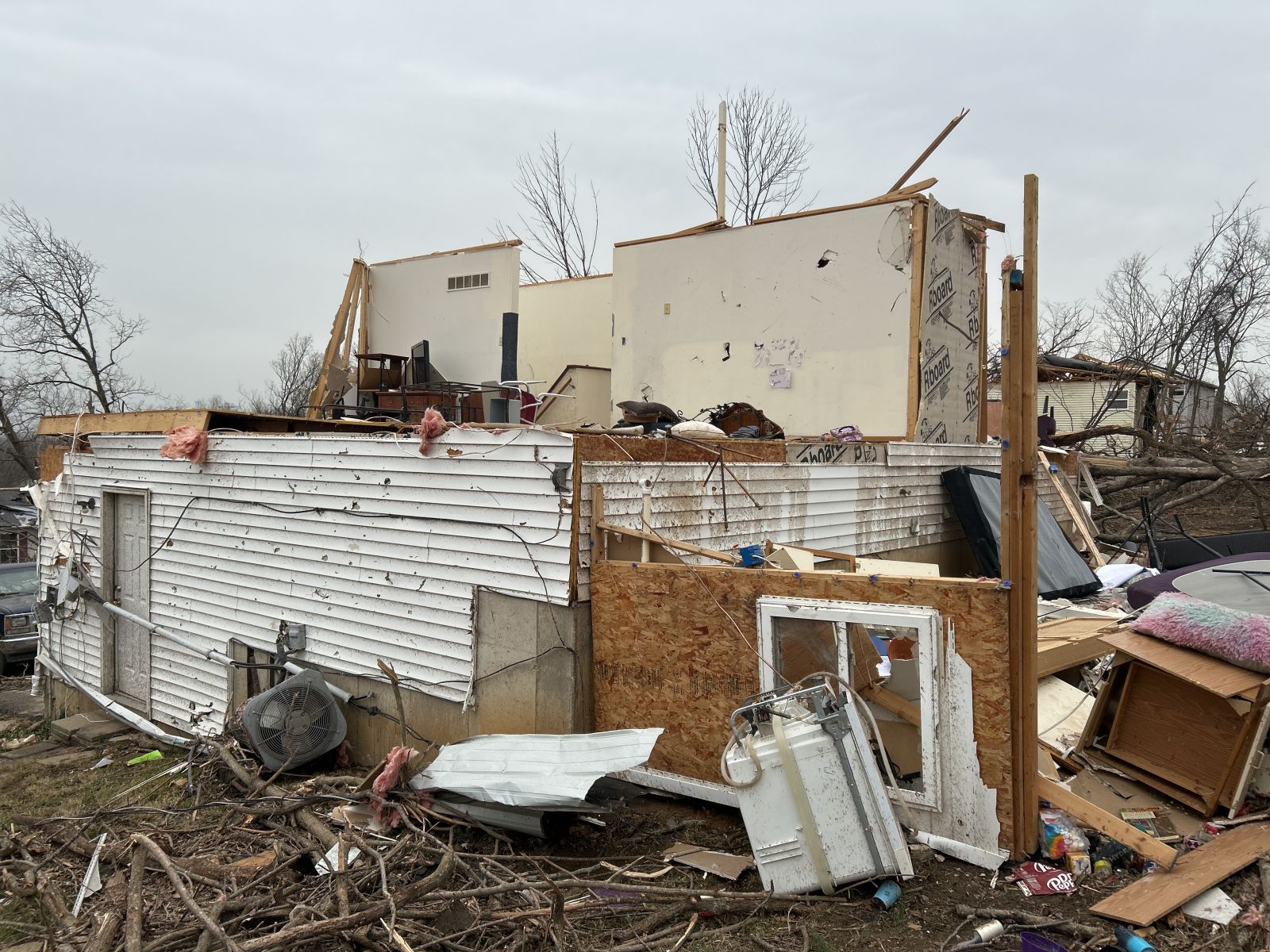
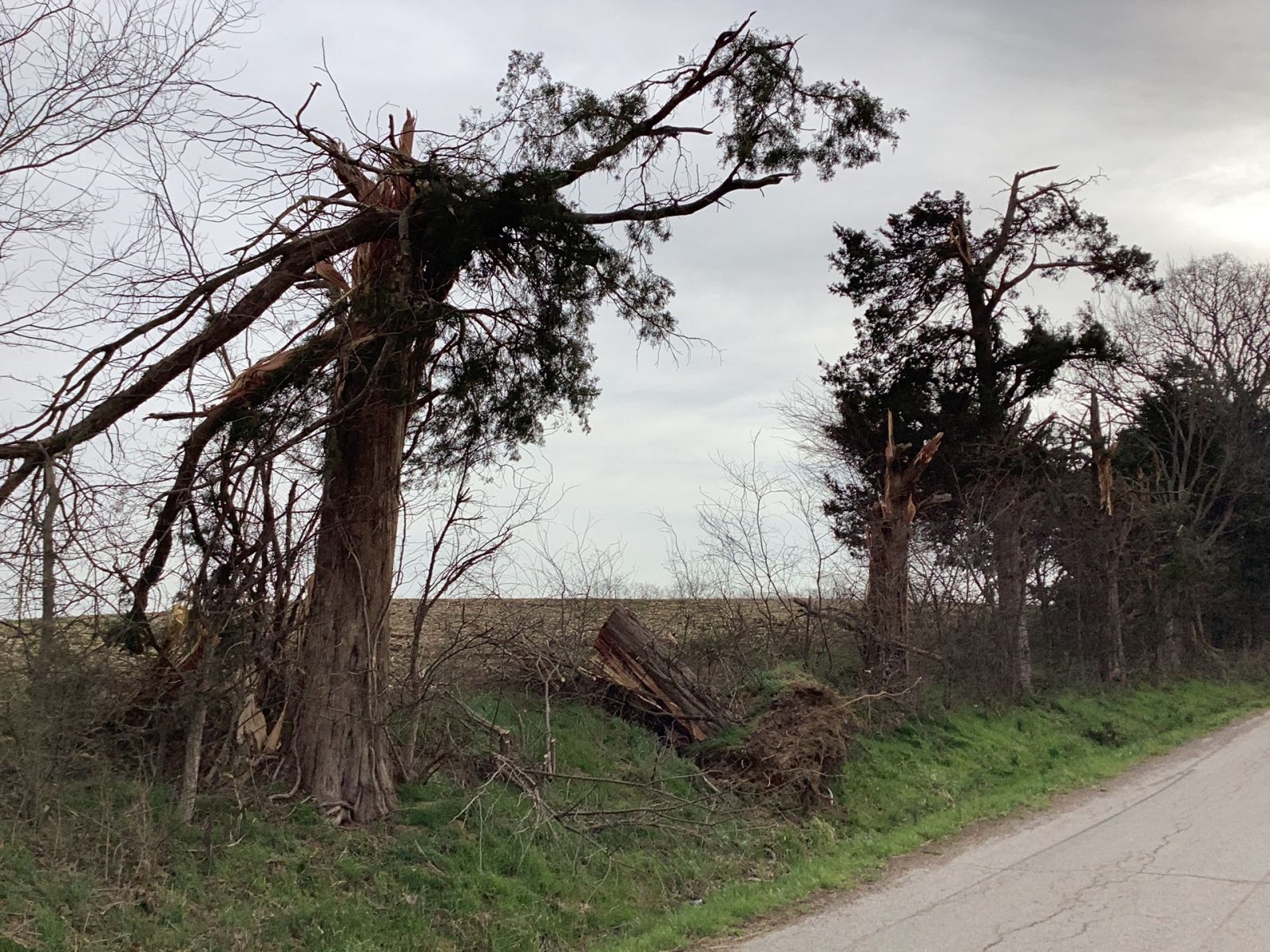
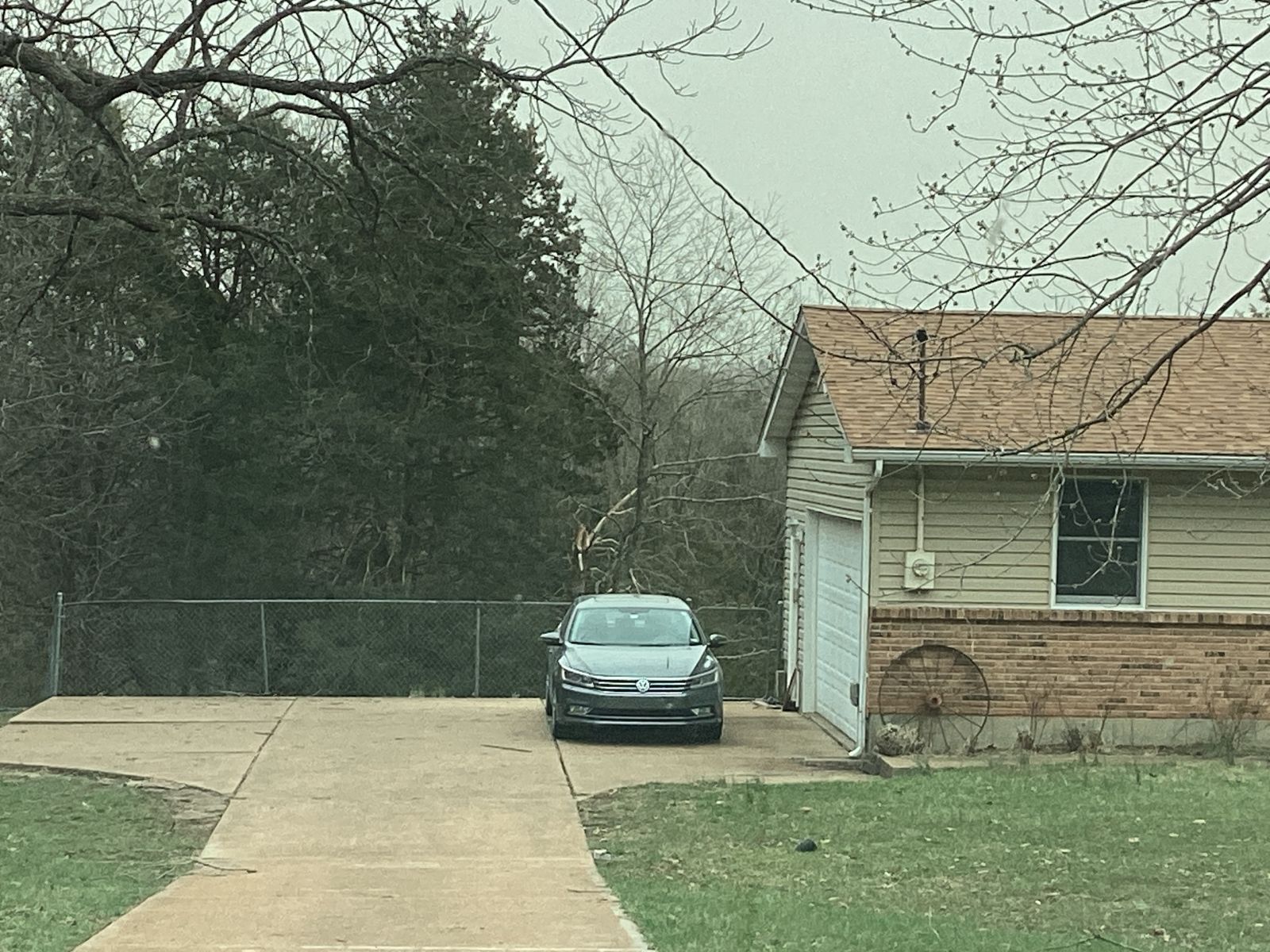
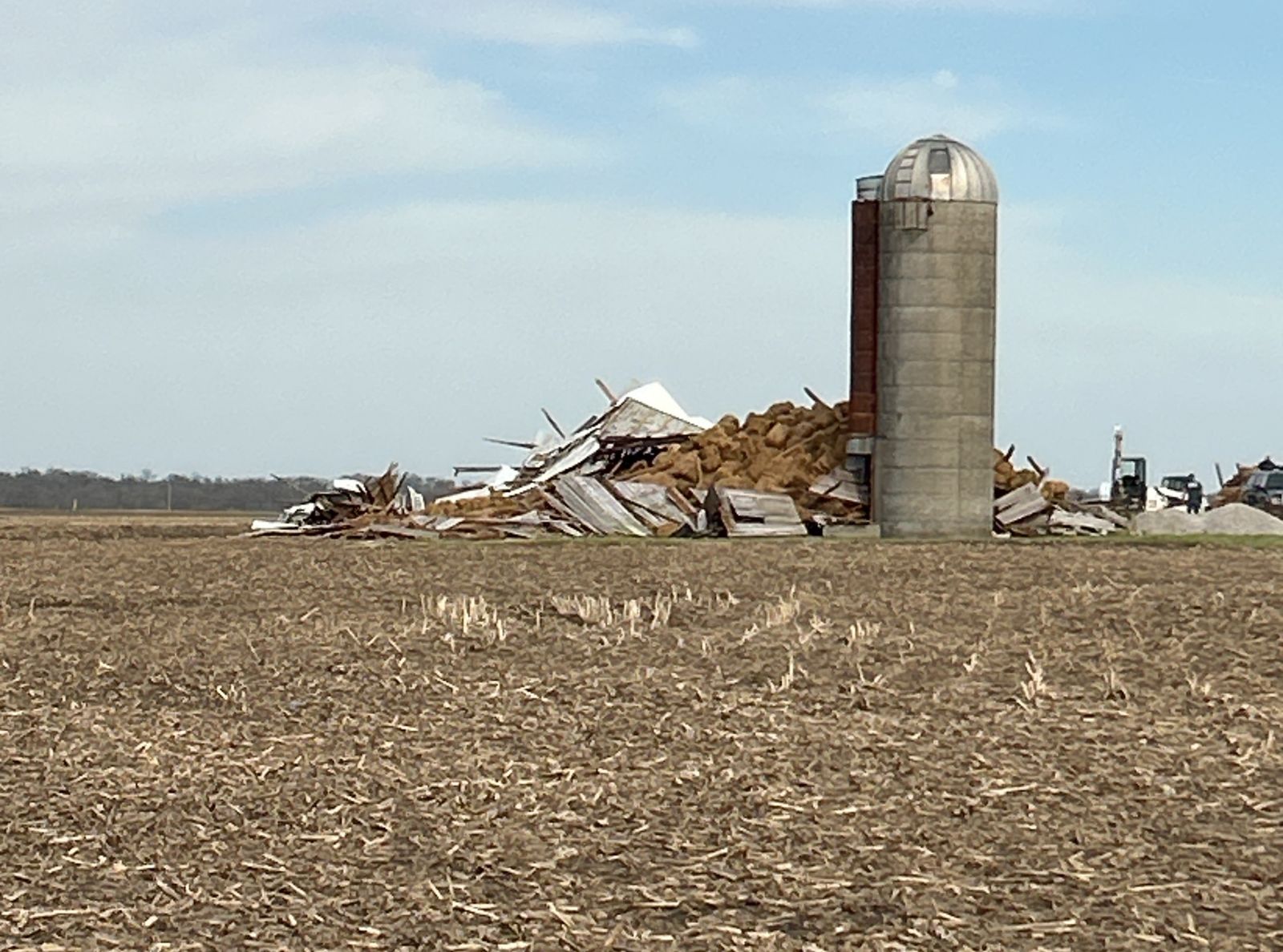
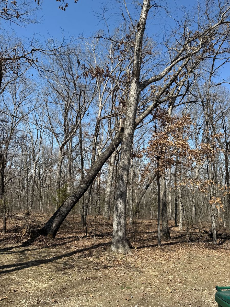
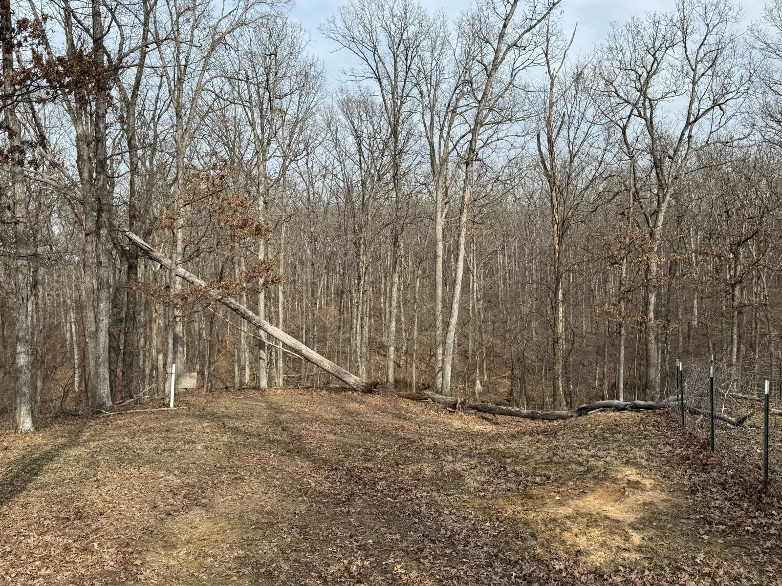
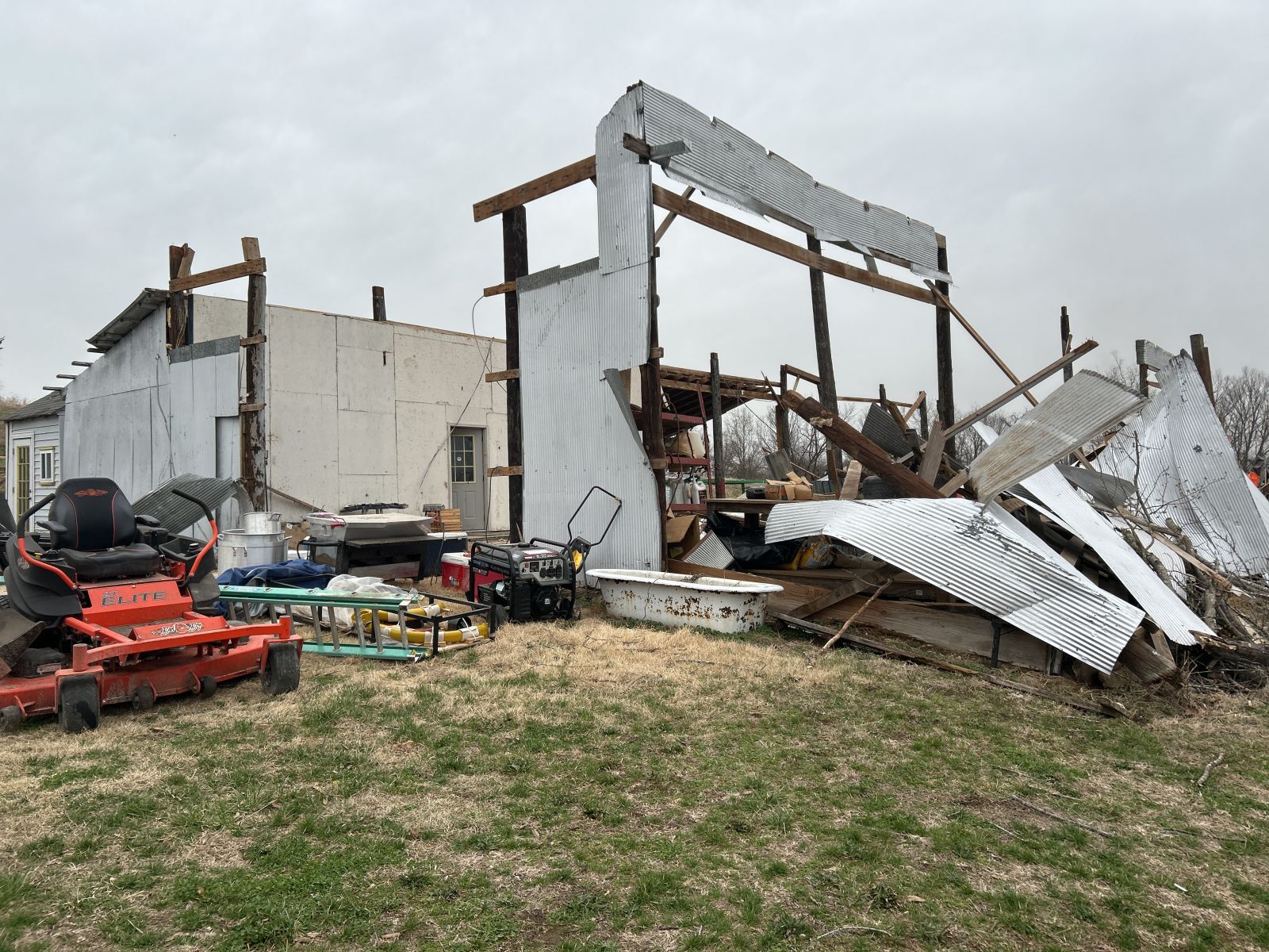
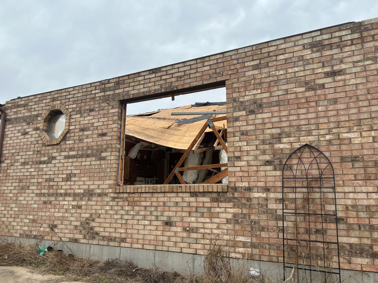
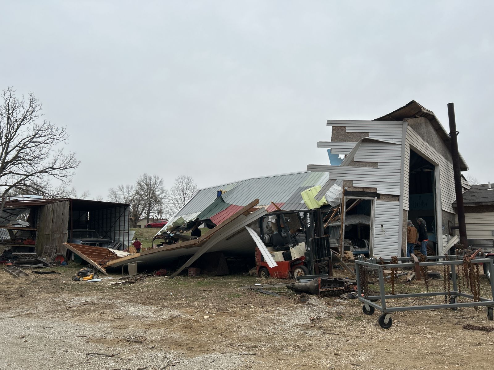
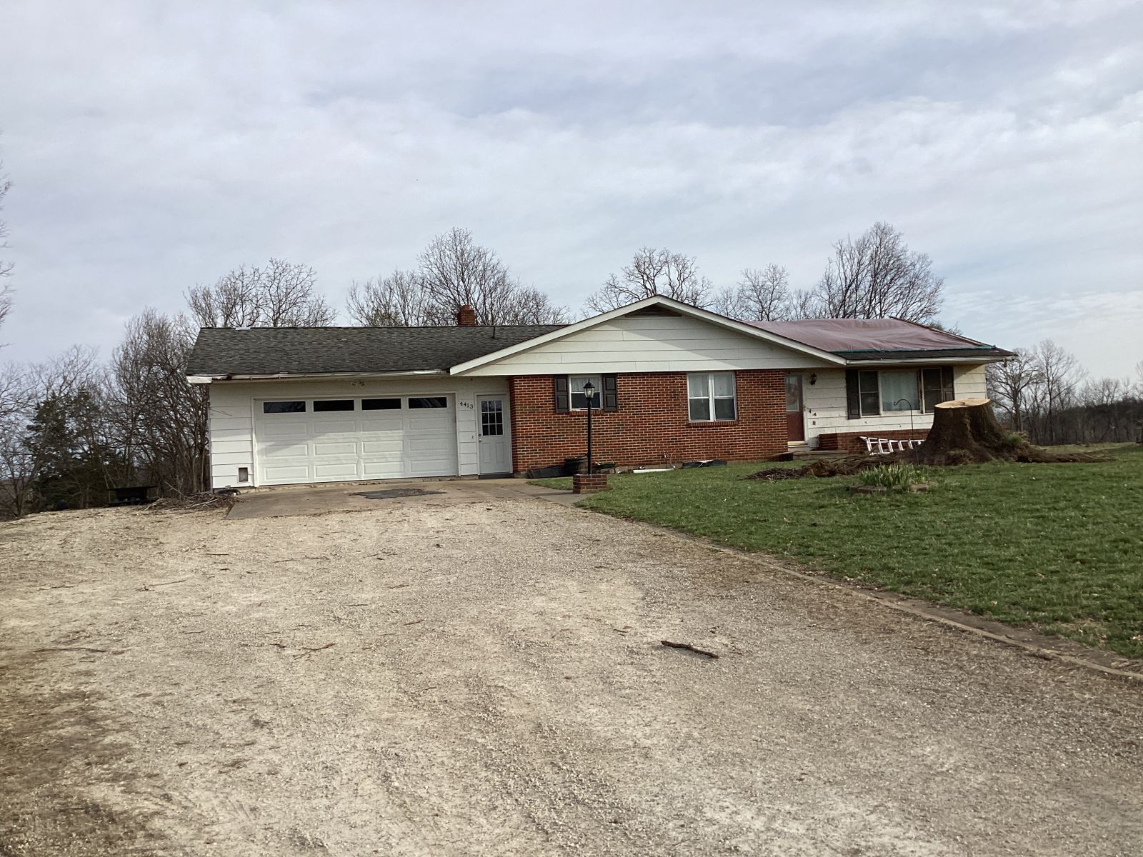
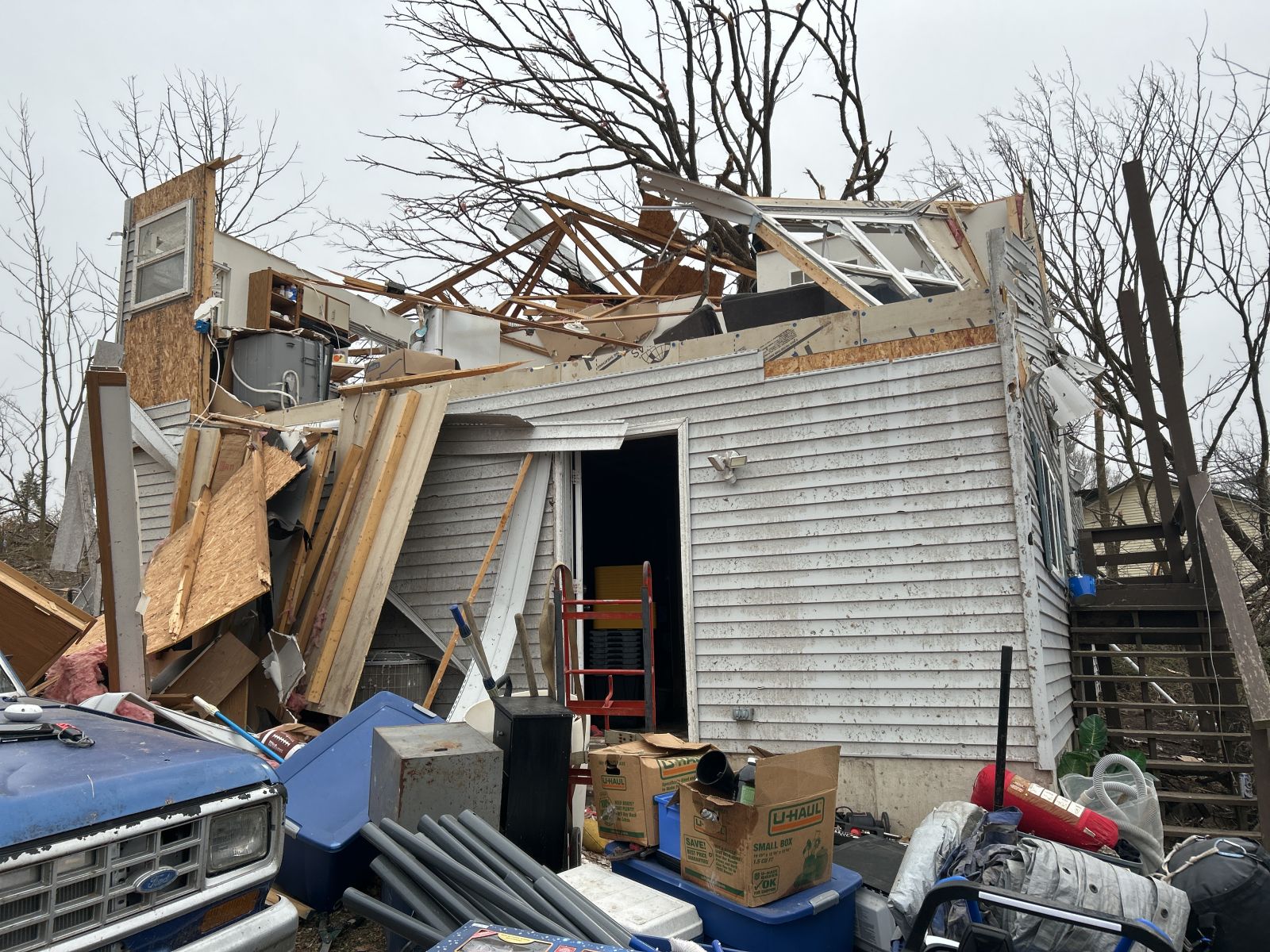
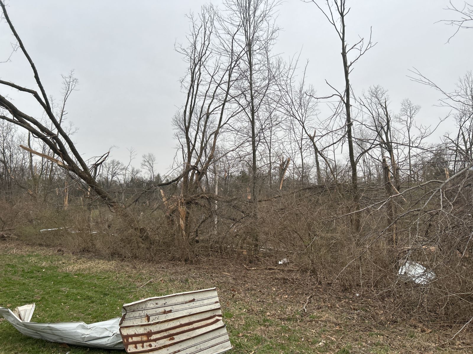
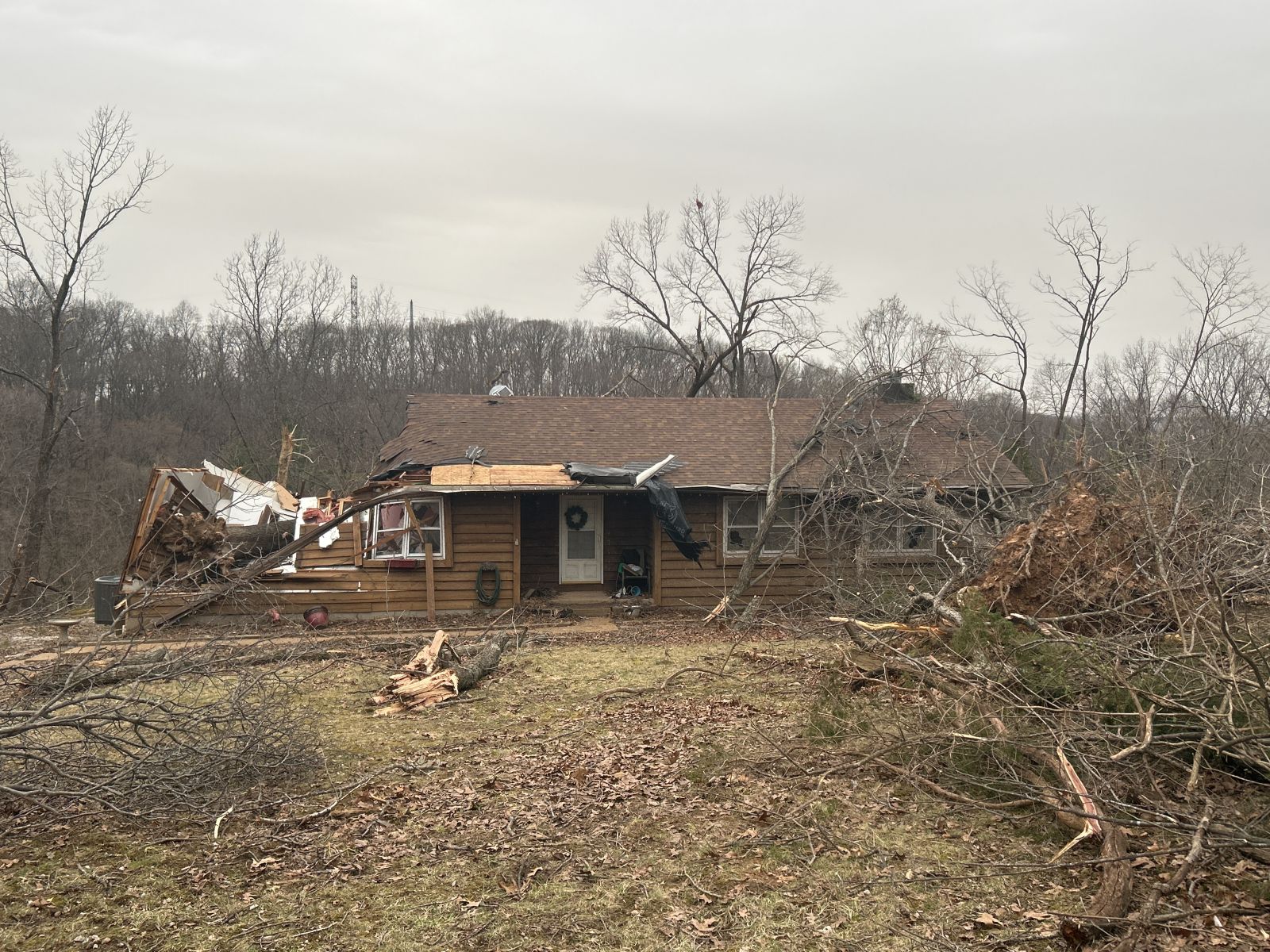
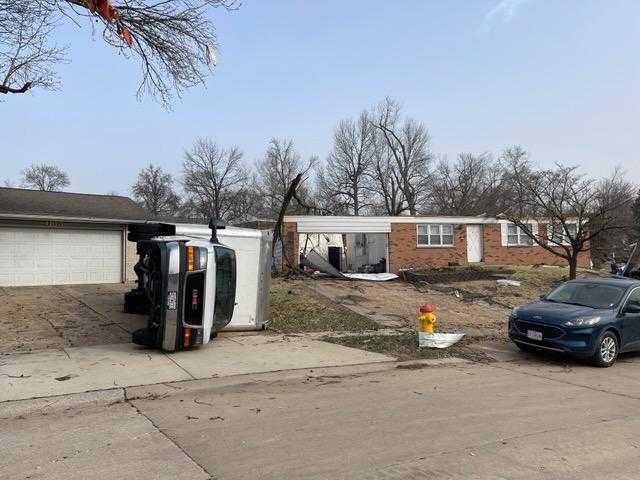
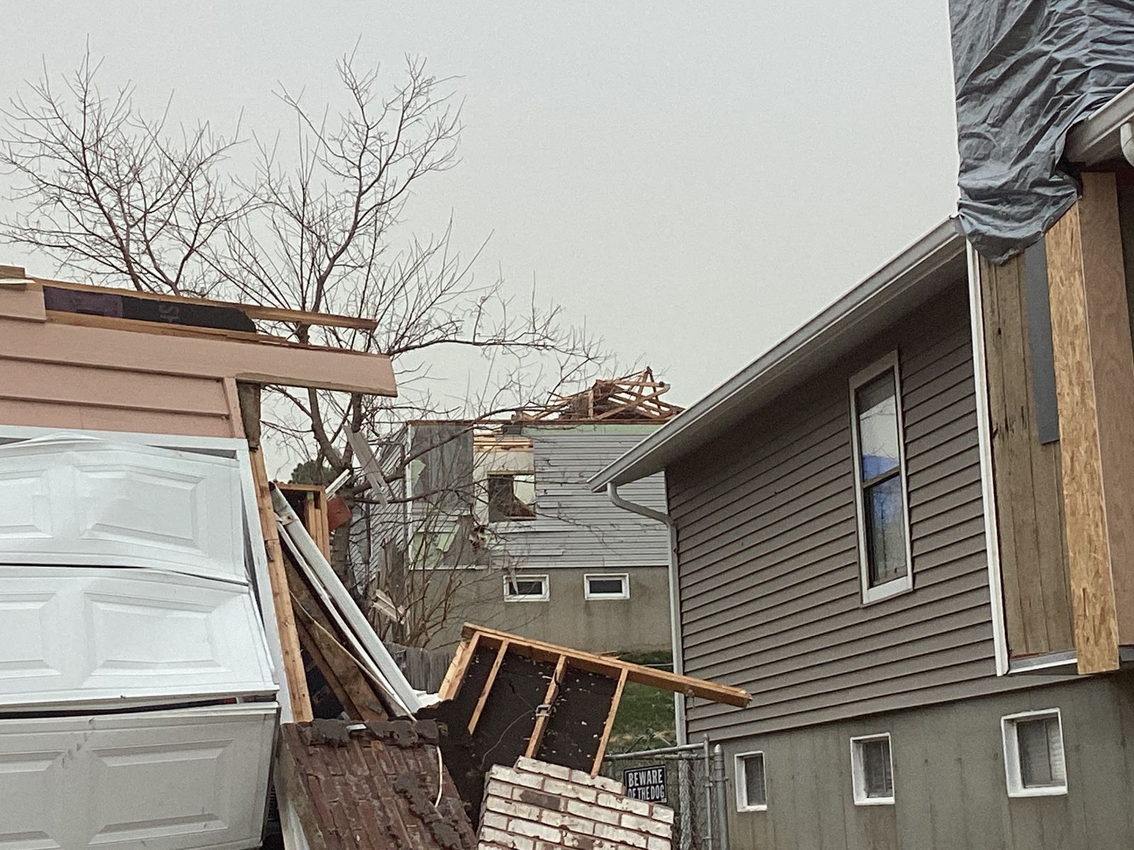
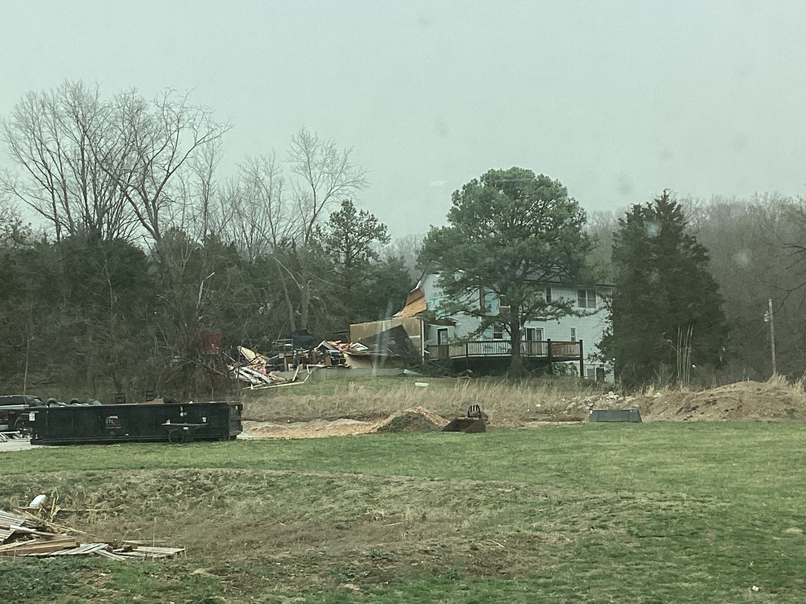
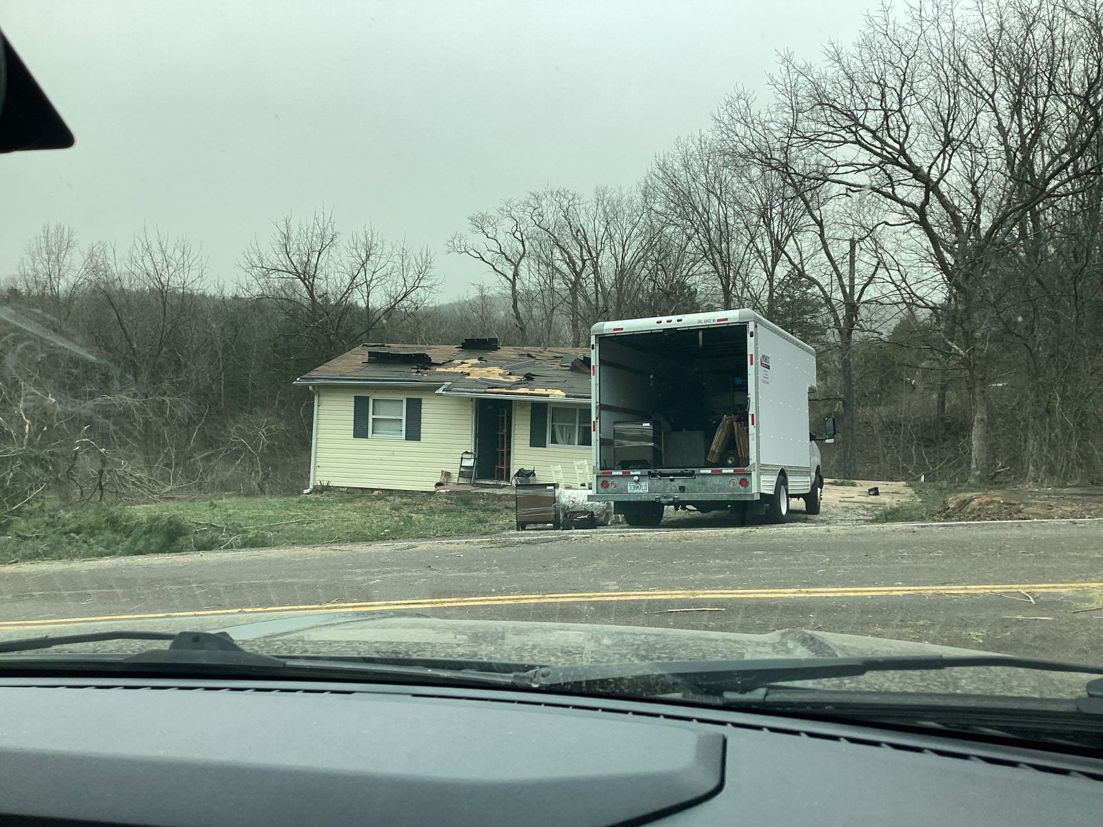
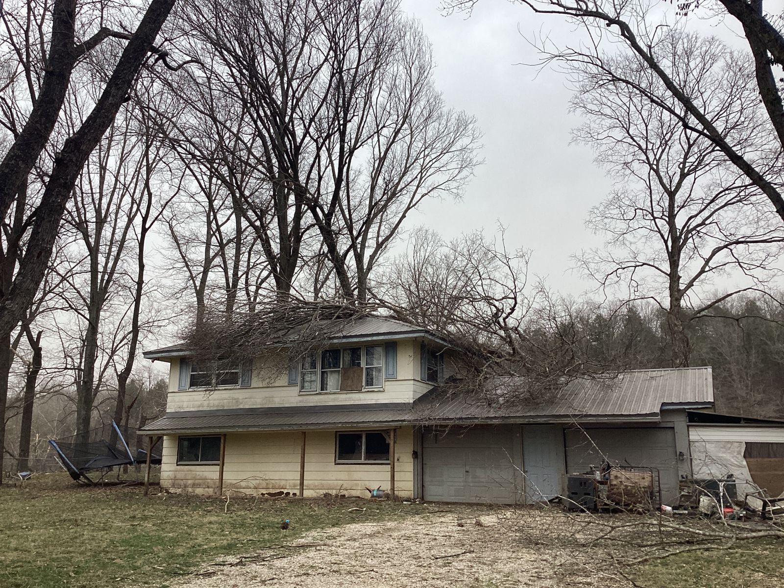
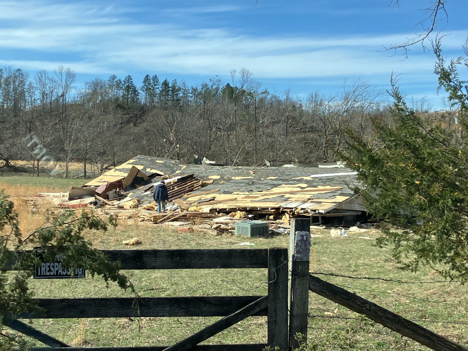
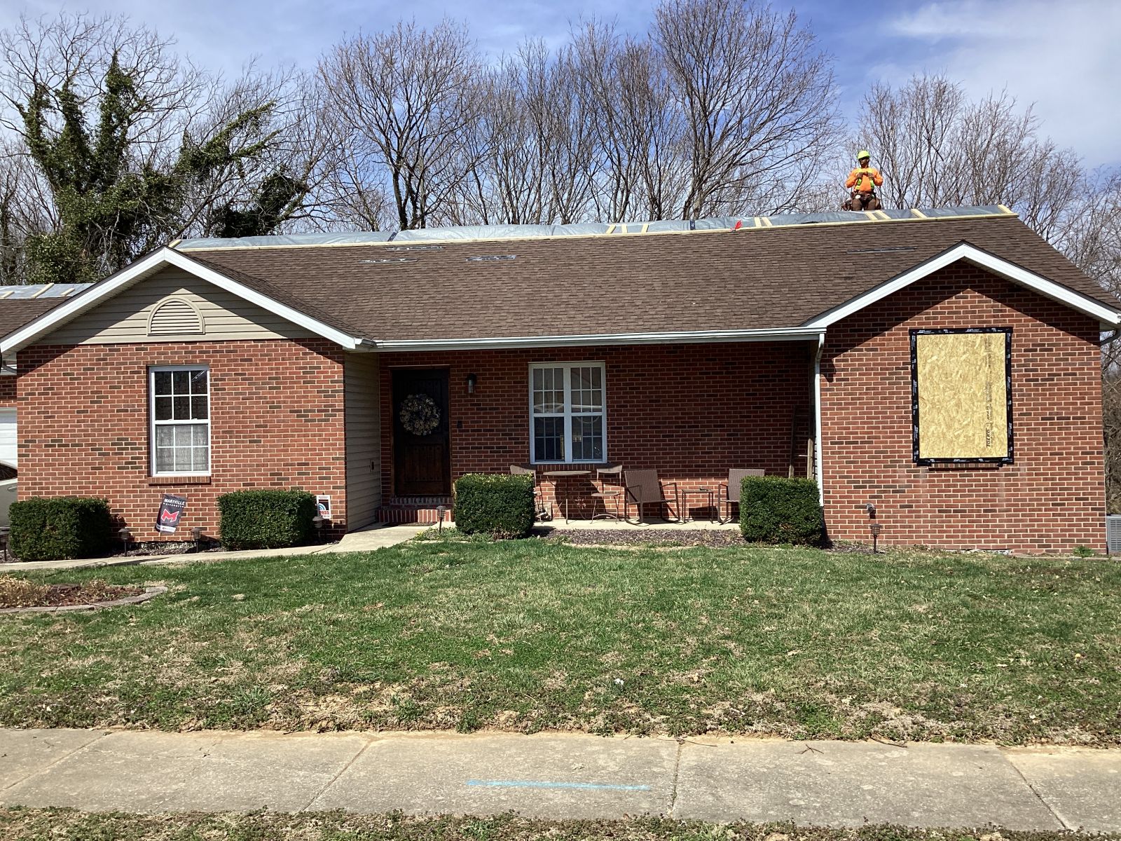
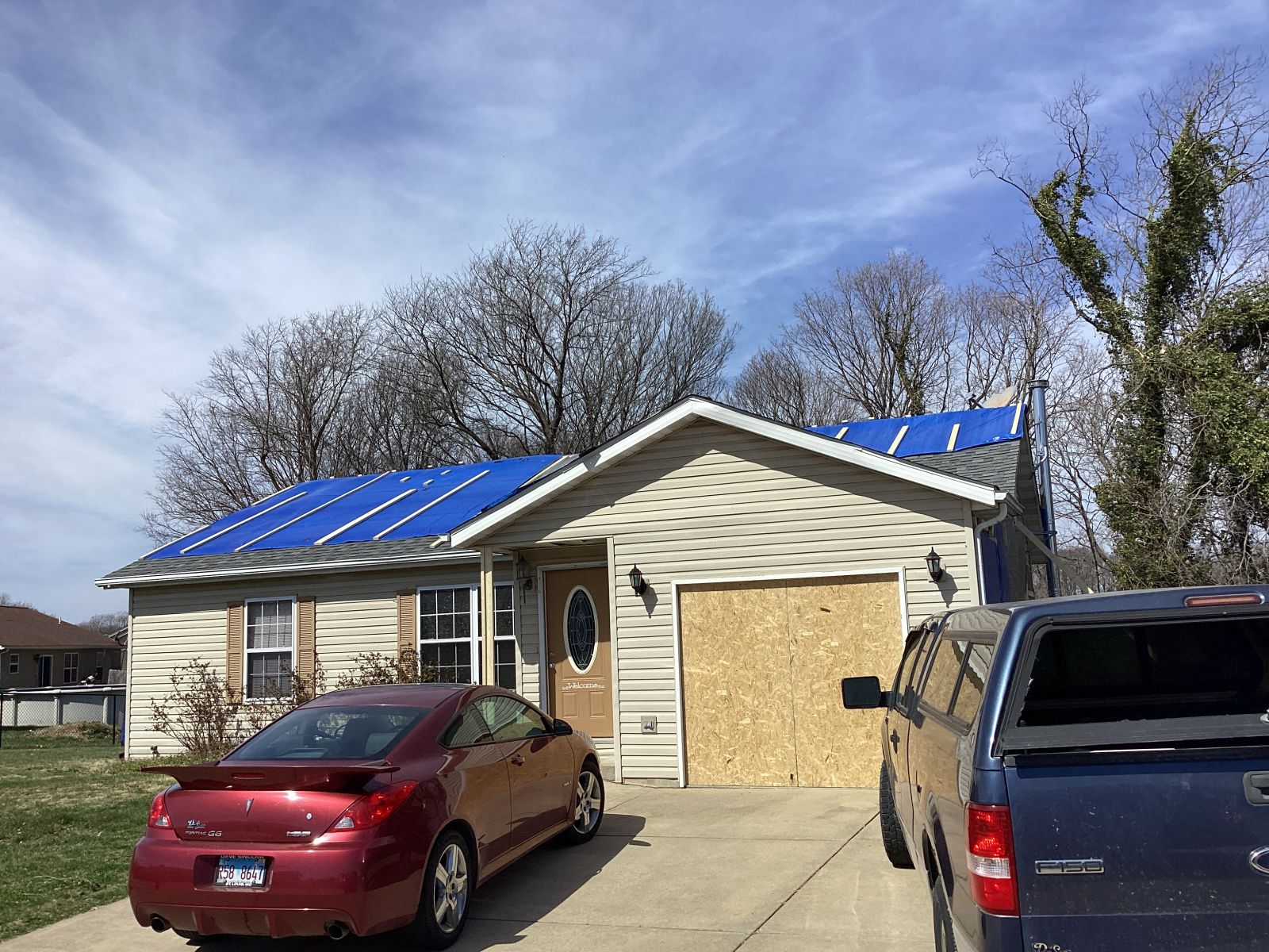
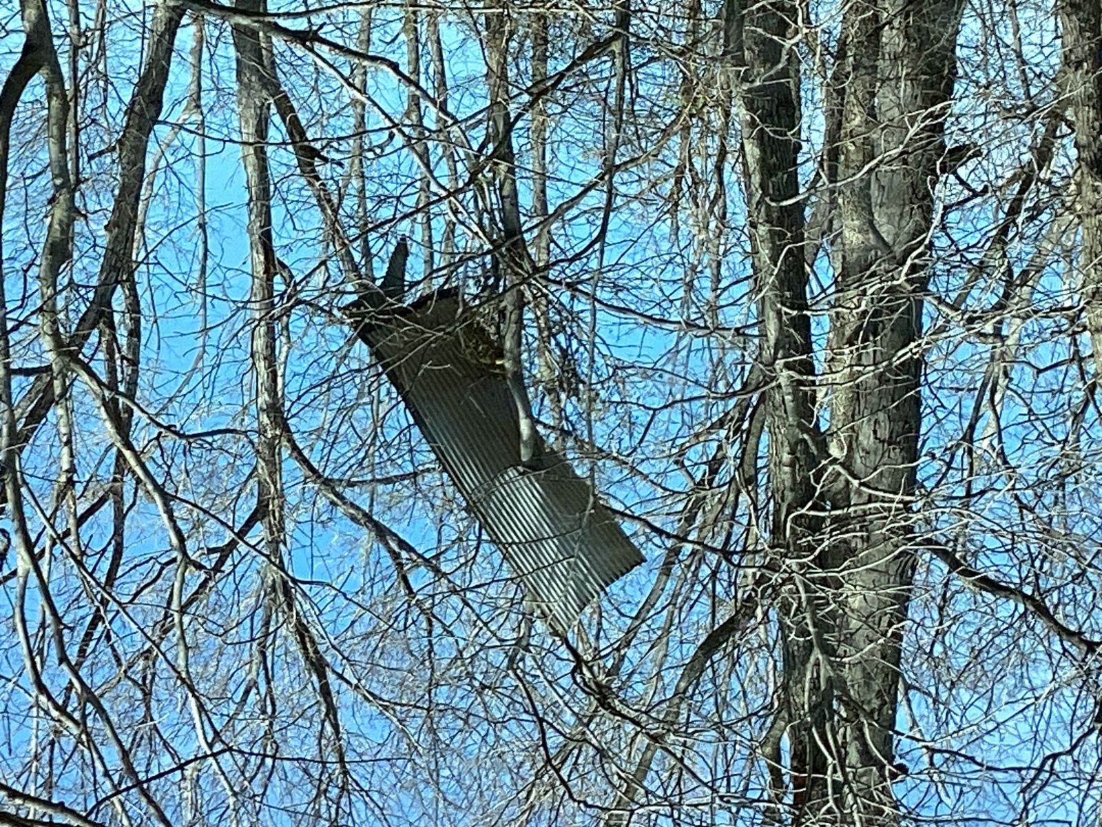
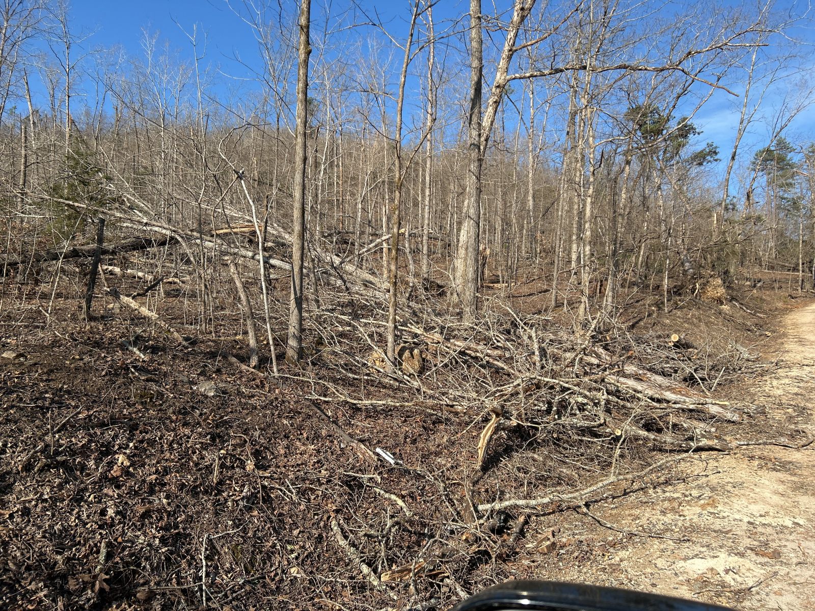
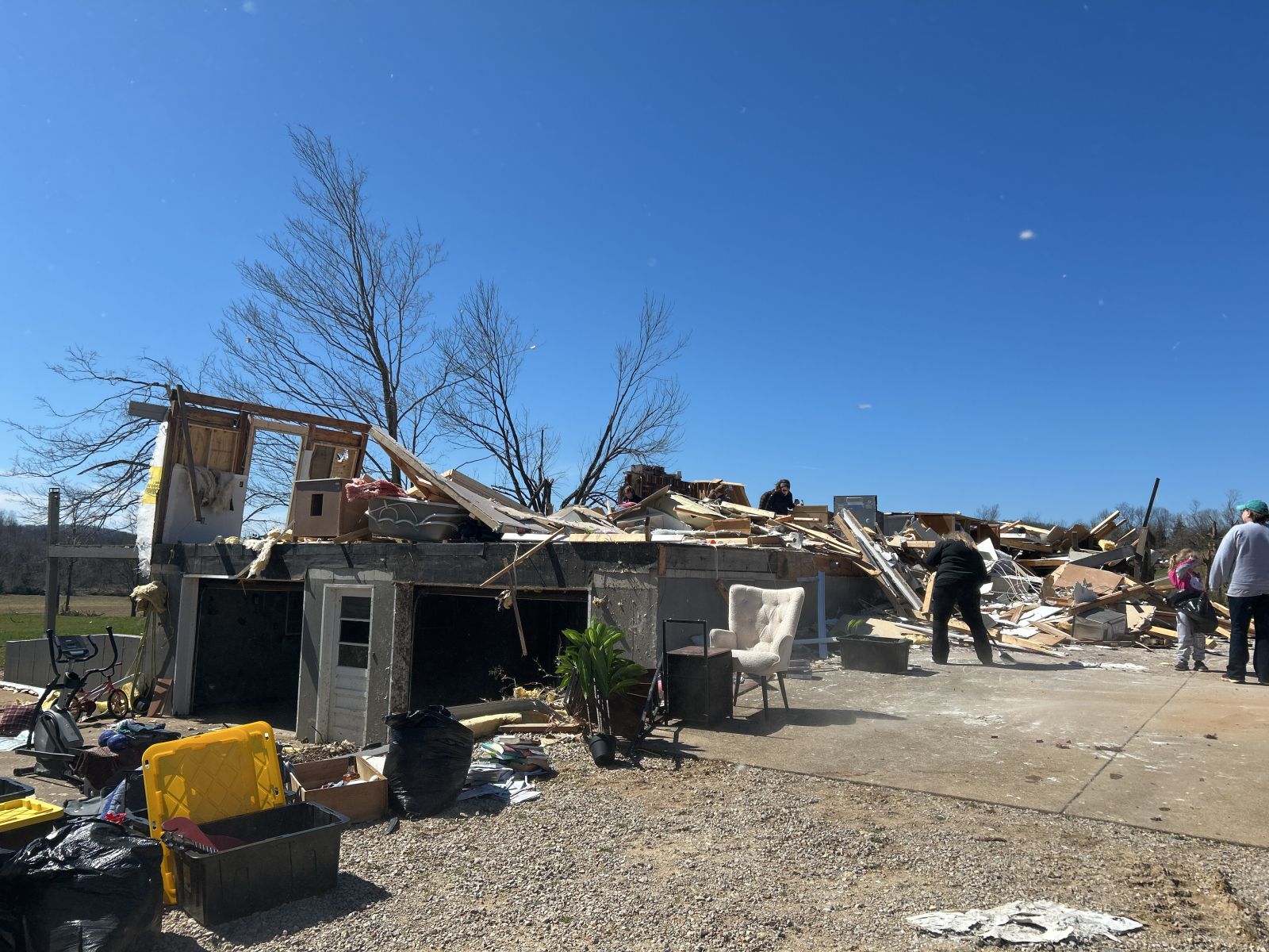
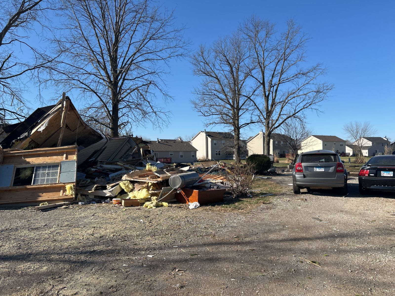
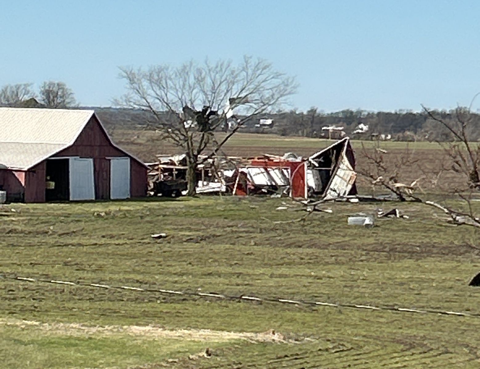
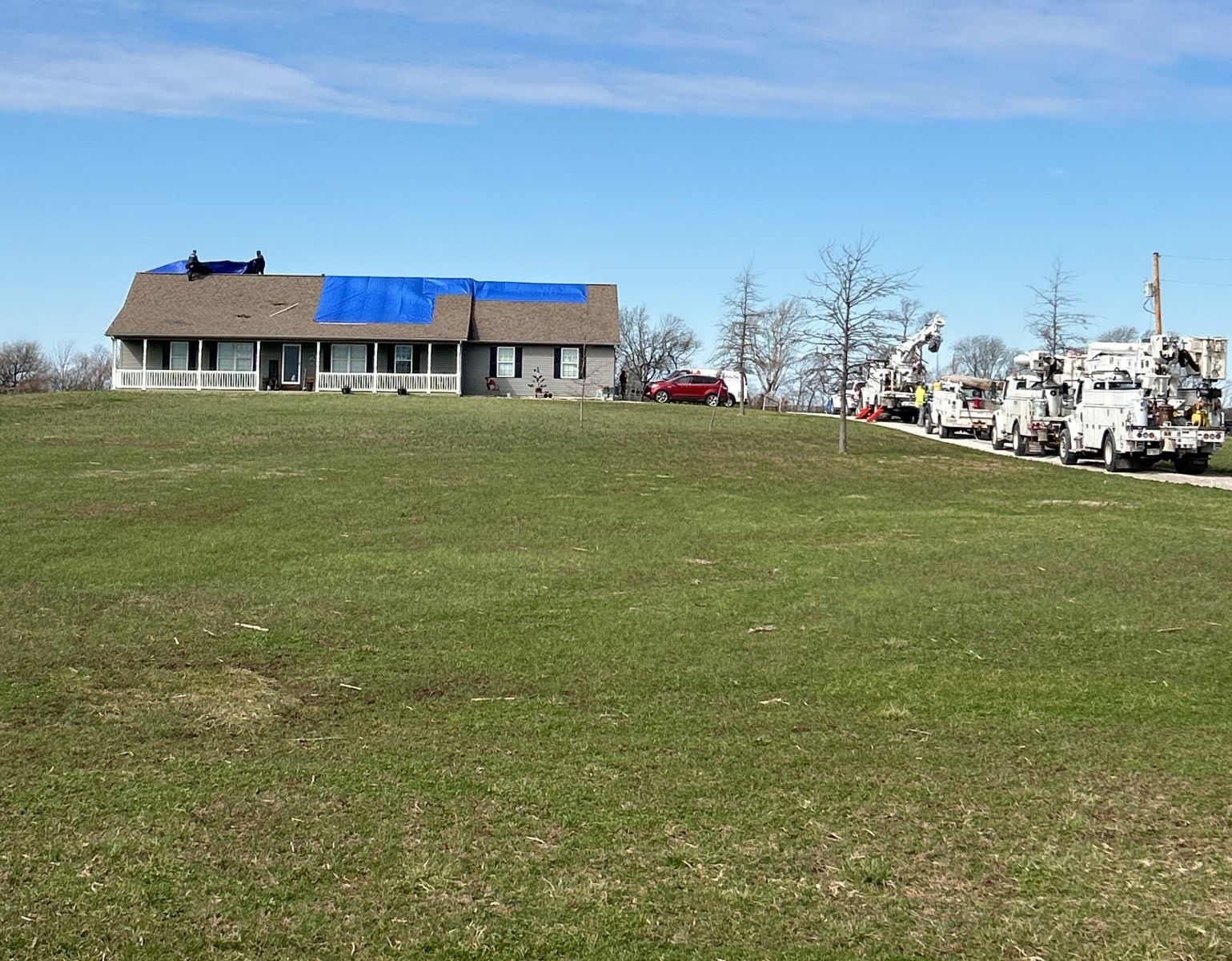
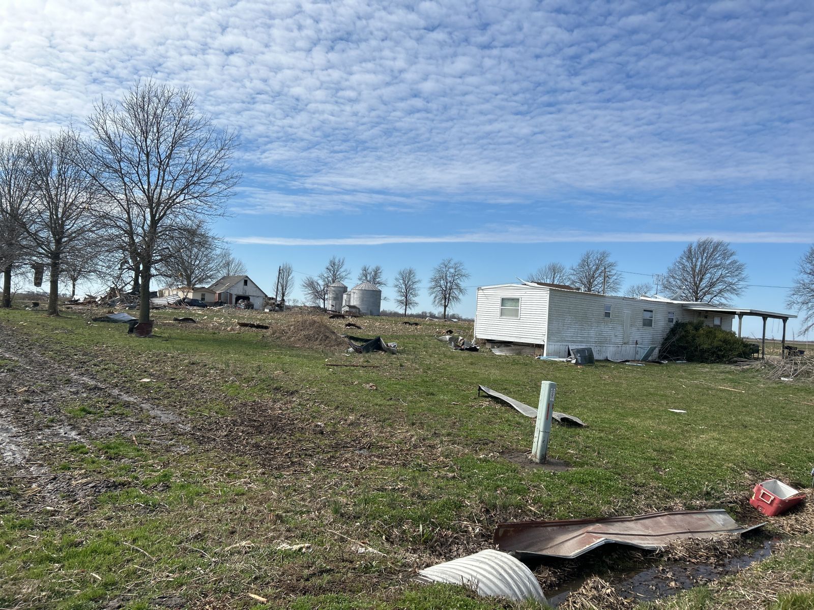
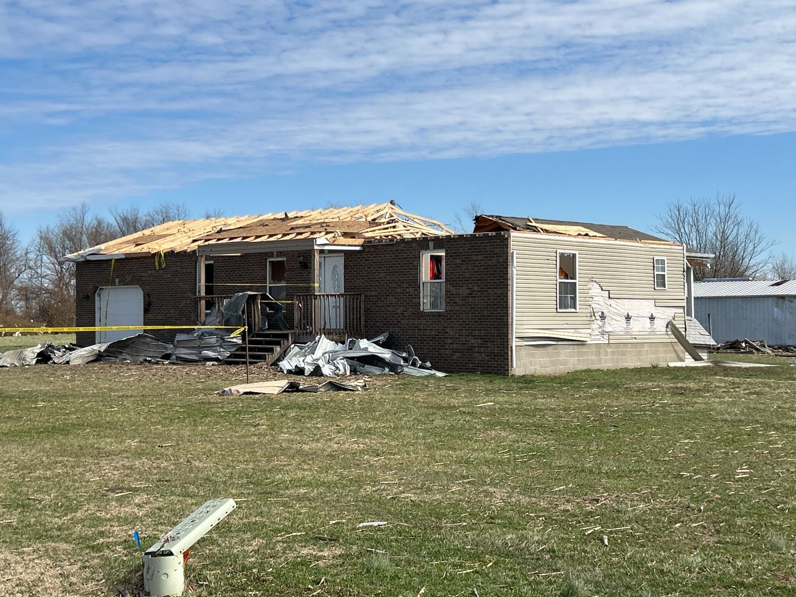
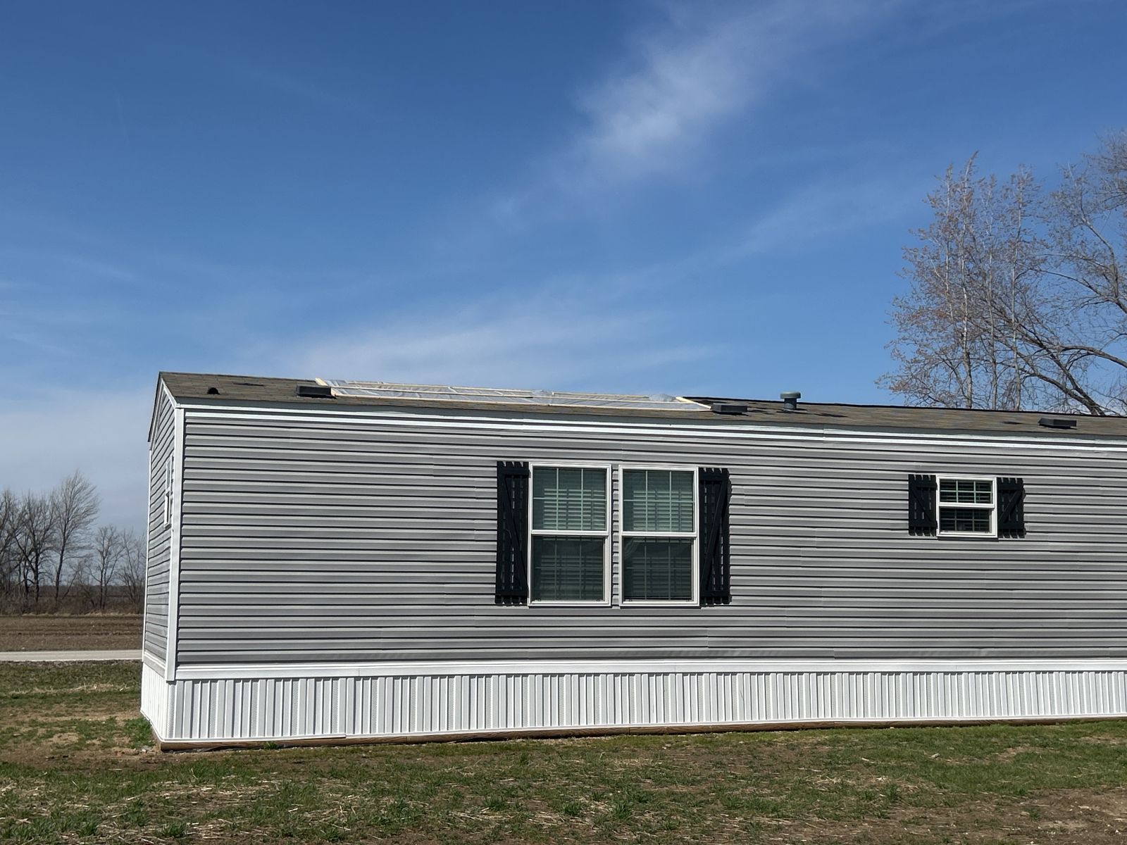
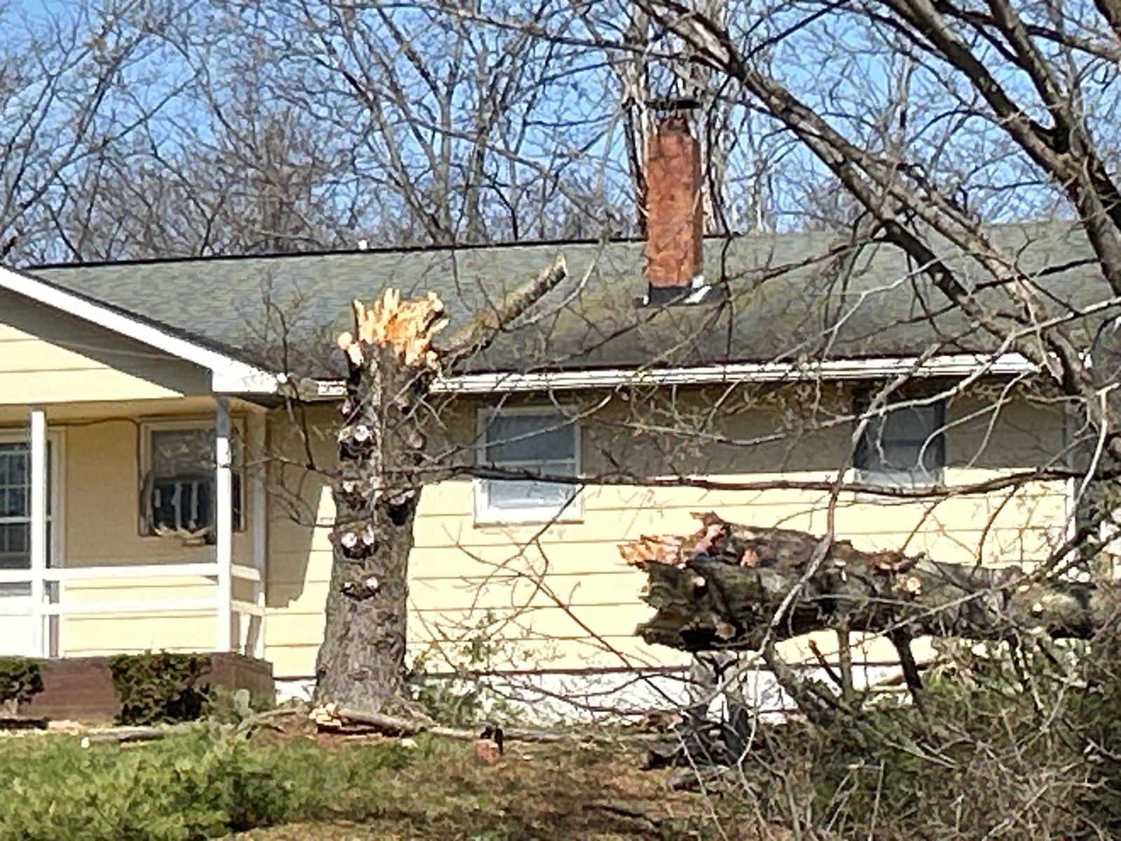
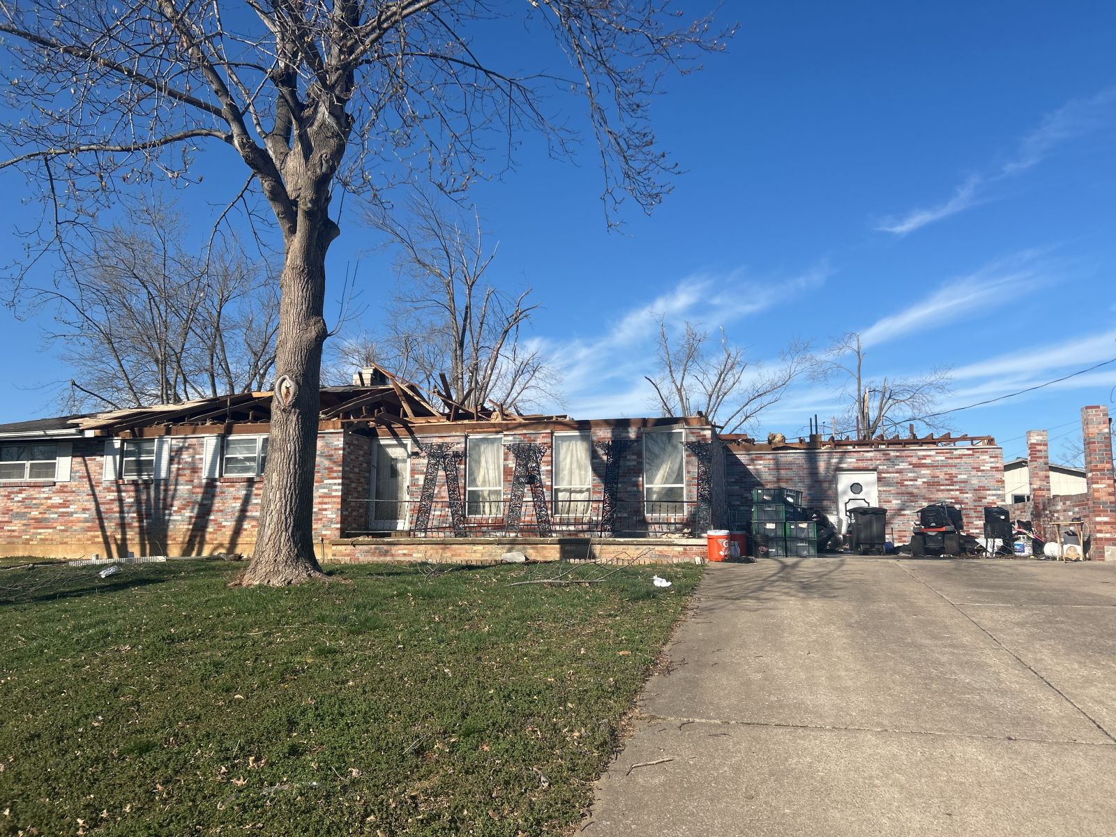
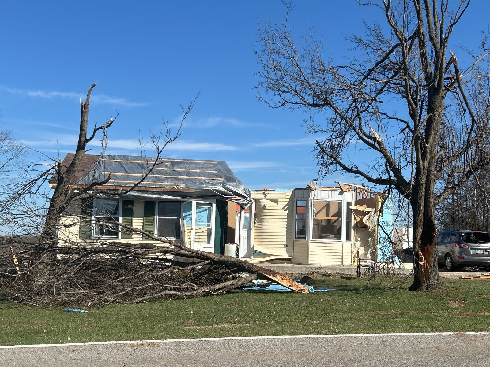
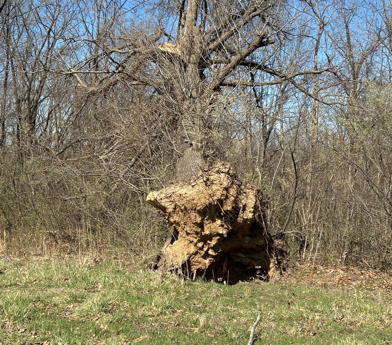
| A home damaged near Gray Summit, MO by a tornado. Photo courtesy of NWS Storm Survey team. | A home damaged near Villa Ridge, MO by a tornado. Photo courtesy of NWS Storm Survey team. | Debris from nearby homes damaged by a tornado in Des Arc, MO. Photo courtesy of NWS Storm Survey team. |
Tornadoes
|
Tornado - Union, MO
Track Map .png) 
|
||||||||||||||||
|
||||||||||||||||
|
Tornado - Kohl City
Track Map 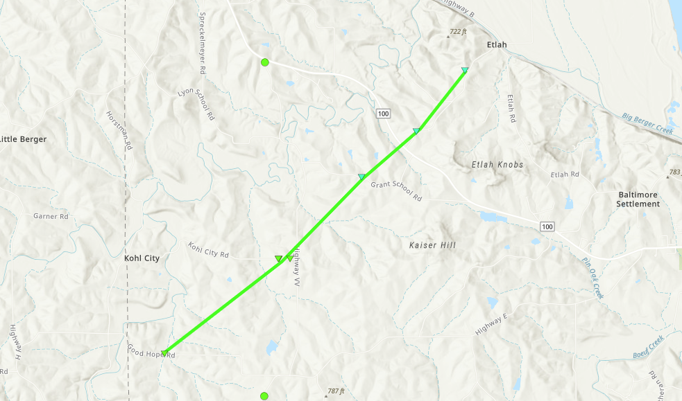
|
||||||||||||||||
|
||||||||||||||||
|
Tornado - Villa Ridge/Fox Creek
Track Map 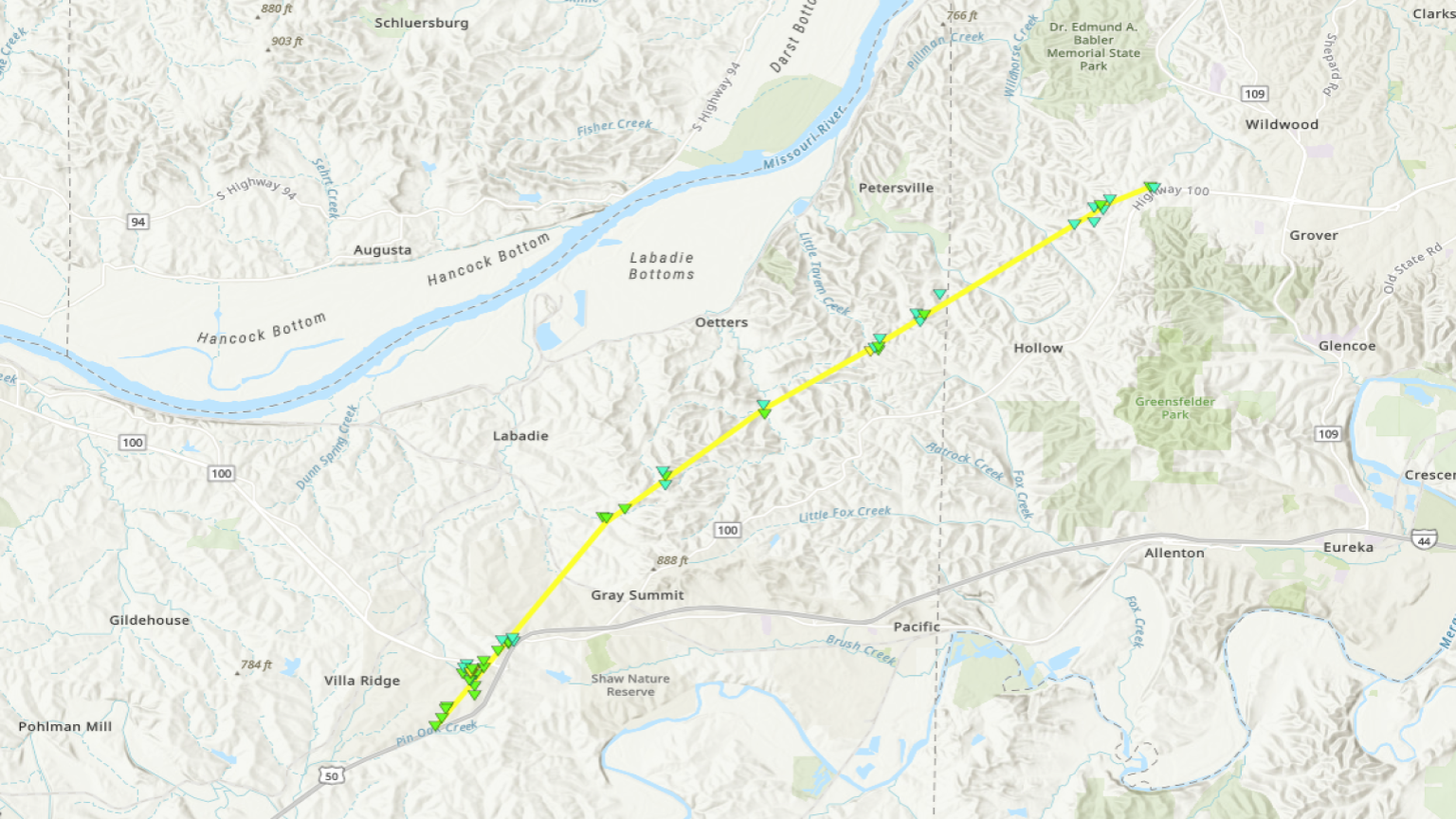
|
||||||||||||||||
|
||||||||||||||||
|
Tornado - Clarkson Valley/Alton
Track Map 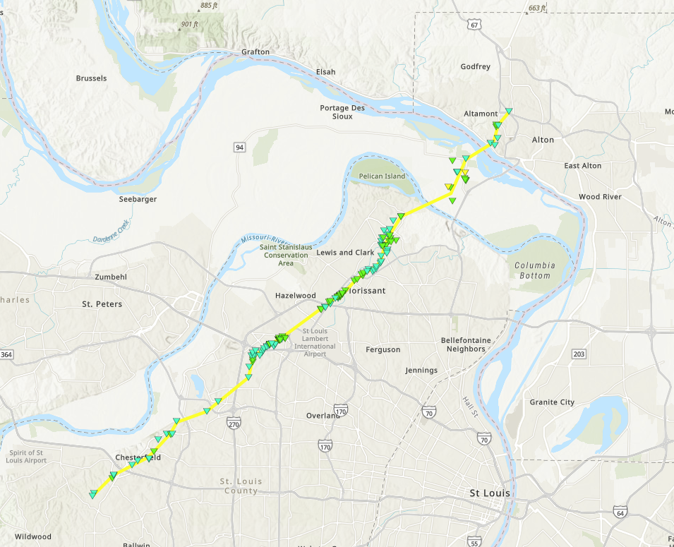
|
||||||||||||||||
|
||||||||||||||||
|
Tornado - Morse Mill/Arnold/Mehlville
Track Map 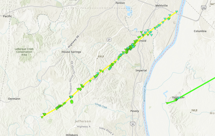
|
||||||||||||||||
|
||||||||||||||||
|
Tornado - Fremont/Grady
Track Map 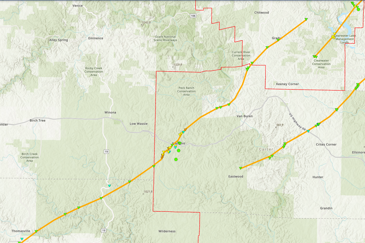
|
||||||||||||||||
|
||||||||||||||||
|
Tornado - Valmeyer
Track Map 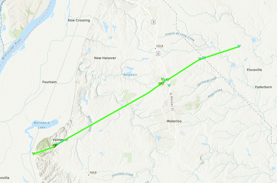
|
||||||||||||||||
|
||||||||||||||||
|
Tornado - Clearwater Lake/Des Arc/Saco
Track Map 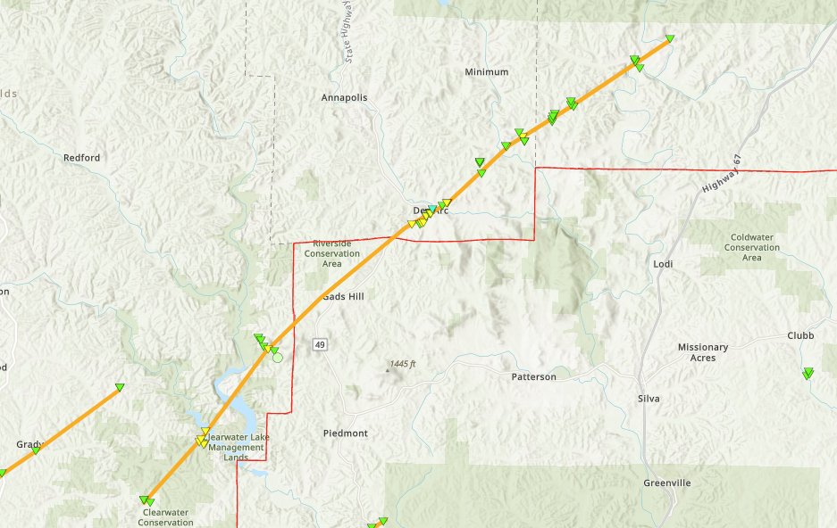
|
||||||||||||||||
|
||||||||||||||||
|
Tornado - O'Fallon/Lebanon/St. Rose
Track Map 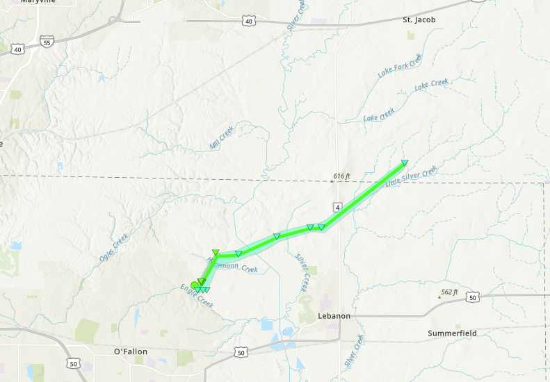
|
||||||||||||||||
|
||||||||||||||||
|
Tornado - Mascoutah/Trenton
Track Map 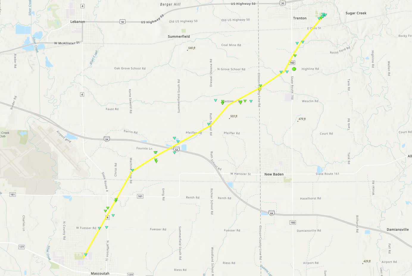
|
||||||||||||||||
|
||||||||||||||||
|
Tornado - Hagarstown/Vandalia
Track Map 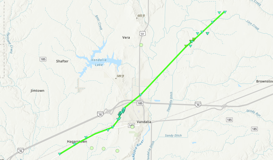
|
||||||||||||||||
|
||||||||||||||||
|
Tornado - Perryville/Leanderville, IL
Track Map 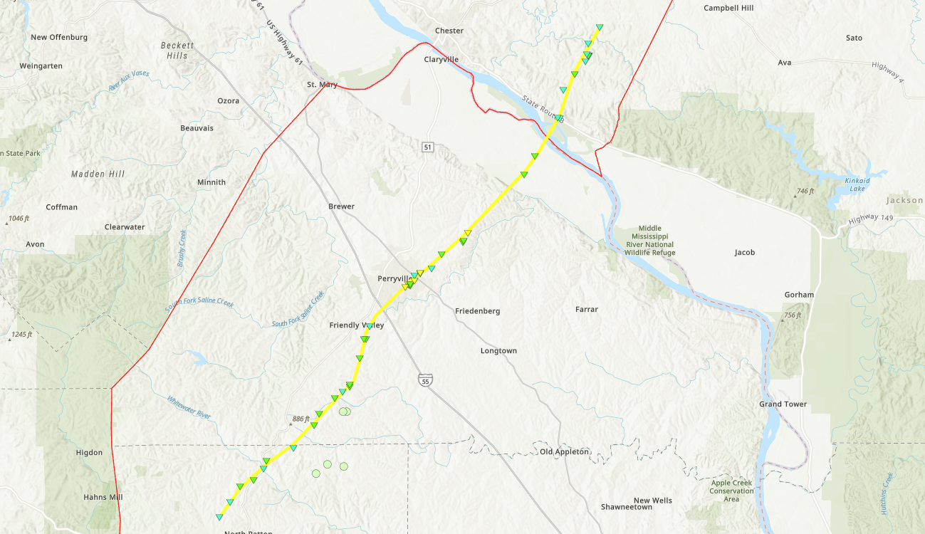
|
||||||||||||||||
|
||||||||||||||||
The Enhanced Fujita (EF) Scale classifies tornadoes into the following categories:
| EF0 Weak 65-85 mph |
EF1 Moderate 86-110 mph |
EF2 Significant 111-135 mph |
EF3 Severe 136-165 mph |
EF4 Extreme 166-200 mph |
EF5 Catastrophic 200+ mph |
 |
|||||
Straight-line Wind and Large Hail
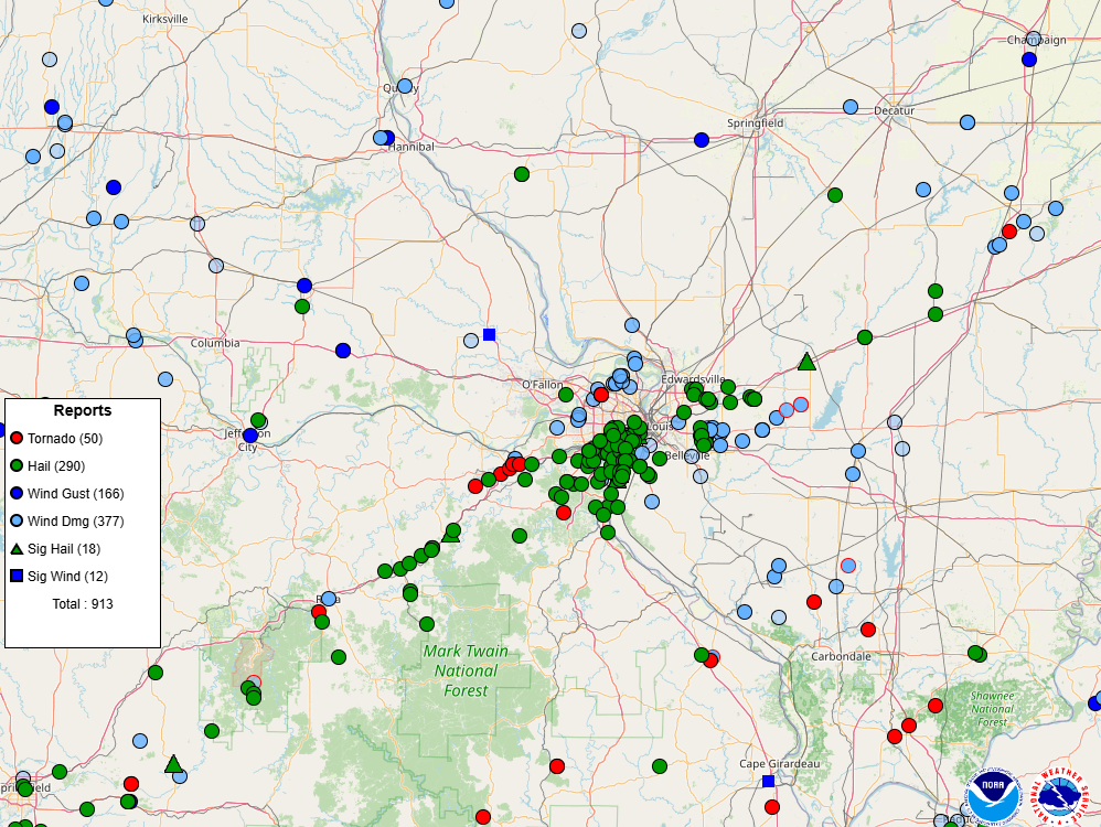
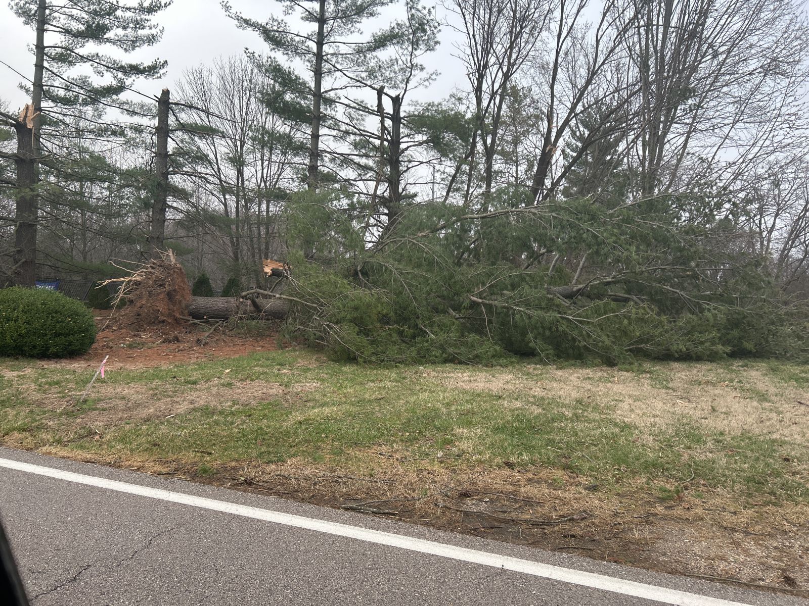
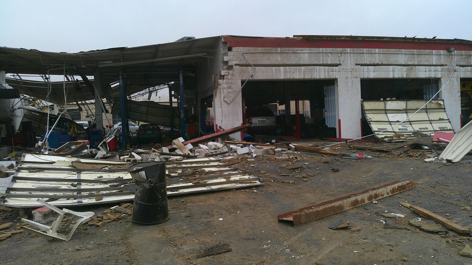
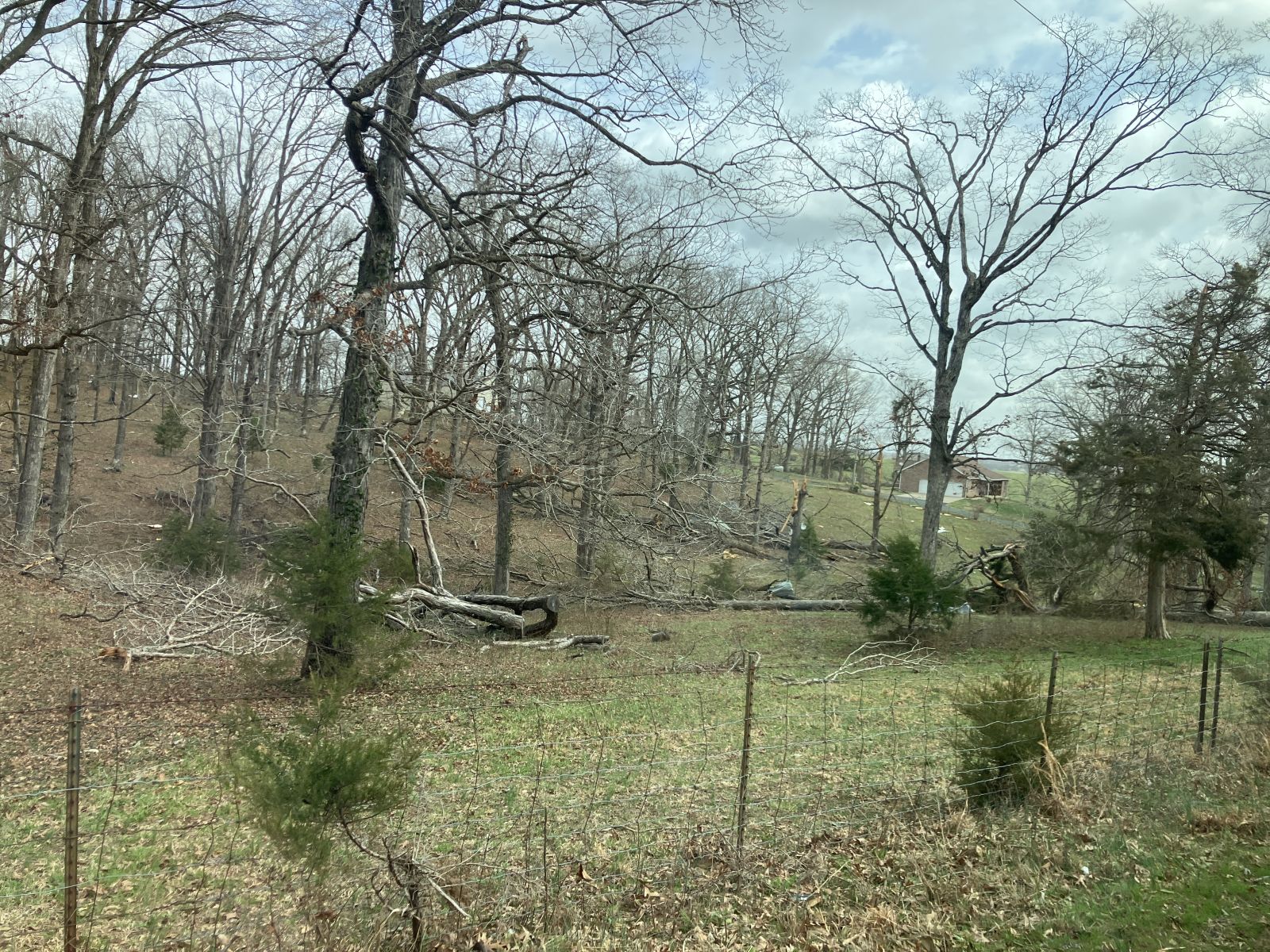
Outside of the tornadoes, nearly all of the stronger thunderstorms produced 60-70 mph straight-line winds and large hail up to 2.25 inches in diameter. At times, the strong wind and large hail combined to produce significant damage to structures. Below is a map of all wind/hail reports and a few pictures.
 |
 |
.jpg) |
 |
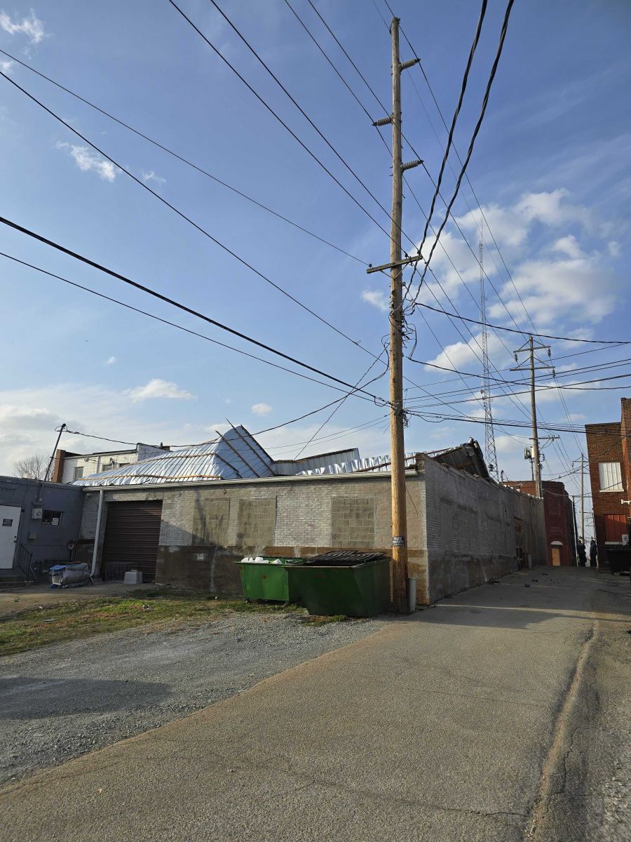
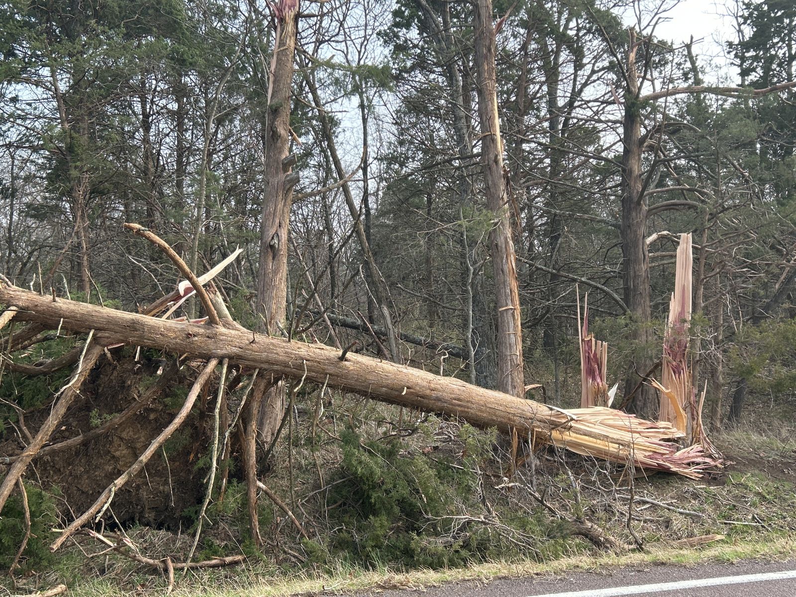
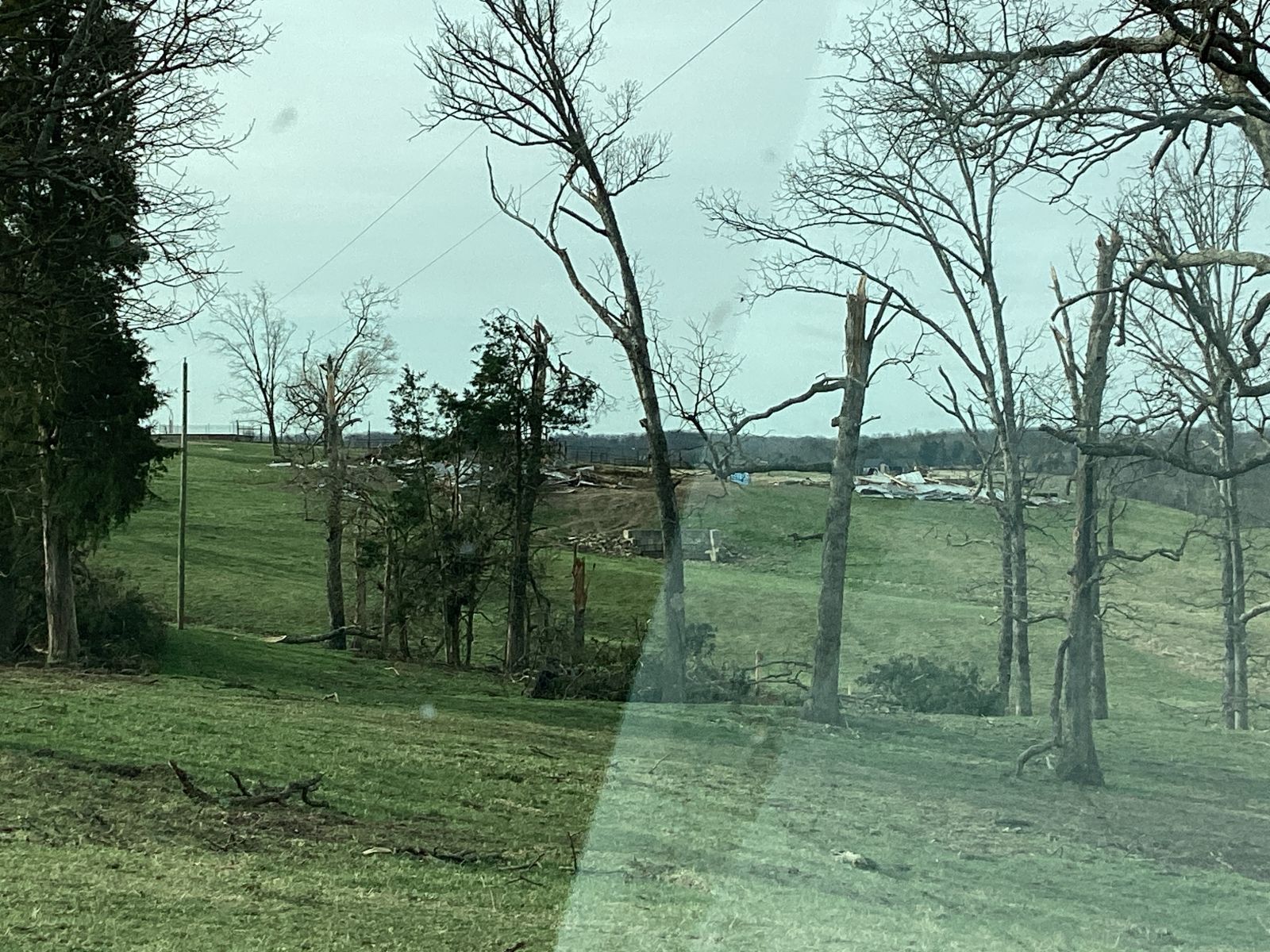
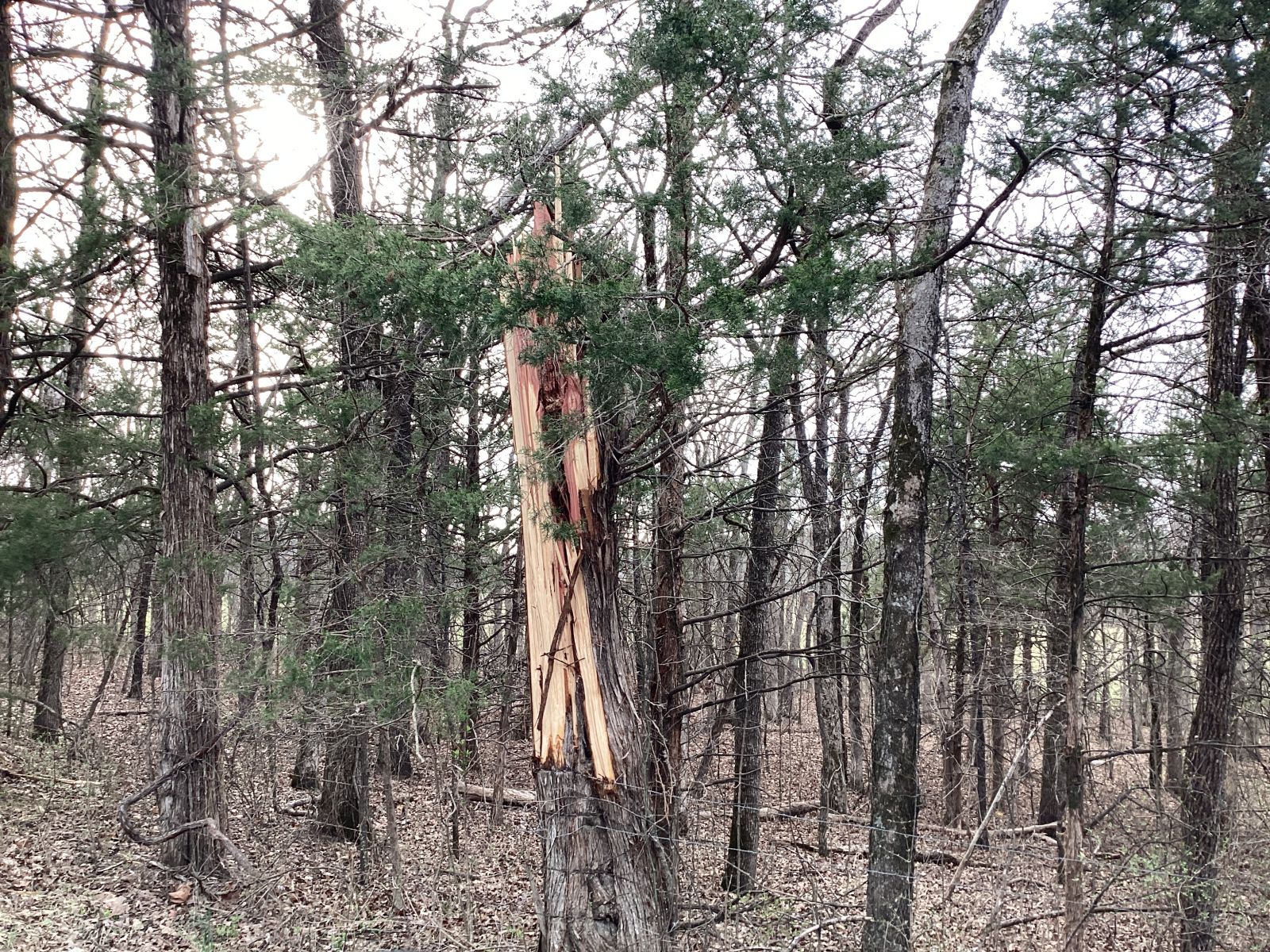
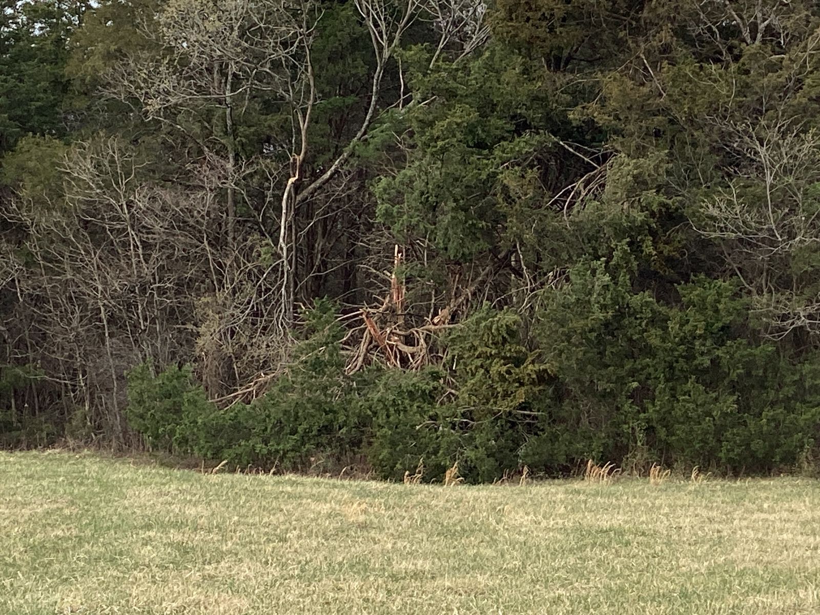
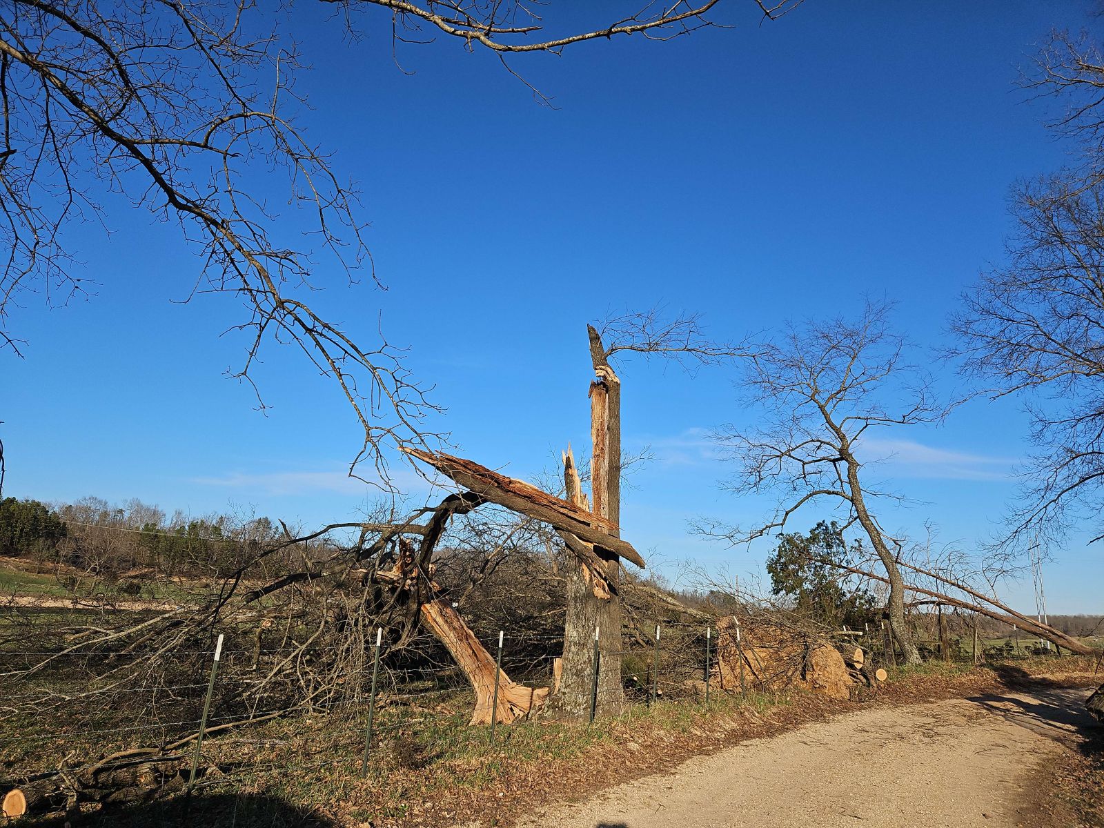
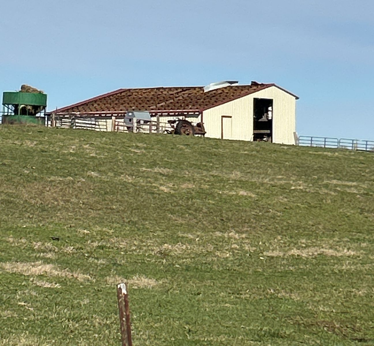
| Trees snapped by straight-line winds in Kohl City, MO. Photo courtesy of NWS Storm Survey team. | Softwood trees snapped near Belews Creek, MO. Photo courtesy of NWS Storm Survey team. | Significant damage to siding of a house due to wind-driven hail. Photo courtesy of NWS Storm Survey team. | A barn destroyed by straight-line wind south of Trenton, IL. Photo courtesy of NWS Storm Survey team. |
Strong Non-Thunderstorm Winds and Wildfires
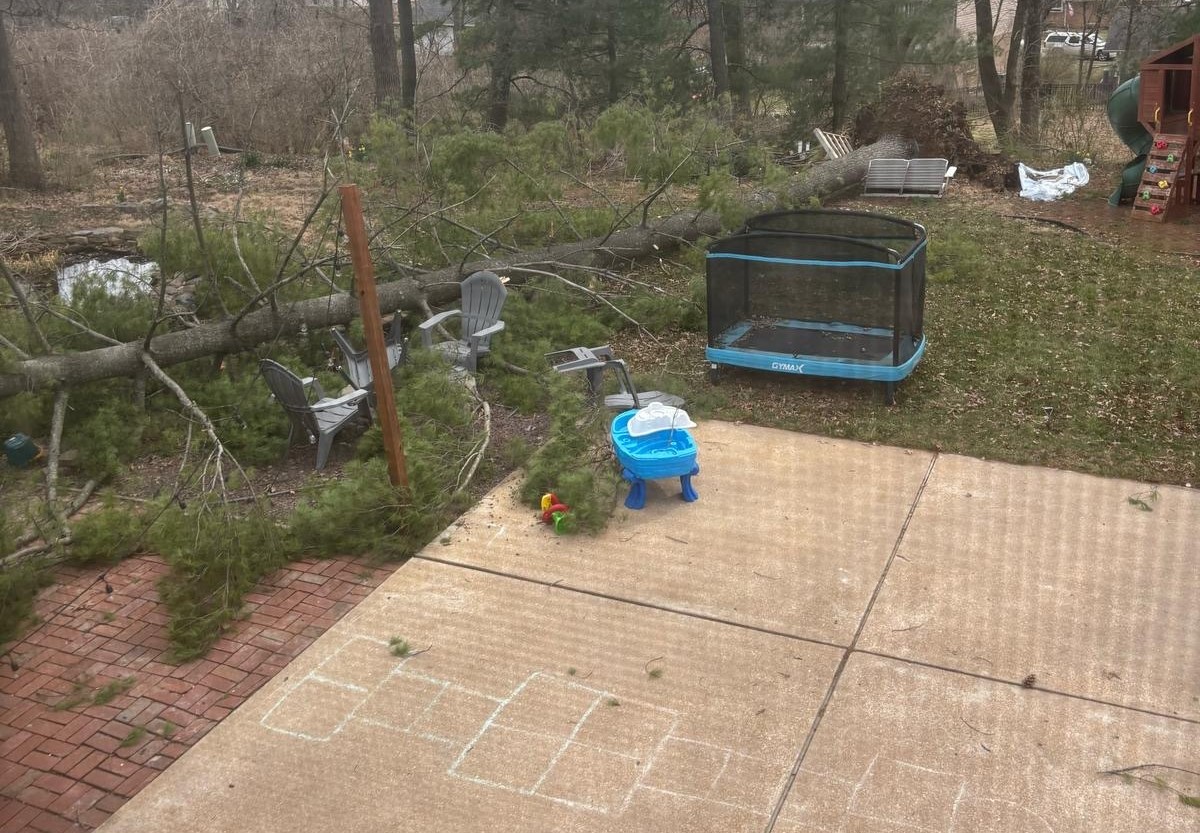
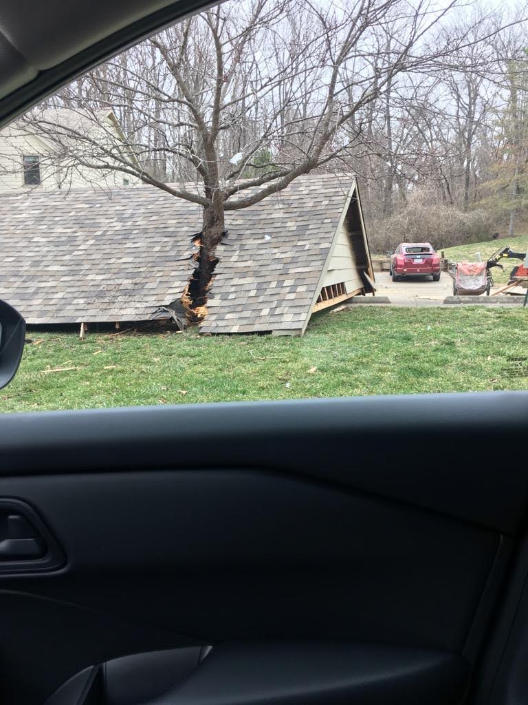
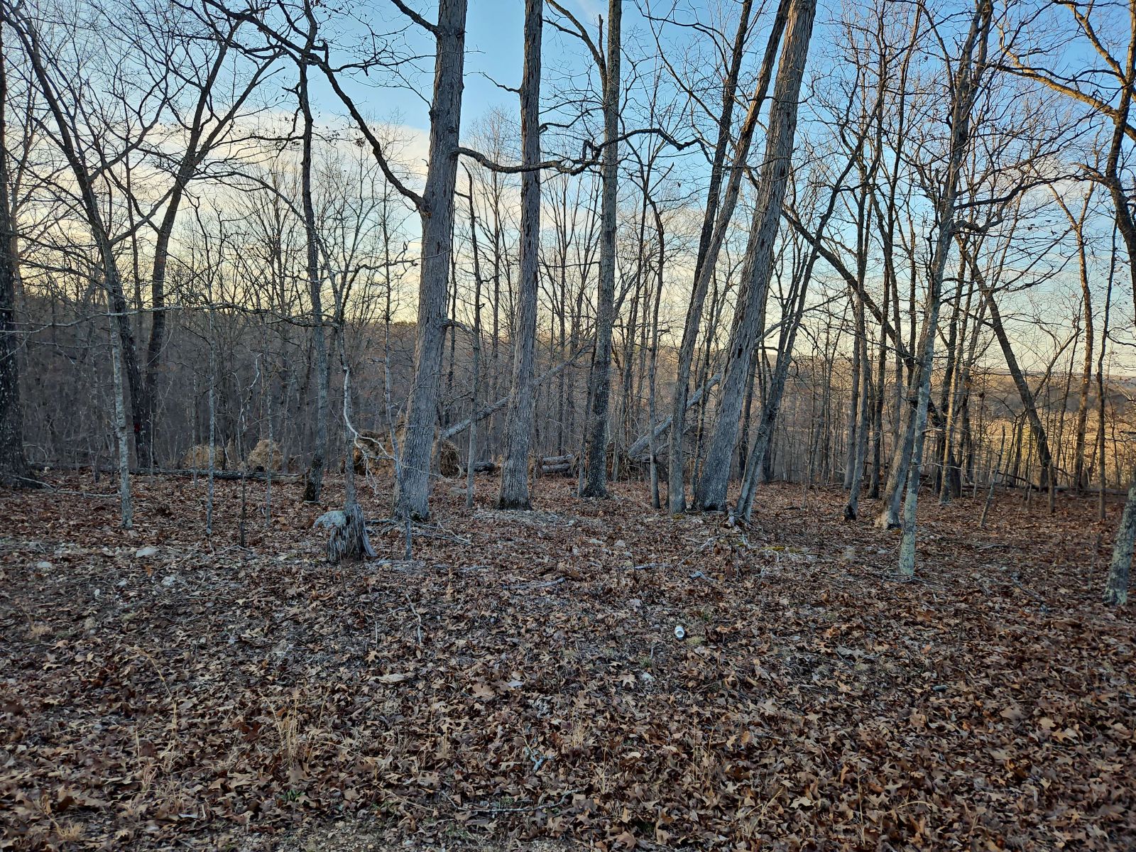
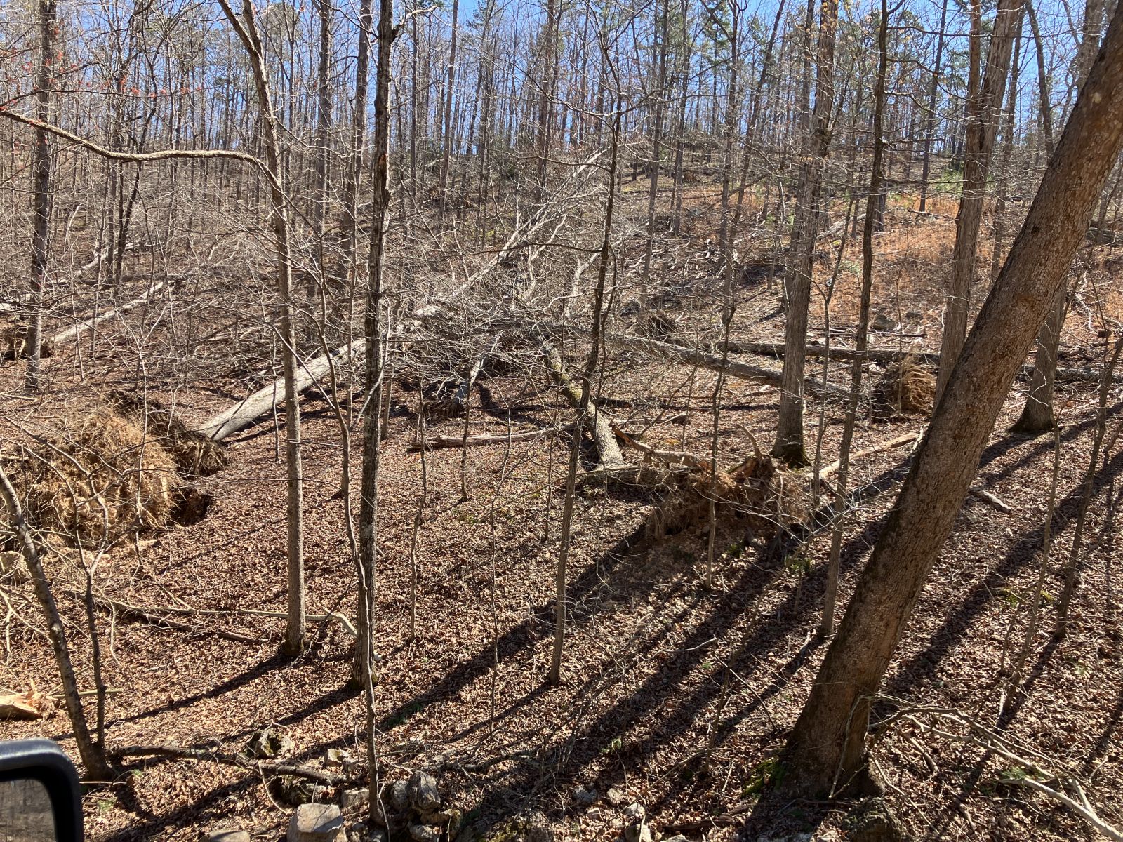
The very strong surface low pressure system that led to the tornado outbreak during the evening of March 14th first causes widespread strong winds in Missouri. These winds caused power outages and led to downed tree limbs ahead of the severe weather later that evening. The strong wind and warm, dry air during the day also led to numerous wildfires across the region. While wildfires are not uncommon in the Show-Me State, the number of fires and sizes of some of them were considerable.
 |
 |
 |
 |
| A downed tree in Ballwin, MO due to strong winds during the afternoon. Photo courtesy of NWS employee. | A downed tree in Pendleton, MO due to strong non-thunderstorm winds. Photo courtesy of local fire department. | A downed tree in Pendleton, MO due to strong non-thunderstorm winds. Photo courtesy of local fire department. | Roof damage to a building in Fredericktown, MO due to non-thunderstorm winds. Photo courtesy of local fire department. |
Storm Reports
Below is a list of observed wind gusts and hail sizes from across the region. This list may not be comprehensive and is considered preliminary. Thank you for all of the reports!
----
903
NWUS53 KLSX 190436
LSRLSX
Preliminary Local Storm Report...Summary
National Weather Service St Louis MO
1136 PM CDT Tue Mar 18 2025
..TIME... ...EVENT... ...CITY LOCATION... ...LAT.LON...
..DATE... ....MAG.... ..COUNTY LOCATION..ST.. ...SOURCE....
..REMARKS..
0933 PM Hail 2 NE Richwoods 38.20N 90.82W
03/14/2025 M1.00 Inch Washington MO Public
0925 PM Hail 1 E Eureka 38.51N 90.62W
03/14/2025 M1.50 Inch St. Louis MO Public
Report from mPING: Ping Pong Ball (1.50
in.).
0933 PM Hail Fenton 38.54N 90.45W
03/14/2025 M0.70 Inch St. Louis MO Fire Dept/Rescue
0934 PM Hail 1 WSW Fenton 38.53N 90.47W
03/14/2025 M1.00 Inch St. Louis MO Amateur Radio
0934 PM Hail 2 S Ballwin 38.57N 90.55W
03/14/2025 M0.70 Inch St. Louis MO Amateur Radio
0935 PM Hail 2 S Fenton 38.51N 90.45W
03/14/2025 M1.75 Inch St. Louis MO Amateur Radio
0936 PM Hail 1 W Mehlville 38.50N 90.33W
03/14/2025 M1.00 Inch St. Louis MO Public
Report from mPING: Quarter (1.00 in.).
0936 PM Hail 1 N Manchester 38.61N 90.51W
03/14/2025 M1.00 Inch St. Louis MO Public
Report from mPING: Quarter (1.00 in.).
0937 PM Hail 2 SE Sunset Hills 38.52N 90.39W
03/14/2025 M1.00 Inch St. Louis MO Public
Report from mPING: Quarter (1.00 in.).
0937 PM Hail 1 SW Crestwood 38.55N 90.40W
03/14/2025 M1.00 Inch St. Louis MO Trained Spotter
0938 PM Hail 1 E Oakville 38.44N 90.31W
03/14/2025 M1.75 Inch St. Louis MO Public
Also wind damage and uprooted trees.
0938 PM Hail Fenton 38.54N 90.45W
03/14/2025 M1.00 Inch St. Louis MO Trained Spotter
0939 PM Hail 1 W Crestwood 38.56N 90.40W
03/14/2025 M1.25 Inch St. Louis MO Public
Report from mPING: Half Dollar (1.25 in.).
0939 PM Hail 1 SW Fenton 38.53N 90.47W
03/14/2025 M1.00 Inch St. Louis MO Public
Report from mPING: Quarter (1.00 in.).
0940 PM Hail 1 SW Kirkwood 38.57N 90.42W
03/14/2025 M1.00 Inch St. Louis MO Public
Report from mPING: Quarter (1.00 in.).
0940 PM Hail 2 SW Oakville 38.42N 90.33W
03/14/2025 M2.00 Inch St. Louis MO Public
Report from mPING: Hen Egg (2.00 in.).
0941 PM Hail 2 SE Sunset Hills 38.52N 90.38W
03/14/2025 M1.00 Inch St. Louis MO Public
0941 PM Hail 3 N Arnold 38.47N 90.36W
03/14/2025 E1.00 Inch St. Louis MO Public
Report from mPING: Quarter (1.00 in.).
0941 PM Hail 1 SE Kirkwood 38.57N 90.41W
03/14/2025 E1.00 Inch St. Louis MO Public
Report from mPING: Quarter (1.00 in.).
0942 PM Hail 1 S Lemay 38.52N 90.28W
03/14/2025 E1.00 Inch St. Louis MO Public
0942 PM Hail 3 N Arnold 38.47N 90.36W
03/14/2025 E1.00 Inch St. Louis MO Public
0942 PM Hail 1 SE Oakville 38.43N 90.31W
03/14/2025 E1.00 Inch St. Louis MO Public
Report from mPING: Quarter (1.00 in.).
0943 PM Hail 1 SE Crestwood 38.55N 90.37W
03/14/2025 M1.25 Inch St. Louis MO Public
0943 PM Hail 2 W Mehlville 38.50N 90.35W
03/14/2025 E1.00 Inch St. Louis MO Public
Report from mPING: Quarter (1.00 in.).
0944 PM Hail Brentwood 38.62N 90.35W
03/14/2025 E1.00 Inch St. Louis MO Trained Spotter
0945 PM Hail 1 S Lemay 38.52N 90.28W
03/14/2025 M1.00 Inch St. Louis MO Public
Two reports from the same individual about 5
minutes apart of hail the size of quarters,
2 to 3 inches deep.
0945 PM Hail 1 SE Lakeshire 38.53N 90.32W
03/14/2025 E1.00 Inch St. Louis MO Public
Report from mPING: Quarter (1.00 in.).
0949 PM Hail Affton 38.55N 90.33W
03/14/2025 E1.00 Inch St. Louis MO Public
Report from mPING: Quarter (1.00 in.).
0950 PM Hail 1 SE Mehlville 38.49N 90.30W
03/14/2025 E1.00 Inch St. Louis MO Public
0950 PM Hail 1 ESE Mehlville 38.49N 90.30W
03/14/2025 M1.50 Inch St. Louis MO Public
He had 1-1.5 inch hail, emailing a photo.
0951 PM Hail 1 NW Lemay 38.54N 90.29W
03/14/2025 E1.00 Inch St. Louis MO Public
0951 PM Hail Maplewood 38.62N 90.33W
03/14/2025 E1.00 Inch St. Louis MO Public
Report from mPING: Quarter (1.00 in.).
0956 PM Hail Webster Groves 38.59N 90.35W
03/14/2025 M1.00 Inch St. Louis MO Fire Dept/Rescue
0956 PM Hail 1 N Webster Groves 38.60N 90.36W
03/14/2025 E1.25 Inch St. Louis MO Public
Report from mPING: Half Dollar (1.25 in.).
0958 PM Hail 2 SE Mehlville 38.49N 90.29W
03/14/2025 E1.00 Inch St. Louis MO Public
Report from mPING: Quarter (1.00 in.).
1001 PM Hail Oakville 38.44N 90.32W
03/14/2025 M2.00 Inch St. Louis MO Public
1003 PM Hail 2 SW Oakville 38.42N 90.33W
03/14/2025 M2.00 Inch St. Louis MO Public
1005 PM Hail 2 S Oakville 38.42N 90.32W
03/14/2025 M1.50 Inch St. Louis MO Public
Broken windows and hail damaged cars.
1005 PM Hail Oakville 38.44N 90.32W
03/14/2025 E1.25 Inch St. Louis MO Public
1007 PM Hail 2 SE Mehlville 38.49N 90.29W
03/14/2025 M1.00 Inch St. Louis MO Public
Report from mPING: Quarter (1.00 in.).
1008 PM Hail 1 E Oakville 38.45N 90.30W
03/14/2025 E1.00 Inch St. Louis MO Public
Report from mPING: Quarter (1.00 in.).
1008 PM Hail Oakville 38.45N 90.32W
03/14/2025 E1.00 Inch St. Louis MO Public
1009 PM Hail 1 SE Oakville 38.43N 90.31W
03/14/2025 M1.50 Inch St. Louis MO Public
Report from mPING: Ping Pong Ball (1.50
in.).
1013 PM Hail 1 SW Brentwood 38.61N 90.36W
03/14/2025 E1.00 Inch St. Louis MO Public
1019 PM Hail 1 SW Kirkwood 38.57N 90.42W
03/14/2025 E1.25 Inch St. Louis MO Public
Report from mPING: Half Dollar (1.25 in.).
1045 PM Hail 1 N Webster Groves 38.59N 90.35W
03/14/2025 E1.00 Inch St. Louis MO Public
Report from mPING: Quarter (1.00 in.).
1119 PM Hail Crestwood 38.56N 90.38W
03/14/2025 E1.00 Inch St. Louis MO Public
0940 PM Hail 2 E Maplewood 38.61N 90.28W
03/14/2025 E1.50 Inch St. Louis City MO Public
Ping pong size hail on Pearl Street on The
Hill.
0945 PM Hail 3 E Shrewsbury 38.59N 90.28W
03/14/2025 M1.00 Inch St. Louis City MO Public
0945 PM Hail 3 SSE Saint Louis 38.60N 90.22W
03/14/2025 E1.50 Inch St. Louis City MO Public
0945 PM Hail 3 S Saint Louis 38.60N 90.25W
03/14/2025 E1.00 Inch St. Louis City MO Public
Report from mPING: Quarter (1.00 in.).
0946 PM Hail 3 NE Lemay 38.57N 90.25W
03/14/2025 M1.00 Inch St. Louis City MO Amateur Radio
0946 PM Hail 2 E Shrewsbury 38.58N 90.29W
03/14/2025 E1.00 Inch St. Louis City MO Public
Report from mPING: Quarter (1.00 in.).
0946 PM Hail 1 NE Shrewsbury 38.59N 90.32W
03/14/2025 E1.00 Inch St. Louis City MO Public
Report from mPING: Quarter (1.00 in.).
0947 PM Hail 3 NNE Lemay 38.57N 90.26W
03/14/2025 M1.00 Inch St. Louis City MO Public
0950 PM Hail 1 NW Saint Louis 38.64N 90.25W
03/14/2025 E1.00 Inch St. Louis City MO Public
0950 PM Hail 2 SE Saint Louis 38.62N 90.22W
03/14/2025 E1.25 Inch St. Louis City MO Public
0955 PM Hail 3 S Saint Louis 38.59N 90.23W
03/14/2025 M2.00 Inch St. Louis City MO Public
0927 PM Hail 1 W Harvester 38.75N 90.59W
03/14/2025 M1.25 Inch St. Charles MO Public
0748 PM Hail Wellsville 39.07N 91.57W
03/14/2025 M0.25 Inch Montgomery MO Trained Spotter
0604 PM Hail 1 SW California 38.62N 92.57W
03/14/2025 M0.25 Inch Moniteau MO Public
0921 PM Hail Cedar Hill 38.36N 90.64W
03/14/2025 M1.00 Inch Jefferson MO Amateur Radio
0921 PM Hail Cedar Hill 38.36N 90.64W
03/14/2025 M1.00 Inch Jefferson MO Emergency Mngr
0925 PM Hail 2 E Cedar Hill 38.35N 90.61W
03/14/2025 M1.25 Inch Jefferson MO Public
Report from mPING: Half Dollar (1.25 in.).
0925 PM Hail 1 WSW House Springs 38.41N 90.58W
03/14/2025 E1.75 Inch Jefferson MO Public
0927 PM Hail 2 SE House Springs 38.40N 90.55W
03/14/2025 M1.00 Inch Jefferson MO Public
Report from mPING: Quarter (1.00 in.).
0928 PM Hail 1 WSW House Springs 38.41N 90.58W
03/14/2025 M1.75 Inch Jefferson MO Trained Spotter
0929 PM Hail 1 N Parkdale 38.49N 90.53W
03/14/2025 M1.00 Inch Jefferson MO Public
Report from mPING: Quarter (1.00 in.).
0930 PM Hail 2 S Murphy 38.47N 90.48W
03/14/2025 E1.00 Inch Jefferson MO Public
0933 PM Hail 2 N Otto 38.40N 90.51W
03/14/2025 U1.00 Inch Jefferson MO Public
Report from mPING: Quarter (1.00 in.).
0935 PM Hail 3 W Arnold 38.41N 90.43W
03/14/2025 M1.00 Inch Jefferson MO Public
0936 PM Hail 1 E Murphy 38.49N 90.47W
03/14/2025 M1.00 Inch Jefferson MO Public
0937 PM Hail 2 E Murphy 38.49N 90.45W
03/14/2025 M1.00 Inch Jefferson MO Public
Report from mPING: Quarter (1.00 in.).
0938 PM Hail 3 W Arnold 38.44N 90.41W
03/14/2025 M1.00 Inch Jefferson MO Public
Report from mPING: Quarter (1.00 in.).
0956 PM Hail 2 NE Arnold 38.45N 90.36W
03/14/2025 E1.00 Inch Jefferson MO Public
Report from mPING: Quarter (1.00 in.).
1000 PM Hail 1 N Kimmswick 38.38N 90.37W
03/14/2025 M1.75 Inch Jefferson MO Public
Report from mPING: Golf Ball (1.75 in.).
1001 PM Hail 2 NE Pevely 38.31N 90.38W
03/14/2025 E1.25 Inch Jefferson MO Public
Report from mPING: Half Dollar (1.25 in.).
1005 PM Hail 3 SW Barnhart 38.31N 90.44W
03/14/2025 E1.00 Inch Jefferson MO Public
Report from mPING: Quarter (1.00 in.).
1006 PM Hail 1 SW Pevely 38.28N 90.40W
03/14/2025 M1.50 Inch Jefferson MO Public
Report from mPING: Ping Pong Ball (1.50
in.).
1006 PM Hail 1 SW Pevely 38.28N 90.40W
03/14/2025 E1.00 Inch Jefferson MO Public
Report from mPING: Quarter (1.00 in.).
1011 PM Hail 2 NE Pevely 38.31N 90.38W
03/14/2025 M1.50 Inch Jefferson MO Public
Report from mPING: Ping Pong Ball (1.50
in.).
1011 PM Hail 1 W Kimmswick 38.37N 90.39W
03/14/2025 M1.75 Inch Jefferson MO Public
Report from mPING: Golf Ball (1.75 in.).
1018 PM Hail Kimmswick 38.36N 90.36W
03/14/2025 E1.25 Inch Jefferson MO Public
Report from mPING: Half Dollar (1.25 in.).
1036 PM Hail 1 S Crystal City 38.21N 90.38W
03/14/2025 E1.00 Inch Jefferson MO Public
Report from mPING: Quarter (1.00 in.).
0847 PM Hail 3 SE Union 38.42N 90.97W
03/14/2025 M1.75 Inch Franklin MO Public
Report from mPING: Golf Ball (1.75 in.).
0849 PM Hail 1 ENE Sullivan 38.22N 91.15W
03/14/2025 E1.00 Inch Franklin MO Public
Quarter size hail, high wind, and street
flooding.
0902 PM Hail 1 ESE Sullivan 38.21N 91.16W
03/14/2025 M2.00 Inch Franklin MO Trained Spotter
0909 PM Hail Pacific 38.48N 90.76W
03/14/2025 M1.00 Inch Franklin MO Trained Spotter
0919 PM Hail Catawissa 38.42N 90.79W
03/14/2025 E1.75 Inch Franklin MO Public
0823 PM Hail 3 NE Rosati 38.06N 91.49W
03/14/2025 M1.00 Inch Crawford MO Public
0830 PM Hail 1 W Cuba 38.07N 91.41W
03/14/2025 M1.00 Inch Crawford MO Public
0834 PM Hail 1 N Steelville 37.98N 91.36W
03/14/2025 M1.25 Inch Crawford MO Public
0837 PM Hail 3 NE Cuba 38.09N 91.37W
03/14/2025 M1.00 Inch Crawford MO Public
Report from mPING: Quarter (1.00 in.).
0840 PM Hail Bourbon 38.15N 91.25W
03/14/2025 M1.25 Inch Crawford MO Public
0841 PM Hail Bourbon 38.15N 91.25W
03/14/2025 E1.25 Inch Crawford MO Public
Picture submitted via social media. Time
estimated by radar.
0844 PM Hail 2 NW Leasburg 38.12N 91.31W
03/14/2025 M1.50 Inch Crawford MO Public
Report from mPING: Ping Pong Ball (1.50
in.).
0845 PM Hail 1 SW Bourbon 38.14N 91.26W
03/14/2025 M1.00 Inch Crawford MO Public
Report from mPING: Quarter (1.00 in.).
0850 PM Hail Steelville 37.97N 91.36W
03/14/2025 E1.50 Inch Crawford MO Public
0900 PM Hail Cherryville 37.85N 91.28W
03/14/2025 E1.75 Inch Crawford MO Public
0655 PM Hail Brazito 38.45N 92.28W
03/14/2025 M0.25 Inch Cole MO Law Enforcement
0659 PM Hail 1 ESE Jefferson City 38.56N 92.17W
03/14/2025 M0.70 Inch Cole MO Law Enforcement
Observation from Lincoln University in
Jefferson City.
0702 PM Hail 1 E Jefferson City 38.58N 92.16W
03/14/2025 E0.75 Inch Cole MO Public
Report from mPING: Dime (0.75 in.).
0707 PM Hail Holts Summit 38.65N 92.12W
03/14/2025 M1.50 Inch Callaway MO Public
Hail damage to trees and cars.
0630 PM Hail 1 W Ashland 38.78N 92.27W
03/14/2025 E0.75 Inch Boone MO Public
Report from mPING: Dime (0.75 in.).
0657 PM Hail 5 N Auxvasse 39.09N 91.90W
03/14/2025 M1.00 Inch Audrain MO Public
About halfway between Auxvasse and Mexico.
0703 PM Hail Mexico 39.17N 91.87W
03/14/2025 M0.88 Inch Audrain MO Trained Spotter
Estimated wind speed 60 mph.
0704 PM Hail 2 SW Mexico 39.15N 91.90W
03/14/2025 E0.75 Inch Audrain MO Public
Report from mPING: Dime (0.75 in.).
1006 PM Hail O'Fallon 38.59N 89.91W
03/14/2025 E1.00 Inch St. Clair IL Public
1025 PM Hail O'Fallon 38.59N 89.92W
03/14/2025 E1.00 Inch St. Clair IL Public
1025 PM Hail O'Fallon 38.59N 89.91W
03/14/2025 M1.75 Inch St. Clair IL Broadcast Media
Wind driven hail resulted in extensive
damage to west facing homes and buildings.
1027 PM Hail 1 N Shiloh 38.57N 89.91W
03/14/2025 M1.00 Inch St. Clair IL Public
Report from mPING: Quarter (1.00 in.).
1027 PM Hail 3 NW Millstadt 38.50N 90.12W
03/14/2025 M1.00 Inch St. Clair IL Public
Report from mPING: Quarter (1.00 in.).
1028 PM Hail 1 NE Shiloh 38.56N 89.89W
03/14/2025 M1.00 Inch St. Clair IL Public
Report from mPING: Quarter (1.00 in.).
1028 PM Hail 2 N O'Fallon 38.62N 89.92W
03/14/2025 M1.00 Inch St. Clair IL Public
Report from mPING: Quarter (1.00 in.).
1030 PM Hail O'Fallon 38.59N 89.91W
03/14/2025 E1.00 Inch St. Clair IL Trained Spotter
1045 PM Hail Shiloh 38.55N 89.90W
03/14/2025 M1.00 Inch St. Clair IL Public
0845 PM Hail 1 S Pittsfield 39.60N 90.81W
03/14/2025 M1.75 Inch Pike IL Public
Report from mPING: Golf Ball (1.75 in.).
0846 PM Hail Pittsfield 39.61N 90.80W
03/14/2025 M1.00 Inch Pike IL Public
Report from mPING: Quarter (1.00 in.).
0847 PM Hail 1 S Pittsfield 39.60N 90.81W
03/14/2025 M1.00 Inch Pike IL Public
Report from mPING: Quarter (1.00 in.).
1005 PM Hail 3 ESE Columbia 38.43N 90.17W
03/14/2025 M1.25 Inch Monroe IL Public
1005 PM Hail 2 E Mehlville 38.49N 90.27W
03/14/2025 E1.00 Inch Monroe IL Public
Report from mPING: Quarter (1.00 in.).
1007 PM Hail 1 SE Columbia 38.44N 90.21W
03/14/2025 E1.25 Inch Monroe IL Law Enforcement
Columbia Police reported hail between
quarter and golf ball size.
1007 PM Hail 2 ESE Columbia 38.44N 90.18W
03/14/2025 E1.25 Inch Monroe IL Law Enforcement
Corrects previous hail report from 2 ESE
Columbia. Columbia PD reported hail between
quarter and golf ball size.
1008 PM Hail 1 W Valmeyer 38.31N 90.33W
03/14/2025 M1.25 Inch Monroe IL Public
Report from mPING: Half Dollar (1.25 in.).
1010 PM Hail Columbia 38.46N 90.23W
03/14/2025 M1.00 Inch Monroe IL Public
1010 PM Hail 1 N Columbia 38.47N 90.22W
03/14/2025 M1.50 Inch Monroe IL Public
Report from mPING: Ping Pong Ball (1.50
in.).
1027 PM Hail 1 N Columbia 38.47N 90.22W
03/14/2025 M1.50 Inch Monroe IL Public
Report from mPING: Ping Pong Ball (1.50
in.).
0108 AM Hail 1 NE Columbia 38.47N 90.22W
03/15/2025 E1.25 Inch Monroe IL Public
Report from mPING: Half Dollar (1.25 in.).
0958 PM Hail Maryville 38.73N 89.96W
03/14/2025 M1.75 Inch Madison IL Public
Photo submitted via social media. Time
estimated by radar.
1000 PM Hail 1 ENE Glen Carbon 38.77N 89.96W
03/14/2025 M1.00 Inch Madison IL Public
1003 PM Hail Collinsville 38.68N 90.00W
03/14/2025 M1.50 Inch Madison IL Trained Spotter
1005 PM Hail 2 E Glen Carbon 38.77N 89.94W
03/14/2025 M1.00 Inch Madison IL Public
1005 PM Hail 1 ESE Troy 38.72N 89.87W
03/14/2025 E1.00 Inch Madison IL Public
1006 PM Hail 1 SE Glen Carbon 38.75N 89.95W
03/14/2025 M1.00 Inch Madison IL Public
1007 PM Hail 1 E Troy 38.73N 89.88W
03/14/2025 M1.00 Inch Madison IL Public
Report from mPING: Quarter (1.00 in.).
1008 PM Hail Troy 38.73N 89.89W
03/14/2025 E1.00 Inch Madison IL Public
1010 PM Hail Marine 38.78N 89.78W
03/14/2025 M1.50 Inch Madison IL Public
1033 PM Hail 1 ESE Troy 38.73N 89.88W
03/14/2025 M1.00 Inch Madison IL Emergency Mngr
From Madison County IL EM.
1039 PM Hail Saint Jacob 38.72N 89.77W
03/14/2025 E1.00 Inch Madison IL Amateur Radio
Dime to quarter size hail.
1040 PM Hail 1 ESE Highland 38.73N 89.65W
03/14/2025 M1.00 Inch Madison IL Public
1044 PM Hail Highland 38.74N 89.67W
03/14/2025 E1.00 Inch Madison IL Amateur Radio
HAM operator reporting quarter size hail.
1045 PM Hail 1 SE Highland 38.73N 89.66W
03/14/2025 E1.75 Inch Madison IL Public
Report from mPING: Golf Ball (1.75 in.).
1100 PM Hail 1 SE Highland 38.73N 89.65W
03/14/2025 E1.00 Inch Madison IL Public
Report from mPING: Quarter (1.00 in.).
1122 PM Hail 1 S Vandalia 38.97N 89.10W
03/14/2025 M1.75 Inch Fayette IL Emergency Mngr
1108 PM Hail 1 SE Greenville 38.88N 89.39W
03/14/2025 E2.25 Inch Bond IL Public
Report from mPING: Hen Egg+ (2.25 in.).
0945 PM Tstm Wnd Dmg 1 WNW West Alton 38.87N 90.24W
03/14/2025 St. Charles MO Public
Corrects previous tstm wnd dmg report from 1
WNW West Alton. Roof blown off house at 345
Bradshaw West Alton as well as power poles
and out buildings down.
0945 PM Tstm Wnd Dmg 2 NW West Alton 38.89N 90.25W
03/14/2025 St. Charles MO Dept of Highways
Large transmission tower blown over.
0734 PM Tstm Wnd Dmg 4 SSE Palmyra 39.74N 91.51W
03/14/2025 Marion MO Fire Dept/Rescue
Medical transport indicated permanent MODOT
signs were down.
0656 PM Tstm Wnd Dmg 1 ENE Jefferson City 38.58N 92.17W
03/14/2025 Cole MO Public
Via email: Large tree branch snapped.
0710 PM Tstm Wnd Dmg Holts Summit 38.64N 92.11W
03/14/2025 Callaway MO Public
Tree down and power lines down in Holts
Summit.
0728 PM Tstm Wnd Gst 4 SSE Palmyra 39.74N 91.48W
03/14/2025 E70 MPH Marion MO Public
Ambulance driver estimated wind speed.
0753 PM Tstm Wnd Gst 4 SSE Palmyra 39.74N 91.48W
03/14/2025 E70 MPH Marion MO 911 Call Center
EMS relayed report to 911 Center. Dime size
hail fell at the location.
0905 PM Tstm Wnd Gst Troy 38.98N 90.97W
03/14/2025 M78 MPH Lincoln MO Emergency Mngr
0701 PM Tstm Wnd Gst 2 ENE Jefferson City 38.59N 92.16W
03/14/2025 M74 MPH Callaway MO ASOS
Jefferson City Memorial Airport.
0740 PM Tstm Wnd Gst Williamsburg 38.92N 91.70W
03/14/2025 E70 MPH Callaway MO Broadcast Media
Wind estimated. Stop sign blew off post and
past the vehicle while driving. Courtesy of
KMIZ-TV.
0742 PM Tstm Wnd Gst Williamsburg 38.92N 91.70W
03/14/2025 E60 MPH Callaway MO Broadcast Media
Wind estimate courtesy of KTVI-TV.
0703 PM Tstm Wnd Gst 1 WNW Mexico 39.17N 91.89W
03/14/2025 M60 MPH Audrain MO Public
Also, nickel size hail falling with the 60
mph wind at Mexico, MO.
1031 PM Tstm Wnd Gst 2 SE O'Fallon 38.58N 89.89W
03/14/2025 M58 MPH St. Clair IL Public
Also reported quarter size hail with 1.1
inches of rain.
&&
$$
 |
Media use of NWS Web News Stories is encouraged! Please acknowledge the NWS as the source of any news information accessed from this site. |
|


.jpg)

.jpg)
 Weather Story
 Weather Map
 Local Radar