Overview
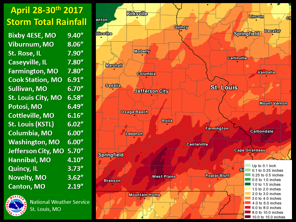
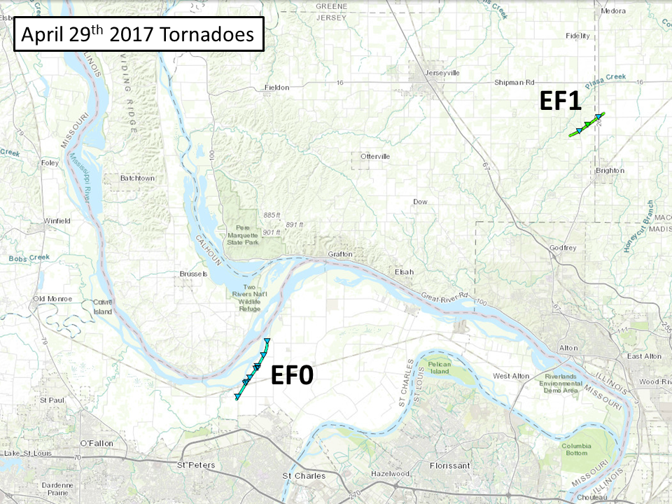
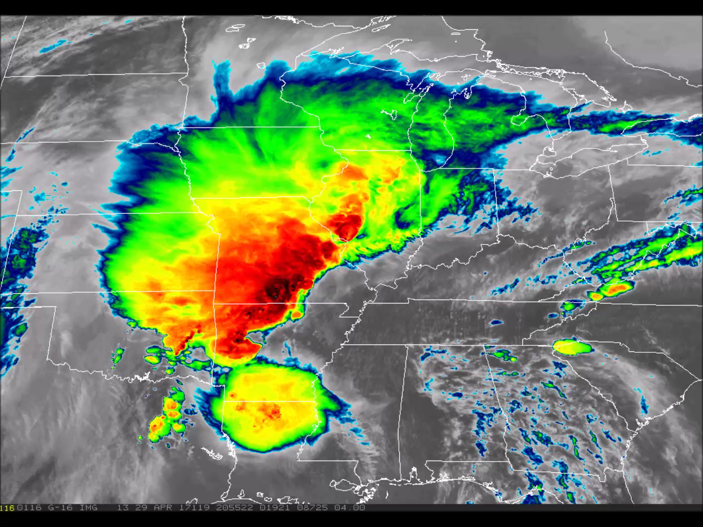
A strong spring storm system brought multiple rounds of thunderstorms and heavy rain to portions of the Midwest during the weekend of April 29th-30th. Rainfall totals surpassed nine inches in some locations and this led flash flooding and historic flooding along some of the tributaries of the Missouri and Mississippi Rivers. A few thunderstorms also became severe during the afternoon of April 29th, with two weak tornadoes documented.
 |
 |
 |
| Storm Total Rainfall | April 29th Tornadoes | GOES-16 (Band 13) Satellite Picture |
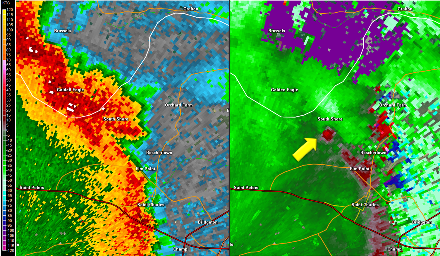
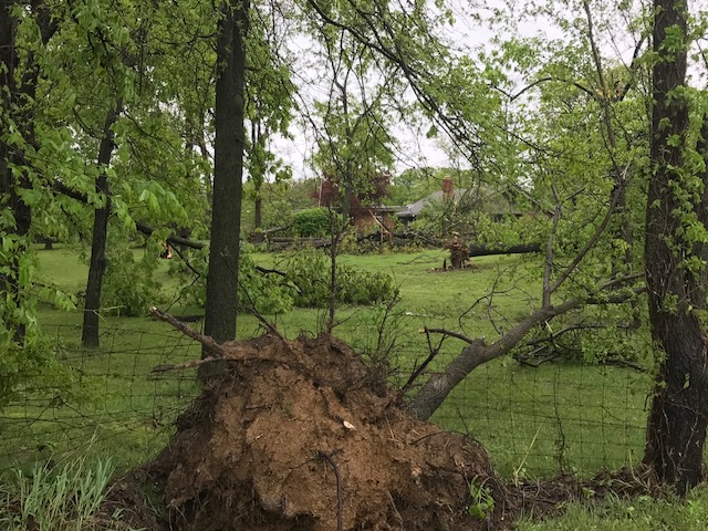
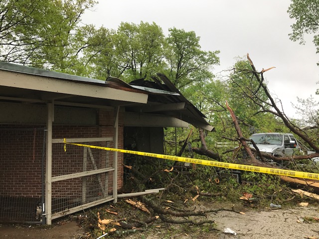
Tornadoes:
|
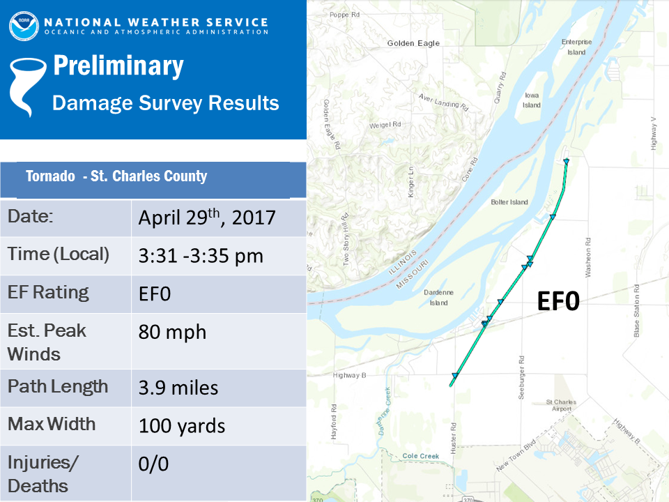
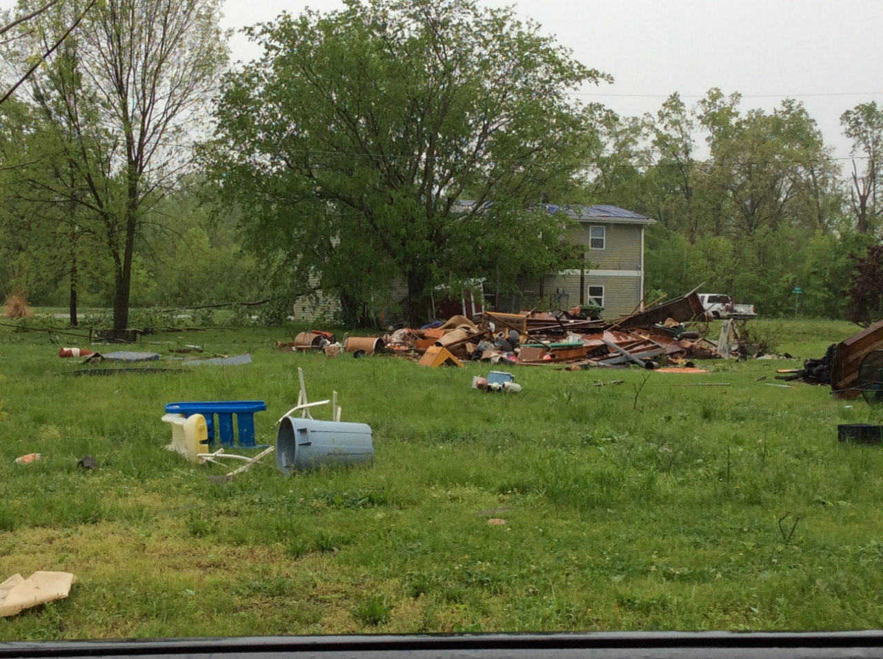
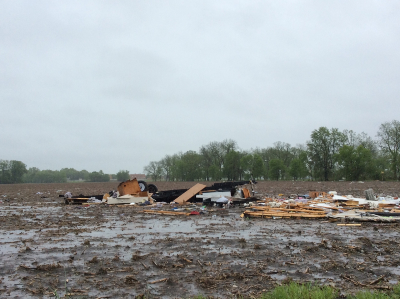
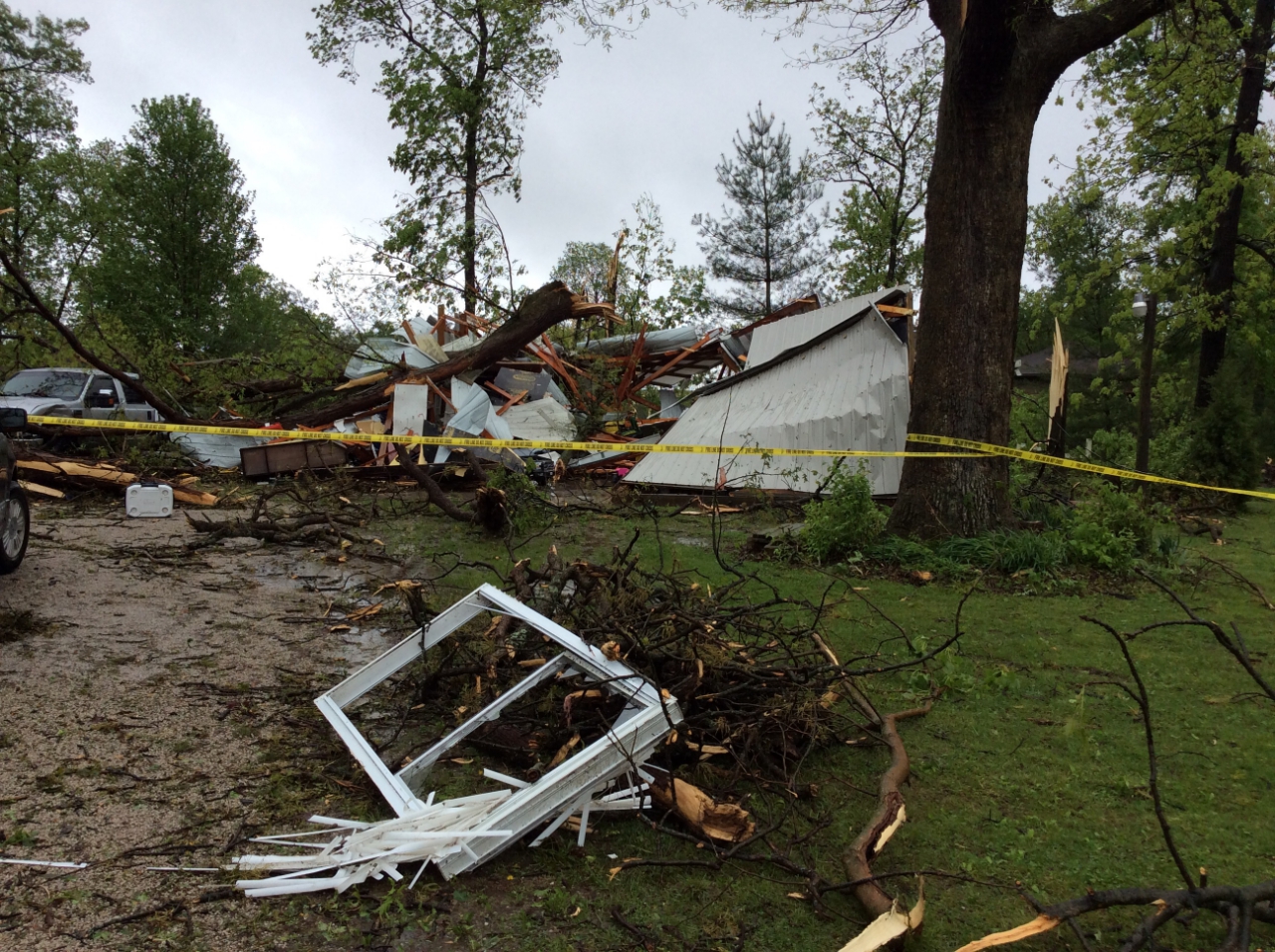
Tornado - Orchard Farm
|
||||||||||||||||
|
||||||||||||||||
|
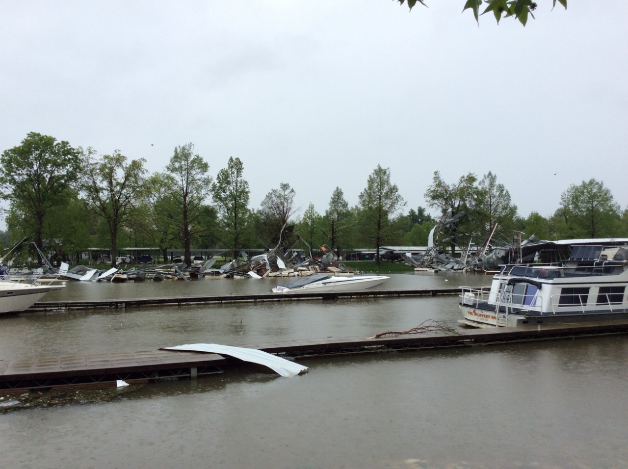
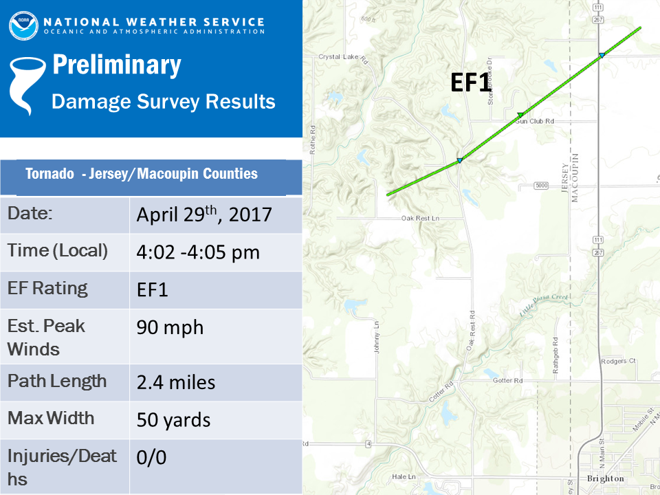
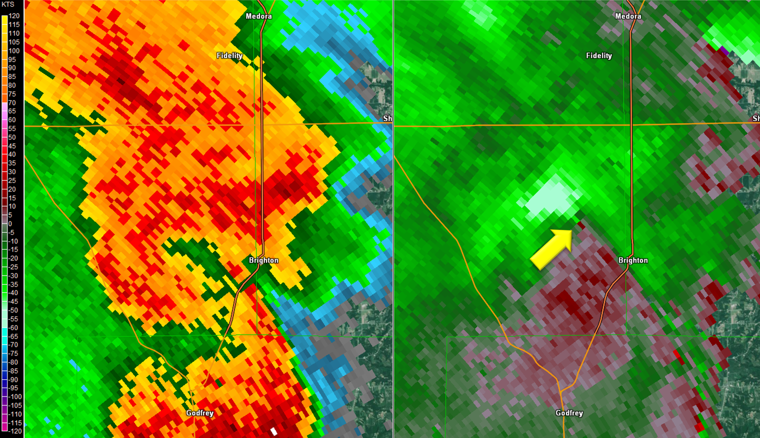
Tornado - Brighton
|
||||||||||||||||
|
||||||||||||||||
The Enhanced Fujita (EF) Scale classifies tornadoes into the following categories:
| EF0 Weak 65-85 mph |
EF1 Moderate 86-110 mph |
EF2 Significant 111-135 mph |
EF3 Severe 136-165 mph |
EF4 Extreme 166-200 mph |
EF5 Catastrophic 200+ mph |
 |
|||||
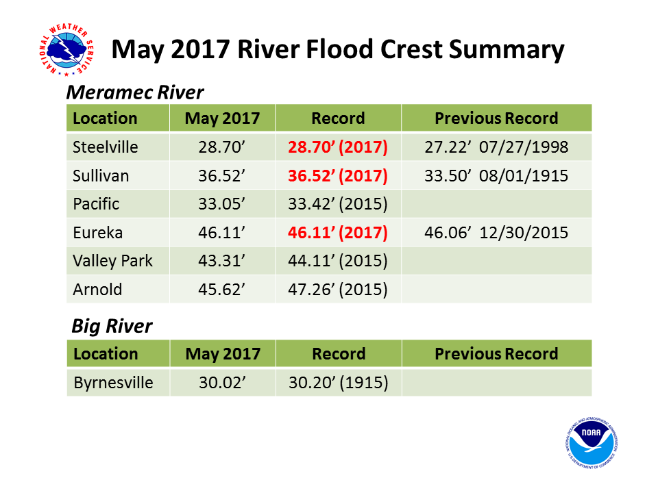
Flooding
Click here for an interactive map of the Meramec River Flooding. The satellite imagery is from Tuesday May 3rd in the early afternoon.
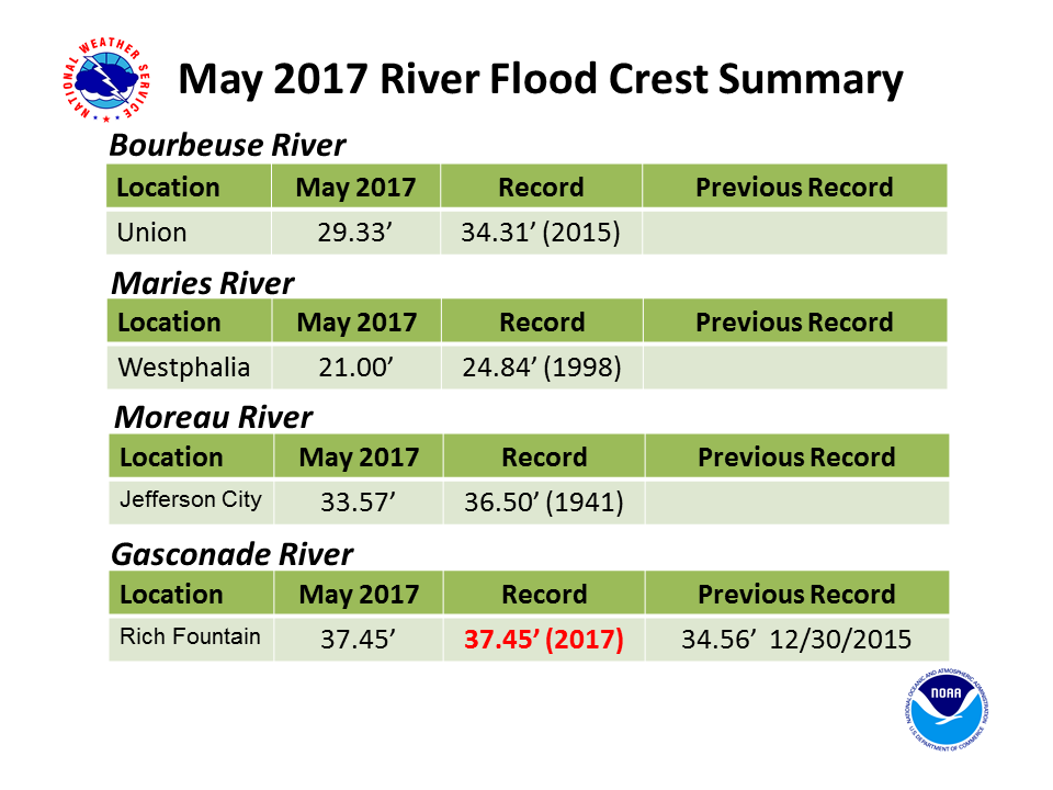
At least four river gauge sites set new record crests during this flooding event.
River Crest Summary Slides
 |
 |
||
| Meramec and Big Rivers Crest Summary |
Bourbeuse, Maries, Moreau, Gasconade Rivers Crest Summary |
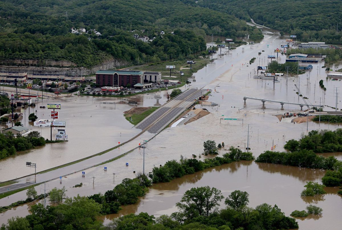
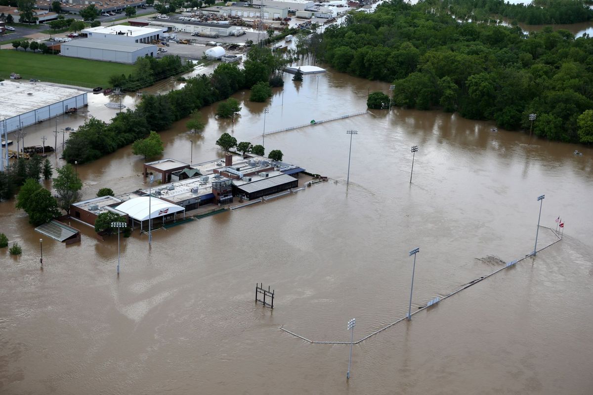
Meramec River Flood Photos (all photos provided and copyright by St. Louis Post Dispatch)
 |
 |
 |
 |
| Pacific, MO | Eureka, MO | Valley Park, MO | Fenton, MO |
Storm Reports
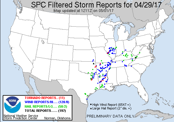
Click here for the individual reports from April 29th, 2017: http://www.spc.noaa.gov/climo/reports/170429_rpts.html
Rain Reports
LOCATION          STATE    RAINFALL     SOURCE
----------------------------------------------
BIXBY 4ESE          MO       9.40       PUBLIC
VIBURNUM            MO       8.06       COOP
ST. ROSE            IL       7.90       PUBLIC
FARMINGTON (KFAM)   MO       7.80       AWOS
NEW MINDEN 1NE      IL       7.80       PUBLIC
CASEYVILLE          IL       7.80       SPOTTER
BARTELSO            IL       7.00       PUBLIC
COOK STATION 1SSE   MO       6.91       MESONET
MOSCOW MILLS        MO       6.71       PUBLIC
SULLIVAN            MO       6.70       COOP
RUMA 1WNW           IL       6.60       SPOTTER
ST. LOUIS CITY      MO       6.58       PUBLIC
SULLIVAN 3E         MO       6.50       PUBLIC
POTOSI 4SW          MO       6.49       COOP
WELDON SPRING       MO       6.35       NWS WFO
EDWARDSVILLE 2W     IL       6.31       COOP
COTTLEVILLE         MO       6.16       COOP
CHESTERFIELD        MO       6.13       COOP
ROSEBUD             MO       6.05       COOP
RED BUD             IL       6.04       COOP
HARVESTER 2SW       MO       6.03       COOP
ST. CHARLES 7SSW    MO       6.03       COOP
ST. LOUIS (KSTL)    MO       6.02       ASOS
UNIV MO (MIZZOU)    MO       6.00       COOP
WASHINGTON          MO       6.00       COOP
DESOTO              MO       5.98       COOP
RAMSEY              IL       5.86       COOP
ST. PAUL            MO       5.85       COOP
ST. PETERS 1E       MO       5.84       HAM
ST. CHARLES         MO       5.79       COOP
COLUMBIA (KCOU)     MO       5.75       ASOS
LAKE ST. LOUIS 2SW  MO       5.74       COOP
ELSBERRY            MO       5.72       USFS RAWS
JEFFERSON CITY      MO       5.70       COOP
FESTUS              MO       5.69       COOP
ASHLAND 3N          MO       5.61       USFS RAWS
WARRENTON 1N        MO       5.52       COOP
COLUMBIA 1SSE       MO       5.51       MESONET
OFALLON 2SSW        MO       5.44       COOP
JENNINGS            MO       5.43       PUBLIC
HIGHLAND            IL       5.35       COOP
COLUMBIA 2S         MO       5.34       MESONET
ST. LIBORY          IL       5.33       COOP
NASHVILLE 1E        IL       5.31       COOP
CLARKSVILLE LD24    MO       5.23       COOP
FULTON              MO       5.17       MESONET
FREEDOM             MO       5.11       COOP
CHESTERFIELD (KSUS) MO       5.10       ASOS
JEFF CITY (KJEF)    MO       5.04       ASOS
CAHOKIA (KCPS)      IL       5.00       ASOS
MOSCOW MILLS 1WSW   MO       4.87       MESONET
COLUMBIA 4SE        MO       4.83       MESONET
ST. CHARLES (KSET)  MO       4.81       ASOS
COLUMBIA 7SE        MO       4.76       MESONET
MEDORA              IL       4.74       COOP
WINFIELD LD25       MO       4.70       COOP
CARLYLE LAKE        IL       4.62       COOP
VANDALIA            MO       4.51       COOP
CENTRALIA           IL       4.48       COOP
BOWLING GREEN       MO       4.45       COOP
SHELBINA            MO       4.45       COOP
PITTSFIELD (KPPQ)   IL       4.22       AWOS
VANDALIA 1WSW       MO       4.12       MESONET
HANNIBAL            MO       4.10       COOP
MONROE CITY 1SSE    MO       4.08       MESONET
QUINCY (KUIN)       IL       3.73       ASOS
NOVELTY 1ENE        MO       3.62       MESONET
QUINCY LD21         IL       2.83       COOP
CANTON LD20         MO       2.19       COOP
 |
Media use of NWS Web News Stories is encouraged! Please acknowledge the NWS as the source of any news information accessed from this site. |
|


 Weather Story
 Weather Map
 Local Radar