Overview
A severe squall line of thunderstorms moved across the region during the late evening hours of Monday March 6th and early morning hours of Tuesday March 7th. Numerous reports of wind damage and hail were received. A total of eight tornadoes have been surveyed or identified from this event. To view the damage surveys and download data in KML format please visit this site: https://apps.dat.noaa.gov/StormDamage/DamageViewer/
Tornadoes:
Tornado - Shelbina
Shelby County in Missouri
Date |
March 6th 2017 |
Time (Local) |
9:40-9:56 PM CST |
EF Rating |
EF1 |
Est. Peak Winds |
100 MPH |
Path Length |
16 miles |
Max Width |
150 yards |
Injuries/Deaths |
1/0 |
Summary:
A tornado moved from extreme southwest Shelby County, MO to northeast of Shelbina. The bulk of the damage was EF0, primarily to trees and farm outbuildings. The South Shelby High School was hit by the tornado and suffered minor roof damage, a couple of storage buildings were destroyed, the baseball backstop was destroyed and the press box was blown off the football field bleachers and destroyed. One home just northeast of the high school had a portion of its roof blown off. Intermittent tree and farm outbuilding damage continued until about 5.5 miles northeast of Shelbina. One injury did occur when a man was cut on the forehead by flying debris. He required stitches.
|
Track Map
|
|
|
|
|
Roof damage to a house on County Road 419, just north of U.S. Hwy 36. |
Areal photo of damage to South Shelby High School baseball field. |
Partial roof damage to an outbuilding at South Shelby High School. |
Reflectivity & Storm Relative Velocity |
|
Tornado - Rhineland to 2SSE Warrenton
Montgomery and Warren Counties in MO
Date |
March 6th, 2017 |
Time (Local) |
11:17 - 11:38 PM CST |
EF Rating |
EF1 |
Est. Peak Winds |
100 |
Path Length |
21 miles |
Max Width |
150 yards |
Injuries/Deaths |
0/0 |
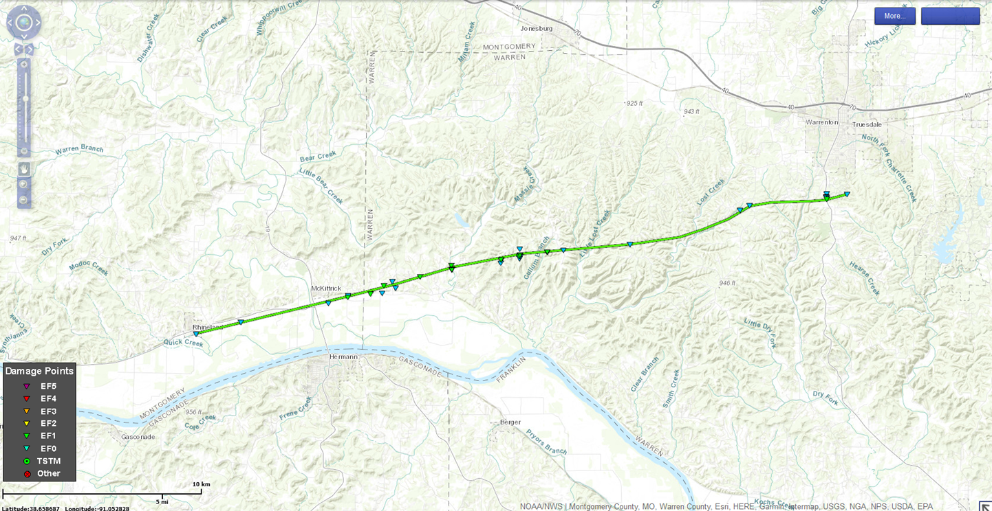
Summary:
A continuous path of damage was observed from Rhineland to two miles south/southeast of Warrenton, Missouri (east of Missouri Highway 47). The tornado developed near the baseball fields in Rhineland along Highway 94 and moved east causing damage to several trees, fences and the roof of a building on the grounds. The tornado continued east paralleling Highway 94 and causing varying amounts of damage to homesteads and farm buildings. It crossed Highway 19 just north of Highway 94 and caused mainly tree damage until it
reached Engemann Farm Road where a barn and garage were destroyed. The tornado continued east causing damage to trees along Case Road and then expanded as it crossed Massas Creek Road to nearly 150 yards. It is at this point that the greatest tree damage occurred with numerous trees uprooted, twisted and snapped in a convergent pattern near the creek. The tornado then crossed
Highway B and Centenial Drive with more large trees uprooted and some minor damage to outbuildings and residences noted. The tornado continued east, destroying a pole barn west of Hickory Heath Ranch Road, and uprooting more trees along State Highway EE and Missouri Highway U. The tornado crossed Highway 47 south of Warrenton causing roof damage to a building of a private campground and then dissipated east of the campground in rural Warren County. The total path length of this EF1 tornado was 21 miles.
|
Track Map
|
|
|
|
|
Small outbuilding destroyed just east of McGirks Drive (south of Hwy 94). |
Trees snapped off on Centenial Drive, just south of Highway B. |
Outbuilding with roof removed and walls collapsed on Hickory Heath Ranch Road. |
Reflectivity & Storm Relative Velocity |
|
Tornado - Wentzville
St. Charles County, Missouri
Date |
March 6th, 2017 |
Time (Local) |
11:51-11:54 PM CST |
EF Rating |
EF1 |
Est. Peak Winds |
100 |
Path Length |
3 miles |
Max Width |
100 yards |
Injuries/Deaths |
3/0 |
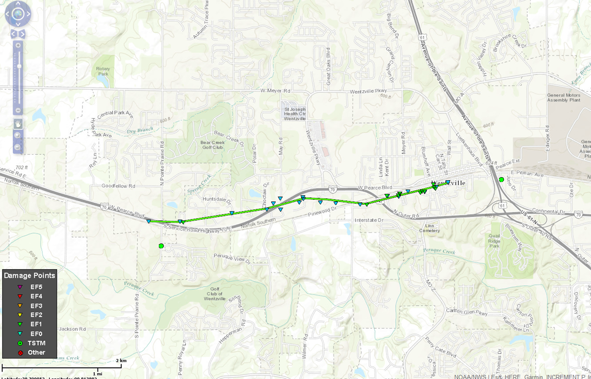
Summary:
The second tornado associated with the small vortex developed along the South Service Road of Interstate 70 west of South Pointe Prarie Road. The tornado crossed Interstate 70 and caused roof and siding damage to a number of homes and uprooted or snapped trees along its path as it moved east across Langtree Drive, Shadow Point Circle, Shadow Pines Drive, Giotto Court, Cabot Court, Tiffany Lynn Court, Huntsdale Drive, Tiger Drive and Ivybrook Drive. The tornado once again approached Interstate 70 causing damage to several business along W Pierce Blvd. The tornado crossed the Interstate, flipping over a large camper trailer along Thomas RV Way and flattening several road signs. The tornado tracked east paralleling Interstate 70, causing varying degrees of damage to buildings along Swantherville Drive and Ruggeri Drive. The tornado then caused significant roof damage to a building along P&A Drywall Drive before crossing Interstate 70 for the third and final time. The tornado continued east into a mobile home park where it flipped one trailer over and damaged many more. This is where the three injuries occurred. The tornado continued east/northeast just to the south of West Main Street through Downtown Wentzville causing mainly minor damage to many residences and businesses. The exception was a lumber business along South Church Street which took the brunt of the tornado and had a large building destroyed. The tornado finally dissipated near the intersection of Pitman Avenue and South Tally Street.
|
Track Map
|
|
|
|
|
Mobile home rolled over on Lucille Street. |
Mobile home with roof removed and pushed off of foundation blocks on Edith Street. |
Collapsed car port and damage to roof and wall of house on Circle Drive. |
Reflectivity & Storm Relative Velocity |
|
Tornado - Dittmer
Jefferson County, Missouri
Date |
March 7th, 2017 |
Time (Local) |
12:29-12:32 AM CST |
EF Rating |
EF0 |
Est. Peak Winds |
85 MPH |
Path Length |
2.6 miles |
Max Width |
80 yards |
Injuries/Deaths |
0/0 |
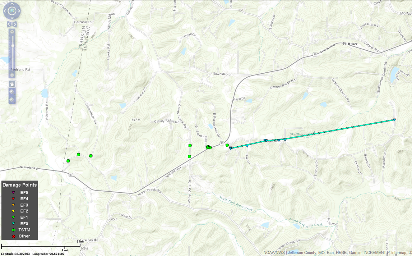
Summary:
A weak tornado touched down along Valley Springs Drive south of Ridge Road causing trees to fall in a convergent pattern to the east/northeast. The tornado moved northeast causing trees to be uprooted, twisted and snapped. Several homes in the track sustained minor roof and siding damage. The greatest damage was located along Ridge Road between Dittmer Ridge Road and Sylvan Place. The tornado lifted near Cedar Tree Drive with only minor tree damage noted.
|
Track Map
|
|
|
|
|
Trees uprooted and a few snapped off on Ridge Road just east of intersection with Dittmer Ridge Road. |
Damage to the roof of a house on Ridge Road just west of Bolle Trails Drive. |
Large pine tree snapped off on Oak Lane just south of Ridge Road. |
Reflectivity & Storm Relative Velocity |
|
Tornado - Hillsboro
Jefferson County, Missouri
Date |
March 7th, 2017 |
Time (Local) |
12:39 - 12:41 AM CST |
EF Rating |
EF0 |
Est. Peak Winds |
80 MPH |
Path Length |
1.2 miles |
Max Width |
75 yards |
Injuries/Deaths |
0/0 |
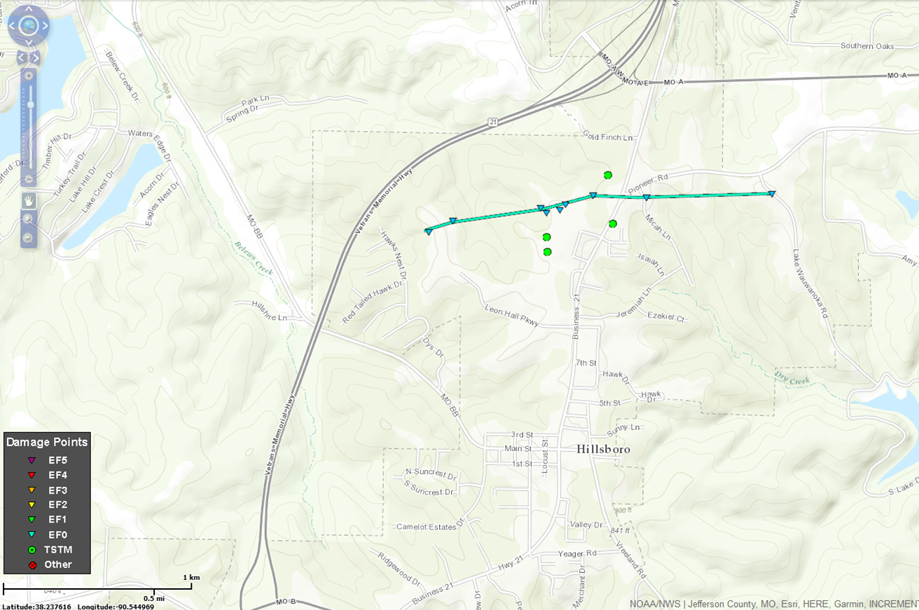
Summary:
A tornado touched down near Hillsboro High School where some trees were topped. It moved across the football field where bleachers, hurdles and other school equipment were destroyed and blown up to 300 yards down the track of the tornado. Tree damage continued from the back side of the Hillsboro High School toward the Jefferson County Fairgrounds. Several buildings, including barns and small outbuildings suffered major roof failures and numerous trees were uprooted across the fairgrounds with debris tossed up to 200 yards to the east/northeast. The tornado continued east damaging the roof of a social services building and
tossing insulation into the trees. It crossed Business Highway 21 topping more trees and causing minor roof damage to a number of homes on Micah Lane. The tornado dissipated near Lake Wauwanoka Road with only a few limbs broken off.
|
Track Map
|
|
|
|
|
Fence blown over at Jefferson County Fairgrounds. |
Debris from damaged building at Jefferson County Fairgrounds. |
Minor roof damage to business building. |
Reflectivity & Storm Relative Velocity |
|
Tornado - Sawyerville-Benld
Macoupin/Montgomery Counties, Illinois
Date |
March 7th, 2017 |
Time (Local) |
12:50-1:03 AM CST |
EF Rating |
EF1 |
Est. Peak Winds |
105 MPH |
Path Length |
13 miles |
Max Width |
100 yards |
Injuries/Deaths |
1/0 |
Summary:
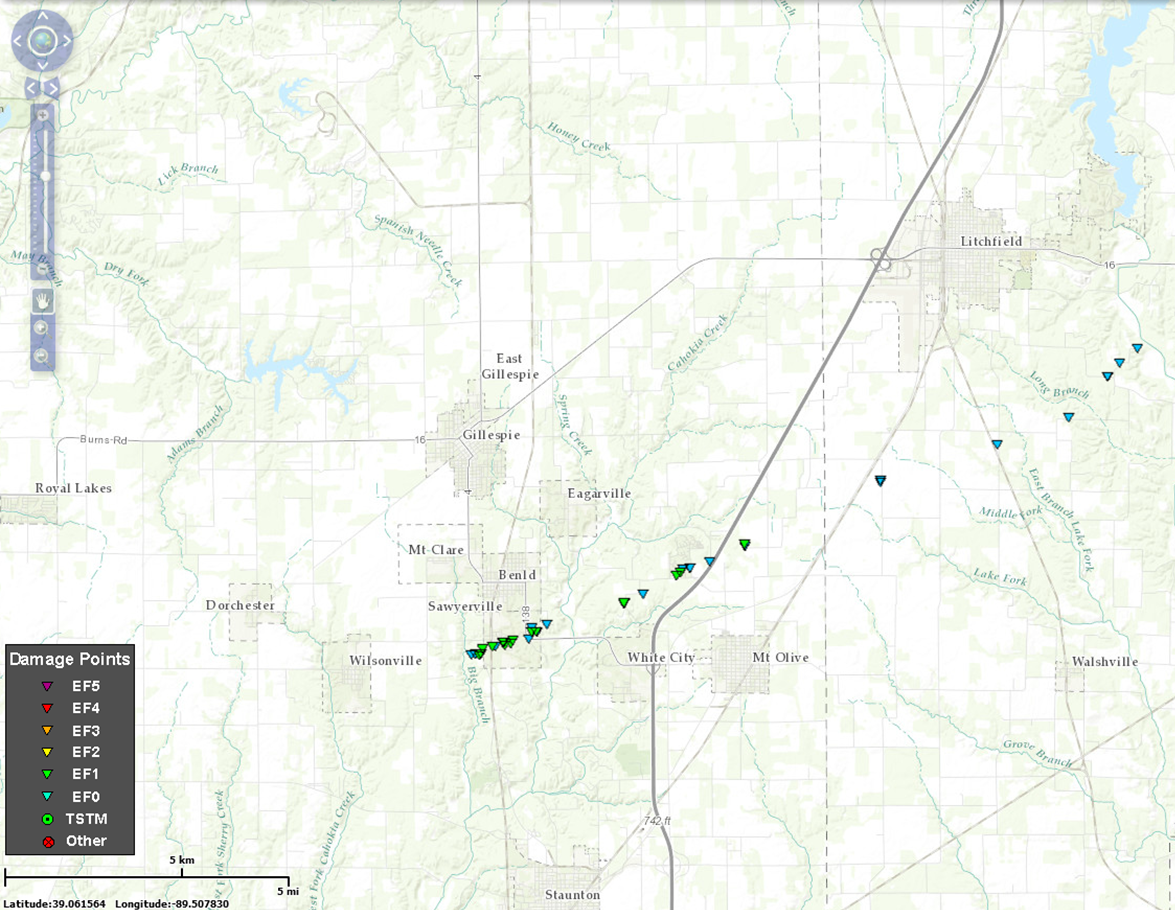
A tornado first formed on the southwest side of Sawyerville, IL and moved northeast for 13 miles moving into Montgomery County, IL. One garage in Sawyerville was destroyed damaging two cars inside. Most damage was to trees and loss of roof covering on homes and outbuildings. Several power poles were also downed. The tornado caused similar damage in the Lake Kaho area. The tornado crossed I-55 Near Panther Creek Road, continued northeast and moving into Montgomery County. The tornado dissipated southeast of Litchfield along Flat School Road. After crossing I-55 the damage was more sporadic and limited to trees and loss of roof covering on farm outbuildings.
|
Track Map
|
|
|
|
|
Destroyed garage and vehicles on Stewart Street. |
Destroyed garage on High Street. |
|
Reflectivity & Storm Relative Velocity |
|
Tornado - Witt
Montgomery County, Illinois
Date |
March 7th, 2017 |
Time (Local) |
1:14 -1:19 AM CST |
EF Rating |
EF1 |
Est. Peak Winds |
100 |
Path Length |
7.2 miles |
Max Width |
100 yards |
Injuries/Deaths |
0/0 |
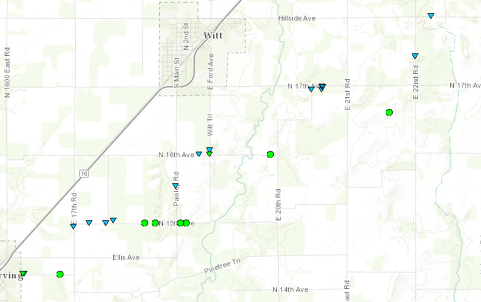
Summary:
A tornado formed at the east city limits of
Irving and moved northeast for 7 miles to about
3 miles east of Witt. The bulk of the damage
was EF-0 with downed large tree limbs and
partial removal of metal covering of farm
outbuildings. A couple of grain bins, empty, were
tossed into fields about 100 to 200 yards. One
home east of Witt had the chimney blow off. A
barn at the same location was pushed such that
it ended up leaning about 6 inches off center.
|
Track Map
|
|
|
|
|
Large tree snapped off. |
Minor roof damage. |
|
Reflectivity & Storm Relative Velocity |
|
Tornado - Argyle-Freeburg
Osage County, Missouri
Date |
March 6th, 2017 |
Time (Local) |
11:03 - 11:11 PM CST |
EF Rating |
EF1 |
Est. Peak Winds |
100 MPH |
Path Length |
7.3 miles |
Max Width |
75 yards |
Injuries/Deaths |
0/0 |
Summary:
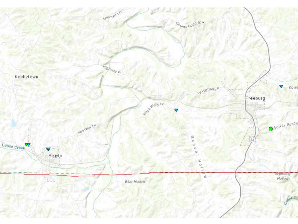
A small tornado formed just to the west
northwestof Argyle, MO and traveled 7 miles
east northeast to just northeast of Freeburg,
MO. The tornado was at its strongest at the very
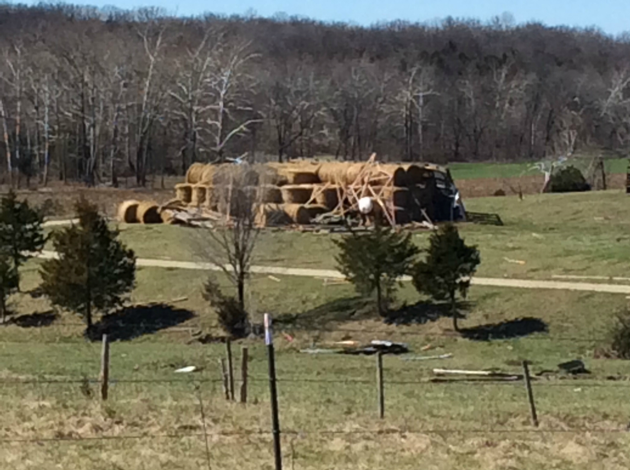
beginning as it destroyed a hay barn, snapped
and uprooted trees. The rest of the path
consisted of occasional downed trees and
broken large tree limbs. Thunderstorm wind
gusts around 75 mph also caused tree damage
on the south side of Freeburg.
|
Track Map
|
|
|
|
|
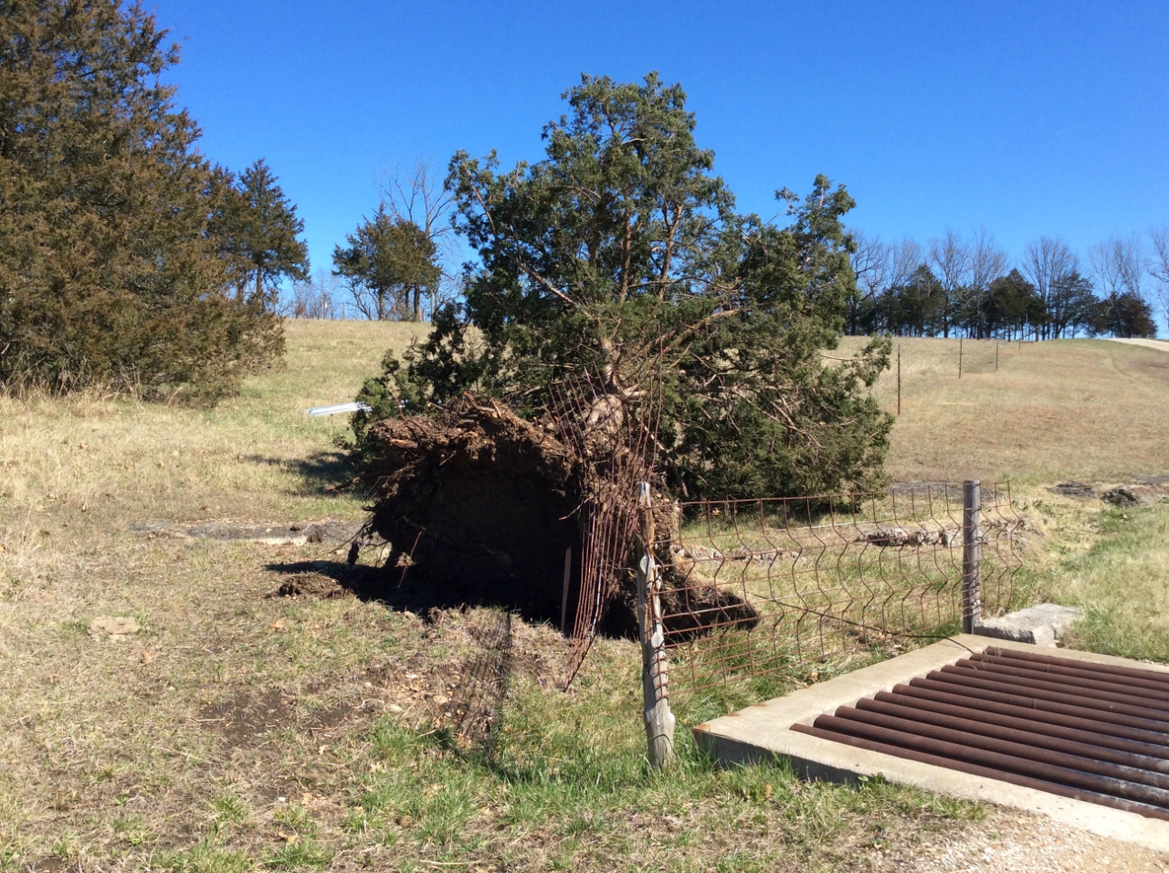
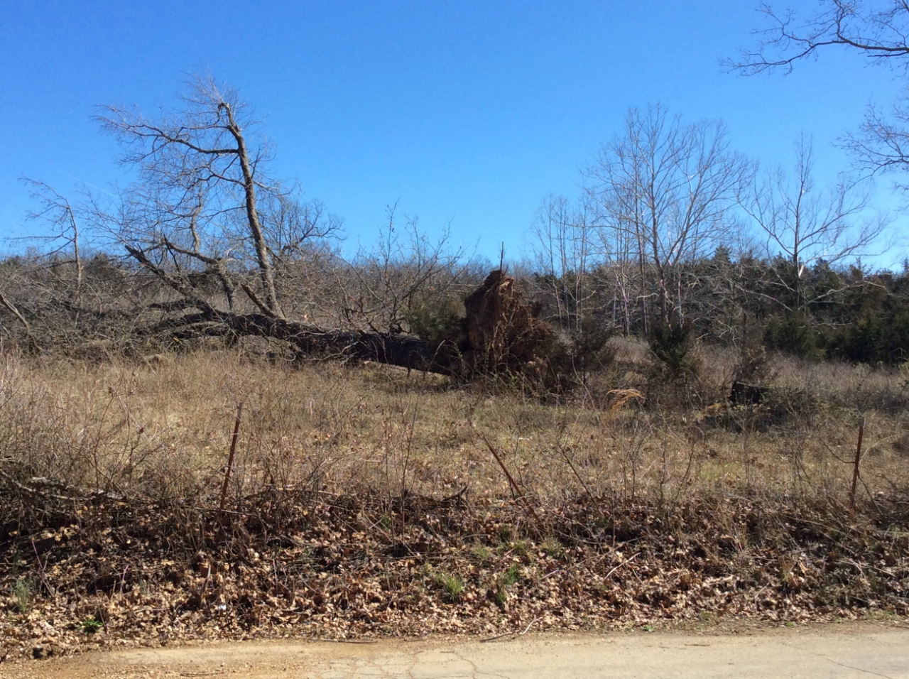
Large tree uprooted on Prairie Trail just west of Highway T. |
Large tree uprooted on Poplar Street |
Barn destroyed on Prairie Trail just west of Highway T. |
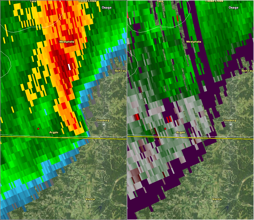
Reflectivity & Storm Relative Velocity |
The Enhanced Fujita (EF) Scale classifies tornadoes into the following categories:
EF0
Weak
65-85 mph |
EF1
Moderate
86-110 mph |
EF2
Significant
111-135 mph |
EF3
Severe
136-165 mph |
EF4
Extreme
166-200 mph |
EF5
Catastrophic
200+ mph |
|
Storm Reports
PRELIMINARY LOCAL STORM REPORT...SUMMARY
NATIONAL WEATHER SERVICE ST LOUIS MO
329 PM CST TUE MAR 07 2017
..TIME... ...EVENT... ...CITY LOCATION... ...LAT.LON...
..DATE... ....MAG.... ..COUNTY LOCATION..ST.. ...SOURCE....
..REMARKS..
0747 PM NON-TSTM WND GST KLIEVER 38.70N 92.50W
03/06/2017 M44 MPH MONITEAU MO TRAINED SPOTTER
0956 PM TSTM WND DMG 1 S CENTER 39.50N 91.53W
03/06/2017 RALLS MO TRAINED SPOTTER
TARP BLOWN OFF CORN STOCK PILE... MINOR TREE DAMAGE...
STREET SIGNS BLOWN DOWN.
0956 PM HAIL 1 S CENTER 39.50N 91.53W
03/06/2017 E0.70 INCH RALLS MO TRAINED SPOTTER
TARP BLOWN OFF CORN STOCK PILE... MINOR TREE DAMAGE...
STREET SIGNS BLOWN DOWN.
1000 PM TSTM WND DMG SHELBYVILLE 39.81N 92.04W
03/06/2017 SHELBY MO BROADCAST MEDIA
LARGE TREE BLOWN OVER ONTO HOUSE
1003 PM TSTM WND DMG EMDEN 39.80N 91.86W
03/06/2017 SHELBY MO BROADCAST MEDIA
VIA KHQA TWEET...BUILDING DAMAGE...TREES DOWN IN EMDEN.
1003 PM TORNADO 2 W SHELBINA 39.69N 92.08W
03/06/2017 SHELBY MO EMERGENCY MNGR
EXTENSIVE DAMAGE TO SOUTH COUNTY HIGH SCHOOL
1007 PM HAIL 8 S HARRISBURG 39.03N 92.46W
03/06/2017 E0.75 INCH BOONE MO TRAINED SPOTTER
1020 PM HAIL COLUMBIA 38.95N 92.33W
03/06/2017 E1.75 INCH BOONE MO PUBLIC
1024 PM HAIL LA GRANGE 40.05N 91.50W
03/06/2017 M0.70 INCH LEWIS MO TRAINED SPOTTER
1025 PM HAIL LA GRANGE 40.05N 91.50W
03/06/2017 E1.75 INCH LEWIS MO PUBLIC
1030 PM HAIL QUINCY 39.93N 91.39W
03/06/2017 M1.00 INCH ADAMS IL TRAINED SPOTTER
1030 PM TSTM WND GST QUINCY 39.93N 91.39W
03/06/2017 M52 MPH ADAMS IL TRAINED SPOTTER
1030 PM TSTM WND DMG COLUMBIA 38.95N 92.33W
03/06/2017 BOONE MO TRAINED SPOTTER
PARTS OF STRIP MALL ROOF BLOWN OFF INTO PARKING LOT.
INTERSECTION OF VANDIVER AND PROVIDENCE
1030 PM TSTM WND DMG HALLSVILLE 39.12N 92.22W
03/06/2017 BOONE MO PUBLIC
LARGE TREE LIMBS AND BRANCHES DOWN.
1035 PM TSTM WND GST 3 WNW HANNIBAL 39.72N 91.44W
03/06/2017 M60 MPH MARION MO AWOS
1041 PM HAIL MEXICO 39.17N 91.87W
03/06/2017 M0.88 INCH AUDRAIN MO EMERGENCY MNGR
1041 PM TSTM WND GST 4 NE BURTON 39.94N 91.20W
03/06/2017 M61 MPH ADAMS IL ASOS
1042 PM HAIL KINGDOM CITY 38.95N 91.94W
03/06/2017 M0.88 INCH CALLAWAY MO BROADCAST MEDIA
1045 PM HAIL 9 E FULTON 38.85N 91.78W
03/06/2017 M0.25 INCH CALLAWAY MO TRAINED SPOTTER
ONE INCH DIA TREE LIMBS BLOWN DOWN
1051 PM HAIL FULTON 38.85N 91.95W
03/06/2017 M1.00 INCH CALLAWAY MO TRAINED SPOTTER
1134 PM TSTM WND DMG PLEASANT HILL 39.44N 90.87W
03/06/2017 PIKE IL EMERGENCY MNGR
UTILITY POLE BLOWN OVER
1149 PM TSTM WND GST TROY 38.98N 90.98W
03/06/2017 E60 MPH LINCOLN MO TRAINED SPOTTER
1151 PM TORNADO WENTZVILLE 38.81N 90.86W
03/06/2017 ST. CHARLES MO EMERGENCY MNGR
*** 3 INJ *** FIVE MOBILE HOMES BLOWN OVER... ANOTHER
ONE HAD A TREE FALL ON IT IN WENTZVILLE NEAR WEST MAIN
STREET AND HILLTOP DRIVE. TWO PEOPLE TRAPPED AT THIS
TIME. GAS LEAK IN AREA. THREE MINOR INJURIES.
1151 PM TSTM WND DMG WENTZVILLE 38.81N 90.86W
03/06/2017 ST. CHARLES MO EMERGENCY MNGR
DEBRIS ON BOTH SIDES OF I-70 NEAR CHURCH STREET/HWY Z
EXIT. TRACTOR TRAILER BLOW OVER IN PARKING LOT OF SUPER
8 MOTEL. STRUCTURAL COLLAPSE OF WENTZVILLE MILLS WORKS.
NO INJURIES REPORTED.
1151 PM TSTM WND DMG WENTZVILLE 38.81N 90.86W
03/06/2017 ST. CHARLES MO LAW ENFORCEMENT
SEVERAL BUSINESSES SUSTAINED MINOR DAMAGE ON SOUTH END
OF WENTZVILLE PARKWAY...SOUTH OF I-70.
1152 PM TSTM WND GST 1 WSW MOSCOW MILLS 38.94N 90.93W
03/06/2017 M48 MPH LINCOLN MO MESONET
1203 AM TSTM WND GST LAKE ST. LOUIS 38.79N 90.78W
03/07/2017 M60 MPH ST. CHARLES MO TRAINED SPOTTER
1205 AM TSTM WND DMG ST. PETERS 38.78N 90.61W
03/07/2017 ST. CHARLES MO TRAINED SPOTTER
SIDING BLOWN OFF AN APARTMENT COMPLEX AT EXECUTIVE
PARKWAY AND INTERSTATE 70
1213 AM TSTM WND GST ROODHOUSE 39.48N 90.37W
03/07/2017 M62 MPH GREENE IL TRAINED SPOTTER
1215 AM TSTM WND GST 3 W CHESTERFIELD 38.66N 90.63W
03/07/2017 M56 MPH ST. LOUIS MO ASOS
1218 AM TSTM WND GST 4 NNE ORCHARD FARMS 38.93N 90.42W
03/07/2017 M63 MPH ST. CHARLES MO ASOS
1228 AM TSTM WND DMG 3 SW GRUBVILLE 38.26N 90.79W
03/07/2017 FRANKLIN MO PUBLIC
LARGE TREE LIMBS AND BRANCHES DOWN.
1234 AM TSTM WND DMG 1 S DITTMER 38.31N 90.68W
03/07/2017 JEFFERSON MO PUBLIC
DAMAGE PATH INCLUDED UPROOTED 100-YEAR OLD OAK TREES...
EXTENDING FROM ABOUT A HALF MILE EAST OF HIGHWAY 30
ALONG RIDGE ROAD TO NEAR LAKE ADELLE. TIME ESTIMATED
FROM RADAR.
1235 AM TSTM WND DMG 4 W HILLSBORO 38.23N 90.64W
03/07/2017 JEFFERSON MO LAW ENFORCEMENT
4 OR 5 HOMES WITH TREES DOWNED ON TOP OF THEM. ALSO...
NUMEROUS TREES AND POWER LINES DOWNED IN THE AREA. TIME
ESTIMATED FROM RADAR.
1236 AM TSTM WND DMG CEDAR HILL 38.36N 90.64W
03/07/2017 JEFFERSON MO 911 CALL CENTER
POWER LINES DOWN ON HWY 30 NEAR CEDAR HILL.
1239 AM TSTM WND DMG 4 SSW OTTO 38.32N 90.53W
03/07/2017 JEFFERSON MO LAW ENFORCEMENT
3 TO 4 HOMES WITH TREES BLOWN ON TOP OF THEM. IN
ADDITION... NUMEROUS TREES AND POWER LINES DOWN IN THIS
AREA. TIME ESTIMATED FROM RADAR.
1240 AM TSTM WND DMG 5 NNW HILLSBORO 38.30N 90.60W
03/07/2017 JEFFERSON MO 911 CALL CENTER
SEVERAL TREES BLOWN DOWN ALONG HIGHWAY B NORTH
NORTHEAST OF HILLSBORO.
1240 AM TSTM WND DMG HOUSE SPRINGS 38.42N 90.57W
03/07/2017 JEFFERSON MO PUBLIC
SHEET METAL ROOF TORN FROM 4 BY 8 FOOT SECTION OF BARN
ROOF AND A 3 BY 6 FOOT SECTION TORN OFF THE FRONT OF THE
BARN ON THE WEST SIDE.
1245 AM TSTM WND DMG BUNKER HILL 39.04N 89.95W
03/07/2017 MACOUPIN IL TRAINED SPOTTER
SHREDDED ROOF SHINGLES... FENCES... AND SMALL TREES
SNAPPED. SHEET METAL TORN OFF BARNES IN AREA.
1249 AM HAIL 6 SW CARLINVILLE 39.22N 89.96W
03/07/2017 M0.70 INCH MACOUPIN IL TRAINED SPOTTER
1251 AM TSTM WND DMG 1 NW BARNHART 38.34N 90.42W
03/07/2017 JEFFERSON MO BROADCAST MEDIA
TREE BLOWN DOWN AT INTERSECTION OF HWY 61 AND HWY M.
1252 AM TSTM WND DMG STAUNTON 39.01N 89.79W
03/07/2017 MACOUPIN IL TRAINED SPOTTER
AWNING BLOWN OFF OF A BUSINESS IN TOWN.
1253 AM TSTM WND DMG 1 SSE GILLESPIE 39.11N 89.81W
03/07/2017 MACOUPIN IL PUBLIC
EXTENSIVE TREE DAMAGE ACROSS THE AREA COURTESY OF
FACEBOOK PICTURES.
1258 AM TSTM WND DMG LITCHFIELD 39.18N 89.66W
03/07/2017 MONTGOMERY IL PUBLIC
SEVERAL LARGE TREES SNAPPED.
0112 AM TSTM WND DMG COLUMBIA 38.46N 90.23W
03/07/2017 MONROE IL BROADCAST MEDIA
HIGHWAY SIGN BLOWN DOWN ON I-255
0117 AM TORNADO 2 S WITT 39.23N 89.35W
03/07/2017 MONTGOMERY IL TRAINED SPOTTER
AT LEAST 3 GRAIN BINS MOVED OFF THEIR FOUNDATIONS. ONE
WAS THROWN MORE THAN 100 YARDS WHILE ANOTHER WAS BLOWN
50 YARDS. ALSO... 3 TO 4 SHEDS WERE UNROOFED. TIME
ESTIMATED FROM RADAR.
0120 AM TORNADO WITT 39.26N 89.35W
03/07/2017 MONTGOMERY IL TRAINED SPOTTER
GRAIN BIN MOVED OFF FOUNDATION AS WELL AS TREES SNAPPED
OR UPROOTED
0127 AM HAIL COFFEEN 39.09N 89.39W
03/07/2017 M0.70 INCH MONTGOMERY IL TRAINED SPOTTER
0130 AM TSTM WND GST MASCOUTAH 38.51N 89.81W
03/07/2017 M60 MPH ST. CLAIR IL TRAINED SPOTTER
0145 AM TSTM WND DMG 3 NW POSEY 38.57N 89.40W
03/07/2017 CLINTON IL LAW ENFORCEMENT
TREE BLOWN DOWN AT REDWOOD STREET AND CAMP JOY ROAD.