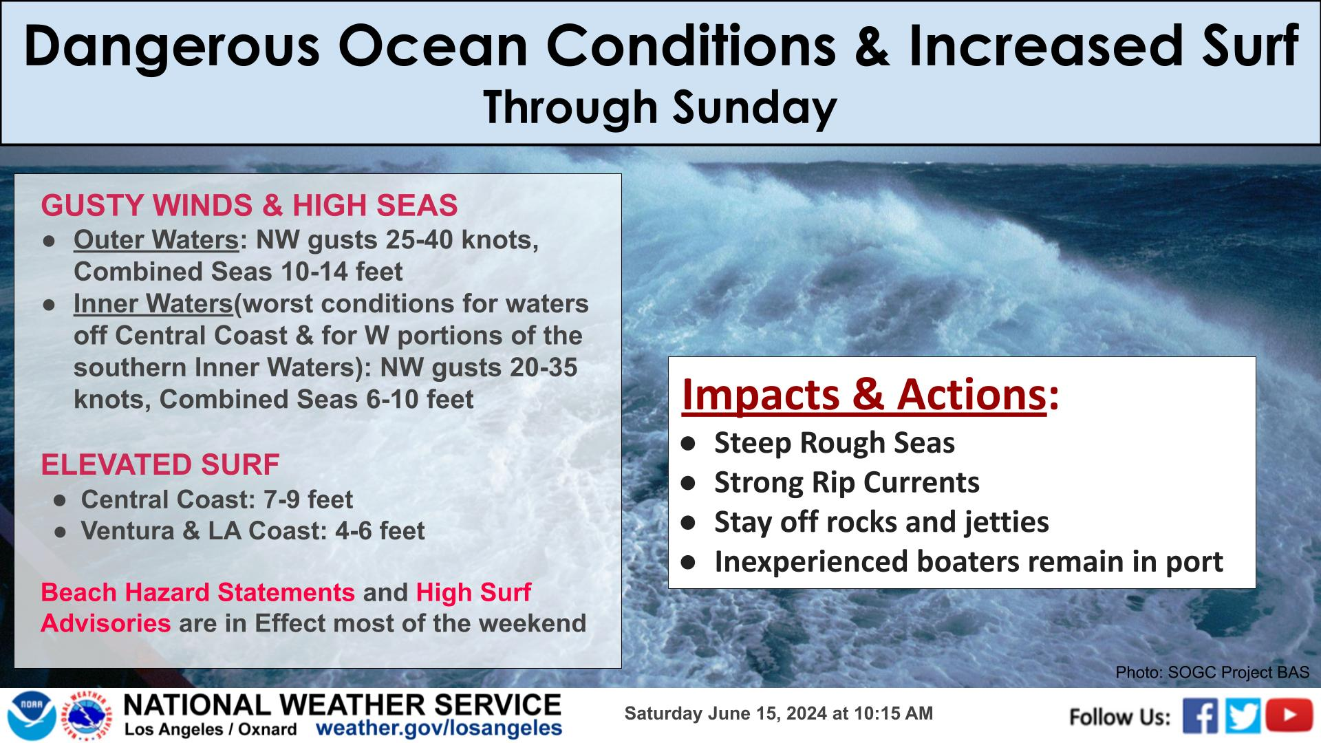
KEY DETAILS:
Elevated fire weather conditions due to hot temperatures, low humidities, and dry vegetation.
Enhanced risk of fast growing fires through at least Monday.
Greatest risk is away from the coasts.
ACTIONS:
Avoid activities that can create a spark outdoors.
Listen to local officials regarding burn bans.


 Hazards
 Observations
 Marine Weather
 Fire Weather
 Aviation Weather
 Hydrology
 Forecast Discussion
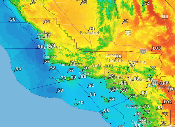 Graphical Forecasts
 Fast Page
 Weather Stats
 Mobile Devices
 Past Weather Data
 Southern CA Radar
 Southwest CA Radar
 Satellite
 Social Media OneStop
 Student Opportunities