Generally beneficial rain
with minor impacts
Additional Totals: 0.50-1.0 inches,
with 1.0-2.0 inches mtns & hills
except 2.0-3.0 inches in Santa
Lucia & Santa Ynez Ranges.
Peak Rates: 0.10-0.25 in/hr,
local 0.25-0.50 in/hr Thu Night.
Confidence: Moderate to High
Peak Timing: Thu 12pm-Fri 6am
Snow levels: 6500-8000 ft
Thunderstorms: 5% chance
Potential Impacts
Travel delays & minor road flooding
Rockslides on canyon roads
Enhance flows in streams & creeks
Very low risk (<5%) reaching burn scar debris flow rain rate thresholds


 Hazards
 Observations
 Marine Weather
 Fire Weather
 Aviation Weather
 Hydrology
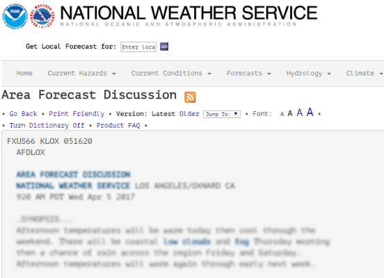 Forecast Discussion
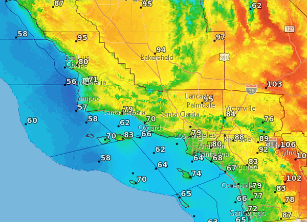 Graphical Forecasts
 Climate Graphs
 Fast Page
 Mobile Devices
 Past Weather Data
 Southern CA Radar
 Southwest CA Radar
 Satellite
 Social Media OneStop
 Student Opportunities