HOME
FORECAST
Local
Graphical
Aviation
Marine
Rivers and Lakes
Hurricanes
Severe Weather
Fire Weather
Sunrise/Sunset
Long Range Forecasts
Climate Prediction
Space Weather
PAST WEATHER
Past Weather
Astronomical Data
Certified Weather Data
SAFETY
INFORMATION
Wireless Emergency Alerts
Brochures
Weather-Ready Nation
Cooperative Observers
Daily Briefing
Damage/Fatality/Injury Statistics
Forecast Models
GIS Data Portal
NOAA Weather Radio
Publications
SKYWARN Storm Spotters
StormReady
TsunamiReady
Service Change Notices
EDUCATION
NEWS
SEARCH
Search For
NWS
All NOAA
ABOUT
About NWS
Organization
For NWS Employees
National Centers
Careers
Contact Us
Glossary
Social Media
NWS Transformation
Local forecast by
"City, St" or ZIP code
Sorry, the location you searched for was not found. Please try another search.
Multiple locations were found. Please select one of the following:
Location Help
News Headlines
Discontinuation of the Routine Temperature and Precipitation Product on July 7th
Customize Your
Weather.gov
Enter Your City, ST or ZIP Code
Remember Me
LOADING...
Elko, NV
Weather Forecast Office
NWS Forecast Office Elko, NV
Weather.gov
> Elko, NV
Current Hazards
Daily Briefing
Detailed Hazards
Current Outlooks
Submit Report
Graphical Hazardous Weather Outlook
Probabilistic Snow Forecast
Current Conditions
Observations
Satellite
Precipitation
Elko Current Sounding
Radar
Regional/National Radar (low bandwidth)
Local Standard Radar (low bandwidth)
Local Enhanced Radar
Forecasts
Travel
Experimental HeatRisk
Aviation Weather
Forecast Discussion
Fire Weather
Local Area
Severe Weather
Hurricane Center
Avalanche Forecast *Experimental*
Probabilistic Snow Forecast
Cold Advisory for Newborn Livestock
Area Forecast Graphics
Rivers and Lakes
National Water Prediction Service (NWPS)
Local River Observations (Map)
Hydro Products
Climate and Past Weather
Local
National
Drought
Local Drought Info
Local Programs
COOP Observer
Volunteer Observing
Useful Links
Other Interest Items
Education Resources
NWS News
Click a location below for detailed forecast.
Last Map Update: Tue, Jun 23, 2026 at 3:18:19 am PDT
Watches, Warnings & Advisories
Zoom Out
Red Flag Warning
What Is HeatRisk?
Heat Risk is an important NWS tool for determining severity of heat events, such as the one occurring this week. Here is an explanation of the Heat Risk severity levels, as well as what factors are used to calculate it.
Read More...
Text Product Selector (Selected product opens in current window)
Latest Text Products Issued
Social Media - Click to view more
Elko Radar
Regional Infrared Satellite Image
National Weather Map - Click to enlarge
Gridded Forecast Image
Forecast Weather Tables
Recent LKN Temperatures
Satellite-GOES
Winter Weather
Weather Stats
Follow us on X
Follow us on Facebook
Follow us on YouTube
LKN RSS Feed


 Social Media - Click to view more
 Elko Radar
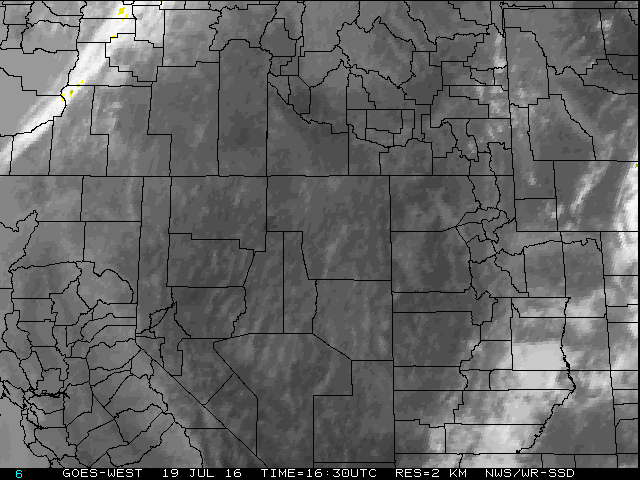 Regional Infrared Satellite Image
 National Weather Map - Click to enlarge
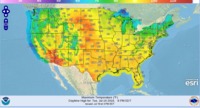 Gridded Forecast Image
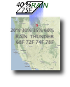 Forecast Weather Tables
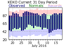 Recent LKN Temperatures
 Satellite-GOES
 Winter Weather
 Weather Stats